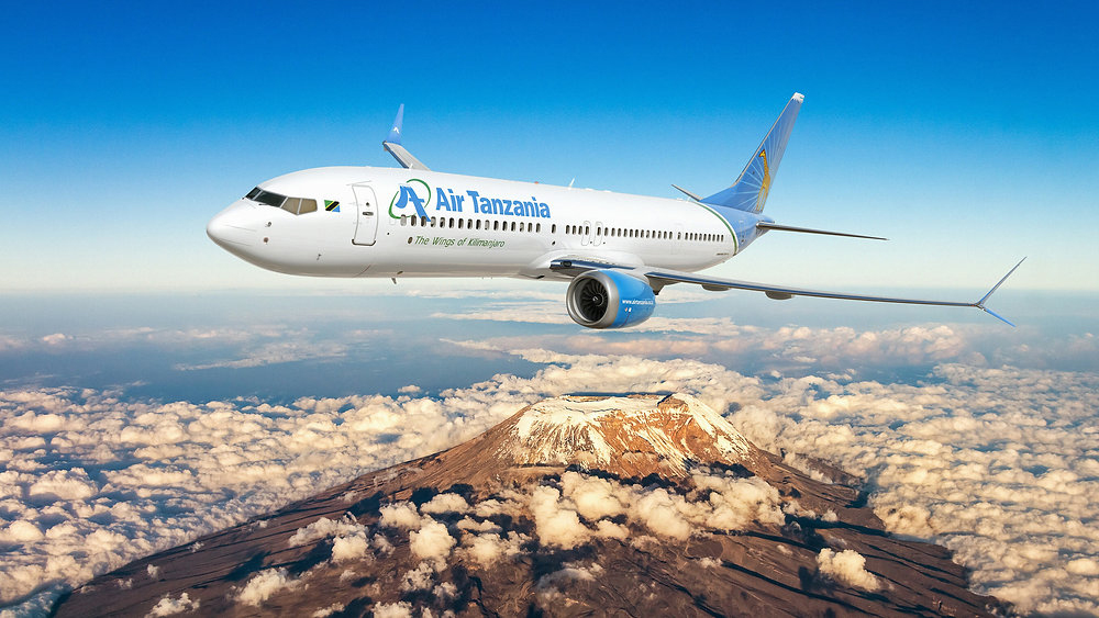
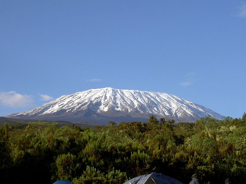
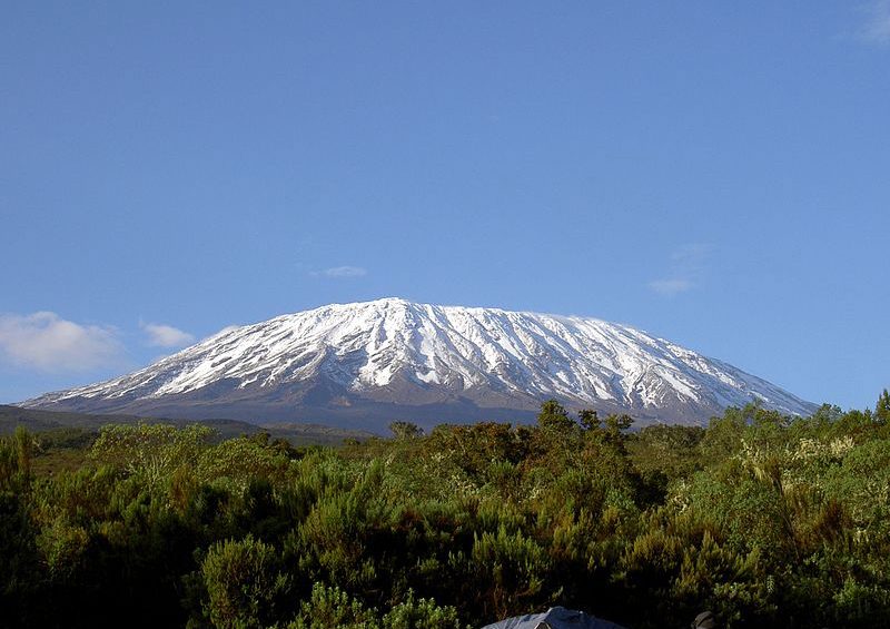
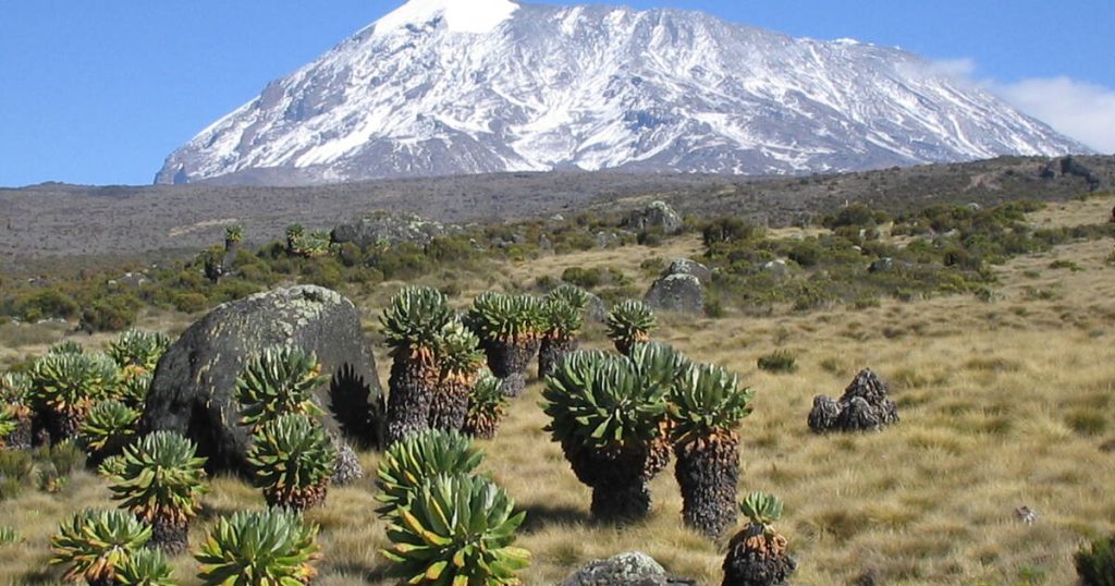
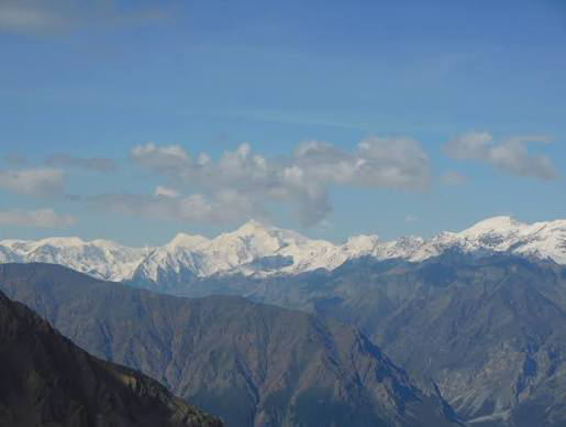
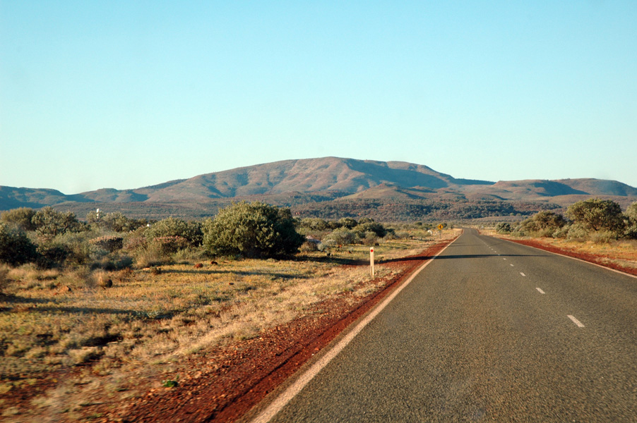
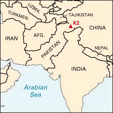
Air Tanzania has officially launched direct flights between Moscow and Tanzania, creating a convenient new gateway for travelers from Russia to East Africa. Operating every Monday, Wednesday, and Friday, this direct route makes it easier than ever to visit Tanzania for unforgettable wildlife safaris, Mount Kilimanjaro trekking, Zanzibar beach holidays, business trips, and cultural experiences.
For many Russian travelers, Tanzania is one of Africa’s most exciting destinations. From witnessing the Great Migration in the Serengeti to climbing Africa’s highest mountain or relaxing on the white-sand beaches of Zanzibar, the country offers a wide range of experiences throughout the year. With Air Tanzania’s direct connection to Moscow, planning a journey to East Africa becomes more convenient and efficient.
Whether you are visiting Tanzania for adventure, nature, business, or leisure, understanding the flight schedule and travel requirements is an important part of planning your trip. Knowing when flights operate, where they depart and arrive, how to book your ticket, and what documents you need before departure can help you travel with confidence.
This guide explains everything you need to know about Air Tanzania flights to Moscow, including the latest schedule, route details, booking options, and practical travel tips. If you are planning a safari, a Mount Kilimanjaro climb, or a tailor-made Tanzania holiday after arriving from Moscow, WeWild Travel can help you organize every part of your journey, from airport transfers and accommodation to guided adventures across Tanzania.
Yes, Air Tanzania operates flights to Moscow, connecting travelers from Tanzania to the Russian capital. The airline runs this route on Monday, Wednesday, and Friday, giving passengers several weekly options to plan their journey.
Travelers can use the Tanzania Moscow route for different purposes, including tourism, business trips, education, and visiting family or friends. Knowing the flight days helps passengers choose the right travel date and prepare their trip more easily.
For travelers who need support with flight planning, accommodation, or a complete travel arrangement, working with a trusted travel company can make the booking process smoother and more convenient.
Air Tanzania Flights to Moscow Schedule
Understanding the Air Tanzania flights to Moscow schedule helps travelers choose the best departure date and prepare their journey in advance. The flight schedule is especially important for passengers planning international trips because it allows them to arrange accommodation, airport transfers, and other travel plans before departure.
Which Days Does Air Tanzania Fly to Moscow?
Air Tanzania operates flights to Moscow on three days each week:
Monday
Wednesday
Friday
This schedule gives travelers flexibility when planning a trip between Russia and Tanzania . Passengers can select a travel day that matches their personal plans, whether they are traveling for business, tourism, study, or other purposes.
Air Tanzania Moscow Flight Frequency
Air Tanzania operates the Moscow route three times per week, providing regular connections between Russia and Tanzania . This frequency allows travelers to have multiple options instead of relying on only one weekly departure.
Knowing the flight frequency helps passengers plan better because they can coordinate their full journey, including visa preparation, hotel bookings, airport transfers, and connecting travel arrangements. Travelers who need help organizing their complete trip can also work with a travel specialist for easier planning and support.
Air Tanzania Route to Moscow
The Air Tanzania route to Moscow connects Russia with Tanzania, creating a direct travel option for passengers moving between Europe and East Africa . Understanding the departure and arrival airports helps travelers prepare for their journey, including airport transfers, check-in, and arrival arrangements.
Departure Airport in Tanzania
Air Tanzania flights to Moscow depart from Julius Nyerere International Airport, the main international airport serving Dar es Salaam and one of the most important aviation hubs in Tanzania.
The airport provides international services for travelers heading to different destinations around the world. Passengers flying to Moscow should arrive early to complete check-in, security procedures, and other travel requirements before departure.
Arrival Airport in Moscow
Flights from Tanzania arrive in Moscow, the capital city of Russia and one of the world’s major travel and business destinations. Moscow has several international airports that serve passengers arriving from different countries.
Travelers should check their flight details carefully to confirm the arrival airport, terminal information, and available transport options into central Moscow.
Flight Duration and Distance
The flight duration from Tanzania to Moscow depends on the exact route, aircraft schedule, and operating conditions. Travelers should prepare for a long international journey and plan enough time for airport procedures before and after the flight.
The Tanzania Moscow route covers a significant distance between East Africa and Russia, connecting two regions with different cultures, climates, and travel experiences. Planning ahead with accommodation, airport transfers, and travel documents helps make the journey smoother.
How to Book Air Tanzania Flights to Moscow
Booking your Air Tanzania flight to Moscow is an important step in planning a successful Tanzania Russia journey. Travelers can choose to book directly with the airline or use a travel company that can provide additional support before and during the trip.
Booking Directly with Air Tanzania
Travelers can book Air Tanzania flights to Moscow through the airline’s official booking channels. Direct booking allows passengers to check available travel dates, select their preferred flight, and manage their reservation based on their travel needs.
Before booking, passengers should confirm important details such as the flight schedule, travel documents, baggage information, and any requirements for international travel.
Booking Through a Travel Company
Booking through a travel company can make the travel process easier, especially for passengers who need more than just a flight ticket. A professional travel company can help organize the full journey and provide support from planning to arrival.
Benefits of using a travel company include:
Itinerary support: Help creating a well-planned travel schedule that matches your purpose of travel.
Airport assistance: Guidance with airport arrangements and travel preparation.
Travel planning: Support with transportation, accommodation, and other important details.
Accommodation and safari connection: Combining your Moscow trip with Tanzania experiences such as wildlife safaris before or after your international journey.
AtWeWild Travel, we help travelers plan smooth journeys by combining flight support with complete travel arrangements. Whether you need help organizing your Tanzania Moscow trip, accommodation, or a safari experience in Tanzania, our team can assist you in creating a convenient travel plan.
Why Choose Air Tanzania for Your Moscow Trip?
Choosing the right airline for an international journey can make a big difference in your overall travel experience. Air Tanzania provides a convenient connection between Tanzania and Moscow, giving travelers an option to travel between Russia and East Africa with a route that fits different travel needs. Whether you are traveling for tourism, business, education, or personal reasons, understanding the benefits of this route can help you plan your journey with more confidence.
Air Tanzania’s Moscow route gives travelers the advantage of having a connection from Tanzania without needing to search through many complicated travel options. A clear flight schedule, planned travel dates, and proper preparation can help passengers organize their journey more easily.
Convenient Tanzania Connection
Air Tanzania creates a direct link between Tanzania and Moscow, making it easier for travelers starting their journey from Tanzania. Passengers can plan their departure around the available flight days and arrange other important travel details before leaving.
For travelers coming from different parts of Tanzania, the connection through Dar es Salaam provides a practical starting point for an international trip. This makes the journey more organized and helps reduce the challenges that come with long-distance travel planning.
Suitable for Business and Leisure Travelers
The Air Tanzania route to Moscow can support different types of travelers. Business travelers can use the connection for meetings, conferences, and professional visits, while leisure travelers can use it to explore Moscow’s culture, history, and attractions.
The route also helps travelers who want to combine different experiences, such as visiting Russia and exploring Tanzania before or after their international journey. With proper planning, passengers can create a travel experience that matches their goals.
Easier Travel Planning from Tanzania
Planning an international trip involves more than booking a flight. Travelers need to consider accommodation, airport transfers, travel documents, timing, and other arrangements. Choosing a reliable travel option helps make the process smoother.
With Air Tanzania flights to Moscow, travelers can organize their journey around a clear schedule and prepare each part of the trip in advance. For passengers who want extra support, a travel company like WeWild Travel can help arrange travel plans, accommodation, and additional experiences in Tanzania.
A well-planned journey allows travelers to focus more on enjoying their trip and less on managing complicated travel arrangements.
Tanzania to Moscow Travel Guide
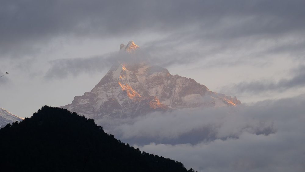
Traveling between Tanzania and Moscow is not only about reaching a destination; it is also about planning the right experience. Many travelers use this connection for different reasons, including business, holidays, cultural visits, and adventure travel. For visitors coming from Moscow to Tanzania, the journey can become an opportunity to explore some of Africa’s most famous attractions, including wildlife safaris and the challenge of climbing Mount Kilimanjaro.
Visa Requirements for Tanzania Travelers
Before traveling between Tanzania and Moscow, passengers should prepare the correct travel documents. Visa requirements depend on the traveler’s nationality and purpose of travel, so checking the latest entry rules before departure is important.
Visitors coming to Tanzania from Moscow should also prepare other travel essentials, including a valid passport, travel insurance, accommodation details, and any documents needed for their planned activities. Proper preparation helps travelers enjoy their trip without unnecessary delays.
Best Time to Visit Moscow and Tanzania
The best time to travel depends on the type of experience you want. Moscow offers unique experiences throughout the year, from city sightseeing and cultural attractions to winter activities.
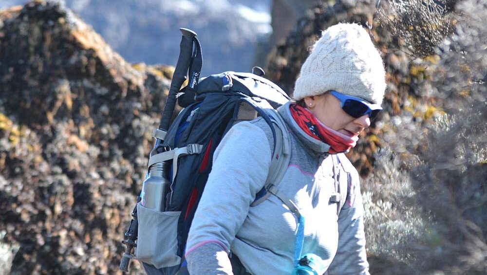
For travelers coming from Moscow to Tanzania, the timing is especially important when planning an adventure. Many visitors choose Tanzania because of its world-famous safari experiences and mountain adventures. The dry seasons are popular for wildlife viewing in national parks, while Mount Kilimanjaro has several good climbing periods for trekkers who want to reach the highest peak in Africa.
A well-planned trip can combine international travel with unforgettable Tanzania experiences, such as a safari in Serengeti National Park or a trekking adventure on Mount Kilimanjaro.
What to Prepare Before Flying
Before your Air Tanzania flight, prepare important travel details such as flight information, passport, visa documents, accommodation arrangements, and airport transfers.
Travelers coming to Tanzania for safari or Kilimanjaro trekking should also prepare suitable clothing, adventure equipment, and a clear itinerary. Working with a local travel company can make the experience easier by helping organize transport, accommodation, guides, safari packages, and mountain trekking arrangements.
With proper planning, travelers can enjoy a smooth journey from Moscow to Tanzania and experience the country’s wildlife, landscapes, and adventure opportunities.
Air Tanzania Moscow Flight vs Other Travel Options
When planning a journey between Tanzania and Moscow, travelers can choose different flight options depending on their budget, travel time, and convenience. Comparing Air Tanzania flights to Moscow with connecting flight options helps passengers understand which choice fits their travel needs better.
For travelers visiting Tanzania for a holiday, safari, or a Mount Kilimanjaro adventure, choosing a convenient flight option can make the entire journey easier. A smoother travel experience means more time to focus on exploring Tanzania instead of managing complicated connections.
Air Tanzania vs Connecting Flights
Connecting flights usually require passengers to change planes in another country before reaching their final destination. While these options may sometimes offer more airline choices, they can involve longer travel times, multiple airport procedures, and additional planning.
Air Tanzania provides a simpler travel option for passengers looking for a connection between Tanzania and Moscow. With a planned schedule and a route designed for travelers between these destinations, passengers can organize their journey with fewer complications.
For visitors coming to Tanzania for safari or trekking experiences, reducing unnecessary travel challenges can help create a more comfortable start to their adventure.
Direct Route Advantages
Choosing a direct route offers several advantages for international travelers. It can reduce the stress of changing flights, make travel planning easier, and help passengers arrive at their destination with more energy.
A more convenient route is especially valuable for travelers planning additional activities after arrival, such as a Tanzania safari, beach holiday, or Mount Kilimanjaro trek. Having a smoother travel experience allows visitors to focus on enjoying their adventure.
For travelers who need complete support beyond flights, WeWild Travel can help arrange the full Tanzania experience, including airport transfers, accommodation, safari adventures, and Kilimanjaro trekking packages. Combining flight planning with local travel support helps create a more organized and memorable journey.
Frequently Asked Questions
Does Air Tanzania fly to Moscow?
Yes, Air Tanzania operates flights to Moscow, connecting travelers between Tanzania and Russia. This route provides an option for passengers traveling for tourism, business, education, or personal reasons.
What days does Air Tanzania fly to Moscow?
Air Tanzania flights to Moscow operate on Monday, Wednesday, and Friday. These weekly flight days give travelers flexibility when planning their journey and allow them to arrange other important travel details such as accommodation, airport transfers, and travel activities.
How long is the flight from Tanzania to Moscow?
The flight duration from Tanzania to Moscow depends on the exact route, flight schedule, and travel conditions. Since this is a long international journey, travelers should prepare for a longer travel time and organize important arrangements before departure.
How can I book Air Tanzania flights to Moscow?
Travelers can book Air Tanzania flights to Moscow through official airline booking channels or with the help of a travel company. A travel company can provide extra support by helping organize flights, accommodation, transportation, and complete travel plans.
For travelers visiting Tanzania for safari or Kilimanjaro trekking, WeWild Travel can help arrange a complete experience, including airport transfers, adventure packages, and travel planning support.
Is Air Tanzania the best option for Tanzania to Russia travel?
Air Tanzania can be a convenient option for travelers looking for a connection between Tanzania and Moscow. The best choice depends on your travel needs, schedule, and preferred level of support.
For visitors who want to combine a Moscow trip with Tanzania adventures, choosing a well-planned travel arrangement can make the journey easier. A complete travel plan can include flights, accommodation, safari experiences, and Kilimanjaro trekking for a memorable Tanzania experience.
Final Thoughts
Air Tanzania flights to Moscow provide a convenient travel connection between Tanzania and Russia, helping travelers plan international journeys with more confidence. With flights available on Monday, Wednesday, and Friday, passengers can choose a schedule that matches their travel plans for business, tourism, or personal trips.
For travelers coming from Moscow to Tanzania, this route also creates an opportunity to experience the best of Tanzania, from exciting wildlife safaris to unforgettable Mount Kilimanjaro trekking adventures. Proper planning, including flight arrangements, accommodation, transportation, and activities, helps create a smoother and more enjoyable journey.
If you are planning a trip between Tanzania and Moscow, preparing early can make your travel experience easier. From flight support to complete Tanzania travel experiences, WeWild Travel can help you organize your journey with professional guidance, including safari packages, Kilimanjaro trekking, accommodation, and travel arrangements.
Start planning your Tanzania Moscow adventure today and enjoy a well-organized travel experience from arrival to departure.
7 Day Machame Route complete guide: Itinerary, map and Price
Estimated reading time: 19 minutes
The 7 Day Machame Route complete guide provides everything you need to plan a successful climb of Mount Kilimanjaro. In this guide, you’ll find the complete 7-day itinerary, route map, price, difficulty, success rate, best time to climb, packing list, accommodation, safety information, and expert travel tips. Whether you are climbing Kilimanjaro for the first time or comparing different routes, this guide will help you choose the 7 Day Machame Route with confidence and prepare for an unforgettable adventure with WeWild Travel.
Summit Success Rate: Up to 70% to 75% on our 7-day itinerary
Accommodation: Mountain Camping
Distance: Approximately 62 km (38.5 miles)
Highest Point: Uhuru Peak (5,895 m / 19,341 ft)
Starting Price: From $3178 per person
Best Time to Climb: January to March & June to October
Group Size: Private and Group Climbs Available
Why Book Your Machame Route with WeWild Travel?
Experienced local Kilimanjaro guides
Carefully designed 7-day itinerary for better acclimatization
High-quality camping equipment
Nutritious mountain meals prepared by professional cooks
Emergency oxygen and comprehensive safety equipment
Ethical porter treatment and responsible tourism
Airport transfers and hotel accommodation available
Fast responses and personalized trip planning
Why Climb the Machame Route with WeWild Travel?
Choosing the right Kilimanjaro operator is just as important as choosing the right route. At WeWild Travel, we combine local expertise, professional mountain crews, and personalized service to give you the best possible chance of reaching Uhuru Peak safely while enjoying every step of the journey.
Our experienced Tanzanian mountain guides know the Machame Route inside and out. They set a comfortable pace, monitor your health throughout the climb, and share their knowledge of Mount Kilimanjaro’s landscapes, wildlife, and culture. Their experience helps you acclimatize properly and climb with confidence.
We recommend the 7-day Machame Route because the additional acclimatization day gives most climbers a better chance of reaching the summit. Rather than rushing the climb, we focus on safety, comfort, and a gradual ascent that improves your overall experience.
Your safety is our highest priority. Every climb includes trained guides, emergency oxygen, first aid equipment, and regular health checks to monitor how your body responds to the altitude. Our team is prepared to respond quickly if any challenges arise during the trek.
We also believe that a successful climb starts with excellent support. Our porters receive fair treatment, our mountain cooks prepare fresh and nutritious meals every day, and we provide quality camping equipment to help you stay comfortable in changing mountain conditions.
Whether you choose a private climb, a group departure, or a customized itinerary, our team takes care of every detail, including airport transfers, hotel accommodation before and after your climb, and expert support from the moment you contact us until you return home.
When you climb the Machame Route with WeWild Travel, you are choosing a local team that is committed to your safety, comfort, and success on Africa’s highest mountain.
Start Planning Your Adventure Today
Ready to climb the Machame Route? Contact WeWild Travel today to discuss your travel dates, receive a personalized itinerary, and request a free, no-obligation quotation. Our Kilimanjaro specialists are ready to help you plan an unforgettable adventure.
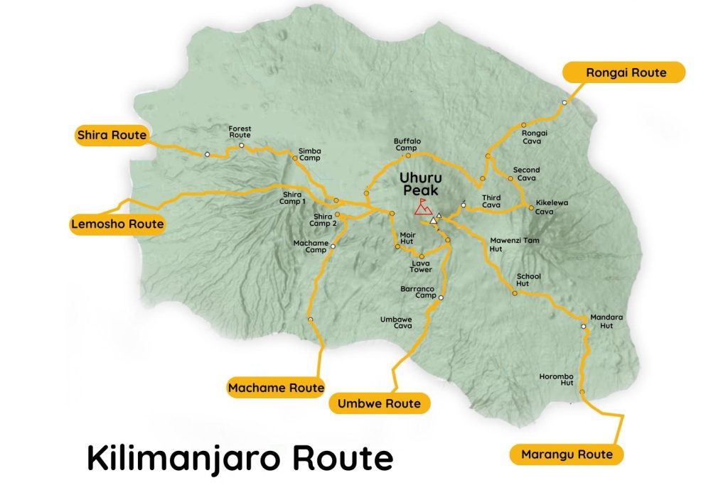
What Is the Machame Route on Kilimanjaro?
The machame route is one of the most popular and scenic routes for climbing Mount Kilimanjaro. Known as the “Whiskey Route,” it follows a gradual 6- or 7-day itinerary that improves acclimatization and increases summit success. The trail passes through five distinct climate zones, from lush rainforest to the glaciers of Uhuru Peak, making it an excellent choice for trekkers seeking breathtaking scenery, a rewarding challenge, and a high chance of reaching Africa’s highest summit.
The Machame Route is one of the best routes for climbing Mount Kilimanjaro because it offers an excellent balance of spectacular scenery, gradual acclimatization, and a high summit success rate. Whether you’re climbing Kilimanjaro for the first time or looking for a memorable mountain adventure, the Machame Route provides an exciting journey through diverse landscapes while giving you a strong chance of reaching Uhuru Peak.
Spectacular Scenery from Start to Summit
Often called the “Whiskey Route,” the Machame Route is famous for its incredible scenery. The trail passes through lush rainforest, open moorland, rocky alpine desert, and finally the snow-covered summit of Kilimanjaro. Every day offers new landscapes, making it one of the most photogenic routes on the mountain.
Better Acclimatization for a Higher Summit Success Rate
One of the biggest advantages of the Machame Route is its “climb high, sleep low” profile. This gradual ascent helps your body adjust to the altitude, reducing the risk of altitude sickness. The recommended 7-day itinerary provides even more time for acclimatization, giving many climbers a better chance of reaching Uhuru Peak successfully.
Experience the Famous Barranco Wall
The Barranco Wall is one of Kilimanjaro’s most exciting highlights. Although it looks steep from a distance, it is a rewarding scramble rather than a technical climb. Reaching the top offers breathtaking views and a real sense of achievement that many climbers describe as one of the best moments of their adventure.
Explore Kilimanjaro’s Diverse Wildlife and Ecosystems
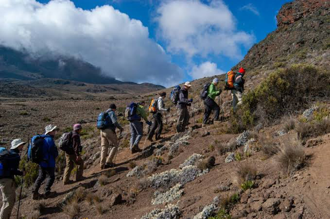
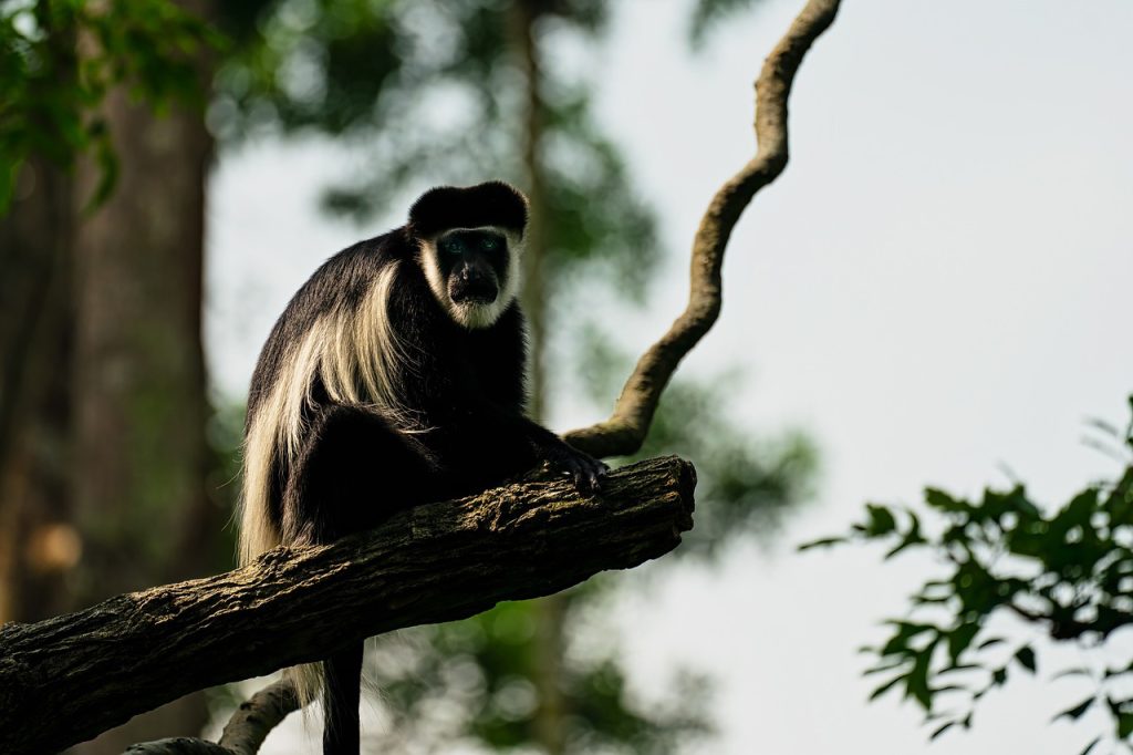
The Machame Route begins in Kilimanjaro’s rainforest, where you may spot black-and-white colobus monkeys, blue monkeys, colorful birds, and unique mountain plants. As you climb higher, you’ll experience five different climate zones, each with its own landscapes and natural beauty.
An Excellent Choice for First-Time Climbers
Although the Machame Route is physically demanding, it is an excellent option for first-time climbers who are reasonably fit and well prepared. Its gradual acclimatization profile, experienced guide support, and outstanding scenery make it one of the most recommended routes for reaching Africa’s highest peak.
Ready to Experience the Machame Route?
If you’re looking for an unforgettable Kilimanjaro adventure, WeWild Travel is here to help. Our experienced local guides, carefully planned itineraries, and personalized service are designed to give you the best possible summit experience.
Is the Machame Route Right for You?
The Machame Route suits climbers who want a rewarding challenge with excellent scenery and a strong chance of reaching Uhuru Peak. Its seven-day itinerary allows more time to adjust to the altitude than shorter routes, making it a popular choice for first-time climbers who arrive well prepared. The trail includes steep sections such as the Barranco Wall, so a reasonable level of fitness and a positive attitude are important.
Experienced hikers often choose the Machame Route because it combines varied landscapes with an engaging trekking experience. Solo travelers also enjoy this route thanks to its lively atmosphere, where climbers from around the world share campsites and celebrate their summit success together. Photographers appreciate the dramatic scenery, from lush rainforest and giant heather to alpine desert and breathtaking sunrise views from the Roof of Africa.
Families with younger children may find the route demanding due to the long hiking days, high altitude, and camping conditions. Families with older teenagers who have hiking experience and good fitness can still enjoy a safe and memorable climb with the right preparation and support.
The table below provides a quick guide to help you decide whether the Machame Route matches your travel style and experience.
Traveler
Recommendation
Beginner
A great choice for beginners with good fitness and proper preparation.
Family
Best suited for families with older teenagers who enjoy hiking and camping.
Experienced Hiker
Highly recommended for experienced hikers seeking a scenic and rewarding climb.
Solo Traveler
An excellent option for solo travelers who enjoy meeting other climbers.
Photographer
One of the best routes for photographers, offering diverse landscapes and spectacular summit views.
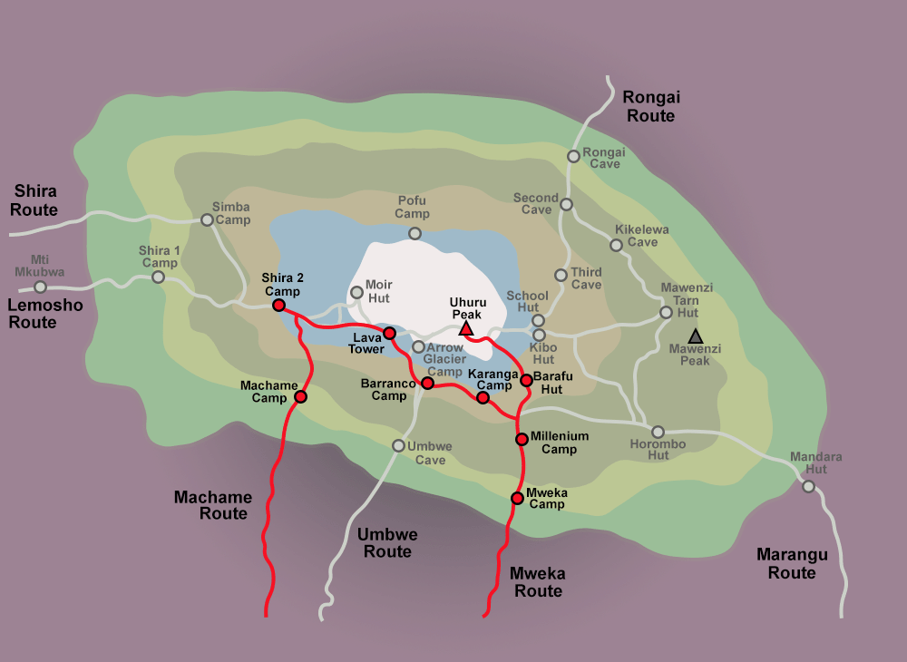
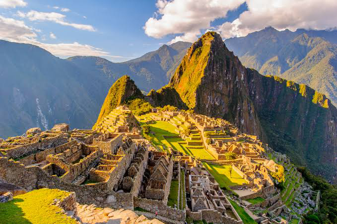
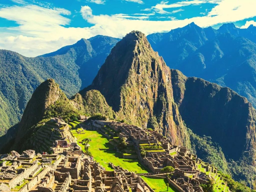
Machame Route Map
The Machame Route begins at Machame Gate on the southern slopes of Mount Kilimanjaro and follows a scenic trail through five distinct climate zones before reaching Uhuru Peak at 5,895 meters (19,341 feet). Along the way, climbers pass Machame Camp, Shira Camp, Barranco Camp, Karanga Camp, and Barafu Camp before making the final summit ascent.
The map below shows the complete route, including daily camps, elevation changes, and key landmarks. Reviewing the route before your climb will help you understand the daily trekking distances, altitude progression, and overnight stops, making it easier to prepare for your Kilimanjaro adventure.
7-Day Machame Route Itinerary
Follow our carefully planned 7-day Machame Route itinerary, designed to give you the best balance of acclimatization, safety, and summit success. Each day brings new landscapes, increasing elevations, and unforgettable views as you make your way to the Roof of Africa with our experienced mountain guides.
Day 1: Machame Gate to Machame Camp
Distance:62 kilometers (37 miles)
Walking Time: 5-7 Hours
Elevation: 1,800 m (5,905 ft) – 3,000 m (9,843 ft)
Meals: Lunch & Dinner
Accommodation: Machame Camp
Today’s Highlight: Trek through Kilimanjaro’s lush rainforest, where towering trees, colorful wildflowers, and playful black-and-white colobus monkeys create an unforgettable introduction to your climb.
The cost of climbing the Machame Route depends on your group size, travel dates, and the level of service you choose. Whether you prefer to join a scheduled group, enjoy the privacy of a private climb, or upgrade to a luxury experience, WeWild Travel offers flexible options to match your budget and travel style.
Package
Starting Price
Group Climb
From $1885 per person
Private Climb
From $3178 per person
Luxury Climb
From $3378 per person
What’s Included
Your Machame Route package includes all Kilimanjaro National Park entry, camping, rescue, and conservation fees, professional English-speaking mountain guides, experienced porters and cooks, airport transfers, accommodation before and after the climb, all meals on the mountain, quality camping equipment, dining tent, table and chairs, emergency oxygen, pulse oximeter health checks, drinking water, and government taxes.
What’s Not Included
The package does not include international or domestic flights, Tanzanian visa fees, travel insurance, personal trekking equipment, sleeping bag and rental gear, alcoholic and soft drinks, personal expenses, guide and porter tips, or any additional accommodation or activities not listed in the itinerary.
Need a personalized price? Contact WeWild Travel for a free, no-obligation quotation based on your preferred travel dates, group size, and climbing package.
Group Departures
Joining one of our scheduled group departures is an excellent way to climb the Machame Route while sharing the experience with travelers from around the world. Group climbs offer a cost-effective option without compromising on safety, professional guiding, or the quality of service. Each departure is carefully planned with limited group sizes to ensure a comfortable and enjoyable trekking experience.
Check the departure calendar below to see upcoming climb dates, available spaces, and current availability. If your preferred date is not listed, we can arrange a private departure on a date that works best for you.
Success Rate
The Machame Route is one of the most successful routes on Mount Kilimanjaro, especially when climbed over seven days. At WeWild Travel, we increase your chances of reaching Uhuru Peak by focusing on careful preparation, gradual acclimatization, and continuous support throughout the climb.
Our experienced mountain guides monitor every climber’s health each day using pulse oximeters and regular wellness checks. They follow the “pole pole” (slowly, slowly) climbing pace, allowing your body to adjust naturally to the increasing altitude. This steady approach helps reduce the risk of altitude sickness and improves your chances of a successful summit.
We also maintain a high guide-to-climber ratio, ensuring every guest receives personal attention on the trail. Our team carries emergency oxygen, first aid equipment, and communication devices, and our guides receive professional mountain safety and first aid training. Every decision on the mountain prioritizes your health and safety.
Success is about more than standing on the summit. It comes from climbing at the right pace, eating well, staying hydrated, resting properly, and trekking with an experienced team that knows Mount Kilimanjaro inside and out. That is the approach WeWild Travel follows on every climb, helping our guests enjoy a safer journey and the best possible chance of reaching the Roof of Africa.
Safety on the Mountain
Your safety is our highest priority on every Kilimanjaro climb. At WeWild Travel, we follow proven mountain safety procedures to help you enjoy a safe, comfortable, and successful journey to Uhuru Peak. Our experienced guides monitor your health throughout the trek and make informed decisions based on your condition and the mountain environment.
Every climber receives daily medical checks, including pulse oximeter readings to measure oxygen saturation and heart rate. Our guides also assess how you are feeling, watch for early signs of altitude sickness, and adjust the pace when necessary. By climbing slowly and following a gradual acclimatization schedule, we help your body adapt to the altitude safely.
Every expedition carries emergency oxygen, a comprehensive first aid kit, and reliable communication equipment. Our mountain guides are trained in wilderness first aid and know how to respond quickly to altitude-related illnesses and other medical emergencies. If a climber requires immediate assistance, our team follows established emergency evacuation procedures and coordinates a rapid descent while arranging additional support when needed.
From your first day on the trail to your summit attempt, our goal is to provide a safe climbing environment where you can focus on enjoying the adventure with confidence. When you climb with WeWild Travel, you are supported by a professional team that puts your health and safety first at every stage of the journey.
Food on the Mountain
Nutritious meals play an important role in helping you stay strong and energized throughout your Kilimanjaro climb. At WeWild Travel, our mountain cooks prepare fresh, balanced meals every day using quality ingredients to provide the energy your body needs at high altitude. Hot meals, warm drinks, and plenty of drinking water help you recover after each day’s trek and prepare for the next stage of your adventure.
Breakfast
Start each morning with a hearty breakfast that may include eggs, porridge, toast, pancakes, sausages, fresh fruit, tea, coffee, and hot chocolate. Breakfast provides the energy needed for the day’s hike.
Lunch
Lunch is served on the trail or at camp, depending on the day’s itinerary. Meals often include soup, sandwiches, chicken, pasta, rice, vegetables, fresh fruit, and refreshing drinks to keep you fueled during the climb.
Dinner
Dinner is the main meal of the day and is served in the dining tent after you arrive at camp. A typical dinner includes hot soup, a choice of meat or fish, rice, potatoes or pasta, fresh vegetables, and a dessert to help replenish your energy.
Snacks
Healthy snacks are available during the trek to maintain your energy between meals. Depending on the day, these may include biscuits, popcorn, peanuts, chocolate, fresh fruit, and energy bars. Hot tea, coffee, and drinking water are also available throughout the climb.
Dietary Options
We cater to a wide range of dietary requirements, including vegetarian, vegan, gluten-free, halal, and other special meal requests. Simply let us know your dietary needs before your climb, and our mountain chef will prepare suitable meals throughout your Kilimanjaro adventure.
Accommodation
Your comfort is an important part of a successful Kilimanjaro climb. At WeWild Travel, we provide clean, comfortable accommodation before and after your trek, along with quality camping equipment on the mountain. Our goal is to ensure you rest well each night so you are ready for the next day’s adventure.
Hotel
Before and after your climb, you will stay at a comfortable hotel in Moshi. Your stay includes a private room, comfortable bed, hot shower, Wi-Fi, and breakfast. This gives you time to relax, prepare for the trek, and celebrate your successful summit after returning from the mountain.
Photo: Hotel room in Moshi.
Camping
During the climb, you will spend each night at designated camps along the Machame Route. Our team sets up your camp before you arrive, allowing you to rest and enjoy the mountain scenery after each day’s trek.
Photo: Campsite on the Machame Route.
Dining Tent
All meals are served in a spacious dining tent where you can enjoy breakfast, lunch, and dinner in comfort. The tent includes tables and chairs, creating a warm and welcoming place to eat, relax, and spend time with your climbing team.
Private Toilet
For greater comfort and hygiene, a private portable toilet is available as an optional upgrade during your climb. Many climbers choose this service for added privacy, especially on longer expeditions.
Photo: Private portable toilet.
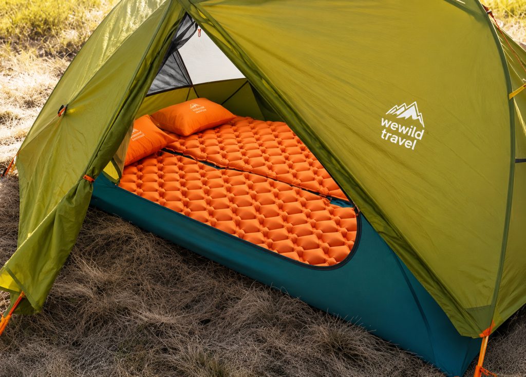
Sleeping Tent
You will sleep in high-quality, weather-resistant mountain tents designed for Kilimanjaro’s changing conditions. The tents provide protection from wind, rain, and cold temperatures while giving you enough space to rest comfortably before the next day’s hike.
Photo: Sleeping tent at camp.
Machame Route vs Other Routes
Choosing the right Kilimanjaro route is one of the most important decisions when planning your climb. Each route offers a different experience, from scenic beauty and acclimatization to accommodation style and overall difficulty. The comparison below highlights the key differences to help you find the route that best matches your fitness level, travel style, and summit goals.
Feature
Machame
Lemosho
Marangu
Rongai
Northern Circuit
Umbwe
Duration
6-7 Days
7-8 Days
5-6 Days
6-7 Days
8-9 Days
5-6 Days
Difficulty
Moderate to Challenging
Moderate
Moderate
Moderate
Moderate
Very Challenging
Accommodation
Camping
Camping
Mountain Huts
Camping
Camping
Camping
Scenery
Excellent
Outstanding
Good
Very Good
Outstanding
Very Good
Acclimatization
Very Good
Excellent
Fair
Good
Excellent
Limited
Summit Success
High
Very High
Moderate
High
Very High
Lower
Crowds
Busy
Moderate
Busy
Quiet
Very Quiet
Quiet
Best For
Most Climbers
Scenic, Longer Climbs
Hut Accommodation
Quiet Trails
Maximum Summit Success
Experienced Climbers
If you want an excellent balance of beautiful scenery, good acclimatization, and a high summit success rate, the Machame Route remains one of the best all-round choices on Mount Kilimanjaro. Travelers looking for a quieter and longer adventure may prefer the Lemosho Route or Northern Circuit, while Marangu appeals to climbers who prefer sleeping in mountain huts. Rongai offers a less crowded approach from the northern side of the mountain, and Umbwe is best suited for experienced hikers seeking a steep and demanding challenge.
Not sure which route is right for you? Contact the WeWild Travel team for expert advice, and we’ll help you choose the Kilimanjaro route that best fits your experience, fitness level, schedule, and travel goals.
Frequently Asked Questions
1. How difficult is the Machame Route?
The Machame Route is considered moderately challenging. It is suitable for climbers with a good level of fitness and proper preparation.
2. How many days does the Machame Route take?
Most climbers choose the 7-day itinerary because it provides better acclimatization and a higher chance of reaching Uhuru Peak.
3. What is the success rate of the Machame Route?
The 7-day Machame Route has a higher summit success rate than the 6-day option because it allows more time to adjust to the altitude.
4. What is the best time to climb the Machame Route?
The best months are January to March and June to October when the weather is generally drier and visibility is excellent.
5. How much does the Machame Route cost?
The price depends on your group size, travel dates, and the package you choose. Contact WeWild Travel for a personalized quotation.
6. Is the Machame Route suitable for beginners?
Yes. Many first-time climbers successfully reach the summit on the 7-day Machame Route with proper preparation.
7. Where does the Machame Route start?
The climb begins at Machame Gate on the southern side of Mount Kilimanjaro.
8. Where does the Machame Route end?
The route finishes at Mweka Gate after your successful summit and descent.
9. How high is Uhuru Peak?
Uhuru Peakstands at 5,895 meters (19,341 feet), making it the highest point in Africa.
10. Do I need previous climbing experience?
No. Previous mountaineering experience is not required, but good physical fitness is recommended.
11. Do I need technical climbing equipment?
No. The Machame Route is a trekking route and does not require ropes or technical climbing skills.
12. What should I pack for the climb?
You should bring warm clothing, waterproof gear, hiking boots, gloves, a headlamp, and other essential mountain equipment. Rental gear is also available.
13. Can I rent mountain equipment?
Yes. Quality sleeping bags, trekking poles, jackets, and other equipment can be rented before your climb.
14. What meals are provided on the mountain?
Our mountain chefs prepare fresh breakfasts, lunches, dinners, snacks, and hot drinks throughout the climb.
15. Can you provide vegetarian or vegan meals?
Yes. We can accommodate vegetarian, vegan, gluten-free, halal, and other dietary requirements with advance notice.
16. How do you help prevent altitude sickness?
Our guides monitor your health daily, encourage a slow climbing pace, and follow an itinerary designed for proper acclimatization.
17. Is emergency oxygen available?
Yes. Every climb carries emergency oxygen, first aid equipment, and medical supplies.
18. Are your mountain guides certified?
Yes. Our guides are professionally trained and experienced in mountain safety, first aid, and emergency response.
19. Do I need travel insurance?
Yes. We strongly recommend comprehensive travel insurance that covers high-altitude trekking and emergency evacuation.
Your package includes comfortable hotel accommodation in Moshi before and after your Kilimanjaro adventure.
22. How many people are in a group?
Group sizes vary, but we keep our groups small to provide better support, safety, and a more enjoyable climbing experience.
23. Can I book a private climb?
Yes. Private departures are available on any date and can be customized to match your schedule and preferences.
24. How far in advance should I book?
We recommend booking several months in advance, especially during the busy climbing seasons, to secure your preferred dates.
25. Why should I climb with WeWild Travel?
WeWild Travel combines experienced local guides, quality equipment, personalized service, and a strong commitment to safety to provide an unforgettable Kilimanjaro experience from arrival to summit. There has never been a better time to climb Mount Kilimanjaro. Contact WeWild Travel today to receive your personalized itinerary and a free, no-obligation quotation. Let our expert team help you turn your dream of reaching Africa’s highest peak into reality.
Why Travelers Choose WeWild Travel for the Machame Route
Choosing the right Kilimanjaro operator can make a big difference to your climbing experience. At WeWild Travel, we focus on providing safe, personalized, and professionally organized adventures led by experienced local mountain crews who know Kilimanjaro better than anyone.
As a locally owned Tanzanian tour company, we believe every climber deserves honest advice, careful planning, and friendly support from the moment they contact us until they return home. Instead of treating you like just another booking, we take the time to understand your goals and help you choose the itinerary that best matches your experience and fitness level.
Our Machame Route climbs are led by experienced guides who prioritize your safety throughout the trek. Daily health checks, emergency oxygen, first aid equipment, and a carefully paced itinerary help give you the best possible chance of reaching Uhuru Peak safely.
We also believe that great adventures should support local communities. That’s why we work with professional local guides, mountain cooks, and porters who help make every Kilimanjaro expedition a success while promoting responsible tourism in Tanzania.
When you book with WeWild Travel, you can expect:
A knowledgeable local team based in Tanzania.
Personalized trip planning and quick responses.
Flexible private and group departures.
Quality camping equipment and freshly prepared mountain meals.
Airport transfers and accommodation options to simplify your trip.
Friendly support before, during, and after your climb.
Whether you’re climbing Kilimanjaro for the first time or returning for another adventure, we’re committed to helping you enjoy a safe, memorable, and rewarding journey to the Roof of Africa.
Start Planning Your Machame Route Adventure
Have questions about prices, travel dates, or the best itinerary? Contact WeWild Travel today for a free, no-obligation quotation. Our team is ready to help you plan your Kilimanjaro adventure with confidence.
The complete guide to Mount Elbrus, the highest peak in Europe.
Estimated reading time: 26 minutes
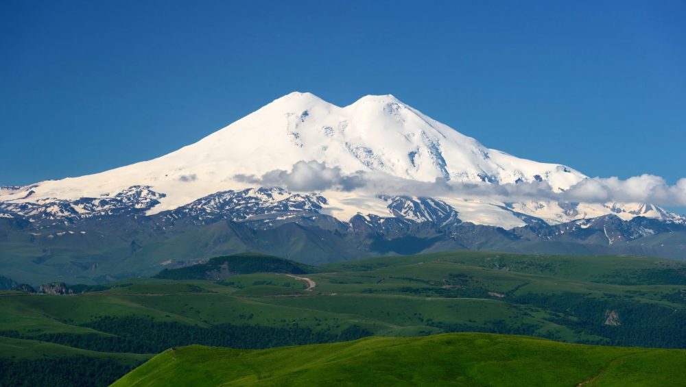
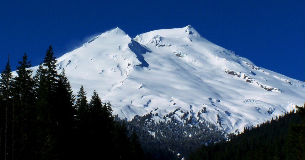
Mount Elbrus is the highest mountain in Europe, standing at 5,642 meters (18,510 feet) above sea level. Located in the Caucasus Mountains of southern Russia, it is a dormant volcano with two summits and a key part of the famous Seven Summits challenge. Known for its breathtaking scenery, glaciers, and relatively accessible climbing routes, Mount Elbrus attracts thousands of climbers each year. Whether you are researching Europe’s highest peak or planning an expedition, understanding its location, height, climbing difficulty, and best routes is essential for a successful journey.
Mount Elbrus is a dormant stratovolcano in the Caucasus Mountains and the highest mountain in Europe. Its western summit reaches 5,642 meters (18,510 feet), making it taller than any other peak on the continent. The mountain is one of the Seven Summits, a collection of the highest mountains on each continent that many climbers aim to complete.
Why Mount Elbrus Is Famous
Mount Elbrus is famous for being the highest mountain in Europe and one of the world’s most popular high-altitude climbs. It attracts adventurers from around the globe who want to complete the Seven Summits challenge. The mountain also stands out because it is a dormant volcano with two distinct summits and extensive glacier systems.
Key Facts About Europe’s Highest Peak
Fact
Information
Elevation
5,642 m (18,510 ft)
Location
Russia
Mountain Range
Greater Caucasus
Type
Dormant Stratovolcano
Highest Point in Europe
Yes
Seven Summits Peak
Yes
First Recorded Ascent
1829
Best Climbing Season
June–September
This structure gives Google the answer immediately after the H1, then expands the topic through the H2 and H3 sections. It is much stronger for SEO than starting with a long introduction.
Mount Elbrus at a Glance
Mount Elbrus is the highest mountain in Europe and one of the world’s most famous climbing destinations. Located in the Caucasus Mountains of southern Russia, this dormant volcano rises to 5,642 meters (18,510 feet) above sea level. As a member of the Seven Summits, Mount Elbrus attracts thousands of climbers each year who hope to stand on the highest point of the European continent.
Mount Elbrus Facts Table
Feature
Details
Mountain Name
Mount Elbrus
Elevation
5,642 m (18,510 ft)
Location
Caucasus Mountains, Russia
Continent
Europe
Mountain Range
Greater Caucasus
Type
Dormant Stratovolcano
Highest Point in Europe
Yes
Number of Summits
Two
Western Summit
5,642 m (18,510 ft)
Eastern Summit
5,621 m (18,442 ft)
First Recorded Ascent
1829
Seven Summits Peak
Yes
Best Climbing Season
June to September
note: Some geographers debate whether Mount Elbrus lies in Europe or Asia, but it is widely recognized as Europe’s highest mountain.
Height, Location, and Volcano Status
Mount Elbrus stands at 5,642 meters (18,510 feet), making it the tallest mountain in Europe and one of the most prominent peaks in the world. The mountain is located in the western part of the Caucasus Mountains near the border between the Russian republics of Kabardino-Balkaria and Karachay-Cherkessia.
Unlike many famous mountains, Elbrus is actually a dormant stratovolcano. Although it has not erupted for thousands of years, its twin volcanic cones and extensive lava formations reveal its volcanic origins. Today, massive glaciers cover much of the mountain, creating the snowy landscape that climbers experience during an ascent.
Mount Elbrus by the Numbers
Elevation: 5,642 m (18,510 ft)
Prominence: 4,741 m (15,554 ft)
Eastern Summit Height: 5,621 m (18,442 ft)
Glaciers: More than 20 major glaciers
Annual Climbers: Approximately 10,000-12,000
Summit Day Duration: 10-15 hours
Typical Expedition Length: 7-10 days
Best Climbing Months: June, July, August, and September
Seven Summits Ranking: 5th highest of the Seven Summits
Last Eruption: Approximately 2,000 years ago
These numbers highlight why Mount Elbrus is one of the most sought-after mountains for climbers. It combines impressive altitude, a rich geological history, and a relatively accessible route to the highest point in Europe.
Where Is Mount Elbrus Located?
Mount Elbrus is located in southern Russia within the Greater Caucasus mountain system. The mountain rises near the border of the Russian republics of Kabardino-Balkaria and Karachay-Cherkessia, between the Black Sea and the Caspian Sea. Its strategic position at the crossroads of Europe and Asia has made it one of the most geographically significant mountains in the world.
Mount Elbrus in Russia
Mount Elbrus lies entirely within Russia and forms part of the country’s rugged Caucasus region. The mountain is situated about 100 kilometers (62 miles) from the border with Georgia and is surrounded by the protected landscapes of Prielbrusye National Park. Most climbers access the mountain through the Baksan Valley, where villages such as Terskol and Azau serve as the main gateways to the climbing routes.
As the highest peak in Russia, Mount Elbrus attracts thousands of local and international visitors each year. The region offers not only mountaineering opportunities but also skiing, hiking, and breathtaking alpine scenery.
The Caucasus Mountain Range
Mount Elbrus is part of the Greater Caucasus, a massive mountain range that stretches for more than 1,200 kilometers (750 miles) between the Black Sea and the Caspian Sea. The Caucasus contains some of the highest and most dramatic peaks in Europe, including several mountains that exceed 5,000 meters (16,404 feet).
The range serves as a natural barrier between Eastern Europe and Western Asia and is known for its glaciers, deep valleys, diverse wildlife, and unique cultures. Mount Elbrus dominates the western section of the Caucasus and stands as the highest peak in the entire mountain system.
Is Mount Elbrus in Europe or Asia?
The question of whether Mount Elbrus is in Europe or Asia has been debated for centuries. The answer depends on where the boundary between the two continents is drawn.
Most geographers place the Europe Asia border along the crest of the Greater Caucasus Mountains. Under this widely accepted definition, Mount Elbrus lies on the European side of the boundary, making it the highest mountain in Europe.
However, some researchers argue that the continental boundary should follow the Kuma-Manych Depression, a lowland area north of the Caucasus. If this definition is used, Mount Elbrus would technically be in Asia, and Mont Blanc would become Europe’s highest mountain.
Despite the debate, the global mountaineering community and the Seven Summits challenge recognize Mount Elbrus as the highest peak in Europe. This recognition is why climbers from around the world travel to Russia to stand on the roof of Europe.
How Tall Is Mount Elbrus?
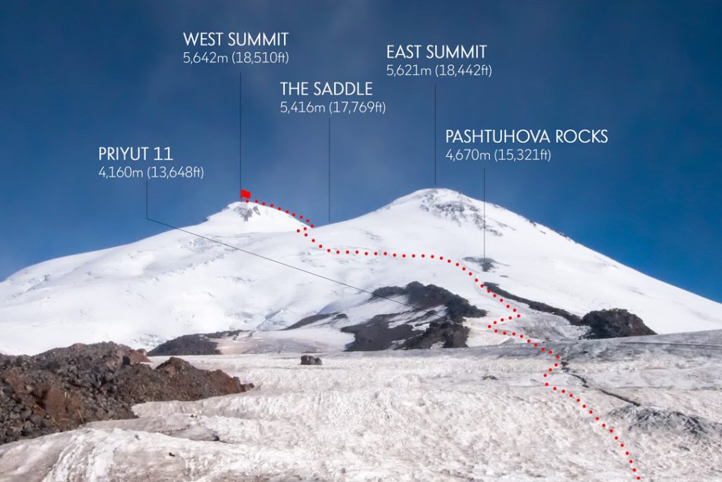
Mount Elbrus stands at an elevation of 5,642 meters (18,510 feet) above sea level, making it the highest mountain in Europe. Unlike many famous peaks, Elbrus has two distinct summits a higher western summit and a slightly lower eastern summit. Both peaks are part of the same dormant volcano and are separated by a saddle that sits around 5,416 meters (17,769 feet) above sea level.
Elevation of the Western Summit
The Western Summit is the highest point of Mount Elbrus, reaching 5,642 meters (18,510 feet). Because it is the taller of the two peaks, this summit is officially recognized as the highest point in Europe and the goal of most climbers attempting Mount Elbrus.
The first successful ascent of the Western Summit took place in 1874 when a British expedition led by Florence Crauford Grove reached the top. Today, most climbers approach the summit via the popular South Route, which offers the easiest and most accessible path to the roof of Europe.
Elevation of the Eastern Summit
The Eastern Summit rises to 5,621 meters (18,442 feet), making it just 21 meters (69 feet) lower than the Western Summit. Although it is not the mountain’s highest point, the Eastern Summit holds historical significance because it was the first summit reached during the mountain’s recorded climbing history.
In 1829, members of a Russian scientific expedition became the first known climbers to reach the Eastern Summit. While fewer climbers visit this peak today, it remains a rewarding objective for experienced mountaineers seeking a more challenging adventure.
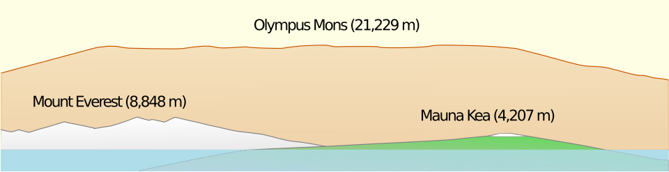
Mount Elbrus Height Comparison Table
The height of Mount Elbrus becomes even more impressive when compared with other famous mountains around the world.
Mountain
Country
Elevation
Mount Everest
Nepal/China
8,849 m (29,032 ft)
Aconcagua
Argentina
6,961 m (22,838 ft)
Denali
United States
6,190 m (20,310 ft)
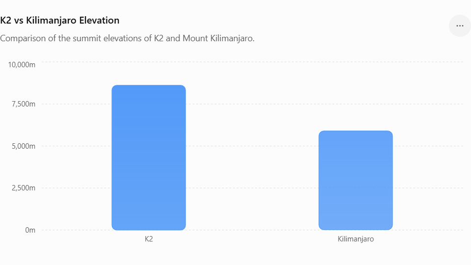
Mount Kilimanjaro
Tanzania
5,895 m (19,341 ft)
Mount Elbrus
Russia
5,642 m (18,510 ft)
Mont Blanc
France/Italy
4,805 m (15,766 ft)
This comparison shows that while Mount Elbrus is lower than peaks such as Everest and Kilimanjaro, it remains the tallest mountain in Europe and one of the most sought-after summits in the world. Its impressive elevation, combined with its status as a Seven Summits peak, makes it a major goal for climbers of all experience levels.
Why Is Mount Elbrus Famous?
Mount Elbrus is famous because it is the highest mountain in Europe, the tallest peak in the Caucasus Mountains, and one of the Seven Summits the highest mountains on each continent. It is also one of the world’s highest dormant volcanoes, attracting thousands of climbers every year who want to complete one of the world’s most prestigious mountaineering challenges.
The Highest Mountain in Europe
Mount Elbrus rises to 5,642 meters (18,510 feet) above sea level, making it the highest mountain in Europe. Located in the western Caucasus Mountains of southern Russia, it surpasses every other European peak, including Mont Blanc. Because of its elevation, Mount Elbrus is recognized as the continent’s highest point by most mountaineering organizations.
Part of the Seven Summits Challenge
Mount Elbrus is one of the Seven Summits, a famous mountaineering challenge that involves climbing the highest mountain on each continent. Many climbers choose Elbrus as an important step toward completing this global achievement because it combines high altitude with relatively low technical difficulty on its standard route.
One of the World’s Highest Volcanoes
Mount Elbrus is a dormant stratovolcano with two volcanic summits. Although it has not erupted in recorded history, scientists classify it as dormant rather than extinct because it still shows signs of geothermal activity. Its volcanic origin, combined with its massive elevation, makes Mount Elbrus one of the highest volcanoes on Earth and the highest volcano in Europe.
The History of Mount Elbrus
Mount Elbrus has a long history that combines exploration, mountaineering, and military significance. Over the centuries, it has attracted explorers, scientists, and climbers from around the world. Today, it remains one of the most climbed high mountains in Europe.
First Recorded Ascent
The first recorded ascent of Mount Elbrus took place in 1829, when a Russian scientific expedition reached the eastern summit. The team explored the mountain to improve geographical knowledge of the Caucasus region. Later, in 1874, a British-led expedition successfully climbed the higher western summit, which is now recognized as the true summit of Mount Elbrus.
Climbing Milestones Through History
Mount Elbrus became increasingly popular during the twentieth century as climbing equipment, transportation, and mountain infrastructure improved. The construction of cable cars, mountain huts, and rescue services made the mountain more accessible to international climbers.
Today, thousands of people attempt to climb Mount Elbrus each year. It has become one of the most popular peaks in the Seven Summits challenge because the standard south route allows experienced trekkers to reach a high-altitude summit without advanced rock or ice climbing.
Mount Elbrus During World War II
Mount Elbrus played an important role during World War II because of its strategic location in the Caucasus Mountains. In 1942, German forces occupied parts of the region and raised their flag on the mountain as part of their campaign to advance into the Caucasus.
The occupation was short-lived. Soviet forces later regained control of the area, and Mount Elbrus became a symbol of resistance and victory. Today, the mountain stands as both a famous climbing destination and a historic landmark that reflects an important chapter in European history.
What Makes Mount Elbrus Unique?
Mount Elbrus is unique because it has two volcanic summits, is the highest mountain in Europe, and ranks among the world’s tallest dormant volcanoes. Its combination of volcanic origin, permanent glaciers, and cultural importance makes it one of the most remarkable mountains on the continent.
A Mountain With Two Summits
Unlike most famous mountains, Mount Elbrus has two distinct summits. The western summit is the highest at 5,642 meters (18,510 feet), while the eastern summit reaches 5,621 meters (18,442 feet). A broad saddle connects the two peaks, allowing experienced climbers to traverse between them. The western summit is the official highest point in Europe.
The Dormant Volcano of Europe
Mount Elbrus is a dormant stratovolcano formed by volcanic eruptions hundreds of thousands of years ago. Although it has not erupted in recorded history, scientists classify it as dormant because geothermal activity still exists beneath the mountain. Thick glaciers now cover much of its upper slopes, creating a striking contrast between volcanic rock and permanent ice.
Cultural and Local Significance
Mount Elbrus has deep cultural importance for the people of the Caucasus region. Local legends describe the mountain as a sacred place and connect it with ancient myths passed down through generations. Today, Mount Elbrus also plays an important role in regional tourism, attracting climbers, hikers, and nature enthusiasts from around the world while supporting local communities through mountaineering and adventure travel.
Can Beginners Climb Mount Elbrus?
Yes, beginners can climb Mount Elbrus, but only with proper preparation, good physical fitness, and an experienced guide. The standard South Route does not require advanced rock climbing skills, but the high altitude, cold temperatures, and changing weather make the climb more challenging than many first-time climbers expect.
Who Can Climb Mount Elbrus?
Mount Elbrus is suitable for healthy adults with a good level of fitness and determination. You do not need previous technical mountaineering experience to climb the standard route, but you should feel comfortable hiking for several hours each day while carrying basic equipment.
Many climbers use Mount Elbrus as their first major high-altitude expedition before attempting more technical mountains.
Physical Fitness Requirements
Good cardiovascular fitness and strong leg muscles are essential for climbing Mount Elbrus. Most successful climbers prepare by hiking, running, cycling, or climbing stairs several months before their expedition.
Altitude is the biggest physical challenge. Even fit climbers can develop symptoms of altitude sickness if they ascend too quickly. Following a proper acclimatization schedule greatly improves the chances of reaching the summit.
Common Challenges for First-Time Climbers
Most first-time climbers struggle with the mountain’s high altitude rather than its technical difficulty. Thin air can cause headaches, fatigue, nausea, and slower movement near the summit.
Cold temperatures, strong winds, and sudden weather changes also make the climb more demanding. Walking on snow while wearing crampons requires practice, but guides usually provide basic training before summit day.
With proper preparation, gradual acclimatization, and experienced guides, many beginners successfully reach the summit of Mount Elbrus each year.
How Difficult Is Mount Elbrus?
Mount Elbrus is considered a moderately difficult high-altitude climb. The standard South Route does not require advanced technical climbing skills, but the mountain presents serious challenges because of its high elevation, freezing temperatures, strong winds, and unpredictable weather. Success depends more on fitness, acclimatization, and preparation than on technical mountaineering experience.
Technical Difficulty Explained
The standard South Route is the easiest way to climb Mount Elbrus. Climbers walk across snow-covered slopes using crampons and an ice axe, but they do not need advanced rock climbing or ice climbing skills under normal conditions. Guides usually teach beginners how to use their equipment before the summit attempt.
The North, East, and West routes are much more demanding. These routes involve longer approaches, fewer facilities, and greater mountaineering experience.
Weather and Altitude Challenges
Weather and altitude create the biggest obstacles on Mount Elbrus. Temperatures near the summit often drop well below freezing, even during summer. Strong winds, heavy snowfall, and poor visibility can develop within hours and force climbers to turn back.
At 5,642 meters (18,510 feet), the reduced oxygen level also affects every climber. Without proper acclimatization, altitude sickness can cause headaches, dizziness, nausea, and extreme fatigue, making the final ascent much more difficult.
Why Climbers Fail to Reach the Summit
Most climbers fail to reach the summit because of altitude sickness, severe weather, or inadequate preparation. Starting the climb without proper fitness or rushing the acclimatization process greatly reduces the chances of success.
Poor pacing, dehydration, and unsuitable clothing also contribute to failed summit attempts. Climbers who train well, follow their guide’s advice, and allow enough time to adjust to the altitude have a much better chance of standing on the highest point in Europe.
Mount Elbrus vs Other Famous Mountains
Mount Elbrus differs from other famous mountains in elevation, climbing difficulty, altitude, and overall experience. While it is the highest mountain in Europe, each mountain offers unique challenges and attracts different types of climbers.
Mount Elbrus vs Kilimanjaro
Mount Elbrus and Mount Kilimanjaro are both popular destinations for climbers aiming to complete the Seven Summits challenge. While Kilimanjaro rises higher at 5,895 meters (19,341 feet), Mount Elbrus reaches 5,642 meters (18,510 feet) and stands as the tallest peak in Europe.
Kilimanjaro is located in Africa and is known for its trekking routes that require no technical climbing skills. In contrast, Elbrus in Russia introduces climbers to snow, glaciers, and basic mountaineering equipment such as crampons and ice axes.
Both mountains offer a major high-altitude experience, but Elbrus generally feels more technical, while Kilimanjaro is more of a long trekking ascent.
Mount Elbrus vs Mont Blanc
Mount Elbrus is higher than Mont Blanc, which rises to about 4,805 meters (15,766 feet). Although Mont Blanc is lower, many climbers consider it more technically demanding because it involves glacier travel, steeper terrain, and objective hazards such as rockfall and crevasses.
Mount Elbrus focuses more on endurance, altitude, and adapting to severe weather, while Mont Blanc requires stronger alpine climbing skills and greater technical experience.
Mount Elbrus vs Mount Everest
Standing at 8,849 meters (29,032 feet), Mount Everest is the highest mountain in the world and presents a significantly greater challenge than Mount Elbrus. The extreme altitude, long expedition time, and technical demands make Everest a serious undertaking for experienced mountaineers only.
Mount Elbrus, in comparison, offers a more accessible high-altitude climb. Although it still reaches over 5,600 meters and requires proper acclimatization, it does not demand the same level of technical skill, logistics, or extended time commitment as Everest.
Comparison Table
Feature
Mount Elbrus
Mount Kilimanjaro
Mont Blanc
Mount Everest
Height
5,642 m (18,510 ft)
5,895 m (19,341 ft)
4,805 m (15,766 ft)
8,849 m (29,032 ft)
Continent
Europe
Africa
Europe
Asia
Technical Difficulty
Moderate
Low
High
Extreme
Glacier Travel
Yes
No
Yes
Yes
Ice Axe and Crampons
Required
Not required
Required
Required
Typical Climb Duration
7-10 days
5-9 days
2-5 days
6-9 weeks
Best For
High-altitude beginners
First high mountain
Experienced alpine climbers
Elite mountaineers
Mount Elbrus Climbing Routes Explained
Mount Elbrus offers four main climbing routes: the South Route, North Route, East Route, and West Route. Each route differs in difficulty, infrastructure, scenery, and the level of climbing experience required. The South Route is the most popular, while the West Route is the most demanding.
South Route
The South Route is the easiest and most frequently used route on Mount Elbrus. Most guided expeditions follow this route because it provides cable cars, mountain huts, snowcats, and well-established trails. Although the climb reaches high altitude, the route requires only basic mountaineering skills under normal conditions. It is the best choice for first-time climbers attempting Europe’s highest mountain.
North Route
The North Route offers a quieter and more remote climbing experience. Unlike the South Route, it has very little infrastructure, so climbers must carry more equipment and camp along the way. The ascent is physically harder because of the longer approach, but many mountaineers prefer its natural scenery and lower number of visitors.
East Route
The East Route is less crowded and provides a more adventurous climb. Climbers travel through untouched volcanic landscapes and experience a true wilderness expedition. This route demands strong fitness, good navigation skills, and previous experience in high-altitude mountaineering because support facilities are limited.
West Route
The West Route is the most difficult route on Mount Elbrus. It crosses steep glaciers, technical terrain, and remote mountain areas with no developed infrastructure. Climbers need advanced mountaineering skills, glacier travel experience, and the ability to manage changing weather conditions. Only experienced alpinists usually attempt this route.
Route Comparison Table
Route
Difficulty
Infrastructure
Typical Duration
Best For
South Route
Moderate
Excellent
7-9 days
Beginners with guides
North Route
Moderate to Challenging
Limited
8-10 days
Experienced trekkers
East Route
Challenging
Very Limited
8-10 days
Experienced mountaineers
West Route
Highly Challenging
None
9-12 days
Advanced climbers and alpinists
Best Time to Climb Mount Elbrus
The best time to climb Mount Elbrus is from June to September, when the mountain has warmer temperatures, longer daylight hours, and more stable weather. July and August are the busiest months because they offer the highest summit success rates and the safest climbing conditions.
Summer Climbing Season
Summer is the most popular climbing season on Mount Elbrus. Snow conditions are generally more stable, temperatures are less severe, and mountain facilities operate at full capacity. Most guided expeditions take place between late June and early September, with July and August providing the best combination of weather and accessibility.
Although summer offers the best conditions, climbers should still expect freezing temperatures near the summit and sudden weather changes.
Spring and Autumn Conditions
Spring and autumn bring colder temperatures, deeper snow, and fewer climbers. During these seasons, weather conditions become less predictable, increasing the difficulty of the climb. Strong winds and fresh snowfall can slow progress and reduce visibility.
Experienced mountaineers often choose these seasons for a quieter climbing experience, but beginners usually achieve better results during summer.
Winter Ascents
Winter is the most challenging time to climb Mount Elbrus. Extreme cold, powerful winds, heavy snowfall, and short daylight hours create dangerous conditions. Climbers need advanced winter mountaineering skills, specialized equipment, and previous experience in snow and ice.
Only experienced alpinists should consider a winter ascent because the risks increase significantly compared with the summer season.
Monthly Weather Comparison
Month
Climbing Conditions
Temperature
Crowds
Recommendation
May
Cold with deep snow
Very Cold
Low
Experienced climbers
June
Improving conditions
Cold
Moderate
Good
July
Stable weather
Cold to Moderate
High
Excellent
August
Best summit conditions
Cold to Moderate
High
Excellent
September
Cooler with fewer crowds
Cold
Moderate
Very Good
October-April
Severe winter conditions
Extremely Cold
Very Low
Only experienced mountaineers
How Much Does It Cost to Climb Mount Elbrus?
The cost to climb Mount Elbrus depends on the level of service, season, route, and whether you join a guided expedition. On average, a full guided climb costs between $1,500 and $3,500 USD, but budget trips can cost less while premium packages can cost more depending on comfort and logistics.
Guide and Tour Costs
Guide and tour services form the largest part of the Mount Elbrus budget. Most climbers join organized expeditions that include guides, permits, accommodation in mountain huts, and transport from base towns.
Basic group expeditions usually cost less, while private guided climbs cost more but offer better support, flexibility, and safety. The South Route is generally cheaper because it has better infrastructure compared to the northern and eastern routes.
Equipment Rental Costs
Climbers who do not own mountaineering gear can rent equipment in the Elbrus region. Items like crampons, ice axes, boots, and insulated jackets are commonly available.
Rental costs vary depending on quality and duration, but most climbers spend a moderate additional amount to complete their gear list. Proper equipment is essential because cold temperatures and icy terrain make safety gear mandatory.
Flights and Accommodation
Flights to Mount Elbrus typically go through Moscow or Mineralnye Vody Airport in Russia, followed by a road transfer to the Caucasus region. Travel costs vary depending on the season and departure country.
Accommodation ranges from basic guesthouses in towns like Terskol and Azau to mountain huts on the slopes. Budget options reduce total trip cost, while comfortable hotels and private lodges increase expenses.
Sample Budget Breakdown
A typical Mount Elbrus expedition budget looks like this:
Guide and expedition package: $1,500 – $3,500
Flights: $400 – $1,200 (varies by location)
Equipment rental: $150 – $400
Accommodation and meals: $200 – $600
Local transport: $100 – $300
Total estimated cost: $2,300 – $5,000 USD
Careful planning and choosing the right season can significantly reduce overall costs without compromising safety or success chances.
How to Prepare for Mount Elbrus
Proper preparation increases your chances of reaching the summit of Mount Elbrus and reduces the risk of altitude sickness, fatigue, and weather-related problems. Successful climbers train their body, adjust to high altitude, and prepare mentally for long, demanding summit days.
Physical Training Plan
Climbing Mount Elbrus requires strong endurance, leg strength, and cardiovascular fitness. A good training plan focuses on hiking, running, cycling, and stair climbing for several months before the expedition.
Most climbers build stamina by doing long hikes with a backpack, which simulates real mountain conditions. Strength training for legs and core also helps improve balance and stability on snow and ice. Consistent training makes the final ascent more manageable and increases summit success rates.
Acclimatization Strategies
Acclimatization is one of the most important factors for climbing Mount Elbrus. The body needs time to adjust to lower oxygen levels at high altitude. Climbers usually follow a gradual ascent plan that includes rest days at intermediate camps.
Many expeditions use a “climb high, sleep low” strategy, where climbers ascend during the day and return to lower elevations to sleep. Staying hydrated, eating well, and avoiding rapid ascent helps reduce the risk of altitude sickness and improves performance on summit day.
Mental Preparation Tips
Mental strength plays a major role in climbing Mount Elbrus. Climbers face cold temperatures, fatigue, and long hours of steady walking, especially during the final push to the summit.
Successful climbers stay patient, focused, and flexible when conditions change. Preparing for discomfort and understanding that the summit is not guaranteed helps maintain a positive mindset. Confidence, discipline, and determination often make the difference between turning back and reaching the top of Europe.
Essential Mount Elbrus Gear List
Having the right gear for Mount Elbrus directly affects your safety, comfort, and summit success. The mountain has freezing temperatures, strong winds, and icy terrain, so every item you carry must protect you from cold and support movement on snow and glaciers.
Clothing and Layering System
Climbers use a layering system to adapt to changing mountain conditions. The base layer manages sweat, the mid layer provides warmth, and the outer layer protects against wind and snow.
Thermal base layers, fleece jackets, and insulated down jackets are essential. A waterproof and windproof shell keeps climbers dry during storms. Gloves, hats, and neck protection are also necessary because exposed skin loses heat quickly at high altitude.
Footwear and Crampons
Strong, insulated mountaineering boots are required for Mount Elbrus. They must keep feet warm in freezing temperatures and provide ankle support on uneven terrain.
Crampons attach to boots and allow climbers to walk safely on ice and hard snow. A good fit is critical because loose or uncomfortable footwear can slow progress and increase the risk of injury or frostbite.
Safety Equipment
Safety gear plays a key role in reducing risk on Mount Elbrus. An ice axe helps with balance and self-arrest on steep slopes. Helmets protect against falling ice or accidental slips.
Climbers also carry headlamps for early morning summit attempts, sunglasses or goggles for snow glare, and backpacks designed for high-altitude expeditions. In some routes, ropes and harnesses may be used depending on conditions and guide decisions.
Packing Checklist
A complete Mount Elbrus packing list includes essential items for survival and comfort:
Thermal base layers
Insulated jacket and waterproof shell
Mountaineering boots and crampons
Gloves (light and heavy pairs)
Hat and balaclava
Ice axe and helmet
Sunglasses and goggles
Sleeping bag rated for extreme cold
Backpack (30-50 liters)
Water bottles or hydration system
Energy snacks and electrolytes
Careful packing ensures climbers stay warm, safe, and prepared for sudden weather changes throughout the expedition.
Mount Elbrus Climbing Statistics
Mount Elbrus attracts thousands of climbers every year because it is the highest mountain in Europe and part of the Seven Summits challenge. However, success depends heavily on weather, fitness, and acclimatization, which makes the mountain both popular and challenging.
Annual Number of Climbers
Mount Elbrus receives an estimated 10,000 to 15,000 climbers each year, with most attempts happening during the summer season. The majority of climbers use the South Route because it offers better infrastructure and easier access compared to other routes.
Tourism and guided expeditions have increased steadily over the years, making Elbrus one of the busiest high-altitude peaks in the world.
Summit Success Rates
The average summit success rate on Mount Elbrus is around 60% to 80%, depending on weather conditions and the quality of preparation. Climbers who acclimatize properly and follow a guided itinerary have a much higher chance of reaching the summit.
Weather changes and altitude sickness are the main reasons why climbers turn back before the top.
Accident and Safety Statistics
Mount Elbrus is not technically extreme, but it still carries risks due to altitude, cold temperatures, and sudden weather changes. Most accidents occur because of:
Altitude sickness
Slips on ice or snow
Poor weather visibility
Lack of proper gear or experience
Guided climbs significantly reduce risk because guides monitor weather conditions, pace the ascent, and provide safety support throughout the expedition.
Interesting Mount Elbrus Facts
Mount Elbrus stands out in global mountaineering because of its unique characteristics:
It is the highest mountain in Europe at 5,642 meters (18,510 feet)
It has two volcanic summits (west and east peaks)
It is part of the Seven Summits challenge
It is a dormant volcano with glaciers covering its upper slopes
It is one of the most climbed high mountains in the world
These facts make Mount Elbrus a popular goal for climbers who want to experience high-altitude mountaineering without extreme technical difficulty.
Is Mount Elbrus Safe?
Mount Elbrus is generally safe for climbers who prepare well and use proper equipment, but it still involves real mountain risks. Most accidents happen because of altitude, weather changes, and poor preparation rather than technical climbing difficulty.
Main Risks on the Mountain
The main risks on Mount Elbrus come from high altitude, cold temperatures, and slippery terrain. Altitude sickness is the most common problem because the summit sits at 5,642 meters (18,510 feet), where oxygen levels are low.
Slips and falls can also occur on icy slopes, especially when climbers do not use crampons correctly. Fatigue and dehydration increase these risks, particularly during summit attempts.
Weather-Related Dangers
Weather on Mount Elbrus changes quickly and can become dangerous without warning. Strong winds, whiteout conditions, and heavy snowfall can reduce visibility and make navigation difficult.
Temperatures near the summit often drop well below freezing, even in summer. These extreme conditions increase the risk of frostbite and hypothermia if climbers are not properly equipped.
Why Guided Climbs Are Safer
Guided climbs significantly improve safety on Mount Elbrus. Experienced guides monitor weather conditions, choose safer routes, and control the pace of ascent to reduce altitude sickness risks.
Guides also provide technical support, equipment advice, and emergency response assistance if problems occur. For beginners and first-time high-altitude climbers, joining a guided expedition is the safest and most reliable option.
Frequently Asked Questions
These FAQs answer the most common questions climbers ask before attempting Mount Elbrus. They focus on difficulty, experience level, safety, and weather conditions.
Is Mount Elbrus harder than Kilimanjaro?
Mount Elbrus is generally considered more challenging than Kilimanjaro because it requires basic glacier travel skills. Climbers use crampons and ice axes on Elbrus, while Kilimanjaro follows trekking trails without technical equipment. However, Kilimanjaro is higher in elevation, so altitude affects both climbs strongly.
Do you need climbing experience?
You do not need advanced climbing experience to climb the standard South Route of Mount Elbrus. However, basic hiking fitness and comfort in cold mountain conditions are essential. Training before the climb improves safety and summit success.
What is the success rate on Mount Elbrus?
The average summit success rate ranges from 60% to 80%, depending on weather, fitness level, and acclimatization. Climbers who follow a proper schedule and use experienced guides have a higher chance of reaching the top.
Can beginners climb Mount Elbrus?
Yes, beginners can climb Mount Elbrus if they prepare well and choose a guided expedition. The South Route is designed for non-technical climbers, but altitude and weather still create serious challenges that require respect and preparation.
Is Mount Elbrus a volcano?
Yes, Mount Elbrus is a dormant stratovolcano. It has two main summits and has not erupted in recorded history. Scientists still classify it as dormant because geothermal activity exists beneath the mountain.
How cold is Mount Elbrus?
Temperatures on Mount Elbrus vary by season, but near the summit they often drop below -10°C to -30°C (14°F to -22°F). Wind chill can make it feel even colder, especially during summit attempts in the early morning or at night.
Final Thoughts: Is Mount Elbrus Worth Climbing?
Mount Elbrus is worth climbing for anyone who wants to experience high-altitude mountaineering, complete the Seven Summits challenge, or test their endurance on Europe’s highest peak. It offers a mix of accessibility and challenge, making it one of the most popular entry-level big mountains in the world.
Who Should Attempt Mount Elbrus?
Mount Elbrus is ideal for climbers who are physically fit, mentally prepared, and eager to experience snow and glacier travel. Beginners can attempt the South Route with a guided expedition, while more experienced climbers may prefer the tougher North or West Routes.
It suits people who want to step up from trekking mountains like Kilimanjaro or Mont Blanc and move toward more serious alpine objectives. However, anyone attempting Elbrus must respect altitude, weather, and cold conditions.
Key Takeaways for First-Time Climbers
First-time climbers should focus on preparation, acclimatization, and patience. Physical training before the trip improves endurance, while a gradual ascent plan increases summit success chances.
Weather conditions on Mount Elbrus can change quickly, so flexibility is essential. Climbers should not rush the summit attempt and should always listen to guide instructions.
With proper preparation and the right mindset, Mount Elbrus becomes a rewarding adventure that offers one of the most memorable high-altitude experiences in the world.
Inca Trail vs Kilimanjaro is a popular comparison for trekkers choosing between two of the world’s most famous hiking adventures. The Inca Trail in Peru leads through ancient Incan ruins toward Machu Picchu, while Mount Kilimanjaro in Tanzania takes climbers to the highest peak in Africa at 5,895 meters (19,341 feet). Both routes offer very different experiences, but each attracts hikers who want a challenging and unforgettable journey.
The Inca Trail focuses more on cultural history, stone pathways, and archaeological sites in the Andes Mountains. Kilimanjaro focuses on high-altitude trekking, diverse climate zones, and reaching a true mountain summit. While the Inca Trail is a multi-day hike through historic landscapes, Kilimanjaro is a climb to one of the Seven Summits of the world.
In this guide, you will compare Inca Trail vs Kilimanjaro based on difficulty, altitude, scenery, cost, duration, and overall experience. This helps you decide which adventure matches your fitness level, travel goals, and trekking style.
Both adventures are rewarding, but Kilimanjaro is generally the more demanding trek due to its altitude, longer duration, and greater physical challenge. The Inca Trail provides a unique blend of hiking and history, while Kilimanjaro offers one of the world’s most iconic mountain experiences.
The Inca Trail and Kilimanjaro are two of the world’s most famous trekking adventures, but they offer very different experiences. If you want to reach a high mountain summit and challenge yourself at extreme altitude, Kilimanjaro is the better choice. If you prefer a shorter trek that combines mountain scenery with ancient history and the iconic ruins of Machu Picchu, the Inca Trail may be a better fit.
Kilimanjaro reaches 5,895 meters (19,341 feet), making it much higher than the Inca Trail, whose highest point is approximately 4,200 meters (13,780 feet). The Inca Trail is known for its archaeological sites and cultural significance, while Kilimanjaro is famous for its summit challenge and diverse climate zones.
Which Trek Is Better Overall?
Neither trek is universally better because they offer very different experiences. The Inca Trail is best known for its combination of mountain scenery, ancient Inca ruins, and the spectacular arrival at Machu Picchu. Kilimanjaro is famous for its high-altitude challenge, diverse climate zones, and the opportunity to stand on the highest mountain in Africa.
If your goal is to reach a major mountain summit and test your endurance, Kilimanjaro is the stronger choice. If you prefer a shorter trek focused on history, culture, and archaeology, the Inca Trail may be a better fit.
For many adventure travelers, Kilimanjaro delivers a greater sense of achievement because reaching Uhuru Peak at 5,895 meters (19,341 feet) requires several days of trekking, careful acclimatization, and determination. However, the Inca Trail offers a unique journey through the heart of the ancient Inca civilization that few trekking routes can match.
Key Differences at a Glance
The biggest difference between the two adventures is their purpose. Kilimanjaro is a summit climb, while the Inca Trail is a trekking route that leads to one of the world’s most famous archaeological sites.
Kilimanjaro is significantly higher, reaching nearly 6,000 meters above sea level, while the highest point on the Inca Trail is approximately 4,200 meters. As a result, altitude plays a much larger role on Kilimanjaro.
The Inca Trail typically takes four to five days to complete, whereas most Kilimanjaro climbs last between six and nine days depending on the route. Kilimanjaro also offers a wider variety of landscapes, including rainforest, heath, moorland, alpine desert, and Arctic conditions near the summit.
Travelers who enjoy cultural history often prefer the Inca Trail because of its ancient ruins and connection to Machu Picchu. Those seeking a physical challenge and a world-famous mountain adventure usually choose Kilimanjaro.
Ultimately, the best trek depends on your interests. The Inca Trail delivers history and culture, while Kilimanjaro provides a true high-altitude mountain experience and the chance to stand on the Roof of Africa.
Inca Trail vs Kilimanjaro Comparison Table
Before choosing between the Inca Trail and Kilimanjaro, it helps to compare the most important factors side by side. Although both adventures involve multi-day trekking at high elevations, they differ significantly in altitude, difficulty, duration, cost, accommodation style, and overall experience.
The table below highlights the key differences between the Inca Trail and Kilimanjaro, making it easier to determine which trek best matches your fitness level, travel goals, budget, and expectations. Whether you are looking for a challenging summit climb or a cultural trekking experience, understanding these differences will help you make an informed decision.
Altitude
One of the biggest differences between the two treks is elevation. Kilimanjaro rises to 5,895 meters (19,341 feet), making it the highest mountain in Africa, while the Inca Trail reaches a maximum altitude of approximately 4,200 meters (13,780 feet). As a result, altitude sickness is generally a greater concern on Kilimanjaro.
Trek
Highest Elevation
Main Challenge
Mount Kilimanjaro
5,895 m (19,341 ft)
Extreme altitude and thinner air
Inca Trail
4,215 m (13,828 ft)
Moderate altitude with steep mountain passes
Difficulty
Both treks require good fitness, but the challenges are different. Kilimanjaro tests endurance and acclimatization at high altitude, while the Inca Trail involves steep ascents, descents, and numerous stone steps. Most trekkers consider Kilimanjaro the more demanding adventure overall.
Trek
Difficulty Level
Why?
Mount Kilimanjaro
Moderate to Challenging
High altitude, long summit day, multi-day trek
Inca Trail
Moderate
Steep stone steps, uneven terrain, continuous ascents and descents
Duration
The Inca Trail usually takes four to five days to complete, whereas most Kilimanjaro climbs last between six and nine days depending on the route. Longer itineraries on Kilimanjaro often improve acclimatization and summit success rates.
Trek
Typical Duration
Mount Kilimanjaro
5-9 days (depending on the route)
Inca Trail
4 days (Classic Inca Trail)
Cost
The total cost of each trek varies depending on the operator, season, and level of service. Kilimanjaro climbs generally cost more because of the longer duration, larger support teams, park fees, and extensive logistics required for a high-altitude expedition.
Trek
Average Cost
Mount Kilimanjaro
Approximately US$2,000-US$5,000
Inca Trail
Approximately US$700-US$1,500
Accommodation
Accommodation differs greatly between the two experiences. Kilimanjaro climbers typically sleep in mountain tents throughout the trek, while Inca Trail hikers use designated campsites and facilities along the route. Both adventures are supported by guides and porters.
Trek
Accommodation Style
Mount Kilimanjaro
Mountain tents or mountain huts, depending on the route
Inca Trail
Camping at designated campsites
Best Time to Visit
Weather conditions play a major role in the trekking experience. Kilimanjaro is best climbed during its two dry seasons, while the Inca Trail is generally most enjoyable during Peru’s dry season. Choosing the right time of year can improve trail conditions, visibility, and overall comfort.
Trek
Best Months
Mount Kilimanjaro
January to March and June to October
Inca Trail
April to October (closed in February for maintenance)
What Is the Inca Trail?
The Inca Trail is one of the most famous trekking routes in the world. Located in Peru’s Andes Mountains, this historic trail follows sections of the ancient road network built by the Inca civilization centuries ago. The trek combines mountain scenery, cloud forests, archaeological sites, and cultural heritage, ending at the iconic citadel of Machu Picchu. For many travelers, the Inca Trail is more than a hike it’s a journey through history and one of South America’s most rewarding outdoor adventures.
Route Overview
The Classic Inca Trail covers approximately 43 kilometers (27 miles) and typically takes four days to complete. Along the route, trekkers pass through mountain valleys, stone pathways, tunnels, and high-altitude passes while enjoying spectacular views of the Andes. The trail reaches its highest point at Dead Woman’s Pass, which sits at about 4,200 meters (13,780 feet) above sea level. Guided tours are mandatory, and visitor numbers are strictly controlled to protect the trail and its archaeological treasures.
Machu Picchu Experience
One of the biggest attractions of the Inca Trail is its dramatic finish at Machu Picchu. After several days of trekking, hikers arrive at the Sun Gate and catch their first view of the ancient city as the morning light illuminates the stone ruins below. This unforgettable moment is often considered the highlight of the entire journey. Unlike visitors who arrive by train, Inca Trail trekkers experience a gradual and rewarding approach to one of the world’s most famous archaeological sites.
Main Highlights
The Inca Trail offers a unique combination of natural beauty, history, and adventure. Trekkers encounter ancient Inca ruins hidden among mountain landscapes, walk along original stone paths built centuries ago, and pass through diverse environments ranging from cloud forests to alpine terrain. The trail also provides opportunities to learn about Inca culture and engineering while enjoying some of the most spectacular scenery in Peru. These features make the Inca Trail one of the most sought-after trekking experiences in the world.
What Is Mount Kilimanjaro?
Mount Kilimanjaro is the highest mountain in Africa and the tallest free-standing mountain in the world. Located in northern Tanzania, it rises to 5,895 meters (19,341 feet) above sea level and attracts thousands of climbers every year. Unlike many famous mountains, Kilimanjaro does not require technical climbing skills, making it accessible to adventurous beginners as well as experienced trekkers. The journey to the summit takes hikers through several distinct climate zones, creating one of the most diverse mountain experiences on Earth.
Climbing Experience
Climbing Kilimanjaro is a multi-day trek that typically takes between five and nine days, depending on the route. The adventure begins in lush rainforest before passing through heathland, moorland, alpine desert, and finally the Arctic summit zone. Each day brings new landscapes and changing weather conditions. While the trails are not technically difficult, the high altitude makes the climb physically demanding. Proper acclimatization, a steady pace, and experienced guides play an important role in helping climbers reach the summit safely.
Summit Experience
Reaching Uhuru Peak is the ultimate goal of every Kilimanjaro climb. Most summit attempts begin before midnight, allowing trekkers to reach the top around sunrise. As the sun rises above the clouds, climbers are rewarded with breathtaking views of glaciers, volcanic landscapes, and the African plains far below. Standing on the Roof of Africa is a memorable achievement that many travelers consider a once-in-a-lifetime experience. The sense of accomplishment at the summit is one of the main reasons Kilimanjaro remains one of the world’s most popular trekking destinations.
Main Highlights
Mount Kilimanjaro offers much more than a summit challenge. Climbers experience five unique climate zones, encounter diverse plant and animal life, and enjoy spectacular scenery throughout the trek. The mountain is home to ancient glaciers, giant groundsels, and some of Tanzania’s most beautiful landscapes. Trekkers also benefit from a well-organized support system that includes professional guides, cooks, and porters. Combined with its status as one of the Seven Summits, these features make Kilimanjaro one of the most rewarding mountain adventures in the world.
Inca Trail vs Kilimanjaro: Detailed Comparison
Although both the Inca Trail and Kilimanjaro rank among the world’s most famous trekking adventures, they offer very different challenges and experiences. From altitude and physical demands to scenery and accommodation, understanding these differences can help you choose the trek that best matches your goals and abilities.
Altitude and Acclimatization
Altitude is one of the most significant differences between the two treks. Kilimanjaro reaches 5,895 meters (19,341 feet), while the highest point on the Inca Trail is approximately 4,200 meters (13,780 feet). As a result, altitude sickness is generally a greater concern on Kilimanjaro. Climbers spend several days gradually gaining elevation to improve acclimatization before attempting the summit. Although altitude can also affect hikers on the Inca Trail, the risks are typically lower because the maximum elevation is considerably lower.
Physical Difficulty
Both adventures require good fitness, but the challenges are different. Kilimanjaro tests endurance over multiple days at high altitude, where thinner air makes every step more demanding. The Inca Trail involves shorter trekking days but includes steep ascents, descents, and hundreds of stone steps. Most trekkers find Kilimanjaro more physically demanding overall due to its altitude and longer duration.
Trek Duration
The Inca Trail is a relatively short adventure, usually completed in four or five days. Kilimanjaro climbs typically last between six and nine days, depending on the route. Longer itineraries on Kilimanjaro provide better acclimatization and often lead to higher summit success rates. Travelers with limited time may prefer the shorter schedule of the Inca Trail.
Daily Hiking Distance
Daily hiking distances vary on both treks. On Kilimanjaro, trekkers often spend five to eight hours walking each day, with summit night lasting much longer. The Inca Trail includes several long hiking days as well, but the overall distance is shorter. The most challenging sections often involve steep climbs and descents rather than extreme altitude.
Scenery and Landscapes
Both destinations offer spectacular scenery, but the landscapes are very different. Kilimanjaro takes climbers through five climate zones, including rainforest, heathland, moorland, alpine desert, and Arctic terrain near the summit. The Inca Trail passes through mountain valleys, cloud forests, and ancient stone pathways while offering impressive views of the Andes. Travelers looking for diverse natural environments may prefer Kilimanjaro, while those interested in dramatic mountain scenery mixed with history may favor the Inca Trail.
Cultural Experience
The Inca Trail provides a stronger cultural and historical experience. Trekkers encounter ancient archaeological sites throughout the route and finish at Machu Picchu, one of the world’s most famous historical landmarks. Kilimanjaro’s appeal focuses more on the mountain itself, though climbers also have opportunities to experience Tanzanian culture before and after their trek.
Wildlife Encounters
Wildlife is not a major focus of either trek, but Kilimanjaro generally offers more opportunities to spot animals, especially in the lower rainforest zone where monkeys and various bird species are common. The Inca Trail is known more for its natural beauty and archaeological sites than for wildlife viewing.
Weather Conditions
Weather can vary significantly on both adventures. Kilimanjaro climbers experience multiple climate zones, ranging from warm and humid rainforest conditions to freezing temperatures near the summit. The Inca Trail generally enjoys milder temperatures, although rain, fog, and changing mountain weather can still affect trekking conditions. Choosing the right season is important for both destinations.
Accommodation and Camping
Accommodation styles differ between the two treks. Kilimanjaro climbers usually sleep in mountain tents throughout the expedition, supported by guides, cooks, and porters. On the Inca Trail, trekkers also camp at designated sites along the route while relying on support teams for meals and logistics. Both adventures provide a rewarding wilderness experience, but Kilimanjaro’s longer duration often requires a greater commitment to camping and life on the mountain.
Which Trek Is Harder?
Both Kilimanjaro and the Inca Trail present unique challenges, but most trekkers consider Kilimanjaro the more difficult adventure overall. The primary reason is altitude. Climbers on Kilimanjaro ascend nearly 6,000 meters above sea level, where oxygen levels are significantly lower than at sea level. The Inca Trail is physically demanding as well, but its lower elevation and shorter duration generally make it more manageable for hikers with moderate fitness.
Why Kilimanjaro Is Challenging
Kilimanjaro’s greatest challenge is its extreme altitude. As climbers gain elevation, the amount of available oxygen decreases, making even simple tasks feel more exhausting. Many trekkers experience symptoms of altitude sickness, including headaches, fatigue, and shortness of breath. In addition to the altitude, climbers spend several consecutive days hiking long distances and often face freezing temperatures during the final summit push. Summit night is particularly demanding because hikers climb in darkness while battling cold conditions and physical exhaustion.
Why the Inca Trail Can Be Difficult
Although the Inca Trail does not reach the same altitude as Kilimanjaro, it still requires a good level of fitness. The route includes steep ascents, descents, and countless stone steps that can be tough on the legs and knees. Hikers carry personal gear while navigating uneven terrain and mountain passes. Weather conditions can also add to the challenge, especially when rain makes the trail slippery. While most people find the Inca Trail achievable, it should not be underestimated.
Altitude vs Terrain
The key difference between the two treks comes down to altitude versus terrain. Kilimanjaro is primarily an altitude challenge. The trails themselves are generally non-technical, but the thin air near the summit makes the climb much harder. The Inca Trail, on the other hand, is more of a terrain challenge. Hikers must tackle steep staircases, rugged mountain paths, and frequent elevation changes throughout the trek.
If altitude is your biggest concern, the Inca Trail may feel easier. If steep climbs and long staircases are your weakness, the Inca Trail can still be demanding. However, when comparing overall difficulty, Kilimanjaro is usually considered the tougher trek because of its greater height, longer duration, and increased risk of altitude-related problems.
Which Trek Is Better for Beginners?
Both Kilimanjaro and the Inca Trail are achievable for beginners, but the best choice depends on your fitness level, hiking experience, and personal goals. Neither trek requires technical climbing skills, yet each presents unique challenges. The Inca Trail is generally easier for first-time trekkers because it is shorter and reaches a lower altitude. Kilimanjaro, however, remains a realistic goal for beginners who prepare properly and choose a suitable route.
Best Choice for First-Time Trekkers
For most first-time trekkers, the Inca Trail is often the more approachable option. The trek usually lasts four to five days, allowing hikers to experience mountain trekking without committing to a longer expedition. While the trail includes steep ascents and descents, the lower altitude compared to Kilimanjaro reduces the risk of severe altitude-related problems.
The Inca Trail also offers frequent rewards along the journey, including spectacular mountain views, ancient ruins, and the unforgettable arrival at Machu Picchu. For travelers new to multi-day trekking, this combination of culture, scenery, and moderate challenge creates an enjoyable introduction to adventure travel.
Best Choice for Experienced Hikers
Experienced hikers often prefer Kilimanjaro because it offers a greater physical and mental challenge. The climb takes several days, reaches nearly 6,000 meters above sea level, and requires careful acclimatization. Although the trails are non-technical, the high altitude makes the trek significantly more demanding than the Inca Trail.
For hikers who have completed previous mountain treks and want to test themselves at extreme elevation, Kilimanjaro provides a rewarding goal. Reaching Uhuru Peak is considered one of the world’s great trekking achievements and offers a sense of accomplishment that few adventures can match.
That said, experienced hikers should not overlook the Inca Trail. Its combination of history, culture, and beautiful Andean scenery makes it one of the most memorable trekking routes in the world. Ultimately, beginners often find the Inca Trail easier to manage, while experienced hikers may appreciate the greater challenge and altitude of Kilimanjaro.
Cost Comparison
The cost of trekking Kilimanjaro and hiking the Inca Trail can vary significantly depending on the season, tour operator, group size, and level of service. While both adventures require guides and support staff, Kilimanjaro is generally more expensive due to its longer duration, larger expedition teams, and higher logistical requirements. Understanding the typical costs of each trek can help travelers choose an adventure that fits their budget and expectations.
Average Cost of Climbing Kilimanjaro
A guided Kilimanjaro climb typically costs between $2,000 and $6,000 per person, depending on the route, number of trekking days, operator quality, and included services. The price often covers park fees, camping equipment, guides, porters, cooks, meals, accommodation before and after the climb, and airport transfers.
Longer routes such as the Northern Circuit and Lemosho Route generally cost more because they involve additional park fees and support services. Although budget operators exist, many climbers choose reputable companies that prioritize safety, experienced guides, quality equipment, and high summit success rates.
Average Cost of Hiking the Inca Trail
The Inca Trail usually costs between $700 and $2,500 per person, depending on the tour package and level of comfort. Most tours include permits, guides, meals, camping equipment, transportation, and entry to Machu Picchu. Luxury packages may include upgraded accommodation, porter services, and additional sightseeing experiences.
Because visitor numbers on the Inca Trail are strictly limited, permits often sell out months in advance. This high demand can affect pricing, particularly during the peak trekking season.
Which Offers Better Value?
Determining which trek offers better value depends on what you want from the experience. The Inca Trail often provides better value for travelers seeking a shorter adventure that combines hiking, history, and access to one of the world’s most famous archaeological sites. It requires less time and usually costs less than a Kilimanjaro expedition.
Kilimanjaro, however, offers exceptional value for those seeking a major mountain challenge. The opportunity to stand on the highest peak in Africa, experience multiple climate zones, and complete one of the world’s most iconic treks makes the higher price worthwhile for many adventure travelers.
If your priority is affordability and cultural exploration, the Inca Trail may provide better value. If your goal is to achieve a world-class summit and experience a true high-altitude expedition, Kilimanjaro is often the stronger investment.
Training and Preparation
Proper training and preparation can make a significant difference on both the Inca Trail and Kilimanjaro. Although neither trek requires technical climbing skills, both demand endurance, determination, and the ability to hike for several consecutive days. Starting your preparation at least two to three months before your trek can improve your experience and increase your chances of success.
How to Prepare for Kilimanjaro
Preparing for Kilimanjaro should focus on building endurance and adapting to long days of hiking. Regular activities such as hiking, running, cycling, swimming, and stair climbing can help improve cardiovascular fitness. If possible, practice hiking with a backpack on uneven terrain to simulate mountain conditions.
Since altitude is the biggest challenge on Kilimanjaro, climbers should learn about acclimatization and choose a route that allows sufficient time to adjust to higher elevations. Testing hiking boots, clothing, and equipment before the expedition is also important to avoid discomfort on the mountain. Mental preparation is equally valuable because summit day can be physically and emotionally demanding.
How to Prepare for the Inca Trail
Preparation for the Inca Trail should focus on leg strength, endurance, and hiking on steep terrain. The trail includes numerous stone steps, mountain passes, and uneven pathways that can be challenging for unprepared hikers. Activities such as hill walking, stair training, jogging, and strength exercises can help build the fitness needed for the trek.
Travelers should also spend time breaking in their hiking boots and becoming comfortable carrying a daypack. Because sections of the trail are located at high altitude, arriving in Peru a few days early can help the body adjust before starting the hike. Proper preparation allows trekkers to enjoy the journey rather than struggle through it.
Fitness Requirements
Neither Kilimanjaro nor the Inca Trail requires elite athletic ability, but both demand a reasonable level of fitness. Trekkers should be capable of walking for several hours a day over consecutive days while carrying essential gear. Good cardiovascular endurance, strong legs, and overall stamina are more important than speed.
For most beginners, the Inca Trail is achievable with moderate training and preparation. Kilimanjaro requires a greater commitment because of its higher altitude and longer duration. Regardless of which trek you choose, investing time in physical preparation will improve your comfort, confidence, and overall enjoyment of the adventure.
Best Time to Hike
Choosing the right season can have a major impact on your trekking experience. Weather affects trail conditions, visibility, comfort, and overall enjoyment on both Kilimanjaro and the Inca Trail. While both destinations can be visited during much of the year, certain months offer better conditions for hiking, photography, and summit success.
Best Time for Kilimanjaro
The best time to climb Kilimanjarois during the mountain’s dry seasons, which typically run from January to March and from June to October. These months generally provide clearer skies, better trail conditions, and improved views of the surrounding landscapes.
January to March is often quieter and offers warmer temperatures, while June to October attracts more climbers due to stable weather and excellent visibility. Although Kilimanjaro can be climbed year-round, the rainy seasons of April to May and November often bring muddy trails, increased cloud cover, and more challenging trekking conditions.
Best Time for the Inca Trail
The Inca Trail is generally best hiked during Peru’s dry season, which runs from May to September. During these months, trekkers typically enjoy sunny days, lower rainfall, and clearer views of the Andes Mountains and Machu Picchu.
June, July, and August are particularly popular because of favorable weather, but they are also the busiest months on the trail. The rainy season, which usually occurs between November and March, can create slippery paths and reduced visibility. In addition, the Inca Trail closes every February for maintenance and conservation work.
Weather Comparison by Season
When comparing seasonal conditions, both treks are most enjoyable during their respective dry periods. Kilimanjaro offers more predictable weather during January to March and June to October, while the Inca Trail generally experiences its best conditions from May through September.
One important difference is temperature. Kilimanjaro climbers encounter a wide range of conditions, from warm rainforest temperatures to freezing weather near the summit. The Inca Trail typically experiences milder temperatures throughout the trek, although cold nights are common at higher elevations.
For travelers seeking the best overall conditions, June through September is often an excellent period because both Kilimanjaro and the Inca Trail usually experience favorable hiking weather. However, this is also the busiest season, so advance booking is highly recommended for either adventure.
Who Should Choose Kilimanjaro?
While both Kilimanjaro and the Inca Trail offer unforgettable trekking experiences, Kilimanjaro is often the better choice for travelers seeking a major mountain challenge. The climb combines high-altitude adventure, diverse landscapes, and the opportunity to stand on the highest peak in Africa. For many people, reaching Uhuru Peak is a lifelong goal and one of the world’s greatest trekking achievements.
Ideal Traveler Profile
Kilimanjaro is ideal for travelers who enjoy physical challenges and want to push themselves beyond their comfort zone. It appeals to adventure seekers, mountain enthusiasts, and anyone looking to experience a true summit expedition without requiring technical climbing skills.
The mountain is also well suited to hikers who enjoy spending several days in nature while progressing toward a clear goal. Travelers who appreciate dramatic scenery, changing ecosystems, and the excitement of reaching a famous summit often find Kilimanjaro more rewarding than shorter trekking routes.
Reasons to Choose Kilimanjaro
One of the biggest reasons to choose Kilimanjaro is the opportunity to stand on the highest mountain in Africa. Reaching Uhuru Peak at 5,895 meters (19,341 feet) is a remarkable accomplishment that attracts climbers from around the world.
Kilimanjaro also offers exceptional landscape diversity. During a single climb, trekkers pass through rainforest, heathland, moorland, alpine desert, and Arctic summit conditions. Few mountains provide such a dramatic variety of environments in one journey.
Another advantage is the sense of achievement that comes with completing a high-altitude expedition. Unlike the Inca Trail, which focuses heavily on cultural history and archaeological sites, Kilimanjaro centers on personal challenge, endurance, and the reward of reaching a world-famous summit.
If your dream adventure involves conquering a legendary mountain, testing your limits, and experiencing one of the most iconic treks on Earth, Kilimanjaro is likely the better choice.
Pros and Cons
Both Mount Kilimanjaro and the Inca Trail offer unforgettable trekking experiences, but each has its own advantages and disadvantages. Understanding the strengths and limitations of each trek can help you choose the one that best matches your goals, fitness level, and travel style.
Kilimanjaro Pros and Cons
Mount Kilimanjaro is an excellent choice for travelers who want to reach one of the world’s most famous summits without technical climbing. It offers diverse landscapes, from rainforest to alpine desert and glaciers, and provides the unique achievement of standing on Africa’s highest point. Several routes also allow climbers to choose an itinerary that fits their schedule and experience.
The biggest challenge is the high altitude. Many climbers experience altitude sickness, especially on shorter routes. The trek also requires several days of camping, and summit night involves a long climb in cold temperatures and thin air.
Inca Trail Pros and Cons
The Inca Trail combines mountain trekking with history and culture. Hikers follow ancient stone pathways through the Andes before arriving at Machu Picchu through the Sun Gate. Along the route, they visit archaeological sites, cloud forests, and scenic mountain passes, creating a diverse and rewarding experience.
However, the Inca Trail has strict permit limits, so bookings often need to be made months in advance. The trail is also closed every February for maintenance. Although the altitude is lower than Kilimanjaro, steep stone steps and continuous ascents can make the trek physically demanding for many hikers.
Frequently Asked Questions
Is Kilimanjaro harder than the Inca Trail?
Yes. Mount Kilimanjaro is generally harder than the Inca Trail because it reaches a much higher altitude of 5,895 meters (19,341 feet). While the Inca Trail includes steep climbs and uneven stone paths, Kilimanjaro’s biggest challenge is altitude, which can affect even fit hikers.
Which trek is higher?
Mount Kilimanjaro is significantly higher than the Inca Trail. Kilimanjaro’s summit stands at 5,895 meters (19,341 feet) above sea level, while the highest point on the Inca Trail, Dead Woman’s Pass, reaches about 4,215 meters (13,828 feet).
Do you need hiking experience?
No, you do not need extensive hiking experience for either trek. Beginners can complete both with good physical fitness and proper preparation. However, previous hiking experience makes the journey more comfortable, especially on long trekking days and at high altitude.
Which trek is more expensive?
Mount Kilimanjaro usually costs more than the Inca Trail. The higher price reflects national park fees, mandatory guides and support crews, camping logistics, and longer itineraries. The Inca Trail also requires permits and licensed guides, but the overall cost is often lower.
Which trek has better scenery?
Both treks offer spectacular scenery, but they provide different experiences. Kilimanjaro features rainforest, moorland, alpine desert, and glacier-covered summit landscapes. The Inca Trail combines mountain views with cloud forests, ancient Inca ruins, and the unforgettable arrival at Machu Picchu. The better choice depends on whether you prefer natural landscapes or a mix of nature and history.
Can beginners do both treks?
Yes. Beginners can complete both the Inca Trail and Mount Kilimanjaro if they prepare properly. Kilimanjaro is suitable for beginners because the standard routes do not require technical climbing, while the Inca Trail is manageable for first-time trekkers with a reasonable level of fitness and endurance.
Final Verdict: Inca Trail or Kilimanjaro?
The best trek depends on what you want from your adventure. Mount Kilimanjaro is the better choice if your goal is to reach a world-famous summit and experience high-altitude trekking. The Inca Trail is ideal if you want to combine hiking with history, archaeology, and the unforgettable arrival at Machu Picchu.
Best for Adventure
Mount Kilimanjaro is the best choice for adventure seekers. Climbing to Uhuru Peak at 5,895 meters is a major achievement, and the journey takes you through rainforest, moorland, alpine desert, and glacier-covered terrain. The challenge of high altitude makes the trek both physically and mentally rewarding.
Best for Culture and History
The Inca Trail is the better option for travelers interested in culture and history. The route follows ancient Inca pathways, passes archaeological sites, and ends at the world-famous Machu Picchu. It offers a unique combination of hiking and historical discovery that few treks can match.
Best for First-Time Trekkers
Both treks are suitable for beginners with good fitness and proper preparation. However, the Inca Trail is often a better first multi-day trek because it reaches a lower altitude and follows a shorter itinerary. Kilimanjaro is also beginner-friendly, but its extreme altitude requires careful acclimatization and increases the physical challenge.
Overall Recommendation
Choose Mount Kilimanjaro if you want to stand on Africa’s highest mountain, challenge yourself at high altitude, and experience one of the world’s greatest trekking achievements. Choose the Inca Trail if you prefer a journey that combines mountain scenery, ancient history, and the iconic ruins of Machu Picchu.
Whichever trek you choose, both offer unforgettable experiences, breathtaking landscapes, and a sense of accomplishment that lasts long after the journey ends.
Highest Mountains in Africa: Top 20 Tallest Peaks Ranked by Height
Estimated reading time: 36 minutes
The highest mountains in Africa include some of the world’s most breathtaking peaks, from the snow-capped summit of Mount Kilimanjaro in Tanzania to the rugged glaciers of the Rwenzori Mountains on the border of Uganda and the Democratic Republic of the Congo. These mountains attract climbers, hikers, scientists, and nature lovers with their impressive elevations, unique landscapes, and rich biodiversity.
Mount Kilimanjaro stands as the highest mountain in Africa at 5,895 meters (19,341 feet) above sea level. However, it is only one of many remarkable peaks across the continent. Africa is home to towering volcanic mountains, ancient mountain ranges, and glacier-covered summits that offer everything from non-technical trekking routes to challenging alpine climbs.
In this guide, you’ll discover the top 20 highest mountains in Africa, ranked by elevation. You’ll also learn where these mountains are located, how difficult they are to climb, which peaks still have glaciers, and which mountains are best for beginners or experienced mountaineers. Along the way, we’ll compare their heights, explore how they formed, and highlight the unique features that make each one worth visiting.
Whether you’re planning your next climbing adventure, researching Africa’s geography, or simply curious about the continent’s tallest peaks, this guide provides accurate rankings, practical comparisons, and essential facts to help you understand Africa’s highest mountains.
Africa’s highest mountains are located mainly in East Africa and include volcanic peaks, glaciated mountain ranges, and ancient highlands. The tallest mountain is Mount Kilimanjaro in Tanzania, which rises to 5,895 meters (19,341 feet) above sea level. Other major peaks include Mount Kenya, Mount Stanley, Mount Speke, Mount Baker, and Mount Meru.
These mountains vary in difficulty, geology, and ecosystems. Some, such as Mount Kilimanjaro and Mount Meru, offer non-technical trekking routes, while others, including Mount Stanley in the Rwenzori Mountains, require technical climbing skills and glacier travel.
The highest mountains in Africa are:
Mount Kilimanjaro (Tanzania) – 5,895 m (19,341 ft)
Mount Kenya (Kenya) – 5,199 m (17,057 ft)
Mount Stanley (Uganda/DR Congo) – 5,109 m (16,762 ft)
Mount Speke (Uganda) – 4,890 m (16,043 ft)
Mount Baker (Uganda) – 4,844 m (15,892 ft)
Most of Africa’s tallest mountains lie in East Africa, where volcanic activity and tectonic forces created some of the continent’s highest peaks.
Why Africa’s Highest Peaks Are Unique
Africa’s highest peaks are unique because they combine exceptional elevation with diverse landscapes and ecosystems. Despite their location near the equator, several mountains still support glaciers and seasonal snow at their highest elevations.
These mountains also formed in different ways. Mount Kilimanjaro, Mount Kenya, and Mount Meru are volcanic mountains created by the East African Rift System, while the Rwenzori Mountains rose through tectonic uplift rather than volcanic eruptions. This geological diversity makes Africa’s highest mountains unlike those on any other continent.
Highest Mountains in Africa at a Glance
The table below ranks the 20 highest mountains in Africa by elevation. It also shows where each mountain is located, helping you compare Africa’s tallest peaks before exploring them in detail.
Top 20 Highest Mountains Table
Rank
Mountain
Height (m)
Height (ft)
Country
1
Mount Kilimanjaro
5,895
19,341
Tanzania
2
Mount Kenya (Batian)
5,199
17,057
Kenya
3
Mount Stanley (Margherita Peak)
5,109
16,762
Uganda / DR Congo
4
Mount Speke
4,890
16,043
Uganda
5
Mount Baker
4,844
15,892
Uganda
6
Mount Emin
4,798
15,741
DR Congo / Uganda
7
Mount Gessi
4,715
15,469
Uganda
8
Mount Meru
4,566
14,980
Tanzania
9
Ras Dashen
4,550
14,928
Ethiopia
10
Mount Karisimbi
4,507
14,787
Rwanda / DR Congo
11
Mount Elgon (Wagagai Peak)
4,321
14,177
Uganda / Kenya
12
Mount Mawenzi
5,149
16,893
Tanzania*
13
Mount Sabyinyo
3,669
12,037
Rwanda / Uganda / DR Congo
14
Mount Muhabura
4,127
13,540
Rwanda / Uganda
15
Mount Mgahinga
3,474
11,398
Uganda
16
Mount Bisoke
3,711
12,175
Rwanda / DR Congo
17
Mount Nyiragongo
3,470
11,385
DR Congo
18
Mount Nyamuragira
3,058
10,033
DR Congo
19
Mount Cameroon
4,040
13,255
Cameroon
20
Mount Toubkal
4,167
13,671
Morocco
Mount Mawenzi is the second volcanic cone of Mount Kilimanjaro rather than a separate mountain.
Height Comparison Chart
The chart below compares the elevations of Africa’s 10 highest mountains, making it easy to see how much taller Mount Kilimanjaro is than the other major peaks.
Key Facts and Statistics
Highest mountain: Mount Kilimanjaro (5,895 m / 19,341 ft)
Country with the highest mountain: Tanzania
Mountains above 5,000 meters: 3 major mountains (Kilimanjaro, Mount Kenya, and Mount Stanley)
Region with the most high mountains: East Africa
Highest volcanic mountain: Mount Kilimanjaro
Highest non-volcanic mountain: Mount Stanley
Highest mountain in North Africa: Mount Toubkal (Morocco)
Highest mountain in Central Africa: Mount Stanley
Highest mountain in East Africa: Mount Kilimanjaro
Highest mountain in Ethiopia: Ras Dashen
Highest mountain in Rwanda: Mount Karisimbi
Where Are the Highest Mountains in Africa Located?
Most of Africa’s highest mountains are located in East Africa, particularly in Tanzania, Kenya, Uganda, Rwanda, and the Democratic Republic of the Congo. These countries lie along the East African Rift System, where volcanic activity and tectonic uplift created many of the continent’s tallest peaks. Ethiopia also has some of Africa’s highest mountains, while North Africa is home to the Atlas Mountains, including Mount Toubkal.
East Africa’s Volcanic Peaks
East Africa contains many of Africa’s highest volcanic mountains. The most famous is Mount Kilimanjaro in Tanzania, which rises to 5,895 meters (19,341 feet) and is the tallest mountain in Africa. Other major volcanic peaks include Mount Kenya, Mount Meru, Mount Karisimbi, Mount Elgon, and Mount Cameroon.
These mountains formed over millions of years as magma rose through the Earth’s crust during the development of the East African Rift System. Today, they feature glaciers, alpine deserts, forests, and diverse wildlife, making them popular destinations for trekking and mountaineering.
The Rwenzori Mountains
The Rwenzori Mountains stretch along the border between Uganda and the Democratic Republic of the Congo. Unlike most of Africa’s highest mountains, they did not form from volcanic eruptions. Instead, tectonic forces pushed the land upward, creating a rugged mountain range with steep valleys and glacier-covered peaks.
The range includes several of Africa’s tallest mountains, such as Mount Stanley, Mount Speke, Mount Baker, Mount Emin, and Mount Gessi. Mount Stanley is the highest peak in the Rwenzori Mountains and the third-highest mountain in Africa.
The Ethiopian Highlands
The Ethiopian Highlands contain the highest mountains in Ethiopia and some of the tallest peaks in Africa. The most prominent is Ras Dashen, which reaches 4,550 meters (14,928 feet) above sea level.
Although these highlands do not reach the elevations of Kilimanjaro or Mount Kenya, they cover one of the largest high-altitude regions on the continent. Their dramatic cliffs, deep valleys, and unique ecosystems support many plant and animal species found nowhere else on Earth.
Why East Africa Has Most of the Highest Mountains
East Africa has most of Africa’s highest mountains because the region sits on the East African Rift System, one of the world’s largest active tectonic zones. As the African Plate slowly separates, volcanic eruptions and tectonic uplift continue to reshape the landscape.
This geological activity created towering volcanoes such as Mount Kilimanjaro, Mount Kenya, and Mount Meru while also uplifting mountain ranges like the Rwenzori Mountains. As a result, East Africa contains nearly all of the continent’s peaks above 4,500 meters (14,764 feet), making it the center of Africa’s highest mountain landscapes.
Top 20 Highest Mountains in Africa
Africa’s 20 highest mountains range from towering volcanoes to rugged glaciated peaks. Each mountain offers a different climbing experience, geological history, and level of difficulty. In the following sections, you’ll learn where each mountain is located, how high it stands, how difficult it is to climb, whether it has glaciers, and what makes it unique. This information helps you compare Africa’s tallest peaks and choose the best mountain for your interests or climbing experience.
1. Mount Kilimanjaro
Mount Kilimanjaro is the highest mountain in Africa and the tallest freestanding mountain in the world. It rises to 5,895 meters (19,341 feet) above sea level and stands in Kilimanjaro National Park in northeastern Tanzania, near the Kenyan border.
As Africa’s tallest peak, Mount Kilimanjaro ranks first among the continent’s highest mountains. It is also the highest volcanic mountain in Africa and one of the Seven Summits, making it one of the world’s most sought-after climbing destinations.
Unlike many mountains above 5,000 meters, climbing Mount Kilimanjaro does not require technical mountaineering skills. Most climbers reach the summit by hiking established trekking routes such as the Lemosho, Machame, Marangu, Rongai, Northern Circuit, Shira, and Umbwe routes. However, the high altitude makes the climb physically demanding, and proper acclimatization plays a key role in summit success.
Mount Kilimanjaro is a dormant stratovolcano with three volcanic cones: Kibo, Mawenzi, and Shira. Uhuru Peak, located on Kibo’s crater rim, marks the highest point in Africa.
Although Kilimanjaro sits just south of the equator, its summit still supports glaciers and permanent ice fields. These glaciers have shrunk significantly over the past century because of climate change, making them one of the mountain’s most remarkable yet vulnerable features.
For beginners, Mount Kilimanjaro is often the best choice among Africa’s highest mountains. While the altitude presents a serious challenge, the standard routes require trekking rather than rock climbing. Choosing a longer itinerary, such as the 8-day Lemosho Route or 9-day Northern Circuit Route, improves acclimatization and increases the chances of reaching Uhuru Peak safely.
Quick Facts
Feature
Details
Rank
1 Highest Mountain in Africa
Elevation
5,895 m (19,341 ft)
Country
Tanzania
Mountain Type
Dormant stratovolcano
Highest Peak
Uhuru Peak
Difficulty
Moderate to challenging (due to altitude)
Technical Climbing
No
Glaciers
Yes (rapidly shrinking)
Best for Beginners
Yes (with proper preparation)
2. Mount Kenya
Mount Kenya is the second-highest mountain in Africa, rising to 5,199 meters (17,057 feet) at Batian Peak. Located in central Kenya, it is an extinct volcano famous for its rugged peaks, alpine scenery, and diverse ecosystems. While it is lower than Mount Kilimanjaro, its highest summits require technical climbing skills, making it one of Africa’s most challenging mountains.
Location and Elevation
Mount Kenya stands inside Mount Kenya National Park, about 150 kilometers (93 miles) northeast of Nairobi. Batian is the highest summit at 5,199 meters (17,057 feet), followed by Nelion at 5,188 meters (17,021 feet). Point Lenana, at 4,985 meters (16,355 feet), is the most popular trekking summit.
Climbing Difficulty
Mount Kenya offers both trekking and technical climbing routes. Point Lenana is suitable for hikers with good fitness and does not require climbing equipment. However, reaching Batian or Nelion demands rock-climbing experience, ropes, and proper mountaineering gear.
Glaciers and Landscape
Mount Kenya still has several glaciers near its highest peaks, although they continue to shrink because of climate change. The mountain features glaciers, alpine meadows, forests, lakes, and rocky ridges, creating one of Africa’s most diverse mountain environments.
Volcanic History
Mount Kenya formed about three million years ago as a stratovolcano during volcanic activity associated with the East African Rift System. Over millions of years, glaciers and erosion shaped its steep valleys and jagged peaks.
Is Mount Kenya Good for Beginners?
Yes, but only if beginners choose Point Lenana. This trekking peak does not require technical climbing and offers an excellent introduction to high-altitude hiking. Climbers aiming for Batian or Nelion should have previous alpine climbing experience or hire a qualified mountain guide.
Quick Facts
Feature
Details
Rank
#2 Highest Mountain in Africa
Elevation
5,199 m (17,057 ft)
Country
Kenya
Mountain Type
Extinct stratovolcano
Highest Peak
Batian Peak
Difficulty
Moderate (trekking) to very difficult (technical peaks)
Technical Climbing
Yes (Batian and Nelion)
Glaciers
Yes (small remaining glaciers)
Best for Beginners
Point Lenana only
3. Mount Stanley
Mount Stanley is the third-highest mountain in Africa, reaching 5,109 meters (16,762 feet) at Margherita Peak. It lies in the Rwenzori Mountains on the border between Uganda and the Democratic Republic of the Congo. Unlike Mount Kilimanjaro and Mount Kenya, Mount Stanley is not a volcano. It formed through tectonic uplift, making it one of Africa’s most unique mountain ranges.
Location and Elevation
Mount Stanley is the highest peak in the Rwenzori Mountains and the tallest mountain in both Uganda and the Democratic Republic of the Congo. Its highest summit, Margherita Peak, stands at 5,109 meters (16,762 feet) above sea level.
Climbing Difficulty
Mount Stanley is one of the most difficult mountains in Africa to climb. Reaching Margherita Peak requires glacier travel, scrambling over steep rocks, and using ropes, crampons, and ice axes. Most expeditions take 7-9 days and demand excellent fitness and previous mountaineering experience.
Glaciers and Landscape
Mount Stanley contains some of the largest remaining glaciers in Africa. Its landscape features snowfields, glaciers, alpine lakes, giant lobelias, moss-covered valleys, and dense montane forests. However, rising temperatures continue to reduce the size of its glaciers.
Geological History
Unlike many of Africa’s highest peaks, Mount Stanley did not form through volcanic activity. Tectonic forces uplifted the Rwenzori Mountains between the western and eastern branches of the East African Rift System, creating a rugged mountain range with dramatic peaks.
Is Mount Stanley Good for Beginners?
No. Mount Stanley is not suitable for beginners because the climb involves technical mountaineering, glacier crossings, and unpredictable weather. Climbers should have previous alpine experience and travel with qualified guides.
Quick Facts
Feature
Details
Rank
3 Highest Mountain in Africa
Elevation
5,109 m (16,762 ft)
Countries
Uganda / Democratic Republic of the Congo
Mountain Type
Tectonic uplift mountain
Highest Peak
Margherita Peak
Difficulty
Very challenging
Technical Climbing
Yes (glacier + rope climbing required)
Glaciers
Yes
Best for Beginners
No
4. Mount Speke
Mount Speke is the fourth-highest mountain in Africa, rising to 4,890 meters (16,043 feet) above sea level. It forms part of the Rwenzori Mountains in western Uganda, close to the border with the Democratic Republic of the Congo. Like Mount Stanley, it is a non-volcanic mountain created by tectonic uplift.
Location and Elevation
Mount Speke lies within Rwenzori Mountains National Park, a UNESCO World Heritage Site. Its highest point, Vittorio Emanuele Peak, reaches 4,890 meters (16,043 feet), making it one of the highest mountains on the continent.
Climbing Difficulty
Climbing Mount Speke is physically demanding because of its high altitude, steep terrain, and remote location. Although it is generally less technical than Mount Stanley, climbers still need strong hiking experience and may encounter snow, ice, and rocky sections near the summit.
Glaciers and Landscape
Mount Speke supports small glaciers and permanent ice in its highest areas. The mountain features spectacular alpine vegetation, glacial valleys, mountain lakes, and unique plant species found only in the Rwenzori Mountains.
Geological History
Mount Speke formed through tectonic uplift rather than volcanic eruptions. The same geological forces that created the Rwenzori Mountains also lifted Mount Speke to nearly 5,000 meters above sea level.
Is Mount Speke Good for Beginners?
No. Although it is less technical than Mount Stanley, Mount Speke remains a demanding high-altitude climb. Beginners should first gain experience on easier trekking mountains such as Mount Kilimanjaro, Mount Meru, or Point Lenana on Mount Kenya.
Quick Facts
Feature
Details
Rank
4 Highest Mountain in Africa
Elevation
4,890 m (16,043 ft)
Country
Uganda
Mountain Type
Tectonic uplift mountain
Highest Peak
Vittorio Emanuele Peak
Difficulty
Challenging
Technical Climbing
Limited technical sections
Glaciers
Yes (small remaining)
Best for Beginners
No
5. Mount Baker
Mount Baker is the fifth-highest mountain in Africa, rising to 4,844 meters (15,892 feet) above sea level. It forms part of the Rwenzori Mountains in western Uganda near the border with the Democratic Republic of the Congo. Although it is one of Africa’s tallest peaks, it remains far less visited than Mount Kilimanjaro or Mount Kenya.
Location and Elevation
Mount Baker lies within Rwenzori Mountains National Park, a UNESCO World Heritage Site. Its highest summit, Edward Peak, reaches 4,844 meters (15,892 feet) and stands between Mount Stanley and Mount Speke in the central Rwenzori range.
Climbing Difficulty
Mount Baker offers a demanding high-altitude climb that requires excellent physical fitness. Climbers navigate steep ridges, rocky trails, muddy sections, and alpine terrain. Some routes include scrambling and glacier travel, so previous mountain experience is highly recommended.
Glaciers and Landscape
Mount Baker still supports small glaciers near its highest elevations, although they continue to shrink because of climate change. The mountain features glacier-fed streams, alpine meadows, giant lobelias, dense bamboo forests, and dramatic valleys that make the Rwenzori Mountains one of Africa’s most spectacular landscapes.
Geological History
Unlike Mount Kilimanjaro and Mount Kenya, Mount Baker did not form through volcanic eruptions. Tectonic uplift raised the Rwenzori Mountains between two branches of the East African Rift System, creating one of the continent’s highest non-volcanic mountain ranges.
Is Mount Baker Good for Beginners?
Mount Baker is not an ideal mountain for beginners. The combination of high altitude, unpredictable weather, and challenging terrain makes it better suited to experienced trekkers and mountaineers. Beginners should first consider less technical peaks such as Mount Kilimanjaro or Mount Meru.
Quick Facts
Feature
Details
Rank
5 Highest Mountain in Africa
Elevation
4,844 m (15,892 ft)
Country
Uganda
Mountain Type
Tectonic uplift mountain
Highest Peak
Edward Peak
Difficulty
Challenging
Technical Climbing
Some sections may require scrambling and glacier travel
Glaciers
Yes, small glaciers remain
Best for Beginners
No
UNESCO Site
Yes, Rwenzori Mountains National Park
6. Mount Emin
Mount Emin is the sixth-highest mountain in Africa, reaching 4,798 meters (15,741 feet) above sea level. It is another major peak in the Rwenzori Mountains, located along the border between Uganda and the Democratic Republic of the Congo. Although it receives fewer visitors than other Rwenzori peaks, it offers an equally impressive alpine environment.
Location and Elevation
Mount Emin rises on the western side of the Rwenzori range. Its highest point, Umberto Peak, stands at 4,798 meters (15,741 feet), making it one of the highest mountains in both Uganda and Central Africa.
Climbing Difficulty
Climbing Mount Emin requires strong endurance because the routes pass through dense forests, steep valleys, rocky ridges, and high-altitude terrain. While the ascent is generally less technical than Mount Stanley, climbers should still prepare for difficult conditions and rapidly changing mountain weather.
Glaciers and Landscape
Mount Emin has limited glacier coverage compared with Mount Stanley, but its upper slopes still contain alpine vegetation, rocky cliffs, and high-altitude habitats. The surrounding landscape supports rare wildlife, unique plant species, and spectacular mountain scenery.
Geological History
Mount Emin formed through tectonic uplift rather than volcanic activity. The movement of the Earth’s crust gradually lifted the Rwenzori Mountains, creating a rugged mountain chain that includes several of Africa’s highest peaks.
Is Mount Emin Good for Beginners?
Mount Emin is not recommended for beginners. Its remote location, high altitude, and demanding trekking conditions require good fitness and previous mountain experience. Climbers who are new to high-altitude trekking should first build experience on more accessible mountains before attempting the Rwenzori range.
Quick Facts
Feature
Details
Rank
6 Highest Mountain in Africa
Elevation
4,798 m (15,741 ft)
Country
Uganda / Democratic Republic of the Congo
Mountain Type
Tectonic uplift mountain
Highest Peak
Umberto Peak
Difficulty
Challenging
Technical Climbing
Moderate to difficult
Glaciers
Limited glacier coverage
Best for Beginners
No
UNESCO Site
Yes, Rwenzori Mountains National Park
7. Mount Gessi
Mount Gessi is the seventh-highest mountain in Africa, rising to 4,715 meters (15,469 feet) above sea level. It is part of the Rwenzori Mountains in western Uganda, close to the border with the Democratic Republic of the Congo. Although it is one of Africa’s tallest peaks, it attracts relatively few climbers because of its remote location and challenging terrain.
Location and Elevation
Mount Gessi lies within Rwenzori Mountains National Park, a UNESCO World Heritage Site. Its highest summit, Iolanda Peak, reaches 4,715 meters (15,469 feet) and forms part of the spectacular Rwenzori mountain range.
Climbing Difficulty
Mount Gessi offers a strenuous climb that requires excellent fitness and previous trekking experience. Climbers pass through dense forests, steep valleys, rocky ridges, and high-altitude terrain. The route is demanding even though it involves less technical climbing than Mount Stanley.
Glaciers and Landscape
Mount Gessi once supported glaciers, but most of its permanent ice has disappeared because of climate change. Today, the mountain is known for its alpine vegetation, giant groundsels, mountain streams, and dramatic valleys that create one of Africa’s most distinctive high-altitude landscapes.
Geological History
Mount Gessi formed through tectonic uplift rather than volcanic activity. The same geological forces that created the Rwenzori Mountains also raised Mount Gessi thousands of meters above the surrounding plains.
Is Mount Gessi Good for Beginners?
No. Mount Gessi is best suited to experienced trekkers because of its remote location, long hiking days, and challenging mountain conditions. Beginners should first gain experience on more accessible trekking peaks before attempting the Rwenzori Mountains.
Quick Facts
Feature
Details
Rank
7 Highest Mountain in Africa
Elevation
4,715 m (15,469 ft)
Country
Uganda
Mountain Type
Tectonic uplift mountain
Highest Peak
Iolanda Peak
Difficulty
Challenging
Technical Climbing
Limited technical sections
Glaciers
No permanent glaciers today
Best for Beginners
No
UNESCO Site
Yes, Rwenzori Mountains National Park
8. Mount Meru
Mount Meru is the eighth-highest mountain in Africa, reaching 4,566 meters (14,980 feet) above sea level. Located in Arusha National Park in northern Tanzania, it is the country’s second-highest mountain after Mount Kilimanjaro. Mount Meru is widely regarded as one of the best trekking mountains in Africa and serves as excellent preparation for climbing Kilimanjaro.
Location and Elevation
Mount Meru stands about 70 kilometers (43 miles) west of Mount Kilimanjaro in northern Tanzania. Its highest point, Socialist Peak, rises to 4,566 meters (14,980 feet) and offers panoramic views of Kilimanjaro on clear mornings.
Climbing Difficulty
Mount Meru is a challenging trek because of its steep trails and high altitude. Most climbers complete the ascent in 3 to 4 days, making it shorter than Kilimanjaro. Although the standard route does not require technical climbing, hikers need good fitness and proper acclimatization.
Glaciers and Landscape
Unlike Mount Kilimanjaro and Mount Kenya, Mount Meru no longer has permanent glaciers. However, it features lush rainforests, open grasslands, alpine deserts, volcanic ash slopes, and a spectacular horseshoe-shaped crater. Wildlife such as giraffes, buffaloes, zebras, and colobus monkeys often appear along the lower slopes.
Volcanic History
Mount Meru is an active stratovolcano formed by volcanic activity within the East African Rift System. Thousands of years ago, a massive eruption destroyed part of the summit, creating the large crater visible today. Although the volcano remains active, it has not experienced a major eruption in recent history.
Is Mount Meru Good for Beginners?
Yes. Mount Meru is one of the best high-altitude mountains for beginners who want to prepare for Mount Kilimanjaro. The climb helps hikers adapt to altitude while providing a rewarding trekking experience with fewer crowds and abundant wildlife.
Quick Facts
Feature
Details
Rank
8 Highest Mountain in Africa
Elevation
4,566 m (14,980 ft)
Country
Tanzania
Mountain Type
Active stratovolcano
Highest Peak
Socialist Peak
Difficulty
Moderate to challenging
Technical Climbing
No
Glaciers
No
Best for Beginners
Yes
National Park
Arusha National Park
9. Ras Dashen
Ras Dashen is the ninth-highest mountain in Africa, rising to 4,550 meters (14,928 feet) above sea level. It is the highest peak in Ethiopia and the tallest mountain in the Simien Mountains, located in Simien Mountains National Park, a UNESCO World Heritage Site.
Location and Elevation
Ras Dashen stands in northern Ethiopia within the dramatic Simien Mountains range. Its summit reaches 4,550 meters (14,928 feet), making it the highest point in Ethiopia and one of the most prominent peaks in North Africa.
Climbing Difficulty
Climbing Ras Dashen is a demanding high-altitude trek. The route involves long hiking days, steep ascents, and cold nighttime temperatures. While it does not require technical climbing equipment, the altitude and distance make it physically challenging.
Glaciers and Landscape
Ras Dashen does not have glaciers, but it features dramatic plateaus, deep valleys, sharp cliffs, and alpine grasslands. The Simien Mountains are also known for unique wildlife such as gelada monkeys, Ethiopian wolves, and Walia ibex.
Geological History
Ras Dashen formed through volcanic activity millions of years ago, followed by erosion that shaped the current rugged landscape. The Simien Mountains are part of the Ethiopian Highlands, one of Africa’s most ancient geological regions.
Is Ras Dashen Good for Beginners?
Ras Dashen is not ideal for beginners because of its long trekking routes and high altitude. However, experienced hikers can complete the climb without technical mountaineering skills if they are well acclimatized.
Quick Facts
Feature
Details
Rank
9 Highest Mountain in Africa
Elevation
4,550 m (14,928 ft)
Country
Ethiopia
Mountain Type
Eroded volcanic highland peak
Highest Peak
Ras Dashen summit
Difficulty
Challenging
Technical Climbing
No
Glaciers
No
Best for Beginners
No
National Park
Simien Mountains National Park
10. Mount Karisimbi
Mount Karisimbi is the tenth-highest mountain in Africa, rising to 4,507 meters (14,787 feet) above sea level. It is the highest volcano in the Virunga Mountains, located on the border between Rwanda and the Democratic Republic of the Congo. Mount Karisimbi sits within the Volcanoes National Park region, one of Africa’s most famous conservation areas.
Location and Elevation
Mount Karisimbi stands in the Virunga volcanic chain, between Mount Bisoke and Mount Mikeno. Its summit reaches 4,507 meters (14,787 feet), making it the highest peak in Rwanda.
Climbing Difficulty
Climbing Mount Karisimbi is a multi-day trek that requires good fitness and endurance. The ascent includes steep volcanic slopes, muddy forest trails, and cold temperatures at higher elevations. Most climbers complete the hike in about two days with an overnight camp near the summit.
Glaciers and Landscape
Mount Karisimbi does not have glaciers, but it features dense rainforest, bamboo zones, volcanic rock, and alpine vegetation. The lower slopes are home to rich biodiversity, including mountain gorillas in the surrounding Virunga region.
Volcanic History
Mount Karisimbi is a dormant stratovolcano formed by volcanic activity along the East African Rift System. It last erupted thousands of years ago and now stands as part of a chain of extinct and dormant volcanoes in the Virunga range.
Is Mount Karisimbi Good for Beginners?
Mount Karisimbi is not recommended for beginners due to its steep trails, altitude, and multi-day trekking requirements. It is better suited for experienced hikers or those with prior high-altitude trekking experience.
Quick Facts
Feature
Details
Rank
10 Highest Mountain in Africa
Elevation
4,507 m (14,787 ft)
Countries
Rwanda / Democratic Republic of the Congo
Mountain Type
Dormant stratovolcano
Highest Peak
Karisimbi summit
Difficulty
Challenging
Technical Climbing
No
Glaciers
No
Best for Beginners
No
National Park
Volcanoes National Park region
11-20. Other Major Peaks
Africa’s remaining highest mountains (ranked 11 to 20) are spread across East, Central, and North Africa. These peaks are generally lower than 5,000 meters but still offer important geological, ecological, and climbing significance. Many of them are volcanic mountains, while others form part of ancient highland systems.
Mount Elgon (11th)
Mount Elgon rises to 4,321 meters (14,177 feet) on the border of Uganda and Kenya. It is an extinct shield volcano known for its massive caldera, caves, and rich biodiversity. The mountain offers non-technical trekking routes, making it suitable for beginners.
Mount Mawenzi (12th)
Mount Mawenzi reaches 5,149 meters (16,893 feet) and is part of the Kilimanjaro massif in Tanzania. It is a rugged volcanic cone with sharp peaks and steep ridges. Although it is technically part of Kilimanjaro, it is often listed separately in geological discussions.
Mount Sabyinyo (13th)
Mount Sabyinyo rises to 3,669 meters (12,037 feet) in the Virunga Mountains shared by Rwanda, Uganda, and the Democratic Republic of the Congo. Its summit marks the meeting point of the three countries. The climb is steep but short, making it accessible for fit hikers.
Mount Muhabura (14th)
Mount Muhabura stands at 4,127 meters (13,540 feet) on the border of Rwanda and Uganda. It is a dormant volcano with a steep ascent and a crater lake near the summit. The climb is physically demanding but does not require technical skills.
Mount Mgahinga (15th)
Mount Mgahinga reaches 3,474 meters (11,398 feet) in Uganda, forming part of the Virunga volcanic chain. It is the smallest of the Virunga volcanoes in Uganda and offers relatively short but steep hikes.
Mount Bisoke (16th)
Mount Bisoke rises to 3,711 meters (12,175 feet) between Rwanda and the Democratic Republic of the Congo. It is a dormant volcano famous for its beautiful crater lake at the summit. The climb is popular and can be completed in a single day.
Mount Nyiragongo (17th)
Mount Nyiragongo stands at 3,470 meters (11,385 feet) in the Democratic Republic of the Congo. It is one of the most active volcanoes in the world, known for its persistent lava lake. Although not extremely high, it is one of Africa’s most dangerous and fascinating peaks.
Mount Nyamuragira (18th)
Mount Nyamuragira reaches 3,058 meters (10,033 feet) in the Democratic Republic of the Congo. It is one of Africa’s most active shield volcanoes, frequently erupting and reshaping the surrounding landscape.
Mount Cameroon (19th)
Mount Cameroon rises to 4,040 meters (13,255 feet) in Cameroon. It is the highest mountain in West Africa and one of the few active volcanoes on the continent. The climb is challenging but does not require technical equipment.
Mount Toubkal (20th)
Mount Toubkal reaches 4,167 meters (13,671 feet) in the Atlas Mountains of Morocco. It is the highest peak in North Africa and one of the most accessible high mountains on the continent. The ascent is a popular trek from the village of Imlil.
Summary Insight
These mountains show the full diversity of Africa’s high peaks, from active volcanoes like Nyiragongo to trekking-friendly summits like Mount Toubkal. While they are lower than the top ten, they remain important for climbers, geologists, and travelers exploring Africa’s mountain landscapes.
Highest Mountains in Africa Comparison Table
This section helps you quickly compare Africa’s highest mountains based on height, difficulty, location, and glacier presence. It makes it easier to understand how each peak differs and which mountains are best for trekking, technical climbing, or general exploration.
Height Comparison
Rank
Mountain
Height (m)
1
Mount Kilimanjaro
5,895
2
Mount Kenya (Batian)
5,199
3
Mount Stanley (Margherita Peak)
5,109
4
Mount Speke
4,890
5
Mount Baker
4,844
6
Mount Emin
4,798
7
Mount Gessi
4,715
8
Mount Meru
4,566
9
Ras Dashen
4,550
10
Mount Karisimbi
4,507
Difficulty Comparison
Moderate (Beginner-friendly with preparation): Mount Kilimanjaro, Mount Meru, Mount Toubkal
Challenging (Good fitness required): Ras Dashen, Mount Karisimbi, Mount Elgon, Mount Speke, Mount Baker
Very challenging / Technical: Mount Kenya (Batian & Nelion), Mount Stanley, Mount Emin, Mount Gessi
Rwanda / DR Congo: Mount Karisimbi and Virunga peaks
Cameroon: Mount Cameroon
Morocco: Mount Toubkal
Most of Africa’s highest mountains are concentrated in East Africa, especially around the East African Rift System.
Glaciers and Snow Coverage
Permanent glaciers (shrinking): Mount Kilimanjaro, Mount Kenya, Mount Stanley
Seasonal snow or ice: Some Rwenzori peaks (Speke, Baker, Emin, Gessi)
No glaciers today: Mount Meru, Ras Dashen, Karisimbi, Elgon, Toubkal, Cameroon
Glaciers in Africa are disappearing rapidly due to climate change, especially on Kilimanjaro and Mount Kenya, where ice cover has reduced significantly over the past century.
Which Is the Highest Mountain in Africa?
Mount Kilimanjaro is the highest mountain in Africa. It rises to 5,895 meters (19,341 feet) above sea level and stands in northern Tanzania near the border with Kenya. It is also the highest freestanding mountain in the world, meaning it is not part of a mountain range.
Mount Kilimanjaro Overview
Mount Kilimanjaro is a dormant stratovolcano made up of three volcanic cones: Kibo, Mawenzi, and Shira. The highest point is Uhuru Peak, located on Kibo’s crater rim. Unlike many high mountains in the world, Kilimanjaro does not require technical climbing skills, so it can be climbed by trekkers with good fitness and proper preparation.
The mountain rises through several ecological zones, starting from farmland and rainforest at the base, moving through moorland and alpine desert, and ending at a cold, icy summit. This makes it one of the most diverse mountains in Africa.
Why Kilimanjaro Is Famous Worldwide
Kilimanjaro is famous because it is the highest mountain in Africa and one of the Seven Summits of the world. It attracts thousands of climbers every year from different countries.
It is also unique because it sits near the equator but still has snow and glaciers at its peak, although these ice fields are shrinking due to climate change. Its combination of accessibility, height, and natural beauty makes it one of the most iconic trekking mountains on Earth.
Climbing Kilimanjaro Today
Climbing Mount Kilimanjaro today is possible without ropes or advanced mountaineering skills, but it still requires strong physical fitness and proper acclimatization to altitude. Most climbers take between 5 to 9 days depending on the route.
Longer routes give the body more time to adjust to high altitude, increasing the chances of reaching the summit safely. The main challenge is not technical difficulty but altitude sickness, which affects many climbers who ascend too quickly.
Despite the challenge, Kilimanjaro remains one of the most achievable high-altitude summits in the world for beginners who prepare well and choose the right route.
Which African Mountains Have Glaciers?
Only a few mountains in Africa still have glaciers today. These glaciers exist mainly on the continent’s highest peaks in East Africa, where elevation is high enough to maintain permanent ice despite being near the equator.
Kilimanjaro Glaciers
Mount Kilimanjaro in Tanzania still has small glaciers near its summit, especially around Kibo Peak. These ice fields sit at nearly 6,000 meters above sea level, where temperatures remain cold enough to preserve ice year-round.
However, Kilimanjaro’s glaciers have shrunk dramatically over the past century. They are now thin, fragmented, and expected to continue disappearing if current warming trends continue.
Mount Kenya Glaciers
Mount Kenya also has remaining glaciers near its highest peaks, particularly around Batian and Nelion. These glaciers are smaller than those on Kilimanjaro but still form part of the mountain’s high-altitude ice environment.
Like Kilimanjaro, Mount Kenya’s glaciers are retreating. Many areas that were once covered in ice are now exposed rock, showing clear evidence of long-term ice loss.
Rwenzori Glaciers
The Rwenzori Mountains between Uganda and the Democratic Republic of the Congo contain some of Africa’s most important remaining glaciers. Peaks such as Mount Stanley still support permanent ice and snow.
These glaciers are more extensive than those on Kilimanjaro and Mount Kenya in some areas, but they are also shrinking. The Rwenzori range is one of the few places in Africa where multiple peaks still show glacial features.
Climate Change and Glacier Loss
Africa’s glaciers are disappearing mainly because temperatures are rising and long-term snow accumulation is no longer enough to sustain permanent ice. Since these mountains are located near the equator, their glaciers are extremely sensitive to even small climate changes.
As a result, all of Africa’s remaining glaciers are shrinking rapidly. Scientists expect that some may disappear completely within decades if warming continues. This makes Africa’s high mountain glaciers not only rare but also highly vulnerable natural features.
Which African Mountain Is Hardest to Climb?
The hardest mountains to climb in Africa are not always the tallest ones. Difficulty depends on technical skills, glacier travel, weather conditions, and remoteness. Some peaks require ropes and ice axes, while others challenge climbers mainly through altitude and long trekking days.
Technical Climbing Peaks
The most difficult mountains in Africa are the ones that require technical mountaineering skills. Mount Stanley (Margherita Peak) in the Rwenzori Mountains is one of the hardest because climbers must cross glaciers, navigate steep rock sections, and use ropes and crampons in unpredictable conditions.
Mount Kenya (Batian and Nelion) also ranks among the most technical climbs. Reaching these summits requires rock climbing experience, rope systems, and multi-pitch ascents. Weather changes quickly, and the high altitude makes climbing even more demanding.
Other challenging technical peaks include parts of the Rwenzori range, such as Mount Speke and Mount Baker, where glacier travel and exposed terrain increase difficulty.
Trekking Peaks
Some African mountains are difficult even without technical climbing because of altitude, steep trails, and long hiking routes. Mount Kilimanjaro is the best example. It does not require ropes, but the extreme altitude of 5,895 meters makes summit day physically demanding.
Ras Dashen in Ethiopia and Mount Karisimbi in Rwanda are also challenging trekking peaks. Climbers face long ascents, cold nights, and high-altitude conditions that require endurance and proper acclimatization rather than technical skills.
Best Mountain for Experienced Climbers
The best mountains for experienced climbers in Africa are those that combine technical difficulty with high altitude. Mount Stanley is often considered the ultimate challenge because it includes glacier crossings, steep alpine routes, and remote terrain.
Mount Kenya’s Batian Peak is another top choice for experienced climbers who want a technical rock-climbing experience at high altitude. The Rwenzori Mountains overall offer some of the most complex and demanding climbs on the continent.
In summary, the hardest African mountains are not defined only by height but by the combination of technical climbing, weather conditions, and isolation that tests even experienced mountaineers.
Which African Mountain Is Best for Beginners?
The best African mountains for beginners are those that do not require technical climbing skills and offer well-established trekking routes. These mountains still reach high altitudes, so proper fitness and acclimatization are important, but they remain accessible to first-time climbers.
Mount Kilimanjaro
Mount Kilimanjaro is the most popular beginner-friendly high mountain in Africa. It does not require ropes or technical climbing skills, and climbers follow established trekking routes to reach Uhuru Peak (5,895 m). The main challenge is altitude, not technical difficulty, which makes preparation and slow ascent very important for success.
Mount Meru
Mount Meru is another excellent option for beginners. Located in Tanzania, it offers a shorter climb compared to Kilimanjaro and helps hikers adjust to high altitude before attempting bigger peaks. The route passes through forests and volcanic landscapes, and climbers can reach Socialist Peak (4,566 m) without technical equipment.
Ras Dashen
Ras Dashen in Ethiopia is more challenging than Kilimanjaro and Mount Meru, but it is still possible for determined beginners with good fitness. The climb involves long trekking days, cold temperatures, and high-altitude hiking, but no technical climbing is required. It is better suited for beginners with prior trekking experience.
Beginner-Friendly Comparison
Mount Kilimanjaro offers the easiest access to very high altitude without technical climbing, making it the top choice for beginners. Mount Meru provides a shorter and less crowded experience that helps build altitude experience. Ras Dashen is more demanding and should only be attempted by beginners who already have strong hiking experience and good endurance.
In general, beginners should choose mountains with established trails, reliable guides, and gradual ascent profiles. These factors matter more than height when deciding which African mountain is suitable for a first high-altitude climb.
Interesting Facts About Africa’s Highest Mountains
Africa’s highest mountains are not only tall peaks; they also hold unique records, rare natural conditions, and important cultural and ecological value. These facts help explain why these mountains stand out globally.
Africa’s Tallest Freestanding Mountain
Mount Kilimanjaro is the tallest freestanding mountain in the world. It rises independently from the surrounding plains in Tanzania without being part of a mountain range. Its massive volcanic base and isolated structure make it visually dominant and geographically unique compared to most other high mountains.
Snow on the Equator
Several of Africa’s highest mountains sit very close to the equator but still support snow and ice at their peaks. Mount Kilimanjaro, Mount Kenya, and parts of the Rwenzori Mountains show this rare phenomenon. The extreme elevation keeps temperatures low enough for ice to form, even in a tropical climate, although this ice is shrinking over time.
Ancient Volcanoes
Many of Africa’s tallest mountains formed through volcanic activity linked to the East African Rift System. Mountains like Kilimanjaro, Mount Kenya, Mount Meru, and Mount Karisimbi began as active volcanoes millions of years ago. Over time, eruptions stopped, and erosion reshaped their slopes into the dramatic peaks seen today.
Unique Wildlife and Ecosystems
Africa’s high mountains support distinct ecosystems that change with altitude. Climbers move from forests filled with monkeys and birds to alpine deserts and icy summits. Mountains such as Kilimanjaro and Mount Kenya also host rare plants adapted to cold, high-altitude conditions, while the Rwenzori range supports dense vegetation and unique wildlife found nowhere else.
UNESCO World Heritage Sites
Several of Africa’s highest mountains are protected as UNESCO World Heritage Sites because of their ecological and geological importance. The Rwenzori Mountains, Mount Kenya, and the Simien Mountains all fall under this protection. These designations help preserve rare species, fragile ecosystems, and important mountain landscapes for future generations.
Why Are Many of Africa’s Highest Mountains Volcanoes?
Many of Africa’s highest mountains are volcanic because they formed along one of the most active tectonic zones on the continent. The movement of Earth’s crust in East Africa created conditions that allowed magma to rise, build volcanoes, and shape some of the tallest peaks in Africa.
The East African Rift System
The East African Rift System is a massive fracture in the Earth’s crust where the African tectonic plate is slowly splitting into two parts. As the crust pulls apart, it becomes thinner and weaker, allowing magma from deep inside the Earth to rise to the surface.
This process creates volcanic activity over millions of years. It is the main reason why many of Africa’s highest mountains are found in East Africa, especially in Tanzania, Kenya, Uganda, and nearby regions.
Formation of Kilimanjaro and Mount Kenya
Mount Kilimanjaro and Mount Kenya formed through repeated volcanic eruptions linked to the East African Rift System. Over time, layers of lava and ash built up large volcanic structures that eventually formed the massive mountains seen today.
Mount Kilimanjaro developed as a complex volcano with three main cones, while Mount Kenya formed as a stratovolcano that later became extinct. Erosion and glacial activity shaped both mountains into their current dramatic forms, with sharp peaks, deep valleys, and high-altitude landscapes.
Active and Dormant Volcanoes
Not all volcanic mountains in Africa behave the same way today. Some, like Mount Kilimanjaro, are dormant, meaning they are not currently erupting but still show signs of past volcanic activity. Others, like Mount Meru and Mount Nyiragongo, are active or potentially active and can erupt again.
Many of Africa’s highest volcanic mountains are now inactive, but they still influence the landscape through their shape, soil, and ecosystems. These volcanic origins explain why so many of Africa’s tallest peaks are concentrated in specific regions rather than spread evenly across the continent.
Frequently Asked Questions
What is the tallest mountain in Africa?
The tallest mountain in Africa is Mount Kilimanjaro in Tanzania. It rises to 5,895 meters (19,341 feet) above sea level and is also the highest freestanding mountain in the world.
How many mountains in Africa are over 5,000 meters?
Africa has three major mountains above 5,000 meters. These are Mount Kilimanjaro in Tanzania, Mount Kenya in Kenya, and Mount Stanley in the Rwenzori Mountains on the Uganda DR Congo border.
Which African mountain is the hardest to climb?
The hardest African mountains to climb are Mount Stanley and the technical peaks of Mount Kenya (Batian and Nelion). These require rock climbing skills, glacier travel, and the use of ropes and mountaineering equipment.
Does Mount Kilimanjaro have snow?
Yes, Mount Kilimanjaro still has snow and small glaciers near its summit, but they are shrinking rapidly due to climate change. The ice cover today is much smaller than it was in the past.
Which country has the most high mountains in Africa?
Uganda has the most high mountains in Africa because it contains several of the Rwenzori peaks, including Mount Stanley, Mount Speke, Mount Baker, Mount Emin, and Mount Gessi.
Can beginners climb Africa’s highest mountains?
Yes, beginners can climb some of Africa’s highest mountains, especially Mount Kilimanjaro and Mount Meru, because they do not require technical climbing skills. However, proper fitness, preparation, and acclimatization are still necessary to reach the summit safely.
Africa highest mountains offer more than just impressive elevations. They represent a mix of volcanic power, tectonic movement, ancient landscapes, and unique ecosystems found nowhere else on Earth. From the snow-covered summit of Mount Kilimanjaro to the rugged glaciers of the Rwenzori Mountains, each peak tells a different geological story.
What makes these mountains truly special is their diversity. Some are beginner-friendly trekking destinations like Mount Kilimanjaro and Mount Meru, while others like Mount Stanley and Mount Kenya challenge even experienced climbers with technical routes and extreme conditions. Together, they create one of the most complete mountain systems in the world.
These peaks also highlight important environmental changes. The shrinking glaciers on Kilimanjaro, Mount Kenya, and the Rwenzori Mountains remind us how climate change is reshaping Africa’s highest landscapes.
Whether you are planning a climb, studying geography, or simply exploring Africa’s natural wonders, these mountains offer a deeper understanding of the continent’s beauty and power. Each summit stands as a reminder of how dynamic and extraordinary Africa’s highlands truly are.
Tallest Mountains in Canada: Top 20 Highest Peaks Ranked
Estimated reading time: 31 minutes
Tallest Mountains in Canada attract climbers, adventurers, and nature lovers from around the world. From the towering summit of Mount Logan to the rugged peaks of the Saint Elias Mountains, Canada is home to some of North America’s most spectacular alpine landscapes. This guide ranks the top 20 highest mountains in Canada, covering their heights, locations, climbing difficulty, and fascinating facts to help you learn more about these remarkable peaks.
The tallest mountains in Canada are known for their massive glaciers, extreme weather, remote wilderness, and breathtaking scenery. Most of the country’s highest peaks are concentrated in the Yukon Territory near the Alaska border, where some of North America’s most challenging mountaineering expeditions take place.
In this guide, you’ll discover the tallest mountains in Canada ranked by elevation, learn where they are located, explore their unique characteristics, and find fascinating facts about the country’s most impressive summits.
The tallest mountain in Canada is Mount Logan, which rises to an elevation of 5,959 meters (19,551 feet) above sea level. Located within Kluane National Park and Reserve, Mount Logan is not only Canada’s highest peak but also the second-highest mountain in North America after Denali. Known for its enormous size, extensive glacier system, and harsh weather conditions, Mount Logan is considered one of the world’s greatest mountaineering challenges.
Mount Logan at a Glance
Mount Logan dominates the landscape of southwestern Yukon and forms part of the Saint Elias Mountains, one of North America’s most spectacular mountain ranges. First climbed in 1925, the mountain is famous for its massive base circumference, making it one of the largest mountain massifs on Earth.
Unlike many of the world’s tallest peaks, Mount Logan remains extremely remote and receives relatively few climbing attempts each year. Its location deep within the Canadian wilderness adds to both its beauty and its challenge.
Key Facts About Canada’s Highest Peak
Feature
Details
Mountain Name
Mount Logan
Elevation
5,959 m (19,551 ft)
Location
Yukon Territory, Canada
Mountain Range
Saint Elias Mountains
National Park
Kluane National Park and Reserve
First Ascent
1925
Rank in Canada
1st Highest
Rank in North America
2nd Highest
Prominence
5,249 m (17,221 ft)
Notable Feature
Largest mountain massif in Canada
Mount Logan stands as the undisputed king of Canadian mountains, towering above every other peak in the country and offering one of the most remote and awe-inspiring alpine environments in the world.
Tallest Mountains in Canada at a Glance
Canada’s tallest mountains are concentrated primarily in the Saint Elias Mountains of Yukon, with several peaks exceeding 5,000 meters (16,404 feet). These mountains rank among the highest in North America and are known for their glaciers, rugged terrain, and extreme weather conditions.
Top 20 Highest Mountains Table
Rank
Mountain
Height (m)
Height (ft)
Province/Territory
1
Mount Logan
5,959
19,551
Yukon
2
Mount Saint Elias
5,489
18,008
Yukon/Alaska Border
3
Mount Lucania
5,226
17,146
Yukon
4
King Peak
5,173
16,972
Yukon
5
Mount Steele
5,073
16,644
Yukon
6
Mount Wood
4,842
15,886
Yukon
7
Mount Vancouver
4,812
15,787
Yukon/Alaska Border
8
Mount Slaggard
4,742
15,558
Yukon
9
Mount Fairweather
4,671
15,325
British Columbia/Alaska Border
10
Mount Hubbard
4,557
14,951
Yukon/Alaska Border
11
Mount Alverstone
4,420
14,501
Yukon
12
Mount Macdonald
4,421
14,505
Yukon
13
Mount Walsh
4,505
14,780
Yukon
14
Mount Augusta
4,287
14,065
Yukon/Alaska Border
15
Mount Queen Mary
3,928
12,887
Yukon
16
Mount Kennedy
4,238
13,904
Yukon
17
Mount Bona
5,005*
Border Region
18
Mount Natazhat
4,095
13,435
Yukon
19
Mount Tom White
3,950
12,959
Yukon
20
Mount Baird
3,860
12,664
Yukon
Some border peaks are shared between Canada and the United States and may appear in different rankings depending on classification methods.
Height Comparison Chart
To put Canada’s tallest mountains into perspective, here is how the five highest peaks compare in elevation:
Mountain
Height (m)
Height (ft)
Mount Logan
5,959
19,551
Mount Saint Elias
5,489
18,008
Mount Lucania
5,226
17,146
King Peak
5,173
16,972
Mount Steele
5,073
16,644
Mount Logan stands nearly 470 meters (1,543 feet) taller than Mount Saint Elias, highlighting its dominance as Canada’s highest mountain. Together, these peaks form part of the Saint Elias Mountains, a region that contains nearly all of Canada’s highest summits and some of the most dramatic alpine landscapes in North America.
Where Are the Highest Mountains in Canada?
Canada’s highest mountains are found primarily in the western part of the country, particularly in the Yukon Territory near the border with Alaska. Most of these towering peaks belong to the Saint Elias Mountains, a rugged mountain range known for its massive glaciers, remote wilderness, and some of the highest elevations in North America.
Unlike the Canadian Rockies, which stretch across Alberta and British Columbia, Canada’s tallest mountains are concentrated in a relatively small region of southwestern Yukon. This area contains nearly all of the country’s peaks exceeding 5,000 meters (16,404 feet).
The Saint Elias Mountains
The Saint Elias Mountains are home to Canada’s highest and most dramatic peaks. This mountain range extends across southwestern Yukon, southeastern Alaska, and a small portion of British Columbia.
Several of Canada’s tallest mountains, including Mount Logan, Mount Saint Elias, Mount Lucania, King Peak, and Mount Steele, are located within this range. The region is famous for its vast ice fields, deep valleys, and some of the largest non-polar glaciers in the world.
Because of its rugged terrain and extreme weather, the Saint Elias Mountains remain one of the most remote mountain regions in North America. Many areas can only be reached by bush plane or multi-day expeditions.
Yukon Territory
The Yukon Territory contains the majority of Canada’s highest mountains. Located in northwestern Canada, Yukon is known for its vast wilderness, low population density, and spectacular mountain landscapes.
All five of Canada’s highest peaks are found in Yukon, including Mount Logan, the tallest mountain in the country. Much of this mountainous terrain lies within protected areas such as Kluane National Park and Reserve, a UNESCO World Heritage Site renowned for its glaciers, wildlife, and stunning alpine scenery.
The combination of high elevations, untouched landscapes, and protected wilderness makes Yukon one of the premier destinations for mountaineering and adventure travel in Canada.
Mountains on the Alaska Border
Several of Canada’s tallest mountains sit directly on the international border between Canada and the United States. These border peaks are shared between Yukon and Alaska and form part of the Saint Elias mountain system.
Notable examples include Mount Saint Elias, Mount Vancouver, Mount Hubbard, and Mount Fairweather. These mountains rise dramatically from glaciers and coastal landscapes, creating some of the most spectacular scenery in North America.
Their location along the border contributes to their rugged character and isolation. Many of these peaks are accessible only through remote wilderness routes and are considered among the most challenging mountains to climb on the continent.
Top 20 Tallest Mountains in Canada
Canada is home to some of North America’s highest and most spectacular mountains. The country’s tallest peaks are concentrated in the Saint Elias Mountains of Yukon, where massive glaciers, rugged landscapes, and extreme elevations create a world-class mountaineering environment. These mountains range from the towering summit of Mount Logan to numerous other peaks that exceed 4,000 meters (13,123 feet).
The following ranking highlights the 20 tallest mountains in Canada based on elevation. Each mountain has its own unique geography, climbing history, and natural beauty. While some are famous among mountaineers worldwide, others remain remote and rarely visited due to their challenging terrain and isolated locations.
From Canada’s highest peak, Mount Logan, to lesser-known giants hidden within the Yukon wilderness, these mountains showcase the incredible scale and diversity of Canada’s alpine landscapes.
1. Mount Logan
Mount Logan is the tallest mountain in Canada and the second-highest peak in North America after Denali. Rising to an elevation of 5,959 meters (19,551 feet), this massive mountain dominates the Saint Elias Mountains of southwestern Yukon.
Located within Kluane National Park and Reserve, Mount Logan is renowned for its enormous size, extensive glacier systems, and harsh weather conditions. In fact, it has the largest base circumference of any non-volcanic mountain on Earth, making it one of the most massive mountain massifs in the world.
The mountain was named after Sir William Edmond Logan, a Canadian geologist and founder of the Geological Survey of Canada. It was first successfully climbed in 1925 by an international expedition that spent weeks navigating glaciers and difficult terrain to reach the summit.
Today, Mount Logan remains one of the most challenging mountaineering objectives in North America. Climbers must contend with extreme cold, unpredictable weather, crevassed glaciers, and its remote wilderness location. As a result, only experienced mountaineers attempt the ascent each year.
Mount Logan at a Glance
Feature
Details
Height
5,959 m (19,551 ft)
Location
Yukon Territory, Canada
Mountain Range
Saint Elias Mountains
National Park
Kluane National Park and Reserve
First Ascent
1925
Rank in Canada
1st Highest
Rank in North America
2nd Highest
Difficulty
Extremely Challenging
Despite its remote location, Mount Logan is widely regarded as one of the world’s great mountain peaks. Its immense size, pristine wilderness, and rugged beauty make it the undisputed king of Canada’s mountains.
2. Mount Saint Elias
Mount Saint Elias is the second-tallest mountain in Canada and the fourth-highest peak in North America. Rising to an elevation of 5,489 meters (18,008 feet), it stands on the international border between Yukon, Canada, and Alaska, United States, within the rugged Saint Elias Mountains.
The mountain is famous for its dramatic rise from the Gulf of Alaska to its snow-covered summit, creating one of the greatest elevation gains of any mountain in the world. Massive glaciers surround Mount Saint Elias, and its steep slopes receive heavy snowfall from Pacific storms, making the landscape both spectacular and extremely challenging.
The first successful ascent took place in 1897, led by Prince Luigi Amedeo, Duke of the Abruzzi, and his international climbing team. Their expedition marked one of the most significant achievements in early North American mountaineering.
Today, Mount Saint Elias remains one of Canada’s most demanding climbing objectives. Climbers face severe weather, crevassed glaciers, avalanche hazards, and technical ice routes. Only experienced mountaineers with advanced alpine and glacier travel skills should attempt the ascent.
Mount Saint Elias at a Glance
Feature
Details
Height
5,489 m (18,008 ft)
Location
Yukon, Canada / Alaska, USA
Mountain Range
Saint Elias Mountains
National Park
Kluane National Park and Reserve / Wrangell–St. Elias National Park
First Ascent
1897
Rank in Canada
2nd Highest
Rank in North America
4th Highest
Difficulty
Extremely Challenging
Mount Saint Elias combines exceptional height, massive glaciers, and unpredictable weather, making it one of the most impressive mountains in Canada. Its remote location, technical climbing routes, and breathtaking scenery continue to attract experienced mountaineers from around the world.
3. Mount Lucania
Mount Lucania is the third-tallest mountain in Canada, reaching an elevation of 5,226 meters (17,146 feet). Located in Yukon Territory within the Saint Elias Mountains, it is one of Canada’s most remote and challenging peaks. The mountain is surrounded by vast glaciers, rugged icefields, and untouched wilderness, making it a true expedition destination.
Mount Lucania is renowned for its enormous glacier systems and isolated location. Unlike more accessible mountains, reaching the base of the mountain often requires a ski-equipped aircraft or a long approach across glaciers. The combination of high altitude, severe weather, and difficult terrain makes every expedition a serious undertaking.
The mountain was first successfully climbed in 1937 by Bradford Washburn and Robert Bates. After reaching the summit, the team completed an epic journey by trekking more than 150 kilometers (93 miles) across glaciers and wilderness to reach safety. Their expedition remains one of the greatest survival stories in North American mountaineering.
Today, Mount Lucania attracts only a small number of experienced climbers each year. Climbers must prepare for crevassed glaciers, extreme cold, rapidly changing weather, and complete self-sufficiency in one of Canada’s wildest mountain environments.
Mount Lucania at a Glance
Feature
Details
Height
5,226 m (17,146 ft)
Location
Yukon Territory, Canada
Mountain Range
Saint Elias Mountains
National Park
Kluane National Park and Reserve
First Ascent
1937
Rank in Canada
3rd Highest
Rank in North America
8th Highest
Difficulty
Extremely Challenging
Mount Lucania stands among Canada’s greatest alpine peaks because of its impressive elevation, remote location, and demanding climbing conditions. Its vast glaciers, dramatic landscapes, and rich mountaineering history make it one of the country’s most respected expedition mountains.
4. King Peak
King Peak is the fourth-tallest mountain in Canada, rising to an elevation of 5,173 meters (16,972 feet). It is located in Yukon Territory within the rugged Saint Elias Mountains, just a short distance from Mount Logan. Surrounded by vast glaciers and snow-covered peaks, King Peak forms part of one of the largest ice-covered mountain regions in North America.
The mountain is known for its remote location, heavily glaciated terrain, and harsh alpine environment. Most expeditions reach the area by ski-equipped aircraft before traveling across glaciers to establish base camps. Climbers must navigate crevasses, steep snow slopes, and rapidly changing weather throughout the ascent.
The first successful ascent of King Peak took place in 1952 during an expedition exploring the Saint Elias Mountains. Although it is lower than Mount Logan, King Peak remains a serious mountaineering objective because of its isolation, difficult glacier travel, and extreme weather conditions.
Today, only experienced climbers attempt King Peak. Successful expeditions require excellent physical fitness, glacier travel experience, and careful planning for travel in remote wilderness.
King Peak at a Glance
Feature
Details
Height
5,173 m (16,972 ft)
Location
Yukon Territory, Canada
Mountain Range
Saint Elias Mountains
National Park
Kluane National Park and Reserve
First Ascent
1952
Rank in Canada
4th Highest
Rank in North America
Among the Highest Peaks
Difficulty
Extremely Challenging
King Peak is one of Canada’s great expedition mountains. Its towering glaciers, remote setting, and demanding climbing conditions attract skilled mountaineers seeking a true wilderness adventure in the heart of the Saint Elias Mountains.
5. Mount Steele
Mount Steele is the fifth-tallest mountain in Canada, standing at an elevation of 5,073 meters (16,644 feet). Located in Yukon Territory within the spectacular Saint Elias Mountains, it lies inside Kluane National Park and Reserve. Before Mount Logan was accurately surveyed, many people believed Mount Steele was Canada’s highest mountain.
The mountain is famous for its broad summit, extensive glacier systems, and rugged alpine landscape. Massive icefields surround the peak, creating a remote wilderness that attracts experienced mountaineers from around the world. Climbers usually reach the mountain by ski-equipped aircraft before crossing glaciers to establish base camp.
Mount Steele was first successfully climbed in 1935 by an expedition led by Walter A. Wood. Since then, it has become one of Canada’s classic expedition peaks, offering a demanding climb through glaciated terrain and high-altitude conditions.
Today, Mount Steele remains a challenging objective for experienced climbers. The route involves glacier travel, crevasse crossings, steep snow slopes, and unpredictable weather. Careful planning, proper equipment, and strong mountaineering skills are essential for a safe ascent.
Mount Steele at a Glance
Feature
Details
Height
5,073 m (16,644 ft)
Location
Yukon Territory, Canada
Mountain Range
Saint Elias Mountains
National Park
Kluane National Park and Reserve
First Ascent
1935
Rank in Canada
5th Highest
Rank in North America
Among the Highest Peaks
Difficulty
Extremely Challenging
Mount Steele is one of Canada’s most iconic mountains, combining impressive elevation, vast glaciers, and a rich climbing history. Its remote location and demanding conditions continue to make it a respected goal for experienced mountaineers seeking a true alpine expedition.
6. Mount Wood
Mount Wood is the sixth-tallest mountain in Canada, reaching an elevation of 4,842 meters (15,886 feet). It is located in Yukon Territory within the Saint Elias Mountains, where it stands among Canada’s highest glaciated peaks. Surrounded by vast icefields and rugged alpine terrain, Mount Wood forms part of the spectacular mountain landscape of Kluane National Park and Reserve.
The mountain is known for its remote location, broad snow-covered slopes, and challenging glacier routes. Like many peaks in the Saint Elias Mountains, access usually requires a ski-equipped aircraft followed by glacier travel to base camp. Climbers must prepare for extreme weather, deep snow, and large crevasses throughout the expedition.
Mount Wood was first successfully climbed in 1948 during an expedition exploring the Saint Elias Mountains. Although it receives fewer climbing attempts than Mount Logan or Mount Steele, it remains a respected objective for experienced mountaineers seeking a remote alpine adventure.
Today, Mount Wood attracts climbers with strong glacier travel and high-altitude mountaineering skills. Its isolation, unpredictable weather, and demanding terrain require careful planning, excellent fitness, and the ability to travel safely in one of Canada’s wildest mountain regions.
Mount Wood at a Glance
Feature
Details
Height
4,842 m (15,886 ft)
Location
Yukon Territory, Canada
Mountain Range
Saint Elias Mountains
National Park
Kluane National Park and Reserve
First Ascent
1948
Rank in Canada
6th Highest
Rank in North America
Among the Highest Peaks
Difficulty
Extremely Challenging
Mount Wood may receive fewer visitors than some of Canada’s better-known peaks, but its impressive elevation, remote glaciers, and untouched wilderness make it an outstanding destination for experienced climbers looking for a true expedition in the Saint Elias Mountains.
7. Mount Vancouver
Mount Vancouver is the seventh-tallest mountain in Canada, rising to an elevation of 4,812 meters (15,787 feet). It stands on the border between Yukon, Canada, and Alaska, United States, within the rugged Saint Elias Mountains. The mountain is surrounded by vast glaciers and snow-covered peaks, making it one of the most spectacular alpine landscapes in North America.
Mount Vancouver is famous for its massive icefields, remote wilderness, and challenging climbing conditions. Most expeditions begin with a flight on a ski-equipped aircraft to a glacier landing site before continuing across glaciated terrain to establish base camp. Climbers must navigate crevasses, steep snow slopes, and rapidly changing weather throughout the ascent.
The mountain was first successfully climbed in 1949 by an expedition led by William H. Long, Alan Bruce-Robertson, and Norman Hardie. Since then, it has remained a respected objective for experienced mountaineers seeking a demanding expedition in Canada’s far north.
Today, Mount Vancouver receives relatively few climbing attempts because of its remote location and difficult access. Successful climbers need excellent glacier travel skills, strong physical fitness, and the ability to adapt to severe mountain weather.
Mount Vancouver at a Glance
Feature
Details
Height
4,812 m (15,787 ft)
Location
Yukon, Canada / Alaska, USA
Mountain Range
Saint Elias Mountains
National Park
Kluane National Park and Reserve
First Ascent
1949
Rank in Canada
7th Highest
Rank in North America
Among the Highest Peaks
Difficulty
Extremely Challenging
Mount Vancouver is one of Canada’s finest expedition mountains. Its impressive elevation, expansive glaciers, and isolated setting offer experienced climbers an unforgettable adventure in the heart of the Saint Elias Mountains.
8. Mount Slaggard
Mount Slaggard is the eighth-tallest mountain in Canada, with an elevation of 4,742 meters (15,558 feet). It is located on the border between Yukon, Canada, and Alaska, United States, in the rugged Saint Elias Mountains. The peak rises above vast glaciers and snowfields, forming part of one of the largest ice-covered mountain regions in North America.
Mount Slaggard is known for its remote location, heavily glaciated slopes, and severe alpine weather. Reaching the mountain usually requires a ski-equipped aircraft followed by glacier travel across challenging terrain. Climbers must be prepared for crevasses, steep snow and ice slopes, and rapidly changing weather conditions.
The first successful ascent of Mount Slaggard took place in 1939 during an expedition exploring the Saint Elias Mountains. Although it is less well known than Mount Logan or Mount Saint Elias, the mountain offers a serious climbing challenge and remains a rewarding objective for experienced mountaineers.
Today, only skilled climbers with glacier travel and high-altitude expedition experience attempt Mount Slaggard. Its isolation, harsh environment, and technical terrain require careful planning, specialized equipment, and excellent mountaineering skills.
Mount Slaggard at a Glance
Feature
Details
Height
4,742 m (15,558 ft)
Location
Yukon, Canada / Alaska, USA
Mountain Range
Saint Elias Mountains
National Park
Kluane National Park and Reserve
First Ascent
1939
Rank in Canada
8th Highest
Rank in North America
Among the Highest Peaks
Difficulty
Extremely Challenging
Mount Slaggard combines impressive elevation, expansive glaciers, and true wilderness, making it one of Canada’s most remote and demanding mountains. For experienced climbers, it offers an unforgettable expedition in the spectacular Saint Elias Mountains.
9. Mount Fairweather
Mount Fairweather is the ninth-tallest mountain in Canada, reaching an elevation of 4,671 meters (15,325 feet). It stands on the border between British Columbia, Canada, and Alaska, United States, within the magnificent Saint Elias Mountains. Despite its name, the mountain is famous for its powerful storms, heavy snowfall, and rapidly changing weather.
Mount Fairweather rises dramatically from the Pacific coastline, creating one of the steepest elevation gains of any coastal mountain in the world. The combination of glaciers, rugged cliffs, and snow-covered ridges makes it one of the most striking peaks in North America. Its remote location and unpredictable weather create challenging conditions throughout the year.
The mountain was first successfully climbed in 1931 by Allen Carpé, Terris Moore, and Andrew C. Taylor. Since then, it has become a respected objective for experienced alpinists seeking a demanding expedition in one of the continent’s wildest mountain regions.
Today, Mount Fairweather attracts only a small number of skilled climbers each year. The climb requires advanced glacier travel, technical mountaineering experience, and careful planning to deal with severe weather and difficult terrain.
Mount Fairweather at a Glance
Feature
Details
Height
4,671 m (15,325 ft)
Location
British Columbia, Canada / Alaska, USA
Mountain Range
Saint Elias Mountains
National Park
Glacier Bay National Park and Preserve / Tatshenshini-Alsek Provincial Park
First Ascent
1931
Rank in Canada
9th Highest
Rank in North America
Among the Highest Peaks
Difficulty
Extremely Challenging
Mount Fairweather is one of Canada’s most spectacular mountains, combining towering glaciers, dramatic coastal scenery, and challenging climbing routes. Its breathtaking beauty and demanding conditions make it a prized destination for experienced mountaineers from around the world.
10. Mount Hubbard
Mount Hubbard is the tenth-tallest mountain in Canada, standing at an elevation of 4,557 meters (14,951 feet). It lies on the international border between Yukon, Canada, and Alaska, United States, within the rugged Saint Elias Mountains. Surrounded by vast glaciers and snow-covered peaks, Mount Hubbard forms part of one of North America’s largest icefields.
The mountain is known for its impressive glaciers, remote wilderness, and challenging alpine terrain. Its slopes feed several major glacier systems, including the Hubbard Glacier, one of the longest tidewater glaciers in North America. The combination of steep snow slopes, crevasses, and severe weather makes climbing Mount Hubbard a demanding expedition.
Mount Hubbard was first successfully climbed in 1951 by Walter A. Wood, William R. MacCarthy, Wayne Merry, Allen Steck, and Carl Wiegand during an expedition to the Saint Elias Mountains. Their successful ascent added another major peak to Canada’s mountaineering history.
Today, Mount Hubbard attracts only a few experienced climbers each year because of its isolated location and difficult access. Successful expeditions require advanced glacier travel skills, excellent physical fitness, and careful preparation for rapidly changing mountain weather.
Mount Hubbard at a Glance
Feature
Details
Height
4,557 m (14,951 ft)
Location
Yukon, Canada / Alaska, USA
Mountain Range
Saint Elias Mountains
National Park
Kluane National Park and Reserve
First Ascent
1951
Rank in Canada
10th Highest
Rank in North America
Among the Highest Peaks
Difficulty
Extremely Challenging
Mount Hubbard completes the list of Canada’s ten tallest mountains with its remarkable elevation, extensive glaciers, and rugged alpine landscape. Its remote setting and demanding climbing conditions make it a rewarding challenge for experienced mountaineers seeking an unforgettable expedition in the Saint Elias Mountains.
11-20. Other Major Peaks
Beyond the top 10, Canada contains several other massive mountains that still rank among the highest in North America. Most of these peaks lie in the Saint Elias Mountains of Yukon and British Columbia, where extreme weather, heavy glaciation, and remote wilderness conditions dominate the landscape.
These mountains may not receive as much attention as Mount Logan or Mount Saint Elias, but they remain significant in terms of elevation, climbing difficulty, and geographic importance. Many of them require advanced expedition skills and are rarely climbed.
Below is a list of mountains ranked 11-20 in Canada:
Rank
Mountain
Height
11
Mount Alverstone
4,420 m (14,501 ft)
12
Mount Kennedy
4,258 m (13,970 ft)
13
Mount Walsh
4,191 m (13,750 ft)
14
Mount Deception
4,168 m (13,675 ft)
15
Mount Hubbard West
4,125 m (13,533 ft)
16
Mount King George
4,137 m (13,566 ft)
17
Mount Queen Mary
4,230 m (13,878 ft)
18
Mount Augusta
4,289 m (14,072 ft)
19
Mount Saint Elias South Peak
4,000+ m (approx.)
20
Various unnamed subpeaks in the Saint Elias range
4,000 m+
Most of these peaks share similar characteristics: massive glaciers, steep ice walls, and extremely remote locations. Climbers often access them only during large-scale expeditions, and weather windows remain short and unpredictable.
Together, these mountains highlight the true scale of the Canadian Cordillera, showing that even outside the top 10, Canada contains some of the most dramatic alpine environments in the world.
How Tall Is Mount Logan?
Mount Logan stands as the tallest mountain in Canada and the second-highest peak in North America. Its immense height and massive base make it one of the most dominant mountains on the continent. Located in Yukon Territory within Kluane National Park and Reserve, Mount Logan rises far above surrounding glaciers and icefields.
Height in Meters and Feet
Mount Logan reaches an elevation of 5,959 meters (19,551 feet) above sea level. This makes it the highest point in Canada and one of the highest non-volcanic mountains in the world.
However, what makes Mount Logan even more impressive is its massive base. The mountain spreads across a wide area of ice and rock, creating one of the largest mountain massifs on Earth.
Mount Logan vs Denali
Mount Logan and Denali are two of the most powerful peaks in North America, but they differ in both height and conditions.
Mount Logan: 5,959 m (19,551 ft), located in Canada
Denali: 6,190 m (20,310 ft), located in Alaska, USA
Denali is higher in elevation, but Mount Logan has a larger base and more ice coverage. Logan also experiences extremely low temperatures, with some of the coldest recorded weather conditions in North America.
Both mountains demand advanced expedition skills, glacier travel experience, and strong physical endurance. However, Denali often sees more climbing traffic due to more established expedition routes.
Mount Logan vs Kilimanjaro
Mount Logan and Mount Kilimanjaro are both iconic peaks, but they offer very different climbing environments.
Mount Logan: 5,959 m (19,551 ft), located in Canada, requires technical glacier travel
Mount Kilimanjaro: 5,895 m (19,341 ft), located in Tanzania, non-technical trekking peak
Although Kilimanjaro is slightly lower, it remains more accessible to non-technical climbers. Mount Logan, on the other hand, requires advanced mountaineering skills, crevasse navigation, and expedition-level preparation.
In summary, Kilimanjaro offers a trekking experience, while Mount Logan demands full alpine expedition capability, making it significantly more challenging despite the similar elevation.
Which Canadian Mountains Can You Climb?
Canada offers some of the most dramatic and challenging climbing experiences in the world. However, not all of its highest mountains are easily accessible. Most of the tallest peaks lie in remote areas of the Saint Elias Mountains, where climbers face glaciers, extreme cold, and unpredictable weather.
Only a small number of mountains in Canada are regularly climbed. Some require advanced expedition skills, while others are suitable only for highly experienced alpinists with technical glacier and ice climbing experience.
Best Mountains for Experienced Climbers
Experienced mountaineers with strong glacier travel skills can attempt several well-known Canadian peaks. These mountains require planning, fitness, and alpine experience but remain achievable under good conditions.
Some of the most climbed expedition peaks include:
Mount Logan (5,959 m) – Requires full expedition logistics and glacier navigation
Mount Steele (5,073 m) – Challenging but more frequently attempted than other high peaks
Mount Lucania (5,226 m) – Remote, often requiring air access
Mount Fairweather (4,671 m) – Technical coastal weather challenges
Mount Vancouver (4,812 m) – Glacier-heavy border peak
These mountains demand strong endurance, rope skills, crevasse rescue knowledge, and the ability to operate in isolated environments.
Most Challenging Expeditions
Some Canadian peaks rank among the hardest climbs in North America due to their isolation and weather conditions rather than just elevation.
The most difficult expeditions include:
Mount Logan: Extreme cold, massive glacier systems, and unpredictable storms
Mount Saint Elias: Very steep rise from sea level and severe coastal weather
Mount Lucania: Remote access and long glacier approaches
King Peak: Technical glacier travel and isolated terrain
Climbers often spend weeks in the field, and rescue options remain extremely limited. Weather windows can close quickly, forcing teams to wait or retreat.
Permit and Safety Requirements
Climbing Canada’s highest mountains requires careful planning and official permissions.
Key requirements include:
Park permits for areas such as Kluane National Park and Reserve
Expedition planning approval in some protected regions
Experienced guides or expedition teams for most commercial climbs
Glacier travel training and crevasse rescue skills
Emergency communication devices (satellite phones or GPS trackers)
Cold-weather survival equipment
Safety plays a major role in every expedition. Climbers must prepare for isolation, extreme cold, and limited rescue support. Weather conditions change quickly, so strong decision-making and experience are essential for survival and success.
In summary, Canada’s highest mountains are not casual trekking destinations. They require serious preparation, technical skills, and respect for some of the harshest environments on Earth.
How Do Canada’s Tallest Mountains Compare to Other Continents?
Canada’s highest mountains rank among the most massive and remote in the world, but they differ greatly from peaks in other continents. The comparison depends on elevation, climbing difficulty, and accessibility. While some mountains in other regions reach higher altitudes, Canada’s peaks stand out for their extreme weather and isolation.
Canada vs United States
Canada and the United States both share parts of the Saint Elias Mountains, which contain some of North America’s tallest peaks.
Canada’s highest peak: Mount Logan (5,959 m)
USA’s highest peak: Denali (6,190 m)
Denali is higher in elevation, but Mount Logan has a larger ice-covered base and experiences some of the coldest temperatures in North America. Both mountains require advanced expedition skills, glacier travel, and strong endurance.
In terms of climbing traffic, Denali receives more attempts due to better-established routes, while Mount Logan remains more remote and less frequently climbed.
Canada vs Africa
Africa’s highest peak, Mount Kilimanjaro (5,895 m), stands slightly lower than Mount Logan in elevation, but the climbing experience differs significantly.
Mount Logan: Technical glacier climbing, extreme cold, remote wilderness
Mount Kilimanjaro: Non-technical trekking route, high altitude, variable weather
Kilimanjaro attracts thousands of trekkers each year because it does not require technical climbing skills. In contrast, Canada’s highest peaks demand glacier travel, rope systems, and expedition-level preparation.
Canada vs Europe
Europe’s highest peak, Mount Elbrus (5,642 m), is lower than both Mount Logan and Mount Kilimanjaro.
Mount Logan: 5,959 m, highly remote and technical
Mount Elbrus: 5,642 m, more accessible but still high altitude
Elbrus is often considered a “Seven Summits” trekking peak with basic mountaineering sections. Canada’s highest mountains, however, involve more complex glacier systems and significantly harsher weather conditions.
Comparison Table
Continent
Highest Peak
Height
Difficulty
Climbing Style
North America (Canada/USA)
Denali
6,190 m
Extremely challenging
Expedition, technical glacier
Canada
Mount Logan
5,959 m
Extremely challenging
Expedition, glacier travel
Africa
Mount Kilimanjaro
5,895 m
Moderate
Trekking (non-technical)
Europe
Mount Elbrus
5,642 m
Moderate to challenging
Trekking with basic alpine skills
Overall, Canada’s tallest mountains stand out not only for their height but also for their remoteness, glacier coverage, and severe weather. These factors make them some of the most demanding expedition peaks on Earth.
Interesting Facts About Canada’s Highest Mountains
Canada’s highest mountains stand out not only for their height but also for their geography, climate, and climbing history. These peaks belong mainly to the Saint Elias Mountains, a region known for extreme conditions and massive ice systems.
Largest Mountain Massif
Mount Logan forms part of one of the largest mountain massifs in the world. Unlike a single sharp peak, it spreads across a wide area of ice and rock. Its base covers an enormous surface, making it one of the most massive non-volcanic mountain structures on Earth. This wide formation creates multiple summits and extensive glacier systems that dominate the landscape of Yukon.
Historic First Ascents
Many of Canada’s highest mountains were first climbed during the early to mid-20th century, when exploration teams pushed into remote wilderness areas.
Mount Logan was first climbed in 1925
Mount Saint Elias was first climbed in 1897
Mount Lucania was first climbed in 1937
Mount Fairweather was first climbed in 1931
These early expeditions required long journeys across glaciers, limited equipment, and strong survival skills. Many of these climbs remain important milestones in North American mountaineering history.
Extreme Weather Conditions
Canada’s tallest mountains experience some of the harshest weather conditions on the continent. Storm systems from the Pacific Ocean collide with the Saint Elias range, creating:
Heavy snowfall
Strong winds
Rapid temperature drops
Whiteout conditions
Temperatures can fall far below freezing even in summer, and storms can last for days. These conditions make climbing unpredictable and highly dangerous.
Massive Glaciers
Glaciers dominate the landscape of Canada’s highest peaks. Some of the most significant include the Kaskawulsh Glacier, Hubbard Glacier, and Logan Glacier system.
These glaciers continuously reshape the mountains through slow movement, carving valleys and feeding rivers. Many climbing routes also depend on glacier travel, which requires careful navigation of crevasses and unstable snow bridges.
Together, these features make Canada’s highest mountains some of the most dramatic and challenging environments in the world.
Best Time to Climb Canada’s Highest Mountains
The best time to climb Canada’s highest mountains is late May to early July. This short window gives climbers the most stable weather, safer glacier conditions, and longer daylight hours, which are all essential for high-altitude expeditions in the Saint Elias Mountains.
Weather Conditions
Late spring and early summer bring the most manageable weather conditions in Canada’s northern mountain regions. Temperatures stay cold, but storms become less frequent compared to winter. Winds can still be strong, and snowfall can occur at any time, but visibility improves during this period.
Glacier conditions also become more predictable. Snow bridges remain stronger in early summer, and colder overnight temperatures help stabilize the snowpack. This improves safety when crossing crevasses and traveling across icefields.
Climbing Season
Most expeditions on peaks like Mount Logan, Mount Saint Elias, and Mount Lucania take place between late May and early July. This period offers the best balance between access and safety.
During this season:
Helicopter or ski-aircraft access to base camps becomes easier
Daylight lasts much longer, allowing extended climbing hours
Weather windows appear more frequently for summit attempts
Snow conditions remain suitable for glacier travel
Because of these advantages, most successful summit attempts happen within this short seasonal window.
Seasonal Challenges
Even during the best season, climbing remains extremely challenging.
Early season (late May): Deep snow and cold temperatures slow progress
Mid-season (June): Best overall conditions but still prone to storms
Late season (early July): Warmer weather increases glacier melting and crevasse danger
Outside this window, conditions become far more extreme. Winter brings severe cold and heavy snowfall, while late summer increases avalanche risk and glacier instability.
In summary, late May to early July offers the safest and most practical time for climbing Canada’s highest mountains, but all expeditions still require strong experience and careful planning.
Frequently Asked Questions
What is the tallest mountain in Canada?
The tallest mountain in Canada is Mount Logan. It rises to 5,959 meters (19,551 feet) and sits in the Saint Elias Mountains within Kluane National Park and Reserve in Yukon. It also ranks as the second-highest peak in North America after Denali.
How many mountains in Canada exceed 5,000 meters?
Canada has only a small number of peaks above 5,000 meters, mainly located in the Saint Elias Mountains. These include Mount Logan, Mount Saint Elias, Mount Lucania, King Peak, and Mount Steele. In total, fewer than ten major peaks exceed 5,000 meters.
Is Mount Logan harder than Kilimanjaro?
Yes, Mount Logan is much harder than Kilimanjaro. Kilimanjaro is a trekking mountain that does not require technical climbing skills, while Mount Logan demands glacier travel, crevasse navigation, and full expedition experience. Logan also has extreme cold and severe weather conditions, making it significantly more challenging.
Can beginners climb Mount Logan?
No, beginners cannot safely climb Mount Logan. The mountain requires advanced mountaineering skills, including glacier travel, rope systems, and cold-weather expedition experience. Most climbers attempt it only after years of high-altitude and technical climbing training.
Which province has the highest mountains in Canada?
Yukon Territory contains most of Canada’s highest peaks, including Mount Logan, Mount Saint Elias, Mount Lucania, and King Peak. British Columbia also has very high mountains, especially in the Saint Elias and Coast Ranges.
What mountain range contains most of Canada’s highest peaks?
Most of Canada’s tallest mountains are located in the Saint Elias Mountains, which stretch across Yukon, British Columbia, and Alaska. This range contains the majority of Canada’s 5,000-meter peaks and some of the most remote and heavily glaciated terrain in North America.
Canada’s tallest mountains stand out for more than just their height. They combine extreme elevation, vast glacier systems, and some of the harshest weather conditions in North America. Peaks like Mount Logan and Mount Saint Elias do not only test physical strength but also demand serious expedition experience and careful planning.
These mountains sit in remote wilderness areas, mainly in the Saint Elias range, where access remains difficult and weather conditions change quickly. Unlike many famous peaks around the world, Canada’s highest mountains see far fewer climbers each year, which helps preserve their untouched and wild character.
For climbers and mountain enthusiasts, these peaks represent true expedition challenges rather than simple trekking goals. For readers and travelers, they offer a deeper appreciation of Canada’s natural scale, beauty, and rugged geography.
In the end, Canada’s highest mountains remind us that some of the most powerful landscapes on Earth still remain wild, remote, and largely untouched.
Climb Mount Meru: Complete Guide to Tanzania’s Second Highest Mountain
Estimated reading time: 32 minutes
Climb Mount Meru for one of Tanzania’s most rewarding trekking adventures. Rising to 4,566 meters (14,980 feet), Mount Meru is Tanzania’s second-highest mountain and the fifth-highest peak in Africa. The climb combines spectacular volcanic scenery, abundant wildlife in Arusha National Park, and breathtaking views of Mount Kilimanjaro. Whether you are preparing for Kilimanjaro or looking for a quieter mountain experience, this complete guide covers everything you need to know, including routes, difficulty, costs, the best time to climb, packing tips, and safety advice.
In this guide, you’ll learn everything you need to know about climbing Mount Meru, including its height, difficulty, routes, itinerary, wildlife, costs, best time to visit, and how it compares to Kilimanjaro.
Mount Meru is a 4,566-meter (14,980-foot) dormant volcano located in Arusha National Park in northern Tanzania. It is the second-highest mountain in Tanzania and the fifth-highest mountain in Africa. Climbers choose Mount Meru for its spectacular scenery, rich wildlife, fewer crowds, and excellent acclimatization benefits before climbing Kilimanjaro. The standard trek takes 3 to 4 days and rewards hikers with stunning sunrise views from Socialist Peak and panoramic views of Mount Kilimanjaro.
Mount Meru at a Glance
Before planning your adventure, it helps to understand the key facts about Mount Meru. Located in northern Tanzania, this impressive volcano combines wildlife, dramatic landscapes, and high-altitude trekking into one unforgettable experience. Although it often stands in the shadow of nearby Kilimanjaro, Mount Meru is a major destination in its own right and attracts climbers from around the world.
Key Facts About Mount Meru
Mount Meru is a dormant stratovolcano situated within Arusha National Park, approximately 70 kilometers (43 miles) west of Mount Kilimanjaro. Standing at 4,566 meters (14,980 feet), it is the second-highest mountain in Tanzania and the fifth-highest mountain in Africa. The mountain’s highest point is known as Socialist Peak, which offers spectacular views of the surrounding plains, volcanic crater, and Mount Kilimanjaro on clear mornings.
One of Mount Meru’s most unique features is its rich wildlife. Unlike most mountain treks, the climb begins in a national park where hikers may encounter giraffes, zebras, buffaloes, warthogs, colobus monkeys, and numerous bird species. The mountain also serves as an excellent acclimatization climb for those planning to summit Kilimanjaro.
Mount Meru Statistics Table
Feature
Details
Mountain Name
Mount Meru
Elevation
4,566 m (14,980 ft)
Location
Arusha National Park, Tanzania
Mountain Type
Dormant Stratovolcano
Highest Point
Socialist Peak
Tanzania Ranking
2nd Highest Mountain
Africa Ranking
5th Highest Mountain
Typical Trek Duration
3-4 Days
Main Route
Momella Route
Accommodation
Mountain Huts
Wildlife Viewing
Excellent
Best For
Trekking, Acclimatization, Wildlife
Nearest City
Arusha
Best Climbing Seasons
January to March, June to October
This combination of high-altitude trekking, diverse ecosystems, and incredible wildlife makes Mount Meru one of the most underrated climbing destinations in Africa.
Where Is Mount Meru Located?
Mount Meru is located in northern Tanzania within Arusha National Park, one of the country’s most beautiful protected areas. The mountain lies in the Great Rift Valley region and serves as a dramatic backdrop to the city of Arusha. Its location makes it easily accessible for travelers visiting Tanzania for trekking, wildlife safaris, or a Kilimanjaro expedition.
The mountain’s fertile slopes support diverse ecosystems ranging from dense rainforest to alpine desert, creating ideal habitats for wildlife and unique plant species. Thanks to its proximity to both Arusha and Kilimanjaro, Mount Meru is often included in northern Tanzania travel itineraries.
Mount Meru in Arusha National Park
Mount Meru stands at the heart of Arusha National Park, a protected area covering approximately 552 square kilometers (213 square miles). The park is famous for its rich biodiversity, scenic landscapes, and excellent wildlife viewing opportunities.
Unlike many mountain treks around the world, climbing Mount Meru begins in a wildlife-rich environment where hikers may encounter giraffes, zebras, buffaloes, warthogs, antelopes, and black-and-white colobus monkeys. Because of the presence of large wildlife, an armed park ranger accompanies all climbing groups during the lower sections of the trek.
Arusha National Park is also home to beautiful attractions such as Momella Lakes, Ngurdoto Crater, waterfalls, and dense montane forests, making it one of Tanzania’s most underrated natural destinations.
Distance from Arusha
Mount Meru is located approximately 15 kilometers (9 miles) northeast of Arusha City, Tanzania’s main gateway for northern safari and trekking adventures.
The drive from Arusha to Momella Gate, the starting point of the climb, typically takes between 45 minutes and 1.5 hours depending on traffic and road conditions. This short travel distance makes Mount Meru one of the most accessible trekking destinations in East Africa.
Most climbers spend at least one night in Arusha before beginning their trek, allowing time to rest, organize equipment, and prepare for the adventure ahead.
Distance from Kilimanjaro
Mount Meru is located about 70 kilometers (43 miles) west of Mount Kilimanjaro. On clear days, climbers can enjoy spectacular views of Kilimanjaro’s snow-capped summit from various points along the Mount Meru trail, especially from Socialist Peak.
The close proximity between these two iconic mountains makes Mount Meru an excellent acclimatization climb before attempting Kilimanjaro. Many trekkers choose to summit Meru first, spend a day or two recovering, and then continue to Kilimanjaro with improved altitude adaptation and trekking confidence.
Because of their location in northern Tanzania, both mountains can easily be combined into a single trekking itinerary, offering one of Africa’s most memorable mountain adventures.
How High Is Mount Meru?
Mount Meru rises to an elevation of 4,566 meters (14,980 feet), making it one of Africa’s most impressive mountains. Although it is often overshadowed by nearby Mount Kilimanjaro, Meru remains a significant peak in its own right. Its dramatic volcanic crater, steep summit ridge, and high altitude provide a challenging and rewarding trekking experience for climbers from around the world.
The mountain’s highest point, known as Socialist Peak, offers breathtaking views of Arusha National Park, the Great Rift Valley, and Mount Kilimanjaro on clear days.
Mount Meru Height in Meters and Feet
Mount Meru stands at an official elevation of 4,566 meters (14,980 feet) above sea level. This height places it well above many famous trekking mountains worldwide and makes it Tanzania’s second-highest peak after Kilimanjaro.
The summit, Socialist Peak, sits on the rim of a massive volcanic crater created by a historic eruption and collapse. Climbers reach the summit after ascending through several ecological zones, including rainforest, moorland, alpine desert, and rocky volcanic terrain.
Because of its altitude, trekkers may experience the effects of high elevation, making proper acclimatization and a gradual pace important for a successful climb.
Mount Meru’s Rank in Africa
Mount Meru is the second-highest mountain in Tanzania and is widely recognized as the fifth-highest mountain in Africa.
While it does not reach the extreme height of Kilimanjaro, Meru remains one of the continent’s most prominent volcanic mountains. Its impressive elevation, combined with its dramatic crater and wildlife-rich surroundings, makes it one of East Africa’s most unique trekking destinations.
Among Tanzania’s mountains, only Mount Kilimanjaro rises higher than Mount Meru.
Height Comparison Table
Mountain
Country
Height (Meters)
Height (Feet)
Mount Kilimanjaro
Tanzania
5,895 m
19,341 ft
Mount Kenya
Kenya
5,199 m
17,057 ft
Mount Stanley
Uganda/DR Congo
5,109 m
16,762 ft
Mount Speke
Uganda
4,890 m
16,043 ft
Mount Meru
Tanzania
4,566 m
14,980 ft
Although Mount Meru is lower than Africa’s highest peaks, its stunning scenery, challenging summit ridge, and excellent wildlife viewing make it one of the continent’s most rewarding mountain climbs.
Why Climb Mount Meru?
Mount Meru offers one of the most rewarding trekking experiences in Africa. While many travelers focus on Mount Kilimanjaro, those who climb Mount Meru often discover a mountain that combines wildlife, diverse landscapes, fewer crowds, and stunning summit views. Whether you are preparing for Kilimanjaro or seeking a standalone adventure, Mount Meru delivers an unforgettable journey from start to finish.
Incredible Wildlife Encounters
One of the biggest reasons to climb Mount Meru is the opportunity to see wildlife during the trek. Unlike most mountain climbs, the journey begins inside Arusha National Park, where animals roam freely across the lower slopes.
Hikers commonly spot giraffes, zebras, buffaloes, warthogs, antelopes, and black-and-white colobus monkeys along the trail. Bird enthusiasts can also enjoy sightings of numerous colorful bird species found throughout the park.
Because of the presence of wildlife, all climbing groups are accompanied by an armed ranger during the early stages of the trek. This unique combination of trekking and safari experiences makes Mount Meru unlike any other mountain in Africa.
Spectacular Views of Kilimanjaro
Mount Meru offers some of the best views of Mount Kilimanjaro in Tanzania. As climbers gain elevation, Kilimanjaro gradually appears above the clouds, creating incredible photo opportunities.
The most breathtaking views occur near Socialist Peak at sunrise. On clear mornings, climbers can watch the sun illuminate Kilimanjaro’s snow-capped summit while standing on Mount Meru’s dramatic crater rim. This unforgettable sight is often considered one of the highlights of the entire climb.
In addition to Kilimanjaro, the summit provides panoramic views of Arusha National Park, the Great Rift Valley, volcanic landscapes, and the surrounding plains of northern Tanzania.
Fewer Crowds Than Kilimanjaro
Unlike Kilimanjaro, which attracts tens of thousands of climbers each year, Mount Meru remains relatively quiet. The trails are less crowded, allowing visitors to enjoy a more peaceful and immersive mountain experience.
The smaller number of trekkers creates a stronger connection with nature and provides more opportunities to appreciate the scenery without busy campsites or crowded viewpoints. Many climbers prefer Mount Meru because it feels more remote and authentic compared to some of the busier routes on Kilimanjaro.
For travelers seeking solitude and natural beauty, Mount Meru offers a refreshing alternative.
Excellent Acclimatization Trek
Many climbers choose Mount Meru as preparation for Mount Kilimanjaro because it provides valuable altitude acclimatization. Spending several days trekking above 3,000 meters helps the body adapt to lower oxygen levels before attempting Africa’s highest mountain.
The gradual ascent profile of Mount Meru allows climbers to gain experience with high-altitude hiking while improving their fitness and confidence. As a result, many trekkers who climb Mount Meru before Kilimanjaro increase their chances of reaching Uhuru Peak successfully.
Even for those who do not plan to climb Kilimanjaro, Mount Meru offers an excellent introduction to high-altitude trekking in East Africa.
How Difficult Is Mount Meru?
Mount Meru offers a challenging but achievable climb for people with good fitness and proper preparation. The trek combines long hiking days, steep trails, and high altitude, making it more demanding than many first-time hikers expect. Unlike technical mountain climbs, you do not need ropes or climbing experience. However, you need stamina, determination, and the ability to walk for several hours each day.
Most climbers complete the trek in 3 or 4 days. The route climbs from Momella Gate (1,500 meters / 4,921 feet) to Socialist Peak (4,566 meters / 14,980 feet), gaining more than 3,000 eters (9,800 feet) in elevation. The final summit ascent starts before midnight and includes steep volcanic ridges, rocky sections, and exposed viewpoints.
Many climbers consider Mount Meru a moderate to strenuous trek. People who train before the climb, pace themselves, and follow their guide’s advice usually have a much better experience.
Fitness Requirements
You do not need to be an elite athlete to climb Mount Meru, but you should have a good level of physical fitness. Expect to hike between 4 and 8 hours on most days, with the summit day lasting 10 to 14 hours from Saddle Hut to Socialist Peak and back.
Before your trip, prepare your body with regular exercise for at least 6 to 8 weeks. Focus on activities that improve endurance and leg strength, including:
Long-distance hiking
Hill walking or stair climbing
Running or jogging
Cycling
Swimming
Strength training for your legs and core
If you can comfortably complete a full-day hike while carrying a light backpack, you will likely handle Mount Meru much better. Good fitness also helps you recover faster each day and enjoy the experience instead of struggling with fatigue.
Altitude Challenges
Altitude presents the biggest challenge on Mount Meru. As you climb higher, the air contains less oxygen, making every step feel more demanding. Even very fit climbers can develop symptoms of altitude sickness because fitness does not prevent the body’s reaction to high elevation.
Some climbers experience:
Headaches
Shortness of breath
Loss of appetite
Mild nausea
Difficulty sleeping
Tiredness
Most symptoms remain mild when climbers ascend gradually, drink plenty of water, eat regular meals, and maintain a slow, steady pace. Guides monitor each climber throughout the trek and encourage a comfortable walking speed to improve acclimatization.
If severe symptoms develop, the safest decision is to descend immediately. Early recognition and quick action greatly reduce the risk of serious altitude illness.
Summit Night Difficulty
Summit night is the most demanding part of the Mount Meru climb. Climbers usually leave Saddle Hut around midnight or 1:00 a.m. to reach Socialist Peak at sunrise.
The trail becomes steeper as it follows the crater rim. Loose volcanic ash, rocky paths, and narrow ridges require careful footing and steady concentration. Cold temperatures, darkness, wind, and high altitude make the climb even more challenging.
Most climbers reach the summit after 4 to 6 hours of uphill hiking. After enjoying the sunrise and panoramic views, they descend back to Saddle Hut for a short rest before continuing down the mountain.
A slow, consistent pace works much better than rushing. Taking regular breaks, staying hydrated, and keeping warm all improve your chances of reaching the summit safely.
Is Mount Meru Suitable for Beginners?
Yes, beginners can climb Mount Meru if they prepare properly. You do not need previous mountaineering experience or technical climbing skills. However, beginners should understand that this is not an easy walk. The combination of steep trails, long hiking days, and high altitude requires both physical preparation and mental determination.
Many first-time mountain climbers choose Mount Meru because it offers excellent acclimatization before climbing Kilimanjaro. The route also provides comfortable mountain huts instead of camping, making the experience more manageable.
Beginners have the best chance of success when they:
Train for several weeks before the climb.
Choose the 4-day itinerary for better acclimatization.
Follow their guide’s pace.
Drink enough water throughout the trek.
Listen to their body and report any altitude symptoms early.
With realistic expectations, proper training, and an experienced guide, many beginners successfully reach Socialist Peak and enjoy one of Tanzania’s most rewarding mountain adventures.
Mount Meru Route Overview
The Mount Meru route follows a well-established trail through forests, open heathland, alpine desert, and the volcanic crater rim before reaching Socialist Peak, the mountain’s highest point. Unlike many other trekking destinations, all climbers stay in mountain huts instead of tents, making the climb more comfortable.
Every climb begins at Momella Gate inside Arusha National Park and follows the same main route. Along the way, you pass several important landmarks, including Miriakamba Hut, Saddle Hut, Rhino Point, and finally Socialist Peak. Each section offers different scenery, wildlife, and hiking conditions.
Momella Gate
Momella Gate sits at an elevation of approximately 1,500 meters (4,921 feet) and serves as the official starting point for every Mount Meru climb. Located inside Arusha National Park, the gate lies about 70 kilometers (43 miles) from Arusha, and the drive usually takes around 1.5 to 2 hours.
Before starting the trek, climbers complete park registration and meet their mountain guide, porters, and an armed park ranger. The ranger accompanies every group because the lower slopes of Mount Meru are home to large wildlife, including buffaloes, elephants, and giraffes.
The trail begins through open grasslands before entering a dense montane forest filled with birds, monkeys, and towering trees. This section provides one of the few mountain hikes in Africa where wildlife viewing forms part of the trekking experience.
Miriakamba Hut
Miriakamba Hut stands at approximately 2,514 meters (8,248 feet) and serves as the first overnight stop for most climbers. The hike from Momella Gate usually takes 4 to 6 hours, depending on the group’s pace.
The route climbs steadily through lush rainforest, where hikers often see giraffes, buffaloes, zebras, bushbucks, warthogs, blue monkeys, and black-and-white colobus monkeys. The forest also supports hundreds of bird species, making this one of the most scenic sections of the climb.
The hut offers shared dormitory-style accommodation, dining facilities, toilets, and nearby water supplies. After arriving, climbers have time to rest, enjoy dinner, and prepare for the next day’s ascent.
Saddle Hut
Saddle Hut sits at approximately 3,570 meters (11,713 feet) and marks the final overnight stop before the summit attempt. The hike from Miriakamba Hut usually takes 3 to 5 hours as the trail leaves the forest and enters open heathland and alpine terrain.
As the vegetation becomes smaller, the landscape opens to impressive views of Mount Meru’s volcanic crater, ash cone, and the surrounding plains. On clear days, climbers may also catch their first distant views of Mount Kilimanjaro.
After reaching Saddle Hut, many climbers complete a short acclimatization hike to Little Meru (3,820 meters / 12,533 feet) before returning for dinner and several hours of rest. Guides usually wake climbers around midnight to prepare for summit day.
Rhino Point
Rhino Point rises to approximately 3,800 meters (12,467 feet) along the crater rim and represents one of the first major landmarks during the summit ascent.
Climbers reach Rhino Point after several hours of hiking in darkness from Saddle Hut. The trail becomes steeper and rockier, requiring careful footing and steady pacing. Strong winds and colder temperatures often make this section feel more demanding than the lower slopes.
After passing Rhino Point, the route continues along the narrow crater ridge toward Cobra Point before making the final climb to Socialist Peak. As dawn approaches, climbers enjoy spectacular views across Meru’s crater and, on clear mornings, Mount Kilimanjaro rising above the clouds.
Socialist Peak
Socialist Peak stands at 4,566 meters (14,980 feet) and forms the highest point on Mount Meru. Reaching the summit rewards climbers with one of the most breathtaking sunrise views in Tanzania.
From the summit, you can see the dramatic volcanic crater, the ash cone below, Arusha National Park, the Great Rift Valley, and, in good weather, the snow-capped summit of Mount Kilimanjaro in the distance.
Most climbers spend a short time taking photographs and enjoying the scenery before beginning the descent. The route returns to Saddle Hut for a rest and meal before continuing down the mountain. Although reaching Socialist Peak requires determination and careful pacing, many climbers describe the sunrise and panoramic views as the highlight of the entire Mount Meru adventure.
Mount Meru Climbing Itinerary
Most climbers complete Mount Meru in either 3 days or 4 days. Both itineraries follow the same route and reach Socialist Peak (4,566 meters / 14,980 feet), but the pace and acclimatization time differ.
The 3-day itinerary suits experienced hikers with limited time, while the 4-day itinerary provides a slower ascent and a better chance to adjust to the altitude. Choosing the right itinerary depends on your fitness level, hiking experience, and future climbing plans.
3-Day Mount Meru Itinerary
The 3-day Mount Meru itinerary follows a faster schedule and requires longer hiking days. It works best for climbers with good fitness and previous high-altitude trekking experience.
Day 1: Momella Gate to Miriakamba Hut
Distance: Approximately 10 km (6.2 miles)
Hiking time: 4-6 hours
Elevation: 1,500 m (4,921 ft) to 2,514 m (8,248 ft)
After registering at Momella Gate, you begin the trek through Arusha National Park with an armed ranger. The trail passes grasslands, dense rainforest, and abundant wildlife before reaching Miriakamba Hut for the night.
Day 2: Miriakamba Hut – Saddle Hut -Socialist Peak -Miriakamba Hut
Distance: Approximately 19 km (11.8 miles)
Hiking time: 10-14 hours
Highest elevation: 4,566 m (14,980 ft)
You hike to Saddle Hut during the afternoon, rest briefly, and begin the summit climb around midnight. After watching the sunrise from Socialist Peak, you descend past Saddle Hut and continue to Miriakamba Hut for your second overnight stay.
Day 3: Miriakamba Hut to Momella Gate
Distance: Approximately 10 km (6.2 miles)
Hiking time: 2-4 hours
The final day follows the forest trail back to Momella Gate, where your Mount Meru adventure comes to an end.
4-Day Mount Meru Itinerary
The 4-day Mount Meru itinerary allows more time for acclimatization and recovery. Many guides recommend this option because the slower pace improves comfort and increases the likelihood of reaching the summit successfully.
Day 1: Momella Gate to Miriakamba Hut
Distance: Approximately 10 km (6.2 miles)
Hiking time: 4-6 hours
Elevation: 1,500 m (4,921 ft) to 2,514 m (8,248 ft)
The first day follows the same scenic route through Arusha National Park, where climbers often see giraffes, buffaloes, zebras, monkeys, and many bird species.
Day 2: Miriakamba Hut to Saddle Hut
Distance: Approximately 8 km (5 miles)
Hiking time: 3-5 hours
Elevation: 2,514 m (8,248 ft) to 3,570 m (11,713 ft)
The trail climbs above the rainforest into open heathland with impressive views of Mount Meru’s crater. After arriving at Saddle Hut, many climbers take an optional acclimatization hike to Little Meru before returning to rest.
Day 3: Saddle Hut – Socialist Peak – Miriakamba Hut
Distance: Approximately 14 km (8.7 miles)
Hiking time: 10-12 hours
Highest elevation: 4,566 m (14,980 ft)
You leave Saddle Hut around midnight for the summit climb. After reaching Socialist Peak at sunrise, you descend to Saddle Hut for a short break before continuing to Miriakamba Hut for the night.
Day 4: Miriakamba Hut to Momella Gate
Distance: Approximately 10 km (6.2 miles)
Hiking time: 2-4 hours
After breakfast, you complete the final descent through the forest and return to Momella Gate.
Which Itinerary Is Better?
For most climbers, the 4-day Mount Meru itinerary offers the better experience. The additional day reduces physical strain, allows more time to adapt to the altitude, and makes the climb more enjoyable.
Choose the 3-day itinerary if you:
Have excellent fitness.
Have previous high-altitude trekking experience.
Need to fit the climb into a shorter travel schedule.
Choose the 4-day itinerary if you:
Are climbing your first high mountain.
Want a better acclimatization schedule.
Plan to climb Mount Kilimanjaro after Mount Meru.
Prefer shorter hiking days and more time to enjoy the scenery.
If your goal is to maximize your chances of reaching the summit while enjoying the journey, the 4-day itinerary is the recommended choice for most hikers.
Best Time to Climb Mount Meru
You can climb Mount Meru throughout the year, but some months provide better weather, clearer views, and safer trail conditions. The best seasons combine dry weather with comfortable temperatures, making the trek more enjoyable from the lower forest to the summit.
Most climbers choose January to March or June to October because these periods usually offer stable weather, better visibility, and drier trails. Although climbing during the rainy season remains possible, wet conditions can make the hike more challenging.
January to March
January to March ranks among the best times to climb Mount Meru. The weather stays relatively warm, rainfall remains low, and the mountain often offers clear morning skies with excellent views.
During this season, you can expect:
Mild daytime temperatures.
Cooler nights at higher elevations.
Good visibility for sunrise at Socialist Peak.
Green forests and healthy vegetation.
Excellent wildlife viewing in Arusha National Park.
February often provides some of the most stable weather of the year, making it a popular month for climbers who want clear views of Mount Kilimanjaro from the summit.
June to October
The June to October dry season is the most popular time to climb Mount Meru. Rainfall remains low, trails stay dry, and the cooler temperatures create comfortable hiking conditions.
During these months, climbers benefit from:
Dry and firm hiking trails.
Excellent visibility from higher elevations.
Comfortable daytime hiking temperatures.
Lower humidity.
Beautiful sunrise views from Socialist Peak.
July, August, and September attract many visitors because they coincide with international holiday periods. Even during these busy months, Mount Meru remains much quieter than Kilimanjaro.
Climbing During the Rainy Season
Mount Meru remains open during the rainy seasons, but wet weather creates more demanding hiking conditions. Tanzania experiences two rainy periods:
Long rains: March to May
Short rains: November to December
Heavy rain can make forest trails muddy and slippery, while clouds often reduce visibility near the summit. Afternoon showers also become more common, especially during the long rainy season.
However, climbing during these months also offers several advantages:
Fewer climbers on the mountain.
Lush green landscapes.
Excellent birdwatching opportunities.
A quieter trekking experience.
If you plan to climb during the rainy season, pack waterproof clothing, gaiters, a rain cover for your backpack, and extra dry clothing for the evenings.
Month-by-Month Conditions Table
Month
Weather
Trail Conditions
Visibility
Recommendation
January
Warm and mostly dry
Good
Excellent
Excellent
February
Warm and dry
Excellent
Excellent
Best month
March
Increasing rainfall
Fair
Good
Good
April
Heavy rain
Muddy
Limited
Challenging
May
Heavy rain
Muddy
Limited
Challenging
June
Cool and dry
Excellent
Excellent
Excellent
July
Dry and cool
Excellent
Excellent
Excellent
August
Dry and cool
Excellent
Excellent
Excellent
September
Dry and pleasant
Excellent
Excellent
Excellent
October
Mostly dry
Very good
Very good
Very good
November
Short rains
Fair
Moderate
Fair
December
Mixed weather
Good
Good
Good
Overall, January to March and June to October offer the best combination of dry weather, clear views, and comfortable trekking conditions. If your schedule allows, choosing one of these seasons will give you the highest chance of enjoying a safe and memorable Mount Meru climb.
Wildlife You May See on Mount Meru
One of the features that makes Mount Meru different from many other mountain climbs is the opportunity to see wildlife during the trek. Because the mountain lies within Arusha National Park, the lower slopes support a wide variety of animals and birds. It is common to begin your climb while watching wildlife before entering the mountain forest.
An armed park ranger accompanies every climbing group to ensure safety, especially in areas where large mammals roam freely. Most wildlife sightings occur on the first and last days of the trek, although monkeys and birds can appear throughout the route.
Giraffes
Giraffes are among the first animals many climbers see after leaving Momella Gate. They often feed on acacia trees across the open grasslands surrounding the lower slopes of Mount Meru.
These gentle animals usually remain calm around people and often continue feeding while climbers pass at a safe distance. Their long necks make them easy to spot, providing excellent opportunities for wildlife photography before the trail enters the forest.
Early morning offers the best chance to see giraffes actively feeding across the plains.
Buffaloes
African buffaloes live throughout Arusha National Park and frequently graze near the lower sections of the Mount Meru trail. Although they may appear calm, buffaloes are strong, unpredictable wild animals that deserve plenty of space.
Your armed ranger monitors the surroundings throughout the trek and decides when it is safe to continue walking. Always follow your guide’s instructions and never approach or attempt to photograph buffaloes from close range.
Most encounters happen from a safe distance, allowing climbers to observe these impressive animals in their natural habitat.
Zebras
Large groups of zebras often graze in the open plains near Momella Gate. Their distinctive black-and-white stripes make them one of the easiest animals to recognize during the climb.
Zebras frequently share grazing areas with giraffes, warthogs, antelopes, and buffaloes, creating a classic East African safari scene before the mountain ascent begins.
The open landscape provides excellent visibility, making zebras one of the most commonly photographed animals on the Mount Meru route.
Colobus Monkeys
Black-and-white colobus monkeys live in the montane forests along the lower slopes of Mount Meru. These beautiful primates have long white tails, soft black fur, and graceful movements through the forest canopy.
Climbers often hear them before seeing them as they leap quietly between tall trees. Unlike some monkey species, colobus monkeys rarely approach people and usually remain high above the trail.
The dense rainforest between Momella Gate and Miriakamba Hut offers the best opportunity to spot these unique monkeys.
Birdlife
Mount Meru ranks among Tanzania’s best destinations for birdwatching. Arusha National Park supports more than 400 recorded bird species, making the mountain a paradise for bird enthusiasts.
Depending on the season, you may see:
Hartlaub’s turaco
Silvery-cheeked hornbill
Crowned eagle
Augur buzzard
White-necked raven
Scarlet-tufted malachite sunbird
Various weavers, barbets, and woodpeckers
The greatest bird diversity appears in the lower forests, while larger birds of prey often soar above the cliffs and crater rim. Bringing a pair of binoculars can greatly enhance your wildlife experience.
The combination of mountain trekking and outstanding wildlife viewing makes Mount Meru one of the few climbs in Africa where hikers enjoy a genuine safari experience before reaching the summit.
Mount Meru Cost
The cost of climbing Mount Meru depends on the length of your itinerary, the size of your group, and the tour operator you choose. Most climbers book an all-inclusive package that covers park fees, guides, accommodation, meals, and transportation.
For most travelers, a 3-day or 4-day Mount Meru climb typically costs between USD 700 and USD 1,300 per person. Private climbs usually cost more than group departures because the expenses are shared among fewer people.
Before booking, always confirm exactly what your package includes to avoid unexpected costs.
Park Fees
Every climber must pay Arusha National Park fees set by the Tanzania National Parks Authority (TANAPA). These mandatory fees make up a significant part of the total climbing cost.
Park fees generally cover:
Park entrance fees
Conservation fees
Hut accommodation fees
Rescue fees
Armed ranger fees
Value Added Tax (VAT), where applicable
TANAPA reviews park fees from time to time, so check the latest rates before booking your trip.
Guide and Porter Costs
You must climb Mount Meru with a licensed guide, and every group also travels with an armed park ranger for wildlife safety. Most climbers hire porters to carry camping equipment, food, and personal bags, allowing them to hike with only a small daypack.
The cost of guides and porters usually forms part of a climbing package. However, climbers should also budget for staff tips at the end of the trek.
Typical mountain staff include:
Licensed mountain guide
Assistant guide (for larger groups)
Armed park ranger
Cook
Porters
Tipping is not mandatory, but it is a long-standing tradition on Tanzania’s mountains and helps support the hardworking climbing crew.
What Is Included in a Climb Package?
Most reputable Mount Meru operators offer all-inclusive climbing packages. While services vary slightly between companies, a standard package usually includes:
All national park fees
Licensed mountain guide
Armed park ranger
Porters and cook
Mountain hut accommodation
All meals during the climb
Drinking water
Rescue fees
Transportation between Arusha and Momella Gate
Most packages do not include:
International flights
Tanzania visa fees
Travel insurance
Personal hiking gear
Sleeping bag rental (if required)
Staff tips
Accommodation before or after the climb unless stated
Reading the package details carefully helps you understand exactly what you are paying for before your trip.
Mount Meru vs Kilimanjaro
Mount Meru and Mount Kilimanjaro are Tanzania’s two most famous mountains, but they offer very different climbing experiences. While Mount Meru provides excellent wildlife viewing, quieter trails, and a shorter trek, Mount Kilimanjaro attracts climbers who want to stand on Africa’s highest peak.
For this reason, many travelers choose to climb Mount Meru first. The gradual ascent helps the body adapt to higher altitudes before taking on the greater challenge of Kilimanjaro, making it an excellent acclimatization trek.
Which Mountain Is Harder?
Mount Kilimanjaro is harder than Mount Meru.
Although Mount Meru includes steep sections and an exposed crater rim, Kilimanjaro reaches a much higher altitude of 5,895 meters (19,341 feet). The thinner air on Kilimanjaro creates a greater risk of altitude sickness, especially during the final summit push.
Mount Meru reaches 4,566 meters (14,980 feet) and usually takes 3 to 4 days to complete. Kilimanjaro requires 5 to 9 days, depending on the route.
For many climbers, Mount Meru serves as excellent preparation because it builds endurance and improves acclimatization before climbing Africa’s highest mountain.
Which Mountain Has Better Wildlife?
Mount Meru offers far better wildlife viewing than Kilimanjaro.
Because Mount Meru lies inside Arusha National Park, climbers regularly see giraffes, buffaloes, zebras, warthogs, antelopes, monkeys, and hundreds of bird species during the trek. Every climbing group also travels with an armed ranger because wildlife moves freely through the park.
Kilimanjaro supports forest wildlife on its lower slopes, but animal sightings remain much less common. Most climbers focus on reaching the summit rather than observing wildlife.
If you want to combine mountain trekking with a safari experience, Mount Meru provides the better choice.
Comparison Table
Feature
Mount Meru
Mount Kilimanjaro
Elevation
4,566 m (14,980 ft)
5,895 m (19,341 ft)
Ranking in Africa
5th highest
Highest
Climbing Duration
3-4 days
5-9 days
Difficulty
Moderate to strenuous
Strenuous
Technical Climbing
No
No
Wildlife Viewing
Excellent
Limited
Accommodation
Mountain huts
Camping on most routes
Crowds
Fewer climbers
Much busier
Best For
Wildlife, acclimatization, first high-altitude trek
Reaching Africa’s highest summit
Success Rate
Generally high with proper preparation
Higher on longer routes with good acclimatization
If you have enough time, climbing Mount Meru before Kilimanjaro offers one of the best mountain adventures in Tanzania. You gain valuable altitude experience, improve your fitness, and enjoy outstanding wildlife viewing before taking on Africa’s highest peak.
Essential Packing List for Mount Meru
Packing the right equipment can make your Mount Meru climb safer, warmer, and more comfortable. The trek begins in warm rainforest but finishes in cold alpine conditions, so you need clothing that works in a wide range of temperatures.
The best approach is to pack lightweight layers that you can add or remove as the weather changes. Avoid bringing unnecessary items because porters carry your main duffel bag, but weight limits usually apply. Keep important items such as water, snacks, rain gear, and extra clothing in your daypack.
Clothing
Mount Meru’s weather changes with altitude, so dressing in layers helps you stay comfortable throughout the climb.
Pack the following clothing:
Moisture-wicking base layers
Lightweight hiking shirts
Fleece or insulated mid-layer
Waterproof and windproof jacket
Waterproof hiking trousers
Comfortable trekking trousers
Thermal top and thermal leggings for summit night
Warm hat or beanie
Sun hat or cap
Lightweight gloves
Insulated gloves for the summit
Several pairs of hiking socks
Gaiters for muddy or dusty trails
Comfortable clothing for relaxing at the huts
Choose quick-drying fabrics instead of cotton because they keep you warmer and dry faster after rain or heavy sweating.
Footwear
Your boots play one of the most important roles in a successful Mount Meru climb. The trail includes forest paths, rocky slopes, loose volcanic ash, and steep sections near the summit.
Bring:
Waterproof hiking boots with good ankle support
Comfortable camp shoes or sandals for the huts
High-quality hiking socks
Spare socks to change into after hiking
Wear your hiking boots several times before your trip to break them in. New boots often cause blisters, especially during long hiking days.
Personal Gear
A well-packed daypack helps you stay comfortable and prepared throughout each day’s hike.
Essential personal gear includes:
Daypack (20-35 liters)
Duffel bag for porter transport
Reusable water bottles or hydration bladder (at least 2-3 liters)
Trekking poles
Headlamp with spare batteries
Sunglasses with UV protection
Sunscreen (SPF 30 or higher)
Lip balm with sun protection
Personal first-aid kit
Prescription medications
Toiletries
Wet wipes and hand sanitizer
Quick-drying towel
Camera or smartphone
Power bank and charging cables
Passport and travel documents
Cash for staff tips
If you climb during the rainy season, also pack a waterproof backpack cover and dry bags to keep your clothing and electronics protected.
A complete packing list helps you stay comfortable in changing mountain conditions and allows you to focus on enjoying the climb instead of worrying about missing equipment.
Safety Tips for Climbing Mount Meru
Climbing Mount Meru is generally safe when you prepare well and follow your guide’s instructions. The mountain does not require technical climbing skills, but high altitude, changing weather, and long hiking days create real challenges. Good preparation and smart decisions greatly improve your chances of reaching the summit safely.
Every climbing group travels with a licensed mountain guide and an armed park ranger. The guide monitors your pace, checks your health, and helps you adapt to the mountain conditions throughout the trek.
Preventing Altitude Sickness
Altitude sickness is the most common health concern on Mount Meru. As you climb higher, the amount of oxygen in the air decreases, making it harder for your body to function normally.
You can reduce your risk by:
Walking at a slow, steady pace.
Drinking plenty of water throughout the day.
Eating regular meals, even if your appetite decreases.
Avoiding alcohol before and during the climb.
Getting enough rest each night.
Choosing the 4-day itinerary if possible for better acclimatization.
Watch for early symptoms of altitude sickness, including:
Headache
Nausea
Dizziness
Unusual tiredness
Loss of appetite
Difficulty sleeping
Tell your guide immediately if you develop any symptoms. Early action helps prevent more serious altitude-related illnesses.
Staying Hydrated
Proper hydration plays a key role in a successful Mount Meru climb. Hiking for several hours at high altitude causes your body to lose water through breathing and sweating, even when the weather feels cold.
Aim to drink at least 3 to 4 liters of water each day during the trek. Many climbers find it easier to drink small amounts regularly instead of waiting until they feel thirsty.
You can stay well hydrated by:
Carrying at least 2 to 3 liters of water while hiking.
Drinking water during every rest stop.
Refilling your bottles whenever water is available.
Using electrolyte tablets or hydration powders if needed.
Limiting excessive caffeine, which may contribute to dehydration in some people.
Clear or light-colored urine usually indicates good hydration, while dark urine often signals that you need to drink more water.
Following Your Guide’s Advice
Your mountain guide has extensive experience on Mount Meru and understands how to manage changing weather, altitude, and trail conditions. Following their instructions is one of the most important ways to stay safe.
During the climb, your guide will:
Set a safe hiking pace.
Monitor your physical condition.
Check for signs of altitude sickness.
Decide when to rest.
Adjust the schedule if weather conditions change.
Respond quickly if an emergency occurs.
Never leave your group or continue hiking without informing your guide. If you feel unwell, report your symptoms immediately instead of trying to push through them.
Successful climbers understand that reaching the summit depends on patience, teamwork, and good judgment. By listening to your guide, staying hydrated, and respecting the effects of altitude, you can enjoy a safer and more rewarding Mount Meru adventure.
Frequently Asked Questions
How long does it take to climb Mount Meru?
Most climbers complete Mount Meru in 3 or 4 days. The 3-day itinerary follows a faster pace and suits experienced hikers with good fitness. The 4-day itinerary allows more time for acclimatization, reduces fatigue, and gives most climbers a better chance of reaching Socialist Peak (4,566 meters / 14,980 feet). For first-time high-altitude trekkers, the 4-day option is usually the better choice.
Is Mount Meru harder than Kilimanjaro?
No. Mount Kilimanjaro is harder than Mount Meru because it is much higher, reaching 5,895 meters (19,341 feet). The greater altitude increases the risk of altitude sickness and makes the summit climb more demanding. Mount Meru still requires good fitness because of its steep trails and long summit day, but most climbers find it less challenging than Kilimanjaro.
Can beginners climb Mount Meru?
Yes. Beginners can climb Mount Meru if they prepare properly before the trek. You do not need technical climbing experience, but you should have good physical fitness and train for several weeks before your trip. Choosing the 4-day itinerary, walking at a steady pace, staying hydrated, and following your guide’s advice all improve your chances of reaching the summit successfully.
Do I need a guide for Mount Meru?
Yes. Every climber must climb Mount Meru with a licensed guide. Tanzania’s park regulations do not allow independent climbing on Mount Meru. In addition, every group travels with an armed park ranger because the lower slopes of the mountain are home to wildlife such as buffaloes and elephants. Your guide also monitors your health, manages the itinerary, and helps you stay safe throughout the climb.
What animals can I see on Mount Meru?
Mount Meru offers some of the best wildlife viewing of any mountain trek in Africa because it lies inside Arusha National Park. During the climb, you may see
Giraffes Buffaloes Zebras Warthogs Bushbucks Black-and-white colobus monkeys Blue monkeys
Final Thoughts: Is Mount Meru Worth Climbing?
Yes, Mount Meru is absolutely worth climbing. It offers an unforgettable combination of mountain adventure, incredible wildlife, breathtaking scenery, and a rewarding summit experience. Few mountains allow you to hike through forests filled with giraffes, buffaloes, zebras, and monkeys before standing on the rim of a spectacular volcanic crater at sunrise.
At 4,566 meters (14,980 feet), Mount Meru provides a challenging but achievable climb for hikers with good preparation. The mountain also serves as one of the best acclimatization treks for anyone planning to climb Mount Kilimanjaro, helping your body adjust to higher altitudes while building confidence for a bigger expedition.
Whether you are looking for your first high-altitude adventure or an alternative to the busier Kilimanjaro routes, Mount Meru delivers an experience that is both exciting and memorable. With fewer crowds, comfortable mountain huts, diverse wildlife, and panoramic views that stretch across northern Tanzania to Mount Kilimanjaro, it remains one of East Africa’s most underrated trekking destinations.
Climbing Olympus Mons: What Would It Take to Reach the Tallest Mountain in the Solar System?
Estimated reading time: 27 minutes
Climbing Olympus Mons would be one of the greatest adventures in human history. Rising about 21.2 kilometers (13.2 miles) above the Martian surface, Olympus Mons is the tallest mountain and largest volcano in the Solar System. It stands nearly three times taller than Mount Everest and covers an area larger than many countries on Earth.
Although no human has ever set foot on Mars, scientists and space agencies continue to develop technologies that could make future missions possible. If astronauts eventually reach the Red Planet, many experts believe that climbing Olympus Mons would become one of the ultimate achievements of space exploration.
But what would it actually take to reach the summit? Future explorers would face extreme cold, deadly radiation, a near-vacuum atmosphere, and a journey stretching hundreds of kilometers across an alien landscape. In this guide, we’ll explore what Olympus Mons is, why it became so enormous, and the incredible challenges humans would face when attempting to climb the tallest mountain ever discovered.
Humans could potentially climb Olympus Mons in the future, but only with advanced space technology and extensive preparation. The mountain’s slopes are not as steep as many peaks on Earth, yet the environment presents enormous challenges. Climbers would need protection from extreme cold, harmful radiation, and the near-absence of breathable air. While no human mission to Mars exists today, future astronauts may one day attempt the long journey to the summit of the tallest mountain in the Solar System.
Olympus Mons at a Glance
Olympus Mons is the largest volcano and tallest mountain ever discovered in the Solar System. Located on Mars, this gigantic shield volcano towers above the surrounding landscape and dwarfs every mountain on Earth. Its immense size, ancient history, and unique geological features make it one of the most fascinating landmarks in planetary science.
Key Facts Table
Feature
Olympus Mons
Planet
Mars
Type
Shield Volcano
Height
21.2 km (13.2 miles) above the average Martian surface
Base Width
601 km (374 miles)
Age
About 3.5 Billion Years
Status
Extinct Volcano
Location
Tharsis Region, Mars
Summit Caldera
Approximately 70 km (43 miles) wide
Relative Height
About 26 km (16.2 miles) from base to summit
Solar System Ranking
Tallest Mountain in the Solar System
These impressive statistics help explain why Olympus Mons remains one of the most studied geological features beyond Earth. Its massive dimensions provide scientists with valuable clues about Mars’s volcanic history and the conditions that shaped the Red Planet billions of years ago.
What Is Olympus Mons?
Olympus Mons is the tallest mountain and largest volcano in the Solar System. Located on Mars, this enormous volcano rises about 21.2 kilometers (13.2 miles) above the average Martian surface and stretches more than 600 kilometers (374 miles) across. To put its size into perspective, Olympus Mons is nearly three times taller than Mount Everest and covers an area larger than many countries on Earth. Its extraordinary dimensions have made it one of the most famous geological features beyond our planet.
Location on Mars
Olympus Mons stands in the Tharsis region, a vast volcanic plateau located near the Martian equator. This area contains several giant volcanoes, but Olympus Mons is by far the largest. The mountain sits on the northwestern edge of the Tharsis volcanic province and dominates the surrounding landscape. Because of its immense size, a person standing on the Martian surface near its base would not be able to see the summit, as it would lie beyond the horizon.
The volcano is surrounded by steep escarpments that rise several kilometers above the nearby plains. Beyond these cliffs, broad lava flows and volcanic deposits extend across hundreds of kilometers, showing evidence of the powerful eruptions that once shaped the mountain.
Discovery of Olympus Mons
Astronomers first noticed a bright area on Mars during the 19th century, long before spacecraft visited the planet. Early observers called this mysterious feature “Nix Olympica,” which means “Snows of Olympus” in Latin. At the time, scientists believed the bright spot might be ice or clouds because telescopes could not reveal its true nature.
The mystery remained unsolved until 1971 when NASA’s Mariner 9 spacecraft entered orbit around Mars. As dust storms cleared, the spacecraft captured images showing that the bright feature was actually a gigantic volcano. Scientists later named it Olympus Mons, inspired by Mount Olympus, the legendary home of the gods in ancient Greek mythology.
Why Scientists Call It a Shield Volcano
Scientists classify Olympus Mons as a shield volcano because it formed from countless flows of low-viscosity lava that spread across the Martian surface over millions of years. Instead of creating a steep, cone-shaped mountain like Mount Fuji, these eruptions built a broad volcano with gently sloping sides.
The same process created shield volcanoes on Earth, including those found in Hawaii. However, Olympus Mons grew much larger because Mars has lower gravity and lacks the active plate tectonics that constantly move Earth’s crust. As a result, lava continued erupting from the same location for an extremely long time, allowing the volcano to reach a size unmatched anywhere else in the Solar System.
How Tall Is Olympus Mons?
Olympus Mons is the tallest mountain in the Solar System, rising approximately 21.2 kilometers (13.2 miles) above the average surface of Mars. If measured from its base to its summit, the volcano reaches an incredible height of about 26 kilometers (16.2 miles). Its size is so immense that it dwarfs every mountain on Earth, including Mount Everest, Mount Kilimanjaro, and Mauna Kea.
Comparing Olympus Mons with Earth’s highest mountains helps illustrate just how extraordinary this Martian giant really is.
Olympus Mons vs Mount Everest
Mount Everest is the highest mountain above sea level on Earth, standing at 8,849 meters (29,032 feet). Located in the Himalayas on the border of Nepal and China, Everest has long been regarded as the ultimate mountaineering challenge.
However, Olympus Mons is in a completely different league. At 21.2 kilometers (13.2 miles) tall, it stands nearly 2.4 times taller than Everest. While climbers spend weeks preparing to reach Everest’s summit, a journey to the top of Olympus Mons would require advanced space technology, life-support systems, and a mission to another planet.
Despite its greater height, Olympus Mons has much gentler slopes than Everest. Most of its surface resembles a gradual incline rather than the steep ridges and ice-covered faces found in the Himalayas.
Olympus Mons vs Kilimanjaro
Mount Kilimanjaro, Africa’s highest mountain, rises 5,895 meters (19,341 feet) above sea level. Located in Tanzania, Kilimanjaro is the tallest free-standing mountain on Earth and one of the world’s most famous trekking destinations.
When compared with Olympus Mons, the difference is astonishing. Olympus Mons is more than three times taller than Kilimanjaro. A mountain that already dominates the African landscape would appear relatively small beside the giant volcano on Mars.
Another interesting similarity is that both mountains are volcanoes. Kilimanjaro formed through volcanic activity on Earth, while Olympus Mons developed through repeated lava eruptions on Mars over billions of years. The difference is that Olympus Mons continued growing far longer, allowing it to reach an unimaginable size.
Olympus Mons vs Mauna Kea
Many people assume Everest is Earth’s tallest mountain, but that depends on how height is measured. If measured from base to summit, Mauna Kea in Hawaii is actually taller. Although only 4,207 meters (13,803 feet) rise above sea level, most of the mountain lies beneath the Pacific Ocean, giving it a total height of about 10,210 meters (33,500 feet).
Even Mauna Kea falls far short of Olympus Mons. The Martian volcano is roughly twice as tall as Mauna Kea and covers a much larger area. While Mauna Kea is one of Earth’s largest volcanoes, Olympus Mons remains the undisputed giant of the Solar System.
Height Comparison Table
Mountain
Planet
Height
Olympus Mons
Mars
21.2 km (13.2 mi)
Mauna Kea (Base to Summit)
Earth
10.2 km (6.3 mi)
Mount Everest
Earth
8.85 km (5.5 mi)
Mount Kilimanjaro
Earth
5.9 km (3.7 mi)
The comparison makes one thing clear: no mountain discovered so far comes close to matching the scale of Olympus Mons. Its immense height and vast volcanic structure make it one of the most remarkable natural features in the Solar System.
How Tall Is Olympus Mons?
Olympus Mons stands about 21.2 kilometers (13.2 miles) above the average surface of Mars, making it the tallest mountain in the Solar System. If measured from its base to its summit, the giant volcano reaches roughly 26 kilometers (16.2 miles). No mountain on Earth comes close to matching its scale. Its extraordinary height results from billions of years of volcanic activity combined with Mars’s lower gravity and lack of moving tectonic plates.
Olympus Mons vs Mount Everest
Mount Everest is the highest mountain above sea level on Earth, reaching 8,849 meters (29,032 feet). For many people, Everest represents the ultimate symbol of mountain height and adventure. Yet compared with Olympus Mons, Everest looks surprisingly small.
Olympus Mons rises nearly 2.5 times higher than Everest above its planet’s average surface. While Everest challenges climbers with steep ridges, glaciers, and thin air, Olympus Mons presents an entirely different scale. The Martian volcano is so massive that a person standing near its base would not even be able to see the summit because it lies beyond the horizon.
Olympus Mons vs Kilimanjaro
At 5,895 meters (19,341 feet), Mount Kilimanjaro is Africa’s highest mountain and the tallest free-standing mountain on Earth. Unlike Everest, which forms part of a larger mountain range, Kilimanjaro rises dramatically from the surrounding plains, making it appear especially impressive.
However, Olympus Mons towers more than three times higher than Kilimanjaro. Interestingly, both mountains share volcanic origins. Kilimanjaro formed through volcanic activity in East Africa, while Olympus Mons developed from repeated lava eruptions on Mars. The difference is that volcanic activity continued much longer on Olympus Mons, allowing it to grow into a mountain unlike any found on Earth.
Olympus Mons vs Mauna Kea
Many scientists consider Mauna Kea in Hawaii the tallest mountain on Earth when measured from its base on the ocean floor to its summit. Although only 4,207 meters (13,803 feet) rise above sea level, its total height reaches approximately 10,210 meters (33,500 feet).
Even with this measurement advantage, Mauna Kea is less than half the height of Olympus Mons. Both are shield volcanoes formed by flowing lava, but the Martian volcano benefited from conditions that allowed it to keep growing for millions of years without significant interruption.
Height Comparison Table
Mountain
Planet
Height
Olympus Mons
Mars
21.2 km (13.2 mi)
Mauna Kea (Base to Summit)
Earth
10.2 km (6.3 mi)
Mount Everest
Earth
8.85 km (5.5 mi)
Mount Kilimanjaro
Earth
5.9 km (3.7 mi)
The comparison highlights just how extraordinary Olympus Mons truly is. If this giant volcano stood on Earth, it would dominate the horizon for hundreds of kilometers and surpass every known mountain by an enormous margin. Its sheer size is one of the main reasons scientists consider it one of the most remarkable geological features in the Solar System.
Why Is Olympus Mons So Large?
Olympus Mons did not become the tallest mountain in the Solar System by chance. Several unique conditions on Mars allowed this giant volcano to grow far larger than any volcano on Earth. Lower gravity, the absence of moving tectonic plates, and millions of years of continuous volcanic eruptions all contributed to its extraordinary size. Together, these factors created a mountain that reaches heights and dimensions unmatched anywhere else in the Solar System.
Weak Martian Gravity
One of the main reasons Olympus Mons grew so large is Mars’s weak gravity. The Red Planet has only about 38% of Earth’s gravity, which means volcanic structures can support much more weight before collapsing under their own mass.
On Earth, extremely tall volcanoes eventually become unstable. Gravity pulls on the mountain’s rocks, limiting how high the structure can grow. Mars places far less stress on volcanic formations, allowing lava and rock to accumulate over vast periods of time. As a result, Olympus Mons continued growing until it reached a height of more than 21 kilometers (13.2 miles).
The weaker gravity also influenced the way lava flowed across the landscape. Lava could travel greater distances before cooling and hardening, helping create the broad, gently sloping shape that characterizes Olympus Mons today.
Lack of Plate Tectonics
Earth’s crust constantly moves through a process known as plate tectonics. These shifting plates gradually carry volcanoes away from their magma sources, limiting how long eruptions can build up a single mountain.
Mars works differently. Scientists have found no evidence of active plate tectonics like those on Earth. Instead, the Martian crust remained relatively fixed above volcanic hotspots for millions of years.
Because the surface did not move, lava repeatedly erupted from the same location. Layer upon layer of volcanic material accumulated in one place, allowing Olympus Mons to keep expanding rather than forming a chain of smaller volcanoes. This unique geological condition played a major role in creating the largest volcano ever discovered.
Billions of Years of Volcanic Activity
Time was another crucial ingredient in the formation of Olympus Mons. Scientists believe the volcano remained active for an incredibly long period, possibly spanning hundreds of millions of years. During this time, countless eruptions released enormous volumes of lava that spread across the surrounding plains.
Each eruption added another layer to the growing mountain. Unlike explosive volcanoes that produce steep peaks, Olympus Mons experienced mostly gentle lava flows that gradually built its immense shield-like structure. Over billions of years, these repeated eruptions transformed a volcanic hotspot into a mountain system covering an area larger than many countries.
The result is a volcano unlike anything found on Earth. Olympus Mons stands as a remarkable example of how planetary conditions can shape landscapes in dramatically different ways, creating geological wonders that stretch the limits of imagination.
What Would Climbing Olympus Mons Be Like?
Climbing Olympus Mons would challenge every part of a Mars expedition. Unlike climbing a steep mountain on Earth, this journey would begin with a long trek across the Martian plains before reaching the volcano’s enormous base. From there, explorers would climb towering cliffs, cross vast volcanic slopes, and travel hundreds of kilometers to reach the summit. The thin atmosphere, freezing temperatures, and lack of oxygen would force every climber to rely on advanced space suits, life-support systems, and carefully planned logistics.
Although Olympus Mons rises more than 21 kilometers (13.2 miles) above the surrounding plains, its gentle average slope of about 5% would make the climb feel more like an extremely long endurance expedition than a technical mountaineering ascent. Every stage would demand patience, precision, and constant attention to safety.
Reaching the Base
Reaching the base of Olympus Mons would likely take several days before the actual climb even begins. The volcano stretches across roughly 600 kilometers (373 miles), making it one of the largest volcanoes ever discovered. Future astronauts would probably travel from a nearby Mars habitat using pressurized rovers capable of carrying supplies, scientific equipment, and emergency life-support systems.
The surrounding landscape would appear unlike any place on Earth. Red volcanic plains covered with fine dust, ancient lava flows, scattered rocks, and countless impact craters would extend toward the horizon. With no forests, rivers, or wildlife, explorers would experience complete isolation across an immense desert shaped by billions of years of volcanic activity.
Navigation would require satellite positioning, onboard computers, and detailed topographic maps because dust storms could reduce visibility without warning. Every kilometer would consume valuable energy, water, oxygen, and battery power, making careful planning essential long before the climb begins.
Scaling the Giant Cliffs
The first major obstacle would appear at the edge of Olympus Mons, where enormous cliffs rise as high as 6 to 8 kilometers (4 to 5 miles) above the surrounding plains. Scientists believe repeated lava flows created these dramatic escarpments over millions of years, forming one of the largest cliff systems in the Solar System.
Astronauts could not simply hike straight up these walls. Instead, they would search for natural breaks, ancient lava channels, or gradual ramps that offer safer routes. Specialized climbing equipment, robotic scouts, and autonomous drones would help identify stable paths before humans continue upward.
Mars’ lower gravity would reduce body weight to about 38% of what climbers experience on Earth, making each step feel lighter. However, bulky space suits would limit movement, reduce flexibility, and increase fatigue. Every climb would require slow, controlled movements because a damaged suit could threaten the entire mission.
Trekking Across the Slopes
After climbing the cliffs, explorers would begin the longest stage of the expedition. Olympus Mons has broad, gently sloping sides that extend for hundreds of kilometers. Instead of steep rock faces, astronauts would spend weeks walking across ancient lava plains, hardened volcanic rock, and fields of loose dust.
The landscape would change gradually rather than dramatically. Massive lava channels, collapsed lava tubes, volcanic ridges, and scattered boulders would reveal the volcano’s violent geological past. Scientists would likely stop often to collect rock samples, study mineral deposits, and search for clues about Mars’ volcanic history.
Daily progress would remain slow because astronauts would need regular breaks to conserve oxygen, recharge equipment, and monitor their health. Every camp would require secure shelters that protect the crew from freezing temperatures, radiation, and powerful dust storms. Mission planners might also deploy supply vehicles ahead of the team to reduce the amount of equipment each astronaut carries.
Unlike climbing mountains on Earth, where weather often changes within hours, the greatest challenge on Olympus Mons would come from distance. The sheer size of the volcano would test physical endurance and mental resilience for weeks or even months.
Reaching the Summit
Reaching the summit of Olympus Mons would mark one of humanity’s greatest exploration achievements. Instead of standing on a narrow peak, astronauts would arrive at a vast volcanic plateau surrounding a giant caldera. The summit contains several overlapping collapse craters that stretch about 80 kilometers (50 miles) across, making the summit area larger than many cities on Earth.
From this incredible vantage point, climbers would look across an endless Martian landscape that curves gently toward the horizon. The thin atmosphere would create a dim salmon-colored sky during the day, while the surrounding plains would appear almost limitless beneath them. On exceptionally clear days, explorers might even see distant volcanoes rising from the Martian surface.
Scientists would use the summit to study ancient lava flows, volcanic rocks, and the geological processes that built the largest volcano in the Solar System. They could also deploy weather instruments, seismic sensors, and communication equipment to support future Mars missions.
Standing on the summit would represent far more than completing a climb. It would symbolize humanity’s ability to explore worlds beyond Earth, overcome extraordinary challenges, and expand scientific knowledge across the Solar System.
Biggest Challenges of Climbing Olympus Mons
Climbing Olympus Mons would involve far more than reaching an incredible height. Every stage of the journey would expose astronauts to harsh environmental conditions that no mountain on Earth can match. The thin Martian atmosphere, freezing temperatures, intense radiation, lack of breathable oxygen, and enormous travel distance would turn the expedition into one of the most demanding missions in human history. Future explorers would need advanced technology, careful planning, and extensive training to complete the climb safely.
Thin Atmosphere
The thin Martian atmosphere would create one of the biggest obstacles for climbers. Mars has an atmospheric pressure of less than 1% of Earth’s at sea level, making the air far too thin for humans to survive without protection. Unlike high-altitude climbers on Earth, astronauts could not rely on supplemental oxygen alone because the atmosphere contains very little oxygen to breathe.
Every explorer would wear a fully sealed space suit with an independent life-support system that supplies oxygen, removes carbon dioxide, regulates air pressure, and controls body temperature. Even a small tear or equipment failure could quickly become life-threatening.
The thin atmosphere also provides very little protection from extreme temperature changes and harmful solar radiation. Although Mars experiences weaker winds than Earth due to its low air density, dust storms can still reduce visibility and cover equipment with fine dust, making navigation more difficult.
Extreme Cold
Olympus Mons experiences extremely cold temperatures throughout the year. Surface temperatures on Mars often fall below -60°C (-76°F), while nighttime temperatures can drop below -100°C (-148°F) depending on the season and location. Higher elevations on Olympus Mons may become even colder because of their altitude and exposure.
Such conditions would affect both astronauts and their equipment. Batteries lose efficiency in freezing temperatures, mechanical parts become more difficult to operate, and electronic systems require additional insulation and heating. Mission teams would need specially designed habitats and heated shelters where astronauts could rest, recharge equipment, and recover after long days of travel.
Space suits would also play a critical role by maintaining a stable internal temperature. Without active heating systems, the cold Martian environment could quickly cause dangerous health problems, including frostbite and hypothermia.
Dangerous Radiation
Radiation poses one of the greatest long-term risks on Mars. Earth benefits from a thick atmosphere and a powerful magnetic field that block much of the Sun’s harmful radiation. Mars lacks both of these natural defenses, leaving its surface exposed to cosmic rays and energetic particles from the Sun.
Astronauts climbing Olympus Mons would receive much higher radiation exposure than people on Earth. Long missions increase the cumulative radiation dose, raising the risk of cancer, damage to body tissues, and other health problems.
Future missions would reduce these dangers by using radiation-resistant habitats, reinforced space suits, and carefully planned schedules that minimize exposure during periods of intense solar activity. Scientists also continue to study new shielding materials that could offer better protection during extended Mars expeditions.
Lack of Oxygen
Humans cannot breathe on Olympus Mons because the Martian atmosphere contains about 95% carbon dioxide and only trace amounts of oxygen. Every breath would depend entirely on artificial life-support systems.
Astronauts would carry oxygen supplies inside their space suits while portable systems remove carbon dioxide and recycle breathable air. Backup oxygen tanks and emergency equipment would remain essential throughout the expedition because any interruption could threaten survival within minutes.
Future Mars bases may produce oxygen using local resources. Scientists have already demonstrated technologies that extract oxygen from carbon dioxide, and future missions could expand these systems to support longer expeditions across the Martian surface.
Long Expedition Duration
The sheer size of Olympus Mons would make the climb an extraordinary endurance challenge. Although the volcano has relatively gentle slopes, its enormous width means astronauts could travel hundreds of kilometers before reaching the summit. The complete expedition, including travel to and from the mountain, scientific research, and scheduled rest periods, could last several weeks or even months.
Mission planners would divide the journey into carefully organized stages. Astronauts would stop regularly to inspect equipment, recharge batteries, replenish supplies, and monitor their physical and mental health. Robotic vehicles, supply depots, and mobile habitats would likely support the expedition by transporting heavy equipment and providing safe locations for recovery.
The long duration would test more than physical strength. Isolation, confined living conditions, communication delays with Earth, and the psychological demands of operating in one of the most remote environments ever explored would challenge every member of the mission. Success would depend on teamwork, discipline, advanced technology, and meticulous planning from beginning to end.
What Would You See From the Summit?
Standing on the summit of Olympus Mons would reveal one of the most extraordinary views in the Solar System. Instead of sharp peaks and narrow ridgelines like Earth mountains, the summit would open into a vast volcanic plateau surrounded by a gently curving horizon. The low Martian gravity, thin atmosphere, and enormous scale of the volcano would create a landscape that feels endless in every direction. Every direction would show signs of ancient volcanic activity, frozen terrain, and a planet shaped by billions of years of geological change.
The Martian Horizon
From the summit, the Martian horizon would stretch far beyond what the human eye normally experiences on Earth. Because Olympus Mons rises about 21 kilometers above the surrounding plains and Mars has a much thinner atmosphere, visibility would extend dramatically on clear days.
The horizon would appear soft and slightly curved, fading into a reddish-orange haze caused by fine dust particles suspended in the atmosphere. Unlike Earth, there would be no forests, cities, or oceans only vast volcanic plains, impact craters, and ancient lava flows stretching into the distance. The silence would feel absolute, broken only by the sound of internal suit systems.
The scale of the view would make nearby features look deceptively close, even when they sit hundreds of kilometers away. This visual distortion would highlight the immense size of Mars and the overwhelming isolation of the summit environment.
Massive Volcanic Caldera
One of the most striking features visible from the summit would be the giant caldera complex of Olympus Mons itself. Instead of a single crater, the summit contains several overlapping collapse pits formed after ancient magma chambers emptied and the surface collapsed inward.
These calderas span about 80 kilometers across, making them larger than many entire cities on Earth. From above, they would appear as deep, layered basins with steep inner walls and rugged volcanic structures shaped by repeated eruptions over millions of years.
Shadows inside the caldera would shift slowly with the Sun, revealing ridges, fractures, and lava channels frozen in time. Scientists would likely study these features closely because they hold important clues about the volcano’s eruption history and internal structure.
Frozen Water Frost
Although Olympus Mons sits in a dry volcanic region, traces of frozen water frost may appear in certain shaded areas or during colder periods. Mars contains water ice beneath its surface and at its polar regions, and atmospheric conditions sometimes allow thin frost layers to form temporarily.
From the summit, astronauts might observe faint white patches forming on rocks or inside shadowed depressions, especially during early morning hours. These frost deposits would not resemble Earth’s snowfields but instead appear as thin, delicate coatings that quickly sublimate when exposed to sunlight.
The presence of water ice, even in small amounts, would carry major scientific importance. It would help researchers understand Mars’ climate history and support future human missions that rely on local water resources.
A Landscape Unlike Earth
The overall view from Olympus Mons would feel completely unfamiliar compared to any place on Earth. There would be no vegetation, no weather systems like thunderstorms or rain, and no signs of living ecosystems. Instead, the landscape would show a planet frozen in geological time.
Vast lava plains would stretch outward in every direction, broken by ancient river-like channels formed by flowing molten rock. Distant volcanoes like Arsia Mons, Pavonis Mons, and Ascraeus Mons might rise faintly along the horizon, forming part of the massive Tharsis volcanic region.
The sky would appear pale butterscotch in color due to dust scattering sunlight across the thin atmosphere. Sunlight would feel dimmer and cooler than on Earth, casting long shadows across the volcanic terrain.
From this vantage point, astronauts would not just see a mountain they would witness an entire planet shaped by fire, time, and silence, offering a perspective that no human has ever experienced before.
Could Olympus Mons Erupt Again?
Olympus Mons no longer shows signs of active volcanism, but scientists still study it carefully to understand its long-term behavior. The volcano formed through billions of years of repeated eruptions, and its enormous size suggests a powerful internal system once drove it. Today, most evidence points to an extinct or dormant state, yet researchers continue to examine Mars for any hints of residual geothermal activity beneath the surface.
What Scientists Know
Scientists classify Olympus Mons as a shield volcano that likely stopped erupting millions of years ago. Orbital spacecraft observations have not detected any recent lava flows, heat anomalies, or gas emissions that would suggest current volcanic activity.
Mars has cooled significantly over time, and its internal heat has decreased, reducing the likelihood of large-scale eruptions. Unlike Earth, Mars lacks active plate tectonics, which limits the movement of molten material that often fuels volcanic systems. Based on current data, most researchers agree that Olympus Mons does not erupt today.
However, scientists remain cautious. Mars still experiences occasional marsquakes, and some subsurface heat may remain in isolated pockets. These findings keep open the possibility that minor geological activity could still exist deep below the surface.
Signs of Ancient Volcanic Activity
Evidence of Olympus Mons’ past eruptions appears across its massive structure. The volcano contains extensive lava flows that spread across hundreds of kilometers, forming smooth plains and layered volcanic deposits.
Satellite images reveal overlapping lava channels, collapsed lava tubes, and stacked flow fields that show repeated eruptions over a very long period. These features indicate that Olympus Mons built itself slowly over millions to billions of years, rather than through a single explosive event.
The caldera at the summit also shows multiple collapse stages, which suggest magma chambers filled and emptied repeatedly. These geological patterns help scientists reconstruct the volcano’s long and powerful eruptive history.
Future Possibilities
Although Olympus Mons appears inactive today, scientists do not completely rule out future volcanic activity on Mars. If internal heat still exists deep within the planet, it could potentially trigger minor eruptions in the distant future.
However, any future activity would likely remain small and infrequent compared to Earth’s volcanoes. Mars has cooled significantly, and its geological engine has slowed over time. Large-scale eruptions like those that built Olympus Mons seem highly unlikely under current conditions.
Future missions to Mars may help answer this question more clearly. Seismic instruments, heat sensors, and subsurface probes could detect hidden magma pockets or thermal anomalies. Until then, Olympus Mons remains one of the most fascinating dormant giants in the Solar System, preserving a record of Mars’ volcanic past.
The Tallest Mountains in the Solar System
Mountains across the Solar System reach extreme heights that far exceed anything on Earth. While Earth’s tallest peak, Mount Everest, rises 8.8 km above sea level, several extraterrestrial mountains dwarf it by a huge margin. These peaks formed through volcanic activity, tectonic movement, and planetary evolution over billions of years.
Top 10 Highest Mountains Comparison Table
Rank
Mountain
Planet/Moon
Height (km)
Type of Formation
1
Olympus Mons
Mars
21.2
Shield volcano
2
Rheasilvia Peak
Vesta
20
Impact-related
3
Boösaule Mons
Io
17.5
Volcanic
4
Arsia Mons
Mars
17.9
Shield volcano
5
Elysium Mons
Mars
12.6
Shield volcano
6
Ascraeus Mons
Mars
18.2
Shield volcano
7
Mauna Kea
Earth
10.2 (from base underwater)
Shield volcano
8
Maxwell Montes
Venus
11.0
Tectonic uplift
9
Skadi Mons
Venus
10+
Volcanic
10
South Mountain
Moon
9
Impact uplift
This comparison shows that Mars dominates the list of the tallest mountains in the Solar System, with multiple shield volcanoes rising far higher than Earth’s geological formations. Olympus Mons remains the undisputed giant, standing as the tallest known mountain in our planetary system.
Why Olympus Mons Matters to Future Mars Exploration
Olympus Mons plays a major role in how scientists and engineers plan future missions to Mars. Its enormous size, long volcanic history, and unique geology offer valuable clues about how Mars formed and evolved. Future explorers will not only study the mountain for science but also use it as a potential reference point for navigation, resource planning, and human survival strategies on the planet.
Scientific Research
Scientists study Olympus Mons to understand Mars’ volcanic history and internal structure. The mountain preserves billions of years of lava flows, collapse events, and geological layering that reveal how Mars cooled and changed over time.
By analyzing rock samples and surface formations, researchers can learn how long volcanoes stayed active on Mars and what types of eruptions occurred. These findings help scientists compare Mars with Earth and other planets, improving our understanding of planetary evolution.
Future robotic missions and possibly human explorers will likely collect more detailed data from Olympus Mons. Instruments such as ground-penetrating radar, seismic sensors, and chemical analyzers will help uncover hidden layers beneath the surface.
Human Colonization
Olympus Mons could influence long-term human settlement planning on Mars. While the mountain itself is not a likely location for a base due to its harsh conditions and long travel distances, it still offers strategic advantages for exploration planning.
Its high elevation provides excellent visibility across the Martian surface, which could help with communication relay stations or scientific observation points. Engineers may also study its surrounding lava plains for stable ground that could support future habitats or infrastructure.
In the long term, understanding large volcanic regions like Olympus Mons will help humans identify safe zones for colonization, access natural resources, and plan sustainable living environments on Mars.
Future Expeditions
Future missions to Mars will likely include Olympus Mons as a key exploration target. Robotic rovers, drones, and possibly human crews may travel to the volcano to study its massive structure in greater detail.
These expeditions could focus on mapping lava flows, analyzing mineral deposits, and searching for signs of past water activity. Advanced autonomous systems may also scout routes before human arrival, making exploration safer and more efficient.
As technology improves, Olympus Mons could become a landmark destination for Mars explorers, representing both a scientific treasure and a symbol of humanity’s expanding reach into the Solar System.
Frequently Asked Questions
Is Olympus Mons taller than Mount Everest?
Yes, Olympus Mons stands far taller than Mount Everest. Olympus Mons rises about 21.2 km high, while Mount Everest reaches 8.8 km above sea level. This makes Olympus Mons nearly three times taller than Earth’s highest mountain.
Can humans breathe on Olympus Mons?
No, humans cannot breathe on Olympus Mons. The Martian atmosphere contains mostly carbon dioxide and very little oxygen. Astronauts would need sealed space suits with full life-support systems to survive.
How long would it take to climb Olympus Mons?
Climbing Olympus Mons could take weeks or even months. Although the slopes stay relatively gentle, the mountain stretches hundreds of kilometers across, so the journey requires long-distance travel rather than steep climbing.
Has anyone visited Olympus Mons?
No, no human or spacecraft has landed on Olympus Mons yet. Only orbiters and satellites have studied the volcano from space and captured detailed images of its surface.
Could Olympus Mons erupt again?
Scientists believe Olympus Mons is most likely extinct. Mars has cooled significantly, and no signs of recent volcanic activity appear. However, researchers still continue to monitor Mars for possible minor internal heat activity.
What is the tallest mountain in the Solar System?
Olympus Mons on Mars is the tallest known mountain in the Solar System. It rises about 21.2 km high and dominates all other planetary peaks, including those on Earth, Venus, and Jupiter’s moon Io.
Final Thoughts
Olympus Mons stands as one of the most extreme natural features in the Solar System. It rises far above any mountain on Earth and shows how different planetary forces can shape landscapes on a massive scale.
A climb up Olympus Mons would not feel like a normal mountain expedition. It would demand long-distance travel, advanced life-support systems, and careful planning at every stage. The journey would test endurance, technology, and human determination in ways no Earth climb can match.
Beyond the challenge, Olympus Mons also helps scientists understand Mars’ volcanic history and the evolution of rocky planets. It remains a powerful reminder that our Solar System still holds landscapes that push the limits of imagination and exploration.
World’s 10 Oldest Mountains: Peaks With Timeless Stories
Estimated reading time: 21 minutes
The world’s 10 oldest mountains include the Barberton Makhonjwa Mountains, Hamersley Range, Waterberg Mountains, Magaliesberg, Guiana Shield, Black Hills, St. Francois Mountains, Stirling Range, Blue Ridge Mountains, and Laurentian Mountains. These ancient mountain ranges formed between 1 billion and 3.6 billion years ago and preserve some of the oldest geological records on Earth.
Unlike young mountain ranges with sharp peaks, these ancient mountains have experienced billions of years of erosion, giving them lower and more rounded landscapes. Despite their age, they remain valuable to scientists because they reveal how Earth’s crust, continents, and early atmosphere developed. In this guide, you’ll discover the world’s 10 oldest mountains, learn where they are located, how old they are, and why they continue to matter today.
The oldest mountains in the world include the Barberton Makhonjwa Mountains, Hamersley Range, Waterberg Mountains, and Magaliesberg. These ancient ranges formed between 2.3 and 3.6 billion years ago, making them far older than famous peaks like Mount Everest. Most of these mountains have been heavily shaped by erosion over billions of years, but they still preserve valuable clues about Earth’s early history, ancient environments, and the origins of life.
World’s 10 Oldest Mountains at a Glance
Oldest Mountains Comparison Table
Rank
Mountain
Country
Estimated Age
1
Barberton Makhonjwa Mountains
South Africa & Eswatini
3.6 Billion Years
2
Hamersley Range
Australia
3.4 Billion Years
3
Waterberg Mountains
South Africa
2.8 Billion Years
4
Magaliesberg
South Africa
2.3 Billion Years
5
Guiana Shield
Venezuela, Guyana, Suriname, French Guiana & Brazil
1.7–2.1 Billion Years
6
Black Hills
United States
1.8 Billion Years
7
St. Francois Mountains
United States
Over 1.5 Billion Years
8
Stirling Range
Australia
1.3 Billion Years
9
Blue Ridge Mountains
United States
1.2 Billion Years
10
Laurentian Mountains
Canada
1 Billion Years
How Do Mountains Become So Old?
Some mountains survive for billions of years because the rocks that form them are incredibly stable and resistant to complete destruction. Over time, wind, rain, ice, and shifting continents reshape these mountains, but their ancient foundations remain. As a result, geologists can still study some of Earth’s oldest mountain ranges and uncover clues about the planet’s early history.
Mountain Formation Explained
Most mountains form when tectonic plates move and interact. When two plates collide, the Earth’s crust folds and rises, creating mountain ranges. Other mountains form through volcanic activity, where layers of lava and ash build up over time. Once formed, mountains continue to change as natural forces shape their landscapes over millions or even billions of years.
Why Ancient Mountains Are Usually Lower
Ancient mountains are usually much lower than younger mountain ranges because erosion has worn them down over vast periods of time. Wind, rain, rivers, glaciers, and temperature changes gradually break rocks apart and carry them away. While young ranges such as the Himalayas still rise due to active tectonic forces, older mountains have had billions of years to lose much of their original height.
How Scientists Determine a Mountain’s Age
Scientists determine a mountain’s age by studying the rocks that make up the range. They often use radiometric dating, a method that measures the decay of radioactive elements within minerals. By analyzing rock samples and geological formations, researchers can estimate when the rocks formed and reconstruct the mountain’s geological history. This process helps identify some of the oldest mountain ranges on Earth, including those that formed more than 3 billion years ago.
The World’s 10 Oldest Mountains
The world’s oldest mountains formed billions of years ago during early Earth tectonic activity. These ranges no longer rise like young mountains. Instead, erosion has shaped them into lower, rounded landscapes. The oldest known mountains include ranges in Africa, Australia, and North America. Examples include the Barberton Makhonjwa Mountains, Hamersley Range, and Blue Ridge Mountains. Scientists study these ancient formations to understand Earth’s early crust and geological history. These mountains still exist today, but time has worn them down, revealing their incredible age and long geological story.
10. Laurentian Mountains
Location: Quebec, Canada
Age: Approximately 1 billion years
Highest Peak: Mount Raoul Blanchard (1,166 m / 3,825 ft)
Why It Matters:
The Laurentian Mountains rank among the oldest mountain ranges in the world and form part of the ancient Canadian Shield, one of Earth’s oldest geological regions. These mountains began forming around one billion years ago, making them significantly older than famous mountain ranges such as the Himalayas and the Andes. Over millions of years, erosion gradually reduced their height, leaving behind the rolling landscapes seen today.
The Laurentians have also played an important role in Canada’s history and culture. Indigenous communities lived in the region long before European explorers arrived, using its forests, rivers, and wildlife for survival. Today, the mountains remain an important natural area that supports diverse ecosystems and provides habitat for animals such as black bears, moose, deer, and numerous bird species.
Modern visitors know the Laurentian Mountains for their outdoor recreation opportunities. The region attracts tourists throughout the year with hiking trails, scenic lakes, skiing resorts, cycling routes, and wildlife viewing experiences. Mont-Tremblant, one of Canada’s most famous resort towns, sits within the range and welcomes visitors from around the world.
Interesting Fact:
The Laurentian Mountains are older than the Atlantic Ocean itself. Their ancient rocks existed hundreds of millions of years before the continents separated into their present-day positions, making them one of North America’s most remarkable geological treasures.
9. Blue Ridge Mountains
Location: Eastern United States
Age: Around 1.2 billion years
Highest Peak: Mount Mitchell (2,037 m / 6,684 ft)
Why It Matters:
The Blue Ridge Mountains are among the oldest mountain ranges in the world and one of the most iconic natural landmarks in the United States. Stretching across several states, including Virginia, North Carolina, Tennessee, and Georgia, they form a major section of the Appalachian Mountains. Although these mountains once rivaled some of the tallest ranges on Earth, billions of years of erosion have gradually worn them down into the rounded peaks and ridges seen today.
The Blue Ridge Mountains hold immense geological importance because their ancient rocks provide evidence of Earth’s early continental development. Scientists believe parts of the range date back approximately 1.2 billion years, making them far older than relatively young mountain systems such as the Himalayas. Their long geological history helps researchers understand how continents collided, separated, and evolved over time.
Beyond their scientific value, the Blue Ridge Mountains have shaped the culture and history of the Appalachian region. Indigenous peoples lived in and around these mountains for thousands of years before European settlers arrived. Later, Scots-Irish immigrants brought traditions, music, crafts, and farming practices that became central to Appalachian culture.
Today, the Blue Ridge Mountains attract millions of visitors every year. Travelers come to explore scenic drives such as the Blue Ridge Parkway, hike famous trails, admire waterfalls, and experience the region’s rich biodiversity. The mountains support diverse wildlife, including black bears, white-tailed deer, wild turkeys, and hundreds of bird species.
Interesting Fact:
The Blue Ridge Mountains get their distinctive blue appearance from isoprene, a natural compound released by trees. When sunlight interacts with this substance, it creates a bluish haze that blankets the mountains and gives the range its famous name.
8. Stirling Range
Location: Western Australia
Age: Over 1 billion years old
Highest Peak: Bluff Knoll (1,095 meters)
Why it matters: It helps scientists study some of the earliest mountain-building events in Australia and reveals how ancient Earth’s crust evolved
The Stirling Range formed during ancient tectonic activity when Earth’s crust collided, folded, and lifted upward. Over billions of years, erosion slowly broke down the once much taller mountains, shaping them into the lower but still rugged range we see today. These long processes make the Stirling Range one of the oldest surviving mountain systems in Australia.
The landscape features steep ridges, sharp peaks, and deep valleys that show how natural forces like wind, rain, and temperature changes gradually reshape mountains over time. Scientists study this range to understand how continents formed and how early geological structures changed across Earth’s history.
The Stirling Range also supports unique plant and animal life. Many species grow only in this region because the isolated environment created special ecological conditions over millions of years. This makes the range important not only for geology but also for biodiversity research.
Interesting fact: The Stirling Range is one of the few places in Western Australia where snowfall can occasionally occur on Bluff Knoll during winter, attracting hikers and nature lovers from around the country.
7. St. Francois Mountains
Location: Missouri, United States
Age: Around 1.4 billion years old
Highest Peak: Taum Sauk Mountain (540 meters)
Why it matters: It represents some of the oldest exposed igneous rock formations in North America and helps scientists study early continental crust formation
The St. Francois Mountains formed through volcanic activity during the Precambrian era. Ancient magma pushed upward through Earth’s crust and cooled slowly, creating hard igneous rocks. Over time, erosion removed the surrounding softer rock layers, exposing the old volcanic core that we see today.
Unlike younger mountain ranges that still rise due to tectonic collisions, these mountains have already gone through billions of years of erosion. That process lowered their height and softened their shape, but it also revealed some of the oldest rocks on the continent. Geologists use this area to study how early Earth developed stable landmasses.
The region now features rolling hills, rocky outcrops, and forested landscapes, but it once stood much taller and more dramatic in its early formation stage.
Interesting fact: Taum Sauk Mountain, the highest point in Missouri, is so old that its rocks predate most life on Earth as we know it today.
6. Black Hills
Location: South Dakota and Wyoming, United States
Age: Around 1.8 to 2.5 billion years old
Highest Peak: Black Elk Peak (2,207 meters)
Why it matters: It exposes some of the oldest Precambrian rocks in North America and helps scientists understand the early formation of continental crust
The Black Hills formed through a long and complex geological history that includes ancient volcanic activity, deep underground magma intrusion, and repeated uplift. Over billions of years, erosion removed the surrounding softer rocks and gradually revealed the hard crystalline core that makes up the modern Black Hills today.
Unlike younger mountain ranges that still grow due to tectonic collisions, the Black Hills no longer rise. Instead, erosion continues to shape them, creating rounded peaks, forested slopes, and deep valleys. This slow transformation gives scientists a clear view of Earth’s ancient interior rocks that normally stay hidden beneath the surface.
Geologists study the Black Hills to understand how stable continental crust formed during Earth’s early history. The region also contains important mineral deposits, including gold, which formed through long geological processes tied to ancient heat and pressure.
Interesting fact: Black Elk Peak, the highest point in the Black Hills, once served as a fire lookout tower location because its high elevation offers one of the widest views in the central United States.
5. Guiana Shield
Location: Northern South America (mainly Venezuela, Guyana, Suriname, French Guiana, and parts of Brazil and Colombia)
Age: Around 1.7 to 2.3 billion years old
Highest Peak: Pico da Neblina (2,995 meters, Brazil)
Why it matters: It represents one of the oldest geological formations on Earth and preserves ancient rock that helps scientists study early continental development
The Guiana Shield formed during the Precambrian era when Earth’s early crust stabilized and large landmasses began to take shape. Over billions of years, erosion and weathering shaped the region into plateaus, mountains, and steep cliffs. Unlike younger mountain ranges formed by active tectonic collisions, this shield remains a stable part of the South American continent.
The region contains vast ancient rock formations, dense rainforests, and unique ecosystems that developed over millions of years in isolation. Scientists study the Guiana Shield to understand how continents formed and how early Earth conditions supported long-term geological stability.
Rivers, waterfalls, and high plateaus dominate the landscape, including some of the tallest and most powerful waterfalls in the world. These features formed as erosion cut through the hard ancient rock over long geological time periods.
Interesting fact: The Guiana Shield includes the famous tabletop mountains called “tepuis,” which inspired the landscape in the movie Up and host many species found nowhere else on Earth.
4. Magaliesberg
Location: South Africa (Gauteng and North West provinces)
Age: Around 2.3 billion years old
Highest Peak: No official single highest peak; part of the range reaches about 1,852 meters (Lansers Peak area)
Why it matters: It is one of the oldest mountain ranges on Earth and preserves some of the earliest sedimentary and volcanic rock formations in Africa
The Magaliesberg formed during the Precambrian era when volcanic activity and sediment deposition built layers of rock that later hardened over time. Tectonic forces uplifted these formations, and millions of years of erosion shaped the range into long ridges and valleys.
Unlike young mountain ranges with sharp, high peaks, Magaliesberg shows smooth contours and deeply weathered rock surfaces. This reflects its extreme age and long exposure to erosion. The range now forms part of a stable geological region known as the Kaapvaal Craton, one of the oldest pieces of Earth’s continental crust.
Scientists study the Magaliesberg to understand how early Earth’s landmasses formed and how stable continents developed over billions of years. The region also provides important fossil evidence and mineral deposits that help researchers trace ancient environmental conditions.
Interesting fact: The Magaliesberg is older than complex life on Earth and has existed since long before dinosaurs appeared.
3. Waterberg Mountains
Location: Limpopo Province, South Africa
Age: Around 2.6 billion years old
Highest Peak: Varies across the plateau; the highest elevations reach about 2,000 meters in parts of the Waterberg Massif
Why it matters: It preserves one of the oldest large sandstone formations in Africa and helps scientists study early continental environments
The Waterberg Mountains formed through a long geological process that began with ancient sediment deposits. Over time, pressure and heat hardened these sediments into sandstone. Later, tectonic uplift raised the region, and millions of years of erosion carved the landscape into cliffs, valleys, and flat-topped hills.
Unlike sharp young mountain ranges, the Waterberg shows wide plateaus and deeply eroded rock structures. This shape reflects billions of years of weathering by wind, rain, and temperature changes. The area now sits on a stable part of the African continent, meaning it no longer experiences major mountain-building activity.
Scientists study the Waterberg region to understand how early landscapes formed and how erosion shapes ancient rock over extreme time periods. The region also holds important fossil sites and mineral evidence that help researchers reconstruct Earth’s early environmental conditions.
Interesting fact: The Waterberg is part of a UNESCO Biosphere Reserve and supports rich wildlife, including many species that thrive in its rugged and ancient terrain.
2. Hamersley Range
Location: Western Australia
Age: Around 2.5 to 3.0 billion years old
Highest Peak: Mount Meharry (1,249 meters)
Why it matters: It contains some of the oldest exposed rocks on Earth and plays a key role in studying early continental crust and banded iron formations
The Hamersley Range formed during the Archean Eon when Earth’s crust was still developing. Intense volcanic activity and sediment deposition created thick layers of iron-rich rock. Over billions of years, tectonic stability and long-term erosion shaped the range into flat-topped plateaus, gorges, and rugged ridges.
This region stands out because it preserves banded iron formations, which scientists use to understand how oxygen first appeared in Earth’s atmosphere. The rocks here record some of the earliest environmental changes on the planet, making the Hamersley Range extremely important for geological research.
Unlike younger mountain systems, the Hamersley Range no longer grows through tectonic movement. Instead, erosion slowly breaks it down, revealing deep layers of ancient rock. This process gives geologists direct access to Earth’s early history.
Interesting fact: The Hamersley Range sits in the Pilbara region, one of the most ancient and geologically stable parts of Earth’s crust, and it contains some of the oldest known rocks in the world.
1. Barberton Makhonjwa Mountains
Location: Mpumalanga, South Africa (near the Eswatini border)
Age: Around 3.5 to 3.6 billion years old
Highest Peak: No single dominant peak; the range includes peaks reaching about 1,800 meters
Why it matters: It contains some of the oldest exposed rocks on Earth and gives scientists direct evidence of early Earth’s crust and atmosphere
The Barberton Makhonjwa Mountains formed during the Archean Eon, when Earth was still a young and highly active planet. Intense volcanic activity, asteroid impacts, and rapid crust formation shaped this region. Over billions of years, erosion exposed these ancient rock layers, allowing scientists to study them directly.
This mountain range plays a key role in understanding how early Earth developed life-supporting conditions. The rocks preserve evidence of ancient oceans, volcanic activity, and early microbial life. Scientists use this area to study how continents formed and how Earth’s surface changed during its earliest history.
Unlike younger mountains, Barberton does not rise through tectonic collision today. Instead, it stands as a stable geological archive, slowly shaped by erosion but still preserving its original ancient structure.
Interesting fact: Some rocks in the Barberton Makhonjwa Mountains are so well preserved that they contain chemical traces that may represent some of the earliest signs of life on Earth.
Oldest Mountains vs Youngest Major Mountain Ranges
Oldest mountains and youngest mountain ranges show very different shapes, heights, and geological activity. Old mountains have faced billions of years of erosion, so they look lower and smoother. Young mountains still rise due to active tectonic forces, so they appear taller, sharper, and more dramatic.
Himalayas
Location: Asia (Nepal, India, Bhutan, China, Pakistan)
Age: Around 50 million years
Highest Peak: Mount Everest (8,849 meters)
The Himalayas formed when the Indian Plate collided with the Eurasian Plate. This collision still continues today, so the mountains keep rising. Strong tectonic pressure created the highest peaks on Earth.
Andes
Location: South America (along the western coast)
Age: Around 30-50 million years
Highest Peak: Aconcagua (6,961 meters)
The Andes formed as the Nazca Plate subducted under the South American Plate. This process continues, so the range remains active and keeps building height over time.
Kilimanjaro
Location: Tanzania, East Africa
Age: Around 3 million years
Highest Peak: Uhuru Peak (5,895 meters)
Kilimanjaro formed through volcanic activity rather than plate collision. Magma pushed upward and created a large volcanic mountain. Although not as old as ancient ranges, it still stands tall due to its volcanic origin.
Why Younger Mountains Are Taller
Younger mountains rise higher because tectonic forces still push the Earth’s upward. These forces include plate collisions, subduction zones, and volcanic eruptions. Older mountains stop growing long ago, so erosion slowly wears them down. Wind, rain, ice, and rivers break down rock over millions of years, making ancient ranges lower and smoother. In contrast, young mountains keep gaining height faster than erosion can reduce them, which keeps them tall and sharp.
Which Is the Oldest Mountain in the World?
The Barberton Makhonjwa Mountains in South Africa hold the title of the oldest mountain range in the world. Scientists estimate their rocks formed around 3.5 to 3.6 billion years ago during the Archean Eon, when Earth’s crust first began to stabilize.
These mountains do not look like tall, sharp peaks today because billions of years of erosion have worn them down. Instead, they appear as rolling hills and exposed rock formations. Even so, they preserve some of the most ancient geological evidence on Earth.
Geologists study this region to understand how the early Earth formed continents, oceans, and possibly the first life forms. The preserved rocks provide direct clues about Earth’s earliest atmosphere and surface conditions.
In short: the Barberton Makhonjwa Mountains represent the oldest known exposed mountain rocks on Earth, making them the clearest answer to the question of the world’s oldest mountains.
Why Ancient Mountains Still Matter Today?
Ancient mountains still matter today because they preserve Earth’s earliest geological history, support unique ecosystems, and influence human culture and scientific research. Even though erosion has reduced their height over billions of years, these mountain systems continue to provide valuable information about how the planet formed and evolved.
Scientific Importance
Ancient mountains play a critical role in geology because they expose some of the oldest rocks on Earth. These rocks formed during the early stages of the planet’s development, long before complex life existed. Scientists study them to understand how Earth’s crust formed, how continents separated, and how volcanic and tectonic processes shaped the planet over billions of years. These mountains also help researchers study early atmospheric conditions and the chemical processes that made life possible. Without ancient mountains, much of Earth’s early history would remain hidden beneath younger rock layers.
Biodiversity
Ancient mountain regions support highly specialized ecosystems because they have remained stable for extremely long periods. This long-term stability allows plants and animals to evolve independently, often leading to species that exist nowhere else on Earth. These ecosystems include unique forests, endemic plant species, and wildlife adapted to specific climates and soil conditions. Many ancient mountain areas also act as natural refuges during climate changes, allowing species to survive in isolated environments while surrounding regions transform over time.
Cultural Heritage
Ancient mountains hold deep cultural and historical importance for many human societies. Communities living near these landscapes often build traditions, spiritual beliefs, and local identities around them. These mountains appear in folklore, indigenous knowledge systems, and historical narratives that connect people to the land. In many regions, ancient mountains are considered sacred or symbolic, representing stability, origin stories, and cultural continuity across generations.
Tourism Value
Ancient mountains attract researchers, hikers, and tourists because they offer rare geological landscapes and unique natural environments. Visitors travel to these regions to experience ancient rock formations, diverse ecosystems, and dramatic scenery shaped by billions of years of natural processes. This tourism supports local economies by creating jobs and generating income for nearby communities. At the same time, it encourages conservation efforts because protecting these landscapes ensures they remain intact for scientific study and future generations.
Frequently Asked Questions
How old are the Appalachian Mountains?
The Appalachian Mountains are around 480 million years old. They formed when ancient continental plates collided and created a massive mountain range. Over time, erosion reduced their height significantly, which is why they now appear as rolling hills and rounded peaks instead of tall, sharp mountains.
Is Mount Everest older than the Barberton Mountains?
No, Mount Everest is much younger than the Barberton Mountains. Everest formed around 50 million years ago as the Indian Plate collided with the Eurasian Plate, while the Barberton Makhonjwa Mountains formed more than 3 billion years ago. This makes Barberton significantly older in geological terms.
Why are older mountains shorter?
Older mountains are shorter because erosion gradually wears them down over millions and billions of years. Wind, rain, ice, and rivers break down rock and carry it away. At the same time, most ancient mountains no longer experience strong tectonic uplift, so they do not grow back. Over time, erosion reduces height and smooths sharp features.
Are there mountains older than 3 billion years?
Yes, some rock formations within ancient shields, such as parts of the Barberton Makhonjwa Mountains and the Pilbara Craton in Australia, contain rocks older than 3 billion years. However, identifying a full “mountain” older than this is difficult because erosion has heavily reshaped and reduced most original structures over time.
Which continent has the oldest mountains?
Africa contains some of the oldest known mountain regions, including the Barberton Makhonjwa Mountains and the Kaapvaal Craton. These formations preserve some of the earliest continental crust on Earth, making Africa one of the most important continents for studying ancient geological history.
Final Thoughts
The world’s oldest mountains show how powerful and slow Earth’s natural processes can be. These ancient ranges formed billions of years ago and still exist today, even though erosion has reduced their height and reshaped their appearance over time. They no longer rise like young mountain ranges, but they preserve valuable records of Earth’s earliest history.
These mountains help scientists understand how continents formed, how the atmosphere changed, and how early geological activity shaped the planet. At the same time, they support unique ecosystems, protect rare species, and hold cultural meaning for many communities around the world.
By studying and protecting ancient mountains, we gain a clearer picture of Earth’s past and ensure that these natural archives remain available for future generations.
K2 vs Kilimanjaro: Which Mountain Is Higher, Harder, and More Dangerous?
Estimated reading time: 17 minutes
K2 is higher, harder, and far more dangerous than Mount Kilimanjaro. K2 stands at 8,611 meters (28,251 feet) and ranks as the world’s second-highest mountain, while Mount Kilimanjaro rises to 5,895 meters (19,341 feet) as Africa’s highest peak. K2 requires advanced mountaineering skills, technical ice climbing, glacier travel, and experience at extreme altitude. In contrast, Kilimanjaro is a non-technical trek that thousands of hikers complete every year.
For most people, Kilimanjaro is the more achievable goal. K2 is considered one of the most difficult and dangerous mountains on Earth, while Kilimanjaro offers a challenging but accessible high-altitude adventure.
This comparison shows why climbers often view K2 and Kilimanjaro as completely different challenges despite both being famous high mountains. K2 tests technical mountaineering skills and survival in extreme conditions, while Kilimanjaro focuses on endurance, altitude adaptation, and multi-day trekking.
Where Are K2 and Kilimanjaro Located?
K2 and Mount Kilimanjaro stand on different continents and in very different environments. K2 rises from the rugged mountains of Asia, while Kilimanjaro towers above the plains of East Africa. Their locations play a major role in their climate, landscapes, and climbing conditions.
K2 Location
K2 is located in the Karakoram Mountains on the border between Pakistan and China. The mountain sits within the remote region of northern Pakistan, with most climbing expeditions approaching from the Pakistani side.
At 8,611 meters (28,251 feet), K2 is the second-highest mountain in the world after Mount Everest. The surrounding terrain consists of steep rock faces, massive glaciers, and some of the most challenging mountain landscapes on Earth. Its remote location makes access difficult, often requiring long treks through the Karakoram wilderness before climbers even reach base camp.
Kilimanjaro Location
Mount Kilimanjaro is located in northeastern Tanzania, close to the border with Kenya in East Africa. The mountain stands within Kilimanjaro National Park and rises dramatically above the surrounding plains.
At 5,895 meters (19,341 feet), Kilimanjaro is the highest mountain in Africa and the tallest free-standing mountain in the world. Unlike K2, Kilimanjaro is not part of a large mountain range. Its isolated position allows it to dominate the landscape and remain visible from many miles away.
The mountain attracts thousands of trekkers each year because its summit can be reached without technical climbing skills.
Map Comparison
The distance between K2 and Kilimanjaro is more than 5,000 kilometers (3,100 miles). K2 lies in South Asia within the Karakoram Range, while Kilimanjaro stands in East Africa near the equator.
Their locations create very different climbing environments. K2 features glaciers, ice fields, and severe alpine conditions throughout the year. Kilimanjaro offers a unique journey through multiple climate zones, beginning in tropical forests and ending on an arctic summit.
Although both mountains rank among the world’s most famous peaks, their geography, surroundings, and climbing experiences could hardly be more different.
Which Mountain Is Higher?
K2 is significantly higher than Mount Kilimanjaro. Standing at 8,611 meters (28,251 feet), K2 ranks as the second-highest mountain in the world, while Kilimanjaro reaches 5,895 meters (19,341 feet) as Africa’s highest peak. The difference in elevation has a major impact on climbing difficulty, altitude exposure, and the amount of time needed to reach the summit.
K2 Height
K2 rises to 8,611 meters (28,251 feet) above sea level and is the highest mountain in the Karakoram Range. Only Mount Everest stands higher.
Its extreme elevation places climbers deep into the “death zone,” the area above 8,000 meters where oxygen levels become too low to sustain human life for extended periods. Because of this, climbers must spend weeks acclimatizing before attempting the summit.
Kilimanjaro Height
Mount Kilimanjaro stands at 5,895 meters (19,341 feet) above sea level. It is the highest mountain in Africa and the tallest free-standing mountain on Earth.
Although Kilimanjaro is much lower than K2, it still presents significant altitude challenges. Many trekkers experience symptoms of altitude sickness during their ascent, especially on shorter routes. However, oxygen levels remain much higher than those found on K2’s upper slopes.
Height Difference
K2 is 2,716 meters (8,910 feet) taller than Kilimanjaro.
This elevation gap explains why K2 requires much longer expeditions and more advanced altitude preparation. While Kilimanjaro climbers typically reach the summit within a week, K2 expeditions often take several weeks because climbers must adapt gradually to the extreme altitude. The higher elevation also contributes to K2’s harsher weather, colder temperatures, and greater overall danger.
Comparison of the summit elevations of K2 and Mount Kilimanjaro.
mountain
elevation
K2
8,611
Kilimanjaro
5,895
Which Mountain Is Harder to Climb?
K2 is far harder to climb than Mount Kilimanjaro. While Kilimanjaro is a trekking peak that requires no technical climbing on standard routes, K2 demands advanced mountaineering skills, glacier travel experience, and the ability to handle extreme altitude and severe weather. Most hikers can attempt Kilimanjaro with proper preparation, but only highly experienced climbers should consider K2.
Technical Climbing Requirements
K2 requires extensive technical climbing skills. Climbers must navigate steep rock sections, snow slopes, exposed ridges, and fixed ropes while carrying specialized equipment. Many sections require the use of crampons, ice axes, harnesses, and rope systems.
Kilimanjaro is very different. Standard routes such as Machame, Lemosho, and Marangu involve hiking rather than technical climbing. Trekkers walk to the summit without using ropes or advanced mountaineering equipment.
Glacier Travel
Glacier travel is a major part of every K2 expedition. Climbers must cross crevasses, unstable ice formations, and heavily glaciated terrain before reaching higher camps. These conditions increase both the technical difficulty and the risks associated with the climb.
Kilimanjaro’s standard routes do not require glacier travel. Although small glaciers remain near the summit, trekkers do not need to cross active glaciers or use specialized glacier-travel techniques.
Altitude Challenges
Both mountains expose climbers to high altitude, but K2 presents a much greater challenge. At 8,611 meters, K2 rises well into the death zone, where oxygen levels are dramatically reduced. Climbers often spend weeks acclimatizing and frequently use supplemental oxygen during summit attempts.
Kilimanjaro reaches 5,895 meters, which is high enough to cause altitude sickness but remains far below the death zone. Most climbers complete the trek in five to nine days, allowing gradual adaptation to the altitude.
Overall Difficulty
K2 is widely regarded as one of the most difficult mountains on Earth. Its combination of extreme altitude, technical climbing, glacier hazards, and unpredictable weather creates a challenge that only experienced mountaineers should attempt.
Kilimanjaro remains physically demanding, but it is achievable for many fit hikers with proper preparation. Success depends largely on fitness, pacing, and acclimatization rather than technical climbing ability.
For overall difficulty, there is no close comparison. K2 ranks among the world’s toughest mountaineering objectives, while Kilimanjaro is considered one of the most accessible high-altitude summits.
Which Mountain Is More Dangerous?
K2 is significantly more dangerous than Mount Kilimanjaro. Both mountains present risks related to altitude and weather, but K2 combines extreme elevation with technical climbing hazards that make it one of the world’s deadliest peaks. Kilimanjaro is much safer by comparison, although climbers must still take altitude sickness and changing weather conditions seriously.
K2 Risks
K2 presents numerous dangers throughout the climb. The mountain is known for steep rock faces, unstable snow slopes, falling ice, avalanches, and severe storms. Climbers often spend weeks on the mountain, increasing their exposure to changing weather and high-altitude conditions.
The biggest danger comes from K2’s extreme elevation of 8,611 meters. Above 8,000 meters, climbers enter the death zone, where oxygen levels become dangerously low. Even experienced mountaineers can suffer from altitude-related illnesses, exhaustion, or poor decision-making in these conditions.
The mountain’s remote location also makes rescue operations difficult and time-consuming.
Kilimanjaro Risks
Mount Kilimanjaro is much safer than K2, but it is not risk-free. The primary challenge is altitude sickness, which can affect climbers who ascend too quickly or fail to acclimatize properly.
Weather conditions near the summit can also become cold, windy, and unpredictable. Fatigue, dehydration, and inadequate preparation may increase the risk of health problems during the climb.
Unlike K2, Kilimanjaro’s standard routes do not involve technical climbing, glacier crossings, or significant avalanche hazards. Most climbers reach the summit by trekking on established trails.
Fatality Comparison
K2 has historically recorded one of the highest fatality rates among the world’s major mountains. The combination of technical climbing, severe weather, and extreme altitude creates a much higher level of risk than most other peaks.
Kilimanjaro has a very low fatality rate compared to K2. Most incidents occur because of altitude-related complications rather than climbing accidents. With proper acclimatization, experienced guides, and adequate preparation, the majority of climbers complete Kilimanjaro safely.
When comparing overall danger, K2 is in a completely different category. It is a mountain reserved for highly skilled mountaineers, while Kilimanjaro remains a challenging but achievable adventure for trekkers and first-time high-altitude climbers.
K2 vs Kilimanjaro Success Rates
Success rates provide one of the clearest ways to compare K2 and Mount Kilimanjaro. While thousands of trekkers reach Kilimanjaro’s summit every year, K2 remains one of the most challenging mountains on Earth, with far fewer successful ascents. The difference reflects the mountains’ vastly different levels of difficulty, altitude, and technical demands.
Kilimanjaro Summit Success Rate
Mount Kilimanjaro has a relatively high summit success rate, especially on longer routes that allow better acclimatization. Depending on the route and operator, success rates generally range from 65% to over 95%.
Routes such as Lemosho and the Northern Circuit often achieve higher success rates because climbers spend more time adjusting to the altitude. Since Kilimanjaro requires no technical climbing, most healthy and well-prepared trekkers have a realistic chance of reaching the summit.
Factors that influence success include route choice, fitness level, pacing, and proper acclimatization.
K2 Summit Success Rate
K2 has a much lower summit success rate than Kilimanjaro. The mountain’s extreme altitude, technical terrain, severe weather, and short climbing season make successful ascents far less common.
Even experienced mountaineers may spend weeks on the mountain without reaching the summit. Storms, avalanche danger, difficult route conditions, and altitude-related problems frequently force climbers to turn back before reaching the top.
Unlike Kilimanjaro, where success largely depends on endurance and acclimatization, success on K2 requires advanced technical skills, extensive mountaineering experience, and favorable weather conditions.
The contrast between the two mountains is striking. Kilimanjaro welcomes thousands of successful summits each year, while K2 remains an elite mountaineering challenge where reaching the summit is never guaranteed, even for the world’s most experienced climbers.
How Much Does It Cost to Climb Each Mountain?
The cost of climbing K2 and Mount Kilimanjaro differs greatly because the two mountains require completely different levels of preparation, equipment, logistics, and support. A K2 expedition is a professional mountaineering journey that can cost tens of thousands of dollars, while Kilimanjaro is a more accessible trekking adventure with a much lower overall price.
K2 Expedition Cost
A K2 expedition usually costs between $30,000 and $80,000+ per person, depending on the expedition company, route, services, and level of support.
The high cost comes from the complexity of climbing the mountain. Climbers need international travel, permits, experienced expedition staff, specialized equipment, base camp services, food supplies, transportation, and long expedition support. A typical K2 climb can take six to ten weeks because climbers need time for acclimatization and waiting for suitable weather conditions.
Additional expenses may include technical climbing gear, insurance, emergency evacuation coverage, and extra days on the mountain if weather delays the summit attempt.
Kilimanjaro Climb Cost
A Mount Kilimanjaro climb usually costs around $1,500 to $5,000+ per person, depending on the route, number of days, group size, and the level of service included.
The price normally covers park fees, permits, guides, mountain crew, camping equipment, meals, and transportation to and from the mountain. Longer routes such as the Lemosho Route and Northern Circuit often cost more because they provide better acclimatization and a higher chance of reaching the summit.
Kilimanjaro does not require expensive technical equipment or specialized climbing systems, making it one of the most affordable high-altitude mountain adventures.
The cost difference between K2 and Kilimanjaro reflects their climbing styles. K2 is a serious expedition for experienced mountaineers, while Kilimanjaro offers an achievable adventure for trekkers who want to experience a famous high mountain without extreme technical climbing.
Best Time to Climb K2 and Kilimanjaro
The best time to climb K2 and Mount Kilimanjaro depends on their different environments and climbing styles. K2 has a very short climbing window because of extreme Himalayan weather, while Kilimanjaro can be climbed during several months of the year because it has more stable conditions.
K2 Season
The best time to climb K2 is usually during July and August, when the Karakoram region experiences its most favorable climbing conditions.
K2 has one of the shortest climbing seasons among major mountains because strong winds, heavy snowfall, freezing temperatures, and storms affect the mountain for much of the year. During the summer window, climbers have a better chance of finding safer conditions for moving above base camp and attempting the summit.
Even during the best season, K2 remains unpredictable. Climbers must wait for suitable weather conditions before making a summit push, and sudden storms can end an expedition at any stage.
The limited climbing window is one reason K2 expeditions require long preparation and experienced teams.
Kilimanjaro Seasons
Mount Kilimanjaro can be climbed throughout the year, but the best seasons are during the dry months from January to March and June to October.
The months of June to October are popular because they offer clearer skies, lower rainfall, and good trekking conditions. This period also matches the summer holiday season, making it one of the busiest times on the mountain.
The January to March season provides another excellent opportunity with generally good weather and fewer crowds compared to the peak months.
The rainy seasons (April May and November) can make trails wetter and more challenging, but some climbers still choose these months because the mountain is quieter.
Unlike K2, Kilimanjaro does not depend on a short summit window. With proper preparation, route selection, and acclimatization, trekkers can successfully climb it in different seasons.
The main difference is simple: K2 requires a narrow weather window for a dangerous expedition, while Kilimanjaro offers more flexible climbing seasons for trekkers.
Who Should Climb K2 or Kilimanjaro?
K2 and Kilimanjaro attract completely different types of adventurers. The right mountain depends on your climbing experience, fitness level, goals, and the type of challenge you want to experience. Kilimanjaro welcomes trekkers looking for a high-altitude adventure, while K2 is designed for experienced mountaineers seeking one of the world’s toughest climbing challenges.
Best for Beginners
Mount Kilimanjaro is the better choice for beginners and first-time high-altitude climbers. The mountain does not require technical climbing skills, ropes, or glacier travel on standard routes. Instead, success depends on physical preparation, proper pacing, and allowing enough time for your body to adjust to the altitude.
Kilimanjaro is suitable for hikers who want to experience a famous summit, explore different climate zones, and challenge themselves without needing years of mountaineering experience.
Although it is more accessible, Kilimanjaro should still be taken seriously. Good preparation, choosing the right route, and climbing with experienced guides improve safety and summit chances.
Best for Experienced Climbers
K2 is only suitable for highly experienced mountaineers with advanced climbing skills. Climbers need experience with technical rock climbing, ice climbing, glacier travel, high-altitude expeditions, and extreme weather conditions.
A K2 expedition requires months or years of preparation because the mountain combines every major challenge found in serious mountaineering. Even skilled climbers face unpredictable conditions and difficult decisions during the ascent.
For climbers seeking a professional-level expedition and one of the greatest tests in mountaineering, K2 represents the ultimate challenge.
The choice between them depends on your goal: Kilimanjaro is ideal for beginners who want to reach a famous summit, while K2 is for elite climbers looking for an extreme mountaineering experience.
K2 vs Kilimanjaro vs Everest
K2, Kilimanjaro, and Mount Everest are three of the world’s most famous mountains, but they represent completely different climbing experiences. Everest is the highest mountain on Earth, K2 is one of the most difficult and dangerous peaks, while Kilimanjaro is the most accessible of the three for many trekkers.
Height Comparison
When comparing elevation, Mount Everest is the tallest, followed by K2 and then Kilimanjaro.
Mountain
Height
Location
Mount Everest
8,848.86 m (29,031.7 ft)
Nepal-China Border
K2
8,611 m (28,251 ft)
Pakistan-China Border
Mount Kilimanjaro
5,895 m (19,341 ft)
Tanzania
Everest is about 237 meters higher than K2, making it the highest point above sea level on Earth. K2 is slightly lower but still rises far above most mountains worldwide. Kilimanjaro is much shorter in comparison, but it remains Africa’s highest mountain and one of the world’s most famous trekking peaks.
The height difference also affects altitude challenges. Everest and K2 both enter the extreme altitude zone above 8,000 meters, while Kilimanjaro stays below that level but still requires careful acclimatization.
Difficulty Comparison
The difficulty difference between these mountains is much greater than the height difference.
K2 is considered one of the hardest mountains to climb because it combines extreme altitude, technical climbing, glaciers, steep terrain, and unpredictable weather. It requires advanced mountaineering skills and extensive expedition experience.
Mount Everest is also extremely challenging. Climbers must deal with high altitude, freezing temperatures, glaciers, and the dangers of the Khumbu Icefall and upper mountain sections. However, Everest has more established routes and larger expedition support compared to K2.
Mount Kilimanjaro is the easiest of the three in terms of technical difficulty. Standard routes involve trekking rather than climbing, and no advanced mountaineering skills are required. The main challenge is altitude, endurance, and proper acclimatization.
Overall:
Highest mountain: Mount Everest
Most technically difficult: K2
Most accessible high-altitude climb: Mount Kilimanjaro
These three mountains show that height alone does not determine difficulty. A lower mountain like K2 can be far more demanding than a taller one, while Kilimanjaro offers a different type of high-altitude adventure.
Frequently Asked Questions
Is K2 harder than Kilimanjaro?
Yes, K2 is much harder than Kilimanjaro. K2 requires advanced mountaineering skills, glacier travel experience, technical climbing ability, and preparation for extreme altitude. Kilimanjaro is a trekking mountain where most climbers focus on endurance, altitude adjustment, and proper pacing rather than technical climbing skills.
Can beginners climb K2?
No, K2 is not suitable for beginners. The mountain requires previous high-altitude climbing experience, knowledge of technical equipment, and the ability to handle dangerous conditions such as steep terrain, glaciers, and unpredictable weather. Most successful K2 climbers have years of mountaineering experience.
Is Kilimanjaro technical?
No, Kilimanjaro is not considered a technical mountain on its standard routes. Climbers do not need ropes, advanced climbing techniques, or glacier skills. However, it is still a serious high-altitude challenge because the summit reaches 5,895 meters (19,341 feet), where altitude sickness can affect climbers.
Which mountain is colder?
K2 is colder than Kilimanjaro because of its much higher elevation and location in the Karakoram Range. Temperatures on K2 can drop extremely low, especially near the summit, with severe winds and winter conditions. Kilimanjaro is closer to the equator, so temperatures are generally warmer, although the summit can still experience freezing conditions.
Which mountain costs more to climb?
K2 costs much more to climb than Kilimanjaro. A K2 expedition can cost tens of thousands of dollars because it requires technical equipment, long expedition periods, specialized support, and complex logistics. Kilimanjaro is far more affordable, with costs mainly covering permits, guides, camping services, food, and mountain support.
Final Thoughts
K2 and Kilimanjaro may share a famous “K” name, but they offer completely different mountain experiences. K2 stands among the world’s most extreme climbing challenges, requiring advanced skills, technical equipment, and years of preparation. Kilimanjaro provides a more accessible adventure where trekkers can experience high altitude, incredible landscapes, and a famous summit without technical climbing.
Choosing the Right Mountain
The right mountain depends on your experience and adventure goals. If you are a beginner or a trekker looking for your first major summit, Kilimanjaro is the better choice because it offers a challenging but achievable climb. It allows you to experience one of the world’s great mountains while developing confidence at high altitude.
Read more about our K2 is for experienced mountaineers who want to test their technical skills in one of the harshest environments on Earth. Its difficulty, remoteness, and danger make it a goal for only a small number of climbers.
Planning for Safety and Success
No matter which mountain you choose, preparation is the key to a successful climb. Proper training, choosing the right season, understanding altitude risks, and climbing with experienced professionals can make the journey safer and more enjoyable.
K2 represents extreme mountaineering, while Kilimanjaro represents adventure and exploration. Both mountains are unforgettable, but they challenge climbers in completely different ways.
We are a team of seasoned African travel experts with over a decade of combined experience in the safari industry designing the best affordable safari adventures in Tanzania, without compromising on quality.