Where Is Mount Everest Located?
Where Is Mount Everest Located
Estimated reading time: 20 minutes
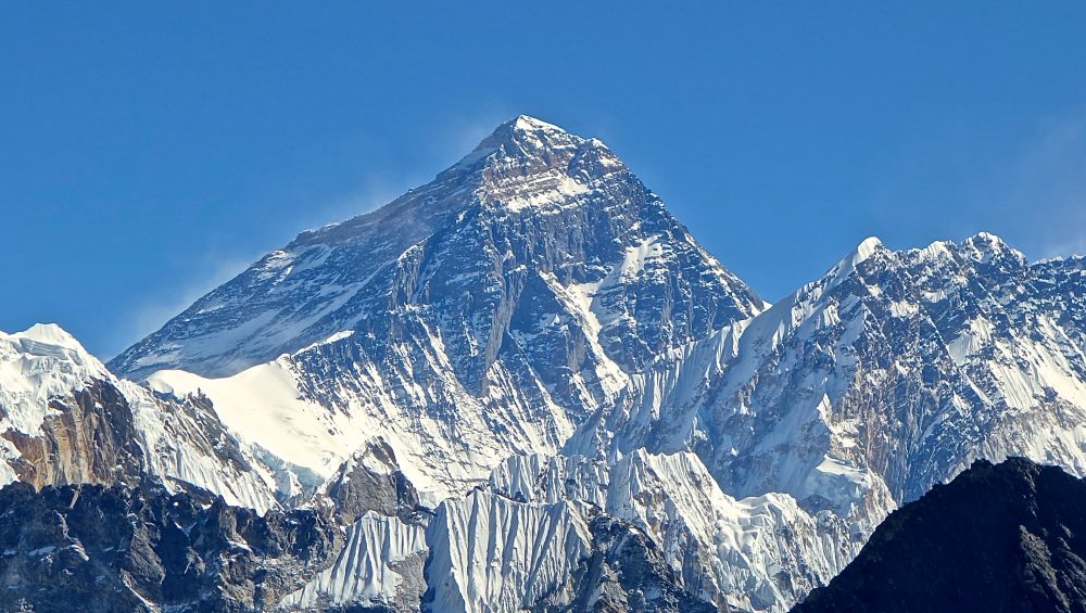
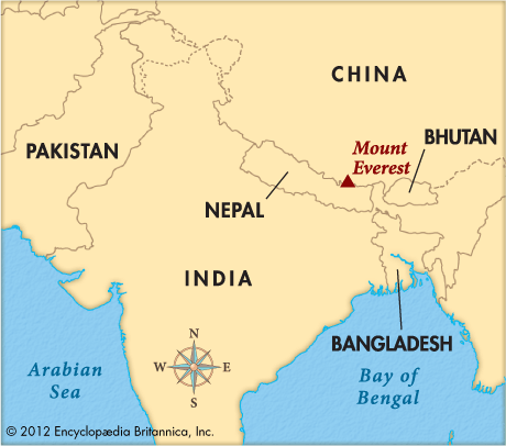
Mount Everest is located on the border between Nepal and Tibet, an autonomous region of China, in the Mahalangur Himal sub-range of the Himalayas. The world’s highest mountain stands at 8,848.86 meters (29,031.7 feet) above sea level and sits between two countries, with Nepal on the southern side and Tibet on the northern side.
Many people search for “where is Mount Everest located?” because Everest is more than just the tallest mountain on Earth. Its unique position connects two cultures, two climbing routes, and some of the most famous mountain landscapes in the world.
The mountain lies inside the Himalayan region of Asia, near important locations such as the Khumbu Valley in Nepal and the Rongbuk Valley in Tibet. Climbers can reach Everest from either side, but each route offers a different experience, environment, and challenge.
This guide explains the exact location of Mount Everest, which country it belongs to, how to find it on a map, and why its location makes it one of the most iconic places on Earth.
Table of contents
- Where Is Mount Everest Located
- Which Country Is Mount Everest In?
- Where Is Mount Everest Located in Asia?
- How Did Mount Everest Get Its Location?
- Why Is Mount Everest Called Different Names?
- Mount Everest Location on the Map
- Everest Climbing Routes and Access Points
- What Makes Mount Everest’s Location Special?
- Environmental Challenges at Everest
- Best Time to Visit Mount Everest
- Interesting Facts About Mount Everest
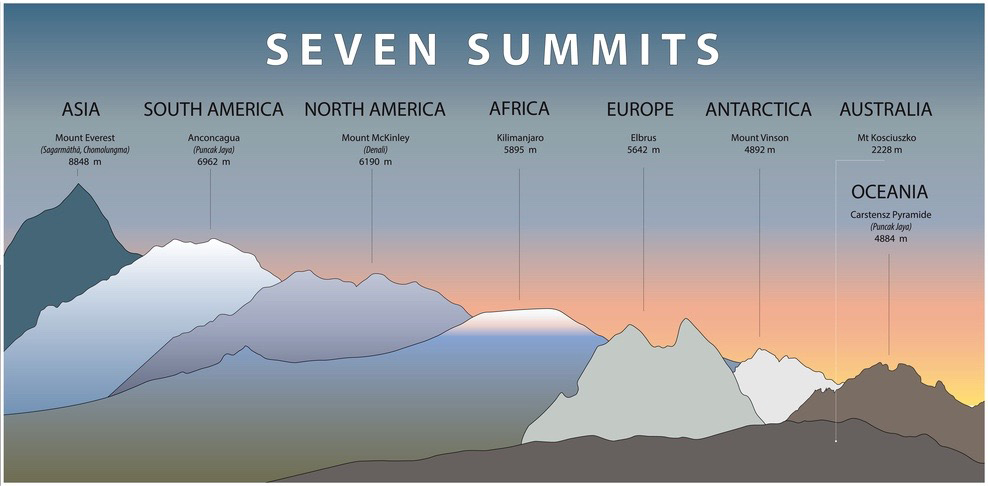
- Mount Everest vs Mount Kilimanjaro
- Frequently Asked Questions
- Final Thoughts
Which Country Is Mount Everest In?
Mount Everest is located on the border between Nepal and Tibet, an autonomous region of China. The mountain does not sit completely inside one country because the summit itself marks part of the international boundary. Nepal controls the southern side, while Tibet controls the northern side.
This unique location gives climbers two different ways to experience Everest. The Nepal side offers the famous Southeast Ridge route through the Khumbu region, while the Tibet side provides access through the North Ridge route.
Nepal and Tibet Border
Mount Everest stands between Nepal and Tibet in the Himalayan mountain range. The southern face of Everest belongs to Nepal, where climbers start their journey from the popular Everest Base Camp in the Khumbu Valley.
On the northern side, Everest rises above Tibet, where climbers use the North Base Camp route. Although both sides reach the same summit, each side has different landscapes, cultures, climbing regulations, and adventure experiences.
Exact Coordinates
Mount Everest sits at approximately 27.9881° N latitude and 86.9250° E longitude. These coordinates place the mountain in the Mahalangur Himal sub-range of the Himalayas, close to the Nepal-Tibet border.
The location helps travelers understand exactly where the world’s highest mountain stands on Earth. Everest is surrounded by dramatic Himalayan peaks, glaciers, valleys, and protected natural areas.
Why Everest Belongs to Two Regions
Everest belongs to two regions because the international border between Nepal and Tibet runs across the mountain’s summit. This means the highest point of Earth sits directly on the boundary between two territories.
The mountain’s shared location has created two different climbing systems, with Nepal and China managing their own sides. Both countries protect Everest’s environment, regulate climbing activities, and welcome visitors who want to explore this legendary peak.
Where Is Mount Everest Located in Asia?
Mount Everest is located in South Asia, within the Himalayan mountain range that stretches across several countries, including Nepal, China, India, Bhutan, and Pakistan. The mountain sits in one of the most dramatic regions on Earth, where some of the world’s highest peaks rise above deep valleys, glaciers, and ancient landscapes.
Its location in Asia makes Everest part of a larger mountain system that shaped the geography, climate, and cultures of the Himalayan region.
Himalayan Mountain Range
Mount Everest sits inside the Himalayan Mountain Range, one of the youngest and most powerful mountain ranges in the world. The Himalayas extend across thousands of kilometers through Asia and contain many of the planet’s highest peaks.
The range formed millions of years ago when the Indian tectonic plate pushed against the Eurasian plate. This slow collision forced the land upward and created the towering mountains that define the region today.
Everest’s position in the Himalayas gives it its extreme height, unique environment, and importance in global mountaineering.
Mahalangur Himal Sub-Range
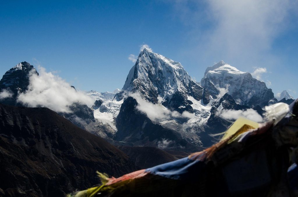
Within the Himalayas, Mount Everest belongs to the Mahalangur Himal sub-range. This area includes several famous peaks, such as Lhotse, Nuptse, and Cho Oyu, creating one of the most impressive mountain regions in the world.
The Mahalangur Himal is located along the Nepal-Tibet border and features massive glaciers, high-altitude valleys, and challenging climbing routes. Everest stands as the highest point in this sub-range and attracts climbers and trekkers from around the world.
Surrounding Areas Near Everest
Several important locations surround Mount Everest and help visitors understand its exact position in Asia.
On the Nepal side, Everest lies near the Khumbu Valley, a famous trekking area known for local Himalayan traditions, mountain villages, and the route to Everest Base Camp. The mountain is also protected inside Sagarmatha National Park, a UNESCO World Heritage Site.
On the Tibet side, Everest rises near the Rongbuk Valley, where climbers access the northern route. Nearby areas such as Tingri and the Tibetan Plateau provide different views and experiences of the world’s highest mountain.
How Did Mount Everest Get Its Location?
Mount Everest reached its current location because powerful geological forces shaped the Himalayas over millions of years. The mountain did not appear suddenly; it formed through the slow movement of Earth’s tectonic plates, which pushed layers of rock upward and created the highest mountain range on the planet.
Understanding Everest’s formation explains why it stands in Asia, between Nepal and Tibet, and why the Himalayan region continues to change today.
Formation of the Himalayas
The Himalayas formed millions of years ago when huge sections of Earth’s crust began moving toward each other. This movement created intense pressure that folded and lifted layers of rock, slowly building one of the world’s greatest mountain ranges.
Mount Everest developed as part of this process inside the Himalayas. Over millions of years, natural forces pushed the mountain higher, creating the massive peak that climbers see today.
The Himalayas continue to show signs of this powerful geological activity, making the region one of the most active mountain areas on Earth.
Indian and Eurasian Plate Collision
The main reason Mount Everest exists is the collision between the Indian Plate and the Eurasian Plate. Around 50 million years ago, the Indian Plate moved north and pushed into the Eurasian Plate.
This massive collision compressed the Earth’s crust and forced rock layers upward. The pressure created the Himalayan mountains, including Everest, along with many other famous peaks in the region.
The same geological process that created Everest also continues to influence the landscape around Nepal, Tibet, and the wider Himalayan region.
Why Everest Is Still Growing
Mount Everest is still growing because the Indian Plate continues to move slowly toward the Eurasian Plate. This ongoing movement pushes the mountain range upward little by little each year.
Scientists estimate that Everest rises by a few millimeters annually, although erosion from wind, ice, and weather works against this growth.
The mountain’s changing height shows that Everest is not just a historical landmark; it remains a living example of Earth’s continuous geological activity.
Why Is Mount Everest Called Different Names?
Mount Everest has different names because the mountain holds deep cultural and historical importance for the communities living around it. Before the world recognized it as “Mount Everest,” local people already had their own names that reflected their beliefs, traditions, and connection with the Himalayas.
The names Sagarmatha, Chomolungma, and Mount Everest each tell a different story about the mountain’s identity.
Sagarmatha (Nepal)
In Nepal, Mount Everest is known as Sagarmatha, a name that comes from the Nepali language. The name is commonly understood to mean “Goddess of the Sky” and represents the mountain’s spiritual importance in Nepalese culture.
The Nepalese side of Everest has a strong connection with local Himalayan communities, who have lived in the region for generations. For many local communities, Everest is not only the highest mountain in the world but also a sacred natural landmark.
Chomolungma / Qomolangma (Tibet)
In Tibet, Mount Everest is called Chomolungma or Qomolangma, meaning “Goddess Mother of the World.” This Tibetan name shows the respect and spiritual connection that local people have with the mountain.
The northern side of Everest lies in Tibet, where the mountain has been part of Tibetan culture for centuries. The name reflects the belief that Everest is more than a physical peak; it represents a powerful and respected presence in the region.
Mount Everest Name History
The name “Mount Everest” came from British surveying efforts in the 19th century. During the Great Trigonometrical Survey of India, British surveyors identified the mountain as Peak XV before discovering that it was the highest mountain on Earth.
In 1865, the mountain received the name Mount Everest in honor of Sir George Everest, a former Surveyor General of India. The name became internationally recognized, but the traditional names Sagarmatha and Chomolungma remain important because they represent the mountain’s local history and cultural identity.
Mount Everest Location on the Map
Mount Everest sits in the Himalayan region of Asia, exactly on the border between Nepal and Tibet, China. Looking at a map, the mountain appears in the eastern part of Nepal and southern Tibet, surrounded by some of the highest peaks, glaciers, and valleys on Earth.
Its remote location makes Everest a unique destination because reaching the mountain requires traveling through high-altitude landscapes, mountain villages, and protected areas.
Everest Coordinates
Mount Everest is located at approximately 27.9881° N latitude and 86.9250° E longitude. These coordinates place the summit in the Mahalangur Himal sub-range of the Himalayas, along the Nepal-Tibet border.
The coordinates help travelers locate Everest precisely on digital maps and navigation systems. From this point, the mountain rises above the surrounding Himalayan landscape as the highest point on Earth.
Nearest Cities and Villages
The closest major city on the Nepal side is Kathmandu, the capital of Nepal, located around 160 kilometers southwest of Everest. Most international travelers begin their Everest journey from Kathmandu before heading toward the Himalayan region.
Near the mountain, several important villages and locations support climbers and trekkers:
- Lukla – the main gateway for the Everest Base Camp trek, famous for its mountain airport.
- Namche Bazaar – a major mountain village and important acclimatization stop for trekkers.
- Tingri – a Tibetan town often used for access to the northern side of Everest.
These communities connect visitors with Everest’s natural environment and local Himalayan culture.
Everest Base Camps
Mount Everest has two main base camps because climbers can approach the mountain from both Nepal and Tibet.
The South Base Camp in Nepal sits at about 5,364 meters (17,598 feet) and serves as the starting point for the popular Southeast Ridge climbing route. Trekkers also visit this area during the famous Everest Base Camp trek.
The North Base Camp in Tibet sits at around 5,150 meters (16,900 feet) and provides access to the northern climbing route. This side offers different views of Everest and a different cultural experience compared with Nepal.
Both base camps allow visitors to experience the scale of Everest while preparing for one of the world’s greatest mountain adventures.
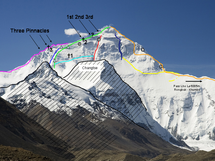
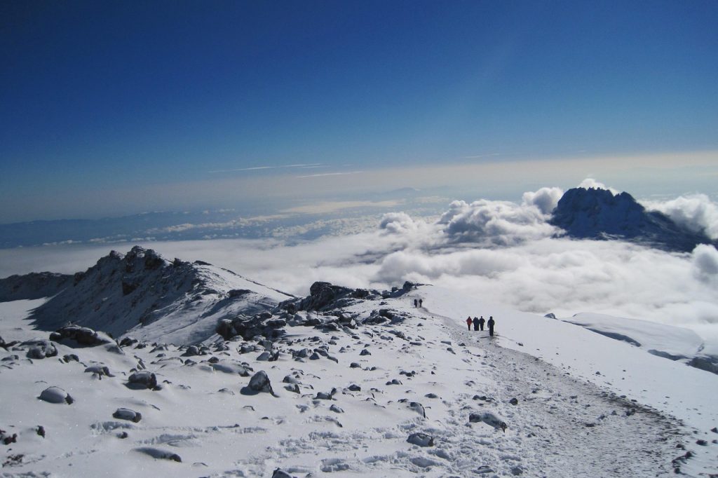
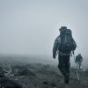
Everest Climbing Routes and Access Points
Mount Everest has two main climbing routes, one from Nepal and one from Tibet, China. Both routes reach the same summit, but each side offers a different climbing experience because of the landscape, weather conditions, regulations, and route difficulty.
The Nepal side remains the most popular choice among climbers because of its famous trekking approach, local Himalayan culture, and historic route. The Tibet side provides a different adventure with easier road access to base camp and a quieter climbing environment.
Nepal South Side Route
The Nepal South Side Route follows the Southeast Ridge, the same route used by Sir Edmund Hillary and Tenzing Norgay during the first successful Everest summit in 1953.
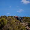
Climbers usually begin their journey in Kathmandu, then fly to Lukla and trek through the Khumbu Valley. The route passes famous locations such as Namche Bazaar, Tengboche, and Everest Base Camp before reaching the higher camps.
The Nepal route includes challenging sections such as the Khumbu Icefall, steep climbs, and extreme altitude. However, many climbers prefer this side because it offers better trekking infrastructure, more support services, and iconic views of Everest.
Tibet North Side Route
The Tibet North Side Route approaches Everest from the Tibetan Plateau and follows the North Ridge. Unlike the Nepal route, climbers can reach the North Base Camp by vehicle, which reduces the long trekking approach.
This route provides impressive views of Everest and often has fewer climbers compared with the Nepal side. However, the higher starting elevation can make acclimatization more difficult because climbers begin their journey at a much greater altitude.
The northern route includes technical sections, strong winds, and challenging weather conditions. Climbers also need to follow China’s climbing regulations and permit requirements.
Nepal vs China Route Comparison
| Comparison Factor | Nepal South Side Route | Tibet North Side Route |
|---|---|---|
| Location | Southern side of Everest | Northern side of Everest |
| Access | Flight to Lukla + trekking through Khumbu Valley | Road access from Tibet to North Base Camp |
| Base Camp Height | About 5,364 meters | About 5,150 meters |
| Famous Route | Southeast Ridge | North Ridge |
| First Successful Summit | Hillary and Tenzing in 1953 | First climbed from north side in 1960 |
| Scenery | Sherpa villages, glaciers, and famous trekking landscapes | Tibetan Plateau views and remote mountain scenery |
| Difficulty | Challenging with Khumbu Icefall and altitude | Challenging with cold, wind, and altitude |
| Popularity | More popular and crowded | Less crowded and more remote |
Both routes provide a once-in-a-lifetime Everest experience. The best choice depends on a climber’s experience, budget, preferred adventure style, and interest in either Nepalese or Tibetan culture.
What Makes Mount Everest’s Location Special?
Mount Everest’s location makes it one of the most remarkable places on Earth. The mountain sits between Nepal and Tibet, rises above the Himalayas, and connects natural beauty, scientific importance, and deep cultural traditions. Its unique position creates a landscape unlike any other mountain region in the world.
Highest Point on Earth
Mount Everest is special because it is the highest point above sea level on Earth, reaching 8,848.86 meters (29,031.7 feet). Its extreme elevation places it above the clouds and creates one of the most challenging environments for climbers.
The mountain’s location in the Himalayas gives it massive glaciers, steep valleys, and powerful weather conditions. The combination of height and harsh conditions makes Everest a symbol of human exploration and adventure.
Cultural Importance
Everest has deep cultural importance for the people who live around the mountain. In Nepal, local communities know it as Sagarmatha, while in Tibet it is called Chomolungma or Qomolangma. These names show the respect and spiritual connection people have with the mountain.
The local communities of the Khumbu region have a strong relationship with Mount Everest. Their knowledge, traditions, and mountain experience have played an important role in supporting climbers and preserving Himalayan culture.
Protected Areas
Mount Everest lies within protected natural areas that help conserve its unique environment. On the Nepal side, Everest is part of Sagarmatha National Park, a UNESCO World Heritage Site known for its glaciers, wildlife, and Himalayan ecosystems.
On the Tibet side, the mountain is protected within the Qomolangma National Nature Preserve, which helps protect the northern Everest landscape.
These protected areas preserve the natural beauty around Everest and support efforts to manage tourism, protect wildlife, and reduce the impact of human activity on the world’s highest mountain.
Environmental Challenges at Everest
Mount Everest’s location creates some of the most extreme environmental conditions on Earth. Its great height, harsh weather, and changing glacier environment make the mountain one of the most difficult places for humans to explore.
Although thousands of climbers and trekkers visit the Everest region every year, the mountain requires careful preparation because the environment can change quickly and create serious challenges.
Extreme Altitude
The biggest challenge on Mount Everest is its extreme altitude. The summit reaches 8,848.86 meters (29,031.7 feet) above sea level, where the air contains much less oxygen than at lower elevations.
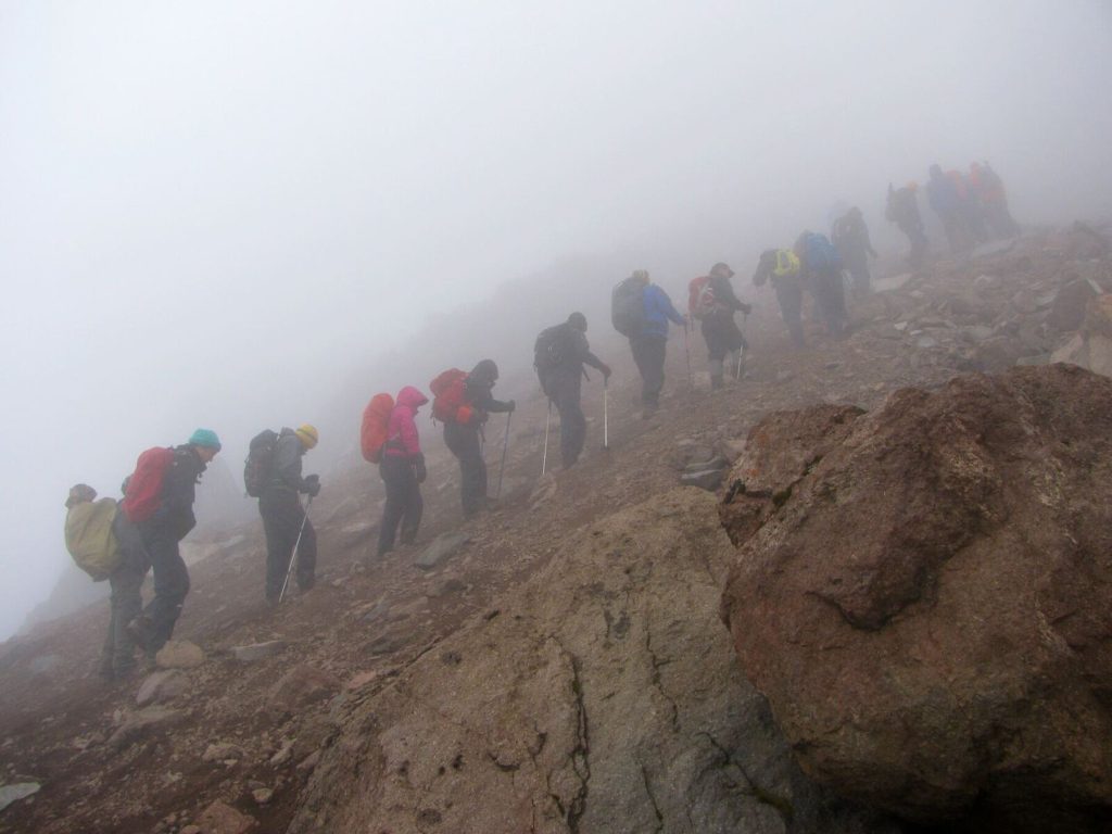
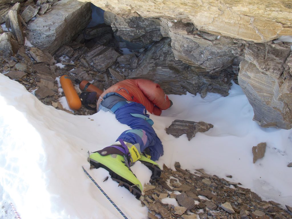
Above 8,000 meters, climbers enter the area known as the Death Zone, where the body struggles to survive because of the lack of oxygen. Many climbers use supplemental oxygen and follow careful acclimatization plans to reduce the risks of high altitude.
The thin air, physical exhaustion, and slow recovery at extreme heights make reaching Everest’s summit a major challenge.
Weather Conditions
Everest experiences some of the harshest weather conditions in the world. Strong winds, freezing temperatures, heavy snowfall, and sudden storms can create dangerous situations for climbers.
The mountain’s location in the Himalayas exposes it to changing weather patterns, including powerful jet streams that can bring extreme conditions to the summit. Because of this, climbers usually wait for short weather windows during the spring climbing season.
Even experienced mountaineers must carefully monitor weather forecasts before attempting the final climb.
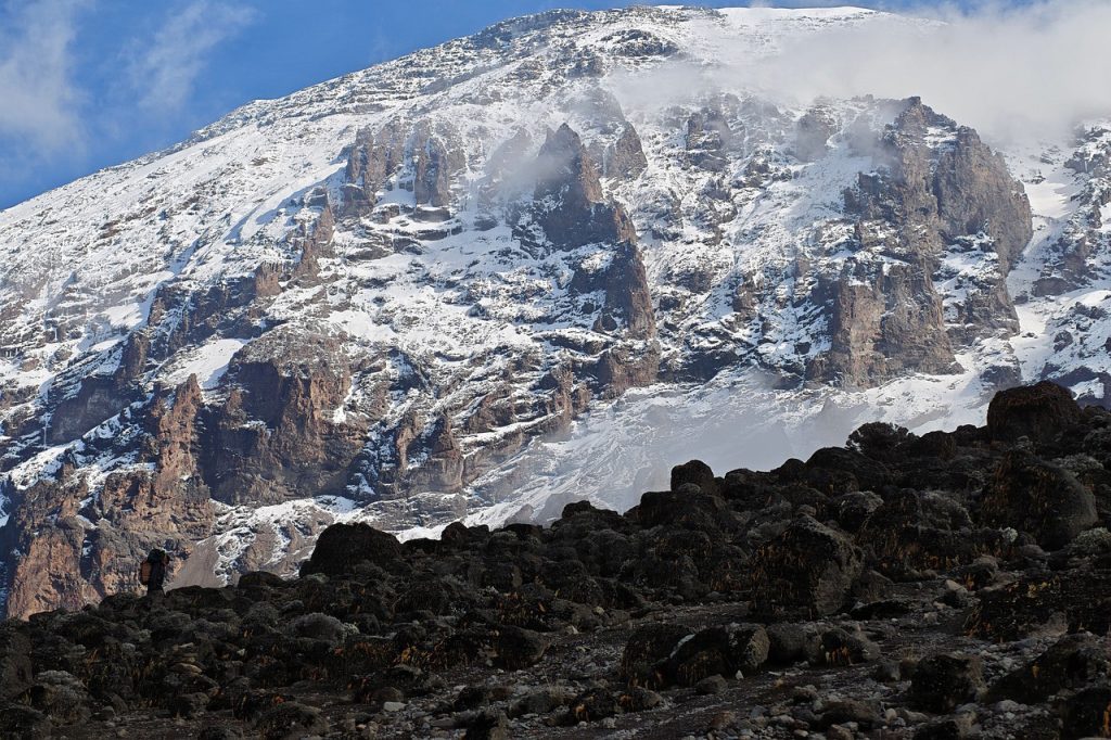
Glacier and Climate Challenges
Glaciers play an important role in Everest’s environment, but they also create major climbing challenges. Climbers must cross areas with moving ice, deep cracks, and unstable snow conditions.
The famous Khumbu Icefall on the Nepal side changes constantly because glaciers move and temperatures affect the ice. These changes make the route unpredictable and require careful navigation.
Climate change has also affected the Everest region by influencing glacier conditions, snowfall patterns, and the mountain environment. Protecting this fragile area remains an important challenge as tourism continues to grow.
Best Time to Visit Mount Everest
The best time to visit Mount Everest depends on what you want to experience. Climbers planning a summit attempt need a different season than trekkers visiting Everest Base Camp. Weather, temperature, visibility, and trail conditions all affect the experience in the Everest region.
The Himalayan climate changes dramatically throughout the year, so choosing the right time helps travelers enjoy safer conditions and better mountain views.
Everest Climbing Season
The main Everest climbing season takes place during spring, especially April and May. During this period, climbers have the best chance of reaching the summit because the jet stream usually moves away from Everest, creating shorter periods of calmer weather.
Spring offers more stable temperatures and better conditions for climbing teams to prepare at higher camps. Most successful Everest summit attempts happen during this season because climbers can take advantage of limited weather windows.
Autumn can also provide climbing opportunities, but it usually has fewer climbers and more unpredictable conditions compared with the popular spring season.
Everest Base Camp Trek Season
The best seasons for the Everest Base Camp trek are spring (March to May) and autumn (September to November). These months provide clear skies, comfortable trekking temperatures, and some of the best views of Everest and surrounding Himalayan peaks.
Spring brings colorful landscapes and blooming flowers in the lower valleys, while autumn offers fresh air and excellent visibility after the monsoon season.
Winter treks are possible for experienced hikers who enjoy quieter trails, but colder temperatures and snow can make the journey more challenging.
Weather Conditions
Weather plays a major role in any Everest adventure because conditions can change quickly at high altitude. The mountain experiences cold temperatures, strong winds, snowfall, and sudden storms throughout the year.
During the climbing season, temperatures near the summit can remain extremely cold even when lower areas experience warmer weather. At higher elevations, strong winds and freezing conditions create some of the biggest challenges for climbers.
For visitors, the best weather usually comes during spring and autumn when the skies are clearer, rainfall is lower, and mountain views are at their best.
Interesting Facts About Mount Everest
Mount Everest is more than just the highest mountain in the world. Its incredible height, changing landscape, and famous climbing history make it one of the most fascinating places on Earth. From its formation millions of years ago to modern-day expeditions, Everest continues to attract explorers and researchers from around the world.
Everest Height
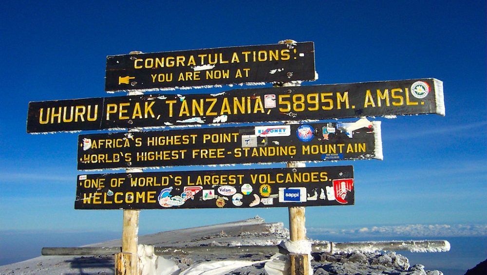
Mount Everest reaches 8,848.86 meters (29,031.7 feet) above sea level, making it the highest mountain on Earth. The official height was updated in 2020 after Nepal and China completed a new measurement using modern surveying technology.
Everest’s extreme elevation places it above most of the Earth’s atmosphere, where oxygen levels are much lower and climbing becomes extremely challenging. Its height is one of the main reasons why mountaineers consider reaching the summit a remarkable achievement.
Mountain Growth
Mount Everest is still growing because the tectonic plates beneath the Himalayas continue to move. The Indian Plate slowly pushes against the Eurasian Plate, causing the mountains to rise gradually.
Scientists estimate that Everest increases by a few millimeters each year, although erosion from wind, ice, and weather also affects its shape. This constant geological activity shows that Everest remains part of a living and changing mountain system.
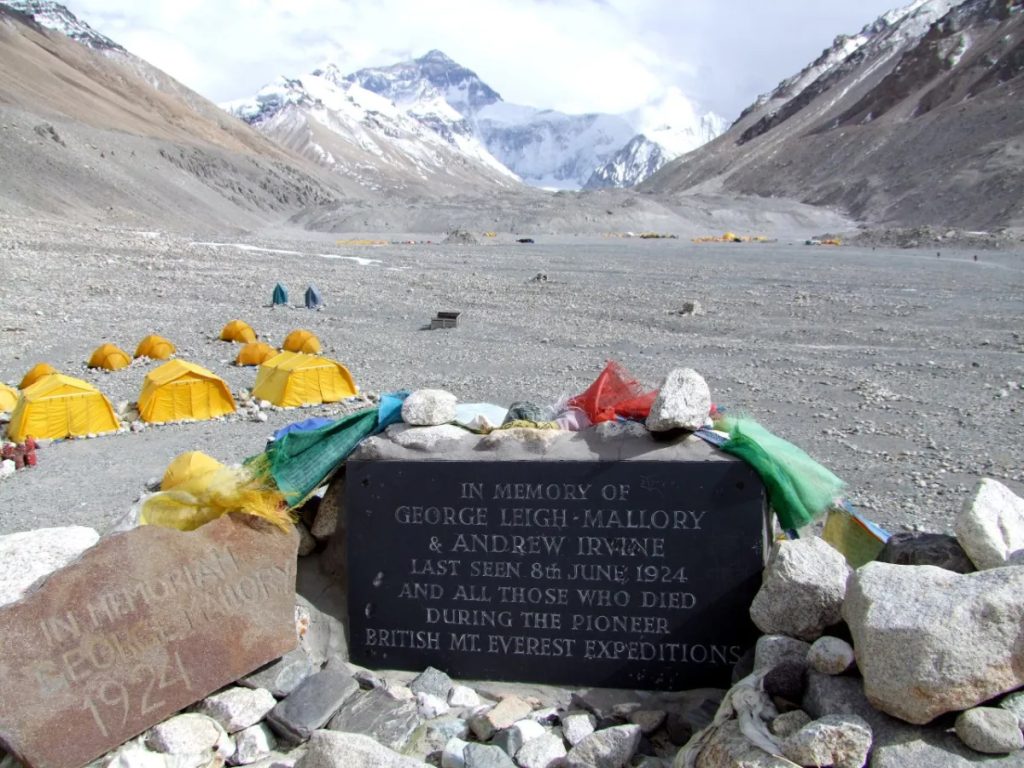
Famous Expeditions
Mount Everest has a long history of famous expeditions and remarkable achievements. The first confirmed successful summit happened on May 29, 1953, when Sir Edmund Hillary from New Zealand and Tenzing Norgay from Nepal reached the summit of Mount Everest through the South Col route.
Since then, climbers from many countries have attempted Everest, including professional mountaineers, researchers, and adventure seekers. The mountain has become a symbol of determination, exploration, and human endurance.
Modern expeditions continue to improve climbing equipment, safety methods, and environmental protection efforts while preserving Everest’s legendary status.
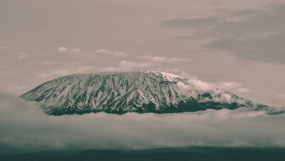
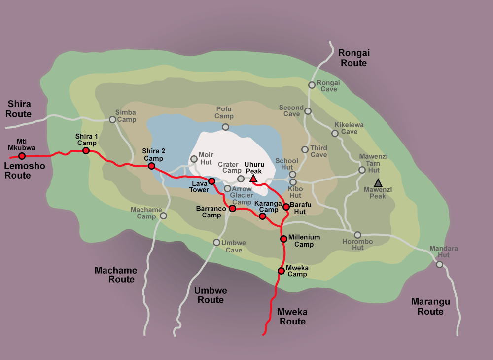
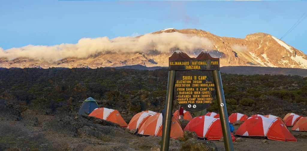
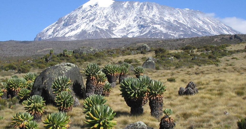
Mount Everest vs Mount Kilimanjaro
Mount Everest and Mount Kilimanjaro are two of the world’s most famous mountains, but they offer very different adventure experiences. Everest represents extreme high-altitude mountaineering in the Himalayas, while Kilimanjaro offers a more accessible trekking experience in Africa.
Both mountains attract thousands of visitors every year, but their locations, heights, and climbing requirements create completely different challenges.
Location Difference
Mount Everest is located in the Himalayas on the border between Nepal and Tibet, China, in Asia. The mountain sits within the Mahalangur Himal sub-range and represents the highest point on Earth.
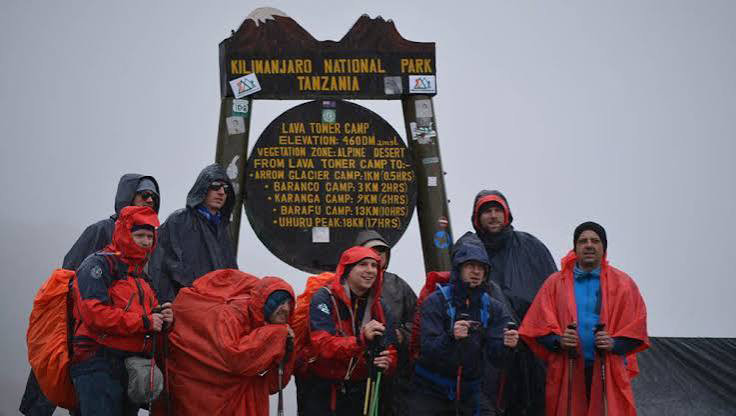
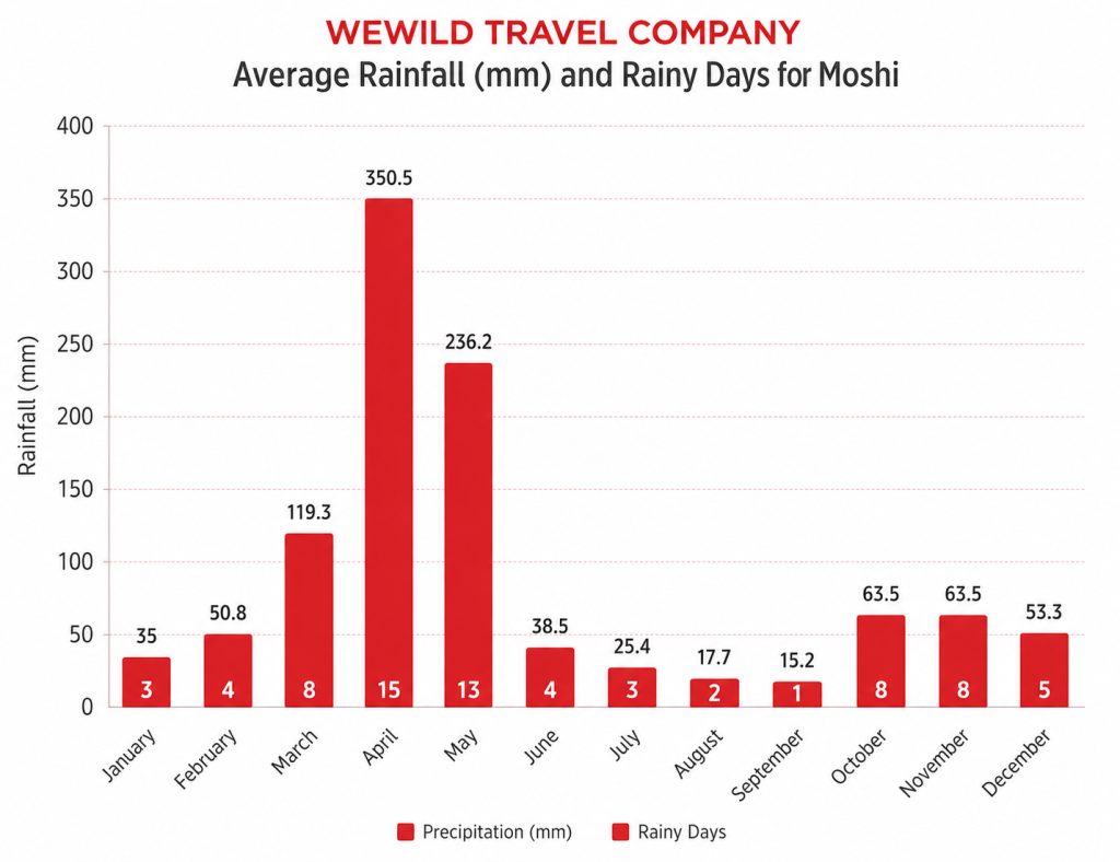
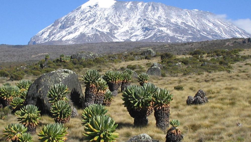
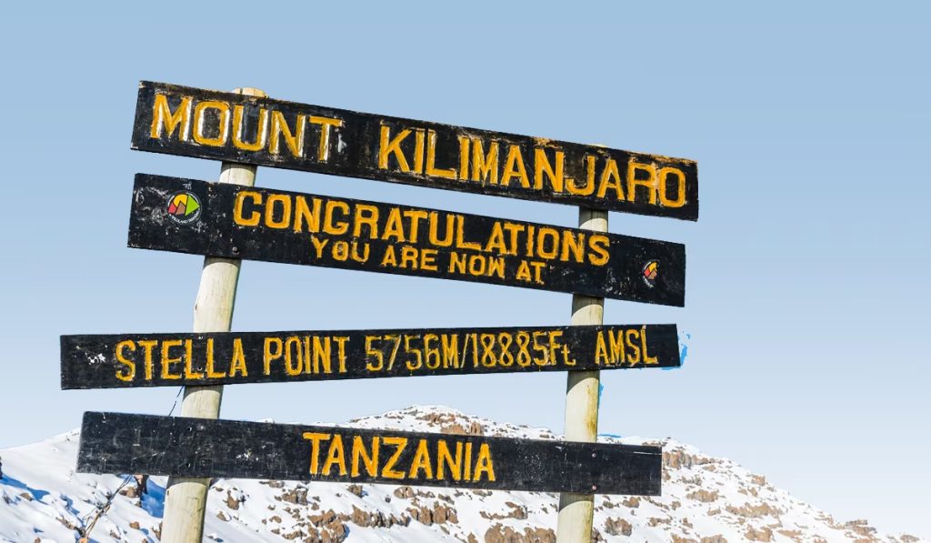
Mount Kilimanjaro is located in Tanzania, East Africa, near the city of Moshi and close to the Kenya border. Unlike Everest, Kilimanjaro stands alone as a free-standing volcanic mountain and is the highest mountain in Africa.
The two mountains are separated by thousands of kilometers, with Everest surrounded by the Himalayan range and Kilimanjaro rising above the African plains.
Height Difference
Mount Everest reaches 8,848.86 meters (29,031.7 feet) above sea level, making it the tallest mountain in the world.
Mount Kilimanjaro reaches 5,895 meters (19,341 feet) and holds the title of the highest mountain in Africa. Although Kilimanjaro is much lower than Everest, it still creates a serious altitude challenge because climbers experience a large elevation gain from the base to the summit.
The height difference means Everest requires advanced mountaineering skills, while Kilimanjaro focuses more on endurance, preparation, and altitude adaptation.
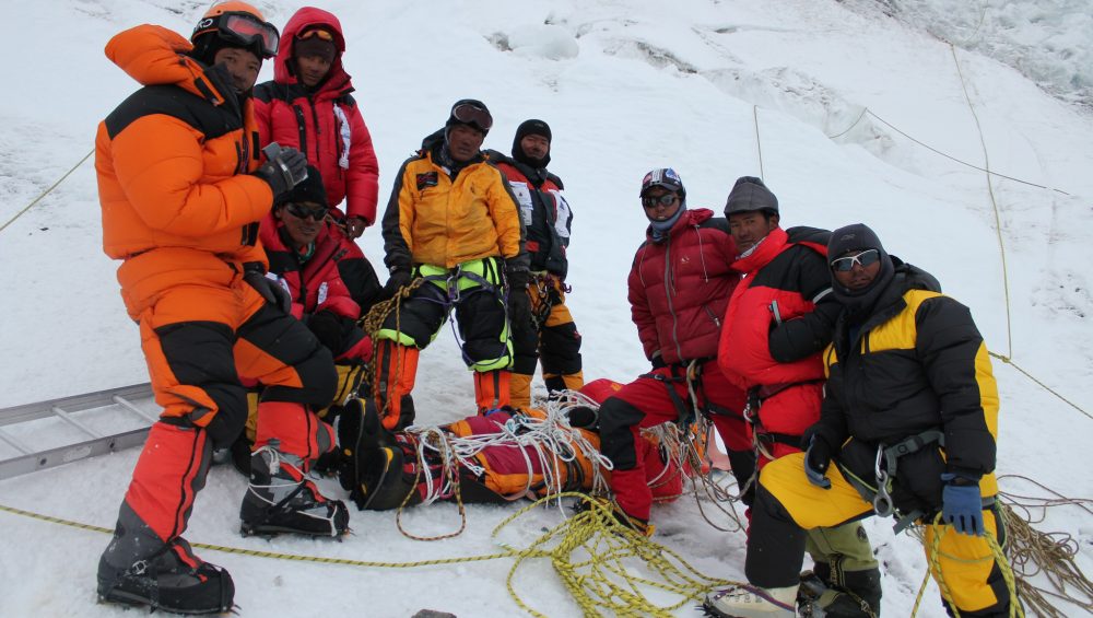
Climbing Experience
Climbing Mount Everest requires technical mountaineering experience, glacier travel skills, specialized equipment, and weeks of expedition preparation. Climbers face extreme cold, thin air, strong winds, and dangerous high-altitude conditions.
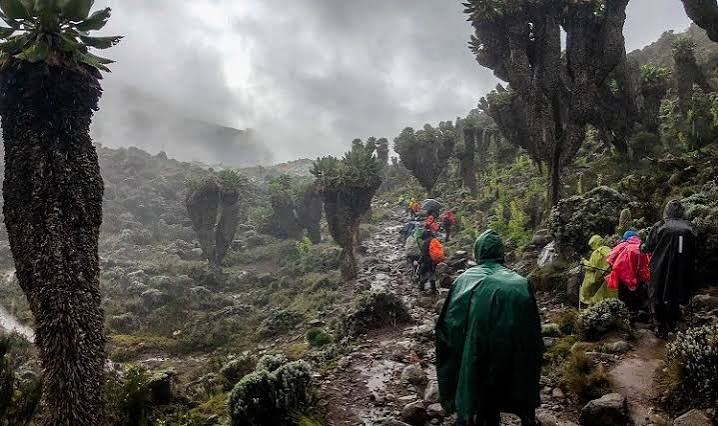
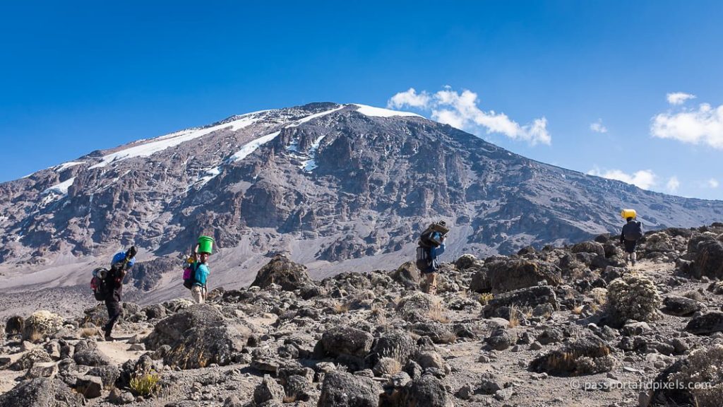
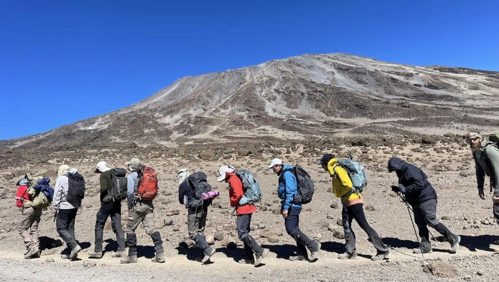
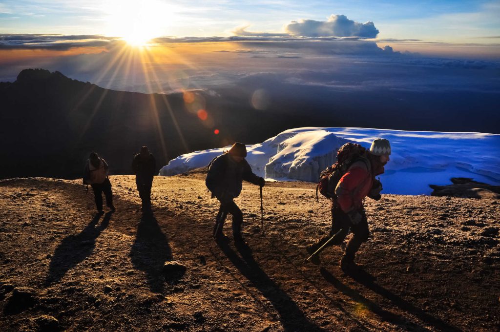
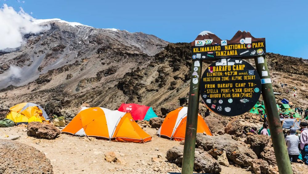
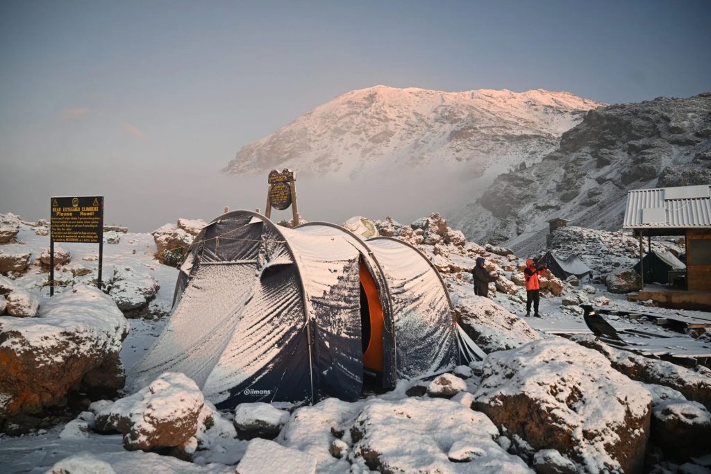
Mount Kilimanjaro does not require advanced technical climbing skills on most routes. Trekkers walk through different climate zones, from tropical forests to alpine deserts and icy summit landscapes. However, reaching Uhuru Peak still requires physical preparation and proper acclimatization.
Everest is a professional-level expedition, while Kilimanjaro offers one of the world’s greatest trekking adventures for people looking to experience a high mountain summit without technical climbing.
Frequently Asked Questions
Mount Everest is located on the border between Nepal and Tibet, an autonomous region of China. The summit sits directly on the international boundary, with the southern side belonging to Nepal and the northern side belonging to Tibet.
Everest is in both Nepal and China because the mountain lies along their shared border. Nepal manages the southern climbing route, while China manages the northern route through Tibet.
The closest major city on the Nepal side is Kathmandu, the capital of Nepal, located about 160 kilometers southwest of Everest. For most visitors, Kathmandu is the main starting point before traveling toward the Everest region.
Yes, tourists can visit the Everest region without climbing to the summit. Many travelers choose the Everest Base Camp trek in Nepal, which allows them to experience Himalayan landscapes, local mountain culture, and views of the world’s highest mountain.
Visitors can also explore the Tibetan side through approved travel routes and visit the North Base Camp.
Mount Everest is approximately 160 kilometers (100 miles) from Kathmandu in a straight line, but the actual journey takes much longer because travelers must fly, drive, and trek through the Himalayan terrain.
Most trekkers fly from Kathmandu to Lukla and then continue on foot through the Khumbu Valley toward Everest Base Camp.
Final Thoughts
Mount Everest’s location makes it one of the most extraordinary places on Earth. Standing on the border between Nepal and Tibet, China, the mountain connects different cultures, landscapes, and climbing traditions. Its position in the Himalayas explains why Everest became the world’s most famous mountain and a symbol of exploration.
Why Everest Location Matters
Everest’s location matters because it influences everything about the mountain, from its climate and climbing routes to its cultural importance. Being part of the Himalayas gives Everest its incredible height, glaciers, and extreme environment.
The mountain’s position between Nepal and Tibet also creates two different experiences for visitors. The Nepal side offers the famous Khumbu Valley and Everest Base Camp trek, while the Tibet side provides a different view through the Tibetan Plateau.
Understanding where Everest is located helps travelers appreciate that the mountain is not only the highest point on Earth but also a place with deep history, culture, and natural importance.
Planning Your Everest Adventure
Planning an Everest adventure depends on the type of experience you want. Climbers preparing for the summit need advanced training, proper equipment, and extensive preparation for extreme conditions.
For most travelers, visiting Everest Base Camp offers an unforgettable way to experience the mountain without attempting the summit. Choosing the right season, preparing for altitude, and respecting local communities will help create a safer and more meaningful journey.
Whether you dream of climbing Everest or simply seeing it from the Himalayas, understanding its location is the first step toward exploring one of the world’s greatest natural wonders.
Read more about Everest
Related reads