Climbing Olympus Mons, the tallest mountain in the Solar System
Climbing Olympus Mons: What Would It Take to Reach the Tallest Mountain in the Solar System?
Estimated reading time: 27 minutes
Climbing Olympus Mons would be one of the greatest adventures in human history. Rising about 21.2 kilometers (13.2 miles) above the Martian surface, Olympus Mons is the tallest mountain and largest volcano in the Solar System. It stands nearly three times taller than Mount Everest and covers an area larger than many countries on Earth.
Although no human has ever set foot on Mars, scientists and space agencies continue to develop technologies that could make future missions possible. If astronauts eventually reach the Red Planet, many experts believe that climbing Olympus Mons would become one of the ultimate achievements of space exploration.
But what would it actually take to reach the summit? Future explorers would face extreme cold, deadly radiation, a near-vacuum atmosphere, and a journey stretching hundreds of kilometers across an alien landscape. In this guide, we’ll explore what Olympus Mons is, why it became so enormous, and the incredible challenges humans would face when attempting to climb the tallest mountain ever discovered.
Table of contents
- Climbing Olympus Mons: What Would It Take to Reach the Tallest Mountain in the Solar System?
- Can Humans Climb Olympus Mons?
- Olympus Mons at a Glance
- What Is Olympus Mons?
- How Tall Is Olympus Mons?
- How Tall Is Olympus Mons?
- Why Is Olympus Mons So Large?
- What Would Climbing Olympus Mons Be Like?
- Biggest Challenges of Climbing Olympus Mons
- What Would You See From the Summit?
- Could Olympus Mons Erupt Again?
- The Tallest Mountains in the Solar System
- Why Olympus Mons Matters to Future Mars Exploration
- Frequently Asked Questions
- Final Thoughts
Can Humans Climb Olympus Mons?
Humans could potentially climb Olympus Mons in the future, but only with advanced space technology and extensive preparation. The mountain’s slopes are not as steep as many peaks on Earth, yet the environment presents enormous challenges. Climbers would need protection from extreme cold, harmful radiation, and the near-absence of breathable air. While no human mission to Mars exists today, future astronauts may one day attempt the long journey to the summit of the tallest mountain in the Solar System.
Olympus Mons at a Glance
Olympus Mons is the largest volcano and tallest mountain ever discovered in the Solar System. Located on Mars, this gigantic shield volcano towers above the surrounding landscape and dwarfs every mountain on Earth. Its immense size, ancient history, and unique geological features make it one of the most fascinating landmarks in planetary science.
Key Facts Table
| Feature | Olympus Mons |
|---|---|
| Planet | Mars |
| Type | Shield Volcano |
| Height | 21.2 km (13.2 miles) above the average Martian surface |
| Base Width | 601 km (374 miles) |
| Age | About 3.5 Billion Years |
| Status | Extinct Volcano |
| Location | Tharsis Region, Mars |
| Summit Caldera | Approximately 70 km (43 miles) wide |
| Relative Height | About 26 km (16.2 miles) from base to summit |
| Solar System Ranking | Tallest Mountain in the Solar System |
These impressive statistics help explain why Olympus Mons remains one of the most studied geological features beyond Earth. Its massive dimensions provide scientists with valuable clues about Mars’s volcanic history and the conditions that shaped the Red Planet billions of years ago.
What Is Olympus Mons?
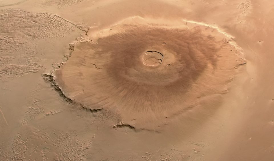
Olympus Mons is the tallest mountain and largest volcano in the Solar System. Located on Mars, this enormous volcano rises about 21.2 kilometers (13.2 miles) above the average Martian surface and stretches more than 600 kilometers (374 miles) across. To put its size into perspective, Olympus Mons is nearly three times taller than Mount Everest and covers an area larger than many countries on Earth. Its extraordinary dimensions have made it one of the most famous geological features beyond our planet.
Location on Mars
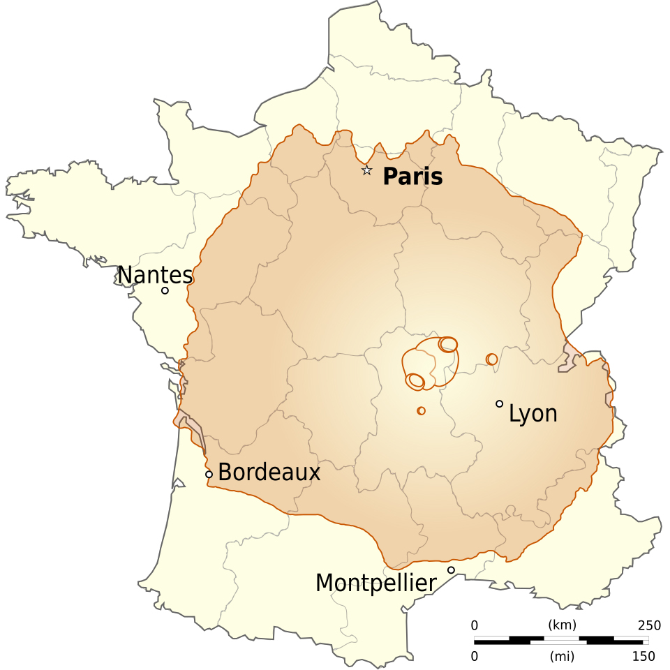
Olympus Mons stands in the Tharsis region, a vast volcanic plateau located near the Martian equator. This area contains several giant volcanoes, but Olympus Mons is by far the largest. The mountain sits on the northwestern edge of the Tharsis volcanic province and dominates the surrounding landscape. Because of its immense size, a person standing on the Martian surface near its base would not be able to see the summit, as it would lie beyond the horizon.
The volcano is surrounded by steep escarpments that rise several kilometers above the nearby plains. Beyond these cliffs, broad lava flows and volcanic deposits extend across hundreds of kilometers, showing evidence of the powerful eruptions that once shaped the mountain.
Discovery of Olympus Mons
Astronomers first noticed a bright area on Mars during the 19th century, long before spacecraft visited the planet. Early observers called this mysterious feature “Nix Olympica,” which means “Snows of Olympus” in Latin. At the time, scientists believed the bright spot might be ice or clouds because telescopes could not reveal its true nature.
The mystery remained unsolved until 1971 when NASA’s Mariner 9 spacecraft entered orbit around Mars. As dust storms cleared, the spacecraft captured images showing that the bright feature was actually a gigantic volcano. Scientists later named it Olympus Mons, inspired by Mount Olympus, the legendary home of the gods in ancient Greek mythology.
Why Scientists Call It a Shield Volcano
Scientists classify Olympus Mons as a shield volcano because it formed from countless flows of low-viscosity lava that spread across the Martian surface over millions of years. Instead of creating a steep, cone-shaped mountain like Mount Fuji, these eruptions built a broad volcano with gently sloping sides.
The same process created shield volcanoes on Earth, including those found in Hawaii. However, Olympus Mons grew much larger because Mars has lower gravity and lacks the active plate tectonics that constantly move Earth’s crust. As a result, lava continued erupting from the same location for an extremely long time, allowing the volcano to reach a size unmatched anywhere else in the Solar System.
How Tall Is Olympus Mons?
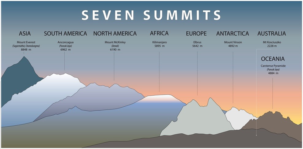
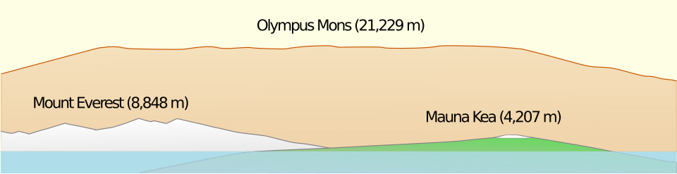
Olympus Mons is the tallest mountain in the Solar System, rising approximately 21.2 kilometers (13.2 miles) above the average surface of Mars. If measured from its base to its summit, the volcano reaches an incredible height of about 26 kilometers (16.2 miles). Its size is so immense that it dwarfs every mountain on Earth, including Mount Everest, Mount Kilimanjaro, and Mauna Kea.
Comparing Olympus Mons with Earth’s highest mountains helps illustrate just how extraordinary this Martian giant really is.
Olympus Mons vs Mount Everest
Mount Everest is the highest mountain above sea level on Earth, standing at 8,849 meters (29,032 feet). Located in the Himalayas on the border of Nepal and China, Everest has long been regarded as the ultimate mountaineering challenge.
However, Olympus Mons is in a completely different league. At 21.2 kilometers (13.2 miles) tall, it stands nearly 2.4 times taller than Everest. While climbers spend weeks preparing to reach Everest’s summit, a journey to the top of Olympus Mons would require advanced space technology, life-support systems, and a mission to another planet.
Despite its greater height, Olympus Mons has much gentler slopes than Everest. Most of its surface resembles a gradual incline rather than the steep ridges and ice-covered faces found in the Himalayas.
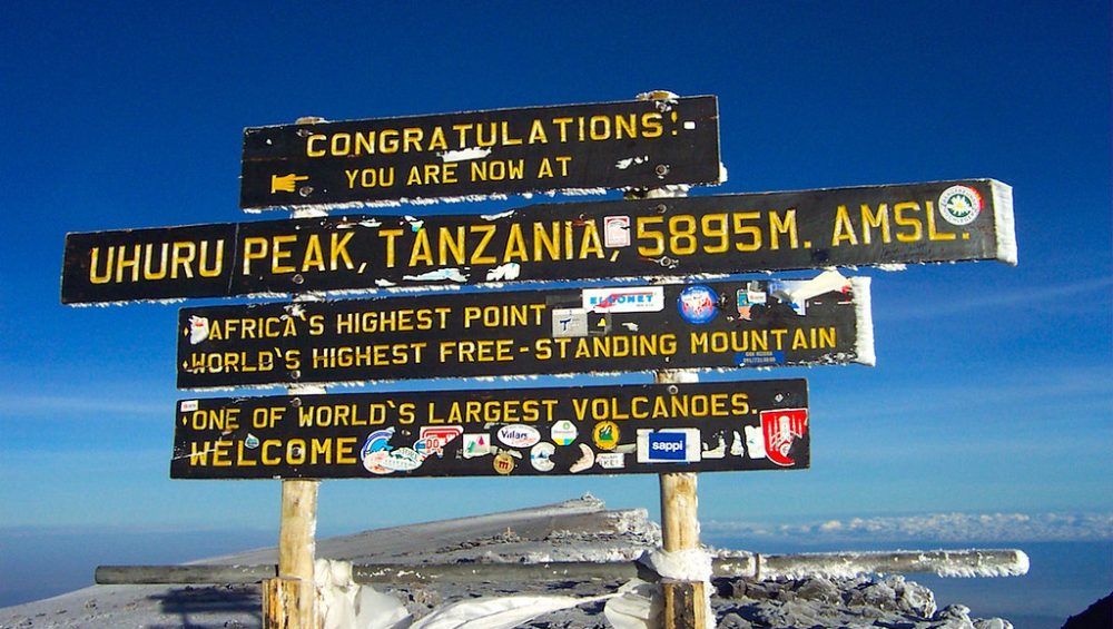
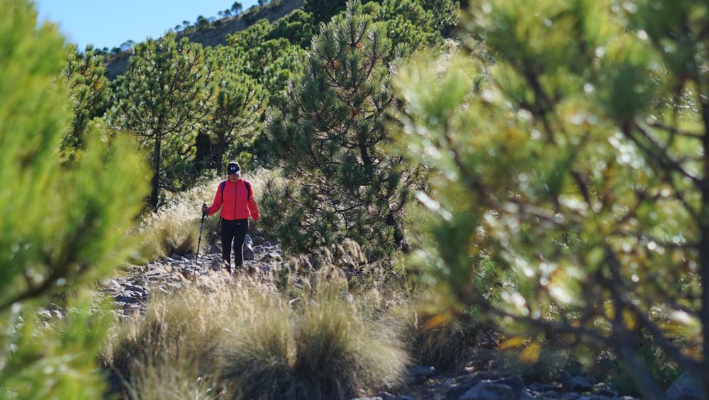
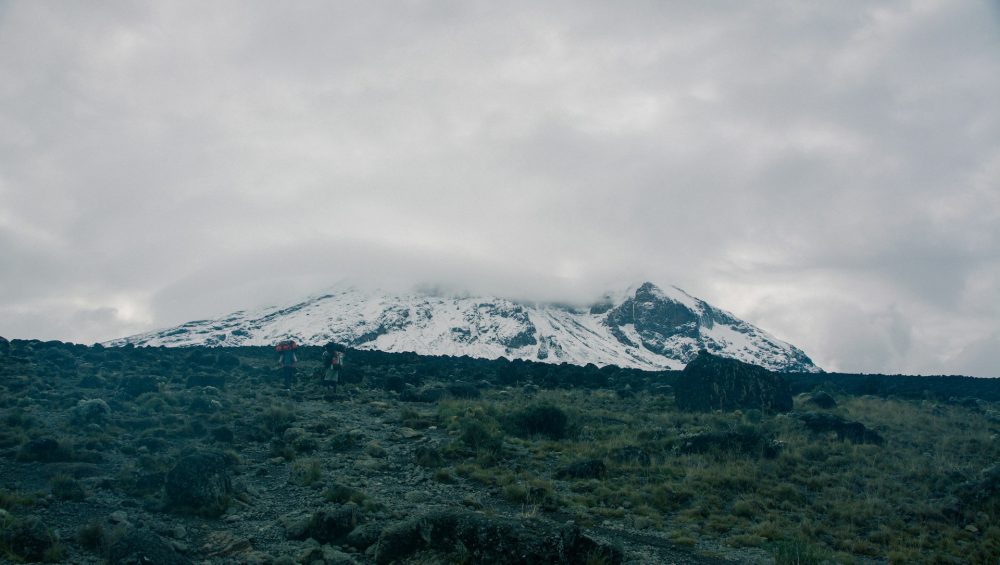
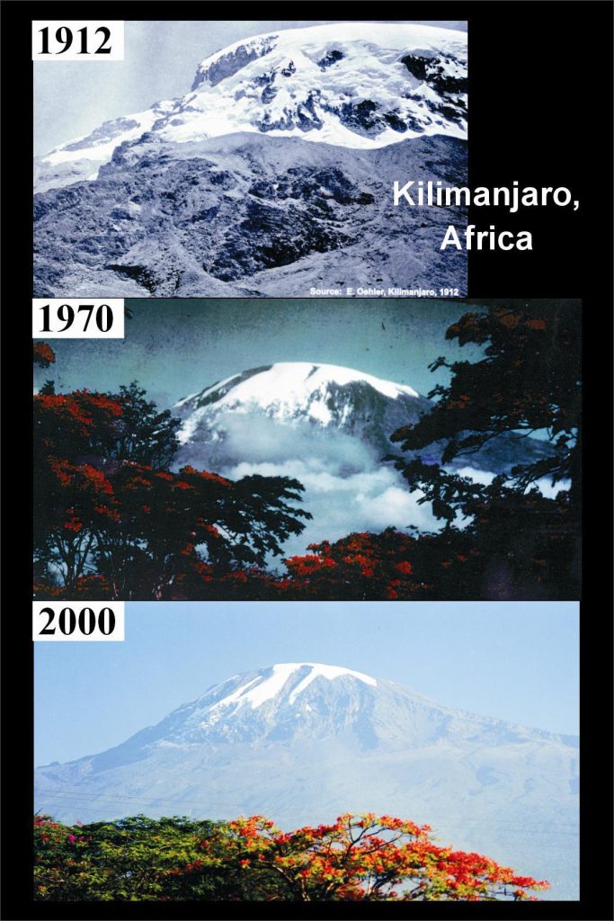
Olympus Mons vs Kilimanjaro
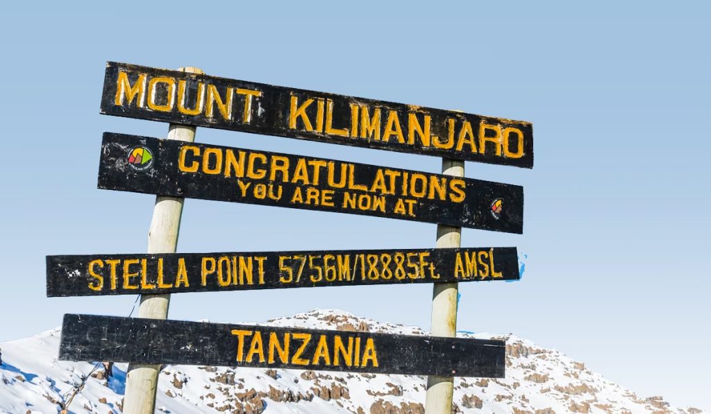
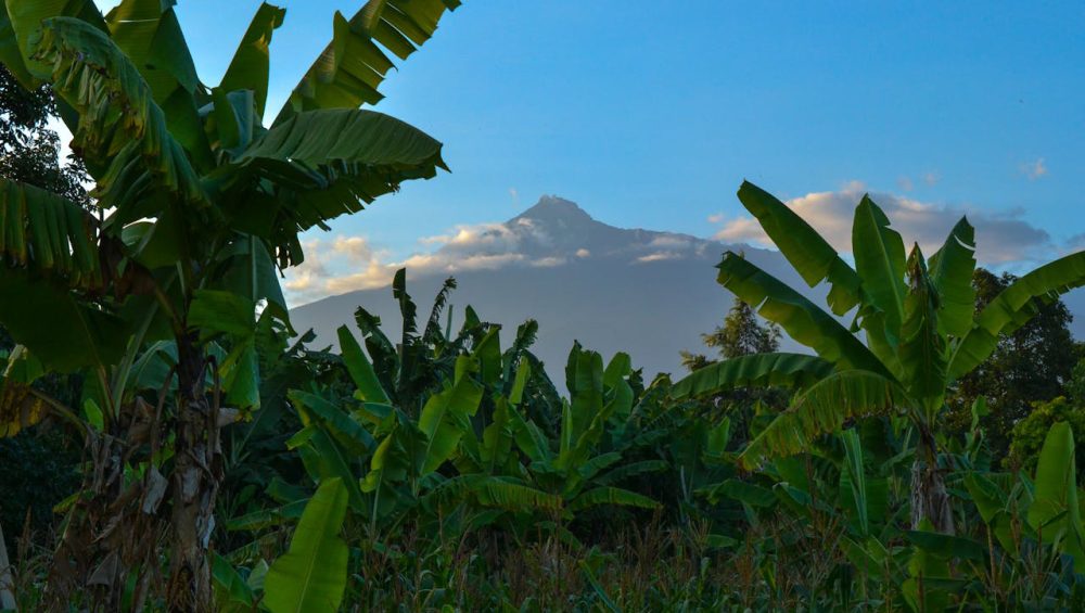
Mount Kilimanjaro, Africa’s highest mountain, rises 5,895 meters (19,341 feet) above sea level. Located in Tanzania, Kilimanjaro is the tallest free-standing mountain on Earth and one of the world’s most famous trekking destinations.
When compared with Olympus Mons, the difference is astonishing. Olympus Mons is more than three times taller than Kilimanjaro. A mountain that already dominates the African landscape would appear relatively small beside the giant volcano on Mars.
Another interesting similarity is that both mountains are volcanoes. Kilimanjaro formed through volcanic activity on Earth, while Olympus Mons developed through repeated lava eruptions on Mars over billions of years. The difference is that Olympus Mons continued growing far longer, allowing it to reach an unimaginable size.
Olympus Mons vs Mauna Kea
Many people assume Everest is Earth’s tallest mountain, but that depends on how height is measured. If measured from base to summit, Mauna Kea in Hawaii is actually taller. Although only 4,207 meters (13,803 feet) rise above sea level, most of the mountain lies beneath the Pacific Ocean, giving it a total height of about 10,210 meters (33,500 feet).
Even Mauna Kea falls far short of Olympus Mons. The Martian volcano is roughly twice as tall as Mauna Kea and covers a much larger area. While Mauna Kea is one of Earth’s largest volcanoes, Olympus Mons remains the undisputed giant of the Solar System.
Height Comparison Table
| Mountain | Planet | Height |
|---|---|---|
| Olympus Mons | Mars | 21.2 km (13.2 mi) |
| Mauna Kea (Base to Summit) | Earth | 10.2 km (6.3 mi) |
| Mount Everest | Earth | 8.85 km (5.5 mi) |
| Mount Kilimanjaro | Earth | 5.9 km (3.7 mi) |
The comparison makes one thing clear: no mountain discovered so far comes close to matching the scale of Olympus Mons. Its immense height and vast volcanic structure make it one of the most remarkable natural features in the Solar System.
How Tall Is Olympus Mons?
Olympus Mons stands about 21.2 kilometers (13.2 miles) above the average surface of Mars, making it the tallest mountain in the Solar System. If measured from its base to its summit, the giant volcano reaches roughly 26 kilometers (16.2 miles). No mountain on Earth comes close to matching its scale. Its extraordinary height results from billions of years of volcanic activity combined with Mars’s lower gravity and lack of moving tectonic plates.
Olympus Mons vs Mount Everest
Mount Everest is the highest mountain above sea level on Earth, reaching 8,849 meters (29,032 feet). For many people, Everest represents the ultimate symbol of mountain height and adventure. Yet compared with Olympus Mons, Everest looks surprisingly small.
Olympus Mons rises nearly 2.5 times higher than Everest above its planet’s average surface. While Everest challenges climbers with steep ridges, glaciers, and thin air, Olympus Mons presents an entirely different scale. The Martian volcano is so massive that a person standing near its base would not even be able to see the summit because it lies beyond the horizon.
Olympus Mons vs Kilimanjaro
At 5,895 meters (19,341 feet), Mount Kilimanjaro is Africa’s highest mountain and the tallest free-standing mountain on Earth. Unlike Everest, which forms part of a larger mountain range, Kilimanjaro rises dramatically from the surrounding plains, making it appear especially impressive.
However, Olympus Mons towers more than three times higher than Kilimanjaro. Interestingly, both mountains share volcanic origins. Kilimanjaro formed through volcanic activity in East Africa, while Olympus Mons developed from repeated lava eruptions on Mars. The difference is that volcanic activity continued much longer on Olympus Mons, allowing it to grow into a mountain unlike any found on Earth.
Olympus Mons vs Mauna Kea
Many scientists consider Mauna Kea in Hawaii the tallest mountain on Earth when measured from its base on the ocean floor to its summit. Although only 4,207 meters (13,803 feet) rise above sea level, its total height reaches approximately 10,210 meters (33,500 feet).
Even with this measurement advantage, Mauna Kea is less than half the height of Olympus Mons. Both are shield volcanoes formed by flowing lava, but the Martian volcano benefited from conditions that allowed it to keep growing for millions of years without significant interruption.
Height Comparison Table
| Mountain | Planet | Height |
|---|---|---|
| Olympus Mons | Mars | 21.2 km (13.2 mi) |
| Mauna Kea (Base to Summit) | Earth | 10.2 km (6.3 mi) |
| Mount Everest | Earth | 8.85 km (5.5 mi) |
| Mount Kilimanjaro | Earth | 5.9 km (3.7 mi) |
The comparison highlights just how extraordinary Olympus Mons truly is. If this giant volcano stood on Earth, it would dominate the horizon for hundreds of kilometers and surpass every known mountain by an enormous margin. Its sheer size is one of the main reasons scientists consider it one of the most remarkable geological features in the Solar System.
Why Is Olympus Mons So Large?
Olympus Mons did not become the tallest mountain in the Solar System by chance. Several unique conditions on Mars allowed this giant volcano to grow far larger than any volcano on Earth. Lower gravity, the absence of moving tectonic plates, and millions of years of continuous volcanic eruptions all contributed to its extraordinary size. Together, these factors created a mountain that reaches heights and dimensions unmatched anywhere else in the Solar System.
Weak Martian Gravity
One of the main reasons Olympus Mons grew so large is Mars’s weak gravity. The Red Planet has only about 38% of Earth’s gravity, which means volcanic structures can support much more weight before collapsing under their own mass.
On Earth, extremely tall volcanoes eventually become unstable. Gravity pulls on the mountain’s rocks, limiting how high the structure can grow. Mars places far less stress on volcanic formations, allowing lava and rock to accumulate over vast periods of time. As a result, Olympus Mons continued growing until it reached a height of more than 21 kilometers (13.2 miles).
The weaker gravity also influenced the way lava flowed across the landscape. Lava could travel greater distances before cooling and hardening, helping create the broad, gently sloping shape that characterizes Olympus Mons today.
Lack of Plate Tectonics
Earth’s crust constantly moves through a process known as plate tectonics. These shifting plates gradually carry volcanoes away from their magma sources, limiting how long eruptions can build up a single mountain.
Mars works differently. Scientists have found no evidence of active plate tectonics like those on Earth. Instead, the Martian crust remained relatively fixed above volcanic hotspots for millions of years.
Because the surface did not move, lava repeatedly erupted from the same location. Layer upon layer of volcanic material accumulated in one place, allowing Olympus Mons to keep expanding rather than forming a chain of smaller volcanoes. This unique geological condition played a major role in creating the largest volcano ever discovered.
Billions of Years of Volcanic Activity
Time was another crucial ingredient in the formation of Olympus Mons. Scientists believe the volcano remained active for an incredibly long period, possibly spanning hundreds of millions of years. During this time, countless eruptions released enormous volumes of lava that spread across the surrounding plains.
Each eruption added another layer to the growing mountain. Unlike explosive volcanoes that produce steep peaks, Olympus Mons experienced mostly gentle lava flows that gradually built its immense shield-like structure. Over billions of years, these repeated eruptions transformed a volcanic hotspot into a mountain system covering an area larger than many countries.
The result is a volcano unlike anything found on Earth. Olympus Mons stands as a remarkable example of how planetary conditions can shape landscapes in dramatically different ways, creating geological wonders that stretch the limits of imagination.
What Would Climbing Olympus Mons Be Like?
Climbing Olympus Mons would challenge every part of a Mars expedition. Unlike climbing a steep mountain on Earth, this journey would begin with a long trek across the Martian plains before reaching the volcano’s enormous base. From there, explorers would climb towering cliffs, cross vast volcanic slopes, and travel hundreds of kilometers to reach the summit. The thin atmosphere, freezing temperatures, and lack of oxygen would force every climber to rely on advanced space suits, life-support systems, and carefully planned logistics.
Although Olympus Mons rises more than 21 kilometers (13.2 miles) above the surrounding plains, its gentle average slope of about 5% would make the climb feel more like an extremely long endurance expedition than a technical mountaineering ascent. Every stage would demand patience, precision, and constant attention to safety.
Reaching the Base
Reaching the base of Olympus Mons would likely take several days before the actual climb even begins. The volcano stretches across roughly 600 kilometers (373 miles), making it one of the largest volcanoes ever discovered. Future astronauts would probably travel from a nearby Mars habitat using pressurized rovers capable of carrying supplies, scientific equipment, and emergency life-support systems.
The surrounding landscape would appear unlike any place on Earth. Red volcanic plains covered with fine dust, ancient lava flows, scattered rocks, and countless impact craters would extend toward the horizon. With no forests, rivers, or wildlife, explorers would experience complete isolation across an immense desert shaped by billions of years of volcanic activity.
Navigation would require satellite positioning, onboard computers, and detailed topographic maps because dust storms could reduce visibility without warning. Every kilometer would consume valuable energy, water, oxygen, and battery power, making careful planning essential long before the climb begins.
Scaling the Giant Cliffs
The first major obstacle would appear at the edge of Olympus Mons, where enormous cliffs rise as high as 6 to 8 kilometers (4 to 5 miles) above the surrounding plains. Scientists believe repeated lava flows created these dramatic escarpments over millions of years, forming one of the largest cliff systems in the Solar System.
Astronauts could not simply hike straight up these walls. Instead, they would search for natural breaks, ancient lava channels, or gradual ramps that offer safer routes. Specialized climbing equipment, robotic scouts, and autonomous drones would help identify stable paths before humans continue upward.
Mars’ lower gravity would reduce body weight to about 38% of what climbers experience on Earth, making each step feel lighter. However, bulky space suits would limit movement, reduce flexibility, and increase fatigue. Every climb would require slow, controlled movements because a damaged suit could threaten the entire mission.
Trekking Across the Slopes
After climbing the cliffs, explorers would begin the longest stage of the expedition. Olympus Mons has broad, gently sloping sides that extend for hundreds of kilometers. Instead of steep rock faces, astronauts would spend weeks walking across ancient lava plains, hardened volcanic rock, and fields of loose dust.
The landscape would change gradually rather than dramatically. Massive lava channels, collapsed lava tubes, volcanic ridges, and scattered boulders would reveal the volcano’s violent geological past. Scientists would likely stop often to collect rock samples, study mineral deposits, and search for clues about Mars’ volcanic history.
Daily progress would remain slow because astronauts would need regular breaks to conserve oxygen, recharge equipment, and monitor their health. Every camp would require secure shelters that protect the crew from freezing temperatures, radiation, and powerful dust storms. Mission planners might also deploy supply vehicles ahead of the team to reduce the amount of equipment each astronaut carries.
Unlike climbing mountains on Earth, where weather often changes within hours, the greatest challenge on Olympus Mons would come from distance. The sheer size of the volcano would test physical endurance and mental resilience for weeks or even months.
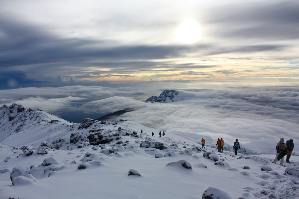
Reaching the Summit
Reaching the summit of Olympus Mons would mark one of humanity’s greatest exploration achievements. Instead of standing on a narrow peak, astronauts would arrive at a vast volcanic plateau surrounding a giant caldera. The summit contains several overlapping collapse craters that stretch about 80 kilometers (50 miles) across, making the summit area larger than many cities on Earth.
From this incredible vantage point, climbers would look across an endless Martian landscape that curves gently toward the horizon. The thin atmosphere would create a dim salmon-colored sky during the day, while the surrounding plains would appear almost limitless beneath them. On exceptionally clear days, explorers might even see distant volcanoes rising from the Martian surface.
Scientists would use the summit to study ancient lava flows, volcanic rocks, and the geological processes that built the largest volcano in the Solar System. They could also deploy weather instruments, seismic sensors, and communication equipment to support future Mars missions.
Standing on the summit would represent far more than completing a climb. It would symbolize humanity’s ability to explore worlds beyond Earth, overcome extraordinary challenges, and expand scientific knowledge across the Solar System.
Biggest Challenges of Climbing Olympus Mons
Climbing Olympus Mons would involve far more than reaching an incredible height. Every stage of the journey would expose astronauts to harsh environmental conditions that no mountain on Earth can match. The thin Martian atmosphere, freezing temperatures, intense radiation, lack of breathable oxygen, and enormous travel distance would turn the expedition into one of the most demanding missions in human history. Future explorers would need advanced technology, careful planning, and extensive training to complete the climb safely.
Thin Atmosphere
The thin Martian atmosphere would create one of the biggest obstacles for climbers. Mars has an atmospheric pressure of less than 1% of Earth’s at sea level, making the air far too thin for humans to survive without protection. Unlike high-altitude climbers on Earth, astronauts could not rely on supplemental oxygen alone because the atmosphere contains very little oxygen to breathe.
Every explorer would wear a fully sealed space suit with an independent life-support system that supplies oxygen, removes carbon dioxide, regulates air pressure, and controls body temperature. Even a small tear or equipment failure could quickly become life-threatening.
The thin atmosphere also provides very little protection from extreme temperature changes and harmful solar radiation. Although Mars experiences weaker winds than Earth due to its low air density, dust storms can still reduce visibility and cover equipment with fine dust, making navigation more difficult.
Extreme Cold
Olympus Mons experiences extremely cold temperatures throughout the year. Surface temperatures on Mars often fall below -60°C (-76°F), while nighttime temperatures can drop below -100°C (-148°F) depending on the season and location. Higher elevations on Olympus Mons may become even colder because of their altitude and exposure.
Such conditions would affect both astronauts and their equipment. Batteries lose efficiency in freezing temperatures, mechanical parts become more difficult to operate, and electronic systems require additional insulation and heating. Mission teams would need specially designed habitats and heated shelters where astronauts could rest, recharge equipment, and recover after long days of travel.
Space suits would also play a critical role by maintaining a stable internal temperature. Without active heating systems, the cold Martian environment could quickly cause dangerous health problems, including frostbite and hypothermia.
Dangerous Radiation
Radiation poses one of the greatest long-term risks on Mars. Earth benefits from a thick atmosphere and a powerful magnetic field that block much of the Sun’s harmful radiation. Mars lacks both of these natural defenses, leaving its surface exposed to cosmic rays and energetic particles from the Sun.
Astronauts climbing Olympus Mons would receive much higher radiation exposure than people on Earth. Long missions increase the cumulative radiation dose, raising the risk of cancer, damage to body tissues, and other health problems.
Future missions would reduce these dangers by using radiation-resistant habitats, reinforced space suits, and carefully planned schedules that minimize exposure during periods of intense solar activity. Scientists also continue to study new shielding materials that could offer better protection during extended Mars expeditions.
Lack of Oxygen
Humans cannot breathe on Olympus Mons because the Martian atmosphere contains about 95% carbon dioxide and only trace amounts of oxygen. Every breath would depend entirely on artificial life-support systems.
Astronauts would carry oxygen supplies inside their space suits while portable systems remove carbon dioxide and recycle breathable air. Backup oxygen tanks and emergency equipment would remain essential throughout the expedition because any interruption could threaten survival within minutes.
Future Mars bases may produce oxygen using local resources. Scientists have already demonstrated technologies that extract oxygen from carbon dioxide, and future missions could expand these systems to support longer expeditions across the Martian surface.
Long Expedition Duration
The sheer size of Olympus Mons would make the climb an extraordinary endurance challenge. Although the volcano has relatively gentle slopes, its enormous width means astronauts could travel hundreds of kilometers before reaching the summit. The complete expedition, including travel to and from the mountain, scientific research, and scheduled rest periods, could last several weeks or even months.
Mission planners would divide the journey into carefully organized stages. Astronauts would stop regularly to inspect equipment, recharge batteries, replenish supplies, and monitor their physical and mental health. Robotic vehicles, supply depots, and mobile habitats would likely support the expedition by transporting heavy equipment and providing safe locations for recovery.
The long duration would test more than physical strength. Isolation, confined living conditions, communication delays with Earth, and the psychological demands of operating in one of the most remote environments ever explored would challenge every member of the mission. Success would depend on teamwork, discipline, advanced technology, and meticulous planning from beginning to end.
What Would You See From the Summit?
Standing on the summit of Olympus Mons would reveal one of the most extraordinary views in the Solar System. Instead of sharp peaks and narrow ridgelines like Earth mountains, the summit would open into a vast volcanic plateau surrounded by a gently curving horizon. The low Martian gravity, thin atmosphere, and enormous scale of the volcano would create a landscape that feels endless in every direction. Every direction would show signs of ancient volcanic activity, frozen terrain, and a planet shaped by billions of years of geological change.
The Martian Horizon
From the summit, the Martian horizon would stretch far beyond what the human eye normally experiences on Earth. Because Olympus Mons rises about 21 kilometers above the surrounding plains and Mars has a much thinner atmosphere, visibility would extend dramatically on clear days.
The horizon would appear soft and slightly curved, fading into a reddish-orange haze caused by fine dust particles suspended in the atmosphere. Unlike Earth, there would be no forests, cities, or oceans only vast volcanic plains, impact craters, and ancient lava flows stretching into the distance. The silence would feel absolute, broken only by the sound of internal suit systems.
The scale of the view would make nearby features look deceptively close, even when they sit hundreds of kilometers away. This visual distortion would highlight the immense size of Mars and the overwhelming isolation of the summit environment.
Massive Volcanic Caldera
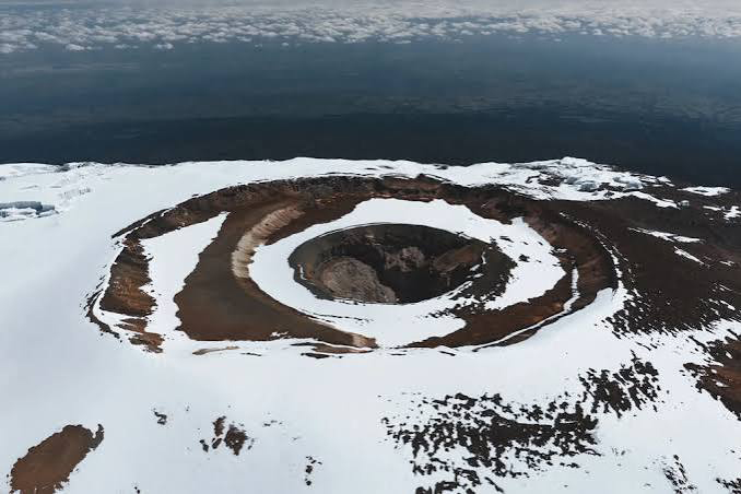
One of the most striking features visible from the summit would be the giant caldera complex of Olympus Mons itself. Instead of a single crater, the summit contains several overlapping collapse pits formed after ancient magma chambers emptied and the surface collapsed inward.
These calderas span about 80 kilometers across, making them larger than many entire cities on Earth. From above, they would appear as deep, layered basins with steep inner walls and rugged volcanic structures shaped by repeated eruptions over millions of years.
Shadows inside the caldera would shift slowly with the Sun, revealing ridges, fractures, and lava channels frozen in time. Scientists would likely study these features closely because they hold important clues about the volcano’s eruption history and internal structure.
Frozen Water Frost
Although Olympus Mons sits in a dry volcanic region, traces of frozen water frost may appear in certain shaded areas or during colder periods. Mars contains water ice beneath its surface and at its polar regions, and atmospheric conditions sometimes allow thin frost layers to form temporarily.
From the summit, astronauts might observe faint white patches forming on rocks or inside shadowed depressions, especially during early morning hours. These frost deposits would not resemble Earth’s snowfields but instead appear as thin, delicate coatings that quickly sublimate when exposed to sunlight.
The presence of water ice, even in small amounts, would carry major scientific importance. It would help researchers understand Mars’ climate history and support future human missions that rely on local water resources.
A Landscape Unlike Earth
The overall view from Olympus Mons would feel completely unfamiliar compared to any place on Earth. There would be no vegetation, no weather systems like thunderstorms or rain, and no signs of living ecosystems. Instead, the landscape would show a planet frozen in geological time.
Vast lava plains would stretch outward in every direction, broken by ancient river-like channels formed by flowing molten rock. Distant volcanoes like Arsia Mons, Pavonis Mons, and Ascraeus Mons might rise faintly along the horizon, forming part of the massive Tharsis volcanic region.
The sky would appear pale butterscotch in color due to dust scattering sunlight across the thin atmosphere. Sunlight would feel dimmer and cooler than on Earth, casting long shadows across the volcanic terrain.
From this vantage point, astronauts would not just see a mountain they would witness an entire planet shaped by fire, time, and silence, offering a perspective that no human has ever experienced before.
Could Olympus Mons Erupt Again?
Olympus Mons no longer shows signs of active volcanism, but scientists still study it carefully to understand its long-term behavior. The volcano formed through billions of years of repeated eruptions, and its enormous size suggests a powerful internal system once drove it. Today, most evidence points to an extinct or dormant state, yet researchers continue to examine Mars for any hints of residual geothermal activity beneath the surface.
What Scientists Know
Scientists classify Olympus Mons as a shield volcano that likely stopped erupting millions of years ago. Orbital spacecraft observations have not detected any recent lava flows, heat anomalies, or gas emissions that would suggest current volcanic activity.
Mars has cooled significantly over time, and its internal heat has decreased, reducing the likelihood of large-scale eruptions. Unlike Earth, Mars lacks active plate tectonics, which limits the movement of molten material that often fuels volcanic systems. Based on current data, most researchers agree that Olympus Mons does not erupt today.
However, scientists remain cautious. Mars still experiences occasional marsquakes, and some subsurface heat may remain in isolated pockets. These findings keep open the possibility that minor geological activity could still exist deep below the surface.
Signs of Ancient Volcanic Activity
Evidence of Olympus Mons’ past eruptions appears across its massive structure. The volcano contains extensive lava flows that spread across hundreds of kilometers, forming smooth plains and layered volcanic deposits.
Satellite images reveal overlapping lava channels, collapsed lava tubes, and stacked flow fields that show repeated eruptions over a very long period. These features indicate that Olympus Mons built itself slowly over millions to billions of years, rather than through a single explosive event.
The caldera at the summit also shows multiple collapse stages, which suggest magma chambers filled and emptied repeatedly. These geological patterns help scientists reconstruct the volcano’s long and powerful eruptive history.
Future Possibilities
Although Olympus Mons appears inactive today, scientists do not completely rule out future volcanic activity on Mars. If internal heat still exists deep within the planet, it could potentially trigger minor eruptions in the distant future.
However, any future activity would likely remain small and infrequent compared to Earth’s volcanoes. Mars has cooled significantly, and its geological engine has slowed over time. Large-scale eruptions like those that built Olympus Mons seem highly unlikely under current conditions.
Future missions to Mars may help answer this question more clearly. Seismic instruments, heat sensors, and subsurface probes could detect hidden magma pockets or thermal anomalies. Until then, Olympus Mons remains one of the most fascinating dormant giants in the Solar System, preserving a record of Mars’ volcanic past.
The Tallest Mountains in the Solar System
Mountains across the Solar System reach extreme heights that far exceed anything on Earth. While Earth’s tallest peak, Mount Everest, rises 8.8 km above sea level, several extraterrestrial mountains dwarf it by a huge margin. These peaks formed through volcanic activity, tectonic movement, and planetary evolution over billions of years.
Top 10 Highest Mountains Comparison Table
| Rank | Mountain | Planet/Moon | Height (km) | Type of Formation |
|---|---|---|---|---|
| 1 | Olympus Mons | Mars | 21.2 | Shield volcano |
| 2 | Rheasilvia Peak | Vesta | 20 | Impact-related |
| 3 | Boösaule Mons | Io | 17.5 | Volcanic |
| 4 | Arsia Mons | Mars | 17.9 | Shield volcano |
| 5 | Elysium Mons | Mars | 12.6 | Shield volcano |
| 6 | Ascraeus Mons | Mars | 18.2 | Shield volcano |
| 7 | Mauna Kea | Earth | 10.2 (from base underwater) | Shield volcano |
| 8 | Maxwell Montes | Venus | 11.0 | Tectonic uplift |
| 9 | Skadi Mons | Venus | 10+ | Volcanic |
| 10 | South Mountain | Moon | 9 | Impact uplift |
This comparison shows that Mars dominates the list of the tallest mountains in the Solar System, with multiple shield volcanoes rising far higher than Earth’s geological formations. Olympus Mons remains the undisputed giant, standing as the tallest known mountain in our planetary system.
Why Olympus Mons Matters to Future Mars Exploration
Olympus Mons plays a major role in how scientists and engineers plan future missions to Mars. Its enormous size, long volcanic history, and unique geology offer valuable clues about how Mars formed and evolved. Future explorers will not only study the mountain for science but also use it as a potential reference point for navigation, resource planning, and human survival strategies on the planet.
Scientific Research
Scientists study Olympus Mons to understand Mars’ volcanic history and internal structure. The mountain preserves billions of years of lava flows, collapse events, and geological layering that reveal how Mars cooled and changed over time.
By analyzing rock samples and surface formations, researchers can learn how long volcanoes stayed active on Mars and what types of eruptions occurred. These findings help scientists compare Mars with Earth and other planets, improving our understanding of planetary evolution.
Future robotic missions and possibly human explorers will likely collect more detailed data from Olympus Mons. Instruments such as ground-penetrating radar, seismic sensors, and chemical analyzers will help uncover hidden layers beneath the surface.
Human Colonization
Olympus Mons could influence long-term human settlement planning on Mars. While the mountain itself is not a likely location for a base due to its harsh conditions and long travel distances, it still offers strategic advantages for exploration planning.
Its high elevation provides excellent visibility across the Martian surface, which could help with communication relay stations or scientific observation points. Engineers may also study its surrounding lava plains for stable ground that could support future habitats or infrastructure.
In the long term, understanding large volcanic regions like Olympus Mons will help humans identify safe zones for colonization, access natural resources, and plan sustainable living environments on Mars.
Future Expeditions
Future missions to Mars will likely include Olympus Mons as a key exploration target. Robotic rovers, drones, and possibly human crews may travel to the volcano to study its massive structure in greater detail.
These expeditions could focus on mapping lava flows, analyzing mineral deposits, and searching for signs of past water activity. Advanced autonomous systems may also scout routes before human arrival, making exploration safer and more efficient.
As technology improves, Olympus Mons could become a landmark destination for Mars explorers, representing both a scientific treasure and a symbol of humanity’s expanding reach into the Solar System.
Frequently Asked Questions
Yes, Olympus Mons stands far taller than Mount Everest. Olympus Mons rises about 21.2 km high, while Mount Everest reaches 8.8 km above sea level. This makes Olympus Mons nearly three times taller than Earth’s highest mountain.
No, humans cannot breathe on Olympus Mons. The Martian atmosphere contains mostly carbon dioxide and very little oxygen. Astronauts would need sealed space suits with full life-support systems to survive.
Climbing Olympus Mons could take weeks or even months. Although the slopes stay relatively gentle, the mountain stretches hundreds of kilometers across, so the journey requires long-distance travel rather than steep climbing.
No, no human or spacecraft has landed on Olympus Mons yet. Only orbiters and satellites have studied the volcano from space and captured detailed images of its surface.
Scientists believe Olympus Mons is most likely extinct. Mars has cooled significantly, and no signs of recent volcanic activity appear. However, researchers still continue to monitor Mars for possible minor internal heat activity.
Olympus Mons on Mars is the tallest known mountain in the Solar System. It rises about 21.2 km high and dominates all other planetary peaks, including those on Earth, Venus, and Jupiter’s moon Io.
Final Thoughts
Olympus Mons stands as one of the most extreme natural features in the Solar System. It rises far above any mountain on Earth and shows how different planetary forces can shape landscapes on a massive scale.
A climb up Olympus Mons would not feel like a normal mountain expedition. It would demand long-distance travel, advanced life-support systems, and careful planning at every stage. The journey would test endurance, technology, and human determination in ways no Earth climb can match.
Beyond the challenge, Olympus Mons also helps scientists understand Mars’ volcanic history and the evolution of rocky planets. It remains a powerful reminder that our Solar System still holds landscapes that push the limits of imagination and exploration.
Read more about A climb up Olympus Mons