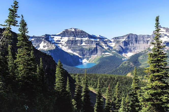
Climbing Mount Elbrus
The complete guide to Mount Elbrus, the highest peak in Europe.
Estimated reading time: 34 minutes
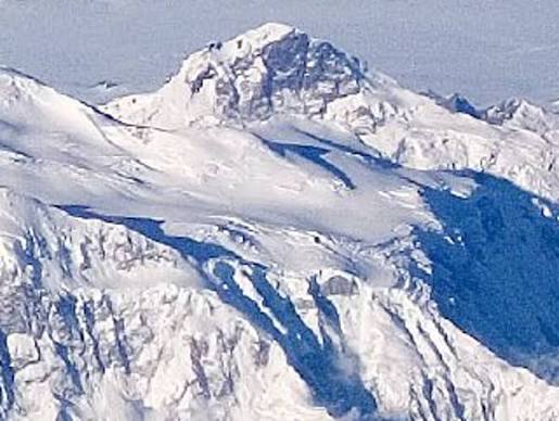
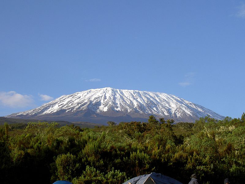
Mount Elbrus is the highest mountain in Europe, rising to 5,642 meters (18,510 feet) above sea level in the Caucasus Mountains of southern Russia. As one of the prestigious Seven Summits, it attracts more than 10,000 climbers each year who hope to stand on the highest point of the European continent. Despite being considered one of the more accessible Seven Summits, climbing Mount Elbrus remains a serious high-altitude challenge due to its extreme weather, freezing temperatures, glaciers, and risk of altitude sickness.
Whether you are planning an expedition or simply researching Europe’s highest peak, this guide covers everything you need to know about Mount Elbrus, including its location, height, climbing routes, difficulty, costs, best time to climb, and essential preparation tips.
Table of contents
- The complete guide to Mount Elbrus, the highest peak in Europe.
- What Is Mount Elbrus?
- Mount Elbrus at a Glance
- Where Is Mount Elbrus Located?
- How Tall Is Mount Elbrus?
- Why Is Mount Elbrus Famous?
- The History of Mount Elbrus
- What Makes Mount Elbrus Unique?
- Can Beginners Climb Mount Elbrus?
- How Difficult Is Mount Elbrus?
- Mount Elbrus vs Other Famous Mountains
- Mount Elbrus Climbing Routes Explained
- Best Time to Climb Mount Elbrus
- How Much Does It Cost to Climb Mount Elbrus?
- How to Prepare for Mount Elbrus
- Essential Mount Elbrus Gear List
- Mount Elbrus Climbing Statistics
- Is Mount Elbrus Safe?
- Final Thoughts: Is Mount Elbrus Worth Climbing?
| Fact | Information |
|---|---|
| Official Name | Mount Elbrus |
| Height | 5,642 m (18,510 ft) |
| Location | Southern Russia |
| Mountain Range | Greater Caucasus |
| Continent | Europe |
| Mountain Type | Dormant Stratovolcano |
| Highest Mountain in Europe | Yes |
| Seven Summits Peak | Yes |
| Western Summit | 5,642 m (18,510 ft) |
| Eastern Summit | 5,621 m (18,442 ft) |
| Best Time to Climb | June to September |
| Difficulty Level | Moderate to Challenging |
| Typical Expedition Length | 7-10 Days |
| Annual Climbers | Approximately 10,000-12,000 |
| First Recorded Ascent | 1829 |
What Is Mount Elbrus?
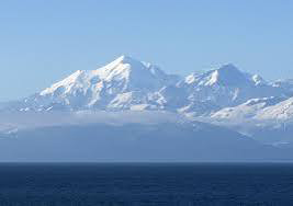
Mount Elbrus is a dormant stratovolcano in the Caucasus Mountains and the highest mountain in Europe. Its western summit reaches 5,642 meters (18,510 feet), making it taller than any other peak on the continent. The mountain is one of the Seven Summits, a collection of the highest mountains on each continent that many climbers aim to complete.
Why Is Mount Elbrus Famous?
Mount Elbrus is famous for several reasons, making it one of the world’s most iconic mountains and a dream destination for climbers and adventure travelers.
The Highest Mountain in Europe
Standing at 5,642 meters (18,510 feet), Mount Elbrus is the highest mountain in Europe and the tallest peak in the Caucasus Mountains. Because of its elevation, it is widely recognized as the “Roof of Europe” and attracts thousands of climbers every year.
One of the Seven Summits
Mount Elbrus is one of the prestigious Seven Summits, which are the highest mountains on each continent. Many mountaineers climb Elbrus as part of their journey to complete this world-famous challenge.
A Dormant Volcano
Unlike many famous mountains, Mount Elbrus is actually a dormant stratovolcano with two distinct summits. Although it has not erupted for approximately 2,000 years, its volcanic origins can still be seen in its landscape, glaciers, and geothermal features.
One of the World’s Most Climbed High Mountains
Mount Elbrus attracts more than 10,000 climbers annually, making it one of the most popular high-altitude mountains in the world. Its standard South Route is considered one of the more accessible routes among the Seven Summits, allowing many beginners to experience high-altitude mountaineering.
Historical Importance During World War II
Mount Elbrus also has historical significance. During World War II, German troops reached the mountain and raised the Nazi flag on its summit in 1942 as part of their campaign in the Caucasus region. The mountain later became a symbol of Soviet resistance after Soviet forces regained control of the area.
Today, Mount Elbrus remains one of the world’s most famous mountains because of its unique combination of natural beauty, mountaineering history, volcanic origins, and status as Europe’s highest peak.
Key Facts About Europe’s Highest Peak
| Fact | Information |
|---|---|
| Elevation | 5,642 m (18,510 ft) |
| Location | Russia |
| Mountain Range | Greater Caucasus |
| Type | Dormant Stratovolcano |
| Highest Point in Europe | Yes |
| Seven Summits Peak | Yes |
| First Recorded Ascent | 1829 |
| Best Climbing Season | June-September |
This structure gives Google the answer immediately after the H1, then expands the topic through the H2 and H3 sections. It is much stronger for SEO than starting with a long introduction.
Can Beginners Climb Mount Elbrus?
Yes, beginners can climb Mount Elbrus, particularly via the standard South Route. Unlike highly technical mountains such as Everest or Denali, the South Route on Mount Elbrus does not require advanced rock climbing skills. However, beginners should not underestimate the mountain.
At 5,642 meters (18,510 feet), Mount Elbrus is a serious high-altitude expedition. The biggest challenges are altitude, cold temperatures, glacier travel, and rapidly changing weather conditions rather than technical climbing.
Do You Need Previous Climbing Experience?
Previous mountaineering experience is helpful but not always necessary. Many first-time high-altitude climbers successfully summit Mount Elbrus each year with proper preparation and experienced guides.
However, beginners should be comfortable with:
- Hiking for several consecutive days
- Walking on snow and steep slopes
- Using crampons and an ice axe
- Hiking for long hours in cold conditions
Why Is the South Route Best for Beginners?
The South Route is considered the easiest and most popular route because it offers:
- Well-established trails
- Mountain huts and refuges
- Cable car access
- Optional snowcat assistance
- Better rescue infrastructure
These facilities significantly improve comfort and increase summit success rates.
Challenges Beginners Should Expect
Even beginner climbers should prepare for:
High Altitude
The reduced oxygen levels above 5,000 meters can cause fatigue, headaches, and altitude sickness.
Cold Temperatures
Summit temperatures can drop below -20°C (-4°F), even during the main climbing season.
Long Summit Day
Summit day typically lasts between 10 and 14 hours and can be physically demanding.
How Should Beginners Prepare?
To improve your chances of success, beginners should:
- Train for cardiovascular endurance several months in advance.
- Practice hiking with a backpack.
- Learn basic crampon and ice axe techniques.
- Choose a longer itinerary for better acclimatization.
- Climb with experienced guides.
Is Mount Elbrus a Good First Seven Summit?
Yes. Mount Elbrus is often recommended as one of the best introductory Seven Summits because it combines high-altitude mountaineering with relatively moderate technical difficulty. Many climbers choose Elbrus as their first major expedition before attempting more demanding peaks such as Denali or Everest.
Mount Elbrus at a Glance
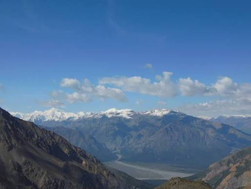
Mount Elbrus is the highest mountain in Europe and one of the world’s most famous climbing destinations. Located in the Caucasus Mountains of southern Russia, this dormant volcano rises to 5,642 meters (18,510 feet) above sea level. As a member of the Seven Summits, Mount Elbrus attracts thousands of climbers each year who hope to stand on the highest point of the European continent.
Mount Elbrus Facts Table
| Feature | Details |
|---|---|
| Mountain Name | Mount Elbrus |
| Elevation | 5,642 m (18,510 ft) |
| Location | Caucasus Mountains, Russia |
| Continent | Europe |
| Mountain Range | Greater Caucasus |
| Type | Dormant Stratovolcano |
| Highest Point in Europe | Yes |
| Number of Summits | Two |
| Western Summit | 5,642 m (18,510 ft) |
| Eastern Summit | 5,621 m (18,442 ft) |
| First Recorded Ascent | 1829 |
| Seven Summits Peak | Yes |
| Best Climbing Season | June to September |
note: Some geographers debate whether Mount Elbrus lies in Europe or Asia, but it is widely recognized as Europe’s highest mountain.
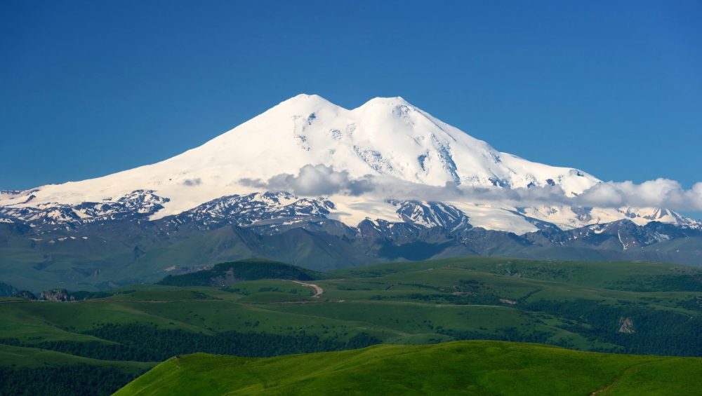
Height, Location, and Volcano Status
Mount Elbrus stands at 5,642 meters (18,510 feet), making it the tallest mountain in Europe and one of the most prominent peaks in the world. The mountain is located in the western part of the Caucasus Mountains near the border between the Russian republics of Kabardino-Balkaria and Karachay-Cherkessia.
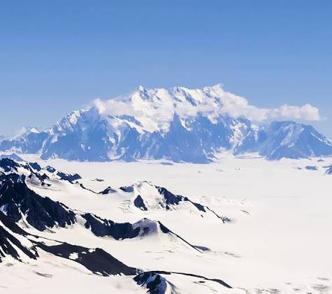
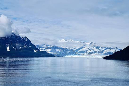
Unlike many famous mountains, Elbrus is actually a dormant stratovolcano. Although it has not erupted for thousands of years, its twin volcanic cones and extensive lava formations reveal its volcanic origins. Today, massive glaciers cover much of the mountain, creating the snowy landscape that climbers experience during an ascent.
Mount Elbrus by the Numbers
- Elevation: 5,642 m (18,510 ft)
- Prominence: 4,741 m (15,554 ft)
- Eastern Summit Height: 5,621 m (18,442 ft)
- Glaciers: More than 20 major glaciers
- Annual Climbers: Approximately 10,000-12,000
- Summit Day Duration: 10-15 hours
- Typical Expedition Length: 7-10 days
- Best Climbing Months: June, July, August, and September
- Seven Summits Ranking: 5th highest of the Seven Summits
- Last Eruption: Approximately 2,000 years ago
These numbers highlight why Mount Elbrus is one of the most sought-after mountains for climbers. It combines impressive altitude, a rich geological history, and a relatively accessible route to the highest point in Europe.
Where Is Mount Elbrus Located?
Mount Elbrus is located in southern Russia within the Greater Caucasus mountain system. The mountain rises near the border of the Russian republics of Kabardino-Balkaria and Karachay-Cherkessia, between the Black Sea and the Caspian Sea. Its strategic position at the crossroads of Europe and Asia has made it one of the most geographically significant mountains in the world.
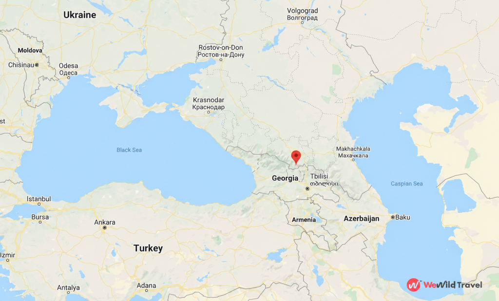
Mount Elbrus in Russia
Mount Elbrus lies entirely within Russia and forms part of the country’s rugged Caucasus region. The mountain is situated about 100 kilometers (62 miles) from the border with Georgia and is surrounded by the protected landscapes of Prielbrusye National Park. Most climbers access the mountain through the Baksan Valley, where villages such as Terskol and Azau serve as the main gateways to the climbing routes.
As the highest peak in Russia, Mount Elbrus attracts thousands of local and international visitors each year. The region offers not only mountaineering opportunities but also skiing, hiking, and breathtaking alpine scenery.
The Caucasus Mountain Range
Mount Elbrus is part of the Greater Caucasus, a massive mountain range that stretches for more than 1,200 kilometers (750 miles) between the Black Sea and the Caspian Sea. The Caucasus contains some of the highest and most dramatic peaks in Europe, including several mountains that exceed 5,000 meters (16,404 feet).
The range serves as a natural barrier between Eastern Europe and Western Asia and is known for its glaciers, deep valleys, diverse wildlife, and unique cultures. Mount Elbrus dominates the western section of the Caucasus and stands as the highest peak in the entire mountain system.
Is Mount Elbrus in Europe or Asia?
The question of whether Mount Elbrus is in Europe or Asia has been debated for centuries. The answer depends on where the boundary between the two continents is drawn.
Most geographers place the Europe Asia border along the crest of the Greater Caucasus Mountains. Under this widely accepted definition, Mount Elbrus lies on the European side of the boundary, making it the highest mountain in Europe.
However, some researchers argue that the continental boundary should follow the Kuma-Manych Depression, a lowland area north of the Caucasus. If this definition is used, Mount Elbrus would technically be in Asia, and Mont Blanc would become Europe’s highest mountain.
Despite the debate, the global mountaineering community and the Seven Summits challenge recognize Mount Elbrus as the highest peak in Europe. This recognition is why climbers from around the world travel to Russia to stand on the roof of Europe.
How Tall Is Mount Elbrus?
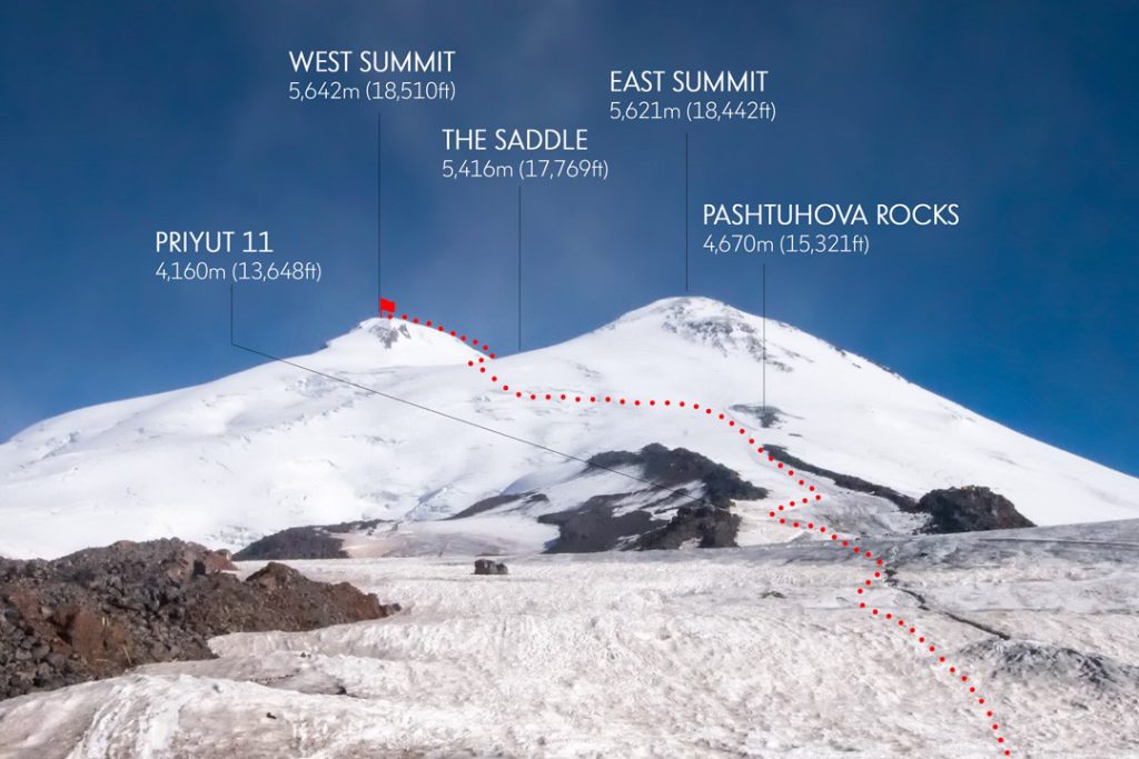
Mount Elbrus stands at an elevation of 5,642 meters (18,510 feet) above sea level, making it the highest mountain in Europe. Unlike many famous peaks, Elbrus has two distinct summits a higher western summit and a slightly lower eastern summit. Both peaks are part of the same dormant volcano and are separated by a saddle that sits around 5,416 meters (17,769 feet) above sea level.
Elevation of the Western Summit
The Western Summit is the highest point of Mount Elbrus, reaching 5,642 meters (18,510 feet). Because it is the taller of the two peaks, this summit is officially recognized as the highest point in Europe and the goal of most climbers attempting Mount Elbrus.
The first successful ascent of the Western Summit took place in 1874 when a British expedition led by Florence Crauford Grove reached the top. Today, most climbers approach the summit via the popular South Route, which offers the easiest and most accessible path to the roof of Europe.
Elevation of the Eastern Summit
The Eastern Summit rises to 5,621 meters (18,442 feet), making it just 21 meters (69 feet) lower than the Western Summit. Although it is not the mountain’s highest point, the Eastern Summit holds historical significance because it was the first summit reached during the mountain’s recorded climbing history.
In 1829, members of a Russian scientific expedition became the first known climbers to reach the Eastern Summit. While fewer climbers visit this peak today, it remains a rewarding objective for experienced mountaineers seeking a more challenging adventure.
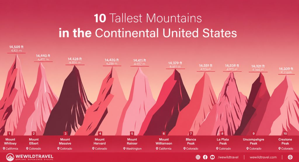
Mount Elbrus Height Comparison Table
The height of Mount Elbrus becomes even more impressive when compared with other famous mountains around the world.
| Mountain | Country | Elevation |
|---|---|---|
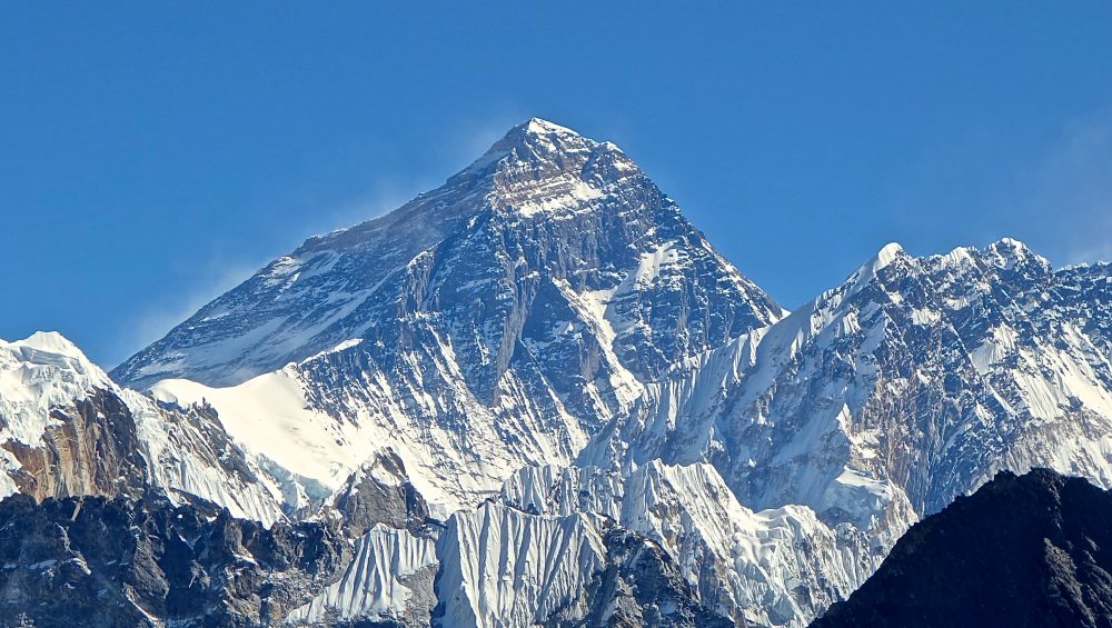
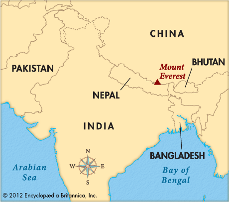
| Mount Everest | Nepal/China | 8,849 m (29,032 ft) |
| Aconcagua | Argentina | 6,961 m (22,838 ft) |
| Denali | United States | 6,190 m (20,310 ft) |
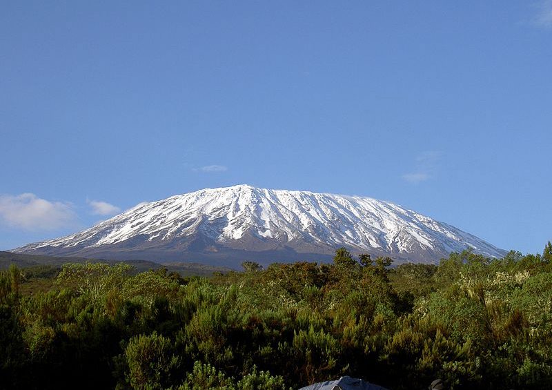
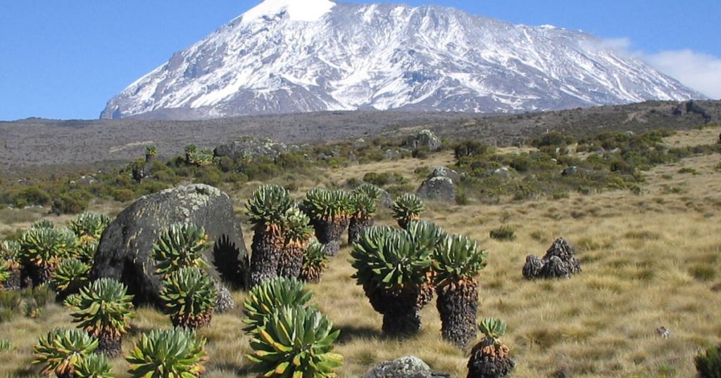
| Mount Kilimanjaro | Tanzania | 5,895 m (19,341 ft) |
| Mount Elbrus | Russia | 5,642 m (18,510 ft) |
| Mont Blanc | France/Italy | 4,805 m (15,766 ft) |
This comparison shows that while Mount Elbrus is lower than peaks such as Everest and Kilimanjaro, it remains the tallest mountain in Europe and one of the most sought-after summits in the world. Its impressive elevation, combined with its status as a Seven Summits peak, makes it a major goal for climbers of all experience levels.
Why Is Mount Elbrus Famous?
Mount Elbrus is famous because it is the highest mountain in Europe, the tallest peak in the Caucasus Mountains, and one of the Seven Summits the highest mountains on each continent. It is also one of the world’s highest dormant volcanoes, attracting thousands of climbers every year who want to complete one of the world’s most prestigious mountaineering challenges.
The Highest Mountain in Europe
Mount Elbrus rises to 5,642 meters (18,510 feet) above sea level, making it the highest mountain in Europe. Located in the western Caucasus Mountains of southern Russia, it surpasses every other European peak, including Mont Blanc. Because of its elevation, Mount Elbrus is recognized as the continent’s highest point by most mountaineering organizations.
Part of the Seven Summits Challenge
Mount Elbrus is one of the Seven Summits, a famous mountaineering challenge that involves climbing the highest mountain on each continent. Many climbers choose Elbrus as an important step toward completing this global achievement because it combines high altitude with relatively low technical difficulty on its standard route.
One of the World’s Highest Volcanoes
Mount Elbrus is a dormant stratovolcano with two volcanic summits. Although it has not erupted in recorded history, scientists classify it as dormant rather than extinct because it still shows signs of geothermal activity. Its volcanic origin, combined with its massive elevation, makes Mount Elbrus one of the highest volcanoes on Earth and the highest volcano in Europe.
The History of Mount Elbrus
Mount Elbrus has a long history that combines exploration, mountaineering, and military significance. Over the centuries, it has attracted explorers, scientists, and climbers from around the world. Today, it remains one of the most climbed high mountains in Europe.
First Recorded Ascent
The first recorded ascent of Mount Elbrus took place in 1829, when a Russian scientific expedition reached the eastern summit. The team explored the mountain to improve geographical knowledge of the Caucasus region. Later, in 1874, a British-led expedition successfully climbed the higher western summit, which is now recognized as the true summit of Mount Elbrus.
Climbing Milestones Through History
Mount Elbrus became increasingly popular during the twentieth century as climbing equipment, transportation, and mountain infrastructure improved. The construction of cable cars, mountain huts, and rescue services made the mountain more accessible to international climbers.
Today, thousands of people attempt to climb Mount Elbrus each year. It has become one of the most popular peaks in the Seven Summits challenge because the standard south route allows experienced trekkers to reach a high-altitude summit without advanced rock or ice climbing.
Mount Elbrus During World War II
Mount Elbrus played an important role during World War II because of its strategic location in the Caucasus Mountains. In 1942, German forces occupied parts of the region and raised their flag on the mountain as part of their campaign to advance into the Caucasus.
The occupation was short-lived. Soviet forces later regained control of the area, and Mount Elbrus became a symbol of resistance and victory. Today, the mountain stands as both a famous climbing destination and a historic landmark that reflects an important chapter in European history.
What Makes Mount Elbrus Unique?
Mount Elbrus is unique because it has two volcanic summits, is the highest mountain in Europe, and ranks among the world’s tallest dormant volcanoes. Its combination of volcanic origin, permanent glaciers, and cultural importance makes it one of the most remarkable mountains on the continent.
A Mountain With Two Summits
Unlike most famous mountains, Mount Elbrus has two distinct summits. The western summit is the highest at 5,642 meters (18,510 feet), while the eastern summit reaches 5,621 meters (18,442 feet). A broad saddle connects the two peaks, allowing experienced climbers to traverse between them. The western summit is the official highest point in Europe.
The Dormant Volcano of Europe
Mount Elbrus is a dormant stratovolcano formed by volcanic eruptions hundreds of thousands of years ago. Although it has not erupted in recorded history, scientists classify it as dormant because geothermal activity still exists beneath the mountain. Thick glaciers now cover much of its upper slopes, creating a striking contrast between volcanic rock and permanent ice.
Cultural and Local Significance
Mount Elbrus has deep cultural importance for the people of the Caucasus region. Local legends describe the mountain as a sacred place and connect it with ancient myths passed down through generations. Today, Mount Elbrus also plays an important role in regional tourism, attracting climbers, hikers, and nature enthusiasts from around the world while supporting local communities through mountaineering and adventure travel.
Mount Elbrus Death Rate: How Dangerous Is Europe’s Highest Mountain?
Although Mount Elbrus is often considered one of the easier Seven Summits, it should never be underestimated. Every year, several climbers require rescue assistance, and reports indicate that approximately 15 to 20 fatalities may occur in some years due to the mountain’s harsh conditions.
Compared to highly technical peaks such as Everest or Denali, Mount Elbrus has a relatively low death rate. However, its extreme weather and high altitude still make it a serious mountaineering challenge.
Main Causes of Death on Mount Elbrus
Severe Weather Conditions
Mount Elbrus is famous for its rapidly changing weather. Strong winds, heavy snowfall, and sudden whiteout conditions can quickly disorient climbers and make navigation extremely difficult.
Altitude Sickness
At 5,642 meters (18,510 feet), oxygen levels are significantly lower than at sea level. Climbers who ascend too quickly may suffer from Acute Mountain Sickness (AMS), and in severe cases, life-threatening conditions such as High Altitude Pulmonary Edema (HAPE) or High Altitude Cerebral Edema (HACE).
Inexperience and Poor Preparation
Some climbers underestimate Mount Elbrus because it is considered one of the more accessible Seven Summits. Inadequate training, poor fitness, and lack of mountaineering knowledge can increase the risk of accidents.
Solo Climbing
Attempting Mount Elbrus without experienced guides or companions significantly increases risk. During bad weather, navigation becomes extremely challenging, and solo climbers may struggle to receive assistance during emergencies.
Is Mount Elbrus Safe?
Yes, Mount Elbrus can be climbed safely with proper preparation. Most climbers who choose experienced guides, acclimatize properly, monitor weather conditions, and use appropriate equipment successfully complete the climb without serious incidents.
While Mount Elbrus is not considered one of the world’s deadliest mountains, it remains a high-altitude expedition that requires respect, preparation, and good decision-making.
Can Beginners Climb Mount Elbrus?
Yes, beginners can climb Mount Elbrus, but only with proper preparation, good physical fitness, and an experienced guide. The standard South Route does not require advanced rock climbing skills, but the high altitude, cold temperatures, and changing weather make the climb more challenging than many first-time climbers expect.
Who Can Climb Mount Elbrus?
Mount Elbrus is suitable for healthy adults with a good level of fitness and determination. You do not need previous technical mountaineering experience to climb the standard route, but you should feel comfortable hiking for several hours each day while carrying basic equipment.
Many climbers use Mount Elbrus as their first major high-altitude expedition before attempting more technical mountains.
Physical Fitness Requirements
Good cardiovascular fitness and strong leg muscles are essential for climbing Mount Elbrus. Most successful climbers prepare by hiking, running, cycling, or climbing stairs several months before their expedition.
Altitude is the biggest physical challenge. Even fit climbers can develop symptoms of altitude sickness if they ascend too quickly. Following a proper acclimatization schedule greatly improves the chances of reaching the summit.
Common Challenges for First-Time Climbers
Most first-time climbers struggle with the mountain’s high altitude rather than its technical difficulty. Thin air can cause headaches, fatigue, nausea, and slower movement near the summit.
Cold temperatures, strong winds, and sudden weather changes also make the climb more demanding. Walking on snow while wearing crampons requires practice, but guides usually provide basic training before summit day.
With proper preparation, gradual acclimatization, and experienced guides, many beginners successfully reach the summit of Mount Elbrus each year.
How Difficult Is Mount Elbrus?
Mount Elbrus is considered a moderately difficult mountain to climb. While it does not require advanced rock climbing skills on the standard South Route, the mountain’s high altitude, severe weather, and glacier terrain make it a serious mountaineering challenge.
Compared to other Seven Summits, Mount Elbrus is often regarded as one of the more accessible peaks, but climbers should not underestimate its risks. Proper training, acclimatization, and preparation are essential for a successful ascent.
Technical Difficulty
The standard South Route on Mount Elbrus is not highly technical. Most climbers do not need advanced climbing experience, but basic mountaineering skills are necessary. Climbers must learn how to use crampons, an ice axe, and walk safely on snow and glaciers.
More challenging routes such as the North, East, and West Routes require greater mountaineering experience, glacier travel knowledge, and better navigation skills.
Technical Rating: Moderate
Altitude Challenges
At 5,642 meters (18,510 feet), Mount Elbrus reaches an altitude where oxygen levels are significantly lower than at sea level. Many climbers experience symptoms of altitude sickness, including:
- Headaches
- Nausea
- Fatigue
- Dizziness
- Shortness of breath
Altitude is one of the biggest reasons why climbers fail to reach the summit. A proper acclimatization schedule greatly increases summit success rates.
Weather Challenges
The weather on Mount Elbrus can change rapidly. Even during the summer climbing season, temperatures near the summit can fall below -20°C (-4°F).
Common weather hazards include:
- Strong winds
- Heavy snowfall
- Whiteout conditions
- Freezing temperatures
- Poor visibility
Bad weather forces many climbers to turn back, even when they are physically fit.
Why Climbers Fail to Reach the Summit
Most failed summit attempts on Mount Elbrus occur because of:
- Poor acclimatization
- Altitude sickness
- Severe weather conditions
- Lack of physical preparation
- Inadequate equipment
- Moving too quickly during the ascent
Climbers who train properly, follow a gradual acclimatization plan, and climb with experienced guides have a much higher chance of reaching the highest point in Europe.
Is Mount Elbrus Harder Than Kilimanjaro?
Although Mount Kilimanjaro is higher at 5,895 meters (19,341 feet), many climbers consider Mount Elbrus slightly more difficult because it involves snow, glaciers, colder temperatures, and the use of technical equipment such as crampons and ice axes.
However, both mountains present significant altitude challenges and require proper preparation.
Mount Elbrus vs Other Famous Mountains
Mount Elbrus differs from other famous mountains in elevation, climbing difficulty, altitude, and overall experience. While it is the highest mountain in Europe, each mountain offers unique challenges and attracts different types of climbers.
Mount Elbrus vs Kilimanjaro
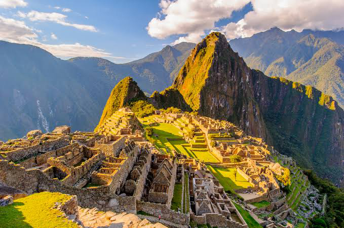
Mount Elbrus and Mount Kilimanjaro are both popular destinations for climbers aiming to complete the Seven Summits challenge. While Kilimanjaro rises higher at 5,895 meters (19,341 feet), Mount Elbrus reaches 5,642 meters (18,510 feet) and stands as the tallest peak in Europe.
Kilimanjaro is located in Africa and is known for its trekking routes that require no technical climbing skills. In contrast, Elbrus in Russia introduces climbers to snow, glaciers, and basic mountaineering equipment such as crampons and ice axes.
Both mountains offer a major high-altitude experience, but Elbrus generally feels more technical, while Kilimanjaro is more of a long trekking ascent.
Mount Elbrus vs Mont Blanc
Mount Elbrus is higher than Mont Blanc, which rises to about 4,805 meters (15,766 feet). Although Mont Blanc is lower, many climbers consider it more technically demanding because it involves glacier travel, steeper terrain, and objective hazards such as rockfall and crevasses.
Mount Elbrus focuses more on endurance, altitude, and adapting to severe weather, while Mont Blanc requires stronger alpine climbing skills and greater technical experience.
Mount Elbrus vs Mount Everest
Standing at 8,849 meters (29,032 feet), Mount Everest is the highest mountain in the world and presents a significantly greater challenge than Mount Elbrus. The extreme altitude, long expedition time, and technical demands make Everest a serious undertaking for experienced mountaineers only.
Mount Elbrus, in comparison, offers a more accessible high-altitude climb. Although it still reaches over 5,600 meters and requires proper acclimatization, it does not demand the same level of technical skill, logistics, or extended time commitment as Everest.
Comparison Table
| Feature | Mount Elbrus | Mount Kilimanjaro | Mont Blanc | Mount Everest |
|---|---|---|---|---|
| Height | 5,642 m (18,510 ft) | 5,895 m (19,341 ft) | 4,805 m (15,766 ft) | 8,849 m (29,032 ft) |
| Continent | Europe | Africa | Europe | Asia |
| Technical Difficulty | Moderate | Low | High | Extreme |
| Glacier Travel | Yes | No | Yes | Yes |
| Ice Axe and Crampons | Required | Not required | Required | Required |
| Typical Climb Duration | 7-10 days | 5-9 days | 2-5 days | 6-9 weeks |
| Best For | High-altitude beginners | First high mountain | Experienced alpine climbers | Elite mountaineers |
Mount Elbrus vs Kilimanjaro: Which Mountain Is Harder?
Mount Elbrus and Mount Kilimanjaro are two of the world’s most famous high mountains. While both peaks attract thousands of climbers each year, they offer very different climbing experiences.
Mount Elbrus vs Kilimanjaro Comparison
| Feature | Mount Elbrus | Mount Kilimanjaro |
|---|---|---|
| Height | 5,642 m (18,510 ft) | 5,895 m (19,341 ft) |
| Location | Russia | Tanzania |
| Continent | Europe | Africa |
| Mountain Type | Dormant Volcano | Dormant Volcano |
| Seven Summits Peak | Yes | Yes |
| Technical Difficulty | Moderate | Easy to Moderate |
| Ice and Snow | Yes | Very Little |
| Glacier Travel | Required | Not Required |
| Equipment Needed | Crampons, Ice Axe, Mountaineering Gear | Basic Trekking Gear |
| Main Challenge | Weather and Technical Conditions | Altitude |
| Typical Duration | 7-10 Days | 5-9 Days |
| Best Season | June-September | January-March and June-October |
Which Mountain Is Harder?
Although Mount Kilimanjaro is higher than Mount Elbrus, many climbers consider Mount Elbrus slightly more difficult because it involves snow and glacier travel, colder temperatures, and the use of technical equipment such as crampons and ice axes.
On the other hand, Kilimanjaro’s primary challenge is altitude sickness. The mountain is a non-technical trek, making it more accessible to first-time high-altitude climbers.
Which Mountain Is Better for Beginners?
For complete beginners with little mountaineering experience, Mount Kilimanjaro is generally considered the better choice because it does not require technical skills or specialized equipment.
However, Mount Elbrus can still be an excellent first Seven Summits expedition for climbers who are physically fit and willing to learn basic mountaineering techniques.
Which Mountain Has a Higher Success Rate?
Longer Kilimanjaro routes such as the Northern Circuit and Lemosho Route often achieve summit success rates above 90%. Mount Elbrus also has relatively high success rates, particularly on the South Route, where many guided groups achieve success rates of around 70% to 85%.
Ultimately, both mountains are rewarding adventures and excellent preparation for more demanding expeditions such as Denali, Aconcagua, or Everest.
Mount Elbrus Climbing Routes Explained
Mount Elbrus offers four main climbing routes: the South Route, North Route, East Route, and West Route. Each route differs in difficulty, infrastructure, scenery, and the level of climbing experience required. The South Route is the most popular, while the West Route is the most demanding.
South Route
The South Route is the easiest and most frequently used route on Mount Elbrus. Most guided expeditions follow this route because it provides cable cars, mountain huts, snowcats, and well-established trails. Although the climb reaches high altitude, the route requires only basic mountaineering skills under normal conditions. It is the best choice for first-time climbers attempting Europe’s highest mountain.
North Route
The North Route offers a quieter and more remote climbing experience. Unlike the South Route, it has very little infrastructure, so climbers must carry more equipment and camp along the way. The ascent is physically harder because of the longer approach, but many mountaineers prefer its natural scenery and lower number of visitors.
East Route
The East Route is less crowded and provides a more adventurous climb. Climbers travel through untouched volcanic landscapes and experience a true wilderness expedition. This route demands strong fitness, good navigation skills, and previous experience in high-altitude mountaineering because support facilities are limited.
West Route
The West Route is the most difficult route on Mount Elbrus. It crosses steep glaciers, technical terrain, and remote mountain areas with no developed infrastructure. Climbers need advanced mountaineering skills, glacier travel experience, and the ability to manage changing weather conditions. Only experienced alpinists usually attempt this route.
Route Comparison Table
| Route | Difficulty | Infrastructure | Typical Duration | Best For |
|---|---|---|---|---|
| South Route | Moderate | Excellent | 7-9 days | Beginners with guides |
| North Route | Moderate to Challenging | Limited | 8-10 days | Experienced trekkers |
| East Route | Challenging | Very Limited | 8-10 days | Experienced mountaineers |
| West Route | Highly Challenging | None | 9-12 days | Advanced climbers and alpinists |
Best Time to Climb Mount Elbrus
The best time to climb Mount Elbrus is from June to September, when the mountain has warmer temperatures, longer daylight hours, and more stable weather. July and August are the busiest months because they offer the highest summit success rates and the safest climbing conditions.
Summer Climbing Season
Summer is the most popular climbing season on Mount Elbrus. Snow conditions are generally more stable, temperatures are less severe, and mountain facilities operate at full capacity. Most guided expeditions take place between late June and early September, with July and August providing the best combination of weather and accessibility.
Although summer offers the best conditions, climbers should still expect freezing temperatures near the summit and sudden weather changes.
Spring and Autumn Conditions
Spring and autumn bring colder temperatures, deeper snow, and fewer climbers. During these seasons, weather conditions become less predictable, increasing the difficulty of the climb. Strong winds and fresh snowfall can slow progress and reduce visibility.
Experienced mountaineers often choose these seasons for a quieter climbing experience, but beginners usually achieve better results during summer.
Winter Ascents
Winter is the most challenging time to climb Mount Elbrus. Extreme cold, powerful winds, heavy snowfall, and short daylight hours create dangerous conditions. Climbers need advanced winter mountaineering skills, specialized equipment, and previous experience in snow and ice.
Only experienced alpinists should consider a winter ascent because the risks increase significantly compared with the summer season.
Monthly Weather Comparison
| Month | Climbing Conditions | Temperature | Crowds | Recommendation |
|---|---|---|---|---|
| May | Cold with deep snow | Very Cold | Low | Experienced climbers |
| June | Improving conditions | Cold | Moderate | Good |
| July | Stable weather | Cold to Moderate | High | Excellent |
| August | Best summit conditions | Cold to Moderate | High | Excellent |
| September | Cooler with fewer crowds | Cold | Moderate | Very Good |
| October-April | Severe winter conditions | Extremely Cold | Very Low | Only experienced mountaineers |
How Much Does It Cost to Climb Mount Elbrus?
The cost to climb Mount Elbrus depends on the level of service, season, route, and whether you join a guided expedition. On average, a full guided climb costs between $1,500 and $3,500 USD, but budget trips can cost less while premium packages can cost more depending on comfort and logistics.
Guide and Tour Costs
Guide and tour services form the largest part of the Mount Elbrus budget. Most climbers join organized expeditions that include guides, permits, accommodation in mountain huts, and transport from base towns.
Basic group expeditions usually cost less, while private guided climbs cost more but offer better support, flexibility, and safety. The South Route is generally cheaper because it has better infrastructure compared to the northern and eastern routes.
Equipment Rental Costs
Climbers who do not own mountaineering gear can rent equipment in the Elbrus region. Items like crampons, ice axes, boots, and insulated jackets are commonly available.
Rental costs vary depending on quality and duration, but most climbers spend a moderate additional amount to complete their gear list. Proper equipment is essential because cold temperatures and icy terrain make safety gear mandatory.
Flights and Accommodation
Flights to Mount Elbrus typically go through Moscow or Mineralnye Vody Airport in Russia, followed by a road transfer to the Caucasus region. Travel costs vary depending on the season and departure country.
Accommodation ranges from basic guesthouses in towns like Terskol and Azau to mountain huts on the slopes. Budget options reduce total trip cost, while comfortable hotels and private lodges increase expenses.
Sample Budget Breakdown
A typical Mount Elbrus expedition budget looks like this:
- Guide and expedition package: $1,500 – $3,500
- Flights: $400 – $1,200 (varies by location)
- Equipment rental: $150 – $400
- Accommodation and meals: $200 – $600
- Local transport: $100 – $300
Total estimated cost: $2,300 – $5,000 USD
Careful planning and choosing the right season can significantly reduce overall costs without compromising safety or success chances.
How to Prepare for Mount Elbrus
Proper preparation increases your chances of reaching the summit of Mount Elbrus and reduces the risk of altitude sickness, fatigue, and weather-related problems. Successful climbers train their body, adjust to high altitude, and prepare mentally for long, demanding summit days.
Physical Training Plan
Climbing Mount Elbrus requires strong endurance, leg strength, and cardiovascular fitness. A good training plan focuses on hiking, running, cycling, and stair climbing for several months before the expedition.
Most climbers build stamina by doing long hikes with a backpack, which simulates real mountain conditions. Strength training for legs and core also helps improve balance and stability on snow and ice. Consistent training makes the final ascent more manageable and increases summit success rates.
Acclimatization Strategies
Acclimatization is one of the most important factors for climbing Mount Elbrus. The body needs time to adjust to lower oxygen levels at high altitude. Climbers usually follow a gradual ascent plan that includes rest days at intermediate camps.
Many expeditions use a “climb high, sleep low” strategy, where climbers ascend during the day and return to lower elevations to sleep. Staying hydrated, eating well, and avoiding rapid ascent helps reduce the risk of altitude sickness and improves performance on summit day.
Mental Preparation Tips
Mental strength plays a major role in climbing Mount Elbrus. Climbers face cold temperatures, fatigue, and long hours of steady walking, especially during the final push to the summit.
Successful climbers stay patient, focused, and flexible when conditions change. Preparing for discomfort and understanding that the summit is not guaranteed helps maintain a positive mindset. Confidence, discipline, and determination often make the difference between turning back and reaching the top of Europe.
Essential Mount Elbrus Gear List
Having the right gear for Mount Elbrus directly affects your safety, comfort, and summit success. The mountain has freezing temperatures, strong winds, and icy terrain, so every item you carry must protect you from cold and support movement on snow and glaciers.
Clothing and Layering System
Climbers use a layering system to adapt to changing mountain conditions. The base layer manages sweat, the mid layer provides warmth, and the outer layer protects against wind and snow.
Thermal base layers, fleece jackets, and insulated down jackets are essential. A waterproof and windproof shell keeps climbers dry during storms. Gloves, hats, and neck protection are also necessary because exposed skin loses heat quickly at high altitude.
Footwear and Crampons
Strong, insulated mountaineering boots are required for Mount Elbrus. They must keep feet warm in freezing temperatures and provide ankle support on uneven terrain.
Crampons attach to boots and allow climbers to walk safely on ice and hard snow. A good fit is critical because loose or uncomfortable footwear can slow progress and increase the risk of injury or frostbite.
Safety Equipment
Safety gear plays a key role in reducing risk on Mount Elbrus. An ice axe helps with balance and self-arrest on steep slopes. Helmets protect against falling ice or accidental slips.
Climbers also carry headlamps for early morning summit attempts, sunglasses or goggles for snow glare, and backpacks designed for high-altitude expeditions. In some routes, ropes and harnesses may be used depending on conditions and guide decisions.
Packing Checklist
A complete Mount Elbrus packing list includes essential items for survival and comfort:
- Thermal base layers
- Insulated jacket and waterproof shell
- Mountaineering boots and crampons
- Gloves (light and heavy pairs)
- Hat and balaclava
- Ice axe and helmet
- Sunglasses and goggles
- Sleeping bag rated for extreme cold
- Backpack (30-50 liters)
- Water bottles or hydration system
- Energy snacks and electrolytes
Careful packing ensures climbers stay warm, safe, and prepared for sudden weather changes throughout the expedition.
Mount Elbrus Success Rate
The summit success rate on Mount Elbrus varies depending on the route, weather conditions, acclimatization, and the climber’s physical preparation. On average, approximately 60% to 80% of climbers successfully reach the summit each year.
Climbers who choose guided expeditions and follow proper acclimatization schedules generally have much higher success rates than independent climbers.
Mount Elbrus Success Rates by Route
| Route | Difficulty | Estimated Success Rate |
|---|---|---|
| South Route | Moderate | 70-85% |
| North Route | Moderate to Challenging | 60-75% |
| East Route | Challenging | 50-70% |
| West Route | Very Challenging | 40-60% |
Why Does the South Route Have the Highest Success Rate?
The South Route is the most popular route on Mount Elbrus because it offers better infrastructure, including cable cars, mountain huts, snowcat support, and well-established trails. These advantages reduce physical strain and improve climbers’ chances of reaching the summit.
Why Do Climbers Fail on Mount Elbrus?
The most common reasons for failed summit attempts include:
- Altitude sickness
- Severe weather conditions
- Poor physical preparation
- Inadequate acclimatization
- Lack of proper equipment
- Strong winds and whiteout conditions
Many climbers underestimate Mount Elbrus because it is considered one of the easier Seven Summits. However, the mountain’s high altitude and rapidly changing weather make it a serious challenge.
How to Increase Your Summit Success Rate
You can significantly improve your chances of reaching the summit by:
- Choosing a longer itinerary (8-10 days).
- Following a gradual acclimatization schedule.
- Training for endurance several months in advance.
- Staying hydrated and maintaining proper nutrition.
- Climbing with experienced guides.
- Allowing extra reserve days for bad weather.
Is Mount Elbrus Easier Than Other Seven Summits?
Compared with mountains such as Everest, Denali, and Vinson, Mount Elbrus has relatively high success rates. However, it is generally considered slightly more challenging than Mount Kilimanjaro because of its colder temperatures, glacier travel, and technical equipment requirements.
Mount Elbrus Climbing Statistics
Mount Elbrus attracts thousands of climbers every year because it is the highest mountain in Europe and part of the Seven Summits challenge. However, success depends heavily on weather, fitness, and acclimatization, which makes the mountain both popular and challenging.
Annual Number of Climbers
Mount Elbrus receives an estimated 10,000 to 15,000 climbers each year, with most attempts happening during the summer season. The majority of climbers use the South Route because it offers better infrastructure and easier access compared to other routes.
Tourism and guided expeditions have increased steadily over the years, making Elbrus one of the busiest high-altitude peaks in the world.
Summit Success Rates
The average summit success rate on Mount Elbrus is around 60% to 80%, depending on weather conditions and the quality of preparation. Climbers who acclimatize properly and follow a guided itinerary have a much higher chance of reaching the summit.
Weather changes and altitude sickness are the main reasons why climbers turn back before the top.
Accident and Safety Statistics
Mount Elbrus is not technically extreme, but it still carries risks due to altitude, cold temperatures, and sudden weather changes. Most accidents occur because of:
- Altitude sickness
- Slips on ice or snow
- Poor weather visibility
- Lack of proper gear or experience
Guided climbs significantly reduce risk because guides monitor weather conditions, pace the ascent, and provide safety support throughout the expedition.
Interesting Mount Elbrus Facts
Mount Elbrus stands out in global mountaineering because of its unique characteristics:
- It is the highest mountain in Europe at 5,642 meters (18,510 feet)
- It has two volcanic summits (west and east peaks)
- It is part of the Seven Summits challenge
- It is a dormant volcano with glaciers covering its upper slopes
- It is one of the most climbed high mountains in the world
These facts make Mount Elbrus a popular goal for climbers who want to experience high-altitude mountaineering without extreme technical difficulty.
Is Mount Elbrus Safe?
Mount Elbrus is generally safe for climbers who prepare well and use proper equipment, but it still involves real mountain risks. Most accidents happen because of altitude, weather changes, and poor preparation rather than technical climbing difficulty.
Main Risks on the Mountain
The main risks on Mount Elbrus come from high altitude, cold temperatures, and slippery terrain. Altitude sickness is the most common problem because the summit sits at 5,642 meters (18,510 feet), where oxygen levels are low.
Slips and falls can also occur on icy slopes, especially when climbers do not use crampons correctly. Fatigue and dehydration increase these risks, particularly during summit attempts.
Weather-Related Dangers
Weather on Mount Elbrus changes quickly and can become dangerous without warning. Strong winds, whiteout conditions, and heavy snowfall can reduce visibility and make navigation difficult.
Temperatures near the summit often drop well below freezing, even in summer. These extreme conditions increase the risk of frostbite and hypothermia if climbers are not properly equipped.
Why Guided Climbs Are Safer
Guided climbs significantly improve safety on Mount Elbrus. Experienced guides monitor weather conditions, choose safer routes, and control the pace of ascent to reduce altitude sickness risks.
Guides also provide technical support, equipment advice, and emergency response assistance if problems occur. For beginners and first-time high-altitude climbers, joining a guided expedition is the safest and most reliable option.
These FAQs answer the most common questions climbers ask before attempting Mount Elbrus. They focus on difficulty, experience level, safety, and weather conditions.
Mount Elbrus is generally considered more challenging than Kilimanjaro because it requires basic glacier travel skills. Climbers use crampons and ice axes on Elbrus, while Kilimanjaro follows trekking trails without technical equipment. However, Kilimanjaro is higher in elevation, so altitude affects both climbs strongly.
You do not need advanced climbing experience to climb the standard South Route of Mount Elbrus. However, basic hiking fitness and comfort in cold mountain conditions are essential. Training before the climb improves safety and summit success.
The average summit success rate ranges from 60% to 80%, depending on weather, fitness level, and acclimatization. Climbers who follow a proper schedule and use experienced guides have a higher chance of reaching the top.
Yes, beginners can climb Mount Elbrus if they prepare well and choose a guided expedition. The South Route is designed for non-technical climbers, but altitude and weather still create serious challenges that require respect and preparation.
Yes, Mount Elbrus is a dormant stratovolcano. It has two main summits and has not erupted in recorded history. Scientists still classify it as dormant because geothermal activity exists beneath the mountain.
Temperatures on Mount Elbrus vary by season, but near the summit they often drop below -10°C to -30°C (14°F to -22°F). Wind chill can make it feel even colder, especially during summit attempts in the early morning or at night.
Final Thoughts: Is Mount Elbrus Worth Climbing?
Mount Elbrus is worth climbing for anyone who wants to experience high-altitude mountaineering, complete the Seven Summits challenge, or test their endurance on Europe’s highest peak. It offers a mix of accessibility and challenge, making it one of the most popular entry-level big mountains in the world.
Who Should Attempt Mount Elbrus?
Mount Elbrus is ideal for climbers who are physically fit, mentally prepared, and eager to experience snow and glacier travel. Beginners can attempt the South Route with a guided expedition, while more experienced climbers may prefer the tougher North or West Routes.
It suits people who want to step up from trekking mountains like Kilimanjaro or Mont Blanc and move toward more serious alpine objectives. However, anyone attempting Elbrus must respect altitude, weather, and cold conditions.
Key Takeaways for First-Time Climbers
First-time climbers should focus on preparation, acclimatization, and patience. Physical training before the trip improves endurance, while a gradual ascent plan increases summit success chances.
Weather conditions on Mount Elbrus can change quickly, so flexibility is essential. Climbers should not rush the summit attempt and should always listen to guide instructions.
With proper preparation and the right mindset, Mount Elbrus becomes a rewarding adventure that offers one of the most memorable high-altitude experiences in the world.