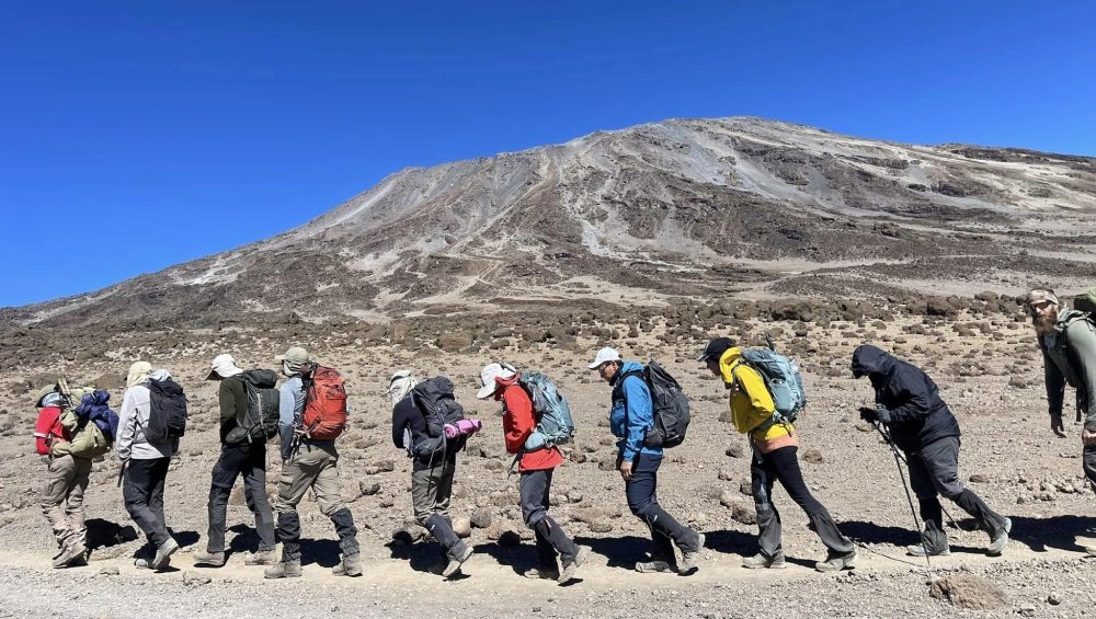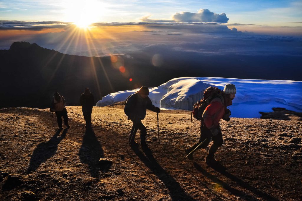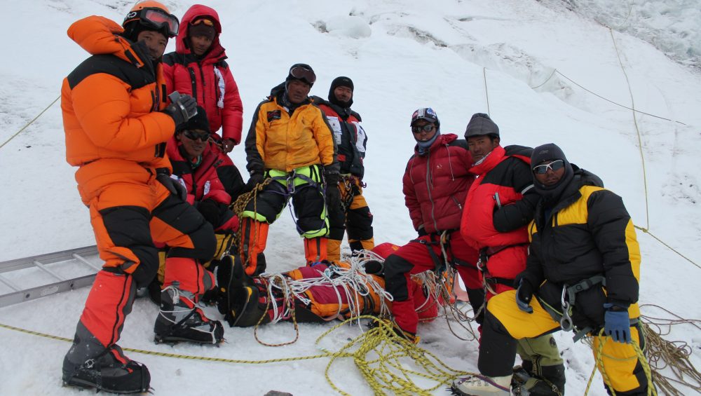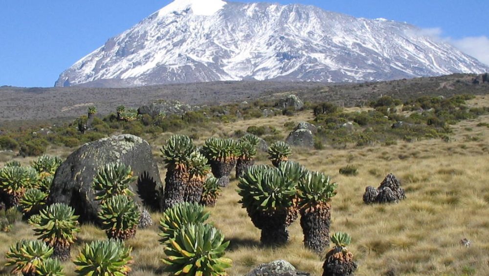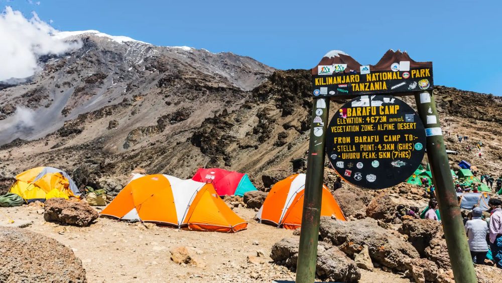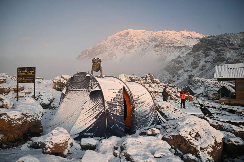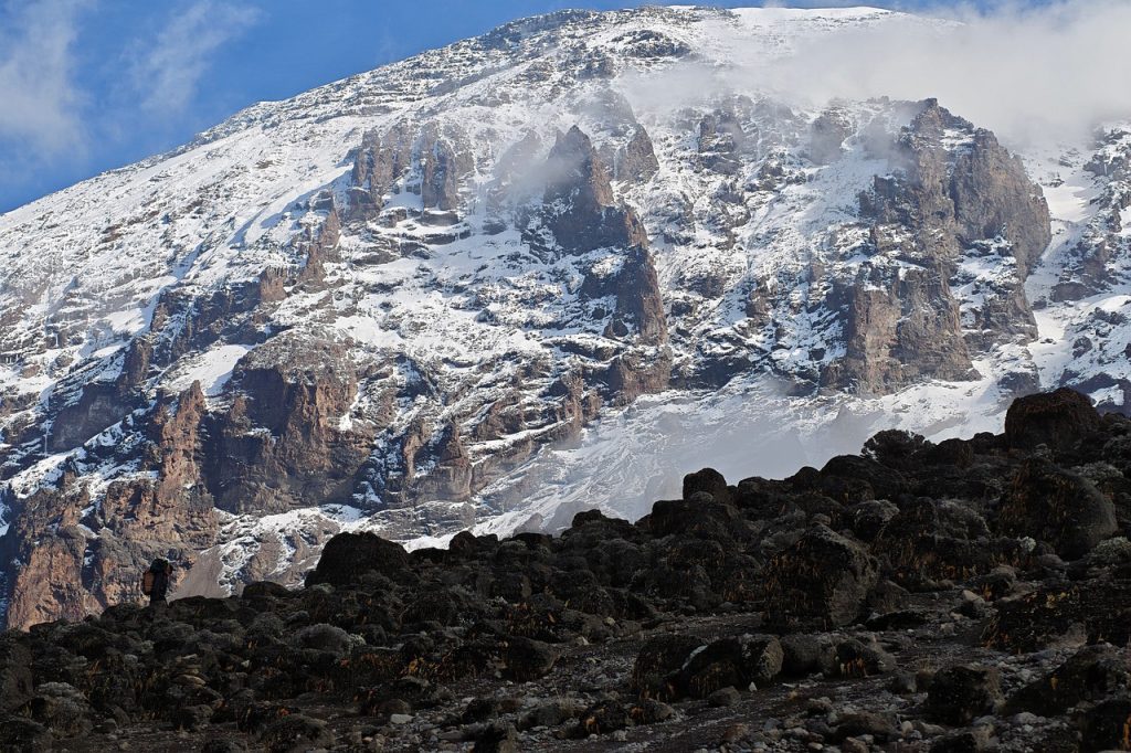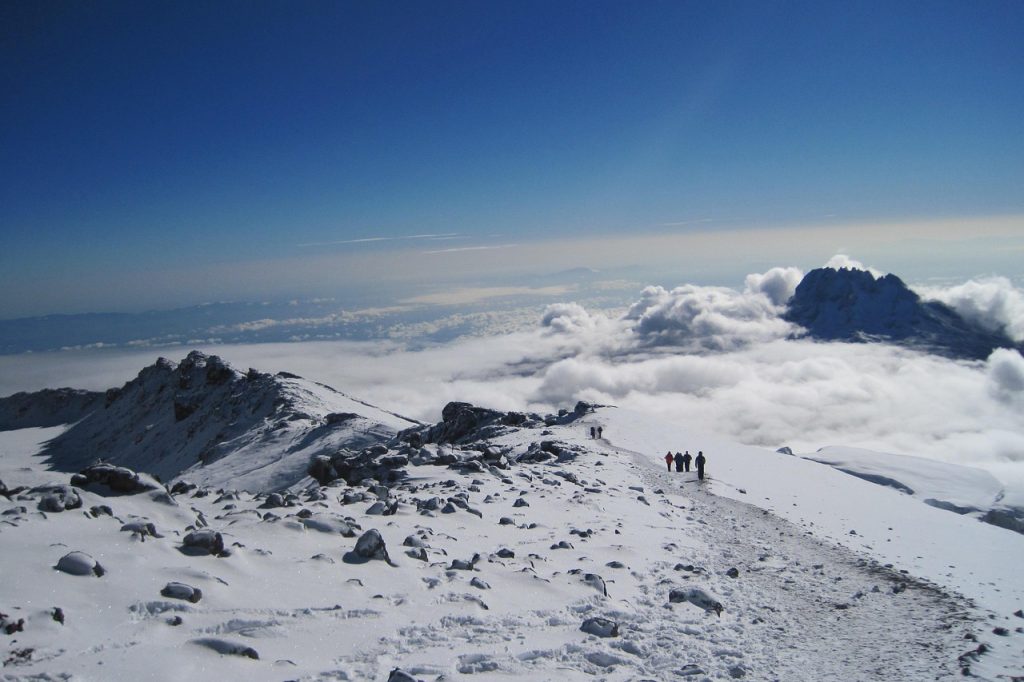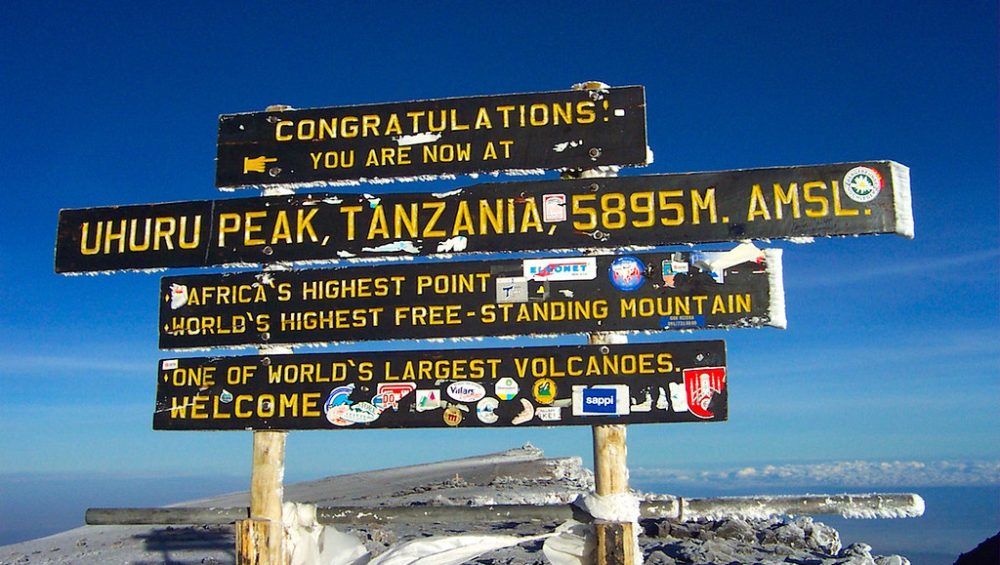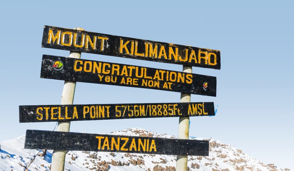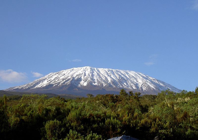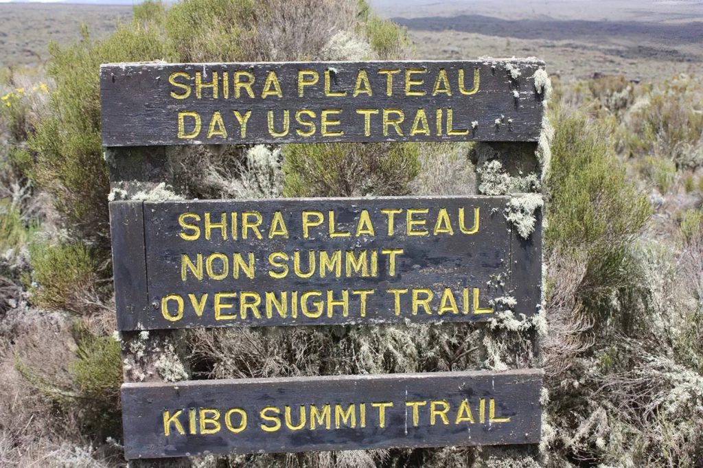
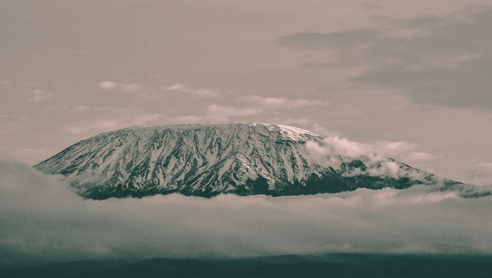
Hikers celebrating after climbing Mount Kilimanjaro summit, showing the number of adventurers who have reached Africa’s highest peak.

How Many People Have Climbed Mount Kilimanjaro?

How Many People Have Climbed Mount Kilimanjaro? Complete Guide

Estimated reading time: 18 minutes

More than 500,000 people are estimated to have climbed Mount Kilimanjaro, making it one of the most climbed high mountains in the world. Today, around 35,000 to 50,000 people attempt to climb Kilimanjaro each year, and thousands successfully reach Uhuru Peak, the highest point in Africa.

No one knows the exact number of people who have climbed Mount Kilimanjaro. Kilimanjaro National Park records annual visitor numbers, but historical records do not provide a complete count of every climber who has reached the summit. In addition, many local guides and porters have climbed the mountain hundreds of times, making it even harder to calculate a precise total.

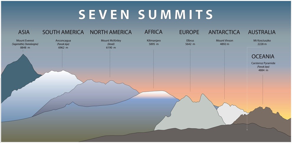
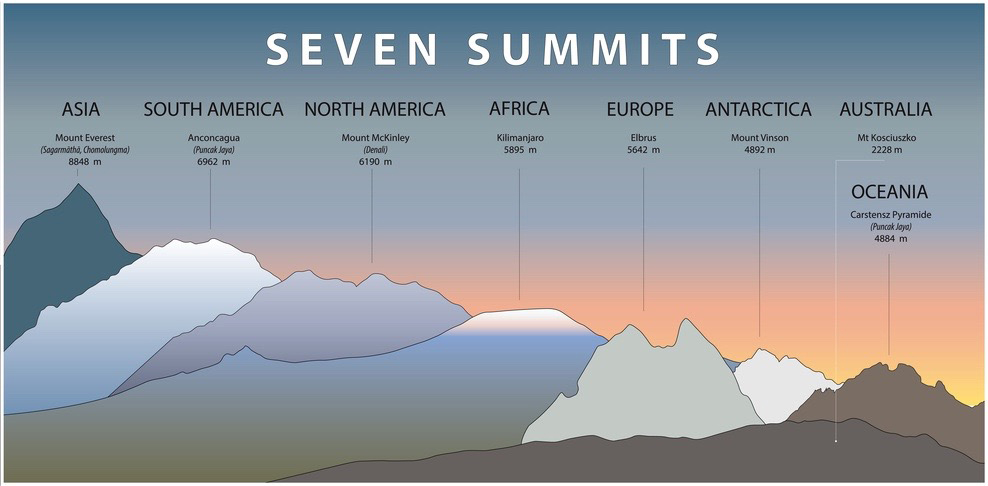
Despite the lack of an official figure, Kilimanjaro remains Africa’s most popular trekking destination. Its non-technical routes, stunning landscapes, and status as one of the Seven Summits attract climbers from around the world every year.

In this guide, you’ll learn how many people climb Kilimanjaro annually, how many reach the summit, the mountain’s success rates, and how climbing numbers have changed over time.

How Many People Have Climed Mount Kilimanjaro?

Millions of people dream of standing on the roof of Africa, but only a fraction make the journey each year. While no official record tracks every climber in history, experts estimate that more than 500,000 people have climbed Mount Kilimanjaro since organized trekking began. Today, the mountain attracts tens of thousands of hikers from around the world and remains Africa’s most popular trekking destination.

Estimated Total Number of Climbers

More than 500,000 people are believed to have climbed Mount Kilimanjaro. This estimate comes from annual visitor records, summit statistics, and tourism data collected over several decades. The actual number may be even higher because thousands of local guides and porters climb the mountain repeatedly throughout their careers.

Kilimanjaro’s popularity has grown significantly since the 1990s. Improved tourism infrastructure, better international access to Tanzania, and the mountain’s reputation as one of the Seven Summits have encouraged more people to attempt the climb each year.

How Many People Reach the Summit Each Year?

Around 35,000 to 50,000 people attempt to climb Mount Kilimanjaro every year. Of those, an estimated 60% to 75% reach Uhuru Peak, depending on the route and the number of days spent on the mountain.

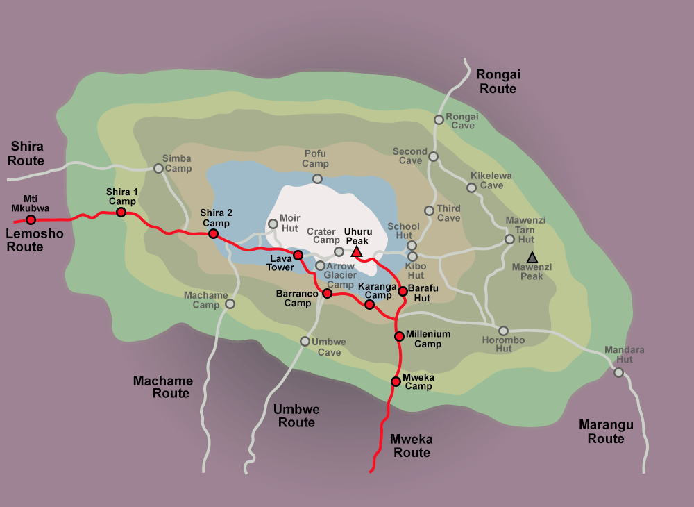
Longer routes such as the Northern Circuit and Lemosho Route generally achieve higher summit success rates because they give climbers more time to acclimatize. As a result, tens of thousands of people stand on Africa’s highest point each year.

Why No Exact Number Exists

No organization keeps a complete historical record of every person who has climbed Mount Kilimanjaro. While Kilimanjaro National Park tracks annual visitors, older records remain incomplete, and climbing data from earlier decades is limited.

The mountain also employs thousands of guides and porters who climb Kilimanjaro many times each year. Some experienced guides have reached the summit hundreds of times. Because of these repeated ascents and gaps in historical data, experts can only estimate the total number of people who have climbed Mount Kilimanjaro.

Mount Kilimanjaro Climbing Statistics at a Glance

Mount Kilimanjaro attracts thousands of climbers every year and remains one of the world’s most popular trekking mountains. While exact figures vary from year to year, available tourism and park data provide a good picture of how many people attempt the climb, reach the summit, and support the mountain’s tourism industry.

Kilimanjaro Statistics Table

StatisticEstimated Figure
Elevation5,895 m (19,341 ft)
Annual Climbers35,000-50,000
Estimated Total Climbers500,000+
Summit Success Rate60%-75%
Highest PointUhuru Peak
Number of Routes7 Main Routes
Guides and Porters Employed Annually20,000+
National Park Established1973

Annual Climbers

Around 35,000 to 50,000 people attempt to climb Mount Kilimanjaro each year. The mountain attracts hikers from more than 100 countries, including the United States, the United Kingdom, Germany, Australia, and Canada.

Kilimanjaro’s popularity continues to grow because climbers do not need technical mountaineering skills to reach the summit. Many people choose the mountain as their first high-altitude trekking adventure and a chance to stand on the highest peak in Africa.

Summit Success Rates

The average summit success rate on Mount Kilimanjaro ranges from 60% to 75%. Success rates vary depending on the route, the number of climbing days, and how well climbers acclimatize to the altitude.

Longer routes such as the Lemosho Route and Northern Circuit Route often achieve the highest success rates because they allow more time for the body to adjust. Shorter itineraries usually record lower success rates because climbers gain altitude too quickly.

Number of Guides and Porters

Kilimanjaro’s tourism industry supports thousands of local jobs. More than 20,000 guides, porters, cooks, and mountain crew members work on Kilimanjaro each year.

Every climber must travel with a licensed guide, and most expeditions also employ several porters to carry equipment, food, and camping gear. These mountain teams play a vital role in climber safety and help make Kilimanjaro one of Tanzania’s most important tourism destinations.

How Many People Climb Kilimanjaro Each Year?

Mount Kilimanjaro attracts between 35,000 and 50,000 climbers each year, making it one of the most popular trekking mountains in the world. The mountain draws adventurers from every continent who want to experience Africa’s highest peak and one of the famous Seven Summits.

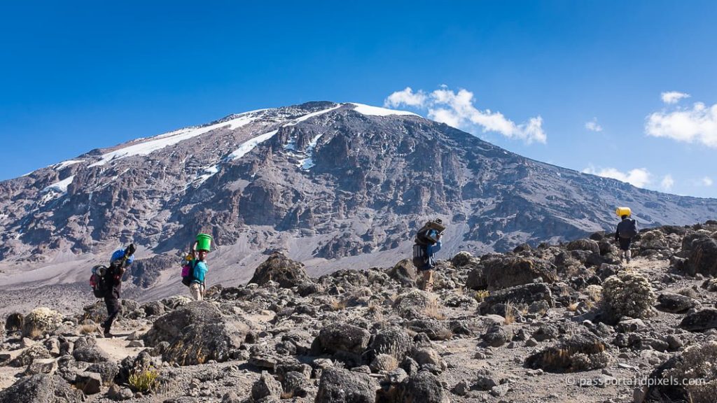
Group of climbers arriving at the Mount Kilimanjaro summit, celebrating their achievement near Uhuru Peak.

Average Annual Visitor Numbers

Most years, Kilimanjaro receives around 35,000 to 50,000 climbing permits. These visitors include first-time trekkers, experienced hikers, charity groups, and adventure travelers from around the world.

The number of climbers can vary from year to year depending on travel trends, economic conditions, and tourism demand. However, Kilimanjaro consistently ranks among the most visited high-altitude trekking destinations on Earth.

Growth in Kilimanjaro Tourism

Kilimanjaro tourism has grown significantly over the last few decades. Improved international flights, better trekking services, and increased global interest in adventure travel have encouraged more people to attempt the climb.

The mountain’s reputation as the highest peak in Africa also attracts climbers who want to complete one of the Seven Summits. As awareness of Kilimanjaro continues to grow, annual visitor numbers have generally increased over time.

Impact of Global Events on Climbing Numbers

Global events can have a major effect on Kilimanjaro tourism. Travel restrictions, economic downturns, and international emergencies often reduce the number of visitors arriving in Tanzania.

For example, the COVID-19 pandemic caused a sharp decline in climbing numbers as international travel slowed worldwide. Once restrictions eased, visitor numbers began to recover as travelers returned to outdoor and adventure-focused experiences.

Despite occasional challenges, Mount Kilimanjaro remains one of Africa’s most popular tourist attractions and continues to welcome thousands of climbers every year.

How Many People Reach the Summit of Kilimanjaro?

Every year, many people climb Mount Kilimanjaro, but not everyone reaches the summit. On average, about 60% to 70% of climbers successfully reach Uhuru Peak. This means most climbers complete the journey, but a significant number still turn back before the top. Success depends on preparation, fitness, route choice, and how well the body adapts to high altitude. Climbers who take longer routes and move slowly have a better chance of reaching the summit. Short routes increase the difficulty because the body does not get enough time to adjust to thin air. Weather conditions, altitude sickness, and physical strength also play a major role in the final outcome.

Overall Summit Success Rate

The summit success rate on Kilimanjaro ranges between 60% and 85%. This variation happens because each route offers different climbing conditions. Routes like Lemosho and Northern Circuit give climbers more time for acclimatization, so they record higher success rates. On the other hand, shorter routes like Marangu have lower success because climbers ascend too quickly.

Estimated Number of Successful Climbers

Each year, about 35,000 to 50,000 people attempt to climb Mount Kilimanjaro. From this number, around 20,000 to 35,000 climbers reach the summit successfully. The exact number changes every year depending on weather, tourism demand, and global travel situations. Most successful climbers follow well-planned itineraries with enough days for acclimatization.

What Percentage Fail to Reach the Top?

Around 15% to 40% of climbers fail to reach Uhuru Peak. The main reason is altitude sickness, which affects the body as oxygen levels drop. Some climbers also fail due to exhaustion, poor preparation, or rushing the climb. Others turn back during the final ascent because of extreme cold, strong winds, and physical pressure near the summit. Proper training and choosing the right route greatly improve success chances.

The History of Climbing Mount Kilimanjaro

The history of climbing Mount Kilimanjaro shows how this mountain changed from a mysterious peak into one of the most popular trekking destinations in the world. Early explorers viewed Kilimanjaro as a distant snow-covered mountain in Africa, and many did not believe people could reach its summit. Over time, exploration, mapping, and scientific interest opened the way for climbers from different parts of the world.

Discovery of Kilimanjaro by Europeans

European explorers first recorded Mount Kilimanjaro in the 19th century. German missionaries Johannes Rebmann and Johann Ludwig Krapf reported the existence of a snow-covered mountain near the equator in the 1840s. At first, many European scientists did not believe their reports because they thought snow could not exist so close to the equator. Later, confirmed expeditions proved the mountain’s existence and attracted global attention.

The First Successful Ascent in 1889

The first recorded successful ascent of Mount Kilimanjaro happened in 1889. German geographer Hans Meyer and Austrian climber Ludwig Purtscheller reached the summit after several attempts. They climbed slowly and carefully because they had no modern equipment or proper climbing gear. Their success marked the beginning of Kilimanjaro as a serious mountaineering destination and inspired future climbers.

How Climbing Numbers Have Changed Over Time

Climbing activity on Mount Kilimanjaro has increased dramatically over the years. In the early 20th century, only a small number of explorers attempted the climb each year. After Tanzania gained independence and tourism developed, more international visitors started climbing the mountain. Today, tens of thousands of climbers attempt Kilimanjaro every year, making it one of the most climbed high mountains in the world. Improved guides, better routes, and tourism infrastructure have made the climb more accessible, but it still remains a serious physical challenge.

Why Do Some Climbers Fail to Reach the Summit?

Not all climbers who attempt Mount Kilimanjaro reach the summit. Many turn back before Uhuru Peak because the climb becomes physically and mentally challenging at high altitude. The mountain tests the body as oxygen levels drop, and even well-prepared climbers can struggle. Success depends on fitness, preparation, route choice, and how the body responds to altitude.

Altitude Sickness

Altitude sickness is the main reason climbers fail to reach the summit. As climbers go higher, oxygen levels decrease and the body struggles to adapt. Symptoms like headaches, nausea, dizziness, and extreme fatigue can become severe. In many cases, climbers must stop or descend immediately to protect their health. Even experienced hikers can suffer from altitude sickness if they ascend too quickly.

Poor Acclimatization

Poor acclimatization happens when climbers do not give their bodies enough time to adjust to high altitude. Fast ascents increase the risk of oxygen deprivation and exhaustion. Climbers who skip rest days or choose short routes often face this problem. Proper acclimatization through slow climbing and longer itineraries greatly improves the chance of reaching the summit.

Inadequate Physical Preparation

Some climbers underestimate the physical demand of Mount Kilimanjaro. Weak fitness levels, lack of endurance training, and poor preparation lead to early exhaustion. The climb requires long hiking days, steep sections, and cold conditions. Without proper training before the trip, many climbers struggle to continue before reaching the summit zone.

Choosing Short Routes

Short routes reduce the time needed for acclimatization, which lowers the chance of success. Climbers on short itineraries move too quickly from low altitude to high altitude. This increases fatigue and altitude-related problems. Longer routes give the body more time to adjust, which is why they consistently show higher summit success rates.

Which Kilimanjaro Routes Have the Highest Success Rates?

Different Kilimanjaro routes offer different success rates because they vary in length, altitude gain, and acclimatization time. Longer routes give climbers more time to adjust to high altitude, which increases the chance of reaching the summit. Shorter routes are faster but more difficult, and they often result in lower success rates. Choosing the right route is one of the most important decisions for climbers who want to reach Uhuru Peak.

Northern Circuit Route

The Northern Circuit Route has the highest success rate on Mount Kilimanjaro. It is the longest route and gives climbers the most time to acclimatize. Because of its slow ascent and gradual elevation gain, many climbers successfully reach the summit. This route is ideal for people who want the highest chance of success and a less rushed climbing experience.

Lemosho Route

The Lemosho Route also has a very high success rate. It starts from the western side of the mountain and offers a quiet, scenic, and gradual climb. Climbers benefit from excellent acclimatization, which increases summit success. Many trekking companies recommend this route for beginners and first-time climbers because it balances beauty, difficulty, and success rate.

Machame Route

The Machame Route is one of the most popular routes on Kilimanjaro. It has a strong success rate because it follows a “climb high, sleep low” strategy, which helps the body adjust to altitude. Although it is more physically demanding than Lemosho or Northern Circuit, many climbers still reach the summit successfully due to good acclimatization patterns.

Marangu Route

The Marangu route is known as the “Coca-Cola Route” and is the only route with hut accommodation. However, it has a lower success rate compared to longer routes because climbers spend fewer days on the mountain. The fast ascent increases the risk of altitude sickness, which reduces the number of successful summits.

Route Success Rate Comparison Table

In general, the Northern Circuit and Lemosho routes have the highest success rates, followed by Machame, while Marangu has the lowest. The main factor affecting success is the number of days spent climbing. More days mean better acclimatization, which directly improves the chance of reaching Uhuru Peak.

RouteDurationDifficultySuccess RateKey Advantage
Northern Circuit8-9 daysModerate85%-95%Best acclimatization
Lemosho7-8 daysModerate85%Scenic and gradual climb
Machame6-7 daysHard75%-85%Good acclimatization strategy
Marangu5-6 daysModerate60%-70%Hut accommodation, faster route

Who Climbs Mount Kilimanjaro?

Mount Kilimanjaro attracts a wide range of climbers from different backgrounds, ages, and fitness levels. People climb it not only for adventure but also for personal achievement, charity challenges, and tourism experience. The mountain does not require technical climbing skills, which makes it accessible to many types of hikers.

First-Time Trekkers

Many climbers on Kilimanjaro are first-time trekkers who have never climbed a high mountain before. They choose Kilimanjaro because it is a non-technical climb, meaning no ropes or climbing equipment are needed. With proper preparation and guidance, beginners can successfully reach the summit despite the physical challenge.

Experienced Mountaineers

Experienced mountaineers also climb Kilimanjaro as part of their global trekking goals. Some use it for training, while others include it in their list of famous mountain summits. Even for experienced climbers, Kilimanjaro remains challenging due to altitude, cold temperatures, and long hiking days.

Families and Older Climbers

Kilimanjaro is one of the few high mountains that attracts families and older climbers. Many people in their 50s, 60s, and even 70s successfully reach the summit. Families also climb together as a shared adventure. Success depends more on endurance, slow pacing, and acclimatization than age or strength.

Climbers From Around the World

Climbers come to Kilimanjaro from all over the world, including Europe, the United States, Asia, and Africa. It is one of the most international trekking destinations on the planet. This global interest makes Kilimanjaro an important tourism attraction for Tanzania and a symbol of African adventure travel.

How Many Guides and Porters Work on Kilimanjaro?

Thousands of guides and porters work on Mount Kilimanjaro every year to support climbers. For almost every climbing group, guides and porters are required because they ensure safety, carry equipment, and manage logistics on the mountain. Without them, most climbers would not be able to complete the trek successfully.

Why Guides Are Required

Guides are required by Tanzanian park regulations for all Kilimanjaro climbs. A certified guide leads every expedition and makes decisions about route, pace, and safety. They monitor climbers for altitude sickness and adjust the climb when needed. Their experience helps reduce risks and increases the chance of reaching the summit safely.

The Role of Porters

Porters carry most of the climbing equipment, including tents, food, cooking supplies, and clothing. This support allows climbers to focus on walking instead of carrying heavy loads. Porters also help set up camps and assist guides in maintaining the trekking schedule. Their work is essential for the success and comfort of every expedition.

Kilimanjaro’s Importance to Tanzania’s Economy

Kilimanjaro plays a major role in Tanzania’s economy through tourism. Thousands of guides, porters, cooks, and support staff earn income from climbing expeditions. The mountain also supports hotels, transport services, and local businesses. This makes Kilimanjaro one of the most important sources of employment and foreign income in the country.

Kilimanjaro Climbing Records and Interesting Facts

Mount Kilimanjaro holds many impressive records that show how different people from around the world challenge the mountain in unique ways. Some climbers focus on speed, others on age achievements, and some guides build lifelong records through repeated summits. These facts highlight both the difficulty and the global popularity of Kilimanjaro.

Fastest Ascent and Descent

The fastest ascent and descent of Mount Kilimanjaro shows how extreme endurance and fitness can push human limits. The record for the fastest known round trip is held by elite mountain runners who complete the climb in just a few hours instead of several days. Unlike normal climbers who take 5 to 9 days, these athletes run up and down the mountain without long rest periods. This achievement requires strong acclimatization, speed training, and excellent physical conditioning, and it is not typical for regular tourists.

Youngest Person to Climb Kilimanjaro

The youngest climbers to reach the summit of Kilimanjaro are usually children who climb with family support and guided teams. These young climbers succeed because they follow slow, well-planned routes that allow enough time for rest and acclimatization. Guides closely monitor their health throughout the journey. This record shows that Kilimanjaro is not only for adults but also possible for younger climbers when safety and preparation come first.

Oldest Person to Reach the Summit

Some of the most inspiring Kilimanjaro records come from older climbers who reach Uhuru Peak in their 60s, 70s, and even beyond. These climbers succeed by moving slowly, choosing longer routes, and focusing on steady acclimatization. Their achievements prove that age is not the main barrier on Kilimanjaro. Instead, determination, preparation, and medical fitness play a bigger role in summit success.

Most Kilimanjaro Summits by a Guide

Kilimanjaro guides often climb the mountain many times each year, and some have reached the summit hundreds of times in their careers. These guides build their records through daily expedition work, supporting different groups of climbers. Their experience makes them highly skilled in handling altitude challenges, weather changes, and emergency situations. This record highlights the importance of local expertise in making Kilimanjaro climbs safe and successful.

Frequently Asked Questions

This section answers the most common questions people ask about climbing Mount Kilimanjaro. These answers help new climbers understand the difficulty, success rates, and basic planning needed before attempting the mountain.

How many people climb Kilimanjaro every year?

Around 35,000 to 50,000 people climb Mount Kilimanjaro every year. The number changes depending on tourism trends, weather conditions, and global travel situations. Kilimanjaro remains one of the most popular trekking mountains in the world because it does not require technical climbing skills.

What percentage of climbers reach the summit?

On average, about 60% to 70% of climbers reach Uhuru Peak. The success rate depends on the route, number of days spent on the mountain, and how well climbers adjust to altitude. Longer routes usually produce higher success rates because they allow better acclimatization.

Is Kilimanjaro harder than Everest Base Camp?

Kilimanjaro is generally considered more physically demanding than Everest Base Camp because it is a faster and steeper climb. However, Everest Base Camp is longer in duration and also challenges endurance. Kilimanjaro is a summit climb, while Everest Base Camp is a trekking route, so they feel different in difficulty.

How long does it take to climb Kilimanjaro?

It usually takes between 5 and 9 days to climb Mount Kilimanjaro depending on the route. Short routes take less time but have lower success rates. Longer routes take more days but give climbers better acclimatization and higher chances of reaching the summit.

What is the best route for success?

The best routes for summit success are the Northern Circuit and Lemosho Route. These routes give climbers more time to adjust to altitude, which increases the chance of reaching Uhuru Peak. Machame is also a strong option, while Marangu has a lower success rate due to its shorter itinerary.

Can beginners climb Kilimanjaro?

Yes, beginners can climb Kilimanjaro successfully. The mountain does not require technical climbing skills, so physical fitness, preparation, and proper guidance matter more than experience. Many first-time trekkers reach the summit when they choose the right route and take enough days for acclimatization.

Final Thoughts: How Many People Have Climbed Mount Kilimanjaro?

Mount Kilimanjaro stands as one of the most climbed high mountains in the world, attracting tens of thousands of people every year. Although exact lifetime numbers are difficult to confirm, the total number of climbers continues to grow as tourism increases and more people choose adventure travel in Tanzania. Most climbers do not only aim to reach the summit but also to experience the journey, landscapes, and personal challenge that the mountain offers.

Key Statistics Recap

Each year, around 35,000 to 50,000 people attempt to climb Kilimanjaro, and about 60% to 85% reach the summit depending on the route. These numbers show that Kilimanjaro is challenging but achievable for well-prepared climbers. Success mainly depends on acclimatization, route selection, and physical preparation.

Kilimanjaro remains popular because it is a non-technical climb, meaning no ropes or climbing experience are required. It also offers multiple routes, stunning landscapes, and a unique experience of moving from rainforest to alpine desert to glacier. This combination makes it one of the most accessible high-altitude adventures in the world.

Planning Your Own Kilimanjaro Climb

Climbing Kilimanjaro requires careful planning, patience, and the right mindset. Choosing a longer route, training before the trip, and following guide instructions greatly improve success chances. With proper preparation, many first-time climbers successfully reach Uhuru Peak and achieve one of the most memorable experiences of their lives.

Read Also:

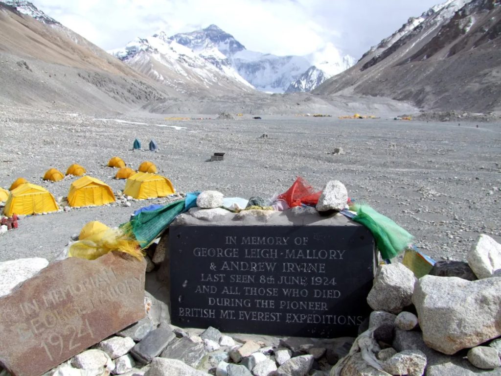
Memorial monument at Everest Base Camp with expedition tents and Mount Everest rising in the background.

Mount Everest Deaths

Mount Everest Deaths

Estimated reading time: 1 minute

Mount Everest deaths have become a major topic of interest due to the mountain’s extreme conditions, with many climbers losing their lives each year in pursuit of the summit. This article explores Mount Everest deaths statistics, major disasters, and survival stories that reveal both the dangers and human resilience on the world’s highest peak.

Most deaths on Everest occur due to altitude sickness, exhaustion, falls, avalanches, extreme weather, and a lack of oxygen in the mountain’s infamous Death Zone. Above 8,000 meters (26,247 feet), the human body begins to deteriorate rapidly, turning even simple tasks into major challenges. At these extreme altitudes, climbers must battle freezing temperatures, powerful winds, and dangerously low oxygen levels while making critical decisions under physical and mental stress.

Despite these dangers, Everest continues to attract adventurers from around the world. For many climbers, standing on the highest point on Earth represents the ultimate mountaineering achievement. However, the mountain’s history includes tragic disasters, remarkable rescues, and survival stories that reveal both the risks and rewards of high-altitude climbing.

In this guide, you’ll discover the latest Mount Everest death statistics, the deadliest disasters in Everest history, the main causes of fatalities, famous stories of climbers who never returned, and the reasons people continue to pursue the dream of reaching the summit despite the risks.

How Many People Have Died on Mount Everest?

Mount Everest has claimed the lives of more than 340 climbers since the first expeditions began in the early 1900s. While the exact number changes almost every climbing season, Everest records more deaths than any other mountain on Earth because thousands of climbers attempt to reach its summit each year.

Despite these statistics, Everest is not the deadliest mountain in the world when measured by mortality rate. Mountains such as K2 and Annapurna have historically recorded much higher percentages of deaths among climbers. However, Everest’s popularity means that even a relatively low mortality rate results in a large number of fatalities over time.

The causes of death vary from season to season. Some climbers die from altitude-related illnesses, while others lose their lives in avalanches, falls, storms, or accidents during the descent. Many fatalities occur above 8,000 meters (26,247 feet), an area known as the Death Zone, where oxygen levels become dangerously low and the human body begins to deteriorate rapidly.

Understanding Everest’s death statistics provides important insight into the risks of climbing the world’s highest mountain and explains why proper preparation, experience, and decision-making remain essential for survival.

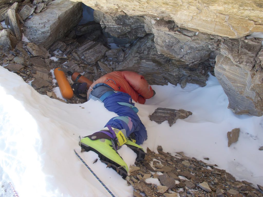
The body known as Green Boots on Mount Everest beside the climbing route in the Death Zone.

Total Deaths on Everest

More than 340 people have died on Mount Everest since the first recorded climbing expeditions in the early twentieth century. The number includes climbers, guides, and Sherpas from many different countries who lost their lives while attempting to reach the summit or descend safely from the mountain.

Deaths have occurred throughout Everest’s climbing history, from the early British expeditions of the 1920s to modern commercial climbs. Some seasons pass with only a few fatalities, while others experience major disasters that claim multiple lives in a single event. Avalanches, earthquakes, storms, and overcrowding have all contributed to spikes in Everest’s death toll.

One reason Everest records so many fatalities is the sheer number of people who attempt the climb. Every year, hundreds of climbers travel to Nepal hoping to stand on the highest point on Earth. As climbing permits increase and more people enter the mountain, the total number of deaths also continues to rise.

Although modern equipment, weather forecasting, and guiding services have improved safety, Everest remains an extreme environment where even experienced climbers can face life-threatening situations.

Everest Mortality Rate

Everest’s mortality rate is relatively low compared to many other famous Himalayan peaks. Modern estimates place the mortality rate at roughly 1% to 2% of all climbers who attempt the summit, although the figure varies depending on the season and the data source.

This percentage may seem small, but it represents a significant risk when hundreds of climbers attempt the mountain every year. Unlike lower mountains, Everest exposes climbers to extreme altitude, freezing temperatures, strong winds, and prolonged physical exhaustion. Even minor mistakes can have serious consequences in such an environment.

The mortality rate on Everest has generally declined over time. Advances in climbing gear, supplemental oxygen systems, communication technology, and weather forecasting have helped reduce risks. Professional guiding companies also provide structured support that was unavailable to early explorers.

However, the mountain remains dangerous. Crowding near the summit, changing weather patterns, and the growing number of inexperienced climbers continue to create new challenges. As a result, Everest’s mortality rate remains a major concern for mountaineers and expedition organizers worldwide.

Death Statistics at a Glance

The following statistics provide a quick overview of Mount Everest deaths and climbing risks:

StatisticFigure
Total Recorded Deaths340+
Mountain Height8,849 m (29,032 ft)
Death Zone Begins8,000 m (26,247 ft)
Estimated Mortality Rate1%-2%
Deadliest Disaster Year2015
Notable Recent High-Fatality Season2023
Main Causes of DeathAltitude sickness, falls, avalanches, exhaustion, weather
First Major Recorded Disaster1922 Avalanche

These numbers highlight both the extraordinary challenge of climbing Everest and the reasons why careful preparation remains critical for anyone attempting the world’s highest mountain.

Why Do People Die on Mount Everest?

Mount Everest presents a combination of dangers that few places on Earth can match. Climbers must contend with extreme altitude, freezing temperatures, powerful storms, dangerous terrain, and physical exhaustion. While modern equipment and guiding services have improved safety, Everest remains an unpredictable environment where even experienced mountaineers can lose their lives.

Most fatalities occur in the Death Zone above 8,000 meters (26,247 feet), where oxygen levels drop dramatically and the human body begins to deteriorate. At these heights, climbers often face several dangers at the same time. A tired climber may struggle with low oxygen, poor weather, and difficult terrain while making critical decisions that affect their survival.

Understanding the leading causes of death on Everest helps explain why reaching the summit is only half the challenge. For many climbers, the descent proves even more dangerous than the climb itself.

Altitude Sickness

Altitude sickness is one of the leading causes of death on Mount Everest. As climbers ascend higher into the atmosphere, air pressure decreases and oxygen becomes less available. At Everest’s summit, climbers breathe only about one-third of the oxygen available at sea level. This lack of oxygen places enormous stress on the body and can quickly become life-threatening.

Many climbers experience symptoms such as headaches, dizziness, nausea, fatigue, and shortness of breath. In severe cases, altitude sickness can develop into High Altitude Pulmonary Edema (HAPE), where fluid builds up in the lungs, or High Altitude Cerebral Edema (HACE), where fluid causes the brain to swell. Both conditions can lead to confusion, loss of coordination, unconsciousness, and death if climbers do not descend immediately.

The danger increases because altitude sickness often affects judgment. A climber may fail to recognize symptoms or continue climbing despite clear warning signs. Even with proper acclimatization, the human body cannot fully adapt to the extreme conditions found in Everest’s Death Zone. For this reason, supplemental oxygen, careful pacing, and strict monitoring remain essential for survival.

Falls

Falls account for many fatalities on Mount Everest. The mountain features steep ridges, exposed slopes, icy rock faces, and deep crevasses that create constant hazards throughout the climb. A single mistake can have fatal consequences, especially at extreme altitudes where climbers move slowly and struggle to maintain balance.

Several sections of the route require climbers to cross narrow ridges with significant drop-offs on either side. Strong winds, poor visibility, and fatigue can make these sections particularly dangerous. Even experienced climbers sometimes lose their footing on icy terrain or slip while descending steep slopes.

The descent from the summit often presents the greatest risk. After many hours of climbing, exhaustion reduces concentration and physical coordination. Climbers may have little energy left to navigate technical sections safely. Some fatal falls occur because individuals continue climbing despite extreme fatigue or remain too high on the mountain after dark.

Modern fixed ropes, harnesses, and safety systems have reduced the risk of falls, but they cannot eliminate it entirely. Everest’s terrain demands constant attention from the moment climbers leave base camp until they return safely.

Avalanches

Avalanches rank among the deadliest natural hazards on Mount Everest. These massive flows of snow, ice, and rock can strike without warning and overwhelm climbers within seconds. Unlike altitude sickness or exhaustion, which often develop gradually, avalanches can kill large numbers of people in a single event.

One of the most dangerous areas is the Khumbu Icefall on Everest’s southern route. This constantly shifting maze of ice towers, crevasses, and unstable seracs creates one of the mountain’s greatest objective dangers. In 2014, the collapse of an ice serac triggered an avalanche that killed 16 Sherpas, making it one of the deadliest disasters in Everest’s history.

Weather conditions also influence avalanche risk. Heavy snowfall, rising temperatures, and unstable snowpack can increase the likelihood of large slides. Climbers and guides carefully monitor conditions, but predicting avalanches remains difficult.

Although modern forecasting and route management have improved safety, avalanches continue to pose a serious threat. Their unpredictable nature means that even well-prepared climbers can find themselves in danger when conditions suddenly change.

Extreme Weather

Everest’s weather can change dramatically within hours, turning a manageable climb into a survival situation. Temperatures near the summit often fall far below freezing, while strong winds can exceed hurricane-force speeds. Combined with low oxygen levels, these conditions create a harsh environment where mistakes become increasingly costly.

Storms often bring whiteout conditions that reduce visibility to only a few meters. Climbers can lose the route, become separated from teammates, or struggle to locate camps during a descent. Strong winds also increase the risk of frostbite and hypothermia by stripping heat from exposed skin.

The 1996 Everest disaster demonstrated how quickly weather can transform a successful summit day into a tragedy. Several climbers reached the summit but became trapped by a powerful storm during their descent. Poor visibility, exhaustion, and freezing temperatures contributed to multiple deaths.

Modern weather forecasting helps climbers choose safer summit windows, but forecasts are not always perfect. Conditions can deteriorate unexpectedly, leaving climbers exposed high on the mountain with limited options for escape.

Exhaustion and Human Error

Exhaustion and human error contribute to many deaths on Mount Everest. A summit attempt often requires climbers to spend 10 to 18 hours moving through thin air while carrying equipment and battling cold temperatures. The physical and mental demands of such an effort can overwhelm even strong athletes.

Severe fatigue affects decision-making, concentration, and reaction time. Climbers may forget important safety procedures, ignore warning signs, or continue climbing when they should turn back. In the Death Zone, low oxygen levels can worsen these problems and impair judgment even further.

Human error can take many forms. Some climbers start their summit push too late, run out of oxygen, underestimate changing weather, or push beyond their physical limits. Others focus so intensely on reaching the summit that they ignore the risks of the descent.

Experienced guides often say that the summit is only halfway. Reaching the top means little if a climber lacks the strength and resources to return safely. Many Everest tragedies result not from a single mistake but from a chain of small decisions that gradually increase risk until disaster becomes unavoidable.

What Is the Everest Death Zone?

The Death Zone is the area on Mount Everest above 8,000 meters (26,247 feet). At this altitude, oxygen levels become so low that the human body can no longer function normally. Climbers can survive in the Death Zone for only a limited time before their physical and mental abilities begin to decline.

Unlike lower elevations where the body can adapt through acclimatization, the Death Zone pushes human physiology beyond its limits. Every breath delivers significantly less oxygen to the muscles, organs, and brain. As a result, climbers face a much higher risk of altitude sickness, exhaustion, frostbite, poor decision-making, and death.

Most Everest fatalities occur within or near the Death Zone. This is why climbers try to spend as little time there as possible during their summit attempt. Understanding the Death Zone helps explain why reaching the summit of Everest remains one of the greatest challenges in mountaineering.

Where the Death Zone Begins

The Death Zone begins at approximately 8,000 meters (26,247 feet) above sea level. On Mount Everest, this zone includes some of the most famous sections of the climb, such as the South Col, the Balcony, the South Summit, and the final ridge leading to the summit.

At these elevations, the atmosphere contains much less oxygen than at sea level. Even simple tasks such as walking, adjusting equipment, or drinking water require enormous effort. Climbers often move extremely slowly, taking only a few steps before stopping to catch their breath.

Most summit attempts begin late at night from Camp IV, located near the edge of the Death Zone. Climbers aim to reach the summit and descend before spending too much time at extreme altitude. However, delays caused by weather, traffic jams, equipment problems, or physical weakness can increase exposure and dramatically raise the risk of serious illness or death.

Although climbers use supplemental oxygen to improve their chances of success, oxygen systems do not completely remove the dangers of the Death Zone. Every hour spent at these heights places additional stress on the body and reduces a climber’s ability to recover.

How Low Oxygen Affects the Body

Low oxygen is the defining feature of the Death Zone and the primary reason it is so dangerous. At Everest’s summit, climbers breathe only about one-third of the oxygen available at sea level. This severe oxygen shortage affects every part of the body.

The brain is one of the first organs to suffer. Climbers often experience slower thinking, poor concentration, confusion, and impaired judgment. Some people struggle to perform simple calculations or make basic decisions. In extreme cases, climbers may experience hallucinations or lose awareness of their surroundings.

The muscles also receive less oxygen, causing rapid fatigue and weakness. Tasks that seem easy at lower elevations become exhausting. Many climbers describe feeling as though they are running a marathon while taking only a few steps at a time.

Low oxygen also increases the risk of life-threatening conditions such as High Altitude Pulmonary Edema (HAPE) and High Altitude Cerebral Edema (HACE). These illnesses can develop quickly and may become fatal if climbers do not descend immediately. Even healthy and experienced mountaineers remain vulnerable because the human body simply was not designed to function at such extreme altitudes.

Why Rescue Is So Difficult

Rescuing climbers in the Death Zone is one of the most challenging tasks in mountaineering. The same conditions that threaten injured climbers also endanger rescuers. Low oxygen, freezing temperatures, strong winds, and extreme exhaustion make every rescue attempt slow, risky, and physically demanding.

Above 8,000 meters, even experienced guides and Sherpas have limited strength. Carrying or assisting another person often requires tremendous effort that can place rescuers in danger as well. In many situations, climbers must rely on their own ability to descend because rescue options become extremely limited.

Helicopters cannot safely operate near Everest’s summit under most conditions, which means rescuers usually have to travel on foot. Reaching an injured climber may take several hours, and worsening weather can make evacuation impossible.

These challenges explain why many bodies remain on Everest. Recovering a deceased climber from extreme altitude can require large teams, specialized equipment, and significant financial resources. More importantly, recovery missions expose rescuers to serious risks. For this reason, climbers often say that self-reliance becomes essential in the Death Zone. Once a person enters this hostile environment, survival depends largely on preparation, sound judgment, and the ability to return safely under their own power.

Death Zone Facts Table:

FactDetail
Death Zone Starts8,000 m (26,247 ft)
Everest Summit8,849 m (29,032 ft)
Oxygen AvailableAbout 33% of sea-level oxygen
Main RisksHAPE, HACE, frostbite, exhaustion
Time Climbers Spend ThereUsually less than 24 hours

The Deadliest Disasters in Everest History

Mount Everest has witnessed many tragedies since climbers first attempted to reach its summit. While individual accidents occur almost every climbing season, several disasters stand out because they claimed multiple lives and changed the way people approach high-altitude mountaineering.

These events reveal the dangers of avalanches, storms, earthquakes, and extreme altitude. They also highlight how unpredictable Everest can be, even for experienced climbers and guides. Many of the safety practices used today emerged from lessons learned during these tragic incidents.

The 1922 Avalanche

The 1922 British Everest Expedition marked a major milestone in mountaineering history. It was the first expedition to climb above 8,000 meters (26,247 feet), pushing human endurance to new limits. However, the expedition also suffered one of Everest’s first major disasters.

On June 7, 1922, a powerful avalanche struck a group of climbers and porters as they ascended the mountain’s North Col route. Seven porters lost their lives, making this the first recorded mass-fatality event on Everest. The tragedy shocked the climbing world and highlighted the dangers of snow and ice movement at high altitude.

The disaster demonstrated that Everest’s greatest threats often come from natural forces rather than technical climbing challenges. It also reminded future expeditions that success on Everest depends as much on understanding mountain conditions as on physical strength and determination.

George Mallory’s Death in 1924

Memorial cairn honoring George Mallory on Mount Everest, surrounded by rocks and the Himalayan mountain landscape.

Few Everest mysteries have captured the public imagination like the disappearance of George Mallory and Andrew Irvine. During the 1924 British Everest Expedition, the two climbers attempted to reach the summit via the mountain’s northern side.

On June 8, 1924, another member of the expedition spotted Mallory and Irvine climbing high on the mountain before clouds obscured the view. Neither man returned. Their disappearance created one of mountaineering’s greatest unanswered questions: Did they reach the summit before vanishing?

For decades, the mystery remained unsolved. In 1999, climbers discovered Mallory’s body at about 8,155 meters (26,755 feet) on the mountain’s North Face. The discovery provided valuable clues but failed to answer the central question. Irvine’s body and camera have never been found.

The story of Mallory and Irvine continues to symbolize both the ambition and risks associated with Everest exploration.

The 1996 Everest Disaster

The 1996 Everest disaster remains one of the most famous tragedies in mountaineering history. During the spring climbing season, several commercial expeditions attempted to guide clients to the summit during a narrow weather window.

On May 10 and 11, climbers encountered severe storms while descending from the summit. Strong winds, freezing temperatures, poor visibility, and exhaustion created a deadly combination. Many climbers remained high on the mountain after their planned turnaround times, increasing their exposure to dangerous conditions.

Eight climbers died during the disaster, making it one of the deadliest events in Everest history at the time. The tragedy gained worldwide attention through books, documentaries, and personal accounts from survivors.

The disaster prompted guides and climbers to place greater emphasis on turnaround times, weather forecasting, decision-making, and risk management during summit attempts.

The 2014 Khumbu Icefall Tragedy

The Khumbu Icefall is one of the most dangerous sections of Everest’s southern route. This constantly shifting maze of ice towers and deep crevasses forces climbers and Sherpas to navigate unstable terrain on their way to higher camps.

On April 18, 2014, a massive block of ice collapsed above the route, triggering an avalanche that swept through the Icefall. Sixteen Sherpas lost their lives, making it one of the deadliest single incidents in Everest history.

The tragedy highlighted the enormous risks Sherpas face while carrying equipment, establishing camps, and supporting climbing expeditions. It also sparked discussions about compensation, safety standards, and the role of local workers in the Everest industry.

Many climbers and expedition companies canceled their summit attempts following the disaster, and the event remains a defining moment in modern Everest history.

The 2015 Earthquake Avalanche

On April 25, 2015, a powerful 7.8-magnitude earthquake struck Nepal. The earthquake triggered a massive avalanche that swept into Everest Base Camp from the slopes of nearby peaks.

The avalanche devastated parts of the camp, destroying tents, equipment, and support facilities. About 19 people lost their lives, making it the deadliest single-day disaster ever recorded on Mount Everest.

Unlike many Everest accidents that occur high on the mountain, this tragedy struck climbers and support staff at Base Camp. The event demonstrated that dangers on Everest extend beyond the climbing route itself. Even individuals who had not yet begun their summit attempts found themselves in harm’s way.

The earthquake ended the 2015 climbing season and left a lasting impact on Nepal’s tourism industry and mountaineering community.

The Record Deaths of 2023

The 2023 climbing season became one of the deadliest in Everest’s history. Authorities and mountaineering databases recorded approximately 18 fatalities during the season, surpassing many previous records.

Unlike the disasters of 2014 and 2015, most deaths in 2023 did not result from a single catastrophic event. Instead, climbers died from a combination of altitude sickness, exhaustion, falls, and other high-altitude complications. Experts also pointed to overcrowding and the growing number of climbers attempting Everest as contributing factors.

The season reignited debates about climbing permits, experience requirements, route congestion, and safety regulations. It also served as a reminder that even with modern equipment, weather forecasts, and professional guiding services, Everest remains one of the most challenging and dangerous mountains on Earth.

YearDisasterDeaths
1922Avalanche7
1924Mallory & Irvine Disappearance2
1996Summit Storm Disaster8
2014Khumbu Icefall Avalanche16
2015Earthquake Avalanche19
2023Record Fatality Season18

Famous Mount Everest Death Stories

Throughout Everest’s history, several tragedies have captured worldwide attention. Some became famous because of the climbers involved, while others raised difficult questions about risk, survival, and human ambition. These stories remind us that Everest is more than a mountain it is a place where determination, courage, and danger often meet.

George Mallory and Andrew Irvine

George Mallory and Andrew Irvine disappeared during their summit attempt on June 8, 1924. The two British climbers were last seen ascending high on Everest’s northeast ridge before clouds hid them from view. Neither man returned to camp.

Their disappearance created one of mountaineering’s greatest mysteries. Many people still wonder whether they reached the summit nearly three decades before the first confirmed ascent by Edmund Hillary and Tenzing Norgay in 1953.

In 1999, climbers discovered Mallory’s body at an altitude of about 8,155 meters (26,755 feet). However, Irvine’s body and camera have never been found. If the camera is ever recovered, it could help answer whether the pair reached the summit.

Their story symbolizes the spirit of early exploration and the enormous risks faced by Everest’s first climbers.

Rob Hall

Rob Hall was one of the world’s most respected mountain guides and the founder of Adventure Consultants. During the 1996 Everest disaster, Hall successfully guided several clients to the summit before severe weather struck the mountain.

As conditions deteriorated, Hall stayed behind to help struggling climber Doug Hansen descend safely. This decision left him trapped high on the mountain as a powerful storm developed.

Hall remained in radio contact with his team and family while stranded near the South Summit. Despite rescue efforts, he could not descend and died on the mountain. His final conversations became some of the most emotional moments in Everest history.

Hall’s story highlights the difficult choices guides face on Everest and demonstrates the extraordinary commitment many leaders show toward their clients.

Scott Fischer

Scott Fischer led the Mountain Madness expedition during the 1996 climbing season. Known for his strength and experience, Fischer had built a reputation as one of the most accomplished high-altitude climbers of his generation.

After reaching the summit on May 10, Fischer became severely exhausted during the descent. The combination of extreme altitude, fatigue, and worsening weather left him unable to continue safely.

Rescuers attempted to assist him, but conditions on the mountain made evacuation impossible. Fischer died on the southeast ridge during the storm that claimed multiple lives.

His death reminded climbers that experience alone cannot eliminate Everest’s dangers. Even elite mountaineers remain vulnerable to the mountain’s extreme conditions.

Francys Arsentiev

Francys Arsentiev became known as one of Everest’s most tragic figures. In 1998, she attempted to become the first American woman to summit Everest without supplemental oxygen.

She and her husband, Sergei Arsentiev, successfully reached the summit. However, the climb left them exhausted and vulnerable at extreme altitude. During their descent, the couple became separated on the mountain.

Francys spent a night exposed to the elements in the Death Zone. Several climbers encountered her during the following day, but the conditions made a rescue impossible. She died high on the mountain, while Sergei later lost his life attempting to save her.

Her story illustrates how quickly conditions can turn deadly on Everest and why even successful summit attempts can end in tragedy.

David Sharp

David Sharp was a British climber who attempted Everest largely on his own in 2006. During his descent from the summit, he became trapped near a rocky shelter known as the Green Boots Cave.

Over the course of several hours, dozens of climbers passed the area while making their own summit attempts. Sharp’s condition continued to worsen, and he eventually died on the mountain.

The incident sparked an international debate about ethics in high-altitude climbing. Many people questioned whether more could have been done to help him, while others argued that the extreme conditions of the Death Zone limited what climbers could realistically do.

Sharp’s death forced the mountaineering community to confront difficult questions about responsibility, survival, and decision-making at extreme altitude.

What Happens to Bodies on Mount Everest?

Mount Everest’s extreme environment makes recovering the bodies of deceased climbers one of the most difficult tasks in mountaineering. Unlike mountains at lower elevations, Everest presents rescuers with severe challenges, including low oxygen levels, freezing temperatures, dangerous terrain, and unpredictable weather.

Over the decades, hundreds of climbers have lost their lives on Everest. While some bodies have been recovered and returned to their families, many remain on the mountain because recovery operations can place rescuers at significant risk.

The presence of these climbers serves as a reminder of Everest’s dangers and the harsh realities of high-altitude mountaineering. Understanding why recovery is so difficult helps explain one of the most unique and challenging aspects of climbing the world’s highest mountain.

Why Recovery Is Difficult

Recovering a body from Mount Everest requires an enormous amount of effort, manpower, and resources. Most fatalities occur above 8,000 meters (26,247 feet) in the Death Zone, where oxygen levels become dangerously low and even simple physical tasks demand tremendous energy.

A recovery team often needs multiple experienced Sherpas, specialized equipment, supplemental oxygen, and favorable weather conditions. Moving a body across steep slopes, icy ridges, and deep snow can take many hours or even several days. At extreme altitudes, rescuers face the same dangers that claimed the climber’s life, including altitude sickness, exhaustion, storms, and falls.

The physical challenge becomes even greater because bodies can weigh significantly more when combined with frozen clothing, climbing gear, and accumulated ice. Every recovery mission requires careful planning to minimize risks to the rescue team.

For these reasons, expedition leaders and families must carefully weigh the emotional importance of recovery against the safety of those who would perform the operation.

Why Some Bodies Remain on the Mountain

Many bodies remain on Mount Everest because recovery is often too dangerous, expensive, or technically difficult. In some cases, climbers die in locations that rescuers cannot safely access. Steep cliffs, crevasses, and exposed ridges can make retrieval nearly impossible without placing additional lives at risk.

The Death Zone creates another major challenge. Above 8,000 meters, rescuers have limited time and energy to work safely. Spending too long at these altitudes increases the risk of serious illness and death, even for highly experienced climbers.

Financial considerations also play a role. Recovery missions can cost tens of thousands of dollars and require large teams working under hazardous conditions. As a result, some families choose not to pursue recovery efforts.

While the idea may seem unusual to people outside the mountaineering community, many climbers understand these realities before attempting Everest. Some even express their wishes regarding recovery before beginning their expedition.

Modern Recovery Efforts

Advances in equipment, logistics, and climbing expertise have improved how teams recover bodies from Mount Everest. These tools help teams carry out recovery operations more safely than in the past.

These teams improve safety on climbing routes, reduce environmental impact, and show respect for climbers who lost their lives on Everest.

Despite these improvements, body recovery remains one of the most difficult tasks in high-altitude mountaineering. Every mission requires careful planning, stable weather conditions, and highly experienced teams willing to operate in one of the harshest environments on Earth.

For this reason, Mount Everest continues to hold a unique place in mountaineering history. Its extreme altitude, technical terrain, and unpredictable conditions ensure that recovery efforts will remain complex and dangerous for future generations of climbers and rescue teams.

Is Climbing Everest More Dangerous Than Before?

Climbing Mount Everest is generally safer today than it was several decades ago, thanks to advances in mountaineering equipment, more accurate weather forecasting, improved communication systems, and experienced guiding companies. These improvements have increased summit success rates and helped climbers make better decisions on the mountain.

However, Everest is far from safe. The mountain still presents life-threatening risks, including extreme altitude, unpredictable weather, avalanches, and the challenges of climbing above 8,000 meters (26,247 feet). In recent years, another major concern has emerged crowding. During the short summit season, long queues of climbers can delay ascents and increase the time spent in the dangerous Death Zone, raising the risk of exhaustion and altitude-related illnesses.

Improved Equipment

Modern climbing equipment has significantly reduced many of the risks associated with climbing Everest. Today’s climbers benefit from lightweight insulated clothing, high-performance mountaineering boots, durable crampons, reliable climbing ropes, advanced ice axes, and high-quality oxygen systems that perform much better than those used by early expeditions.

Communication has also improved dramatically. Satellite phones, GPS devices, and emergency communication equipment allow climbers and expedition teams to stay connected even in remote areas of the mountain. Many guided expeditions also carry portable weather devices and emergency medical supplies, making it easier to respond to changing conditions.

These innovations have made Everest more accessible and have contributed to higher summit success rates. Even so, no equipment can eliminate the dangers of extreme altitude, severe cold, or sudden storms. Climbers must still rely on proper training, physical fitness, careful acclimatization, and sound decision-making to reach the summit safely.

Better Weather Forecasting

One of the biggest improvements in modern Everest expeditions is the accuracy of weather forecasting. In the past, climbers often had limited information about approaching storms and had to rely largely on observation and experience. Today, expedition leaders receive detailed forecasts from professional meteorologists who monitor wind speeds, snowfall, temperatures, and atmospheric pressure throughout the climbing season.

These forecasts help teams identify short periods of stable weather, commonly known as summit windows, when conditions are most favorable for reaching the top. By choosing the right time to climb, expeditions can reduce their exposure to dangerous winds, whiteout conditions, and extreme cold.

Although forecasting technology has greatly improved safety, it is not foolproof. Weather on Everest can change rapidly, and even the most accurate predictions cannot prevent every storm. Climbers must remain prepared to turn back if conditions deteriorate, even when they are close to the summit.

Crowding and New Risks

While technology has made Everest safer in many ways, the growing popularity of the mountain has introduced new dangers. Each climbing season, hundreds of mountaineers from around the world attempt to reach the summit, often during the same narrow weather windows. This can create long lines on steep sections such as the Hillary Step and the Southeast Ridge.

Traffic jams at high altitude force climbers to spend more time in the Death Zone, where oxygen levels are too low for the human body to function normally over extended periods. Waiting in line increases oxygen consumption, causes fatigue, and exposes climbers to freezing temperatures for longer than planned. In some tragic cases, delays have contributed to altitude sickness, frostbite, and fatalities.

Crowding also places additional pressure on guides, Sherpas, rescue teams, and fixed-rope systems. As a result, many mountaineering experts believe that managing the number of permits, improving climber experience requirements, and encouraging responsible expedition planning are essential steps toward making Everest safer in the future.

Overall, modern technology has reduced many traditional risks, but Mount Everest remains one of the world’s most dangerous mountains. Success still depends on careful preparation, responsible decision-making, favorable weather, and respecting the mountain’s extreme environment.

Why Do People Still Climb Everest?

Despite the dangers, high costs, and physical challenges, thousands of people continue to dream of climbing Mount Everest every year. For many, reaching the summit of the world’s highest mountain represents far more than an adventure it is the fulfillment of a lifelong ambition. Others are motivated by personal goals, a love of mountaineering, or the desire to test their limits in one of the harshest environments on Earth.

While every climber has a unique reason for attempting Everest, most are driven by a combination of challenge, achievement, and the unforgettable experience of standing on the highest point on the planet.

The Challenge

For experienced mountaineers, Everest is considered the ultimate climbing challenge. Standing at 8,849 meters (29,032 feet) above sea level, the mountain demands months of physical training, technical preparation, mental resilience, and careful acclimatization.

Climbers must endure freezing temperatures, hurricane-force winds, steep ice slopes, deep crevasses, and extremely low oxygen levels. Even simple tasks such as eating, walking, or putting on gloves become exhausting at high altitude. Reaching the summit requires determination, patience, and the ability to make sound decisions under intense physical and mental stress.

For many adventurers, overcoming these obstacles is what makes climbing Everest one of the greatest achievements in mountaineering.

Personal Achievement

Many people climb Everest to accomplish a personal goal rather than to break records or gain recognition. For some, it represents years of preparation and dedication. Others see the climb as a way to celebrate a milestone, honor a loved one, raise money for charity, or prove to themselves that they can overcome extraordinary challenges.

The journey to the summit teaches valuable lessons about perseverance, teamwork, discipline, and resilience. Climbers often describe the expedition as life-changing, not only because they reached the top of the world but because they discovered their own physical and mental strength along the way.

Even those who do not reach the summit frequently consider the experience rewarding, having pushed themselves beyond what they believed was possible.

The Dream of Standing on the Highest Point on Earth

For countless adventurers, the greatest motivation is the opportunity to stand on the highest point on Earth. The summit of Mount Everest has become a global symbol of exploration, courage, and human determination. Reaching the top is a dream that inspires climbers from every continent, regardless of age, nationality, or background.

After weeks of trekking, acclimatization, and climbing through the Khumbu Icefall, high camps, and the Death Zone, successful climbers are rewarded with breathtaking views across the Himalayas and the unforgettable feeling of standing above every other place on Earth.

For many, that moment lasts only a few minutes, but the memories and sense of accomplishment remain for a lifetime. It is this powerful combination of adventure, personal growth, and the pursuit of an extraordinary goal that continues to draw people to Mount Everest despite its well-known risks.

Mount Everest Death Statistics by Decade

Since the first serious attempts to climb Mount Everest in the early 20th century, hundreds of climbers have lost their lives on the world’s highest mountain. However, the causes and patterns of these deaths have changed significantly over time. Advances in climbing technology, improved forecasting, and commercial expeditions have increased the number of successful summits, but they have also brought more people and new risks to Everest.

Looking at Everest deaths by decade helps illustrate how mountaineering has evolved and why fatalities continue to occur despite major improvements in safety.

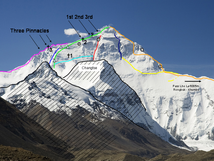
North Face route on Mount Everest showing steep snow-covered slopes, rocky terrain, and the challenging ascent toward the summit.

Early Expeditions

The earliest Everest expeditions, from the 1920s through the 1950s, were among the most dangerous in mountaineering history. Climbers explored unknown routes with limited equipment, heavy clothing, early oxygen systems, and almost no reliable weather forecasting. Maps were incomplete, communication was nearly impossible, and rescue operations were extremely limited.

One of the first major tragedies occurred during the 1922 British Everest Expedition, when an avalanche killed seven Sherpas the first recorded fatalities on Mount Everest. Two years later, British climbers George Mallory and Andrew Irvine disappeared high on the mountain while attempting the summit. Their fate remained one of mountaineering’s greatest mysteries for decades.

Although relatively few expeditions took place during this period, each climb carried enormous risks due to the lack of modern technology and limited understanding of high-altitude physiology.

The Commercial Climbing Era

Everest changed dramatically in the 1990s as commercial guiding companies began offering expeditions to paying clients. Advances in equipment, fixed ropes, bottled oxygen, and professional guiding made the mountain accessible to experienced amateur climbers rather than only elite mountaineers.

The number of summit attempts increased rapidly, leading to both greater success and more accidents. The most well-known tragedy of this era was the 1996 Everest disaster, when sudden storms claimed the lives of eight climbers in a single day. The event highlighted how quickly weather can change on Everest and demonstrated that even experienced guides and well-organized expeditions remain vulnerable to the mountain’s extreme conditions.

Throughout the commercial climbing era, fatalities were often linked to altitude sickness, exhaustion, falls, avalanches, and severe weather. As more people attempted Everest each year, the total number of deaths also gradually increased.

In recent years, Everest has experienced record numbers of climbers, resulting in both higher summit totals and continued fatalities. These innovations have significantly increased the overall summit success rate compared with earlier decades.

However, modern challenges have also emerged. During favorable weather windows, hundreds of climbers may attempt the summit within a few days, creating long queues in the Death Zone. These delays can increase oxygen consumption, worsen fatigue, and expose climbers to extreme conditions for longer than planned.

Recent climbing seasons have shown that most fatalities are no longer caused solely by poor equipment or lack of knowledge. Instead, deaths often result from a combination of extreme altitude, underlying medical conditions, unpredictable weather, exhaustion, and heavy traffic on the mountain.

Overall, Mount Everest has become more accessible and better understood than ever before, but it remains one of the world’s most demanding and unforgiving environments. While modern technology has improved safety, no advancement can eliminate the inherent risks of climbing nearly 9,000 meters above sea level.

Frequently Asked Questions

This section answers some of the most common questions people ask about Mount Everest deaths, risks, and climbing conditions. These quick answers help clarify important facts about the mountain and how dangerous it really is.

How many people have died on Everest?

More than 300 people have died on Mount Everest since expeditions began in the early 20th century. The exact number changes slightly each year as new data is updated, but fatalities remain relatively high due to the extreme altitude, harsh weather, and technical difficulty of the climb. Most deaths occur above 8,000 meters, in what is known as the Death Zone.

Who was the first person to die on Everest?

These were the first known fatalities linked directly to Everest climbing attempts. Later, in 1924, British climbers George Mallory and Andrew Irvine disappeared during an attempt to reach the summit. Their fate remains one of mountaineering’s greatest mysteries.

What is the Death Zone?

The Death Zone refers to altitudes above 8,000 meters (26,247 feet), where oxygen levels are too low to sustain human life for extended periods. In this zone, the body begins to deteriorate rapidly due to lack of oxygen, extreme cold, and physical exhaustion. Climbers must rely on supplemental oxygen, but even then, long exposure significantly increases the risk of altitude sickness, confusion, and death.

Can helicopters rescue climbers from Everest?

Helicopter rescues on Mount Everest are extremely limited and only possible under very specific conditions. While helicopters have successfully performed rescues from lower sections of the mountain, the high altitude near the summit is often beyond safe operating limits for most aircraft. Thin air, unpredictable winds, and dangerous terrain make rescue operations extremely risky and rare at extreme elevations.

Do climbers pass bodies on Everest?

Yes, climbers often pass bodies during their ascent or descent on Mount Everest. Due to the extreme difficulty and danger of recovery operations, many bodies remain on the mountain permanently. Over time, snow and ice may partially cover them, but some remain visible for years, serving as a sobering reminder of the risks involved in high-altitude climbing.

Is Everest the deadliest mountain in the world?

Mount Everest is not the deadliest mountain in terms of fatality rate, but it is the most famous and one of the most dangerous due to the number of climbers who attempt it each year. Other mountains, such as Annapurna, have higher death rates, but far fewer people climb them. Everest’s combination of extreme altitude, weather conditions, and heavy traffic contributes to its overall risk.

Final Thoughts

Mount Everest remains one of the most powerful symbols of human ambition and endurance. While modern technology, better forecasting, and experienced guiding teams have made climbing safer than in the past, the mountain is still extremely dangerous. Every season reminds the world that Everest is not just a destination it is a serious high-altitude environment where even small mistakes can have life-threatening consequences.

Understanding the Risks of Everest

Understanding the risks of Everest is essential for anyone interested in high-altitude mountaineering. The dangers come from a combination of extreme altitude, unpredictable weather, physical exhaustion, and limited oxygen above 8,000 meters. Even well-prepared climbers with modern equipment face serious challenges, especially in the Death Zone where the human body begins to deteriorate rapidly.

Another important factor is decision-making. Many accidents occur not because climbers lack skill, but because they push forward despite worsening conditions, fatigue, or overcrowding on the route. The mountain demands respect, patience, and the ability to turn back when necessary.

Why Everest Continues to Inspire Climbers

Despite the risks, Everest continues to attract climbers from around the world. For many, it represents the ultimate test of endurance, discipline, and mental strength. Standing on the highest point on Earth is a rare achievement that holds deep personal meaning, often symbolizing years of preparation and sacrifice.

Everest also inspires people because it represents exploration and the limits of human possibility. Each climber who attempts the summit becomes part of a long history of adventure and discovery. Even for those who do not reach the top, the journey itself often becomes a life-changing experience.

In the end, is Everest not only about danger or statistics it is about human determination, respect for nature, and the desire to explore what lies beyond ordinary limits.

Read more Everest

Read Also:

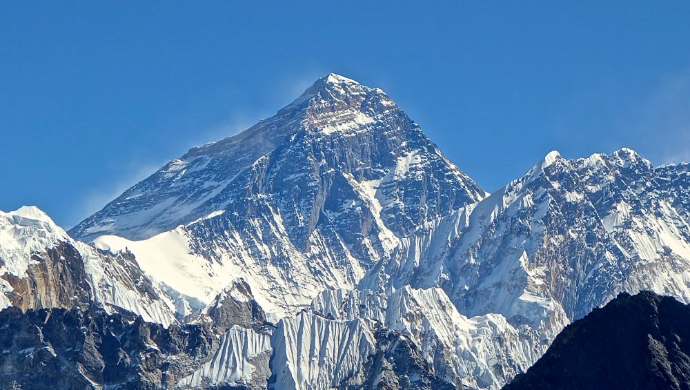
Mount Everest snow-covered peak rising above clouds in the Himalayas Nepal and China border

Is Everest Really the Tallest Mountain in the World?

Is Everest Really the Tallest Mountain in the World?

Estimated reading time: 21 minutes

Yes, Mount Everest is the tallest mountain in the world when you measure height above sea level. Its summit reaches 8,849 meters (29,032 feet), making it the highest point on Earth.

However, the answer becomes more complicated when you use other ways to measure a mountain. If you measure from base to summit, Mauna Kea in Hawaii rises higher than Everest. If you measure from the center of the Earth, Chimborazo in Ecuador extends farther into space. Meanwhile, Mount Kilimanjaro in Tanzania holds the title of the tallest free-standing mountain on Earth.

So, is Everest really the tallest mountain in the world? The answer depends on how you define “tallest.” In this guide, you’ll discover how scientists measure mountain height, why Everest remains the official record holder, and how Mauna Kea, Chimborazo, and Kilimanjaro challenge its claim to the title.

The Short Answer: Is Everest the Tallest Mountain in the World?

Yes, Mount Everest is the tallest mountain in the world when measured above sea level. Its summit stands at 8,849 meters (29,032 feet), making it the highest point on Earth’s surface.

However, Everest does not hold every mountain height record. Scientists and geographers use several methods to measure mountains, and different methods produce different winners. Mauna Kea rises higher when measured from base to summit, Chimborazo reaches farther from the Earth’s center, and Kilimanjaro stands as the tallest free-standing mountain on Earth.

Everest Is the Tallest Mountain Above Sea Level

Everest earns its title because its summit reaches a higher elevation above sea level than any other mountain. Located in the Himalayas on the border of Nepal and China, Everest remains the official highest mountain in the world.

Why Some Mountains Can Be Considered Taller

Height above sea level represents only one way to measure a mountain. Some experts measure from a mountain’s base to its summit, while others compare the distance from the Earth’s center. These different approaches reveal that other mountains can surpass Everest in specific categories.

Quick Comparison Table

Measurement MethodTallest Mountain
Above Sea LevelMount Everest
Base to SummitMauna Kea
Closest to SpaceChimborazo
Free-StandingMount Kilimanjaro

Why the Definition of “Tallest” Matters

The answer to whether Everest is the tallest mountain in the world depends on how you measure a mountain. Most people think of height above sea level, but scientists use several methods to compare mountains. Each method highlights a different aspect of a mountain’s size and can produce a different record holder.

Measuring Height Above Sea Level

Height above sea level is the most widely used method for measuring mountains. It calculates the distance between a mountain’s summit and the average level of the world’s oceans.

Using this method, Mount Everest ranks first. Its summit reaches 8,849 meters (29,032 feet) above sea level, making it the highest point on Earth. This measurement explains why Everest holds the official title of the world’s highest mountain.

Measuring Height from Base to Summit

Some geographers measure a mountain from its base to its summit. This method considers the mountain’s entire structure rather than only the portion that rises above sea level.

When measured this way, Mauna Kea in Hawaii surpasses Everest. Although only 4,207 meters (13,803 feet) of Mauna Kea rise above sea level, most of the volcano lies beneath the Pacific Ocean. From its underwater base to its summit, Mauna Kea stands more than 10,200 meters (33,500 feet) tall.

Measuring Distance from Earth’s Center

Earth is not a perfect sphere. The planet bulges slightly at the equator, which means locations near the equator sit farther from the Earth’s center than locations closer to the poles.

Because of this shape, Mount Chimborazo in Ecuador extends farther from the Earth’s center than Everest. Even though Chimborazo is much lower above sea level, its location near the equator gives it an advantage. As a result, Chimborazo’s summit is the point on Earth’s surface that lies closest to outer space.

Mount Everest – The Highest Mountain Above Sea Level

Mount Everest holds the official title of the world’s tallest mountain because it has the highest elevation above sea level. Although other mountains can claim different height records depending on how scientists measure them, Everest remains the recognized champion under the standard method used worldwide. Its immense height, challenging environment, and iconic status have made it the most famous mountain on Earth.

How Tall Is Everest?

Mount Everest stands 8,848.86 meters (29,031.7 feet) above sea level, making it the highest mountain on Earth by official measurement. Nepal and China jointly announced this height in 2020 after completing a detailed survey using modern GPS technology and advanced geodetic measurements.

Scientists have measured Everest many times over the years. Small differences in recorded height occur because of improved technology, earthquakes, and natural geological movements within the Himalayas. Despite these adjustments, Everest has consistently remained the highest mountain above sea level.

Its extreme elevation creates harsh conditions near the summit, including thin air, freezing temperatures, and powerful winds. These challenges make reaching the top one of the greatest achievements in mountaineering.

Where Is Everest Located?

Mount Everest lies in the Himalayas on the border between Nepal and Tibet, an autonomous region of China. It forms part of the Mahalangur Himal sub-range, which contains several of the world’s highest peaks.

The mountain attracts climbers from every continent and serves as one of the most famous adventure travel destinations in the world. Most climbers approach Everest from Nepal through the Khumbu region, while others climb from the Tibetan side.

Its location within the Himalayas places it in a region shaped by the ongoing collision between the Indian and Eurasian tectonic plates. This geological activity helped create the world’s highest mountain range and continues to influence Everest today.

Why Everest Holds the Official Record

Everest holds the official record because mountains are traditionally measured from sea level to their highest point. Under this internationally accepted system, no mountain reaches a greater elevation than Everest.

Some mountains appear taller when measured from their underwater base or by their distance from the center of the Earth. However, these alternative methods use different definitions of height. When people refer to the tallest mountain in the world, they usually mean the mountain with the highest summit above sea level.

For this reason, maps, scientific organizations, atlases, and educational institutions around the world recognize Mount Everest as the tallest mountain on Earth.

Quick Facts About Mount Everest

FactDetail
Official Height8,848.86 m (29,031.7 ft)
LocationNepal-China (Tibet) Border
Mountain RangeHimalayas
First Successful Summit1953
Famous ClimbersEdmund Hillary and Tenzing Norgay
Official TitleHighest Mountain Above Sea Level
ContinentAsia

Is Mauna Kea Taller Than Everest?

The answer depends on how you measure a mountain. If you measure from sea level, Mount Everest is taller. However, if you measure from a mountain’s base to its summit, Mauna Kea in Hawaii exceeds Everest. This unique distinction makes Mauna Kea one of the most fascinating mountains in the world and an important part of the debate over which mountain truly deserves the title of the tallest.

What Is Mauna Kea?

Mauna Kea is a dormant volcano located on the Big Island of Hawaii in the United States. Its summit rises 4,207 meters (13,803 feet) above sea level, which is much lower than Everest’s summit. At first glance, it may not seem like a contender for the world’s tallest mountain.

However, most of Mauna Kea lies beneath the Pacific Ocean. Only the upper portion of the mountain rises above the water, while the majority remains hidden underwater. This submerged base dramatically changes how scientists view its overall size.

Today, Mauna Kea is famous not only for its size but also for its world-class astronomical observatories. Its high elevation, stable atmosphere, and clear skies make it one of the best places on Earth for studying the universe.

Measuring from the Ocean Floor

When scientists measure Mauna Kea from its base on the ocean floor to its summit, the mountain reaches approximately 10,210 meters (33,500 feet) in total height. This measurement makes it significantly taller than Mount Everest.

The difference comes from the starting point. Everest’s official height begins at sea level, while Mauna Kea’s total height begins thousands of meters below the surface of the Pacific Ocean. Because most of the mountain remains underwater, people rarely think of it as taller than Everest.

This example shows why the definition of “tallest mountain” matters. Different measurement methods can produce different winners depending on where the measurement starts.

Everest vs Mauna Kea Comparison

Mount Everest remains the tallest mountain above sea level and holds the official world record. Climbers, maps, and scientific organizations use this measurement standard worldwide. As a result, Everest continues to be recognized as the highest mountain on Earth.

Mauna Kea, however, wins when scientists measure total height from base to summit. Its underwater foundation gives it an advantage that Everest cannot match. Both mountains therefore hold impressive records, but they achieve them using different definitions of height.

The comparison highlights an important lesson: the answer to “What is the tallest mountain in the world?” depends on how the measurement is made.

Comparison Table

MountainTotal Height
Mauna Kea10,210 m
Everest8,849 m

Chimborazo: The Mountain Closest to Space

Chimborazo is often called the mountain closest to space, even though it is not the tallest mountain above sea level. This surprising fact comes from how Earth is shaped rather than the mountain’s actual height. Because of Earth’s bulge around the equator, Chimborazo’s summit sits farther from the planet’s center than Mount Everest, making it the closest point on Earth’s surface to outer space.

Why Earth Is Not a Perfect Sphere

Earth is not a perfect sphere; it is slightly wider at the equator due to its rotation. This shape is called an oblate spheroid. Because of this bulge, mountains located near the equator naturally sit farther from Earth’s center compared to mountains at higher latitudes.

Chimborazo is located in Ecuador, very close to the equator. This position gives it a natural advantage in terms of distance from Earth’s center, even though its elevation above sea level is lower than Everest. This is why location matters just as much as height when comparing mountains in different parts of the world.

How Chimborazo Beats Everest

Mount Everest is the highest mountain above sea level, but Chimborazo wins in terms of distance from Earth’s center. Chimborazo’s summit reaches about 6,263 meters above sea level, which is much lower than Everest. However, because it sits near the equator, the Earth’s bulge lifts it farther outward.

When measured from Earth’s center, Chimborazo’s peak is approximately 2,168 meters farther than Everest’s summit. This makes it the closest point on Earth to space, even though it is not the tallest mountain in the traditional sense.

Distance from Earth’s Center Comparison

The difference between Chimborazo and Everest shows how measurement methods change the results. While Everest is measured from sea level, Chimborazo is measured based on its position on a bulging planet. This creates two different “tallest” outcomes depending on the reference point.

From a scientific perspective, this comparison highlights how geography, physics, and Earth’s shape all influence how we understand mountain height. It also makes Chimborazo one of the most interesting mountains in the world for educational and scientific discussions.

Is Kilimanjaro the Tallest Free-Standing Mountain in the World?

Mount Kilimanjaro is widely recognized as the tallest free-standing mountain in the world. This means it is not part of a larger mountain range and rises completely on its own from the surrounding landscape. Unlike peaks in the Himalayas or Andes, Kilimanjaro stands isolated above the African plains, making its shape and height especially impressive and easy to see from a distance.

Tallest free-standing mountain Mount Kilimanjaro with rainforest and summit view

What Is a Free-Standing Mountain?

A free-standing mountain is a mountain that is not connected to a larger mountain range. It rises independently from the surrounding terrain rather than being part of a continuous chain of peaks.

Kilimanjaro is a perfect example of this type of mountain. It rises sharply from the plains of northern Tanzania and dominates the landscape with its snow-capped summit. This isolation makes it visually striking and geologically unique compared to mountain systems like the Himalayas, where peaks are clustered together.

Free-standing mountains are often formed by volcanic activity, where magma builds a large volcanic structure over time. Kilimanjaro’s volcanic origin explains its isolated shape and massive size.

Why Kilimanjaro Holds This Record

Kilimanjaro holds the record as the tallest free-standing mountain because it rises approximately 5,895 meters (19,341 feet) above sea level without being part of any mountain range. Its base starts in the surrounding plains of Tanzania, and it rises directly upward in a single massive structure.

This makes Kilimanjaro unique because its full height is visible from base to summit, unlike many mountains where surrounding terrain already sits at high elevation. Its volcanic formation and isolated position contribute to its global recognition.

For adventure travel companies like WeWild Travel, Kilimanjaro’s accessibility and clear structure make it one of the most popular trekking destinations in the world. Climbers do not need technical mountaineering skills, which allows thousands of people each year to attempt reaching its summit.

Kilimanjaro vs Everest

Kilimanjaro and Mount Everest are often compared, but they represent different types of records. Everest is the highest mountain above sea level, while Kilimanjaro is the tallest free-standing mountain.

Everest rises from the Himalayas and is part of a vast mountain range, with surrounding terrain already at high altitude. In contrast, Kilimanjaro rises alone from relatively low-lying plains, making its vertical rise more dramatic when viewed from its base.

MountainRecord
Mount EverestHighest mountain above sea level (8,848.86 m)
Mount KilimanjaroTallest free-standing mountain (5,895 m above sea level)

Both mountains are globally important, but they represent different ways of measuring natural height and geological formation. This is why Kilimanjaro remains one of the most iconic trekking mountains in the world.

How Scientists Measure Mountain Height

Scientists measure mountain height using precise methods that have improved over time. The goal is to determine how high a mountain rises compared to a reference point, usually sea level. Different technologies now allow experts to calculate mountain elevation with high accuracy, even in remote and difficult environments like the Himalayas.

Traditional Surveying Methods

Traditional surveying methods were the first techniques used to measure mountain height. Surveyors used tools like theodolites, trigonometry, and ground-based observations to calculate elevation.

They would measure angles from known points at lower elevations and apply mathematical formulas to estimate the height of a mountain peak. This method required clear visibility and careful calculations, but it was limited by terrain, weather conditions, and human error.

Despite these limitations, traditional surveying provided the first official measurements of famous mountains like Mount Everest. It laid the foundation for modern geodetic science and helped establish early maps and elevation records around the world.

GPS Measurements

Global Positioning System (GPS) technology improved mountain measurement accuracy significantly. GPS uses signals from satellites orbiting Earth to determine exact coordinates and elevation.

Survey teams place GPS receivers at mountain summits or key points, and the devices collect data from multiple satellites. This allows scientists to calculate height with much greater precision than traditional methods.

GPS technology also helps account for small changes in elevation caused by tectonic movement or geological shifts. This is especially important for mountains like Everest, which continue to grow slowly over time due to plate movement.

Satellite Technology

Modern satellite technology provides the most advanced method for measuring mountain height. Satellites use radar, laser scanning (LiDAR), and remote sensing systems to map Earth’s surface in detail.

These systems can create highly accurate 3D models of mountains, allowing scientists to measure elevation, slope, and terrain structure without physically climbing the mountain.

Satellite data is especially useful for remote or dangerous regions where ground surveys are difficult. It also helps update global elevation maps and ensures that mountain height records remain accurate as technology improves.

The World’s Tallest Mountains by Different Measurements

The idea of the “tallest mountain in the world” depends entirely on how you measure height. Scientists use different reference points such as sea level, the ocean floor, and Earth’s center. Because of these different methods, more than one mountain can claim to be the tallest depending on the definition used.

Highest Mountains Above Sea Level

When people talk about the tallest mountain, they usually mean height above sea level. This is the most widely accepted global standard used in maps, education, and mountaineering records.

Mount Everest leads this category, standing higher above sea level than any other mountain on Earth. This measurement is important because it provides a consistent reference point across all continents.

Other mountains may have large bases or unique structures, but none exceed Everest’s summit elevation above sea level.

Tallest Mountains from Base to Summit

Another way to measure mountains is from base to summit. This method looks at the total vertical rise of a mountain from its lowest natural base to its highest point.

Using this measurement, Mauna Kea in Hawaii becomes the tallest mountain in the world because most of its structure lies beneath the Pacific Ocean. Its total height from ocean floor to summit is greater than Everest’s height above sea level.

This method shows that hidden underwater terrain can significantly change how we understand mountain size.

Mountains Closest to Space

A third method measures how far a mountain’s peak is from Earth’s center. Because Earth is not a perfect sphere and bulges at the equator, mountains near the equator sit slightly farther from the planet’s center.

Using this measurement, Chimborazo in Ecuador is the closest point on Earth to space. Even though it is lower than Everest in elevation, its equatorial position gives it a unique advantage.

This perspective shows that “tallest” can mean different things depending on geography and physics.

Large Comparison Table

MountainMeasurement TypeValueResult
Mount EverestAbove sea level8,848.86 mTallest above sea level
Mauna KeaBase to summit10,210 mTallest total height
ChimborazoDistance from Earth’s center6,384 km from centerClosest to space
Mount KilimanjaroFree-standing height5,895 mTallest free-standing mountain

Is Everest Still Growing?

Mount Everest is not a static mountain. It continues to change slowly over time due to powerful geological forces deep within the Earth. Scientists confirm that Everest is still growing, although the changes are extremely small and happen over long periods.

The Himalayan Tectonic Plates

Mount Everest is located in the Himalayas, a mountain range formed by the collision of two major tectonic plates: the Indian Plate and the Eurasian Plate. These plates are constantly moving toward each other.

When the Indian Plate pushes beneath the Eurasian Plate, the land is forced upward. This process is called tectonic uplift, and it is the main reason the Himalayas, including Everest, continue to rise. This same movement also causes earthquakes in the region, which can slightly reshape the mountain over time.

Because this collision is still active today, Everest remains a “growing” mountain in geological terms.

How Fast Everest Is Rising

Scientists estimate that Mount Everest is rising at an average rate of about 4 millimeters per year. This may seem very small, but over thousands or millions of years, it results in significant changes in height.

However, natural events like earthquakes can temporarily change this rate. For example, major seismic activity in the Himalayas can either increase or slightly decrease elevation in certain areas depending on how the land shifts.

Even with these changes, Everest remains the highest mountain above sea level and continues to hold its global record.

Future Height Predictions

In the future, Mount Everest is expected to continue rising slowly as tectonic forces remain active. Scientists believe the Himalayas will keep growing for millions of years as long as the Indian and Eurasian plates continue to collide.

However, erosion from wind, ice, and weather also works against this growth. These forces slowly wear the mountain down while tectonic uplift pushes it upward.

This balance between growth and erosion means Everest’s height may fluctuate slightly, but it will likely remain the tallest mountain above sea level for a very long time.

The Tallest Mountains Beyond Earth

When we move beyond Earth, mountains become even more extreme and fascinating. The solar system contains peaks that are far larger than anything on our planet. Studying these mountains helps scientists understand geology, volcanic activity, and planetary formation across different worlds.

Olympus Mons on Mars

Olympus Mons is located on Mars and is the tallest volcano and mountain in the entire solar system. It rises about 22 kilometers (13.6 miles) high, making it nearly three times taller than Mount Everest.

Unlike Earth’s mountains, Olympus Mons formed on a planet with lower gravity and no moving tectonic plates. This allowed lava to build up in one place over millions of years without shifting, creating a massive shield volcano with gentle slopes and an enormous base.

Its size is so large that if you stood on its peak, you would not easily see its base because it stretches far across the Martian surface.

How It Compares to Everest

Mount Everest is the highest mountain above sea level on Earth, but it is very small compared to Olympus Mons. Everest reaches 8,848.86 meters, while Olympus Mons is more than 22,000 meters tall.

This comparison highlights how different planetary conditions affect mountain formation. Earth’s active tectonic plates limit mountain growth, while Mars allows continuous volcanic buildup in one location over time.

Even though Everest is the tallest on Earth, it is only a fraction of the size of Mars’s largest mountain.

The Tallest Known Mountains in the Solar System

Olympus Mons is not the only giant mountain beyond Earth. Other planets and moons also contain massive peaks formed by volcanic and tectonic activity.

For example, Mount Rheasilvia on the asteroid Vesta is one of the tallest known mountain structures relative to its size. Some icy moons in the outer solar system also show large ridges and cliffs formed by freezing and cracking processes.

These discoveries show that mountains are not just an Earth feature they are a common and powerful result of planetary geology throughout the solar system.

Fascinating Facts About the World’s Tallest Mountains

The world’s tallest mountains each hold unique records and surprising features. From Everest’s extreme altitude to Mauna Kea’s hidden underwater base, and from Chimborazo’s closeness to space to Kilimanjaro’s free-standing structure, each mountain tells a different story about how Earth’s geography works.

Everest Facts

Mount Everest is the highest mountain above sea level at 8,848.86 meters. It sits on the border between Nepal and China in the Himalayas and continues to grow slowly due to tectonic plate movement. Everest was first successfully climbed in 1953 by Edmund Hillary and Tenzing Norgay, and it remains one of the most challenging and famous climbing destinations in the world. Despite its popularity, the summit conditions are extremely dangerous due to thin air and freezing temperatures.

Mauna Kea Facts

Mauna Kea in Hawaii is a dormant volcano that is often considered the tallest mountain when measured from its base on the ocean floor. Its total height is about 10,210 meters, but most of it lies underwater. Above sea level, it reaches 4,207 meters. Mauna Kea is also one of the most important astronomical observation sites in the world because of its clear skies and high elevation.

Chimborazo Facts

Chimborazo is located in Ecuador and is the mountain closest to space when measured from Earth’s center. Although its elevation is 6,263 meters above sea level, the Earth’s equatorial bulge makes its summit farther from the planet’s center than Everest. This unique position makes Chimborazo one of the most scientifically interesting mountains in the world.

Kilimanjaro Facts

Mount Kilimanjaro is the tallest free-standing mountain in the world, rising 5,895 meters above the plains of Tanzania. It is a dormant volcano made up of three cones: Kibo, Mawenzi, and Shira. Kilimanjaro is famous because climbers can reach its summit without technical climbing skills, making it one of the most accessible high mountains on Earth.

Frequently Asked Questions

This section answers the most common questions about the world’s tallest mountains. These FAQs help clarify why different mountains can hold different “tallest” titles depending on the measurement method used.

Is Everest Really the Tallest Mountain in the World?

Yes, Mount Everest is the tallest mountain in the world when measured above sea level. It reaches 8,848.86 meters, making it the highest point on Earth by the official global standard used in geography and mountaineering.

Is Mauna Kea Taller Than Everest?

Mauna Kea is taller than Everest only when measured from its base on the ocean floor. Its total height is about 10,210 meters, but most of it lies underwater. Above sea level, Everest is still higher.

Why Is Chimborazo Closer to Space?

Chimborazo is closer to space because Earth is not a perfect sphere. The planet bulges at the equator, and Chimborazo sits near this bulge in Ecuador. This makes its summit the farthest point from Earth’s center.

What Is the Tallest Free-Standing Mountain?

Mount Kilimanjaro is the tallest free-standing mountain in the world. It rises independently from the surrounding plains in Tanzania without being part of a mountain range.

Is Kilimanjaro Taller Than Everest?

No, Kilimanjaro is not taller than Everest. Kilimanjaro reaches 5,895 meters above sea level, while Everest is 8,848.86 meters. However, Kilimanjaro is the tallest free-standing mountain.

What Is the Tallest Mountain in the Solar System?

Olympus Mons on Mars is the tallest known mountain in the solar system. It rises about 22 kilometers high, making it nearly three times taller than Mount Everest.

Final Verdict: Is Everest Really the Tallest Mountain in the World?

The question of whether Mount Everest is really the tallest mountain in the world depends entirely on how you define “tallest.” Different scientific methods produce different answers, but only one is accepted as the official global standard.

The Official Answer

Mount Everest is the tallest mountain in the world when measured above sea level. At 8,848.86 meters, it holds the official record recognized by geography, science, and international mapping organizations. This is the standard used in education, mountaineering, and global records, which makes Everest the official tallest mountain on Earth.

The Scientific Answer

From a scientific perspective, the answer becomes more complex.Measured from its underwater base to its summit, Mauna Kea is taller than Mount Everest. By distance from Earth’s center, Chimborazo is the closest point on Earth to space. Meanwhile, Kilimanjaro holds the distinction of being the world’s tallest free-standing mountain.

Each method highlights a different natural feature of Earth, showing that “tallest” is not a single fixed definition but depends on measurement criteria.

Which Mountain Deserves the Title?

Everest deserves the title of tallest mountain in the world under the official sea-level measurement system. However, other mountains also deserve recognition for their unique records. Mauna Kea, Chimborazo, and Kilimanjaro each hold special distinctions that make them important in global geography.

In conclusion, Everest is the tallest mountain by standard definition, but the true answer depends on how you choose to measure the Earth’s surface. This makes all these mountains equally fascinating in their own scientific and geographic ways.

Read Also:

Interesting facts about Mount Kilimanjaro snow peak above clouds in Tanzania

Interesting Facts About Mt. Kilimanjaro

Mount Kilimanjaro Facts

13–19 minutes

Mount Kilimanjaro is one of the world’s most fascinating mountains. In this guide, you will learn Interesting Facts About Mt. Kilimanjaro, including its geography, wildlife, glaciers, history, and climbing records. It is the highest mountain in Africa, a free-standing volcano, and one of the Seven Summits. This article explains everything in a simple and clear way.

  • Kilimanjaro is one of the world’s most fascinating mountains because it is the highest in Africa and the tallest free-standing mountain on Earth.
  • In this article, you will learn quick facts, geography details, climbing challenges, wildlife, glaciers, history, records, and surprising truths about Mount Kilimanjaro.

Quick Facts About Mount Kilimanjaro

Mount Kilimanjaro stands as one of the most important natural landmarks in the world. This section gives you a clear overview of its main facts, including its location, height, structure, and why it is globally recognized. These quick facts help readers understand the mountain before going deeper into detailed topics like geography, climbing, and history.

Mount Kilimanjaro at a Glance

Mount Kilimanjaro is a dormant volcano in northeastern Tanzania near the Kenyan border. It rises to 5,895 meters (19,341 feet), making it the highest mountain in Africa. The mountain stands alone above the surrounding plains, which makes it the tallest free-standing mountain in the world. It has three volcanic cones: Kibo, Mawenzi, and Shira, with Uhuru Peak on Kibo as the highest point. Many climbers visit Kilimanjaro because it allows trekking to a very high altitude without technical climbing skills.

Quick Facts Table

FactDetail
LocationTanzania, East Africa
Height5,895 meters (19,341 feet)
Highest PointUhuru Peak
Mountain TypeDormant stratovolcano
Volcanic ConesKibo, Mawenzi, Shira
StatusFree-standing mountain
National ParkKilimanjaro National Park
UNESCO SiteYes
Climbing TypeTrekking (non-technical)

Why Kilimanjaro Is World Famous

Mount Kilimanjaro is world famous because it combines height, beauty, and accessibility in one destination. It is the highest mountain in Africa and part of the Seven Summits challenge, which attracts climbers from around the world. It also allows non-technical trekking, so people do not need ropes or climbing equipment to reach the summit.

Another reason for its fame is its unique environment. Climbers pass through five different ecological zones, starting from rainforest at the base and ending in icy conditions at the summit. This rare combination of accessibility, diversity, and global recognition makes Kilimanjaro one of the most famous mountains on Earth.

Interesting Geography Facts About Mount Kilimanjaro

Mount Kilimanjaro has unique geographical features that make it one of the most remarkable mountains in the world. It rises independently from the surrounding plains, reaches extreme height, and contains different volcanic structures and ecological zones. These geography facts help explain why Kilimanjaro looks so different from other mountains and why it attracts global attention.

Kilimanjaro Is the Highest Mountain in Africa

Mount Kilimanjaro is the highest mountain in Africa with an elevation of 5,895 meters (19,341 feet) above sea level. It dominates the landscape of northern Tanzania and can be seen from far distances on clear days. This height makes it a major landmark on the continent and a top destination for climbers who want to reach Africa’s highest point.

It Is the World’s Tallest Free-Standing Mountain

Kilimanjaro is the tallest free-standing mountain in the world because it does not belong to a mountain range. It rises directly from the flat plains of Tanzania without connecting peaks around it. This isolated structure makes it visually dramatic and scientifically interesting because it stands alone with no surrounding highland support.

Kilimanjaro Has Three Volcanic Cones

Mount Kilimanjaro consists of three volcanic cones: Kibo, Mawenzi, and Shira. Kibo is the highest cone and contains Uhuru Peak, the summit of the mountain. Mawenzi has sharp rugged peaks, while Shira is an older cone that has mostly collapsed over time. These cones show that Kilimanjaro formed through volcanic activity over thousands of years.

It Contains Five Major Ecological Zones

Mount Kilimanjaro has five major ecological zones: cultivated zone, rainforest, heath and moorland, alpine desert, and arctic summit. Each zone has different climate conditions, plants, and animals. As climbers move higher, they experience a full environmental transition from warm tropical conditions to freezing arctic conditions. This makes Kilimanjaro one of the few places in the world with such rapid ecological change in a single climb.

Interesting Climbing Facts About Mount Kilimanjaro

Mount Kilimanjaro is one of the few high mountains in the world that people can climb without technical mountaineering skills. This makes it very popular, but it still presents serious challenges such as altitude, weather changes, and endurance demands. These climbing facts show what makes the journey to the summit both possible and difficult at the same time.

No Technical Climbing Skills Are Required

Climbers do not need ropes, ice axes, or advanced climbing training to reach the summit of Mount Kilimanjaro. Most routes involve hiking on established trails rather than technical rock or ice climbing. This allows beginners with good fitness levels to attempt the climb. However, climbers still need proper preparation, mental strength, and endurance because the altitude makes the journey more demanding as they go higher.

Thousands of People Climb Kilimanjaro Every Year

Every year, thousands of people from different countries travel to Tanzania to climb Mount Kilimanjaro. It is one of the most popular trekking mountains in the world because it offers a chance to reach a very high summit without technical skills. Tour companies organize guided climbs throughout the year, and the mountain supports a large climbing industry that helps local communities.

Altitude Is the Biggest Challenge

Altitude is the main difficulty on Mount Kilimanjaro, not technical climbing. As climbers go higher, oxygen levels decrease, and the body becomes weaker. This can lead to altitude sickness, which affects people regardless of their fitness level. Symptoms can include headache, fatigue, and nausea. Proper acclimatization and slow ascent are important for increasing the chances of reaching the summit safely.

Summit Success Depends on Route Length

The success of reaching Uhuru Peak depends heavily on the route and the number of days spent on the mountain. Longer routes give climbers more time to adjust to altitude changes, which improves success rates. Shorter routes are more physically demanding and increase the risk of turning back before the summit. Choosing the right route is one of the most important decisions for climbers.

Interesting Wildlife and Nature Facts

Mount Kilimanjaro is not only a climbing destination but also a rich natural habitat with diverse wildlife and plant life. The mountain supports different ecosystems that change with altitude, creating environments for both large animals and unique plant species. These nature facts show how life adapts to the mountain’s changing conditions.

Kilimanjaro Is Home to Elephants and Buffalo

The lower slopes of Mount Kilimanjaro support large African wildlife such as elephants and buffalo. These animals move through forested areas where food and water are available. The mountain’s base is part of a wider ecosystem that connects with surrounding national parks and conservation areas. This makes Kilimanjaro an important habitat for wildlife movement and survival.

Giant Groundsels Grow on the Mountain

Giant groundsels are unusual plants that grow in the higher zones of Mount Kilimanjaro. These plants have thick stems and large leaves that help them survive cold temperatures at high altitude. Their strange appearance makes them one of the most interesting botanical features on the mountain. They are often found in the moorland zone, where conditions are harsh but still support specialized plant life.

The Mountain Supports Diverse Ecosystems

Mount Kilimanjaro supports multiple ecosystems that change dramatically with elevation. These include rainforest at the base, heath and moorland in the middle zones, and alpine desert near the upper regions. Each ecosystem has its own climate, rainfall patterns, and living organisms. This vertical diversity makes Kilimanjaro one of the most ecologically rich mountains in the world.

Unique Plants Survive Extreme Conditions

Many plants on Mount Kilimanjaro have adapted to survive extreme conditions such as cold temperatures, strong winds, and low oxygen levels. Some plants grow close to the ground to avoid wind damage, while others store water to survive dry conditions. These adaptations allow life to exist even in areas that appear too harsh for vegetation.

Interesting Glacier and Climate Facts

Mount Kilimanjaro has one of the most unusual climates in the world because it sits near the equator but still supports ice, snow, and glaciers at its highest peaks. The climate changes dramatically with altitude, creating extreme contrasts from warm base conditions to freezing summit environments. These facts show how unique Kilimanjaro’s weather and glaciers really are.

Kilimanjaro Has Glaciers Near the Equator

Mount Kilimanjaro is one of the few places in the world where glaciers exist near the equator. Even though it is located in a tropical region, its high elevation allows ice to form and remain at the summit area. These glaciers sit on the upper slopes of Kibo, creating a rare combination of tropical location and polar-like conditions.

The Ice Fields Are Shrinking

The ice fields on Mount Kilimanjaro have been shrinking over time due to changing climate conditions. Scientists have observed a significant reduction in glacier size compared to the past. This makes Kilimanjaro an important natural site for studying climate change and its long-term effects on high-altitude environments.

Snow Can Fall on Kilimanjaro

Snow can fall on Mount Kilimanjaro, especially near the summit area. Even though the mountain is close to the equator, its high altitude creates temperatures cold enough for snowfall. This snow adds to the mountain’s iconic appearance, especially when seen on the summit during clear weather conditions.

Temperatures Change Dramatically With Altitude

Temperature on Mount Kilimanjaro changes rapidly as altitude increases. The base of the mountain has warm tropical weather, while the summit experiences freezing conditions. This sharp temperature shift happens because the air becomes thinner and colder at higher elevations. Climbers experience multiple climate zones in a single ascent, from hot forests to icy summit conditions.

Interesting History Facts About Mount Kilimanjaro

Mount Kilimanjaro has a rich history shaped by exploration, local culture, and global mountaineering achievements. Its past includes early summit attempts, naming history, and its symbolic connection to Tanzania’s independence. These history facts show how Kilimanjaro became one of the most famous mountains in the world.

The First Recorded Summit

The first recorded successful ascent of Mount Kilimanjaro happened in 1889 when German geographer Hans Meyer and Austrian mountaineer Ludwig Purtscheller reached the summit of Kibo. Their climb marked a major milestone in African exploration. Before this success, many attempts failed due to harsh weather, altitude challenges, and lack of proper equipment. This achievement opened the way for future climbers to explore the mountain.

How Uhuru Peak Got Its Name

Uhuru Peak, the highest point of Mount Kilimanjaro, got its name after Tanzania’s independence. “Uhuru” means “freedom” in Swahili. The name reflects the country’s liberation from colonial rule in 1961. Renaming the summit symbolized national pride and independence, turning the mountain into an important cultural and historical landmark for Tanzania.

Kilimanjaro and Tanzania’s Independence

Mount Kilimanjaro holds strong symbolic value in Tanzania’s independence history. After independence, the mountain became a national symbol representing freedom, unity, and identity. Its image appears in national symbols and tourism branding. Kilimanjaro is not just a natural wonder but also a proud representation of Tanzania’s independence journey.

Kilimanjaro’s Place Among the Seven Summits

Mount Kilimanjaro is one of the Seven Summits, which are the highest mountains on each continent. This global list attracts climbers who aim to complete all seven peaks. Kilimanjaro is considered the most accessible of the Seven Summits because it does not require technical climbing skills. This makes it an important starting point for many mountaineers pursuing the challenge.

The Seven Summits highest mountains on each continent mountaineering challenge

Fun and Surprising Facts About Mount Kilimanjaro

Mount Kilimanjaro is full of surprising features that make it different from most mountains in the world. It combines multiple climate zones, cultural importance, and global recognition in one place. These fun facts show why Kilimanjaro continues to amaze travelers, scientists, and climbers.

You Can Walk From Rainforest to Arctic Conditions

One of the most surprising facts about Mount Kilimanjaro is that climbers move from a tropical rainforest at the base to arctic-like conditions near the summit. This happens because altitude changes create different climate zones. In just a few days of hiking, a person experiences environments similar to traveling from the equator to the polar regions, making the climb extremely unique.

The Summit Is Higher Than Most Clouds

The summit of Mount Kilimanjaro rises above most cloud layers. When climbers reach the top, they often stand above a sea of clouds covering the lower landscape. This creates a powerful visual experience where the sky appears below the summit. This high elevation is one reason Kilimanjaro is known for its breathtaking sunrise views.

Kilimanjaro Appears on Tanzania’s National Symbols

Mount Kilimanjaro is featured on several of Tanzania’s national symbols, including currency and official emblems. It represents strength, natural beauty, and national pride. Its image is widely used in tourism branding, making it one of the most recognizable symbols of the country both locally and internationally.

The Mountain Inspired Books and Films

Mount Kilimanjaro has inspired many writers, filmmakers, and artists over the years. Its dramatic landscape and legendary status have appeared in literature and documentaries. The mountain’s beauty and challenge continue to attract creative storytelling that highlights adventure, nature, and human endurance.

Records and Achievements on Kilimanjaro

Mount Kilimanjaro has become a stage for remarkable human achievements. People from different ages, backgrounds, and fitness levels have attempted to reach its summit, and many have set impressive records along the way. These records show how the mountain continues to challenge endurance, speed, and determination.

Fastest Known Ascents

Fastest known ascents of Mount Kilimanjaro involve climbers reaching the summit in extremely short times compared to normal multi-day treks. These record attempts require excellent physical fitness, altitude adaptation, and strong mental focus. While most climbers take several days to reach Uhuru Peak, speed climbers push the limits by ascending and descending in a very short period, often within a single day or just a few days depending on the route and conditions.

Youngest Climbers

Mount Kilimanjaro has been climbed by young adventurers who show that age does not always limit achievement. The youngest climbers typically follow strict safety rules, guided support, and gradual acclimatization plans. These achievements highlight how determination and proper preparation can allow younger individuals to reach one of the highest points in Africa.

Oldest Climbers

Older climbers have also successfully reached the summit of Mount Kilimanjaro, proving that age is not a barrier when preparation and health are carefully managed. Many older adventurers take longer routes to allow better acclimatization. These achievements show that with proper guidance, fitness, and pacing, even senior climbers can reach Uhuru Peak.

Most Climbed Route

The Marangu Route is often recognized as one of the most commonly used and most climbed routes on Mount Kilimanjaro. It is popular because it offers hut accommodations and a more direct path to the summit. However, its shorter duration can reduce acclimatization time, making proper preparation important for success. Other routes are also popular, but Marangu remains widely used by many climbers each year.

Frequently Asked Questions About Mount Kilimanjaro Facts

Mount Kilimanjaro raises many common questions because it is both unique and widely visited. These FAQs help clarify the most important facts about the mountain, including its geography, fame, volcanic nature, and snow conditions.

What Is the Most Interesting Fact About Kilimanjaro?

The most interesting fact about Mount Kilimanjaro is that it is the highest free-standing mountain in the world and allows climbers to reach 5,895 meters without technical climbing skills. This combination of extreme height and accessibility makes it one of the most unique mountains on Earth.

Why Is Kilimanjaro So Famous?

Mount Kilimanjaro is famous because it is the highest mountain in Africa and one of the Seven Summits. It is also well known because climbers can reach the summit without ropes or advanced climbing equipment. Its variety of ecosystems, from rainforest to ice summit, also adds to its global recognition.

Is Kilimanjaro a Volcano?

Yes, Mount Kilimanjaro is a dormant volcano. It consists of three volcanic cones: Kibo, Mawenzi, and Shira. Kibo is the highest cone and contains Uhuru Peak. Although it is not currently active, its structure clearly shows its volcanic origin.

Does Kilimanjaro Have Snow Year-Round?

Yes, Mount Kilimanjaro has snow and glaciers on its highest peak throughout the year. However, the amount of snow has decreased over time due to climate change. Despite being located near the equator, its extreme altitude allows ice and snow to exist at the summit.

Final Thoughts on Interesting Facts About Mt. Kilimanjaro

Mount Kilimanjaro is more than just the highest mountain in Africa. It is a powerful symbol of natural beauty, adventure, and global significance. From its volcanic origin and changing ecological zones to its glaciers near the equator, Kilimanjaro offers a rare combination of geography, climate, wildlife, and human achievement in one place. These facts show why the mountain continues to attract travelers, climbers, and researchers from all over the world.

What makes Kilimanjaro truly special is how it connects nature and people. Climbers experience multiple climates in a single journey, local communities depend on its environment, and Tanzania proudly presents it as part of its national identity. Every fact about the mountain adds to its reputation as one of the most iconic natural landmarks on Earth.

For more official information and national updates about Tanzania, you can visit Tanzania’s official government platform.

Read more Tanzania Huru.

Read Also:

Barafu Camp sign standing among rocky terrain near the final summit route on Mount Kilimanjaro.

Barafu Camp Kilimanjaro

Barafu Camp Kilimanjaro: Everything You Need to Know

Estimated reading time: 1 minute

Barafu Camp Kilimanjaro is the final high-altitude campsite where climbers rest before making their summit attempt to Uhuru Peak, the highest point on Mount Kilimanjaro. Located at 4,673 meters (15,330 feet) above sea level, Barafu Camp sits on the southern side of the mountain and provides the last preparation point before the challenging summit climb.

Many trekkers reach Barafu Camp through the Machame, Lemosho, and Umbwe routes before starting the midnight journey toward the summit. The camp offers a unique alpine desert experience with cold temperatures, rocky landscapes, and incredible views. In this guide, you will learn everything about Barafu Camp Kilimanjaro, including its location, altitude, routes, weather, preparation tips, and what to expect before summit day.

What Is Barafu Camp on Mount Kilimanjaro?

Barafu Camp is a high-altitude campsite on Mount Kilimanjaro where climbers rest before the final climb to Uhuru Peak. It sits at 4,673 meters (15,330 feet) above sea level on the southern side of the mountain. The camp is one of the most important stopping points because it prepares climbers for summit day, which is the hardest part of the Kilimanjaro climb.

Barafu Camp does not offer a traditional mountain lodge. Climbers stay in tents surrounded by a rocky alpine desert landscape with cold temperatures and strong winds. Despite the harsh conditions, the camp provides a special experience because it marks the final stage before reaching the highest point in Africa.

Meaning of Barafu Camp

The name Barafu means “ice” in Swahili. The name reflects the cold conditions found at high elevations on Mount Kilimanjaro. Long ago, glaciers covered a larger area of the mountain, and climbers noticed the icy environment near the upper slopes. Today, the area around Barafu Camp remains cold because of its high altitude and exposure to mountain weather.

Barafu Camp sits above the vegetation zones where trees and large plants can no longer survive. The landscape changes into a dry and rocky environment with volcanic stones and open views. The meaning of Barafu matches the challenging conditions climbers experience while staying at this important campsite before the summit attempt.

Why Barafu Camp Is Important

Barafu Camp is important because it is the main preparation point before the summit climb on several Kilimanjaro routes. Climbers use this camp to rest, eat, check their equipment, and prepare mentally for the final push to Uhuru Peak. The summit hike starts around midnight from Barafu Camp, allowing climbers to reach the top around sunrise.

The camp also plays a role in acclimatization because climbers spend time at a high altitude before going higher. At 4,673 meters, the body experiences lower oxygen levels, which helps prepare climbers for the conditions near the summit. Proper rest and preparation at Barafu Camp can make a big difference during the final climb.

Barafu Camp as the Final Base Before Summit Day

Barafu Camp is the final base before summit day for climbers using routes such as Machame, Lemosho, and Umbwe. After reaching the camp, trekkers usually rest during the afternoon and prepare their gear for the early morning summit departure. The next climb from Barafu Camp to Uhuru Peak is challenging because it involves steep terrain, cold temperatures, and high altitude.

From Barafu Camp, climbers begin their journey through the volcanic landscape toward Stella Point and then continue to Uhuru Peak, the highest point on Mount Kilimanjaro. Reaching the summit requires physical strength, patience, and good preparation. For many climbers, staying at Barafu Camp becomes one of the most memorable moments of the entire Kilimanjaro adventure.

Where Is Barafu Camp Located?

Barafu Camp is located on the southern slope of Mount Kilimanjaro, near the southeastern base of the Kibo volcanic cone. The camp sits in the alpine desert zone, where the landscape becomes dry, rocky, and exposed. It is one of the highest camps on Kilimanjaro and serves as the main resting point before climbers attempt the final summit push to Uhuru Peak.

The camp location makes it ideal for summit preparation because it is close to the top of the mountain. Climbers using popular routes such as Machame, Lemosho, and Umbwe pass through Barafu Camp before beginning their midnight summit climb. The area offers wide views of the mountain surroundings, but the high altitude creates cold temperatures and challenging conditions.

Snow-covered tents at Barafu Camp on Mount Kilimanjaro surrounded by rocky terrain before summit night.

Barafu Camp Location on Kilimanjaro

Barafu Camp is located on the southern side of Mount Kilimanjaro at approximately 4,673 meters (15,330 feet) above sea level. The camp sits on a rocky ridge between the Kibo and Mawenzi volcanic peaks, giving climbers views of the mountain’s dramatic landscape.

The word “Barafu” means ice in Swahili, which reflects the cold environment found at this altitude. The camp is above the forest and moorland zones, so there are almost no trees or large plants around the area. Instead, climbers find volcanic rocks, dust, and open alpine desert scenery.

Its location makes Barafu Camp a key stop because it provides the best position for climbers to rest before the final ascent. From here, trekkers prepare for the long summit night journey toward Stella Point and Uhuru Peak.

Barafu Camp Elevation and Distance from the Summit

Barafu Camp sits at an elevation of 4,673 meters (15,330 feet) above sea level. From the camp, climbers continue upward to Uhuru Peak, which stands at 5,895 meters (19,341 feet), the highest point in Africa.

The distance from Barafu Camp to Uhuru Peak is about 5 kilometers (3.1 miles), but the climb is difficult because of the steep terrain and high altitude. Most climbers leave the camp around midnight and spend about 6 to 7 hours reaching the summit.

The elevation difference between Barafu Camp and Uhuru Peak is more than 1,200 meters, so climbers need good pacing and preparation. The thin air, cold weather, and long uphill climb make this section the hardest part of the Kilimanjaro journey.

Barafu Camp Map Overview

A map of Barafu Camp shows its position on the southern route of Mount Kilimanjaro and its connection with major trekking routes. The camp appears after Karanga Camp for climbers following the Machame, Lemosho, and Umbwe routes.

The map helps trekkers understand the final stages of the climb, including the path from Barafu Camp to Stella Point and then Uhuru Peak. It also shows the location between Kilimanjaro’s two main volcanic peaks, Kibo and Mawenzi.

Understanding the Barafu Camp location on the map helps climbers plan their route, estimate distances, and prepare for the summit attempt. It gives a clear picture of how close they are to reaching the top of Mount Kilimanjaro.

Quick Facts About Barafu Camp

Barafu Camp is one of the most important camps on Mount Kilimanjaro because it is the final resting point before the summit attempt. Located at a high altitude on the southern side of the mountain, the camp prepares climbers for the final challenge to Uhuru Peak. The area has cold weather, rocky terrain, and a unique alpine desert environment. Many climbers pass through Barafu Camp on their way to Africa’s highest point, making it one of the most famous camps on Kilimanjaro.

Elevation

Barafu Camp sits at an elevation of 4,673 meters (15,330 feet) above sea level. This high altitude means the air contains less oxygen compared to lower areas of the mountain. Climbers often feel the effects of altitude here, which makes proper rest, hydration, and preparation very important before summit day.

At this elevation, the landscape changes completely. The forest disappears, and the area becomes a dry alpine desert filled with volcanic rocks and open mountain views. The cold temperatures and thin air make Barafu Camp a challenging but memorable place to stay.

Kilimanjaro Zone

Barafu Camp is located in the Alpine Desert Zone of Mount Kilimanjaro. This is one of the highest ecological zones on the mountain, found above the moorland area and below the summit zone. The environment here is harsh, with strong winds, low temperatures, and very little vegetation.

Because of the extreme conditions, only a few plants can survive around Barafu Camp. The area mainly contains rocks, volcanic soil, and a wide open landscape. This unique environment gives climbers a feeling of being close to the summit and shows the dramatic changes that happen while climbing Kilimanjaro.

Distance to Uhuru Peak

The distance from Barafu Camp to Uhuru Peak is about 5 kilometers (3.1 miles). Although the distance may seem short, it is the most challenging part of the climb because of the steep ascent and high altitude.

Most climbers leave Barafu Camp around midnight and climb through the darkness toward Stella Point before continuing to Uhuru Peak. The journey usually takes around 6 to 7 hours, depending on fitness level, weather, and climbing pace. Reaching the summit requires patience, energy, and good preparation.

Routes That Use Barafu Camp

Barafu Camp is used by three main Kilimanjaro routes: Machame Route, Lemosho Route, and Umbwe Route. These routes approach the summit from the southern side of the mountain and use Barafu Camp as the final overnight stop before summit day.

The Machame Route is one of the most popular routes because of its scenery and good acclimatization profile. The Lemosho Route is known for its gradual climb and high summit success rate. The Umbwe Route is steeper and more challenging but also reaches Barafu Camp before the summit attempt. Each route gives climbers a different experience before reaching Africa’s highest peak.

Which Kilimanjaro Routes Reach Barafu Camp?

Three main Kilimanjaro routes reach Barafu Camp before the final summit attempt: Machame Route, Lemosho Route, and Umbwe Route. These routes approach Mount Kilimanjaro from the southern side and use Barafu Camp as the last overnight resting point before climbers begin the journey to Uhuru Peak.

Each route offers a different trekking experience. Machame is popular because of its beautiful scenery and balanced acclimatization. Lemosho is known for its gradual climb and high success rate. Umbwe is a shorter and steeper route that suits experienced climbers. Although all three routes meet at Barafu Camp, the journey to reach the camp is different depending on the chosen route.

Machame Route

Machame Route is one of the most popular routes that reaches Barafu Camp. Many climbers choose this route because it offers beautiful scenery and a good acclimatization profile. The route starts in the rainforest zone and passes through different landscapes, including the Shira Plateau, Barranco Wall, and Karanga Camp before reaching Barafu Camp.

After arriving at Barafu Camp, climbers rest and prepare for the summit attempt. The next stage begins around midnight when they start climbing toward Stella Point and Uhuru Peak. The Machame Route usually takes 6 to 7 days, giving climbers enough time to adjust to the altitude. Its combination of scenery, challenge, and success rate makes it one of the best choices for many trekkers.

Lemosho Route

Lemosho Route is another popular route that reaches Barafu Camp and is considered one of the best options for Kilimanjaro climbing. It starts on the western side of the mountain and provides a gradual ascent through rainforest, moorland, and alpine desert areas.

The route joins other southern routes before reaching Barafu Camp through Karanga Camp. Lemosho is famous for its excellent acclimatization because it allows more time for the body to adjust to altitude. This makes it a great choice for beginners and climbers looking for a higher chance of reaching Uhuru Peak.

Before reaching Barafu Camp, trekkers enjoy some of Kilimanjaro’s best scenery, including views of the Shira Plateau and the southern slopes of the mountain. Most Lemosho climbs take 7 to 8 days, making it a longer but safer option.

Umbwe Route

Umbwe Route is one of the shortest and steepest routes that reaches Barafu Camp. It approaches Kilimanjaro from the southern side and is known for its direct and challenging climb. Unlike Lemosho and Machame, Umbwe gains altitude quickly, making it more demanding.

The route joins the Machame and Lemosho paths near Barranco Camp before continuing toward Karanga Camp and finally Barafu Camp. Because of its steep nature and faster altitude gain, Umbwe is better suited for experienced trekkers who are comfortable with difficult climbs.

Although it is challenging, Umbwe offers quiet trails, dramatic landscapes, and a more adventurous experience. Climbers who choose this route still enjoy the same final approach from Barafu Camp to Uhuru Peak.

Route Comparison Table

RouteStarting SideDaysDifficultyMain Advantage
Machame RouteSouthern side6-7 daysModerateScenic and popular route
Lemosho RouteWestern side7-8 daysModerateBest acclimatization and high success rate
Umbwe RouteSouthern side6-7 daysDifficultDirect and less crowded adventure

What Is It Like Staying at Barafu Camp?

Staying at Barafu Camp is a unique experience because it is the last resting point before climbing to Uhuru Peak. The camp sits at 4,673 meters, where the environment becomes cold, dry, and completely different from the lower parts of Mount Kilimanjaro. Climbers do not stay here for comfort; they stay here to prepare for one of the toughest parts of the journey.

The atmosphere at Barafu Camp is full of excitement because everyone knows the summit attempt is close. Climbers spend the afternoon resting, eating, organizing their equipment, and preparing mentally for the midnight departure. Although the conditions are challenging, the feeling of being close to Africa’s highest point makes Barafu Camp one of the most memorable stops on Kilimanjaro.

Camping Conditions

Barafu Camp has basic camping conditions because there are no permanent accommodation buildings for climbers. Most trekkers sleep in tents set up by the support crew. The ground is rocky and uneven because the camp sits in the alpine desert zone, so the area feels very different from the forest camps below.

The camp can become busy, especially during the high climbing seasons, because many routes use Barafu Camp before summit day. Climbers should expect cold temperatures, strong winds, and limited facilities. There are basic toilet facilities, but the environment remains simple and close to nature.

A warm sleeping bag, good clothing layers, and proper equipment are important for staying comfortable at Barafu Camp. The cold conditions can make resting difficult, so preparation plays a big role in helping climbers recover before the summit push.

Landscape and Views

The landscape around Barafu Camp is rocky, open, and dramatic. The camp sits above the vegetation zones, so there are no forests or large plants nearby. Instead, climbers see volcanic rocks, dry ground, and wide views of the mountain.

On clear days, trekkers can enjoy views of Kibo Peak and the surrounding areas of Mount Kilimanjaro. The sunrise and sunset views from this high-altitude camp can be unforgettable. The quiet environment and huge mountain scenery create a special feeling that many climbers remember long after finishing the trek.

The harsh landscape also shows how the environment changes as climbers move higher on Kilimanjaro. Barafu Camp represents the final stage before entering the summit zone, where conditions become colder and more challenging.

Food, Rest, and Preparation Before Summit

Food and rest are very important at Barafu Camp because climbers need energy for the final summit climb. After arriving at the camp, trekkers usually eat a meal, rest for several hours, and prepare their gear before the midnight departure.

The support team prepares meals to help climbers maintain energy at high altitude. Drinking enough water and eating properly helps the body handle the physical demands of summit night. Climbers also organize warm clothes, headlamps, gloves, and other equipment before going to sleep.

Most climbers leave Barafu Camp around midnight to begin the climb toward Stella Point and Uhuru Peak. The short rest before this climb is important because the summit day requires strength, focus, and determination. Good preparation at Barafu Camp can make the final climb more comfortable and successful.

Why Do Climbers Stay at Barafu Camp Before Summit Day?

Climbers stay at Barafu Camp because it is the final preparation point before the summit attempt on Mount Kilimanjaro. Located at 4,673 meters (15,330 feet), the camp places trekkers close to Uhuru Peak and allows them to prepare for the hardest part of the climb. From Barafu Camp, climbers begin the final ascent during the night when temperatures are colder and the trail becomes more challenging.

The camp gives climbers time to recover, organize their equipment, and adjust to the high altitude before pushing toward the summit. Although the conditions are basic and cold, staying at Barafu Camp increases the chance of a successful summit because climbers start the final stage from a strategic location.

Final Acclimatization Point

Barafu Camp works as a final acclimatization point because it exposes climbers to very high altitude before they reach the summit. At 4,673 meters, the air has less oxygen compared to lower areas of Kilimanjaro. Spending time at this elevation helps the body continue adapting before climbing higher to Uhuru Peak.

Proper acclimatization is important because the summit is almost 1,200 meters higher than Barafu Camp. Climbers need to manage their energy and allow their bodies to adjust to the changing conditions. Routes like Machame, Lemosho, and Umbwe use Barafu Camp because it provides a good position before the final climb.

Rest Before the Summit Attempt

Rest at Barafu Camp is important because summit day is the most demanding part of the Kilimanjaro climb. After several days of trekking, climbers arrive at the camp tired and need time to recover before the final push. Most climbers eat an early meal, drink water, check their equipment, and try to sleep before leaving at night.

The rest period helps save energy for the long climb ahead. The journey from Barafu Camp to Uhuru Peak requires physical effort, mental focus, and patience. Good preparation at the camp can help climbers handle the cold temperatures, steep sections, and high altitude during the summit attempt.

Starting Point for Midnight Summit Climb

Barafu Camp is the main starting point for the midnight summit climb on several Kilimanjaro routes. Climbers usually leave the camp around midnight because this timing gives them the best chance to reach Uhuru Peak around sunrise. The night climb also helps avoid some daytime heat and allows climbers to experience the famous sunrise from the summit.

From Barafu Camp, the trail goes upward through rocky terrain toward Stella Point on the crater rim. After reaching Stella Point, climbers continue along the crater edge to Uhuru Peak, the highest point in Africa. Starting from Barafu Camp makes the summit journey possible because it places climbers close enough to complete this challenging final stage.

How Hard Is the Summit From Barafu Camp?

The summit climb from Barafu Camp to Uhuru Peak is the hardest and most challenging part of the Mount Kilimanjaro journey. Although the distance is not very long, the high altitude, steep trail, cold temperatures, and limited oxygen make this section difficult. Climbers start this final ascent during the night when their bodies are already tired from several days of trekking.

The challenge is not only physical but also mental. Climbers need patience, proper pacing, and determination to continue through the rocky terrain toward the highest point in Africa. With good preparation, proper acclimatization, and support from experienced guides, many climbers successfully complete this final stage.

Climber ascending steep rocky trail above Barafu Camp during the challenging final push toward summit.

Distance from Barafu Camp to Uhuru Peak

The distance from Barafu Camp to Uhuru Peak is approximately 5 kilometers (3.1 miles). While this may seem like a short distance, the climb is difficult because it involves a steep uphill ascent of more than 1,200 meters in elevation.

The trail begins with a steep climb through loose volcanic rocks and continues toward Stella Point on the crater rim. After reaching Stella Point, climbers follow the crater edge to Uhuru Peak. The slow pace required at this altitude makes the short distance feel much longer.

The final climb from Barafu Camp is considered one of the most demanding mountain sections because every step requires more effort in the thin air.

Time Needed to Reach the Summit

Most climbers need around 6 to 7 hours to reach Uhuru Peak from Barafu Camp. The climb usually starts around midnight, allowing trekkers to arrive at the summit in time for sunrise.

The pace is intentionally slow because the altitude makes breathing harder and energy levels decrease faster. Climbers usually take short breaks along the way to drink water, eat snacks, and recover before continuing upward.

After reaching Uhuru Peak, climbers do not finish the day immediately. They descend back down the mountain, usually returning to Barafu Camp for a short rest before continuing to a lower camp. Summit day can become one of the longest and most exhausting days of the entire Kilimanjaro adventure.

Stella Point and Uhuru Peak Challenge

Reaching Stella Point is one of the biggest challenges during the summit climb. Located at 5,739 meters (18,831 feet), Stella Point sits on the edge of the Kilimanjaro crater. Many climbers feel extremely tired when they arrive because they have already completed the steepest part of the climb.

From Stella Point, the trail continues along the crater rim to Uhuru Peak. This final section is less steep but still challenging because of the altitude and cold conditions. Climbers need to continue slowly while protecting their energy.

Uhuru Peak stands at 5,895 meters (19,341 feet) and represents the final goal of the Kilimanjaro climb. Standing at the summit after the difficult journey from Barafu Camp is a rewarding experience and one of the greatest achievements for many trekkers.

Barafu Camp Weather and Temperature

The weather at Barafu Camp is cold and unpredictable because of its high elevation on Mount Kilimanjaro. Located at 4,673 meters (15,330 feet), the camp experiences alpine desert conditions with strong winds, low temperatures, and very little vegetation. Climbers need to prepare for freezing conditions, especially before the summit attempt.

The temperature at Barafu Camp can change quickly during the day and night. Even when the weather looks calm, the high altitude can make the environment feel much colder. Proper clothing and equipment are essential to stay warm, rest well, and prepare for the final climb to Uhuru Peak.

Daytime Weather Conditions

During the day, Barafu Camp usually has cold but manageable weather conditions. Temperatures can range around 0°C to 10°C depending on the season and weather conditions. The sun can feel strong at this altitude because there is less atmosphere protecting climbers from direct sunlight.

The area is mostly dry with rocky ground and strong winds. Rain is less common compared to lower sections of Kilimanjaro, but weather can change quickly. Climbers often experience sunshine, clouds, and wind within a short period.

Although daytime temperatures may not feel extremely cold, the wind and high altitude can make the conditions feel much colder. Wearing layers allows climbers to adjust easily while resting or moving around the camp.

Night Temperature Before Summit

Night temperatures at Barafu Camp are much colder, especially before the summit climb begins. Temperatures can drop between -5°C and -15°C, and sometimes feel colder because of strong winds. This is why climbers need warm sleeping bags and proper cold-weather gear.

Most climbers leave Barafu Camp around midnight when temperatures are at their lowest. The first hours of the summit climb are usually the coldest part of the entire Kilimanjaro trek. Warm gloves, insulated jackets, and good layering become very important during this stage.

The cold combined with high altitude makes summit night challenging. Staying warm at Barafu Camp helps climbers save energy and focus on reaching Stella Point and Uhuru Peak.

What Clothes Do You Need for Barafu Camp?

Climbers need warm and comfortable clothing to stay safe and prepared at Barafu Camp. The most important items include a warm jacket, thermal layers, gloves, a hat, and a good sleeping bag designed for freezing temperatures.

A layering system works best because conditions can change throughout the day. Climbers can remove layers when walking and add more warmth when resting at camp. Recommended clothing includes:

  • Thermal base layers to keep body heat
  • Fleece or warm mid-layers
  • Insulated down or synthetic jacket
  • Waterproof and windproof outer jacket
  • Warm gloves and beanie
  • Thick hiking socks
  • Headlamp for the midnight summit climb

Good clothing preparation helps climbers stay comfortable at Barafu Camp and improves their ability to handle the final challenge toward Uhuru Peak.

What Should You Pack for Barafu Camp?

Packing the right equipment for Barafu Camp is important because the camp is located at a high altitude with cold temperatures and challenging conditions. Since Barafu Camp is the final stop before the summit attempt, climbers need to carry items that help them stay warm, comfortable, and prepared for the midnight climb to Uhuru Peak.

Unlike lower camps on Mount Kilimanjaro, Barafu Camp has a cold alpine desert environment with limited facilities. A good packing list helps climbers rest properly, maintain energy, and handle the difficult summit conditions. Every item should have a purpose, especially clothing, sleeping gear, and summit equipment.

Warm Clothing and Sleeping Gear

Warm clothing and sleeping gear are some of the most important items for staying at Barafu Camp. Temperatures can drop below freezing at night, so climbers need proper protection from the cold. A quality sleeping bag rated for cold conditions helps the body recover before the summit attempt.

Important warm items include:

  • Thermal base layers
  • Fleece jacket or warm mid-layer
  • Insulated down or synthetic jacket
  • Waterproof and windproof jacket
  • Warm gloves
  • Wool or thermal socks
  • Warm hat or beanie

A comfortable sleeping setup is essential because climbers usually get only a few hours of rest before starting the summit climb. A good sleeping bag, warm clothes, and dry layers help save energy for the final ascent.

Headlamp and Summit Equipment

A headlamp is one of the most important pieces of equipment for Barafu Camp because the summit climb starts around midnight. Climbers leave the camp in darkness and need reliable light to follow the rocky trail toward Stella Point and Uhuru Peak.

Before leaving the camp, climbers should prepare their summit equipment, including:

  • Headlamp with extra batteries
  • Trekking poles for balance
  • Sunglasses for strong sunlight
  • Small backpack for personal items
  • Camera or phone for photos
  • Waterproof cover for electronics

The summit trail is challenging because of darkness, cold, and high altitude. Having the correct equipment makes the climb safer and more comfortable.

Water, Snacks, and Personal Items

Staying hydrated and maintaining energy are very important at Barafu Camp. At high altitude, the body uses more energy, and dehydration can make climbing more difficult. Climbers should carry enough water and use a bottle or hydration system that can handle cold temperatures.

Useful items include:

  • Water bottles or hydration pack
  • Energy snacks such as chocolate, nuts, or energy bars
  • Personal medication
  • Sunscreen and lip balm
  • Small toiletries
  • Hand sanitizer
  • Extra batteries or power bank

Small personal items can make a big difference during the final stage of the climb. Proper preparation at Barafu Camp allows climbers to focus on reaching Uhuru Peak and enjoying one of Africa’s greatest mountain adventures.

How Barafu Camp Helps With Summit Success

Climbers approaching Barafu Camp summit route through rocky terrain beneath Mount Kilimanjaro's high alpine slopes.

Barafu Camp plays an important role in summit success because it prepares climbers for the final challenge of reaching Uhuru Peak. Located at 4,673 meters (15,330 feet), the camp gives trekkers experience at high altitude before they climb to the highest point of Mount Kilimanjaro. The time spent at Barafu Camp allows climbers to rest, organize their equipment, and prepare mentally for summit day.

Reaching the summit is not only about physical strength. Proper acclimatization, good preparation, enough rest, and a steady pace all influence the chance of success. Barafu Camp provides the right location for climbers to recover before starting the demanding night climb toward Stella Point and Uhuru Peak.

High Altitude Experience

Barafu Camp gives climbers valuable experience at high altitude before the summit attempt. At 4,673 meters, the air contains less oxygen than at lower elevations, so the body must work harder. Spending time at this elevation helps climbers understand how their bodies respond before going even higher.

Many climbers notice changes such as slower movement, deeper breathing, or lower energy levels at this altitude. This experience helps them adjust their pace and prepare for the conditions they will face during the summit climb.

The high-altitude environment at Barafu Camp also teaches climbers the importance of hydration, rest, and listening to their bodies. These factors become very important during the final ascent to Uhuru Peak.

Importance of Proper Rest

Proper rest at Barafu Camp is one of the biggest factors that helps climbers prepare for summit day. After several days of trekking, the body needs time to recover before the hardest climb begins.

Most climbers arrive at Barafu Camp in the afternoon, eat a meal, organize their gear, and rest before the midnight departure. Although sleeping can be difficult because of the cold and altitude, even a few hours of rest helps save energy for the long summit climb.

A tired climber may struggle more with the steep trail, cold temperatures, and thin air. Good rest allows climbers to start the summit attempt with more energy, better focus, and stronger motivation.

Acclimatization and Summit Preparation

Barafu Camp supports acclimatization and final summit preparation by placing climbers close to the top while still allowing time to adjust. The camp is part of longer routes like Machame and Lemosho, which already include gradual altitude gains before reaching this point.

Before leaving Barafu Camp, climbers prepare their warm clothing, headlamps, water, and snacks for the summit night. Guides also check that everyone is ready and understands the pace needed for the climb.

The combination of altitude experience, proper rest, and careful preparation increases the chance of reaching Uhuru Peak successfully. Barafu Camp is more than just a campsite; it is the final stage where climbers prepare both physically and mentally for the biggest moment of their Kilimanjaro adventure.

Is Barafu Camp Safe?

Yes, Barafu Camp is generally safe for climbers when they prepare properly and climb with an experienced team. The camp is used by thousands of trekkers every year as the final resting point before the summit attempt on Mount Kilimanjaro. However, its high altitude, cold temperatures, and difficult conditions mean climbers need to take safety seriously.

Barafu Camp does not have the comfort of lower mountain camps, and the environment can feel challenging. Climbers must follow their guide’s advice, stay hydrated, rest properly, and prepare well for the summit climb. Good preparation and a professional support team help reduce risks and make the experience safer.

Altitude Challenges

The biggest challenge at Barafu Camp is the high altitude. Sitting at 4,673 meters (15,330 feet), the camp has much less oxygen compared to lower areas of Mount Kilimanjaro. Some climbers may experience altitude-related symptoms such as headaches, tiredness, shortness of breath, or difficulty sleeping.

The best way to handle altitude challenges is through proper acclimatization and a slow climbing pace. Routes that spend more days on the mountain give the body more time to adjust before reaching Barafu Camp.

Climbers should also listen to their bodies and inform their guides if they feel unwell. Ignoring altitude problems can make the summit attempt more difficult. Good preparation, hydration, and rest help climbers manage the conditions at this high-altitude camp.

Importance of Experienced Guides

Experienced guides play an important role in keeping climbers safe at Barafu Camp and during the summit climb. They understand the mountain conditions, weather changes, and signs of altitude problems. Their knowledge helps climbers make better decisions throughout the journey.

Guides control the pace of the climb, encourage proper hydration, and check how climbers are feeling before the summit attempt. During the midnight climb, they guide trekkers through the dark and challenging terrain toward Stella Point and Uhuru Peak.

Choosing a reliable climbing company with trained guides improves the overall experience. A good guide provides support, motivation, and safety from the moment climbers arrive at Barafu Camp until they complete their summit journey.

Emergency Support and Safety Preparation

Safety preparation is important because Barafu Camp is located in a remote high-altitude environment. Professional climbing teams carry essential safety equipment and have plans for handling emergencies during the trek.

Important safety preparation includes:

  • First aid equipment
  • Communication devices
  • Emergency evacuation plans
  • Trained mountain guides
  • Proper health checks during the climb

Climbers should also prepare personally by carrying suitable clothing, travel insurance, necessary medication, and the right equipment. The combination of good preparation and professional support helps climbers stay safe while experiencing one of the world’s most famous mountain adventures.

Barafu Camp vs Kibo Hut

Barafu Camp and Kibo Hut are the two main high-altitude camps used before the final summit attempt on Mount Kilimanjaro. Both camps serve the same purpose: giving climbers a place to rest before reaching Uhuru Peak. However, they are located on different sides of the mountain and are used by different Kilimanjaro routes.

Barafu Camp is mainly used by southern routes, while Kibo Hut serves climbers coming from the northern and eastern sides. The choice between these camps depends on the route selected, acclimatization plan, and the overall trekking experience a climber wants.

Main Differences

The biggest difference between Barafu Camp and Kibo Hut is their location and the routes that use them. Barafu Camp sits on the southern side of Kilimanjaro at 4,673 meters (15,330 feet), while Kibo Hut sits higher at about 4,703 meters (15,430 feet) on the eastern side of the Kibo cone.

Barafu Camp is a tented campsite located in the alpine desert zone. Climbers stay in tents with basic facilities and prepare for the summit climb in a rugged environment. Kibo Hut is a permanent-style hut camp where climbers usually sleep in shared rooms.

Another difference is the summit approach. From Barafu Camp, climbers climb through the southern route toward Stella Point before reaching Uhuru Peak. From Kibo Hut, climbers follow a more direct route across the Kibo saddle toward the crater rim.

Which Camp Is Better for Summit Preparation?

Both Barafu Camp and Kibo Hut can prepare climbers for summit day, but the better option depends on the route and climbing style. Barafu Camp is often preferred because routes like Lemosho and Machame provide better acclimatization before reaching the camp.

The longer approach through routes using Barafu Camp allows the body more time to adjust to altitude. This gradual climb can improve comfort and increase the chance of reaching the summit successfully.

Kibo Hut also provides a good starting point because it is close to the summit. However, some routes reaching Kibo Hut have fewer acclimatization opportunities, which can make the altitude feel more challenging.

For many climbers, Barafu Camp offers a stronger preparation experience because of the longer routes and better acclimatization profile.

Routes Using Each Camp

CampKilimanjaro RouteRoute Experience
Barafu CampMachame RouteOne of the most popular routes with scenic landscapes, good acclimatization, and a southern approach to the summit.
Barafu CampLemosho RouteA longer route with gradual altitude gain, excellent acclimatization, and beautiful views before reaching the summit.
Barafu CampUmbwe RouteA steep and challenging route for experienced climbers that joins the southern circuit before Barafu Camp.
Kibo HutMarangu RouteThe only Kilimanjaro route with hut accommodation, offering a more direct summit approach.
Kibo HutRongai RouteA quieter northern route that crosses toward the Kibo side before the summit climb.
Kibo HutNorthern Circuit RouteA longer route with excellent acclimatization that approaches the summit through the Kibo area.

Summary:
Both Barafu Camp and Kibo Hut serve as important starting points for the final summit attempt. The best choice depends on your route, acclimatization needs, and the type of Kilimanjaro experience you want.

Best Time to Visit Barafu Camp

The best time to visit Barafu Camp depends on weather conditions, trail conditions, and your climbing goals. Since Barafu Camp sits at 4,673 meters (15,330 feet) on Mount Kilimanjaro, the weather can change quickly and temperatures remain cold throughout the year. Choosing the right season can make the climb more comfortable and improve your overall summit experience.

The main climbing seasons are usually January to March and June to October. These periods offer better weather conditions, clearer views, and more stable trekking conditions. The rainy seasons can still be possible for experienced climbers, but they bring more challenges such as wet trails, clouds, and lower visibility.

January to March

January to March is one of the best times to visit Barafu Camp because the weather is generally stable and the mountain is less crowded compared to the peak season. During this period, climbers can enjoy clearer views of Kilimanjaro and a quieter trekking experience.

Temperatures at Barafu Camp remain cold, especially at night, but the conditions are usually manageable with proper clothing and equipment. The trails are often drier, making the journey toward the summit more comfortable.

This season is a good choice for climbers who want a balance between good weather and fewer people on the mountain. The clear skies also provide excellent opportunities to see the surrounding landscape and enjoy sunrise views from the summit.

June to October

June to October is the most popular climbing season on Mount Kilimanjaro, and many climbers choose this period to visit Barafu Camp. The weather is usually dry, with good visibility and more predictable conditions.

The colder temperatures during these months make proper warm clothing important, especially when staying at Barafu Camp before the midnight summit climb. However, the dry weather creates better trail conditions and reduces the chance of rain affecting the climb.

Because this is the busiest season, camps and routes can become crowded. Climbers who prefer a quieter experience may choose longer routes or travel during less busy months. Despite the crowds, June to October remains a favorite time because of the excellent climbing conditions.

Rainy Seasons

The rainy seasons on Kilimanjaro usually happen from March to May and around November. During these months, visiting Barafu Camp is still possible, but climbers should expect more difficult conditions.

Rain can make lower sections of the mountain muddy and slippery, while clouds may reduce visibility around the higher camps. At Barafu Camp, temperatures can feel colder because of wind, moisture, and changing weather.

The advantage of climbing during rainy seasons is fewer crowds and a quieter mountain experience. Experienced climbers who prepare well may still enjoy the trek, but beginners often prefer the drier months for a more comfortable and predictable climb.

No matter the season, proper preparation, good equipment, and choosing the right route are important for a successful Barafu Camp experience.

Frequently Asked Questions About Barafu Camp

Barafu Camp is one of the most important camps on Mount Kilimanjaro, and many climbers have questions before reaching this high-altitude resting point. Understanding the camp’s altitude, conditions, and summit connection helps trekkers prepare better for their Kilimanjaro adventure.

How High Is Barafu Camp?

Barafu Camp is located at an elevation of 4,673 meters (15,330 feet) above sea level. It sits on the southern side of Mount Kilimanjaro in the alpine desert zone, making it one of the highest camps used before the summit attempt.

Can Beginners Stay at Barafu Camp?

Yes, beginners can stay at Barafu Camp if they choose a suitable route and prepare properly. Many first-time climbers reach Barafu Camp through routes like the Lemosho Route and Machame Route because these routes allow more time for acclimatization.
Barafu Camp itself is not the biggest challenge; the difficult part is the summit climb that starts from the camp. Beginners need good physical preparation, proper equipment, and support from experienced guides to handle the cold temperatures and high altitude.

How Cold Is Barafu Camp?

Barafu Camp can become very cold, especially at night before the summit climb. Temperatures can drop to around -5°C to -15°C depending on the season and weather conditions. Strong winds can make it feel even colder.
Because climbers leave Barafu Camp around midnight, they need warm clothing such as thermal layers, insulated jackets, gloves, and a good sleeping bag. Staying warm during the night helps save energy for the final climb toward Uhuru Peak.

How Long Does It Take From Barafu Camp to Uhuru Peak?

It usually takes around 6 to 7 hours to climb from Barafu Camp to Uhuru Peak. Climbers normally start around midnight and aim to reach the summit around sunrise.
The distance is approximately 5 kilometers (3.1 miles), but the climb feels challenging because of the steep trail, cold weather, and high altitude. The route passes through Stella Point on the crater rim before continuing to Uhuru Peak.
After reaching the summit, climbers begin their descent back down the mountain. The summit day is long and demanding, but reaching Uhuru Peak after starting from Barafu Camp becomes one of the most rewarding moments of the Kilimanjaro climb.

Final Thoughts on Barafu Camp Kilimanjaro

Barafu Camp Kilimanjaro is more than just a place to sleep before reaching the summit. It is the final preparation point where climbers rest, recover, and get ready for the biggest challenge of their Mount Kilimanjaro journey. Located at 4,673 meters (15,330 feet), the camp places trekkers close to Uhuru Peak and marks the beginning of the unforgettable summit attempt.

Although the conditions at Barafu Camp are cold, rocky, and basic, the experience makes it one of the most memorable stops on the mountain. The views, the high-altitude environment, and the feeling of being close to Africa’s highest point create a special atmosphere that many climbers never forget.

Choosing the right route, preparing with proper equipment, allowing enough time for acclimatization, and following experienced guides can greatly improve your chances of reaching the summit. Whether you climb through the Machame, Lemosho, or Umbwe Route, Barafu Camp will always remain an important part of the Kilimanjaro adventure.

For many trekkers, standing at Barafu Camp before summit night represents the moment when a dream becomes real. From this camp, the final steps toward Uhuru Peak begin, leading to one of the greatest mountain achievements in the world.

Read Also:

Uhuru Peak summit sign on Mount Kilimanjaro showing Africa’s highest point above the clouds.

Uhuru Peak Kilimanjaro

Estimated reading time: 23 minutes

Uhuru Peak Kilimanjaro is the highest point on Mount Kilimanjaro and the tallest mountain summit in Africa. Standing at 5,895 meters (19,341 feet) above sea level, it attracts thousands of climbers every year who dream of reaching the famous Roof of Africa. As the ultimate destination on Africa’s highest mountain, Uhuru Peak represents one of the world’s greatest trekking achievements.

However, reaching Uhuru Peak involves much more than simply hiking to a summit. Climbers must navigate high altitude, changing weather conditions, and long trekking days. Fortunately, Mount Kilimanjaro does not require technical climbing skills, which makes the mountain accessible to both experienced trekkers and determined beginners. Therefore, many first-time mountaineers choose Kilimanjaro as their introduction to high-altitude adventure.

In addition, Uhuru Peak holds deep historical and cultural significance for Tanzania. The word “Uhuru” means “freedom” in Swahili and celebrates the country’s independence and national identity. As a result, the summit stands not only as a geographical landmark but also as a symbol of pride and achievement.

Moreover, the journey to Uhuru Peak takes climbers through several distinct ecological zones, including rainforest, heath, alpine desert, and arctic summit terrain. Consequently, trekkers experience an incredible variety of landscapes within a single expedition. Along the way, they encounter breathtaking scenery, dramatic sunrises, and unforgettable views across East Africa.

This complete guide explains everything you need to know about Uhuru Peak Kilimanjaro, including its height, meaning, history, climbing routes, difficulty, weather, summit experience, and practical tips for reaching Africa’s highest point successfully.

What Is Uhuru Peak?

Uhuru Peak is the highest point on Mount Kilimanjaro and the tallest mountain summit in Africa. It stands at 5,895 meters (19,341 feet) above sea level on Kibo, the highest of Kilimanjaro’s three volcanic cones. For most climbers, reaching Uhuru Peak marks the ultimate goal of the Kilimanjaro trek and represents a remarkable personal achievement.

In addition, Uhuru Peak serves as the official summit of Mount Kilimanjaro and one of the world’s most famous trekking destinations. Every year, thousands of adventurers travel to Tanzania to stand beside the iconic summit sign and celebrate reaching the Roof of Africa.
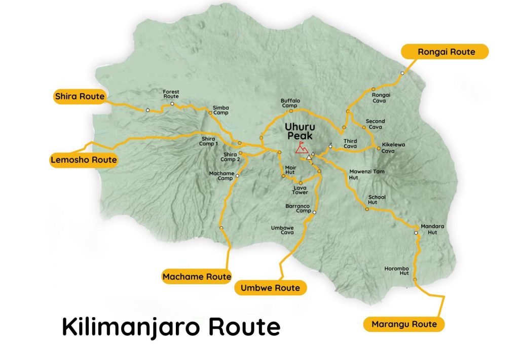
Where Is Uhuru Peak Located?

Uhuru Peak lies within Mount Kilimanjaro National Park in northeastern Tanzania, near the border with Kenya. More specifically, the summit sits on Kibo, the central and highest volcanic cone of Mount Kilimanjaro. The other two cones, Mawenzi and Shira, rise prominently beside Kibo but do not reach the same elevation.

Most climbers begin their journey from one of Kilimanjaro’s established routes, such as Machame, Lemosho, Marangu, Rongai, Umbwe, or the Northern Circuit. From there, they gradually ascend through several ecological zones before reaching the summit area. Eventually, hikers arrive at Stella Point or Gilman’s Point before completing the final stretch to Uhuru Peak.

Furthermore, the summit overlooks glaciers, volcanic landscapes, and vast plains that extend across Tanzania and Kenya. On clear mornings, climbers enjoy some of the most spectacular mountain views in Africa.

Why Is Uhuru Peak Famous?

Uhuru Peak is famous because it represents the highest point in Africa and the ultimate destination on Mount Kilimanjaro. As a result, many travelers include it on their bucket-list adventures and dream of standing at the summit at least once in their lifetime.

Moreover, Uhuru Peak attracts climbers because it does not require technical mountaineering skills. Unlike many of the world’s highest mountains, Kilimanjaro allows determined hikers to reach an extreme altitude through trekking rather than rock climbing. Therefore, both experienced trekkers and motivated beginners can attempt the summit with proper preparation.

Another reason for its popularity is the unforgettable summit experience. Most climbers reach Uhuru Peak shortly after sunrise, when golden light illuminates the glaciers, volcanic crater, and surrounding landscapes. Consequently, many people describe the moment as one of the most emotional and rewarding experiences of their lives.

Finally, Uhuru Peak carries strong cultural significance. The word “Uhuru” means “freedom” in Swahili, symbolizing Tanzania’s independence and national pride. Because of this meaning, the summit stands as both a natural wonder and a powerful national symbol.

How High Is Uhuru Peak?

Uhuru Peak stands at 5,895 meters (19,341 feet) above sea level, making it the highest point on Mount Kilimanjaro and the tallest mountain summit in Africa. Located on Kibo, Kilimanjaro’s highest volcanic cone, Uhuru Peak rises far above the surrounding plains of northern Tanzania. As a result, climbers who reach the summit stand at the highest elevation on the African continent and achieve one of the world’s most celebrated trekking accomplishments.

Uhuru Peak Elevation in Meters and Feet

Uhuru Peak reaches an elevation of 5,895 meters (19,341 feet) above sea level. This remarkable height places it among the world’s most famous mountain summits and makes it the centerpiece of Mount Kilimanjaro National Park.

Because of its elevation, oxygen levels near the summit are significantly lower than at sea level. Consequently, climbers must move slowly and allow their bodies time to acclimatize. In addition, temperatures can drop well below freezing, especially during summit night.

Is Uhuru Peak the Highest Point in Africa?

Yes, Uhuru Peak is the highest point in Africa. No other mountain on the continent reaches a greater elevation. Therefore, climbers who stand at Uhuru Peak can proudly say they have reached the Roof of Africa.
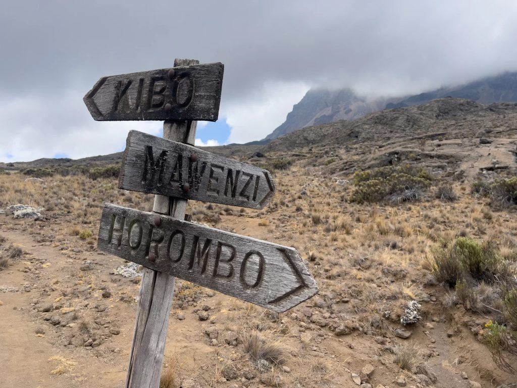
Furthermore, Uhuru Peak forms part of the famous Seven Summits challenge, which includes the highest mountain on each continent. Although Kilimanjaro does not require technical climbing skills, reaching Africa’s highest point remains a major achievement for hikers from around the world.

How It Compares to Other African Peaks

Uhuru Peak stands significantly higher than every other mountain in Africa. While Mount Kenya and the Rwenzori Mountains feature impressive summits, they do not match Kilimanjaro’s elevation.

MountainCountryElevation
Uhuru Peak (Mount Kilimanjaro)Tanzania5,895 m (19,341 ft)
Mount Kenya (Batian Peak)Kenya5,199 m (17,057 ft)
Mount Stanley (Margherita Peak)Uganda/DR Congo5,109 m (16,762 ft)
Mount SpekeUganda4,890 m (16,043 ft)
Mount MeruTanzania4,562 m (14,968 ft)

As the highest mountain summit in Africa, Uhuru Peak rises nearly 700 meters above Mount Kenya, the continent’s second-highest peak. Consequently, Kilimanjaro remains Africa’s most iconic mountain and one of the world’s most popular trekking destinations.

What Does Uhuru Peak Mean?

Uhuru Peak means “Freedom Peak” in Swahili. The word uhuru translates to “freedom” or “independence,” making the summit much more than just the highest point on Mount Kilimanjaro. Today, the name symbolizes Tanzania’s national identity, independence, and aspirations. As a result, reaching Uhuru Peak represents not only a physical achievement but also a connection to an important chapter in the country’s history.

Meaning of “Uhuru”

The word uhuru comes from the Swahili language and means “freedom,” “liberty,” or “independence.” Swahili serves as Tanzania’s national language and plays a central role in the country’s culture and identity.

Because of its powerful meaning, the word appears in many important places, events, and national symbols throughout Tanzania and East Africa. In the case of Mount Kilimanjaro, the name Uhuru Peak reflects the values of freedom, unity, and national pride.

Furthermore, many climbers find the name especially meaningful after completing the challenging journey to the summit. Standing at Africa’s highest point often creates a sense of accomplishment, perseverance, and personal freedom.

Connection to Tanzania’s Independence

The name Uhuru Peak has a direct connection to Tanzania’s independence. On December 9, 1961, Tanganyika gained independence from British colonial rule. This historic event marked the beginning of self-governance and national freedom for the country.

At the same time, leaders wanted Mount Kilimanjaro to serve as a symbol of the new nation’s hopes and achievements. Therefore, they chose the name “Uhuru,” which perfectly captured the spirit of independence and optimism that swept across the country.

In addition, Tanzania’s first president, Julius Nyerere, viewed Kilimanjaro as a powerful national symbol. He famously spoke about bringing a torch to the summit to shine beyond the borders of Tanzania and symbolize friendship, dignity, and freedom.

Why the Summit Was Given This Name

The summit received the name Uhuru Peak to celebrate freedom and honor Tanzania’s independence. Before independence, the highest point on Kilimanjaro carried a different name during the colonial period. However, after Tanganyika became independent, the government renamed the summit to reflect the country’s new identity.

Consequently, Uhuru Peak became a symbol of national pride and achievement. The name transformed Africa’s highest summit into more than a geographical landmark. Instead, it became a place that represents freedom, determination, and the ability to overcome challenges.

Today, thousands of climbers from around the world stand beside the famous Uhuru Peak sign every year. While many come for the adventure, they also experience a location that carries deep historical and cultural significance for Tanzania.

The History of Uhuru Peak

Uhuru Peak has a fascinating history that combines exploration, national identity, and mountaineering achievement. Long before thousands of trekkers began climbing Mount Kilimanjaro each year, the mountain attracted explorers, scientists, and adventurers eager to reach Africa’s highest point. Today, Uhuru Peak stands not only as the summit of Kilimanjaro but also as a symbol of Tanzania’s independence and a major milestone in the global climbing community.

First Successful Ascent

The first recorded successful ascent of Mount Kilimanjaro took place on October 6, 1889. German geographer Hans Meyer and Austrian mountaineer Ludwig Purtscheller reached the highest point of Kibo after several challenging attempts.

At that time, the climb presented many difficulties. The explorers had limited equipment, little knowledge of high-altitude trekking, and few reliable maps. Nevertheless, they persevered and successfully reached the summit, proving that Africa’s highest mountain could be climbed.

Their achievement marked an important moment in mountaineering history. As a result, Mount Kilimanjaro gained international attention and gradually became one of the world’s most sought-after climbing destinations.

The Renaming of the Summit

The summit did not always carry the name Uhuru Peak. During the colonial era, the highest point on Kilimanjaro was known as Kaiser Wilhelm Peak, named after the German emperor.

However, everything changed when Tanganyika gained independence on December 9, 1961. To celebrate freedom and national self-determination, the government renamed the summit Uhuru Peak. The word uhuru means “freedom” in Swahili, making it a powerful symbol of the country’s new future.

Consequently, the new name transformed the summit into more than just a geographical landmark. It became a lasting reminder of Tanzania’s independence, unity, and national pride. Even today, climbers from around the world learn about this history as they stand beside the famous summit sign.

Kilimanjaro’s Place Among the Seven Summits

Kilimanjaro summit view representing Africa’s highest mountain and one of the world’s Seven Summits.

Mount Kilimanjaro holds a special position in the mountaineering world because it forms part of the Seven Summits challenge. This challenge involves climbing the highest mountain on each continent, making it one of the most prestigious goals for adventure seekers.

As Africa’s highest mountain, Kilimanjaro represents the African continent on this famous list. Unlike some of the other Seven Summits, Kilimanjaro does not require advanced technical climbing skills. Therefore, many climbers consider it the most accessible of the Seven Summits and often choose it as their first major high-altitude mountain.

Furthermore, Kilimanjaro’s combination of altitude, scenic beauty, and relative accessibility attracts tens of thousands of climbers every year. Reaching Uhuru Peak allows trekkers to join a select group of people who have stood on the highest point in Africa and completed one of the world’s most iconic mountain adventures.

What Is It Like to Reach Uhuru Peak?

Reaching Uhuru Peak is one of the most rewarding moments on Mount Kilimanjaro. After days of trekking through different climate zones, climbers make a final overnight push to the summit. The experience is physically demanding, but standing at the highest point in Africa makes the effort worthwhile. From the darkness of summit night to the first rays of sunrise and the iconic summit sign, reaching Uhuru Peak is an unforgettable achievement.

Summit Night Experience

Summit night is often considered the toughest part of the Kilimanjaro climb. Most climbers wake up around midnight and begin hiking in darkness under the light of headlamps. Temperatures are extremely cold, and the high altitude makes every step feel more difficult.

The climb is slow and steady as trekkers make their way up steep volcanic slopes toward the crater rim. Guides encourage climbers to follow the “polepole” principle, meaning “slowly, slowly” in Swahili. Although summit night can be physically and mentally challenging, determination and patience help many climbers reach the top.

Sunrise at Uhuru Peak

One of the most memorable moments of the climb is watching the sunrise near or at Uhuru Peak. As darkness fades, the sky begins to glow with shades of orange, pink, and gold. The views stretch across the clouds, glaciers, and vast plains below.

For many climbers, the sunrise is an emotional reward after hours of climbing through the cold night. It creates a sense of accomplishment and offers some of the most spectacular scenery found anywhere in Africa.

The Famous Summit Sign

The Uhuru Peak sign is one of the most photographed landmarks on Mount Kilimanjaro. Located at 5,895 meters (19,341 feet), the sign marks the highest point in Africa and serves as proof of reaching the summit.

Most climbers celebrate by taking photos beside the sign, waving national flags, or sharing the moment with fellow trekkers and guides. Standing next to the sign represents the successful completion of a journey that requires preparation, determination, and perseverance.

How Difficult Is Uhuru Peak?

Reaching Uhuru Peak is challenging, but it does not require technical climbing skills. Most healthy people with proper preparation can reach the summit. The main difficulties come from the long hiking days, cold temperatures, and high altitude rather than steep rock climbing or mountaineering techniques.

Physical Challenge

The climb to Uhuru Peak requires endurance rather than technical ability. Trekkers spend several days walking long distances on mountain trails while gaining elevation. Summit day is especially demanding because climbers may hike for 10 to 15 hours between the ascent and descent.

Good fitness can make the climb more comfortable, but determination and pacing are often more important than athletic ability.

Altitude Challenge

Altitude is the biggest obstacle for most climbers. At nearly 6,000 meters above sea level, oxygen levels are much lower than at sea level. As a result, many people experience symptoms such as headaches, fatigue, shortness of breath, or nausea.

Proper acclimatization is essential because it allows the body to adjust gradually to the reduced oxygen levels.

Why Most Climbers Struggle Near the Summit

Most climbers struggle near the summit because this is where the altitude is highest and oxygen is at its lowest. The combination of exhaustion, freezing temperatures, and thin air can make even simple movements feel difficult.

This is why experienced guides recommend choosing longer routes that provide more acclimatization time. Climbers who move slowly, stay hydrated, and follow their guide’s advice generally have a better chance of reaching Uhuru Peak successfully.

Stella Point vs Uhuru Peak

Stella Point and Uhuru Peak locations on Mount Kilimanjaro summit route showing final climbing stages.

Many Kilimanjaro climbers reach Stella Point before continuing to Uhuru Peak, which often creates confusion about the mountain’s true summit. While both locations are important milestones on the climb, they are not the same. Understanding the differences helps climbers know exactly what to expect on summit day.

Key Differences

Stella Point is located on the crater rim of Mount Kilimanjaro at an elevation of approximately 5,756 meters (18,885 feet). It serves as a major checkpoint for climbers ascending from the southern routes.

Uhuru Peak, on the other hand, stands at 5,895 meters (19,341 feet) and is the highest point on Mount Kilimanjaro and in Africa. Reaching Stella Point is a significant achievement, but climbers must continue farther along the crater rim to officially reach Uhuru Peak.

Distance Between Stella Point and Uhuru Peak

The distance between Stella Point and Uhuru Peak is approximately 1 kilometer (0.6 miles). Although the distance may seem short, the high altitude makes this section feel more challenging than expected.

Most climbers take between 45 minutes and 1 hour to walk from Stella Point to Uhuru Peak, depending on their pace, weather conditions, and physical condition. The trail follows the crater rim and offers impressive views of glaciers and the surrounding landscape.

Which One Counts as the Summit?

Uhuru Peak is the official summit of Mount Kilimanjaro. Climbers who reach Uhuru Peak have reached the highest point on the mountain and the highest point in Africa.

Stella Point is considered an important milestone but not the final summit. While reaching Stella Point is a major accomplishment, most climbers continue to Uhuru Peak to complete their Kilimanjaro journey and stand at the true Roof of Africa.
Which Routes Reach Uhuru Peak?

All official Kilimanjaro climbing routes lead to Uhuru Peak, but each route offers a different experience in terms of scenery, duration, acclimatization, and difficulty. Choosing the right route can have a significant impact on comfort and summit success.

Machame Route

The Machame Route is one of the most popular routes on Kilimanjaro. Known for its beautiful scenery and excellent acclimatization profile, it approaches the summit from the south and reaches Uhuru Peak via Stella Point. Most climbers complete this route in six to seven days.

Lemosho Route

The Lemosho Route is widely regarded as one of the best routes for reaching Uhuru Peak. It offers stunning landscapes, fewer crowds during the early stages, and excellent acclimatization opportunities. The route usually takes seven to eight days, giving climbers a strong chance of reaching the summit successfully.

Marangu Route

The Marangu Route is often called the “Coca-Cola Route” and is unique because climbers sleep in mountain huts rather than tents. It is one of the oldest routes on Kilimanjaro and reaches Uhuru Peak via Gilman’s Point and the crater rim.

Rongai Route

The Rongai Route approaches Kilimanjaro from the northern side near the Kenyan border. It receives less rainfall than the southern routes, making it a good option during wetter months. The route offers a quieter trekking experience and eventually joins the summit path leading to Uhuru Peak.

Northern Circuit Route

The Northern Circuit Route is the longest route on Kilimanjaro and offers some of the highest summit success rates. Its extended itinerary allows excellent acclimatization while providing access to remote areas of the mountain before reaching Uhuru Peak.

Umbwe Route

The Umbwe Route is the steepest and most challenging route on Kilimanjaro. It is best suited for experienced hikers due to its rapid ascent and limited acclimatization opportunities. Despite its difficulty, the route ultimately leads climbers to Uhuru Peak through the southern approach.

How Long Does It Take to Reach Uhuru Peak?

The time required to reach Uhuru Peak depends on the route you choose, your pace, weather conditions, and how well your body adapts to high altitude. Most climbers spend between five and nine days on Mount Kilimanjaro before reaching the summit. Longer itineraries generally provide better acclimatization and increase the chances of a successful summit.

Summit Day Timeline

Summit day usually begins around midnight from the final high-altitude camp. Climbers leave camp in darkness and slowly make their way toward the crater rim. Depending on the route, reaching Stella Point or Gilman’s Point typically takes between five and eight hours.

After reaching the crater rim, climbers continue to Uhuru Peak, which often takes an additional 45 minutes to 2 hours. Following time at the summit, trekkers descend back to a lower camp for rest. In total, summit day can last between 10 and 15 hours, making it the longest and most demanding day of the climb.

Average Hiking Times

The total time needed to reach Uhuru Peak varies by route:

  • Marangu Route: Usually 5-6 days
  • Machame Route: Usually 6-7 days
  • Rongai Route: Usually 6-7 days
  • Lemosho Route: Usually 7-8 days
  • Northern Circuit Route: Usually 8-9 days
  • Umbwe Route: Usually 5-6 days

While shorter routes may seem appealing, they provide less time for acclimatization and often have lower summit success rates.

Factors That Affect Success

Several factors influence how long it takes to reach Uhuru Peak and whether a climber successfully reaches the summit. The most important factor is acclimatization. Climbers who spend more days on the mountain generally adapt better to altitude and have a higher chance of success.

Physical fitness also plays a role, although endurance and determination are often more important than speed. Weather conditions, route selection, hydration, and following the guide’s pace can all affect progress on the mountain.

Many experienced guides recommend choosing a longer route and maintaining a slow, steady pace. This approach gives the body more time to adjust to altitude and greatly improves the chances of standing on Uhuru Peak.

Weather and Temperature at Uhuru Peak

Weather at Uhuru Peak is very different from the conditions experienced at the base of Mount Kilimanjaro. As climbers gain elevation, temperatures drop significantly and weather becomes more extreme. The summit sits in an arctic zone where freezing temperatures, strong winds, and low oxygen levels are common throughout the year.

How Cold Does It Get?

Uhuru Peak is one of the coldest places in Africa due to its high elevation of 5,895 meters (19,341 feet). During summit night, temperatures typically range between -7°C and -20°C (19°F to -4°F), depending on the season and weather conditions.

Strong winds can make the temperature feel even colder. Most climbers begin their summit attempt around midnight, which means they experience the coldest part of the day. Proper clothing and layering are essential to stay warm and comfortable during the final ascent.

Best Time to Climb

The best time to climb Uhuru Peak is during Kilimanjaro’s dry seasons, which occur from January to March and June to October. These months generally offer clearer skies, lower rainfall, and better trail conditions.

Many climbers prefer January, February, July, August, and September because weather conditions are more stable and visibility is often excellent. Although it is possible to reach Uhuru Peak during the rainy seasons, wet trails, clouds, and changing weather can make the climb more challenging.

What to Wear at the Summit

Dressing properly for summit day is essential because temperatures can be well below freezing. Climbers should wear several layers to stay warm while allowing flexibility as conditions change.

A typical summit clothing system includes a moisture-wicking base layer, an insulating fleece or down jacket, and a waterproof outer shell. Warm gloves, thermal socks, insulated trousers, and a winter hat are also highly recommended.

Many climbers also use a neck gaiter or balaclava to protect their face from cold winds. Wearing the right clothing can make the difference between an enjoyable summit experience and a very uncomfortable one.

Tips for Reaching Uhuru Peak Successfully

Reaching Uhuru Peak is achievable for many climbers, but success depends on proper preparation and smart decisions on the mountain. While fitness is important, factors such as acclimatization, pacing, and hydration often play a bigger role in determining whether you reach the summit. The following tips can significantly improve your chances of standing on the highest point in Africa.

Choose a Longer Route

One of the best ways to increase your summit success rate is to choose a longer route. Routes such as the Lemosho Route and Northern Circuit Route give climbers more time to adjust to the altitude. Extra days on the mountain allow the body to acclimatize gradually, reducing the risk of altitude sickness and improving the likelihood of reaching Uhuru Peak.

Although longer routes require more time and a larger budget, they generally offer higher success rates than shorter itineraries.

Acclimatize Properly

Acclimatization is the process of allowing your body to adapt to lower oxygen levels at higher elevations. Poor acclimatization is one of the main reasons climbers fail to reach the summit.

Choosing a route with enough acclimatization days, ascending gradually, and listening to your guide’s advice can help your body adjust effectively. If symptoms of altitude sickness become severe, descending is often the safest option.

Follow the Polepole Principle

“Polepole” is a Swahili word that means “slowly, slowly.” It is one of the most important principles on Mount Kilimanjaro and is frequently repeated by local guides.

Many climbers make the mistake of walking too fast during the early days of the trek. Moving at a slow and steady pace helps conserve energy, improves acclimatization, and reduces stress on the body. Climbers who follow the polepole approach often feel stronger during summit day and have a better chance of reaching Uhuru Peak.

Stay Hydrated

Staying hydrated is essential when climbing at high altitude. The body loses fluids more quickly due to increased breathing, physical exertion, and dry mountain air. Dehydration can worsen the symptoms of altitude sickness and reduce overall performance.

Most guides recommend drinking several liters of water each day throughout the climb. Regular hydration helps maintain energy levels, supports acclimatization, and improves overall comfort on the mountain. Combined with proper nutrition and rest, it is an important part of a successful Kilimanjaro summit attempt.

10 Interesting Facts About Uhuru Peak

1. Uhuru Peak Is the Highest Point in Africa

Uhuru Peak stands at 5,895 meters (19,341 feet) above sea level, making it the highest point on the African continent. It is located on Mount Kilimanjaro in Tanzania and attracts climbers from around the world.

2. The Name “Uhuru” Means Freedom

The word “Uhuru” means “freedom” in Swahili. The summit was named to celebrate Tanzania’s independence and remains a powerful national symbol.

3. It Is One of the World’s Most Famous Trekking Summits

Unlike many high mountains that require technical climbing skills, Uhuru Peak can be reached by trekking. This makes it one of the most accessible high-altitude summits in the world.

4. No Technical Climbing Skills Are Required

Climbers do not need ropes, ice axes, or mountaineering experience to reach Uhuru Peak. Success depends more on fitness, determination, and proper acclimatization.

5. Mount Kilimanjaro Is Part of the Seven Summits

Mount Kilimanjaro is Africa’s representative in the Seven Summits challenge, which involves climbing the highest mountain on each continent. Reaching Uhuru Peak completes the African portion of this challenge.

6. Uhuru Peak Sits on Kibo Volcano

The summit is located on Kibo, the highest of Kilimanjaro’s three volcanic cones. The other two cones are Mawenzi and Shira.

7. Most Climbers Reach the Summit at Sunrise

Many summit attempts begin around midnight so climbers can reach Uhuru Peak shortly after sunrise. The views at dawn are often considered the highlight of the entire climb.

8. Temperatures Can Drop Well Below Freezing

Despite being close to the equator, Uhuru Peak experiences extremely cold temperatures. During summit night, temperatures can fall below -10°C (14°F), especially when strong winds are present.

9. The Summit Sign Is a World-Famous Landmark

The Uhuru Peak sign marks the highest point in Africa and is one of the most photographed locations on Mount Kilimanjaro. Reaching the sign is a memorable achievement for every climber.

10. The Summit Offers Incredible Views

On clear days, climbers can enjoy panoramic views of glaciers, volcanic landscapes, and the vast plains surrounding Kilimanjaro. The scenery from Uhuru Peak is one of the reasons the mountain is famous worldwide.

Frequently Asked Questions About Uhuru Peak

What is Uhuru Peak?

Uhuru Peak is the highest point on Mount Kilimanjaro and the highest point in Africa. Located on the Kibo volcanic cone, it stands at an elevation of 5,895 meters (19,341 feet) above sea level. Reaching Uhuru Peak is the main goal for most Kilimanjaro climbers.

How high is Uhuru Peak?

Uhuru Peak rises to 5,895 meters (19,341 feet) above sea level. This elevation makes it not only the highest point in Tanzania but also the highest mountain summit on the African continent.

Can beginners reach Uhuru Peak?

Yes, beginners can reach Uhuru Peak if they prepare properly and choose an appropriate route. No technical climbing skills are required, but climbers should have a reasonable level of fitness and allow enough time for acclimatization. Longer routes such as Lemosho and Northern Circuit are often recommended for first-time climbers.

How cold is Uhuru Peak?

Temperatures at Uhuru Peak are typically below freezing, especially during summit night. Conditions often range between -7°C and -20°C (19°F to -4°F), depending on the season and weather. Wind chill can make it feel even colder.

What is the success rate?

The success rate for reaching Uhuru Peak varies depending on the route and number of climbing days. Longer routes generally have higher success rates because they provide better acclimatization. Climbers who choose routes lasting seven days or more often have a significantly better chance of reaching the summit.

Is Uhuru Peak one of the Seven Summits?

Yes. Uhuru Peak on Mount Kilimanjaro is the highest mountain summit in Africa and is included in the Seven Summits challenge. This challenge involves climbing the highest peak on each continent.

How far is Stella Point from Uhuru Peak?

Stella Point is located approximately 1 kilometer (0.6 miles) from Uhuru Peak along the crater rim. Most climbers take between 45 minutes and 1 hour to walk from Stella Point to the true summit, depending on weather conditions and their physical condition.

Final Thoughts: Why Reaching Uhuru Peak Is a Life-Changing Experience

Reaching Uhuru Peak is much more than standing on the highest point in Africa. It is a journey that tests determination, patience, and perseverance while rewarding climbers with unforgettable views and a deep sense of achievement. From the challenging summit night to the breathtaking sunrise above the clouds, every step toward the peak becomes part of a remarkable adventure.

What makes Uhuru Peak truly special is that it is accessible to people from many backgrounds and experience levels. With proper preparation, the right route, and enough time to acclimatize, thousands of climbers successfully reach the summit each year. The experience proves that extraordinary goals can be achieved through steady progress and determination.

Whether you are planning your first Kilimanjaro trek or simply dreaming about the adventure, standing beside the famous Uhuru Peak sign is a moment that stays with you for a lifetime. It represents the culmination of days of effort and the satisfaction of reaching the Roof of Africa. For many climbers, reaching Uhuru Peak is not just a mountain summit-it is a personal milestone and one of the most memorable experiences of their lives.
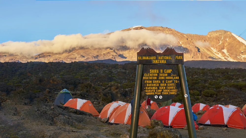
Read Also:

Mount Kilimanjaro summit with trekkers enjoying sunrise views above the clouds in Tanzania.

Mount Kenya vs Mount Kilimanjaro

Mount Kenya vs Kilimanjaro: What’s the Difference?

Estimated reading time: 32 minutes

Mount Kenya vs Kilimanjaro is a common comparison for trekkers choosing between two of Africa’s most famous mountains. While Mount Kenya offers a more technical climbing experience with rugged peaks, Kilimanjaro is Africa’s highest mountain and a more accessible trekking destination. Both mountains provide unforgettable adventures, but they appeal to different types of hikers based on experience, fitness, and climbing goals. This guide explains the main differences between Mount Kenya and Kilimanjaro, including height, difficulty, routes, scenery, and which mountain is better for your adventure. The main difference between Mount Kenya and Kilimanjaro is that Kilimanjaro is a higher, non-technical trekking mountain, while Mount Kenya offers a more technical climbing experience on its highest peaks. At 5,895 meters (19,341 feet), Kilimanjaro is Africa’s tallest mountain and one of the Seven Summits, whereas Mount Kenya reaches 5,199 meters (17,057 feet) at Batian Peak. Kilimanjaro is better suited for first-time high-altitude trekkers, while Mount Kenya appeals to climbers seeking a quieter and more challenging adventure.

Mount Kenya vs Kilimanjaro: Quick Comparison

If you want to stand on Africa’s highest mountain, choose Kilimanjaro. If you prefer a less crowded adventure with more technical climbing opportunities, choose Mount Kenya. Kilimanjaro rises to 5,895 meters (19,341 feet), making it the tallest mountain in Africa and one of the Seven Summits. Mount Kenya reaches 5,199 meters (17,057 feet) and offers rugged landscapes, dramatic peaks, and a quieter trekking experience.

Key Differences at a Glance

The biggest difference between Mount Kenya and Kilimanjaro lies in the climbing experience. Kilimanjaro is a non-technical trek that allows hikers to reach the summit without climbing equipment. Mount Kenya’s highest peaks, Batian and Nelion, require technical rock climbing skills, while Point Lenana remains accessible to trekkers. Kilimanjaro attracts more climbers, offers more route options, and provides the achievement of reaching Africa’s highest point.

Mount Kenya vs Kilimanjaro Comparison Table

FeatureMount KenyaKilimanjaro
CountryKenyaTanzania
Highest PointBatian (5,199m)Uhuru Peak (5,895m)
Mountain TypeExtinct StratovolcanoDormant Volcano
Technical ClimbingYes (Batian & Nelion)No
Trek Duration4-6 Days5-9 Days
DifficultyTechnical ClimbingHigh Altitude Trekking
CostLowerHigher
PopularityModerateVery High
UNESCO StatusYesYes
Seven SummitsNoYes

Which Mountain Is Right for You?

Choose Kilimanjaro if you want to climb Africa’s highest mountain, complete a Seven Summits challenge, or experience a high-altitude trek without technical climbing. Choose Mount Kenya if you enjoy quieter trails, diverse landscapes, and the option of tackling technical peaks. For most first-time mountain trekkers, Kilimanjaro offers the more accessible and rewarding summit experience.

What Is the Main Difference Between Mount Kenya and Kilimanjaro?

The main difference between Mount Kenya and Kilimanjaro lies in their height, climbing style, and overall trekking experience. Kilimanjaro stands as Africa’s highest mountain at 5,895 meters (19,341 feet) and allows trekkers to reach the summit without technical climbing skills. Mount Kenya, Africa’s second-highest mountain, rises to 5,199 meters (17,057 feet) and features rugged peaks that require technical climbing to reach the highest summits. While Kilimanjaro attracts climbers seeking the challenge of standing on Africa’s highest point, Mount Kenya appeals to adventurers looking for quieter trails and more diverse mountain terrain.

Mount Kenya Overview

Mount Kenya rises above the surrounding landscape with rugged peaks, glaciers, and alpine vegetation.

Mount Kenya sits in central Kenya, about 150 kilometers (93 miles) northeast of Nairobi. This extinct stratovolcano features several peaks, with Batian and Nelion forming the highest and most challenging summits. Most trekkers aim for Point Lenana, a non-technical peak that reaches 4,985 meters (16,355 feet). The mountain offers dramatic landscapes, alpine lakes, deep valleys, and abundant wildlife, making it one of East Africa’s most scenic trekking destinations.

Kilimanjaro Overview

Mount Kilimanjaro rises in northern Tanzania near the Kenyan border and dominates the surrounding plains as the world’s tallest free-standing mountain. Its highest point, Uhuru Peak, sits on Kibo, the largest of Kilimanjaro’s three volcanic cones. Unlike Mount Kenya, Kilimanjaro does not require technical climbing skills, allowing thousands of trekkers to reach the summit each year. Climbers pass through five distinct climate zones, from rainforest to arctic conditions, during the ascent.

The Biggest Differences Explained

Several key differences separate Mount Kenya from Kilimanjaro. Kilimanjaro stands nearly 700 meters (2,300 feet) higher, making altitude the biggest challenge for climbers. Mount Kenya offers a more technical and rugged mountain environment, especially for those attempting Batian or Nelion. Kilimanjaro attracts significantly more visitors because it forms part of the Seven Summits challenge and does not require mountaineering experience. Mount Kenya, meanwhile, provides a quieter and less crowded adventure with excellent opportunities for wildlife viewing and technical climbing. For most first-time trekkers, Kilimanjaro offers the more accessible summit experience, while Mount Kenya rewards climbers seeking greater variety and solitude.

Where Are Mount Kenya and Kilimanjaro Located?

Mount Kenya and Mount Kilimanjaro stand in East Africa, but they lie in different countries. Both mountains attract climbers from around the world and offer unique trekking experiences. Understanding their locations helps travelers plan their adventures and appreciate the landscapes that surround these famous peaks.

Location of Mount Kenya

Mount Kenya rises in central Kenya, about 150 kilometers (93 miles) northeast of Nairobi. The mountain sits inside Mount Kenya National Park, a UNESCO World Heritage Site known for its forests, wildlife, and stunning alpine scenery.

As Kenya’s highest mountain, Mount Kenya dominates the surrounding landscape. Several towns, including Nanyuki and Chogoria, serve as popular starting points for climbing expeditions. The mountain lies almost directly on the Equator, which creates unique weather patterns and ecosystems at different elevations.

Location of Mount Kilimanjaro

Mount Kilimanjaro stands in northeastern Tanzania near the border with Kenya. The mountain lies within Kilimanjaro National Park and rises above the plains surrounding the city of Moshi.

Kilimanjaro is Africa’s highest mountain and the world’s tallest free-standing mountain. Like Mount Kenya, it sits close to the Equator. Despite its tropical location, snow and ice often cover parts of the summit. Most climbers begin their journey from Moshi or Arusha before heading to one of Kilimanjaro’s trekking routes.

Distance Between Mount Kenya and Kilimanjaro

Mount Kenya and Kilimanjaro sit approximately 320 kilometers (200 miles) apart in a straight line. The driving distance is longer and depends on the route and border crossing used during the journey.

Because the mountains are relatively close, many travelers combine both climbs into a single East African adventure. This combination allows trekkers to experience two of Africa’s most famous peaks in one trip.

Can You See Kilimanjaro From Mount Kenya?

On exceptionally clear days, some people report seeing Mount Kilimanjaro from the higher slopes of Mount Kenya. However, the long distance, weather conditions, and surrounding terrain often limit visibility.

Most visitors should not expect to see Kilimanjaro from Mount Kenya during their climb. If conditions are perfect, distant views may be possible from high elevations, but they remain rare. The best way to enjoy each mountain is to visit and experience its unique landscapes firsthand.

Height and Summit Comparison

One of the biggest differences between Mount Kenya and Kilimanjaro is their height. Both mountains rank among Africa’s most famous peaks, but Kilimanjaro rises significantly higher. They also differ in the number and type of summits they offer. Understanding these differences can help climbers choose the mountain that best matches their goals and experience level.

How High Is Mount Kenya?

Mount Kenya reaches an elevation of 5,199 meters (17,057 feet) above sea level. It is the second-highest mountain in Africa after Kilimanjaro.

The mountain features several peaks, with Batian standing as the highest point. Many trekkers aim for Point Lenana, which reaches 4,985 meters (16,355 feet). Point Lenana does not require technical climbing skills, making it the most popular summit for hikers.

How High Is Kilimanjaro?

Mount Kilimanjaro rises to 5,895 meters (19,341 feet) above sea level at Uhuru Peak. This makes it the highest mountain in Africa and the tallest free-standing mountain in the world.

Unlike Mount Kenya, Kilimanjaro allows climbers to reach its highest summit through trekking rather than technical rock climbing. Thousands of people successfully reach Uhuru Peak every year using one of the mountain’s established routes.

Mount Kenya’s Main Peaks: Batian, Nelion, and Point Lenana

Mount Kenya has three well-known peaks, each offering a different climbing experience.

Batian (5,199 meters / 17,057 feet) is the highest peak on the mountain. Reaching Batian requires technical rock climbing skills and experience.

Nelion (5,188 meters / 17,021 feet) is the second-highest peak. Climbers also need technical climbing equipment and advanced mountaineering knowledge to reach this summit.

Point Lenana (4,985 meters / 16,355 feet) is the most accessible peak. Trekkers can reach it without technical climbing, making it the preferred choice for most visitors.

Kilimanjaro’s Volcanic Peaks: Kibo, Mawenzi, and Shira

Mount Kilimanjaro consists of three volcanic cones that formed over thousands of years.

Kibo is the highest and youngest cone. It contains Uhuru Peak, the highest point in Africa at 5,895 meters (19,341 feet).

Mawenzi rises to 5,149 meters (16,893 feet). Its rugged terrain and steep rock formations make it difficult to climb, and only experienced mountaineers attempt its summit.

Shira is the oldest cone and has largely collapsed over time. Today, it forms the Shira Plateau, a beautiful high-altitude area crossed by several Kilimanjaro routes.

Which Mountain Is Higher?

Kilimanjaro is significantly higher than Mount Kenya. At 5,895 meters (19,341 feet), Kilimanjaro stands about 696 meters (2,284 feet) taller than Mount Kenya’s highest peak, Batian.

This extra elevation makes Kilimanjaro a greater altitude challenge. Climbers often face stronger effects of altitude sickness as they approach the summit. However, Kilimanjaro’s highest point remains accessible through trekking, while Mount Kenya’s highest peaks require technical climbing skills.

For climbers who want to stand on Africa’s highest mountain, Kilimanjaro is the clear winner. For those seeking a mix of trekking and mountaineering challenges, Mount Kenya offers a unique and rewarding experience.

Which Mountain Is Harder to Climb?

Many climbers ask whether Mount Kenya or Kilimanjaro is harder to climb. The answer depends on what type of challenge you consider most difficult. Mount Kenya demands more technical climbing skills on its highest peaks, while Kilimanjaro presents a greater altitude challenge. Comparing both mountains can help you understand which climb best matches your experience and fitness level.

Technical Difficulty Comparison

Mount Kenya is more technically challenging than Kilimanjaro. Reaching its highest peaks, Batian and Nelion, requires rock-climbing skills, specialized equipment, and mountaineering experience. Climbers must navigate steep rock faces and exposed sections that demand confidence and technical ability.

Kilimanjaro does not require technical climbing on any of its standard routes. Climbers walk to the summit using well-established trails. Because of this, many first-time trekkers choose Kilimanjaro as their introduction to high-altitude mountain climbing.

Altitude Challenge Comparison

Kilimanjaro presents a greater altitude challenge because it rises much higher than Mount Kenya. At 5,895 meters (19,341 feet), Kilimanjaro exposes climbers to thinner air and lower oxygen levels.

Many trekkers find the final summit push physically demanding due to the altitude. Even fit climbers can experience symptoms of altitude sickness if they do not acclimatize properly.

Mount Kenya also reaches a significant elevation, especially at Point Lenana and the higher technical peaks. However, its lower altitude generally reduces the risk of severe altitude-related problems compared to Kilimanjaro.

Physical Fitness Requirements

Both mountains require good physical fitness, but the demands differ.

Kilimanjaro requires endurance for long trekking days and the ability to handle high altitude. Climbers often spend several consecutive days hiking uphill before reaching the summit.

Mount Kenya requires strong fitness as well, especially for technical climbers aiming for Batian or Nelion. Trekkers heading to Point Lenana need stamina for steep trails, but they do not face the same altitude challenge as those climbing Kilimanjaro.

In either case, regular hiking, cardio training, and strength exercises can improve your chances of a successful climb.

Which Mountain Is More Difficult Overall?

For most trekkers, Kilimanjaro feels more difficult because of its extreme altitude. Reaching nearly 6,000 meters challenges even experienced hikers and makes acclimatization a critical part of success.

However, for experienced mountaineers, Mount Kenya’s highest peaks present a greater technical challenge. Batian and Nelion require climbing skills that Kilimanjaro’s trekking routes do not.

If you compare the most popular trekking summits Point Lenana on Mount Kenya and Uhuru Peak on Kilimanjaro Kilimanjaro is generally the harder climb due to its higher elevation and increased risk of altitude sickness. If you compare the highest peaks on both mountains, Mount Kenya offers the more technical and demanding mountaineering experience.

Climbing Routes Comparison

The routes you choose can greatly affect your climbing experience. Mount Kenya and Kilimanjaro both offer several routes, but they differ in scenery, difficulty, and overall trekking style. Understanding the available options can help you select the mountain that best suits your goals and experience level.

Mount Kenya has several well-established routes that lead to Point Lenana and the mountain’s higher peaks.

Sirimon Route is the most popular route. It offers gradual elevation gain, beautiful scenery, and excellent opportunities for acclimatization. Many climbers choose this route for both ascent and descent.

Chogoria Route is often considered the most scenic. It passes stunning features such as lakes, waterfalls, and dramatic valleys. Many trekkers use this route for descent after ascending via Sirimon.

Naro Moru Route provides the shortest and fastest path to Point Lenana. However, it is steeper and offers less time for acclimatization, making it more challenging for some climbers.

Kilimanjaro offers several trekking routes, each with its own advantages.

Machame Route is one of the most popular choices. It provides excellent scenery, good acclimatization opportunities, and a high summit success rate.

Lemosho Route offers a longer trek with beautiful landscapes and fewer crowds during the early stages. Many guides consider it one of the best routes for acclimatization.

Marangu Route is famous for its mountain huts and shorter itinerary. Because of its direct approach, it often has lower summit success rates than longer routes.

Rongai Route approaches the mountain from the northern side near the Kenyan border. It usually sees fewer climbers and offers a quieter trekking experience.

Route Difficulty Comparison

Mount Kenya routes vary in difficulty, but most trekkers can reach Point Lenana without technical climbing. The main challenges include steep trails, changing weather, and moderate altitude.

Kilimanjaro routes do not require technical climbing, but they involve more days at high altitude. Climbers must manage longer trekking distances and a greater risk of altitude sickness.

In general, Kilimanjaro routes challenge trekkers more with elevation, while Mount Kenya routes challenge them more with terrain and steep sections.

Which Mountain Offers Better Route Options?

Both mountains offer excellent route choices, but Kilimanjaro provides more variety for most trekkers. Climbers can choose from several routes that differ in length, scenery, crowd levels, and acclimatization profiles.

Mount Kenya offers fewer trekking routes, but many hikers appreciate its quieter trails and diverse landscapes. The combination of trekking routes and technical climbing options also appeals to experienced mountaineers.

If you want a wider selection of trekking routes and a better chance to customize your climb, Kilimanjaro offers more options. If you prefer fewer crowds and a more rugged mountain experience, Mount Kenya may be the better choice.

Altitude and Acclimatization Comparison

Altitude plays a major role in the difficulty of any mountain climb. As you gain elevation, the air contains less oxygen, making it harder for your body to perform. Both Mount Kenya and Kilimanjaro reach heights where altitude sickness can occur, but the risk and acclimatization requirements differ significantly between the two mountains.

Altitude Profile of Mount Kenya

Mount Kenya rises to 5,199 meters (17,057 feet), with most trekkers aiming for Point Lenana at 4,985 meters (16,355 feet). Climbers usually spend several days ascending through different vegetation zones, from forest and moorland to alpine terrain.

The mountain’s routes allow for gradual altitude gain, which helps many trekkers adjust to the thinner air. While altitude can still affect climbers, the lower trekking summit compared to Kilimanjaro generally reduces the overall challenge.

Altitude Profile of Kilimanjaro

Mount Kilimanjaro reaches 5,895 meters (19,341 feet) at Uhuru Peak, making it nearly 700 meters higher than Mount Kenya’s highest peak. Climbers pass through several ecological zones, including rainforest, moorland, alpine desert, and the arctic summit zone.

Because Kilimanjaro rises so high, trekkers spend more time at extreme elevations. The final summit push often takes place above 5,000 meters, where oxygen levels are significantly lower than at sea level.

Risk of Altitude Sickness

Altitude sickness can affect climbers on both mountains, regardless of age or fitness level. Common symptoms include headaches, nausea, dizziness, fatigue, and shortness of breath.

The risk is generally higher on Kilimanjaro because of its greater elevation. Many climbers begin to feel the effects of altitude as they approach the summit. Longer routes with more acclimatization days often improve summit success rates and reduce the likelihood of serious altitude-related problems.

Mount Kenya also presents an altitude challenge, especially near Point Lenana and the higher technical peaks. However, most trekkers face a lower risk compared to those climbing Kilimanjaro.

Which Mountain Requires Better Acclimatization?

Kilimanjaro requires more careful acclimatization than Mount Kenya. Its higher elevation places greater stress on the body and increases the chance of altitude sickness.

Climbers on Kilimanjaro benefit from choosing longer routes such as Lemosho or the Northern Circuit, which provide additional days for adjustment. Following the principle of “climb high, sleep low” also helps the body adapt more effectively.

Mount Kenya still requires proper acclimatization, but its lower trekking altitude makes the process slightly easier for most hikers. For this reason, Kilimanjaro demands a stronger focus on acclimatization and altitude management to achieve a successful summit.

Scenery Comparison

Both Mount Kenya and Kilimanjaro offer breathtaking scenery, but the landscapes differ in several ways. From lush rainforests and giant plants to rocky peaks and glaciers, each mountain provides a unique visual experience. The best choice depends on the type of scenery you enjoy most.

Rainforest and Lower Slopes

The lower slopes of both mountains feature rich forests filled with wildlife and diverse plant species.

Mount Kenya’s forests contain bamboo zones, giant trees, waterfalls, and a variety of wildlife, including monkeys, buffaloes, and elephants. The landscape feels wild and untouched, giving trekkers a strong sense of adventure.

Kilimanjaro’s rainforest is also impressive. Climbers often spot blue monkeys, colobus monkeys, and colorful birds along the trail. Dense vegetation covers the lower slopes, creating a dramatic contrast with the barren summit far above.

Moorlands and Alpine Zones

As climbers gain altitude, both mountains reveal some of East Africa’s most remarkable alpine scenery.

Mount Kenya is famous for its beautiful valleys, alpine lakes, rocky ridges, and unique plants such as giant lobelias and giant groundsels. The landscape feels diverse and changes constantly throughout the climb.

Kilimanjaro’s moorland zone features giant groundsels, heather, and wide-open views. Higher up, the terrain changes into a vast alpine desert with volcanic rocks and dramatic mountain vistas. The scenery becomes more rugged as climbers approach the summit.

Glaciers and Summit Landscapes

The summit areas of the two mountains look very different.

Mount Kenya’s highest peaks feature sharp rocky spires, steep cliffs, and dramatic mountain scenery. The remaining glaciers have shrunk significantly over the years, but the rugged summit still attracts climbers seeking a true alpine environment.

Kilimanjaro offers a completely different experience. Near Uhuru Peak, climbers encounter massive ice fields, glaciers, and a striking arctic landscape. Standing above the clouds beside ancient glaciers creates one of the most memorable summit experiences in the world.

Which Mountain Has Better Views?

Choosing a winner depends on personal preference.

Mount Kenya offers more varied scenery, including lakes, valleys, forests, rocky peaks, and unique alpine vegetation. Many hikers appreciate the constant changes in landscape throughout the trek.

Kilimanjaro delivers bigger and more dramatic views. Its immense height provides sweeping panoramas across the plains of Tanzania, while the glaciers near the summit create a truly iconic setting.

If you prefer diverse mountain scenery and rugged alpine landscapes, Mount Kenya may have the better views. If you dream of standing above the clouds on Africa’s highest mountain surrounded by glaciers, Kilimanjaro is hard to beat.

Wildlife Comparison

Both Mount Kenya and Kilimanjaro support a variety of wildlife, especially in their lower forests and moorland zones. However, the wildlife experience differs between the two mountains. While climbers should not expect a traditional safari on either peak, they can still encounter fascinating animals and birds during their trek.

Wildlife on Mount Kenya

Small alpine plants growing on Mount Kenya with rugged mountain peaks rising in the background.

Mount Kenya is one of the best mountains in Africa for wildlife viewing. Its forests provide habitat for a wide range of animals, including elephants, buffaloes, bushbucks, giant forest hogs, and several monkey species.

Birdwatchers also enjoy Mount Kenya because the mountain supports hundreds of bird species. Colorful sunbirds, eagles, and other highland birds often appear along the trails.

Many climbers spot wildlife while hiking through the lower slopes and forest zones. Because Mount Kenya National Park protects a large area of natural habitat, animals thrive throughout the region.

Wildlife on Kilimanjaro

Kilimanjaro also supports diverse wildlife, particularly in its rainforest zone. Climbers often see blue monkeys, black-and-white colobus monkeys, and a variety of bird species during the first days of their trek.

Larger animals such as elephants, buffaloes, and leopards live on the mountain, but visitors rarely encounter them because they tend to stay away from busy trekking routes.

As climbers move into the higher moorland, alpine desert, and summit zones, wildlife becomes less common due to the harsh conditions and limited vegetation.

Best Mountain for Wildlife Encounters

Mount Kenya generally offers better wildlife viewing opportunities than Kilimanjaro. Its extensive forests, lower visitor numbers, and rich ecosystems support a greater variety of visible animals and birds.

Kilimanjaro provides some wildlife encounters, especially in the rainforest, but most climbers focus on reaching the summit rather than observing animals.

If wildlife is a major part of your adventure, Mount Kenya is the stronger choice. If your main goal is to climb Africa’s highest mountain, Kilimanjaro remains the more iconic trekking destination. Many travelers combine a Kilimanjaro climb with a Tanzanian safari to enjoy both world-class trekking and exceptional wildlife viewing.

Success Rates Comparison

Reaching the summit is the main goal for most climbers, but success depends on several factors, including fitness, altitude adaptation, route choice, and weather conditions. Mount Kenya and Kilimanjaro have different success rates because they present different challenges.

Mount Kenya Summit Success Rates

For trekkers aiming for Point Lenana, Mount Kenya offers a relatively high summit success rate. Many hikers who prepare properly and follow a suitable itinerary reach the summit without major difficulties.

At 4,985 meters (16,355 feet), Point Lenana sits lower than Kilimanjaro’s Uhuru Peak, which reduces the risk of severe altitude sickness. A gradual ascent on popular routes also gives climbers more time to acclimatize, improving their chances of success.

In contrast, Batian and Nelion have much lower success rates because they require technical climbing skills, mountaineering experience, and suitable weather conditions. These challenging peaks attract experienced climbers rather than regular trekkers.

Kilimanjaro Summit Success Rates

Kilimanjaro’s summit success rate varies significantly depending on the route and the number of days spent on the mountain.

Shorter routes often produce lower success rates because climbers have less time to acclimatize. Longer routes such as Lemosho and the Northern Circuit usually achieve much higher success rates because they give the body more time to adjust to the altitude.

Many climbers reach Uhuru Peak each year, but altitude sickness remains the biggest obstacle to a successful summit.

Factors That Affect Summit Success

Several factors influence summit success on both mountains:

  • Proper acclimatization
  • Good physical fitness
  • Choosing an appropriate route
  • Adequate hydration
  • Positive mental attitude
  • Experienced guides and support teams
  • Favorable weather conditions

Climbers who prepare well and allow enough time for acclimatization usually enjoy much better success rates than those who rush their ascent.

Which Mountain Has a Higher Success Rate?

For non-technical trekking summits, Mount Kenya often has a slightly higher success rate because trekkers usually face less extreme altitude. Many hikers successfully reach Point Lenana without major difficulties.

Kilimanjaro’s higher elevation creates a greater challenge, especially on shorter routes. However, climbers who choose longer itineraries and follow proper acclimatization practices can achieve excellent summit success rates.

Overall, Mount Kenya may offer a higher chance of reaching its most popular trekking summit, while Kilimanjaro demands more preparation due to its altitude. Despite the challenge, thousands of climbers successfully stand on Uhuru Peak every year, making it one of the world’s most rewarding trekking achievements.

Best Time to Climb Mount Kenya vs Kilimanjaro

Choosing the right time to climb can make a huge difference to your experience. Weather affects trail conditions, visibility, wildlife sightings, and summit success rates. Fortunately, both Mount Kenya and Kilimanjaro offer excellent climbing opportunities during much of the year, especially during the dry seasons.

Dry Season Climbing

The dry seasons provide the best conditions for climbing both mountains. Trails remain less muddy, skies stay clearer, and climers enjoy better views throughout the trek.

For Mount Kenya, the main dry seasons run from January to March and June to October. These months often bring sunny days and stable weather.

For Kilimanjaro, the most popular climbing periods are also January to March and June to October. During these months, trekkers usually experience drier trails and better summit conditions.

Because of the favorable weather, the dry season attracts the largest number of climbers on both mountains.

Rainy Season Considerations

Both mountains experience rainy seasons that can make climbing more challenging.

Mount Kenya typically receives heavier rainfall from March to May and again during November. Wet trails, cloudy conditions, and reduced visibility can affect the trekking experience.

Kilimanjaro experiences similar rainy periods. Rain can make lower trails slippery, while clouds may limit mountain views. However, some climbers prefer these quieter months because they encounter fewer people on the routes.

Climbing during the rainy season remains possible, but trekkers should prepare for wetter conditions and changing weather.

Best Months for Clear Views

If spectacular scenery and photography are your priorities, clear skies are essential.

For Mount Kenya, January, February, September, and October often provide some of the clearest mountain views. During these months, trekkers can enjoy excellent visibility of the peaks, valleys, and surrounding landscapes.

For Kilimanjaro, January, February, August, September, and October frequently offer outstanding visibility. Climbers often enjoy breathtaking sunrise views and panoramic vistas from the upper slopes.

These months give visitors the best chance to experience the dramatic scenery that makes both mountains famous.

Best Months for Summit Success

The best summit success rates usually occur during the dry seasons when weather conditions remain more predictable.

On Mount Kenya, January to March and June to October generally provide the best opportunities for a successful ascent.

On Kilimanjaro, January, February, July, August, September, and October often produce the highest summit success rates. Climbers benefit from drier conditions, better visibility, and more stable weather.

No matter when you climb, proper preparation, fitness, and acclimatization remain the most important factors for reaching the summit. Choosing a favorable season simply improves your chances of enjoying a safer and more comfortable adventure.

Cost Comparison

Cost is often a major factor when choosing between Mount Kenya and Kilimanjaro. While both mountains require guides, permits, and logistical support, Kilimanjaro usually costs more due to higher park fees, longer itineraries, and larger support crews. Understanding the typical expenses can help you plan your adventure and choose the option that fits your budget.

Mount Kenya Climbing Costs

Mount Kenya is generally the more affordable mountain to climb. Most treks last between three and six days, which helps keep overall costs lower.

Budget-conscious travelers can often find reasonably priced guided treks that include park fees, accommodation, meals, and guide services. Climbers who choose Point Lenana usually spend less than those attempting the technical peaks of Batian or Nelion, which require specialized guides and equipment.

Because of its lower costs, Mount Kenya appeals to travelers looking for a rewarding mountain experience without a large financial commitment.

Kilimanjaro Climbing Costs

Kilimanjaro typically costs more than Mount Kenya. Most climbs last between five and nine days, and all climbers must join a licensed operator that provides guides, porters, and support staff.

A significant portion of the cost comes from national park fees, camping fees, rescue fees, and crew expenses. Longer routes such as Lemosho and the Northern Circuit often cost more, but they also provide better acclimatization and higher summit success rates.

Although Kilimanjaro requires a larger budget, many climbers consider the experience worth the investment because it offers the chance to stand on Africa’s highest peak.

What Is Included in the Price?

The exact inclusions vary by operator, but most climbing packages provide:

  • National park entry fees
  • Professional guides
  • Porters and support staff
  • Accommodation on the mountain
  • Meals during the trek
  • Camping equipment or mountain huts where applicable
  • Safety equipment and basic first aid support

Travelers should also budget for international flights, visas, travel insurance, tips for the mountain crew, personal gear, and accommodation before and after the climb.

Which Mountain Offers Better Value for Money?

The answer depends on your goals.

Mount Kenya offers excellent value for travelers seeking beautiful scenery, wildlife, and a challenging trekking experience at a lower cost. It delivers a memorable mountain adventure without the higher expenses associated with Kilimanjaro.

Kilimanjaro offers outstanding value for climbers who dream of reaching Africa’s highest mountain and completing one of the world’s most famous treks. While the cost is higher, the achievement of standing on Uhuru Peak makes the investment worthwhile for many adventurers.

If your priority is affordability, Mount Kenya usually provides better value. If your goal is a bucket-list summit and a world-famous trekking experience, Kilimanjaro offers a unique return on your investment.

Accommodation Comparison

Accommodation plays an important role in shaping the climbing experience on both Mount Kenya and Kilimanjaro. Each mountain uses a different system. Mount Kenya offers mountain huts on some routes, while Kilimanjaro mainly uses camping. These differences affect comfort, convenience, and overall trekking style.

Mountain Huts on Mount Kenya

Map showing mountain huts on Mount Kenya, including major trekking routes and overnight camps.

Mount Kenya provides hut accommodation on some of its popular routes, especially the Sirimon and Chogoria routes. These huts offer basic shelter for climbers during the trek.

Most huts include bunk beds, simple mattresses, and shared dining areas. They provide protection from cold weather, wind, and rain, especially at higher altitudes. However, facilities remain basic, and climbers should not expect luxury services.

Some routes also allow camping for those who prefer tents instead of huts. This flexibility gives trekkers more options depending on their comfort level and budget.

Camping on Kilimanjaro

Kilimanjaro uses a full camping system on all trekking routes. Climbers sleep in tents set up by porters at designated campsites along the mountain.

Each campsite provides basic toilet facilities and shared dining tents for meals. The experience feels more adventurous because climbers stay close to nature throughout the journey.

Camping conditions vary depending on altitude. Lower camps feel warmer and more comfortable, while higher camps near the summit become colder and more challenging due to strong winds and low temperatures.

Comfort and Facilities Comparison

Mount Kenya generally offers slightly more comfort on hut-based routes because climbers sleep indoors and stay protected from harsh weather. Huts reduce exposure to wind and cold, which can improve rest and recovery.

Kilimanjaro provides a more adventurous experience through camping. While tents offer less comfort than huts, they allow greater flexibility and a stronger sense of wilderness.

Both mountains provide basic facilities rather than luxury accommodation. Climbers should prepare for simple living conditions, cold nights, and limited amenities.

In summary, Mount Kenya offers more comfort through hut options, while Kilimanjaro delivers a more immersive camping experience in the heart of the mountain environment.

Crowds and Trail Experience

The level of crowds on a mountain can strongly affect your overall experience. Some climbers enjoy busy trails with social interaction, while others prefer quiet routes and solitude in nature. Mount Kenya and Kilimanjaro differ a lot in how crowded their trails feel.

How Busy Is Kilimanjaro?

Kilimanjaro attracts thousands of climbers every year from all over the world. Popular routes like Machame and Marangu often feel busy, especially during peak seasons.

On these routes, you may see other trekking groups at campsites and along the trail. The mountain has a well-organized infrastructure, so many groups follow similar schedules and stay in designated camps.

Some quieter routes, like Rongai or parts of the Northern Circuit, offer fewer crowds, but Kilimanjaro still remains one of Africa’s most popular trekking destinations.

How Busy Is Mount Kenya?

Mount Kenya feels much quieter than Kilimanjaro. Fewer climbers visit the mountain, and the trails often feel more remote and peaceful.

Even on popular routes like Sirimon and Chogoria, you may hike long sections without seeing other groups. This creates a strong sense of wilderness and solitude.

Because Mount Kenya receives fewer visitors, it offers a more intimate mountain experience with nature, wildlife, and open landscapes.

Which Mountain Offers More Solitude?

Mount Kenya clearly offers more solitude than Kilimanjaro. The lower number of climbers and quieter routes create a peaceful trekking experience where you can enjoy nature without large crowds.

Kilimanjaro offers more social interaction and shared experiences with other climbers, especially on busy routes. This can feel motivating for some trekkers, but less appealing for those who want isolation.

If you want a quiet and remote mountain adventure, Mount Kenya is the better choice. If you prefer a well-supported climb with more people on the trail, Kilimanjaro offers a more social trekking environment.

Mount Kenya or Kilimanjaro: Which Should You Choose?

Choosing between Mount Kenya and Kilimanjaro depends on your experience level, budget, and what kind of adventure you want. Both mountains offer unforgettable experiences, but each one suits a different type of traveler.

Best for First-Time Trekkers

Kilimanjaro is the better choice for first-time trekkers who want to reach a high summit without technical climbing. Its routes are well-established, and professional guides support climbers throughout the journey.

Mount Kenya also works for beginners if they aim for Point Lenana. However, the terrain can feel steeper and more rugged in some sections compared to Kilimanjaro’s main trekking routes.

Best for Experienced Climbers

Experienced climbers often prefer Mount Kenya because it offers technical routes to peaks like Batian and Nelion. These climbs require rope skills, rock climbing experience, and proper mountaineering knowledge.

Kilimanjaro suits experienced trekkers who want a high-altitude trekking challenge without technical climbing. It focuses more on endurance and altitude than technical skill.

Best for Budget Travelers

Mount Kenya usually costs less to climb. Shorter itineraries and lower park fees make it more affordable for budget travelers.

Kilimanjaro costs more due to longer routes, higher park fees, and larger support teams. However, many travelers still choose it for the iconic experience of reaching Africa’s highest point.

Best for Wildlife Lovers

Mount Kenya is the stronger choice for wildlife encounters. Its forests support elephants, buffaloes, monkeys, and many bird species, especially on the lower slopes.

Kilimanjaro also has wildlife in its rainforest zone, but sightings are less frequent and the main focus of the climb is the summit.

Best for Scenic Landscapes

Both mountains offer stunning scenery, but in different ways.

Mount Kenya provides varied landscapes, including forests, alpine lakes, valleys, and rocky peaks. The scenery changes frequently during the climb.

Kilimanjaro offers dramatic, large-scale landscapes, from tropical forests to an icy summit above the clouds. Its views feel more expansive and iconic.

In summary, Mount Kenya suits climbers who want variety, wildlife, and a quieter adventure, while Kilimanjaro suits those who want a world-famous summit experience and a non-technical high-altitude challenge.

Why Many Climbers Choose Kilimanjaro

Kilimanjaro attracts climbers from all over the world. Many people choose it not only because of its height, but also because of its reputation as one of the most iconic trekking destinations on Earth. The mountain offers a unique combination of challenge, accessibility, and achievement that few other peaks can match.

Africa’s Highest Mountain

Kilimanjaro stands as the highest mountain in Africa, reaching 5,895 meters (19,341 feet) above sea level. This fact alone draws thousands of climbers each year who want to stand on the highest point of the continent.

The mountain rises dramatically from the surrounding plains of Tanzania, making it visible from far away. Its size and presence create a powerful sense of achievement for anyone who reaches the summit.

One of the Seven Summits

Kilimanjaro is also part of the famous Seven Summits challenge, which includes the highest mountain on each continent. This global recognition makes it a top goal for many adventure seekers and mountaineers.

Climbers who complete Kilimanjaro feel a strong sense of accomplishment because they have conquered one of the most recognized peaks in the world. This status adds to its popularity among international trekkers.

A Non-Technical Summit Trek

One of Kilimanjaro’s biggest advantages is that it does not require technical climbing skills. Climbers do not need ropes, ice axes, or advanced mountaineering training on standard routes.

Instead, trekkers follow established paths with the support of professional guides and porters. This makes Kilimanjaro accessible to people with good fitness levels but limited climbing experience.

Reaching Uhuru Peak

The final goal of every Kilimanjaro climb is Uhuru Peak, the highest point on the mountain. Reaching this summit feels like a major personal achievement for most climbers.

The final ascent often begins at night, and climbers reach the top at sunrise. Standing at Uhuru Peak above the clouds creates an unforgettable moment that many describe as life-changing.

This powerful combination of accessibility, global recognition, and emotional reward explains why Kilimanjaro remains one of the most popular trekking mountains in the world.

FAQ

Frequently Asked Questions

This section answers the most common questions travelers ask when comparing Mount Kenya and Kilimanjaro. The answers help you understand the key differences in difficulty, cost, and overall experience.

Is Mount Kenya Harder Than Kilimanjaro?

Mount Kenya is harder in terms of technical climbing. Peaks like Batian and Nelion require rock climbing skills and equipment. Kilimanjaro is harder in terms of altitude because it reaches a much higher elevation, which increases the risk of altitude sickness.

Which Mountain Is Higher?

Kilimanjaro is higher. It reaches 5,895 meters (19,341 feet), while Mount Kenya reaches 5,199 meters (17,057 feet) at its highest point.

Can Beginners Climb Mount Kenya?

Yes, beginners can climb Mount Kenya if they aim for Point Lenana. This peak does not require technical skills, but climbers still need good fitness and basic trekking experience.

Which Mountain Is Cheaper to Climb?

Mount Kenya is usually cheaper. It has shorter routes and lower overall park and logistics costs compared to Kilimanjaro.

How Many Days Does Each Climb Take?

Mount Kenya usually takes 3 to 6 days depending on the route. Kilimanjaro takes longer, usually 5 to 9 days, depending on the chosen route and acclimatization plan.

Which Mountain Has Better Wildlife?

Mount Kenya has better wildlife viewing. Its forests support elephants, buffaloes, monkeys, and many bird species. Kilimanjaro has wildlife too, but sightings are less frequent.

Can You See Kilimanjaro From Mount Kenya?

Sometimes, but only on very clear days. The distance and weather conditions usually make it difficult to see Kilimanjaro from Mount Kenya.

Is Mount Kenya Part of the Seven Summits?

No, Mount Kenya is not part of the Seven Summits. Kilimanjaro is part of the Seven Summits because it is the highest mountain in Africa.

Final Thoughts: Mount Kenya vs Kilimanjaro

Mount Kenya and Kilimanjaro both offer unforgettable mountain experiences in East Africa. Each mountain gives climbers something different, from technical challenges and wildlife encounters to high-altitude trekking and iconic summit views. The best choice depends on your goals, fitness level, and the type of adventure you want.

Which Mountain Is Best for You?

Mount Kenya is best for climbers who want a quieter, more rugged experience. It suits travelers who enjoy wildlife, varied landscapes, and less crowded trails. It also fits experienced climbers who want to attempt technical peaks like Batian and Nelion.

Kilimanjaro is best for trekkers who want to reach the highest point in Africa without technical climbing. It suits first-time high-altitude climbers who want a well-supported trek and a world-famous summit experience.

Our Recommendation

If you want a challenging but accessible trek with a high chance of reaching the summit, Kilimanjaro is the stronger choice. It offers a clear path to Uhuru Peak, professional support teams, and a globally recognized achievement.

If you want a more adventurous, less crowded mountain with rich wildlife and varied terrain, Mount Kenya offers a more natural and rugged experience.

For many travelers, the ideal option is to climb both mountains at different times to experience the full beauty of East Africa’s highlands.

Kilimanjaro remains the most popular trekking mountain in Africa because it combines height, accessibility, and global fame. As the highest mountain on the continent, it attracts climbers from all over the world who want to stand on its summit.

The mountain also offers non-technical routes, which allow people without mountaineering experience to attempt the climb. Its well-organized trekking system, multiple route options, and strong support teams make the journey achievable for many hikers.

Reaching Uhuru Peak creates a powerful emotional reward. Standing above the clouds at sunrise gives climbers a sense of achievement that lasts a lifetime. This combination of challenge and accessibility keeps Kilimanjaro at the top of many adventure bucket lists worldwide.

Read Also:

Mawenzi Peak on Mount Kilimanjaro with rugged volcanic cliffs and dramatic mountain scenery

Mawenzi Peak Kilimanjaro

Mawenzi Peak Kilimanjaro – Complete Guide to Africa’s Most Rugged Summit

Estimated reading time: 19 minutes

Mawenzi Peak stands as one of the most dramatic and rugged peaks on Mount Kilimanjaro. It rises sharply beside Kibo and forms part of the famous Kilimanjaro volcanic massif in Tanzania. Many travelers see it during their Kilimanjaro climb, but few understand its true nature, history, and difficulty.

Mawenzi reaches an elevation of 5,149 meters and ranks as the third-highest peak in Africa after Kibo on Kilimanjaro and Mount Kenya. Unlike the smooth dome of Kibo, Mawenzi shows sharp ridges, jagged rocks, and steep walls that look wild and untouched. This appearance comes from ancient volcanic activity followed by strong erosion over time.

Most climbers do not attempt to reach Mawenzi’s summit because it demands technical mountaineering skills. The mountain does not offer simple trekking routes like Uhuru Peak on Kibo. Instead, it challenges climbers with loose rock, steep couloirs, and unpredictable weather conditions.

Mawenzi also holds strong historical value. Early explorers tried to climb it during the early expeditions on Kilimanjaro, but its difficult terrain stopped many attempts. Today, only experienced climbers with proper equipment and permits can approach its higher sections.

Travelers who trek Kilimanjaro often view Mawenzi from a distance, especially from the Rongai and Marangu routes. Its sharp silhouette creates one of the most striking views on the mountain and gives Kilimanjaro its unique three-peak structure.

Mawenzi Peak offers more than a destination. It represents the raw and untamed side of Kilimanjaro, where nature shows its power through rock, height, and isolation.

What Is Mawenzi Peak on Mount Kilimanjaro?

Mawenzi Peak is one of the three volcanic cones of Mount Kilimanjaro and the second-highest peak on the mountain at 5,149 meters. It stands out because it has sharp rock towers, steep ridges, and a very rugged shape compared to the smooth dome of Kibo. Most climbers do not reach Mawenzi because it requires technical climbing skills, so it is mainly seen during Kilimanjaro trekking routes rather than climbed.

Mawenzi Peak Overview

Mawenzi Peak formed through volcanic activity millions of years ago. Over time, erosion shaped it into a jagged and dramatic peak. Today, it looks more like a rocky mountain wall than a typical trekking summit. Climbers and hikers on Kilimanjaro often see Mawenzi from a distance, especially on the eastern side of the mountain.

Why Mawenzi Is Part of Kilimanjaro Massif

Mawenzi is part of the Kilimanjaro massif because it formed from the same volcanic system as Kibo and Shira. These three peaks developed from ancient volcanic eruptions in the same region. Even though Mawenzi looks separate today, it still connects geologically to Kilimanjaro. This shared origin makes it one of the key volcanic cones of the mountain.

Mawenzi vs Kibo vs Shira

Mawenzi, Kibo, and Shira are the three main volcanic cones of Mount Kilimanjaro, but they differ in height, shape, and climbing access. Kibo is the highest peak and home to Uhuru Peak, which most climbers aim to reach. Mawenzi is lower but much more rugged and difficult, so only experienced climbers attempt it. Shira is the oldest cone and has collapsed into a plateau due to erosion. Together, they form the complete volcanic structure of Kilimanjaro.

Where Is Mawenzi Peak Located?

Mawenzi Peak is located in northern Tanzania inside Kilimanjaro National Park. It forms part of the Mount Kilimanjaro volcanic massif and sits to the east of Kibo Peak. The mountain rises in the same protected area where most Kilimanjaro trekking routes pass, so climbers often see Mawenzi during their ascent even if they do not climb it directly.

Location in Kilimanjaro National Park

Mawenzi Peak sits within Kilimanjaro National Park, which protects the entire mountain and its surrounding ecosystem. It lies on the eastern side of Mount Kilimanjaro, near the border area between Tanzania and Kenya. Most trekkers see Mawenzi from routes like Marangu and Rongai, which pass through the eastern slopes of the mountain.

Distance from Kibo Peak

Mawenzi lies close to Kibo Peak, but a deep saddle called the “Saddle Plateau” separates them. This plateau stretches between the two volcanic cones and forms a high-altitude desert zone. The distance between Mawenzi and Kibo looks short on a map, but the rough terrain and elevation make movement between them difficult without proper mountaineering skills.

How Mawenzi Appears on the Kilimanjaro Map

Map of Kilimanjaro routes highlighting Marangu and Rongai trails approaching and passing Mawenzi Peak.

On a Kilimanjaro map, Mawenzi appears as a sharp, jagged peak to the east of the central Kibo cone. It stands out clearly because of its irregular shape compared to the smooth circular outline of Kibo. Maps often show Mawenzi connected to Kibo through the Saddle Plateau, which highlights its role as part of the same volcanic system rather than a separate mountain.

How High Is Mawenzi Peak?

Mawenzi Peak rises to 5,149 meters above sea level, making it the second-highest peak on Mount Kilimanjaro and the third-highest peak in Africa. Its height makes it a major volcanic summit, but its rugged terrain prevents normal trekking access. Unlike Kibo, Mawenzi does not offer a simple walking route to the top, so only experienced climbers attempt technical ascents.

Mawenzi Peak Height (5,149m)

Mawenzi reaches an elevation of 5,149 meters (16,893 feet). This height places it just below Kibo Peak, which forms the highest point of Kilimanjaro. Even though Mawenzi is lower than Kibo, it still rises high above the surrounding landscape and creates a dramatic skyline when viewed from the eastern side of the mountain.

Hans Meyer Peak – The Highest Point

Hans Meyer Peak marks the highest point of Mawenzi. It sits at 5,149 meters and gets its name from Hans Meyer, one of the early explorers of Kilimanjaro. This point represents the true summit of Mawenzi, but reaching it requires technical climbing skills because of steep rock faces and exposed ridges.

Comparison with Kibo and Mount Kenya

Kibo Peak stands as the highest point of Mount Kilimanjaro at 5,895 meters, making it the highest mountain summit in Africa. Mawenzi comes next within the Kilimanjaro massif at 5,149 meters. Mount Kenya stands slightly higher than Mawenzi at 5,199 meters, which places Mawenzi just below it in Africa’s mountain ranking. Even so, Mawenzi remains one of the most rugged and visually striking peaks on the continent.

What Makes Mawenzi Peak So Unique?

Mawenzi Peak stands out on Mount Kilimanjaro because it does not look like a normal trekking mountain. It has sharp rock towers, deep ridges, and broken cliffs that create a wild and dramatic landscape. This rugged appearance makes Mawenzi one of the most visually striking parts of Kilimanjaro and one of the most difficult peaks to climb in East Africa.

Sharp Volcanic Rock Formations

Mawenzi shows sharp volcanic formations that rise like stone spikes into the sky. These formations formed from ancient lava that cooled and cracked over time. Erosion then shaped the mountain into steep ridges and unstable rock walls. Climbers see very little flat ground here, which makes movement extremely difficult and dangerous.

Old Eroded Volcano Structure

Mawenzi is an old volcanic cone that has gone through millions of years of erosion. Wind, rain, and temperature changes slowly broke down its original shape. Unlike younger volcanic peaks, Mawenzi no longer has a smooth cone structure. Instead, it shows exposed rock layers and deep gullies that reveal its long geological history.

Why Mawenzi Looks Different from Kibo

Mawenzi looks very different from Kibo because both peaks formed under different geological conditions. Kibo still keeps a smooth, dome-like shape because it is younger and less eroded. Mawenzi, on the other hand, is older and heavily damaged by erosion. This difference creates a strong contrast on Kilimanjaro, where Kibo looks calm and rounded while Mawenzi looks sharp and rugged.

Can You Climb Mawenzi Peak?

Mawenzi Peak is not a normal trekking summit like Uhuru Peak on Kibo. You can climb it, but only under strict conditions and with advanced mountaineering skills. Most visitors to Mount Kilimanjaro cannot access Mawenzi because the routes do not support regular tourist hiking. The peak remains one of the most technical and dangerous climbing areas in Tanzania.

Is Mawenzi Open for Climbers?

Mawenzi is technically open, but only for experienced mountaineers. Kilimanjaro National Park allows limited access to its higher sections, but it does not promote it as a trekking destination. Most climbers view Mawenzi from a distance during standard Kilimanjaro routes such as Marangu and Rongai. Very few climbers actually attempt the summit each year.

Why Mawenzi Is Restricted and Dangerous

Mawenzi is restricted because of its extreme terrain and high risk level. The peak has steep rock walls, loose volcanic stones, and exposed ridges that increase the chance of accidents. Weather conditions also change quickly, which adds more danger. These factors make Mawenzi unsuitable for beginners or standard trekking groups, so authorities control access to protect climbers.

Permit and Guide Requirements

Climbing Mawenzi requires special permission from Kilimanjaro National Park. Climbers must apply in advance and show proof of technical mountaineering experience. A licensed guide must also accompany every expedition. In addition, climbers must carry proper equipment such as ropes, helmets, harnesses, and safety gear. Without these requirements, access to Mawenzi remains prohibited.

How Difficult Is Mawenzi Peak to Climb?

Mawenzi Peak is one of the most difficult peaks on Mount Kilimanjaro. It does not allow normal trekking like Kibo. The mountain has steep rock walls, loose volcanic stones, and exposed ridges that make every step risky. Climbers need strong experience, physical strength, and full mountaineering skills to handle the terrain safely.

Technical Climbing Skills Needed

Climbing Mawenzi requires advanced technical skills. Climbers must know how to use ropes, harnesses, helmets, and protection gear on steep rock faces. The route includes scrambling and vertical sections where balance and climbing technique matter more than walking ability. Without proper mountaineering training, reaching the summit becomes extremely dangerous.

Rockfall and Weather Challenges

Mawenzi faces constant rockfall risk because its volcanic structure is broken and unstable. Small stones can fall without warning, especially on steep slopes. Weather also changes quickly at high altitude. Strong winds, cold temperatures, and sudden clouds reduce visibility and increase danger during the climb. These conditions make timing and experience very important.

Who Can Attempt Mawenzi Climb

Only experienced climbers can attempt Mawenzi Peak. A person must have prior mountaineering experience in high-altitude rock climbing. Beginners and regular Kilimanjaro trekkers should not attempt it. Climbers also need permission from Kilimanjaro National Park and must go with a licensed guide. Most visitors to Kilimanjaro only view Mawenzi from a distance instead of climbing it.

Routes to Mawenzi Peak

Signboard showing directions to Mawenzi, Kibo Hut, and Horombo on Mount Kilimanjaro trails.

Mawenzi Peak does not have normal trekking routes like Kibo. Climbers reach its lower sections through Kilimanjaro routes that pass near or around the mountain. The most common access comes from Rongai and Marangu routes, which allow trekkers to view or approach Mawenzi from the eastern side of Kilimanjaro. Technical climbers use these approaches to reach Mawenzi Tarn and attempt advanced ascents.

Rongai Route Approach

The Rongai Route approaches Kilimanjaro from the northern side and gives some of the best views of Mawenzi Peak. As climbers move along this route, they see Mawenzi rising sharply across the Saddle Plateau. This route does not lead directly to the summit of Mawenzi, but it provides access to nearby high camps and offers a clear approach for experienced climbers who want to explore the area.

Marangu Route Approach

The Marangu Route approaches Kilimanjaro from the southeast and also offers strong views of Mawenzi. Climbers pass through huts like Mandara and Horombo before reaching higher altitude zones near the Saddle. From Horombo Hut, Mawenzi appears very close and dramatic. This route gives the easiest visual access to Mawenzi, but it still does not provide a standard trekking path to its summit.

Mawenzi Tarn and Base Camp Access

Mawenzi Tarn sits on the northern side of Mawenzi at about 4,330 meters and acts as the main base area for technical attempts. From here, experienced climbers plan routes toward the steep rock faces of Mawenzi Peak. The terrain becomes very rugged beyond this point, and only mountaineers with proper equipment continue higher. Mawenzi Tarn also serves as a key resting and acclimatization point for expeditions in this remote part of Kilimanjaro.

Best Time to Visit Mawenzi Peak

The best time to visit Mawenzi Peak depends on weather conditions on Mount Kilimanjaro. Clear skies and stable weather make climbing safer and improve visibility of the rugged summit. Climbers usually choose dry months because Mawenzi becomes very dangerous during heavy rain and snow conditions.

Dry Season (Best Months)

The best time to visit Mawenzi Peak is during the dry seasons from January to March and June to October. During these months, the weather stays more stable, and the rocks remain drier and safer for movement. Visibility improves, so climbers and trekkers can clearly see Mawenzi’s sharp ridges and volcanic formations. These months also offer better conditions for acclimatization on Kilimanjaro.

Rainy Season Risks

The rainy seasons run from March to May and again from November to early December. During these periods, Mawenzi becomes very dangerous due to slippery rocks, heavy clouds, and low visibility. Rain increases the risk of rockfall and makes climbing routes unstable. Most expeditions avoid this time because conditions reduce safety and make progress extremely difficult.

Weather Conditions on Mawenzi

Mawenzi experiences cold and harsh weather throughout the year because of its high altitude. Temperatures drop below freezing at night, and strong winds often hit the upper slopes. Weather changes quickly, so climbers must prepare for sun, fog, wind, and cold conditions in a single day. This unpredictable weather makes Mawenzi one of the most challenging environments on Kilimanjaro.

Wildlife Around Mawenzi Peak

Mawenzi Peak supports a unique mountain ecosystem even though its upper slopes look harsh and rocky. Wildlife does not live on the summit area because of the extreme cold and lack of vegetation. Instead, animals and birds concentrate on the lower slopes and surrounding Kilimanjaro forest zones where food and shelter exist.

Bearded Vultures and Mountain Birds

Bearded vultures dominate the skies around Mawenzi. These large birds fly over the cliffs searching for bones and carcasses, using strong winds to glide across the mountain. Other mountain birds also live in the rocky areas, including alpine species adapted to cold and thin air. These birds use Mawenzi’s cliffs for nesting because the steep rock faces protect them from predators.

Animals on Lower Kilimanjaro Slopes

The lower slopes of Kilimanjaro around Mawenzi support much richer wildlife. Forest zones below the peak host animals such as elephants, buffalo, colobus monkeys, and antelopes. These animals move through the forested areas where water, grass, and trees are available. As elevation increases, wildlife gradually decreases because conditions become colder and more difficult for survival.

Ecosystem of Mawenzi Region

The Mawenzi region forms part of Kilimanjaro’s wider ecosystem, which changes with altitude. The base areas include rainforest, followed by heath and moorland, and finally alpine desert near the summit. Each zone supports different plant and animal life adapted to its environment. Mawenzi itself sits in the alpine zone, where only specialized species survive harsh wind, cold temperatures, and rocky terrain.

History of Mawenzi Peak

Mawenzi Peak has a long exploration history connected to early Kilimanjaro expeditions. Unlike Kibo, which attracted most climbers, Mawenzi challenged explorers with its steep rock walls and dangerous terrain. Over time, it became known as one of the most difficult volcanic peaks in East Africa.

First Ascent in 1912

The first successful ascent of Mawenzi Peak happened in 1912. German climbers Fritz Klute and Eduard Oehler reached the summit after earlier attempts failed due to the extreme difficulty of the terrain. Their climb proved that Mawenzi could be summited, but only with advanced technical skill and careful planning. This ascent marked an important moment in Kilimanjaro exploration history.

Hans Meyer and Early Expeditions

Portrait of Hans Meyer, the first person to successfully reach Kilimanjaro's summit in 1889.

Hans Meyer played a major role in the early exploration of Kilimanjaro. He became the first recorded person to reach the summit of Kibo in 1889, but he did not succeed in climbing Mawenzi during his attempts. Early expeditions faced harsh conditions, limited equipment, and little knowledge of the mountain. These challenges made Mawenzi one of the least explored parts of Kilimanjaro during that time.

Notable Historical Events (Plane Crash & Exploration)

Mawenzi also has a record of notable historical events beyond climbing. One of the most known incidents involved a plane crash in the 1950s when an aircraft collided with the mountain during poor weather conditions. The rugged cliffs and unpredictable clouds around Mawenzi made navigation extremely difficult. Over the years, explorers and researchers have continued to study its geology and unique volcanic structure, adding to its historical importance within Kilimanjaro National Park.

Mawenzi Tarn and Surrounding Features

Mawenzi Tarn and its surrounding area form one of the most important high-altitude zones on Mount Kilimanjaro. This region sits between Mawenzi and Kibo and acts as a key acclimatization and resting area for climbers moving through the eastern side of the mountain. The landscape looks harsh and rocky, but it also holds unique geological and ecological features.

Mawenzi Tarn Lake

Mawenzi Tarn Lake sits at about 4,330 meters on the northern side of Mawenzi Peak. The lake collects water in a natural basin surrounded by steep rock walls. It has no major outflow, so it depends mainly on rainfall and melting ice. Climbers often use this area for rest and acclimatization because it offers a quiet environment with clear views of Mawenzi’s jagged summit.

Mawenzi Hut Camp

Mawenzi Hut Camp lies higher on the mountain at about 4,600 meters. It serves as a shelter point for climbers and expedition teams exploring the Mawenzi region. The camp provides basic protection from cold weather and strong winds, but conditions remain very harsh due to the high altitude. Most trekkers only pass through or use it for short stays during acclimatization.

Geological Features of the Area

The Mawenzi region shows some of the most dramatic volcanic geology on Mount Kilimanjaro. The area contains steep ridges, exposed lava formations, and deep gullies shaped by erosion over millions of years. These features reveal the mountain’s ancient volcanic history and explain why Mawenzi looks so rugged today. The combination of rock formations and high-altitude desert creates a unique landscape that differs strongly from the smoother slopes of Kibo.

Mawenzi Peak vs Kibo Peak

Mawenzi and Kibo form the two most important volcanic peaks of Mount Kilimanjaro, but they offer very different experiences. Kibo serves as the main summit for climbers, while Mawenzi stands as a rugged, technical peak that few people attempt. Comparing them helps you understand the real structure and challenge of Kilimanjaro.

Height Comparison

Kibo Peak reaches 5,895 meters at Uhuru Peak, making it the highest point in Africa. Mawenzi reaches 5,149 meters, which makes it the second-highest peak on Kilimanjaro. Even though Mawenzi stands tall, it remains almost 700 meters lower than Kibo. This height difference also changes climate conditions, snow coverage, and climbing accessibility between the two peaks.

Difficulty Comparison

Kibo offers a trekking route to the summit, so most climbers can reach Uhuru Peak without technical climbing skills. Mawenzi demands advanced mountaineering experience because of its steep rock faces, loose stones, and exposed ridges. Climbers need ropes, helmets, and technical gear to attempt Mawenzi, while Kibo mainly requires endurance and altitude adaptation. This makes Mawenzi far more technically difficult than Kibo.

Which Peak Is More Important for Climbers?

Kibo holds more importance for most climbers because it contains Uhuru Peak, the main goal of Kilimanjaro expeditions. It attracts thousands of trekkers every year who want to reach the highest point in Africa. Mawenzi holds importance for experienced mountaineers who want technical challenges and unique climbing routes. For general tourism, Kibo dominates, but for technical adventure, Mawenzi offers a more extreme experience.

Safety and Dangers of Mawenzi Peak

Mawenzi Peak is one of the most dangerous sections of Mount Kilimanjaro because of its steep terrain, unstable rock structure, and extreme weather conditions. Unlike Kibo, which allows trekking routes, Mawenzi requires technical climbing skills and strict safety preparation. Most climbers avoid the summit because the risks increase quickly as altitude and exposure rise.

Rockfall Risks

Mawenzi has a very unstable volcanic structure, which creates constant rockfall danger. Loose stones sit on steep slopes and can move without warning, especially when temperatures change. Even small vibrations or climber movement can trigger falling rocks. This makes climbing extremely risky and forces climbers to use helmets, ropes, and careful route planning at all times.

Extreme Weather Conditions

Weather on Mawenzi changes quickly and becomes harsh at high altitude. Strong winds, freezing temperatures, and sudden cloud cover reduce visibility and increase danger on exposed ridges. Rain and frost also make rock surfaces slippery, which raises the risk of slipping or losing grip. These conditions make timing and preparation very important for any attempt.

Why Most Climbers Avoid the Summit

Most climbers avoid Mawenzi because it requires technical mountaineering experience and advanced equipment. The combination of rockfall, steep walls, and unpredictable weather makes it unsuitable for regular trekking tourists. In addition, Kilimanjaro routes focus mainly on Kibo and Uhuru Peak, so Mawenzi receives very few climbing attempts each year. Only experienced alpinists with permits and guides consider summiting it.

Frequently Asked Questions

Is Mawenzi Peak higher than Mount Kenya?

No, Mawenzi Peak is not higher than Mount Kenya. Mawenzi reaches 5,149 meters, while Mount Kenya reaches 5,199 meters. Mount Kenya stands slightly higher, even though both mountains rank among the tallest in Africa.

Can beginners climb Mawenzi?

No, beginners cannot climb Mawenzi Peak. The mountain requires technical climbing skills, rope use, and experience on steep rock terrain. Beginners can only view Mawenzi from other Kilimanjaro routes but cannot safely attempt the summit.

Do tourists visit Mawenzi Peak?

Yes, tourists visit the Mawenzi area, but they do not usually climb it. Most tourists see Mawenzi during Kilimanjaro treks on routes like Marangu and Rongai. Only a very small number of expert climbers attempt the summit itself.

Is Mawenzi part of the Seven Summits?

No, Mawenzi is not part of the Seven Summits. The Seven Summits list includes the highest peak on each continent, and Kilimanjaro’s highest point (Uhuru Peak on Kibo) represents Africa, not Mawenzi.

Why is Mawenzi dangerous?

Mawenzi is dangerous because of its steep cliffs, loose volcanic rock, and unpredictable weather. The terrain is unstable, and rockfall can happen at any time. High altitude also makes climbing harder and increases risk, which is why only experienced mountaineers attempt it.

Final Thoughts on Mawenzi Peak Kilimanjaro

Mawenzi Peak stands as one of the most dramatic and rugged parts of Mount Kilimanjaro. It does not offer an easy trekking summit, but it delivers powerful scenery, deep geological history, and a true sense of wilderness. Many climbers remember Mawenzi as the most striking visual feature they see during their Kilimanjaro journey.

Why Mawenzi Is One of Africa’s Most Dramatic Peaks

Mawenzi looks dramatic because of its sharp volcanic spires, deep ridges, and steep rock walls. Time and erosion shaped it into a wild and broken peak that looks very different from the smooth dome of Kibo. This unique structure makes it one of the most visually impressive mountains in Africa, especially when seen at sunrise or sunset.

Should You Visit or Attempt the Climb?

You should visit Mawenzi for its scenery and experience, not for a normal trekking summit. Most travelers can safely view it during Kilimanjaro climbs without attempting the technical ascent. Only experienced mountaineers with proper equipment and permits should consider climbing it. For most people, enjoying the view from nearby routes offers the best and safest experience.

Travel Recommendation for Kilimanjaro Climbers

If you plan to climb Kilimanjaro, include Mawenzi in your journey as a highlight rather than a target summit. Choose routes like Rongai or Marangu if you want the best views of the peak. Focus your main summit goal on Kibo and Uhuru Peak, but take time to appreciate Mawenzi’s dramatic landscape, which adds depth and beauty to the entire Kilimanjaro experience.

Read Also:

Shira Camp on Mount Kilimanjaro with open moorland and mountain views

Shira Plateau Kilimanjaro

Shira Plateau Kilimanjaro: Everything You Need to Know

Estimated reading time: 23 minutes

The Shira Plateau is a vast high-altitude plateau on the western side of Mount Kilimanjaro. It formed when the ancient Shira volcano collapsed thousands of years ago, leaving behind a broad landscape of grasslands, volcanic rock formations, and unique alpine vegetation. Today, the plateau serves as one of the most scenic sections of Kilimanjaro and plays a key role in popular trekking routes such as the Lemosho Route and the Northern Circuit Route.

At an average elevation of about 3,600 meters (11,811 feet), the Shira Plateau offers spectacular views of Kibo Peak, dramatic volcanic scenery, and excellent acclimatization opportunities. Many climbers consider it one of the most beautiful areas on Africa’s highest mountain.

Whether you plan to climb Kilimanjaro or simply want to learn about its geography, the Shira Plateau deserves a place on your itinerary.

What Is the Shira Plateau on Mount Kilimanjaro?

The Shira Plateau is a large volcanic plateau that sits on Kilimanjaro’s western flank. It marks the remains of the ancient Shira volcano, the oldest of the three volcanic cones that formed Mount Kilimanjaro.

Millions of years ago, volcanic activity created the Shira cone. Over time, the volcano became inactive and its summit collapsed, forming the broad plateau visitors see today. Later eruptions from Kibo Volcano reshaped parts of the landscape and added new volcanic features to the area.

Today, the Shira Plateau covers approximately 62 square kilometers and ranks among the highest plateaus in the world. The plateau attracts climbers with its wide-open views, fascinating geology, and unique plant life.

Is Shira a Volcano or a Plateau?

Shira is both a volcano and a plateau.

The original Shira Volcano formed more than two million years ago and became the first volcanic cone of the Kilimanjaro massif. After the volcano stopped erupting, its crater collapsed and created the Shira Plateau.

When people refer to the Shira Plateau today, they usually mean the large flat area that stretches across Kilimanjaro’s western side. When geologists discuss Shira, they often refer to the ancient volcano that existed before the collapse.

How the Shira Plateau Formed

The Shira Plateau formed through a series of volcanic and geological events.

First, volcanic eruptions built the Shira cone. Then the volcano became extinct and lost structural support near its summit. Eventually, the crater walls collapsed and created a massive caldera-like depression. Over time, lava flows from nearby Kibo Volcano covered parts of the eastern plateau and shaped the landscape seen today.

This process created one of the most distinctive geological features on Mount Kilimanjaro.

Why the Shira Plateau Is Important

The Shira Plateau plays an important role for both climbers and scientists.

For trekkers, the plateau provides excellent acclimatization opportunities before higher-altitude sections of the mountain. The relatively gentle terrain allows hikers to gain altitude gradually while enjoying panoramic views.

For researchers, the plateau offers valuable insights into Kilimanjaro’s volcanic history, ecosystems, and geological development.

The area also contains some of Kilimanjaro’s most famous landmarks, including Shira Cathedral, Shira Ridge, and Johnsell Point.

Where Is the Shira Plateau Located?

The Shira Plateau lies on the western side of Mount Kilimanjaro in northern Tanzania. It forms part of Kilimanjaro National Park and sits between the mountain’s lower rainforest zone and the higher alpine desert region. Most climbers reach the plateau through the Lemosho Route or the Northern Circuit Route, making it one of the first major highlights of their Kilimanjaro adventure.

The plateau offers wide-open landscapes, stunning views of Kibo Peak, and some of the mountain’s most unique volcanic scenery. Its location also makes it an important acclimatization area for climbers heading toward the summit.

Shira Plateau Location on Kilimanjaro

The Shira Plateau occupies Kilimanjaro’s western flank, between the Shira Ridge and the slopes of Kibo, the mountain’s highest volcanic cone. It stretches across a vast area of open moorland and volcanic terrain, creating one of the largest high-altitude plateaus in Africa.

Travelers typically enter the plateau after passing through Londorossi Gate and ascending from the western side of the mountain. From here, the landscape opens dramatically, revealing rolling grasslands, volcanic rock formations, and distant views of Kilimanjaro’s snow-capped summit.

Because of its position, the plateau serves as a natural gateway to several of Kilimanjaro’s most scenic trekking routes.

Shira Plateau Elevation and Size

The Shira Plateau sits at an average elevation of approximately 3,600 meters (11,811 feet) above sea level. Elevations across the plateau generally range from about 3,500 meters to nearly 4,000 meters, depending on the location.

Covering roughly 62 square kilometers (24 square miles), the plateau ranks among the highest and largest volcanic plateaus in the world. Its highest point, Johnsell Point, reaches approximately 3,962 meters (13,000 feet).

The combination of high altitude and relatively gentle terrain allows climbers to acclimatize while enjoying some of the most spectacular views on Mount Kilimanjaro.

Shira Plateau Map Overview

Map showing Shira Plateau location on Mount Kilimanjaro with western routes and surrounding mountain zones depicted

A map of the Shira Plateau shows a broad volcanic plain on Kilimanjaro’s western side. Several important landmarks stand out across the plateau, including Shira Cathedral, Shira Ridge, Johnsell Point, and the nearby Lava Tower.

The Lemosho Route crosses the plateau from west to east before continuing toward Lava Tower and Barranco Camp. The Northern Circuit Route also passes through this area before circling around the northern slopes of Kibo.

When viewed on a Kilimanjaro route map, the Shira Plateau appears as a key transition zone between the mountain’s lower moorland habitats and the harsher alpine desert environment found at higher elevations.

Quick Facts About the Shira Plateau

The Shira Plateau is one of the most remarkable features on Mount Kilimanjaro. This vast high-altitude plateau combines stunning volcanic landscapes, unique plant life, and panoramic mountain views. Many climbers consider it one of the most beautiful sections of their Kilimanjaro trek.

Elevation

The Shira Plateau sits at an average elevation of approximately 3,600 meters (11,811 feet) above sea level. Most areas of the plateau range between 3,500 and 3,900 meters (11,480-12,795 feet).

Because of its high altitude, the plateau offers climbers their first real experience of Kilimanjaro’s alpine environment. The thinner air also helps trekkers begin acclimatizing before they move to higher camps on the mountain.

Highest Point

Johnsell Point marks the highest point on the Shira Plateau. This prominent summit rises to approximately 3,962 meters (13,000 feet) above sea level.

Several other notable landmarks surround the plateau, including Shira Cathedral, Klute Peak, and Shira Ridge. These volcanic formations create dramatic scenery and offer excellent viewpoints across the western side of Mount Kilimanjaro.

Climate and Weather

The Shira Plateau experiences cool temperatures throughout the year due to its high elevation. Daytime temperatures usually range between 5°C and 15°C (41°F-59°F), while nighttime temperatures often drop below freezing.

Clouds frequently drift across the plateau, especially during the rainy seasons. On clear days, trekkers enjoy spectacular views of Kibo Peak, Mount Meru, and the surrounding plains of northern Tanzania.

Weather conditions can change quickly, so climbers should carry warm layers, waterproof clothing, and sun protection.

Routes That Cross the Plateau

Several of Kilimanjaro’s most scenic routes cross the Shira Plateau.

Lemosho Route – The most popular route through the plateau. It offers excellent acclimatization, diverse scenery, and high summit success rates.

Northern Circuit Route – Kilimanjaro’s longest route. It crosses the plateau before circling around the quieter northern slopes of the mountain.

Shira Route – This route starts at a higher elevation and reaches the plateau quickly. Fewer climbers choose this option because the rapid altitude gain provides less time for acclimatization.

Each route gives trekkers the opportunity to experience the Shira Plateau’s open landscapes, unique vegetation, and breathtaking mountain views.

What Makes the Shira Plateau Unique?

The Shira Plateau stands out as one of the most extraordinary landscapes on Mount Kilimanjaro. Unlike the mountain’s steep trails and rugged slopes, the plateau offers a vast open expanse of volcanic terrain, unique alpine vegetation, and breathtaking views. Its geological history, high elevation, and dramatic scenery make it one of the most memorable parts of any Kilimanjaro climb.

One of the Highest Plateaus in the World

The Shira Plateau ranks among the highest plateaus on Earth. At an average elevation of about 3,600 meters (11,811 feet), it rises far above the surrounding plains of northern Tanzania.

Few places in the world allow visitors to walk across such a large plateau at this altitude while enjoying relatively gentle terrain. The combination of elevation and accessibility makes the Shira Plateau a rare geographical feature and one of Kilimanjaro’s most impressive natural attractions.

For many climbers, reaching the plateau feels like stepping into a completely different world above the clouds.

Views of Kibo Peak

The Shira Plateau offers some of the best views of Kibo Peak, the highest volcanic cone on Mount Kilimanjaro and home to Uhuru Peak.

On clear mornings, trekkers can see Kibo’s massive summit dome rising above the surrounding landscape. As sunlight reaches the mountain, the glaciers and rocky slopes create a spectacular scene that photographers and climbers never forget.

The open terrain of the plateau provides unobstructed views that few other sections of Kilimanjaro can match. Many climbers consider these views a highlight of the entire trek.

Volcanic Landscapes and Open Moorlands

Ancient volcanic activity shaped every part of the Shira Plateau. Today, visitors can see lava formations, volcanic rock outcrops, and rugged ridges that reveal Kilimanjaro’s geological past.

The plateau also supports vast moorlands covered with hardy alpine vegetation. Giant groundsels, giant lobelias, and colorful wildflowers thrive in this high-altitude environment despite the cool temperatures and harsh conditions.

This combination of volcanic terrain and open moorland creates a landscape unlike any other on Mount Kilimanjaro. The scenery changes constantly throughout the day as clouds drift across the plateau and sunlight illuminates the surrounding peaks and valleys.

Wildlife and Plants on the Shira Plateau

The Shira Plateau supports a remarkable variety of plant life despite its harsh high-altitude conditions. Cool temperatures, intense sunlight, and seasonal rainfall have created a unique environment where specialized species thrive. As climbers cross the plateau, they encounter some of Kilimanjaro’s most iconic plants and experience one of Africa’s most fascinating mountain ecosystems.

Giant Lobelias

Giant lobelia growing in Kilimanjaro's afro-alpine vegetation zone

Giant lobelias rank among the most recognizable plants on the Shira Plateau. These unusual plants grow tall rosettes of thick leaves that help them survive freezing nights and strong daytime sunlight.

Some giant lobelias can reach heights of over two meters (6.5 feet), creating striking silhouettes against the open landscape. Their unique appearance often surprises climbers who do not expect to find such large plants at high altitude.

The giant lobelia has adapted perfectly to Kilimanjaro’s challenging environment, making it a symbol of the mountain’s alpine zone.

Giant Groundsels

Giant groundsel plant adapted to cold conditions on Mount Kilimanjaro

Giant groundsels are another famous plant species found on the Shira Plateau. These tree-like plants belong to the daisy family and can grow several meters tall.

Their thick trunks store water, while their dense leaf crowns protect the plants from cold temperatures. Some specimens live for decades and become important landmarks along Kilimanjaro’s trekking routes.

The giant groundsels create an almost prehistoric landscape, giving the plateau a unique character that visitors rarely find elsewhere in the world.

Afro-Alpine Ecosystem

The Shira Plateau forms part of Kilimanjaro’s Afro-alpine ecosystem, a rare habitat found only on high mountains in East Africa. This ecosystem exists between the forest zone below and the alpine desert above.

Plants and animals in this environment have developed special adaptations that help them survive dramatic temperature changes, strong ultraviolet radiation, and limited oxygen levels.

In addition to giant lobelias and groundsels, the plateau supports hardy grasses, heathers, wildflowers, insects, and various bird species. Together, these organisms create a delicate ecosystem that contributes to Kilimanjaro’s status as one of Africa’s most important natural landmarks.

For many trekkers, the unique vegetation and open landscapes of the Shira Plateau provide some of the most memorable scenery on the journey to the summit of Mount Kilimanjaro.

Which Kilimanjaro Routes Pass Through the Shira Plateau?

Several of Mount Kilimanjaro’s most popular routes cross the Shira Plateau. These routes give climbers the opportunity to experience the plateau’s open landscapes, unique vegetation, and spectacular views of Kibo Peak. While each route follows a different itinerary, all offer unforgettable scenery as they traverse this remarkable section of the mountain.

Lemosho Route

The Lemosho Route is the most popular route that crosses the Shira Plateau. Many climbers choose this route because it combines beautiful scenery, gradual acclimatization, and high summit success rates.

After entering Kilimanjaro National Park through Londorossi Gate, trekkers walk through rainforest and heathland before reaching the plateau. The route then continues eastward across Shira toward Lava Tower and the Southern Circuit.

The Lemosho Route typically takes 7 to 8 days, giving climbers plenty of time to adjust to the altitude while enjoying some of Kilimanjaro’s most impressive landscapes.

Northern Circuit Route

The Northern Circuit Route also passes through the Shira Plateau before circling around Kilimanjaro’s quieter northern slopes.

As the longest route on the mountain, the Northern Circuit offers excellent acclimatization and some of the highest summit success rates. After crossing the plateau, climbers continue around Kibo Peak and spend several days exploring remote sections of the mountain that receive far fewer visitors.

Trekkers who want solitude, diverse scenery, and maximum acclimatization often choose the Northern Circuit Route.

Shira Route

The Shira Route begins at a higher elevation than most Kilimanjaro routes and reaches the plateau almost immediately.

Vehicles transport climbers to the starting point at around 3,500 meters (11,480 feet), which reduces the amount of hiking required during the first day. While this route offers beautiful scenery, the rapid altitude gain provides less time for acclimatization.

For this reason, many climbers prefer the Lemosho Route, which follows a similar path but starts at a lower elevation and allows a more gradual ascent.

Route Comparison Table

RouteDurationStarting ElevationDifficultyAcclimatizationBest For
Lemosho Route7-8 DaysLowModerateExcellentFirst-time climbers and scenic trekking
Northern Circuit Route8-10 DaysLowModerateExcellentMaximum acclimatization and fewer crowds
Shira Route6-8 DaysHighModerate to ChallengingFairExperienced trekkers comfortable with altitude

For most climbers, the Lemosho Route offers the best overall experience on the Shira Plateau. However, the Northern Circuit provides greater solitude, while the Shira Route offers the quickest access to this spectacular high-altitude landscape.

Shira Route vs Lemosho Route

Trekkers usually spend 1 to 2 days on or around the Shira Plateau, depending on the route they choose. Shorter itineraries, such as the Shira Route, may cross the plateau in a single day, while the Lemosho and Northern Circuit routes allow more time to explore this remarkable area. Your itinerary and acclimatization schedule determine exactly how long you stay on the plateau. Extra time at this altitude helps your body adapt to thinner air, increasing your chances of a successful summit. During the journey, you’ll also have plenty of opportunities to admire the dramatic volcanic landscape, capture stunning photographs, and experience one of Kilimanjaro’s most scenic regions.

Shira Route and Lemosho Route are both western routes on Mount Kilimanjaro but they are different in safety, difficulty, and acclimatization. Shira Route starts at a very high altitude, around 3,500 meters, so climbers enter thin air immediately. Lemosho Route starts lower in the rainforest zone and climbs slowly. This makes Lemosho safer and more popular. Both routes give good views, but Lemosho gives a better trekking experience and higher summit success because the body adjusts better to altitude.

Key Differences

The main difference is altitude at the start. Shira Route starts high, so climbers feel altitude effects early. Lemosho Route starts low and climbs step by step. Shira Route skips the rainforest zone, while Lemosho passes through forest, moorland, and alpine desert. Lemosho gives more time for acclimatization, which reduces altitude sickness. Shira is shorter in lower zones but more difficult for beginners. Lemosho is longer but safer and more stable for most trekkers.

Advantages and Disadvantages

Shira Route advantages are fast access to high altitude views and fewer forest sections. But it has disadvantages like higher altitude sickness risk, poor acclimatization, and lower success rate. Lemosho Route advantages are better acclimatization, higher summit success rate, and more scenic variety. It is also safer for beginners. Its disadvantages are longer trekking days and higher cost because of more time on the mountain. Overall, Lemosho gives a better and safer climbing experience.

Which Route Is Better for Acclimatization?

Lemosho Route is better for acclimatization. It starts lower and allows the body to adjust slowly to altitude. This reduces headaches, tiredness, and altitude sickness. Shira Route starts too high, so the body struggles to adjust quickly. Because of this, Lemosho has a higher chance of reaching Uhuru Peak safely.

Top Attractions on the Shira Plateau

The Shira Plateau has several famous natural attractions that make it one of the most interesting parts of Mount Kilimanjaro. These attractions include rock formations, viewpoints, and volcanic features formed from ancient volcanic activity. Trekkers pass through or near these spots while hiking western routes like Lemosho, Shira, and Northern Circuit. Each attraction offers unique scenery, clear views of Kibo Peak, and great photography opportunities. The area is open, high-altitude, and peaceful, making it a memorable section of the climb for many hikers.

Shira Cathedral

Shira Cathedral is one of the most iconic rock formations on the Shira Plateau. It is a large volcanic structure shaped by ancient lava and erosion over time. Trekkers often stop here because it offers wide views of the surrounding plateau and Kibo Peak. The area feels open and quiet, with strong winds and thin air due to high altitude. It is also used as a resting point during acclimatization hikes. Its massive cliffs and distinctive rock formations make Shira Cathedral one of the most photographed landmarks on this side of Mount Kilimanjaro.

Shira Ridge

Shira Ridge is a long elevated section of the plateau that offers clear panoramic views of the landscape. From the ridge, trekkers can see open moorlands, volcanic rock formations, and distant views of the summit area. The ridge is important for acclimatization because it keeps climbers active at high altitude. The area is usually windy and cold, but the visibility is often very good on clear days. Many trekking routes pass near or along Shira Ridge, making it a natural viewpoint where climbers can rest and take photos.

Johnsell Point

Johnsell Point is a less crowded viewpoint on the Shira Plateau. It is used as a resting or observation spot during trekking. From this point, climbers can see wide open plains and parts of the mountain landscape. It is not as famous as other landmarks, but it is still valuable for its calm environment and scenic views. Trekkers often stop here to adjust to altitude and enjoy the silence of the plateau. The location gives a clear feeling of isolation and high-altitude wilderness.

Lava Tower

Lava Tower is a major volcanic rock formation near the Shira Plateau area and is one of the key acclimatization points on Kilimanjaro. It was formed from solidified lava from ancient volcanic activity. Trekkers usually pass this area on routes like Lemosho and Northern Circuit. The climb to Lava Tower helps the body adjust to higher altitude before descending for sleep, which improves acclimatization. The landscape around Lava Tower is rocky, dry, and very exposed, showing the harsh alpine environment of Kilimanjaro.

Can You Drive to the Shira Plateau?

Yes, you can drive close to the Shira Plateau, but you cannot drive across it. Vehicles can reach a high starting point on the western side of Mount Kilimanjaro through Londorossi Gate. From there, trekkers continue on foot. This makes the Shira Route different from other routes because it allows a vehicle-supported start at high altitude. However, the real experience of the plateau still requires hiking. The drive mainly helps reduce walking distance at the beginning, but climbers still need to adapt to high altitude conditions immediately after starting the trek.

Signboard marking the Shira Plateau along a Kilimanjaro trekking route

Access via Londorossi Gate

Londorossi Gate is the main access point used to reach the Shira Plateau area from the western side of Kilimanjaro. Vehicles drive from Moshi or Arusha through forest roads until they reach a drop-off point above the rainforest zone. This route is rough and depends on weather conditions, especially during rainy seasons. From Londorossi Gate, trekkers register and then continue deeper into the mountain area. This gate is important because it allows access to higher starting points compared to other Kilimanjaro routes.

Vehicle Access Explained

Vehicles can only go part of the way to the Shira Plateau. They stop at a designated drop-off point where the road ends and trekking begins. The rest of the journey must be done on foot because the terrain becomes too steep, rocky, and protected for vehicles. This is also done to protect the environment and maintain the natural condition of the mountain. The vehicle access mainly helps trekkers start at higher altitude, which shortens the first trekking section but increases immediate exposure to thin air.

What to Expect After Arrival

After arriving at the drop-off point, trekkers immediately enter a high-altitude environment. The air is cooler, thinner, and more open compared to the forest zone below. The landscape becomes wide and volcanic, with few trees and more grassland and rock formations. Climbers often feel the altitude quickly because of the elevation. The trekking begins across open moorland, and the scenery becomes very expansive with views of Kibo Peak on clear days. It is a quiet and remote area with strong winds and changing weather conditions.

How the Shira Plateau Helps With Acclimatization

The Shira Plateau plays an important role in helping climbers adjust to high altitude on Mount Kilimanjaro. It sits at a high elevation where oxygen levels are lower, so the body starts adapting early. This area is often used in western routes like Lemosho and Northern Circuit to improve acclimatization before moving to higher camps. Spending time on the plateau helps reduce altitude sickness because climbers experience high altitude conditions while still trekking at a steady pace. The open landscape also allows gradual exposure to changing oxygen levels, which helps the body prepare for the summit push.

Altitude Benefits

The main benefit of the Shira Plateau is its high altitude. At around 3,500 meters, the air is thinner and contains less oxygen compared to lower parts of the mountain. When climbers spend time here, their bodies start producing more red blood cells to carry oxygen more efficiently. This natural adjustment helps reduce symptoms of altitude sickness such as headaches, nausea, and fatigue. Because climbers are already exposed to high altitude early in the trek, their bodies become stronger and more prepared for higher camps later on Kilimanjaro.

Climb High, Sleep Low Principle

The “climb high, sleep low” principle is commonly used around the Shira Plateau area. Climbers hike to higher elevations during the day, such as ridges or nearby peaks, and then descend to sleep at a lower camp. This method helps the body adjust to altitude without putting too much stress on it. On the Shira Plateau, this process works well because the terrain allows easy movement between different elevations. It improves oxygen efficiency and gives the body time to recover at night, which is very important for long climbs like Kilimanjaro.

Impact on Summit Success Rates

The Shira Plateau improves summit success rates because it supports early acclimatization. Climbers who spend time adjusting at this altitude are less likely to suffer from severe altitude sickness later on the mountain. This leads to better energy levels, stronger performance, and more stable climbing progress. Routes that pass through the Shira Plateau, especially Lemosho and Northern Circuit, usually have higher success rates compared to shorter or steeper routes. Proper acclimatization here increases the chance of reaching Uhuru Peak safely and comfortably.

Best Time to Visit the Shira Plateau

The best time to visit the Shira Plateau is during the dry seasons when the weather is more stable and the trails are easier to walk. During these months, the sky is usually clear, visibility is good, and trekkers get better views of Kibo Peak and the surrounding landscapes. The plateau is high and exposed, so weather changes quickly, but dry seasons reduce rain, mud, and cloud cover. This makes trekking safer and more comfortable, especially for climbers who want better photography and easier hiking conditions. The main trekking seasons on Kilimanjaro also match these periods, so more guided climbs happen during this time.

January to March

January to March is a good time to visit the Shira Plateau. The weather is generally clear, and the mountain is less crowded compared to peak season. Temperatures are cold, especially at night and early morning, but daytime conditions are usually stable for trekking. This period also offers good visibility of the landscape, including wide views of the plateau and Kibo Peak. However, some light rain can still occur in early March, so trekkers should be prepared for mixed conditions. Overall, this season is suitable for climbers who prefer fewer crowds and calm trekking routes.

June to October

June to October is the most popular and best time to visit the Shira Plateau. This is the main dry season in Tanzania, so the weather is more stable and predictable. Trails are dry, skies are often clear, and visibility is excellent. This makes it easier to enjoy the open landscapes of the plateau and take clear photos. Temperatures are cold but manageable for most trekkers. Because this is peak season, more climbers are on the mountain, so routes can feel busier. However, it is the safest and most reliable time for trekking Kilimanjaro.

Rainy Seasons

The rainy seasons are from April to May and again in November. During this time, the Shira Plateau becomes wetter, colder, and more difficult to trek. Clouds often cover the mountain, reducing visibility and blocking views of Kibo Peak. Trails can become muddy and slippery, making hiking more challenging. Heavy rain is not constant, but conditions are less stable compared to dry seasons. Fewer trekkers choose this time, so the mountain feels quiet and less crowded. However, it is not the best time for beginners or first-time Kilimanjaro climbers due to weather difficulty.

FAQ

Frequently Asked Questions About the Shira Plateau

The Shira Plateau is one of the most interesting parts of Mount Kilimanjaro, and many trekkers ask questions about its height, difficulty, routes, and trekking time. These questions usually come from climbers who want to understand what to expect before choosing a route. The plateau sits at high altitude and is part of several major Kilimanjaro routes, so it plays an important role in acclimatization and scenery. Below are the most common questions with simple answers to help you understand the Shira Plateau better before your climb.

How High Is the Shira Plateau?

The Shira Plateau is about 3,500 meters above sea level. This makes it one of the highest plateaus on Mount Kilimanjaro. At this altitude, the air is thinner and oxygen levels are lower compared to the lower forest zones. Climbers often feel the change in breathing and energy when they reach this level. Because of the height, the plateau is an important acclimatization area for western routes like Lemosho and Northern Circuit. The high elevation also creates wide views of the mountain landscape and Kibo Peak on clear days.

Can Beginners Visit the Shira Plateau?

Yes, beginners can visit the Shira Plateau, but only as part of a guided Kilimanjaro trek. The plateau is not a tourist site you can visit independently; it is inside the mountain climbing routes. Beginners usually experience it through routes like Lemosho, which are safer because they allow gradual acclimatization. However, the altitude is high, so beginners must be prepared for thin air, cold temperatures, and physical effort. With proper guidance, pacing, and acclimatization, beginners can safely experience the Shira Plateau during their climb.

Which Route Offers the Best Views?

The Northern Circuit Route offers the best views of the Shira Plateau because it spends more time crossing the area. Trekkers get wide panoramic views of open moorlands, volcanic formations, and Kibo Peak. The Lemosho Route also offers excellent views and is very popular for scenic trekking. Both routes pass through beautiful parts of the plateau, but Northern Circuit gives the longest and most detailed experience. Shira Route also offers direct views, but it is shorter and less commonly used today. Overall, Northern Circuit provides the most complete visual experience.

How Long Do Trekkers Spend on the Plateau?

Trekkers usually spend 1 to 2 days on or around the Shira Plateau depending on the route. Shorter routes like Shira may pass through quickly in one day, while Lemosho and Northern Circuit spend more time crossing and exploring the area. The duration depends on the trekking schedule and acclimatization plan. Spending more time on the plateau helps the body adjust better to altitude and improves summit success chances. Longer exposure also allows trekkers to enjoy the scenery, take photos, and experience the unique volcanic landscape of this part of Kilimanjaro.

Final Thoughts on the Shira Plateau Kilimanjaro

The Shira Plateau is one of the most important and scenic areas on Mount Kilimanjaro. It offers wide open landscapes, strong volcanic features, and clear views of Kibo Peak. It also plays a key role in acclimatization because of its high altitude. Trekkers passing through this area experience one of the most unique sections of the mountain, especially on western routes like Lemosho and Northern Circuit. The plateau shows both the beauty and the challenge of Kilimanjaro, combining high elevation with dramatic natural scenery. For most climbers, it becomes a memorable highlight of the entire journey to Uhuru Peak.

Read Also:

Panoramic view of the best mountains in Tanzania, featuring scenic hiking landscapes and iconic mountain peaks.

Best Mountains in Tanzania for Hiking and Exploration

Best Mountains in Tanzania for Hiking and Exploration: Top Peaks for Every Adventure

Estimated reading time: 1 minute

Tanzania is home to some of the most spectacular mountains in Africa, making it a dream destination for hikers, trekkers, nature lovers, and adventure seekers. From the snow-capped summit of Mount Kilimanjaro to the lush rainforests of the Udzungwa Mountains, the country offers a wide variety of landscapes, hiking experiences, and breathtaking views.

The best mountains in Tanzania for hiking and exploration range from world-famous peaks to hidden gems that few international travelers discover. Some mountains challenge climbers with multi-day summit treks, while others reward visitors with scenic day hikes, waterfalls, wildlife encounters, and cultural experiences. Whether you are a beginner looking for an easy trail or an experienced hiker searching for your next adventure, Tanzania has a mountain that matches your goals.

In addition, Tanzania’s mountains showcase the country’s incredible natural diversity. Hikers can walk through tropical rainforests, alpine deserts, volcanic craters, grasslands, and cloud forests within a single journey. Many mountains also lie near national parks and conservation areas, creating opportunities to combine hiking with wildlife viewing and cultural tourism.

This guide explores the best mountains in Tanzania for hiking and exploration, including Mount Kilimanjaro, Mount Meru, Mount Hanang, the Usambara Mountains, the Udzungwa Mountains, and other remarkable peaks. You’ll discover what makes each destination unique, how difficult the hikes are, and which mountain best suits your travel style.

Whether you dream of standing on Africa’s highest summit, trekking through ancient forests, or exploring remote volcanic landscapes, Tanzania offers unforgettable mountain adventures for every type of traveler.

Why Tanzania Is One of Africa’s Best Hiking Destinations

Tanzania ranks among the best hiking destinations in Africa because it combines world-class mountains, diverse landscapes, rich wildlife, and unique cultural experiences. Few countries offer such a wide range of trekking opportunities, from climbing Africa’s highest mountain to exploring remote rainforests, volcanic peaks, and scenic highlands.

One of the biggest reasons hikers visit Tanzania is Mount Kilimanjaro, the tallest mountain in Africa. Every year, thousands of adventurers travel from around the world to reach Uhuru Peak at 5,895 meters (19,341 feet). Unlike many famous mountains, Kilimanjaro does not require technical climbing skills, making it accessible to a wide range of hikers.

However, Tanzania offers much more than Kilimanjaro. Mount Meru provides a challenging trek through wildlife-rich landscapes, while Mount Hanang attracts hikers looking for a quieter and less crowded experience. The Usambara and Udzungwa Mountains offer lush forests, waterfalls, and exceptional biodiversity, creating opportunities for both hiking and nature exploration.

Another advantage is the country’s remarkable variety of landscapes. Hikers can walk through tropical forests, volcanic craters, alpine deserts, rolling hills, and mountain grasslands within different regions of Tanzania. This diversity ensures that every mountain adventure feels unique.

In addition, many hiking destinations lie close to national parks and cultural attractions. Visitors can combine mountain trekking with wildlife safaris, coffee tours, village visits, and cultural experiences. For example, hikers on Mount Meru often see giraffes, buffaloes, and zebras, while visitors to the Usambara Mountains can explore local communities and traditional farming areas.

Tanzania also enjoys favorable hiking conditions throughout much of the year. The dry seasons from January to March and June to October provide excellent weather for mountain adventures, with clear skies and stunning views.

Quick Comparison of the Best Mountains in Tanzania

Tanzania offers a wide range of mountain adventures, from Africa’s highest peak to remote volcanic summits and lush rainforest trails. Some mountains challenge trekkers with multi-day climbs, while others provide easier hikes with spectacular scenery, wildlife, and cultural experiences. The comparison below helps you choose the mountain that best matches your interests, fitness level, and travel goals.

Mountain Comparison Table

MountainHeightDifficultyTypical DurationBest For
Mount Kilimanjaro5,895 mModerate to Challenging5-9 DaysSummit seekers and bucket-list adventures
Mount Meru4,562 mModerate3-4 DaysWildlife and acclimatization
Mount Hanang3,420 mModerate1-2 DaysRemote hiking experiences
Ol Doinyo Lengai2,962 mChallenging1 DayVolcano enthusiasts
Usambara MountainsUp to 2,440 mEasy to Moderate1-3 DaysScenic hiking and culture
Udzungwa MountainsUp to 2,576 mEasy to Moderate1-3 DaysRainforests and waterfalls
Mahale MountainsUp to 2,520 mModerate1-3 DaysChimpanzee trekking and nature

Best Mountain for Beginners

The Usambara Mountains rank among the best mountains in Tanzania for beginner hikers. The trails are generally less demanding than high-altitude climbs and reward visitors with beautiful viewpoints, forests, farms, and local villages. Hikers can enjoy multi-hour walks or full-day treks without facing extreme altitude.

Mount Meru also suits active beginners who want a more challenging mountain experience. Although the trek involves several days of hiking, it offers excellent acclimatization and professional guide support throughout the journey.

Best Mountain for Experienced Hikers

Mount Kilimanjaro remains the ultimate challenge for most hikers visiting Tanzania. Standing at 5,895 meters above sea level, it requires physical endurance, mental determination, and proper acclimatization. Reaching Uhuru Peak delivers one of the most rewarding trekking achievements in the world.

Experienced hikers looking for something different may also enjoy Ol Doinyo Lengai. This active volcano features steep slopes and a demanding nighttime ascent, making it one of Tanzania’s most unique mountain adventures.

Best Mountain for Wildlife and Nature

Mount Meru provides one of the best combinations of hiking and wildlife viewing in Tanzania. Located within Arusha National Park, the mountain allows trekkers to see giraffes, buffaloes, zebras, antelopes, and many bird species during the ascent.

For nature lovers, the Udzungwa Mountains offer a completely different experience. Dense rainforests, rare wildlife, endemic plants, and spectacular waterfalls make this region one of East Africa’s biodiversity hotspots. Meanwhile, the Mahale Mountains combine forest hiking with the unforgettable opportunity to observe wild chimpanzees in their natural habitat.

Mount Kilimanjaro – Africa’s Highest Mountain

Standing at 5,895 meters (19,341 feet), Mount Kilimanjaro is the highest mountain in Africa and the tallest free-standing mountain in the world. Located in northern Tanzania, Kilimanjaro attracts thousands of hikers every year who dream of reaching its famous Uhuru Peak. Unlike many high mountains that require technical climbing skills, Kilimanjaro can be climbed by trekkers with good fitness and determination, making it one of the most accessible high-altitude adventures on Earth.

Mount Kilimanjaro rising above the clouds with snow-covered summit and scenic alpine landscapes in Tanzania.

Why Hike Mount Kilimanjaro?

Mount Kilimanjaro offers a once-in-a-lifetime experience that combines adventure, natural beauty, and personal achievement. During the climb, hikers pass through several ecological zones, including lush rainforests, heath and moorland, alpine deserts, and the arctic summit zone. Few mountains in the world provide such dramatic changes in scenery within a single trek.

Reaching the summit is a major accomplishment for many travelers. Standing on Uhuru Peak at sunrise allows climbers to enjoy breathtaking views above the clouds while celebrating their achievement on Africa’s highest point. The mountain is also home to unique plants such as giant groundsels and giant lobelias, adding to the remarkable experience.

Several routes lead to the summit of Mount Kilimanjaro, each offering different scenery, difficulty levels, and success rates.

  • Machame Route: Known as the “Whiskey Route,” this is one of the most scenic and popular options. It offers excellent acclimatization and high summit success rates.
  • Lemosho Route: Considered one of the best routes for acclimatization, beautiful landscapes, and a less crowded experience during the early days of the trek.
  • Marangu Route: Often called the “Coca-Cola Route,” it is the only route with mountain huts instead of tents. It is popular among beginners but has lower summit success rates due to shorter acclimatization time.
  • Rongai Route: Approaches the mountain from the northern side and is generally quieter than the southern routes.
  • Northern Circuit Route: The longest route on Kilimanjaro and one of the most successful for reaching the summit because it allows ample time for acclimatization.
  • Umbwe Route: A steep and challenging route recommended for experienced hikers seeking a more demanding climb.

Difficulty and Success Rates

Many people wonder whether Mount Kilimanjaro is difficult to climb. The answer depends largely on preparation, fitness, and route selection. While technical climbing skills are not required, the mountain’s high altitude presents the biggest challenge.

Altitude sickness affects many climbers, especially those who ascend too quickly. Choosing a longer route with better acclimatization significantly improves the chances of success. Routes lasting seven to nine days generally achieve much higher summit success rates than shorter itineraries.

Most healthy hikers who train properly, walk slowly, stay hydrated, and follow their guides’ instructions have a good chance of reaching the summit. The famous Kilimanjaro climbing motto, “Pole Pole” (slowly, slowly), plays an important role in successful ascents.

Best Time to Climb Kilimanjaro

The best time to climb Mount Kilimanjaro is during Tanzania’s dry seasons when weather conditions are more stable and trail conditions are better.

The most popular climbing seasons are:

  • January to March: Cooler temperatures, fewer crowds, and occasional snow near the summit.
  • June to October: Dry weather, clear skies, and excellent mountain views. This is the busiest climbing season.

The rainy seasons from April to May and November can make trails muddy and reduce visibility. However, some experienced hikers prefer these quieter periods for a more secluded experience.

For most travelers, January to March and June to October provide the best combination of favorable weather, beautiful scenery, and a higher likelihood of a successful summit.

Mount Meru – Tanzania’s Best Alternative to Kilimanjaro

Mount Meru towering above Arusha National Park with lush forests, volcanic slopes, and scenic hiking trails.

While Mount Kilimanjaro often receives most of the attention, Mount Meru is one of Tanzania’s most rewarding hiking destinations. Rising to 4,566 meters (14,980 feet), Mount Meru is the second-highest mountain in Tanzania and the fifth-highest mountain in Africa. Located within Arusha National Park, the mountain offers stunning scenery, diverse wildlife, and a challenging trekking experience.

Many hikers choose Mount Meru as a standalone adventure, while others use it as preparation for climbing Kilimanjaro. With fewer crowds, excellent wildlife viewing opportunities, and spectacular summit views, Mount Meru provides an unforgettable mountain experience for nature lovers and adventure seekers.

Why Mount Meru Is Special

Mount Meru stands out because it combines mountain trekking with wildlife encounters that are rarely found on other major hiking routes. The mountain is an active stratovolcano with a dramatic horseshoe-shaped crater formed by a massive volcanic eruption thousands of years ago.

The trek passes through several ecological zones, including grasslands, montane forests, heathlands, and alpine landscapes. As hikers gain elevation, they enjoy panoramic views of the surrounding countryside and, on clear days, breathtaking views of Mount Kilimanjaro in the distance.

One of the highlights of climbing Mount Meru is reaching Socialist Peak at sunrise. From the summit, hikers can witness spectacular views over the crater rim, volcanic ash cone, and surrounding plains. Many experienced trekkers consider the summit sunrise one of the most beautiful mountain views in Tanzania.

Wildlife Encounters on the Trek

Unlike most mountain climbs, Mount Meru begins with a walking safari through Arusha National Park. Armed park rangers accompany hikers because wildlife is commonly seen along the lower slopes.

Trekkers may encounter:

  • Giraffes grazing in open grasslands
  • Buffalo moving through the forest
  • Zebras and warthogs near the trail
  • Colobus monkeys and blue monkeys in the canopy
  • Various bird species, including eagles and turacos

These wildlife encounters make the climb unique and provide excellent photography opportunities. Many hikers describe Mount Meru as a combination of a mountain trek and a safari experience, making it one of Tanzania’s most diverse outdoor adventures.

Mount Meru vs Kilimanjaro

Although they are located close to each other in northern Tanzania, Mount Meru and Mount Kilimanjaro provide very different trekking experiences.

At 5,895 meters (19,341 feet), Kilimanjaro is Africa’s highest mountain and one of the world’s most famous trekking destinations. Thousands of climbers travel to Tanzania each year to attempt its summit. Reaching the top typically requires more days on the mountain, and the extreme altitude presents a greater challenge for many hikers.

In contrast, Mount Meru offers a quieter and more intimate adventure. The trek is shorter, usually taking three to four days, and features exceptional wildlife viewing opportunities within Arusha National Park. Hikers often encounter giraffes, buffalo, zebras, and various monkey species along the route.

While Kilimanjaro is the ultimate goal for many trekkers, Meru appeals to travelers seeking fewer crowds, diverse landscapes, and a unique combination of hiking and safari experiences. Many climbers also choose to trek Mount Meru before Kilimanjaro to improve fitness and acclimatization.

Mount Hanang – Tanzania’s Hidden Hiking Gem

Mount Hanang summit overlooking northern Tanzania's rolling hills, rugged landscapes, and scenic hiking trails.

Mount Hanang is one of Tanzania’s most underrated mountains, offering an exciting hiking experience away from the crowds found on more famous peaks. Standing at approximately 3,420 meters (11,220 feet), it is Tanzania’s fourth-highest mountain and the highest peak in the Hanang District of northern Tanzania. Despite its impressive height and beautiful landscapes, Mount Hanang remains relatively unknown to international travelers, making it a perfect destination for hikers seeking a quieter and more authentic adventure.

The mountain features steep slopes, scenic forests, open grasslands, and spectacular viewpoints. Climbers who reach the summit are rewarded with panoramic views of the surrounding countryside, including Lake Balangida and the vast plains below.

Where Is Mount Hanang?

Mount Hanang is located in the Manyara Region of northern Tanzania, near the town of Katesh. The mountain lies approximately 250 kilometers southwest of Arusha and is often visited as part of a northern Tanzania travel itinerary.

Unlike Mount Kilimanjaro and Mount Meru, which are located within national parks, Mount Hanang is surrounded by local communities and agricultural landscapes. The area is home to the Barbaig and Iraqw people, providing visitors with opportunities to learn about local cultures and traditions.

Its location makes Mount Hanang a convenient option for travelers looking to explore lesser-known hiking destinations while still remaining within reach of Tanzania’s popular safari circuit.

What to Expect on the Hike

The hike to Mount Hanang is challenging but highly rewarding. Most climbers complete the trek in one long day, although some choose to camp overnight depending on their pace and itinerary.

The trail begins in farmland and gradually climbs through forests and heath vegetation before reaching the rocky upper slopes. As hikers gain altitude, they encounter increasingly dramatic views of the surrounding valleys and lakes.

Key highlights of the hike include:

  • Stunning panoramic views from the summit
  • Peaceful trails with few other hikers
  • Diverse landscapes ranging from farmland to alpine vegetation
  • Opportunities to observe local birdlife
  • A sense of wilderness and solitude rarely found on more popular mountains

The final ascent can be steep and physically demanding, but the breathtaking scenery makes the effort worthwhile.

Who Should Climb Mount Hanang?

Mount Hanang is an excellent choice for adventurous travelers who want to explore beyond Tanzania’s most famous mountains. It is particularly suitable for hikers who enjoy challenging day hikes and prefer less crowded trails.

This mountain is ideal for:

  • Experienced hikers looking for a new challenge
  • Travelers seeking off-the-beaten-path destinations
  • Nature enthusiasts who enjoy quiet mountain environments
  • Photographers searching for unique landscapes
  • Climbers preparing for higher-altitude mountains such as Kilimanjaro

While beginners with good fitness can successfully climb Mount Hanang, the steep sections and significant elevation gain make it better suited to hikers with some trekking experience.

For those willing to venture beyond Tanzania’s most famous peaks, Mount Hanang offers a rewarding combination of natural beauty, cultural encounters, and a genuine sense of adventure.

Ol Doinyo Lengai – The Mountain of God

Ol Doinyo Lengai active volcano rising above the Great Rift Valley near Lake Natron in Tanzania.

Rising dramatically above the eastern branch of the Great Rift Valley, Ol Doinyo Lengai is one of Tanzania’s most extraordinary mountains. Located near Lake Natron in northern Tanzania, the mountain reaches an elevation of approximately 2,962 meters (9,718 feet). Its name means “Mountain of God” in the Maasai language, reflecting its deep cultural and spiritual significance to the local Maasai people.

Unlike Tanzania’s other major peaks, Ol Doinyo Lengai is an active volcano that offers hikers a rare opportunity to climb one of the world’s most unique volcanic mountains. The combination of geological wonders, stunning landscapes, and cultural importance makes it one of the most fascinating hiking destinations in East Africa.

Why This Volcano Is Unique

Ol Doinyo Lengai is unlike any other volcano on Earth because it produces a rare type of lava known as carbonatite lava. This unusual lava is cooler and more fluid than the lava found in most volcanoes around the world. As it cools, the lava changes color from dark black to light gray or white, creating a distinctive appearance on the mountain’s slopes.

The volcano remains active and has experienced several eruptions throughout its history. Its volcanic activity continues to shape the surrounding landscape, making it a popular destination for geologists, photographers, and adventure travelers.

In addition to its geological significance, the mountain offers breathtaking views of Lake Natron, the Gregory Rift, and the distant volcanic highlands of northern Tanzania. On clear days, hikers can enjoy panoramic vistas that stretch across some of East Africa’s most dramatic scenery.

Climbing Experience and Difficulty

Climbing Ol Doinyo Lengai is considered one of the most challenging hiking adventures in Tanzania. Although the mountain is lower than Kilimanjaro and Mount Meru, its steep slopes and loose volcanic ash make the ascent physically demanding.

Most treks begin around midnight, allowing hikers to reach the summit before sunrise. Climbing during the cooler nighttime hours helps avoid the intense heat that can affect the lower slopes during the day.

The route is steep for much of the ascent and requires good physical fitness, endurance, and determination. Hikers should expect a strenuous climb that often takes between five and eight hours to reach the summit, followed by a careful descent.

Despite the challenge, the reward is unforgettable. Watching the sunrise over Lake Natron and the Great Rift Valley from the summit is one of the most spectacular mountain experiences in Tanzania.

Best Time to Visit

The best time to climb Ol Doinyo Lengai is during Tanzania’s dry seasons, when trail conditions are safer and visibility is generally better.

The recommended months are:

  • June to October
  • January to March

During these periods, hikers typically enjoy clear skies, comfortable climbing conditions, and excellent views from the summit.

The rainy seasons, especially April and May, can make the trail slippery and more difficult to navigate. Heavy rainfall may also reduce visibility and increase the risks associated with the steep volcanic terrain.

For the best overall experience, many travelers combine a climb of Ol Doinyo Lengai with a visit to Lake Natron, where they can explore waterfalls, observe flamingos, and experience the unique landscapes of northern Tanzania.

Usambara Mountains – Scenic Trails and Cultural Experiences

Usambara Mountains featuring lush green hills, scenic hiking trails, traditional villages, and breathtaking valley views.

The Usambara Mountains are among Tanzania’s most beautiful and accessible hiking destinations. Located in the northeastern part of the country, these lush mountains are part of the ancient Eastern Arc Mountain range, a region known for its exceptional biodiversity and stunning scenery. Unlike Tanzania’s volcanic peaks, the Usambara Mountains offer gentle hiking trails, rolling hills, dense forests, and vibrant rural communities.

Travelers visit the Usambara Mountains not only for hiking but also for the opportunity to experience local culture, explore traditional villages, and enjoy some of the most breathtaking viewpoints in Tanzania. The region’s cool climate and peaceful atmosphere make it an excellent destination for nature lovers, photographers, and hikers of all skill levels.

Best Hiking Routes

The Usambara Mountains feature an extensive network of trails that connect villages, forests, farms, and scenic viewpoints. Many routes can be completed as day hikes, while longer treks allow visitors to spend several days exploring the region.

Some of the most popular hiking routes include:

  • Lushoto to Irente Viewpoint: A relatively easy hike offering spectacular views over the Maasai Plains.
  • Lushoto to Mtae Trek: A multi-day route that passes through villages, forests, and agricultural landscapes.
  • Magamba Forest Trails: Ideal for nature enthusiasts interested in birdwatching and forest ecosystems.
  • Mambo Village Routes: Scenic trails that provide opportunities to interact with local communities and enjoy panoramic mountain views.

Most trails are suitable for hikers with moderate fitness levels, making the Usambara Mountains one of Tanzania’s best destinations for beginner and intermediate trekkers.

Viewpoints and Landscapes

One of the biggest attractions of the Usambara Mountains is the incredible variety of landscapes. Hikers can enjoy green valleys, terraced farms, dense forests, rocky cliffs, and expansive mountain vistas throughout the region.

Irente Viewpoint is the most famous viewpoint in the mountains and offers dramatic views stretching across the plains below. On clear days, visitors can see vast areas of northeastern Tanzania from this spectacular location.

Other scenic highlights include:

  • Rolling hills covered with farmland and forests
  • Ancient cloud forests rich in biodiversity
  • Rocky ridges overlooking deep valleys
  • Colorful sunsets above the mountain landscape
  • Panoramic views from Mtae and surrounding villages

The combination of natural beauty and peaceful surroundings makes the Usambara Mountains a favorite destination for landscape photographers and outdoor enthusiasts.

Local Culture and Villages

Beyond the hiking opportunities, the Usambara Mountains provide visitors with a chance to experience authentic Tanzanian culture. The region is home to several ethnic communities that have lived in the mountains for generations.

Many hiking routes pass through traditional villages where visitors can observe daily life, learn about local farming practices, and interact with residents. Local guides often share stories about the history, traditions, and customs of the area, adding cultural depth to the hiking experience.

Popular cultural experiences include:

  • Visiting local markets
  • Exploring traditional villages
  • Learning about sustainable farming methods
  • Sampling locally grown fruits and vegetables
  • Participating in community-based tourism activities

These cultural encounters help make a visit to the Usambara Mountains more than just a hiking trip. The combination of scenic trails, welcoming communities, and spectacular landscapes creates a unique travel experience that differs greatly from Tanzania’s more famous mountain destinations.

For travelers seeking a blend of nature, culture, and relaxation, the Usambara Mountains offer one of the most rewarding hiking experiences in Tanzania.

Udzungwa Mountains – Tanzania’s Rainforest Adventure

Udzungwa Mountains covered in lush rainforest with scenic hiking trails, waterfalls, and diverse wildlife in Tanzania.

The Udzungwa Mountains are one of Tanzania’s most remarkable natural treasures and a paradise for hikers, wildlife enthusiasts, and nature lovers. Located in south-central Tanzania, the mountains form part of the ancient Eastern Arc Mountain range, which is internationally recognized for its exceptional biodiversity. Unlike Tanzania’s volcanic mountains, Udzungwa is known for its lush rainforests, waterfalls, and rare wildlife rather than high-altitude summits.

Often referred to as the “Galápagos of Africa,” the Udzungwa Mountains contain an extraordinary concentration of plant and animal species found nowhere else on Earth. Visitors can explore pristine forests, hike scenic trails, and discover one of the most biologically important ecosystems in Africa.

Wildlife and Biodiversity

The Udzungwa Mountains are among the most biodiverse areas in Tanzania. The forests provide a refuge for a wide variety of mammals, birds, reptiles, amphibians, and plant species, many of which are endemic to the region.

Wildlife enthusiasts may encounter:

  • Endemic primates such as the Iringa red colobus monkey and Sanje mangabey
  • Forest elephants that occasionally move through the ecosystem
  • More than 400 bird species
  • Numerous butterflies, reptiles, and amphibians
  • Rare plant species found only within the Eastern Arc Mountains

Scientists consider the Udzungwa Mountains a global biodiversity hotspot because of the high number of unique species that have evolved in isolation over millions of years. This rich biodiversity makes the region one of the most important conservation areas in East Africa.

Sanje Waterfalls Hike

The Sanje Waterfalls Trail is the most popular hiking route in the Udzungwa Mountains and one of the finest day hikes in Tanzania. This scenic trail leads hikers through dense rainforest to the spectacular Sanje Waterfalls, which cascade approximately 170 meters (558 feet) down the mountainside.

Along the hike, visitors can enjoy:

  • Beautiful rainforest scenery
  • Opportunities to spot monkeys and birds
  • Panoramic viewpoints overlooking the Kilombero Valley
  • Natural pools near the waterfalls
  • A refreshing escape from the heat of the surrounding lowlands

The hike is moderately challenging and suitable for most travelers with a reasonable level of fitness. Reaching the waterfall viewpoint rewards hikers with some of the most impressive natural scenery in Tanzania.

Why Nature Lovers Visit Udzungwa

Nature lovers are drawn to the Udzungwa Mountains because they offer a completely different experience from Tanzania’s famous safari parks and mountain peaks. Instead of focusing on summits, visitors immerse themselves in ancient rainforests filled with wildlife, waterfalls, and unique ecosystems.

Several factors make Udzungwa especially appealing:

  • Exceptional biodiversity and endemic wildlife
  • Well-maintained hiking trails through pristine forests
  • Spectacular waterfalls and scenic viewpoints
  • Excellent birdwatching opportunities
  • Peaceful surroundings with relatively few visitors

The mountains provide an ideal destination for travelers seeking adventure, photography, wildlife observation, and nature-based tourism. Many visitors combine a trip to Udzungwa with nearby safari destinations, creating a diverse Tanzanian itinerary that includes both rainforest exploration and classic wildlife experiences.

For hikers who appreciate biodiversity, scenic landscapes, and unspoiled wilderness, the Udzungwa Mountains offer one of the most rewarding outdoor adventures in Tanzania.

Mahale Mountains – Hiking with Chimpanzees

The Mahale Mountains are one of Tanzania’s most remote and extraordinary hiking destinations. Located along the eastern shores of Lake Tanganyika in western Tanzania, the mountains are home to lush tropical forests, rugged peaks, and one of Africa’s largest protected populations of wild chimpanzees. The combination of mountain scenery, rich biodiversity, and unique wildlife encounters makes Mahale a truly unforgettable destination for adventurous travelers.

Unlike Tanzania’s more famous hiking destinations, the Mahale Mountains offer a rare opportunity to combine forest trekking with chimpanzee tracking. Visitors can explore pristine wilderness while observing some of humanity’s closest relatives in their natural habitat.

Unique Wildlife Experiences

The highlight of any visit to the Mahale Mountains is the chance to see wild chimpanzees. The region is internationally renowned for its long-term chimpanzee research and conservation efforts, making it one of the best places in Africa to observe these intelligent primates.

Guided treks take visitors deep into the forest in search of chimpanzee groups. Once located, travelers can watch the animals feeding, grooming, playing, and interacting with one another in the wild.

In addition to chimpanzees, the Mahale ecosystem supports a variety of wildlife, including:

  • Red colobus monkeys
  • Red-tailed monkeys
  • Blue monkeys
  • Bushbucks and other forest antelope
  • Numerous bird species and butterflies

The opportunity to observe wildlife in such a remote and undisturbed environment creates a unique experience that differs greatly from traditional safari adventures.

Hiking Trails and Forests

The Mahale Mountains feature a network of forest trails that wind through dense vegetation, mountain slopes, and river valleys. Hiking conditions vary from relatively gentle walks near the lakeshore to more demanding treks into the higher elevations of the mountain range.

The forests are rich in plant life and provide a cool, shaded environment for hiking. As visitors move through the landscape, they encounter towering trees, crystal-clear streams, and diverse wildlife habitats.

Popular hiking activities include:

  • Chimpanzee tracking excursions
  • Forest nature walks
  • Birdwatching hikes
  • Trekking to scenic viewpoints overlooking Lake Tanganyika
  • Exploring remote sections of the mountain range

The peaceful atmosphere and pristine surroundings make hiking in Mahale one of the most rewarding wilderness experiences in Tanzania.

How to Visit Mahale Mountains

Because of their remote location, the Mahale Mountains are more difficult to access than many other destinations in Tanzania. Most visitors reach Mahale Mountains National Park by scheduled charter flight followed by a boat transfer across Lake Tanganyika.

The dry season from June to October is generally considered the best time to visit. During this period, hiking conditions are favorable and chimpanzees are often easier to locate within the forest.

Visitors typically stay at safari camps or lodges situated along the shores of Lake Tanganyika. These accommodations provide access to guided chimpanzee treks, forest hikes, and other outdoor activities.

Although reaching Mahale requires more planning than visiting many of Tanzania’s other parks, the effort is well worth it. The combination of mountain landscapes, tropical forests, and close encounters with wild chimpanzees makes the Mahale Mountains one of the country’s most unique and rewarding travel destinations.

Other Mountains Worth Exploring in Tanzania

While Mount Kilimanjaro, Mount Meru, and the Mahale Mountains attract many visitors, Tanzania is home to several lesser-known mountain destinations that offer equally rewarding experiences. These mountains provide opportunities for hiking, cultural exploration, wildlife viewing, and breathtaking scenery away from the country’s busiest tourist routes.

For travelers seeking unique adventures and off-the-beaten-path destinations, the following mountains are well worth exploring.

Pare Mountains

Pare Mountains in northern Tanzania with rolling green hills, farmland terraces, and scenic rural mountain landscapes.

The Pare Mountains are located in northeastern Tanzania between Mount Kilimanjaro and the Usambara Mountains. This scenic mountain range is known for its rolling hills, fertile valleys, traditional villages, and rich cultural heritage.

Hiking trails pass through agricultural landscapes, forests, and local communities, allowing visitors to experience authentic rural life while enjoying beautiful mountain scenery. The region is also known for its historical sites, traditional irrigation systems, and welcoming local culture.

The Pare Mountains are ideal for travelers interested in cultural tourism, nature walks, and peaceful hiking experiences away from crowded trekking routes.

Ngorongoro Highlands

Ngorongoro Highlands with volcanic landscapes, green rolling hills, Maasai villages, and sweeping views of the Great Rift Valley.

The Ngorongoro Highlands offer some of the most spectacular hiking landscapes in Tanzania. Situated around the famous Ngorongoro Conservation Area, the highlands feature volcanic peaks, crater lakes, grasslands, forests, and sweeping views across the Great Rift Valley.

Unlike many mountain destinations, hiking in the Ngorongoro Highlands often includes encounters with Maasai communities and wildlife such as zebras, wildebeest, and antelope. Popular trekking routes connect remote villages, volcanic craters, and scenic viewpoints throughout the conservation area.

The combination of dramatic landscapes, wildlife, and cultural experiences makes the Ngorongoro Highlands one of Tanzania’s most unique hiking destinations.

Rungwe Mountain

Rungwe Mountain in Tanzania’s Southern Highlands surrounded by lush forests, tea plantations, and rolling volcanic landscapes.

Rungwe Mountain is located in the Southern Highlands of Tanzania and forms part of a volcanic region known for its fertile soils and diverse ecosystems. Rising to approximately 2,981 meters (9,780 feet), the mountain is surrounded by forests, tea plantations, and rolling hills.

The area supports a variety of wildlife and bird species, making it a rewarding destination for nature enthusiasts and birdwatchers. Hiking trails lead through montane forests and offer beautiful views of the surrounding Southern Highlands.

Because relatively few international tourists visit the region, Rungwe Mountain provides a peaceful and authentic outdoor experience for adventurous travelers.

Longido Mountain

Longido Mountain in northern Tanzania with dry savannah landscapes, rocky slopes, and views toward Mount Kilimanjaro.

Located near the Tanzania-Kenya border, Longido Mountain is a hidden gem that offers excellent hiking opportunities and stunning views of the surrounding plains. The mountain rises above the semi-arid landscapes inhabited by Maasai communities and provides a completely different environment from Tanzania’s forested mountain regions.

The hike passes through woodland areas that support wildlife such as giraffes, zebras, antelope, and various bird species. Reaching the upper slopes rewards hikers with panoramic views of the surrounding countryside and, on clear days, distant views of Mount Kilimanjaro.

Longido Mountain is particularly appealing to travelers seeking a day hike that combines natural beauty, wildlife encounters, and cultural experiences with the Maasai people.

Together, these lesser-known mountains showcase the incredible diversity of Tanzania’s landscapes and hiking opportunities. Whether you are interested in culture, wildlife, volcanoes, or scenic trekking routes, these destinations offer memorable adventures beyond the country’s most famous peaks.

Which Mountain in Tanzania Should You Choose?

With so many incredible mountains to explore, choosing the right destination depends on your experience level, interests, fitness, and travel goals. Some mountains are ideal for beginners, while others offer challenging multi-day treks, exceptional wildlife encounters, or remote adventures far from the typical tourist trail.

The good news is that Tanzania has a mountain for every type of traveler. Whether you want to reach Africa’s highest summit, hike through rainforest, encounter chimpanzees, or enjoy scenic cultural walks, you can find an adventure that matches your interests.

Best for First-Time Hikers

The Usambara Mountains are often the best choice for first-time hikers. The region offers well-established trails, moderate terrain, and beautiful scenery without the physical demands of high-altitude trekking.

Many routes can be completed in a day, making the mountains accessible to travelers with limited hiking experience. Visitors also enjoy cultural interactions with local communities, adding another dimension to the experience.

Mount Meru can also be a good option for fit beginners seeking a greater challenge, although the higher altitude and steeper terrain require more preparation.

Best for Multi-Day Treks

Mount Kilimanjaro is Tanzania’s premier destination for multi-day trekking adventures. Depending on the route selected, climbers typically spend between five and nine days on the mountain while crossing diverse ecological zones and gradually acclimatizing to the altitude.

The journey to Uhuru Peak offers an unforgettable sense of achievement and some of the most spectacular mountain scenery in Africa. For hikers seeking a challenging expedition and a world-famous summit, Kilimanjaro remains the ultimate choice.

Mount Meru is another excellent option for multi-day trekking, especially for travelers who want a shorter but still demanding mountain experience.

Best for Wildlife Lovers

Mount Meru stands out as the best mountain for wildlife enthusiasts. Located within Arusha National Park, the trek begins with a walking safari where hikers may encounter giraffes, buffalo, zebras, warthogs, and various monkey species.

For travelers interested in primates, the Mahale Mountains provide an extraordinary opportunity to observe wild chimpanzees in their natural habitat. Meanwhile, the Udzungwa Mountains offer exceptional biodiversity, including rare monkeys, endemic birds, and unique rainforest ecosystems.

Each destination provides a different type of wildlife experience, but Mount Meru offers the best combination of mountain trekking and classic African wildlife viewing.

Best for Photography

Photographers are spoiled for choice when exploring Tanzania’s mountains. Mount Kilimanjaro offers dramatic landscapes, glaciers, alpine deserts, and unforgettable summit sunrises. The views from Uhuru Peak rank among the most iconic in Africa.

The Usambara Mountains provide rolling green hills, picturesque villages, and stunning viewpoints that are ideal for landscape photography. Meanwhile, Ol Doinyo Lengai rewards photographers with volcanic scenery, dramatic Rift Valley views, and spectacular sunrise opportunities.

For wildlife and nature photography, the Mahale Mountains and Udzungwa Mountains offer unique opportunities to capture rare animals within pristine forest environments.

Best Off-the-Beaten-Path Adventure

Travelers seeking a less crowded and more adventurous experience should consider Mount Hanang, Longido Mountain, or the Mahale Mountains.

Mount Hanang attracts relatively few visitors despite being one of Tanzania’s highest peaks, making it an excellent choice for hikers who value solitude and untouched landscapes. Longido Mountain offers a blend of cultural experiences, wildlife viewing, and scenic hiking away from the country’s major tourist routes.

For the ultimate remote adventure, the Mahale Mountains stand out. Their isolated location on the shores of Lake Tanganyika creates a true wilderness experience where visitors can combine forest trekking with unforgettable chimpanzee encounters.

Ultimately, the best mountain depends on the type of adventure you are seeking. From beginner-friendly trails to challenging summit climbs and wildlife-rich forests, Tanzania offers some of Africa’s most diverse and rewarding mountain experiences.

Best Time to Hike Mountains in Tanzania

The best time to hike mountains in Tanzania depends on weather conditions, trail accessibility, and the type of experience you are seeking. In general, the dry seasons provide the most favorable hiking conditions, with clear skies, better visibility, and less muddy trails.

The two main hiking seasons are:

  • January to March: Warm temperatures, relatively stable weather, and fewer visitors on most trails.
  • June to October: Cool, dry conditions and excellent visibility, making this the most popular hiking season in Tanzania.

These months are ideal for climbing Mount Kilimanjaro, Mount Meru, Ol Doinyo Lengai, and other major hiking destinations throughout the country.

The rainy seasons occur from March to May and during November. Heavy rainfall can make trails slippery and reduce visibility, particularly in forested areas such as the Udzungwa and Usambara Mountains. However, these months often bring lush green landscapes and fewer tourists.

For most hikers, June to October and January to March offer the best balance of good weather, scenic views, and comfortable trekking conditions.

Essential Hiking Tips for Tanzania

Proper preparation can make a significant difference in the success and enjoyment of your hiking adventure. Whether you plan to climb Kilimanjaro or explore Tanzania’s lesser-known mountains, the following tips will help you stay comfortable and safe on the trail.

Fitness Preparation

Many of Tanzania’s mountains require good physical fitness, especially those involving steep terrain or high altitudes. Preparing several weeks or months before your trip can improve endurance and increase your chances of completing the hike successfully.

Effective training may include:

  • Regular walking, hiking, or trekking
  • Cardiovascular exercises such as running, cycling, or swimming
  • Strength training for legs and core muscles
  • Practice hikes carrying a daypack
  • Gradual endurance-building activities

Altitude can affect even experienced hikers, so physical fitness alone does not guarantee success. Taking time to acclimatize and maintaining a steady pace are equally important.

Packing Essentials

Weather conditions can change quickly in Tanzania’s mountains, particularly at higher elevations. Packing appropriate gear helps ensure comfort throughout the trek.

Essential hiking equipment includes:

  • Comfortable hiking boots with good traction
  • Lightweight moisture-wicking clothing
  • Warm layers for cold mornings and evenings
  • Waterproof jacket and rain protection
  • Hat, sunglasses, and sunscreen
  • Reusable water bottles or hydration system
  • Headlamp or flashlight
  • Basic first-aid supplies
  • Trekking poles for steep trails

For high-altitude climbs such as Mount Kilimanjaro and Mount Meru, additional cold-weather clothing may be necessary due to freezing summit temperatures.

Safety and Guide Requirements

Safety should always be a priority when hiking in Tanzania. Conditions can vary significantly depending on the mountain, weather, and altitude.

Several mountains, including Mount Kilimanjaro and Mount Meru, require hikers to be accompanied by licensed guides. Guided treks not only ensure compliance with park regulations but also improve safety and provide valuable local knowledge.

To stay safe while hiking:

  • Follow your guide’s instructions at all times
  • Stay hydrated throughout the trek
  • Ascend slowly to reduce the risk of altitude sickness
  • Check weather conditions before departure
  • Carry appropriate clothing and emergency supplies
  • Avoid hiking alone in unfamiliar areas

Hiring experienced guides and choosing reputable tour operators can greatly enhance your overall experience while helping you navigate Tanzania’s diverse mountain environments safely and responsibly.

With proper preparation, suitable equipment, and realistic expectations, hikers of all experience levels can enjoy the incredible mountain adventures that Tanzania has to offer.

10 Interesting Facts About Tanzania’s Mountains

Tanzania is home to some of Africa’s most diverse and fascinating mountain landscapes. From snow-capped peaks and active volcanoes to ancient rainforests and wildlife-rich highlands, the country’s mountains offer far more than just hiking opportunities. Here are ten interesting facts that highlight the uniqueness of Tanzania’s mountains.

1. Tanzania Is Home to Africa’s Highest Mountain

Mount Kilimanjaro rises to 5,895 meters (19,341 feet) above sea level, making it the highest mountain in Africa and the tallest free-standing mountain in the world.

2. Mount Kilimanjaro Has Glaciers Near the Equator

Despite being located close to the equator, Mount Kilimanjaro’s summit features glaciers and permanent ice fields. These glaciers have been shrinking over the past century due to climate change.

3. Mount Meru Is an Active Volcano

Mount Meru, Tanzania’s second-highest mountain, is an active stratovolcano. Although it has not erupted in recent history, its dramatic crater was formed by powerful volcanic activity.

4. Ol Doinyo Lengai Produces a Rare Type of Lava

Ol Doinyo Lengai is the only active volcano in the world known to produce carbonatite lava. This unusual lava is cooler and more fluid than the lava found in most volcanoes.

5. The Mahale Mountains Are Famous for Chimpanzees

The Mahale Mountains contain one of Africa’s largest protected populations of wild chimpanzees. Visitors can hike through the forest and observe these remarkable primates in their natural habitat.

6. The Udzungwa Mountains Are Known as the “Galápagos of Africa”

Scientists consider the Udzungwa Mountains a biodiversity hotspot because they contain numerous plant and animal species found nowhere else on Earth.

7. Mount Hanang Is Tanzania’s Fourth-Highest Mountain

Although less famous than Kilimanjaro and Meru, Mount Hanang reaches approximately 3,420 meters (11,220 feet) and offers challenging hiking opportunities with far fewer crowds.

8. The Usambara Mountains Are Among Africa’s Oldest Mountain Ranges

The Usambara Mountains form part of the ancient Eastern Arc Mountains, which are believed to be millions of years old and support unique ecosystems and wildlife.

9. Some Tanzanian Mountains Combine Hiking and Wildlife Viewing

Unlike many mountain destinations around the world, places such as Mount Meru allow hikers to encounter wildlife including giraffes, zebras, buffalo, and monkeys during the trek.

10. Tanzania Offers Mountains for Every Skill Level

From gentle cultural walks in the Usambara Mountains to demanding summit climbs on Kilimanjaro and Ol Doinyo Lengai, Tanzania provides mountain adventures suitable for beginners, experienced hikers, and serious trekkers alike.

These fascinating facts demonstrate why Tanzania is one of Africa’s premier destinations for hiking, trekking, wildlife experiences, and mountain exploration. Whether you are seeking a challenging summit, a rainforest adventure, or a scenic cultural trek, Tanzania’s mountains offer unforgettable experiences for every type of traveler.

Faq

What is the highest mountain in Tanzania?

Mount Kilimanjaro is the highest mountain in Tanzania and the tallest mountain in Africa. Its highest point, Uhuru Peak, stands at 5,895 meters (19,341 feet) above sea level. The mountain attracts thousands of climbers every year who aim to reach the Roof of Africa.
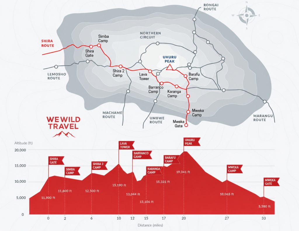
What is the best mountain to hike in Tanzania?

The best mountain to hike in Tanzania depends on your interests and experience level. Mount Kilimanjaro is the most famous and offers the ultimate trekking achievement. Mount Meru is ideal for hikers seeking wildlife encounters and fewer crowds, while the Usambara Mountains are perfect for scenic trails and cultural experiences.

Is Mount Meru harder than Kilimanjaro?

Mount Meru is generally considered less challenging than Kilimanjaro because it is lower in elevation. However, some sections of the Meru trek are steeper and more physically demanding. Kilimanjaro’s greater altitude presents a bigger challenge due to the increased risk of altitude sickness.

What is the best time for mountain hiking in Tanzania?

The best time for mountain hiking in Tanzania is during the dry seasons from January to March and June to October.

Do I need a guide to hike mountains in Tanzania?

For some mountains, guides are mandatory. Climbers on Mount Kilimanjaro and Mount Meru must be accompanied by licensed guides according to park regulations. Even on mountains where guides are not required, hiring a local guide is highly recommended for safety, navigation, and cultural insights.

Are there active volcanoes in Tanzania?

Yes, Tanzania is home to active volcanoes. The most famous is Ol Doinyo Lengai, located near Lake Natron. Known as the “Mountain of God” by the Maasai people, it is the only volcano in the world that produces rare carbonatite lava. Mount Meru is also classified as an active volcano, although it has not erupted in recent history.

Final Thoughts: Discovering Tanzania’s Most Incredible Mountain Adventures

Tanzania is one of Africa’s most diverse and rewarding destinations for hiking and mountain exploration. From the towering slopes of Mount Kilimanjaro and the wildlife-rich trails of Mount Meru to the rainforests of the Udzungwa Mountains and the remote wilderness of the Mahale Mountains, the country offers an incredible variety of landscapes and outdoor experiences.

Whether you are a first-time hiker, an experienced trekker, a wildlife enthusiast, or a photographer seeking spectacular scenery, Tanzania has a mountain adventure to match your interests. Some destinations provide challenging summit climbs, while others offer cultural encounters, rainforest exploration, volcanic landscapes, or unforgettable wildlife experiences.

What makes Tanzania truly special is the diversity found within its mountain regions. In a single country, travelers can stand on Africa’s highest peak, trek through ancient forests, observe wild chimpanzees, explore active volcanic landscapes, and hike alongside local communities that have lived in these mountains for generations.

No matter which mountain you choose, proper preparation, the right equipment, and a spirit of adventure will help you make the most of your journey. Each destination offers its own unique rewards, from breathtaking viewpoints and rare wildlife sightings to personal achievements and lifelong memories.

For travelers seeking some of Africa’s finest hiking experiences, Tanzania’s mountains deliver unforgettable adventures that extend far beyond the trail. Whether your goal is reaching the summit of Kilimanjaro or discovering hidden gems such as Mount Hanang, the Usambara Mountains, or the Mahale Mountains, Tanzania promises extraordinary experiences at every elevation.

Read more Mount Meru

Read Also: