Climbing Ol Doinyo Lengai: Complete Guide to Tanzania’s Mountain of God
Estimated reading time: 40 minutes
Climbing Ol Doinyo Lengai is a challenging and rewarding adventure in northern Tanzania, offering hikers a chance to explore one of Africa’s most distinctive volcanic mountains. Known as the “Mountain of God,” Ol Doinyo Lengai rises to 2,962 meters and remains an active volcano. This guide covers the climbing route, safety, best time to visit, costs, preparation, and what to expect on the mountain.
Unlike a conventional mountain trek, climbing Ol Doinyo Lengai takes you onto an active volcanic landscape shaped by eruptions and an exceptionally unusual type of lava. It is the only active volcano in the world known to produce carbonatite lava, a rare lava rich in calcium, sodium and carbon dioxide rather than the silica-rich lava produced by most volcanoes.
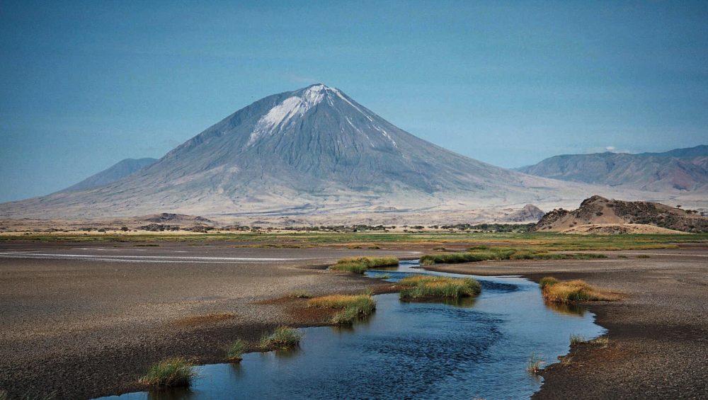
The mountain rises dramatically from the surrounding Rift Valley, creating wide views toward Lake Natron, the Ngorongoro highlands and the surrounding volcanic landscape. The journey also connects the climb with the wider cultural and geological attractions of the Lake Natron area, including Maasai communities and remarkable features along the Ol Doinyo Lengai route.
This guide explains what makes Ol Doinyo Lengai special, how difficult the climb is, what the volcanic landscape is like, the mountain’s geology and eruption history, the best time to visit, how the area connects with Lake Natron, and the key things travelers should understand before considering this experience.
Table of contents
- Climbing Ol Doinyo Lengai: Complete Guide to Tanzania’s Mountain of God
- Quick Answer
- Quick Facts About Ol Doinyo Lengai
- What Is Ol Doinyo Lengai?
- Where Is Ol Doinyo Lengai?
- Why Is Ol Doinyo Lengai Famous?
- How High Is Ol Doinyo Lengai?
- How Hard Is Climbing Ol Doinyo Lengai?
- Ol Doinyo Lengai Climbing Route
- Ol Doinyo Lengai Climb: Hour-by-Hour Itinerary
- What Is It Like to Climb Lengai at Night?
- What Can You See From the Summit?
- Ol Doinyo Lengai Volcano: Geology & Eruption History
- Is Climbing Ol Doinyo Lengai Safe?
- Who Should Climb Ol Doinyo Lengai?
- What to Pack for Ol Doinyo Lengai
- Best Time to Climb Ol Doinyo Lengai
- How Much Does Ol Doinyo Lengai Cost?
- Where to Stay Near Ol Doinyo Lengai
- Things to Do Around Lake Natron
- Ol Doinyo Lengai vs Kilimanjaro vs Mount Meru
- Why Climb Ol Doinyo Lengai With WeWild Travel?
- Frequently Asked Questions
- Conclusion
Quick Answer
Climbing Ol Doinyo Lengai is a demanding ascent of Tanzania’s active “Mountain of God,” reaching 2,962 meters above sea level. Located south of Lake Natron in the Gregory Rift Valley, the volcano is famous for its rare carbonatite lava and deep Maasai cultural significance. The climb involves steep volcanic terrain and is commonly planned around cooler conditions and sunrise.
Quick Facts About Ol Doinyo Lengai
This section should be short, highly scannable, and fact-focused. It can also give readers the key information before you explain the mountain in detail.
| Fact | Details |
|---|---|
| Name | Ol Doinyo Lengai |
| Meaning | “Mountain of God” in the Maasai language |
| Location | Northern Tanzania, south of Lake Natron |
| Region | Gregory Rift Valley, within the East African Rift System |
| Elevation | 2,962 m (9,718 ft) above sea level |
| Type | Active stratovolcano |
| Volcanic status | Tanzania’s only active volcano |
| Unique feature | The only active volcano known to produce carbonatite lava |
| Lava type | Natrocarbonatite, rich in sodium and carbonate minerals |
| Cultural importance | Sacred mountain for the Maasai people |
| Nearby landmark | Lake Natron |
| Geological setting | East African Rift System |
| Major eruption periods | Recorded eruptions include 1880, 1914-15, 1926, 1940-41, 1958, 1960-66, 1983-93, 1994-98, and 2007-08 |
| Most recent eruption listed by the Geopark | 2013 |
| Surrounding landscape | Rift escarpments, volcanic formations, Lake Natron and Maasai cultural landscapes |
What Is Ol Doinyo Lengai?
Ol Doinyo Lengai is an active stratovolcano in northern Tanzania, rising from the Gregory Rift Valley south of Lake Natron. Its name comes from the Maasai language and means “Mountain of God,” reflecting the mountain’s deep spiritual and cultural importance to the Maasai people.
What makes Ol Doinyo Lengai especially remarkable is its geology. Unlike most active volcanoes, it produces carbonatite lava, a rare type of volcanic material rich in carbonate minerals. The Ngorongoro Lengai Geopark identifies Ol Doinyo Lengai as the only active volcano known to produce carbonatite lava, making it an exceptional geological site.
The mountain reaches approximately 2,962 meters (9,718 feet) above sea level. From the surrounding Rift Valley, it rises dramatically above the landscape, creating a distinctive volcanic landmark near Lake Natron.
Ol Doinyo Lengai is also different from Tanzania’s famous trekking mountains such as Kilimanjaro and Mount Meru. It is not simply a high mountain covered by several ecological zones; it is an active volcanic environment where the landscape, crater and volcanic formations tell the story of ongoing geological processes.
For travelers, this combination of volcanic geology, Maasai culture, remote scenery and demanding terrain makes Ol Doinyo Lengai a completely different experience from a conventional mountain trek.
Why Is Ol Doinyo Lengai Called the “Mountain of God”?
The name Ol Doinyo Lengai translates to “Mountain of God” in the Maasai language. The mountain holds spiritual significance for Maasai communities, which makes it more than a geological landmark or hiking destination.
This cultural connection is an important part of understanding Lengai. A visit to the mountain takes place within a landscape where geology, Maasai traditions and the Great Rift Valley come together.
What Makes Ol Doinyo Lengai Different?
Four characteristics make the mountain particularly distinctive:
- Active volcano: Ol Doinyo Lengai remains an active volcanic system.
- Rare carbonatite lava: It is internationally notable for producing carbonatite lava.
- Maasai sacred mountain: Its name and cultural significance connect it closely with Maasai traditions.
- Rift Valley setting: The volcano rises dramatically within the geological landscape of the East African Rift.
Together, these features make Ol Doinyo Lengai one of Tanzania’s most unusual volcanic destinations and an important part of the northern Tanzania landscape.
Where Is Ol Doinyo Lengai?
Ol Doinyo Lengai is located in northern Tanzania, just south of Lake Natron, within the dramatic landscape of the Gregory Rift Valley, part of the wider East African Rift System. The volcano stands in the Ngorongoro-Lengai region, an area known for volcanic mountains, Rift Valley escarpments, archaeological sites and Maasai cultural heritage.
The mountain’s position is one of the reasons it is so visually impressive. Ol Doinyo Lengai rises from the Rift Valley landscape near the eastern side of the Serengeti ecosystem, while Lake Natron lies immediately to its north. From the surrounding area, the volcano forms a striking landmark above the dry plains and volcanic terrain.
Ol Doinyo Lengai and the Great Rift Valley
Ol Doinyo Lengai is closely connected to the geological forces that created the East African Rift. The official Ngorongoro Lengai Geopark describes the Ol Doinyo Lengai route as beginning around Karatu and the Mto wa Mbu junction, continuing north through the Gregory Rift Valley toward Lake Natron. Along this corridor, travelers encounter volcanic features such as maars, tuff rings, cones and tufa towers.
This makes the journey to Lengai more than simply traveling to a mountain. The surrounding landscape provides a visible introduction to the volcanic and tectonic forces that have shaped northern Tanzania over millions of years.
How Close Is Ol Doinyo Lengai to Lake Natron?
Ol Doinyo Lengai stands just south of Lake Natron, making the lake one of the defining landmarks of the region. Lake Natron is a highly alkaline soda lake and an important breeding area for Lesser Flamingos. The lake and volcano form a distinctive natural landscape where volcanic geology meets the Rift Valley floor.
For travelers visiting the area, Lake Natron also provides access to other experiences beyond the volcano, including the surrounding waterfalls, geological features and cultural attractions.
What Is Around Ol Doinyo Lengai?
The wider area contains several notable attractions:
- Lake Natron a spectacular alkaline lake north of the volcano.
- Gregory Rift Valley the geological setting surrounding Lengai.
- Engaruka an important archaeological site along the route toward Lake Natron.
- Engaresero Waterfall a freshwater waterfall within the otherwise dry landscape.
- Engaresero Footprints an archaeological site containing more than 400 preserved human footprints.
- Maasai communities communities whose cultural traditions are closely connected with the landscape and sacred mountain.
The location therefore gives Ol Doinyo Lengai a character that is difficult to separate from its surroundings. The volcano, Rift Valley, Lake Natron and Maasai cultural landscape all form part of the same northern Tanzania experience.
Why Is Ol Doinyo Lengai Famous?
Ol Doinyo Lengai is famous for much more than its steep slopes. It combines unusual geology, active volcanic activity, and deep cultural importance. The mountain rises above the Gregory Rift Valley south of Lake Natron and is one of Tanzania’s most distinctive volcanic landscapes.
Mountain of God
Ol Doinyo Lengai means “Mountain of God” in the Maasai language. The name reflects the mountain’s importance to Maasai communities in the surrounding region.
Unlike many mountains known mainly for their height or scenery, Ol Doinyo Lengai has a strong cultural identity. Its distinctive cone rises dramatically from the Rift Valley landscape, making it an important natural landmark as well as a geological feature.
Active Volcano
Ol Doinyo Lengai is an active stratovolcano, making it very different from Tanzania’s better-known trekking mountains such as Kilimanjaro.
The volcano has experienced repeated eruptions during historical times. Volcanic activity has included ash and tephra emissions, lava flows, and activity from small volcanic cones inside its summit crater. The Smithsonian Global Volcanism Program records ongoing volcanic activity and lists a 2026 last-known-eruption entry in its current database.
Because volcanic conditions can change, access to the mountain should always follow current local safety guidance and official restrictions.
Carbonatite Lava
One of the biggest reasons Ol Doinyo Lengai attracts geologists is its carbonatite lava.
Most volcanic lava contains large amounts of silica. Ol Doinyo Lengai is unusual because it produces natrocarbonatitic lava, a sodium-carbonate-rich volcanic material. The Smithsonian describes it as the only volcano known to have erupted carbonatite lava and tephra during historical time.
The lava also behaves differently from many familiar volcanic lavas. Fresh flows can appear dark, then weather and change to a much lighter color relatively quickly. This unusual chemistry gives Ol Doinyo Lengai a special place in modern volcanology.
Maasai Cultural Significance
Ol Doinyo Lengai is closely connected with Maasai culture and beliefs. For the Maasai people living around the mountain, it is not simply a geological landmark. Its traditional name, “Mountain of God,” reflects its spiritual significance.
This cultural connection adds another dimension to visiting the area. The mountain stands within a landscape where geology, wildlife, local communities, and traditional knowledge are closely connected.
For travelers, understanding this significance is important. Ol Doinyo Lengai should be approached not only as a mountain to photograph or climb, but also as a culturally important place for the communities who live around it.
How High Is Ol Doinyo Lengai?
Ol Doinyo Lengai stands at 2,962 metres (9,718 feet) above sea level. It rises sharply from the Gregory Rift Valley in northern Tanzania, creating a dramatic difference between the surrounding lowlands and the volcanic summit.
Although Ol Doinyo Lengai is much lower than Mount Kilimanjaro at 5,895 metres, its steep volcanic slopes make the ascent demanding. The mountain gains substantial elevation over a relatively short horizontal distance, so the climb can feel physically intense.
Ol Doinyo Lengai Elevation at a Glance
| Feature | Elevation |
|---|---|
| Ol Doinyo Lengai summit | 2,962 m (9,718 ft) |
| Mount Kilimanjaro to Uhuru Peak | 5,895 m (19,341 ft) |
| Mount Meru summit | 4,566 m (14,980 ft) |
| Lake Natron area | Around 600 m above sea level |
The mountain’s elevation is only part of what makes it distinctive. Its steep volcanic terrain, loose ash and rock, active geological setting, and exposed upper slopes can make the experience more demanding than its height alone suggests.
Why the Elevation Matters
At 2,962 metres, Ol Doinyo Lengai reaches an altitude where conditions can differ noticeably from the surrounding Rift Valley. Temperatures generally become cooler as elevation increases, while wind and exposure can become more noticeable near the upper mountain.
The elevation also creates exceptional views across the surrounding volcanic landscape. From higher points on the mountain, the Rift Valley and the area around Lake Natron form a striking backdrop.
Important: Different websites sometimes publish different elevations for Ol Doinyo Lengai. For an accurate travel guide, WeWild Travel should use 2,962 metres (9,718 feet) and keep this figure consistent throughout the article.
How Hard Is Climbing Ol Doinyo Lengai?
Climbing Ol Doinyo Lengai is a demanding mountain experience. The summit is only 2,962 metres high, but the route rises steeply through loose volcanic material. The combination of steep terrain, uneven footing, darkness during the ascent, and a long descent makes the climb physically challenging.
The difficulty also varies with weather, volcanic conditions, route conditions, and each person’s experience and fitness. A local guide should assess current conditions before and during the climb.
Steep Volcanic Slopes
The upper slopes of Ol Doinyo Lengai are notably steep. Instead of following a gentle mountain trail, the route climbs directly up the volcanic cone.
This steep gradient requires sustained physical effort. The terrain can also make progress slower, particularly where the surface becomes unstable. Climbers should expect a strenuous ascent rather than a relaxed mountain walk.
Loose Ash and Rock
Volcanic ash, loose rock, and scree are important parts of the terrain. These surfaces can shift underfoot and make walking less predictable.
The loose material also adds effort because some movement may not translate into much forward progress. Good footwear and careful movement are therefore important. A guide can also help visitors choose safer sections of the route according to current conditions.
Night Climbing
Ol Doinyo Lengai is commonly approached during the cooler hours of darkness, with the aim of reaching higher ground around sunrise. Night conditions add another challenge because visibility is limited and the terrain can be difficult to judge.
The darkness also means that the experience depends heavily on appropriate local guidance and careful pacing. Weather and mountain conditions should always take priority over a planned timetable.
Descent
The descent deserves just as much attention as the ascent. After spending several hours climbing, fatigue can affect balance and concentration.
Loose volcanic ground can also feel different when descending. The combination of steep slopes and unstable surfaces requires patience and careful footing. A strong climb is not complete until the descent is finished safely.
Fitness Requirements
You do not need to be an elite athlete to consider a mountain such as Ol Doinyo Lengai, but you should have a good level of general fitness and be comfortable with prolonged uphill walking.
Training should focus on general endurance, leg strength, balance, and sustained walking rather than speed. Anyone considering the climb should also discuss their suitability with a qualified guide or tour operator, particularly because conditions on an active volcano can change.
In short: Ol Doinyo Lengai is challenging because of its steep volcanic terrain, loose ash and rock, night conditions, and demanding descent. Its 2,962-metre elevation alone does not tell the whole story.
Ol Doinyo Lengai Climbing Route
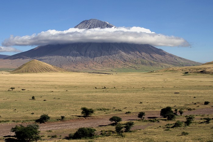
The Ol Doinyo Lengai climbing route follows the mountain’s steep volcanic cone from the lower slopes toward the summit crater rim. Unlike Kilimanjaro routes, the ascent does not pass through several distinct vegetation zones or established mountain camps. Instead, the landscape becomes increasingly volcanic and exposed as elevation increases.
The route is known for its steep gradient, loose volcanic material, and dramatic views across the Rift Valley and Lake Natron.
Trailhead
The climb begins from the lower slopes of Ol Doinyo Lengai, after traveling from the Lake Natron area toward the mountain.
The trailhead sits in the dry Rift Valley landscape, where the mountain rises sharply above the surrounding plains. From here, the route heads upward toward the volcanic cone.
Local conditions can affect the exact starting point and access arrangements. Therefore, visitors should follow the instructions of their local guide and current authorities rather than relying on an old route description.
Lower Slopes
The lower section begins in the open landscape around the base of the volcano. The surroundings provide a strong contrast between the relatively broad Rift Valley and the steep mountain ahead.
As the route gains elevation, the slope gradually becomes more pronounced. The surface remains volcanic, while views across the surrounding landscape become increasingly impressive.
During a night ascent, much of the lower landscape may remain hidden in darkness. As daylight approaches, the surrounding Rift Valley begins to come into view.
Upper Slopes
The upper slopes are where the character of the climb becomes more demanding. The gradient becomes very steep, while loose volcanic ash, scree, and rock can make the surface unstable.
This section requires greater concentration and physical effort than the lower slopes. Conditions can also vary depending on recent weather and volcanic activity.
The higher you go, the more exposed the landscape becomes. The surrounding Rift Valley and Lake Natron area gradually open out below, creating spectacular high-elevation views.
Crater Rim
The route finishes at the summit area and crater rim of Ol Doinyo Lengai, at approximately 2,962 metres (9,718 feet) above sea level.
Reaching the crater rim provides a completely different experience from the lower slopes. The volcanic character of the mountain becomes especially clear, with the summit crater and surrounding geological features forming the main attraction.
If the ascent takes place overnight, arriving around sunrise can provide views across the Rift Valley and Lake Natron as the landscape becomes illuminated.
Because Ol Doinyo Lengai remains an active volcano, the condition of the summit area can change. Access should always depend on current volcanic, weather, and safety information.
Ol Doinyo Lengai Climb: Hour-by-Hour Itinerary
A typical Ol Doinyo Lengai climb is planned around the cooler nighttime hours and sunrise. The exact schedule can change depending on weather, volcanic conditions, the group’s pace, and guidance from the local mountain team.
Unlike a Kilimanjaro trek, this is generally a concentrated mountain experience rather than a multi-day ascent with established camps along the route.
11:00 PM – Prepare for the Climb
The evening begins at the accommodation around the Lake Natron area. After a final check of the weather and current mountain conditions, climbers prepare for the journey to the trailhead.
The guide confirms the day’s arrangements and ensures everyone understands the plan before departure.
12:00 AM – Start the Ascent
The climb begins during the night. Darkness covers the surrounding Rift Valley, so the first part of the experience feels very different from a normal daytime hike.
The group progresses at a controlled pace while the guide monitors the terrain and conditions.
1:00-3:00 AM – Steepening Volcanic Terrain
As the ascent continues, the slope becomes increasingly steep. Loose volcanic ash and rock can make the surface uneven.
The focus during this section is steady progress rather than speed. Short pauses may be taken when necessary, particularly if the group needs to regroup.
3:00-5:00 AM – Upper Slopes
The upper mountain becomes more exposed and physically demanding. Fatigue can become noticeable after several hours of climbing.
The darkness gradually begins to give way to the first signs of dawn. Depending on the group’s progress and conditions, the summit area may come into view around this time.
Around Sunrise – Crater Rim
Reaching the crater rim around sunrise can be one of the most memorable moments of the experience.
As daylight spreads across the landscape, views toward Lake Natron and the surrounding Gregory Rift Valley become clearer. The volcanic character of Ol Doinyo Lengai is also easier to appreciate in daylight.
The exact arrival time varies and should never take priority over safety.
Morning – Time at the Summit Area
After reaching the summit area, the group has an opportunity to appreciate the volcanic landscape and surrounding scenery, subject to current access restrictions and guidance.
Because Ol Doinyo Lengai is an active volcano, the condition of the summit area can change. Visitors should remain within areas approved by their guide and local authorities.
Morning to Midday – Descent
The return journey begins after the summit experience. Descending the steep volcanic slopes can be physically demanding, especially after the long ascent.
Loose ash and rock require continued attention. The guide controls the pace according to the conditions and the group’s ability.
Around Midday – Return to the Lower Mountain
By late morning or around midday, the group may reach the lower mountain area, depending on the pace and conditions.
From here, the journey continues back toward the Lake Natron area for rest and recovery.
Important Note About the Schedule
This itinerary is a general example, not a fixed timetable. Start times, summit timing, route conditions, and access to the upper mountain can change.
Weather, volcanic activity, visibility, and the condition of the route should always take priority over reaching the summit at a particular hour. A qualified local guide should make the final decision about whether conditions are suitable to continue.
What Is It Like to Climb Lengai at Night?
Climbing Ol Doinyo Lengai at night creates a very different experience from a normal daytime mountain hike. The ascent takes place under dark skies, with headlamps providing the main source of light while the volcanic slopes rise into the darkness above.
The timing also helps avoid the strongest daytime heat in the surrounding Rift Valley. As the night progresses, the focus shifts from the landscape around Lake Natron to the mountain itself. Then, as dawn approaches, the darkness gradually gives way to wide views across northern Tanzania.
A Dark and Quiet Mountain
At the beginning of the climb, the surrounding landscape can feel almost completely dark. The lights of the group become small points of brightness against the volcanic slopes.
This changes the character of the experience. Instead of seeing the entire mountain ahead, you concentrate on the terrain immediately around you. The silence and isolation can make the volcano feel especially remote.
The Night Sky
Away from towns and major sources of artificial light, the Lake Natron region can offer impressive views of the night sky when conditions are clear.
Stars may remain visible throughout parts of the ascent. However, cloud cover, weather, and visibility can change quickly, so night-sky viewing should be considered an added experience rather than a guaranteed part of the climb.
As Dawn Approaches
One of the most memorable transitions happens before sunrise. The darkness begins to lift, revealing the surrounding Rift Valley and the landscape around Lake Natron.
The changing light also makes the volcanic terrain easier to appreciate. What was almost invisible during the night becomes a broad landscape of volcanic slopes, valleys, and distant features.
Sunrise From the Mountain
If conditions and the group’s progress allow, reaching the summit area around sunrise provides a spectacular change in scenery.
The first daylight can illuminate the crater area while the Rift Valley stretches across the horizon. This combination of volcanic geology and African landscape is one of the main reasons the nighttime ascent is so distinctive.
What Makes Night Climbing Challenging?
Night climbing also adds important challenges. Darkness reduces visibility, while steep and loose volcanic terrain requires careful attention.
Fatigue can increase as the hours pass, especially during a prolonged ascent. Weather and volcanic conditions can also affect the experience.
For that reason, the objective should not simply be to reach the summit at sunrise. Safety and current mountain conditions should always come first. A qualified local guide should make decisions about route conditions, access, and whether the climb should continue.
Overall, a nighttime ascent of Ol Doinyo Lengai combines darkness, volcanic terrain, quiet surroundings, and the gradual arrival of sunrise. It is an unusual mountain experience that feels very different from a conventional daytime trek.
What Can You See From the Summit?
Reaching the summit area of Ol Doinyo Lengai offers a remarkable view over northern Tanzania. From the upper mountain, the landscape changes from steep volcanic slopes to a wide panorama of the Gregory Rift Valley, Lake Natron, and the surrounding volcanic terrain.
The view is one of the highlights of the experience because it shows how dramatically Ol Doinyo Lengai rises above the surrounding Rift Valley.
Lake Natron
Lake Natron is one of the most recognizable features of the landscape below Ol Doinyo Lengai. The shallow soda lake lies north of the volcano and stands out against the surrounding dry Rift Valley.
From higher elevations, the lake forms an impressive part of the panorama, especially when visibility is clear.
The Gregory Rift Valley
The summit provides a high viewpoint over the Gregory Rift Valley, part of the larger East African Rift system.
The valley’s broad floor contrasts sharply with the steep volcanic cone. This makes the summit an excellent place to appreciate the geological setting of Ol Doinyo Lengai rather than viewing the volcano as an isolated mountain.
The Volcanic Landscape
Looking across the surrounding region reveals a landscape shaped by volcanic and tectonic activity. Volcanic cones, escarpments, dry plains, and distant geological features form the wider scenery around the mountain.
This landscape helps explain why the area is so important for understanding the geology of the East African Rift.
The Summit Crater
The summit itself offers a close view of Ol Doinyo Lengai’s volcanic crater environment. The crater is one of the most distinctive features of the mountain and reflects its active volcanic nature.
However, access around the summit and crater can depend on current volcanic conditions and official safety guidance. Visitors should remain only in areas approved by their local guide and authorities.
Sunrise Over the Rift Valley
When the climb is timed around sunrise, the changing light can transform the landscape. The surrounding valleys, lake, and volcanic terrain gradually become more visible as daylight spreads across the region.
For many visitors, this combination of volcanic scenery, Lake Natron, the Rift Valley, and sunrise is one of the most memorable aspects of an Ol Doinyo Lengai experience.
The summit view is therefore more than a mountain panorama. It provides a clear perspective of the unusual relationship between volcanic activity, Rift Valley geology, Lake Natron, and the wider northern Tanzanian landscape.
Ol Doinyo Lengai Volcano: Geology & Eruption History
Ol Doinyo Lengai is not an ordinary volcano. It is an active stratovolcano in Tanzania’s Gregory Rift Valley and is internationally important because of the unusual lava it produces. Unlike most volcanoes, Lengai has erupted carbonatite lava, a rare type of magma rich in carbonate minerals. The volcano has also experienced major changes in eruptive behavior, including the powerful explosive eruptions of 2007 and 2008.
Understanding the geology and eruption history of Ol Doinyo Lengai helps explain why the mountain looks different from Kilimanjaro or Mount Meru and why volcanic activity remains an important part of its story.
Carbonatite Lava
One of the most remarkable features of Ol Doinyo Lengai is its natrocarbonatite lava. The Smithsonian Global Volcanism Program identifies Lengai as the only volcano known to have erupted carbonatite lava and tephra in historical time.
Carbonatite lava differs significantly from the silica-rich lava produced by many other volcanoes. Lengai’s natrocarbonatite lava is relatively low in temperature and can appear dark or black when freshly erupted. As it cools and reacts with moisture and the atmosphere, its appearance can change considerably.
For geologists, these unusual lava flows provide an important opportunity to study rare volcanic processes. The volcano’s activity is closely connected to the geological forces shaping the East African Rift, where the Earth’s crust is gradually being pulled apart.
Historically, much of Lengai’s activity consisted of relatively small, fluid natrocarbonatite lava flows within the summit crater. Lava gradually filled parts of the northern crater and eventually overflowed onto several sections of the upper flanks.
Previous Eruptions
Ol Doinyo Lengai has a long record of volcanic activity. Its cone-building stage ended roughly 15,000 years ago, followed by periods of ash and tephra production during the Holocene. Historical eruptions have included both explosive activity and the emission of natrocarbonatite lava.
During the twentieth century, many eruptions were relatively small and concentrated around the summit crater. From 1983 into the early 2000s, the volcano entered a prolonged period dominated by small, fluid carbonatite lava flows.
This activity gradually changed the shape of the summit crater. Lava accumulated around small volcanic cones, known as hornitos, and eventually spilled over parts of the crater rim. By the late 1990s, lava had begun reaching several areas of the upper slopes.
However, the volcano’s behavior changed dramatically in 2007. Increased seismic and volcanic activity preceded a new period of explosive eruptions that continued into 2008.
2007-2008 Eruption
The 2007-2008 eruption was one of the most significant recent changes in Ol Doinyo Lengai’s volcanic behavior.
In July 2007, volcanic activity increased, and reports described ash and lava emissions around the mountain. On 4 September 2007, a major explosive eruption produced a substantial ash plume. The eruption marked a major shift after decades when activity had mainly involved relatively quiet lava extrusion inside the summit crater.
Explosive activity continued into 2008. The Smithsonian Global Volcanism Program records repeated ash-producing eruptions, including powerful events in March 2008. Some ash plumes rose more than 10 kilometres above the volcano, and volcanic activity affected nearby communities.
The eruptions also changed the appearance of the summit. A new pyroclastic cone developed inside the crater, replacing much of the earlier crater-floor landscape.
By mid-April 2008, the strongest explosive activity had decreased. Later observations showed renewed formation of hornitos and smaller lava flows within the summit crater.
The 2007-2008 period is particularly important because it demonstrated that Lengai can shift between relatively quiet carbonatite lava production and much more explosive volcanic behavior.
Current Volcanic Status
Ol Doinyo Lengai remains classified as an active volcano. The Smithsonian Global Volcanism Program lists its elevation at 2,962 metres (9,718 feet) and its last known eruption as 2026 CE in its current database.
Recent volcanic activity has generally been associated with the summit crater, including lava flows, spattering, hornitos and other volcanic features. Satellite observations have become increasingly useful for monitoring changes in thermal activity and fresh lava around the summit.
This active status is important for anyone researching or visiting Ol Doinyo Lengai. The mountain should not be treated like an ordinary hiking destination. Volcanic conditions can change, and access to areas around the crater depends on current safety assessments and local guidance.
For travelers, the most important point is simple: Ol Doinyo Lengai is a living volcano, not an extinct mountain. Its geology continues to evolve, making it one of Tanzania’s most fascinating volcanic landscapes.
Is Climbing Ol Doinyo Lengai Safe?
Climbing Ol Doinyo Lengai can be undertaken under suitable conditions, but it is important to understand that Lengai is an active volcano. It is not possible to describe the climb as risk-free. The Smithsonian Global Volcanism Program currently lists Ol Doinyo Lengai as an active volcano, with continuing eruptive activity recorded from 2017 through March 2026.
The main concern is volcanic activity. Lengai has produced lava, ash, gas and explosive activity at different times. Historical observations have also documented unstable crater terrain and sudden changes in volcanic activity.
What Are the Main Safety Risks?
Several factors make safety particularly important:
- Active volcanic activity: Eruptions and changes around the summit can occur.
- Steep volcanic terrain: The upper mountain has loose and unstable surfaces.
- Crater hazards: Cracks and unstable ground around active volcanic areas can present serious risks.
- Ash and volcanic gases: Conditions around the summit can change depending on volcanic activity and wind.
- Weather: Cloud, rain and poor visibility can make the upper mountain more difficult to assess.
- Night conditions: Many ascents are planned during darkness, which makes changing terrain and conditions harder to see.
Historical Smithsonian reports demonstrate why visitors should never assume that conditions around an active crater remain stable.
Why Local Safety Assessment Matters
The decision to visit or climb Ol Doinyo Lengai should depend on current volcanic and weather conditions, rather than simply following a fixed itinerary.
If volcanic activity increases or conditions around the summit become unsuitable, the climb should be postponed or stopped. A successful mountain experience is never more important than personal safety.
This is especially important because the volcano remains active. The Smithsonian Global Volcanism Program records Ol Doinyo Lengai as having continuing eruptive activity through March 31, 2026.
Is Ol Doinyo Lengai Safer Than Kilimanjaro?
The two mountains present very different types of risk.
Kilimanjaro is a dormant volcano, while Ol Doinyo Lengai is an active volcano. Therefore, Lengai has an additional volcanic hazard that does not normally define a Kilimanjaro climb.
However, safety cannot be judged simply by comparing the two mountains. Terrain, weather, altitude, route conditions and current volcanic activity all influence the overall risk.
A Responsible Approach to Climbing Lengai
The safest approach is to treat Ol Doinyo Lengai as an active volcanic environment rather than an ordinary hiking trail.
Travelers should follow current instructions from local authorities and experienced local professionals. Conditions should be assessed before any ascent, and access should be avoided when volcanic activity, weather or terrain creates unacceptable risk.
The goal is not simply to reach the summit. The goal is to experience Ol Doinyo Lengai responsibly while respecting the mountain’s active volcanic nature.
Who Should Climb Ol Doinyo Lengai?
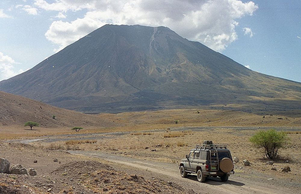
Ol Doinyo Lengai is best suited to experienced, physically prepared travelers who understand the risks of an active volcanic environment. The climb involves steep terrain, loose volcanic surfaces, and changing conditions. It should not be approached like an ordinary sightseeing hike.
Because Lengai remains an active volcano, suitability also depends on current volcanic activity, weather, route conditions, and local safety guidance. Historical observations have documented unstable terrain and hazardous activity around the summit.
People Who May Be Suitable
Ol Doinyo Lengai may appeal to travelers who:
- Have good general physical fitness.
- Are comfortable with demanding mountain terrain.
- Have previous hiking or trekking experience.
- Enjoy geology, volcanoes, and unusual landscapes.
- Understand that summit access can change because of volcanic conditions.
- Are prepared to follow instructions from qualified local guides and authorities.
- Are willing to turn back if conditions become unsafe.
Who Should Think Carefully Before Going?
This climb may not be appropriate for someone who is inexperienced with demanding mountain terrain or who expects a relaxed tourist activity.
It is also important to consider personal fitness, previous trekking experience, weather conditions, and any individual health concerns with a qualified professional before undertaking strenuous travel.
Most importantly, reaching the summit should never take priority over safety. Conditions around an active volcano can change, and historical reports have recorded situations where climbing was discouraged because of volcanic activity.
Experience Matters More Than Speed
Ol Doinyo Lengai is not a mountain where speed should be the main goal. A responsible experience means moving according to the conditions, staying with the appropriate local support, and respecting any restrictions around active volcanic areas.
The Smithsonian Global Volcanism Program has specifically documented hazards associated with summit access, including unstable crater areas and volcanic activity.
A Good Mindset for Lengai
The right mindset is simple: respect the mountain, listen to local guidance, and accept that plans can change.
For travelers interested in Tanzania’s volcanic landscapes, Lengai offers a very different experience from climbing Kilimanjaro. Its active geology, Maasai cultural importance, and location beside Lake Natron make it particularly interesting for people who want to understand the landscape rather than simply collect another summit.
The best person for Ol Doinyo Lengai is not necessarily the fastest or strongest climber. It is someone who is prepared, responsible, flexible, and willing to put safety first.
What to Pack for Ol Doinyo Lengai
Packing properly for Ol Doinyo Lengai can make the experience more comfortable and manageable. The mountain has steep volcanic terrain, loose surfaces, cool conditions at higher elevations, and many ascents take place during the night.
You do not need an oversized expedition pack. Instead, focus on comfortable footwear, warm layers, reliable lighting, sun protection, hydration, and basic personal essentials.
Essential Clothing
Choose lightweight layers that you can adjust as conditions change.
- Hiking trousers: Comfortable trousers protect your legs from volcanic dust and rough terrain.
- Moisture-wicking shirt: A breathable base layer helps manage sweat during the ascent.
- Warm jacket or fleece: Temperatures can feel much cooler before sunrise.
- Windproof layer: Useful on exposed sections and around the summit.
- Warm hat and gloves: Helpful during the colder nighttime hours.
- Sun hat: Important for protection during the descent.
- Sunglasses: Protect your eyes from strong sunlight and airborne dust.
Footwear
Sturdy, comfortable hiking boots are one of the most important items to bring. Choose footwear that you have already worn and know fits well.
Volcanic terrain can contain loose ash, gravel and uneven surfaces, so good grip and ankle support can improve comfort and stability.
Lighting
If your itinerary involves a nighttime ascent, bring a reliable headlamp with sufficient battery power. A small backup light can also be useful.
Keep spare batteries or a fully charged backup power source available for personal electronics.
Water and Food
Carry enough drinking water for the planned outing and follow your guide’s advice about hydration.
Pack simple, easy-to-carry snacks such as:
- Energy bars
- Dried fruit
- Nuts
- Sandwiches
- Other familiar, lightweight foods
The exact amount of food and water you need depends on the itinerary, weather, and support provided by your tour operator.
Sun and Skin Protection
The combination of altitude, open terrain and strong sunlight makes sun protection important.
Pack:
- Sunscreen
- Lip balm with sun protection
- Sunglasses
- Sun hat
- Lightweight long-sleeved clothing
These items become especially useful during the descent when the sun is stronger.
Personal Essentials
A small daypack can hold your essential items without adding unnecessary weight.
Consider bringing:
- Personal medication, if applicable
- Small first-aid essentials
- Phone or camera
- Portable power bank
- Identification and necessary travel documents
- Tissues or toilet paper
- Small rubbish bag for carrying waste out
Trekking Poles
Trekking poles can be useful, particularly on loose volcanic surfaces and during the descent. They can provide additional balance and reduce the feeling of instability on uneven ground.
However, they are optional and should complement not replace careful movement and guidance.
What You Should Not Forget
Before leaving for the mountain, check that your most important items are ready:
| Item | Why It Matters |
|---|---|
| Hiking boots | Grip and comfort on volcanic terrain |
| Headlamp | Visibility during nighttime travel |
| Warm layers | Protection from cooler conditions |
| Windproof jacket | Protection on exposed sections |
| Water | Maintaining hydration |
| Snacks | Convenient energy during the outing |
| Sunglasses | Protection from sunlight and dust |
| Sunscreen | Protection from strong sunlight |
| Daypack | Carrying essential personal items |
| Trekking poles | Additional balance on loose terrain |
| Phone/power bank | Communication and battery backup |
Pack Light, But Pack Smart
The best approach is to bring the essentials without carrying unnecessary weight. Your local guide or tour operator can also confirm what is provided as part of the climbing arrangement.
Most importantly, equipment cannot remove the risks associated with an active volcano. Current volcanic conditions, weather, local guidance and access restrictions should always take priority over completing the climb.
A well-prepared traveler arrives with the right equipment, understands the environment, and is prepared to change plans when conditions require it.
Best Time to Climb Ol Doinyo Lengai
The best time to climb Ol Doinyo Lengai is generally during Tanzania’s drier months, especially June through October, when rainfall is usually lower and conditions around northern Tanzania are often more favorable. However, there is no completely risk-free season because Lengai is an active volcano and mountain conditions can change.
The best date for a climb should therefore consider weather, volcanic activity, trail conditions, and current local guidance rather than the calendar alone.
June to October: The Drier Season
June through October is often the most comfortable period for exploring the Lake Natron and Ol Doinyo Lengai area.
Lower rainfall can mean firmer ground and better visibility around the Rift Valley. The generally drier conditions can also make travel in the surrounding region easier.
For travelers combining Lengai with other northern Tanzania experiences, this period can be particularly convenient.
January to February: Another Good Window
January and February can also offer relatively favorable conditions between the main rainy periods.
The surrounding landscape may appear greener than during the long dry season, creating a different experience for photographers and nature enthusiasts.
However, conditions can vary from year to year, so travelers should check the forecast before planning their visit.
March to May: Long Rains
March through May is commonly associated with Tanzania’s long rainy season.
Rain can make roads and volcanic terrain more difficult to navigate. Cloud cover can also reduce visibility across the Rift Valley and around Lake Natron.
This does not mean every day during these months will have poor conditions. Weather varies, but travelers should expect a greater possibility of rain and changing ground conditions.
November to December: Short Rains
November and December can bring Tanzania’s short rainy season.
Some days may remain suitable for travel, while others can experience rainfall that affects roads and mountain conditions. Flexible planning is therefore useful during this period.
Best Time at a Glance
| Period | General Conditions | Planning Consideration |
|---|---|---|
| June to October | Generally drier | Often the most favorable period |
| January to February | Relatively favorable | Can offer greener scenery |
| March to May | Long rains | Higher chance of rain and difficult ground conditions |
| November to December | Short rains | Weather can change quickly |
What About Climbing for Sunrise?
Many Ol Doinyo Lengai itineraries are planned around reaching the summit area around sunrise. The timing can offer dramatic views across the Rift Valley and Lake Natron.
However, sunrise should never be the reason to continue when conditions are unsuitable. Weather, volcanic conditions, and local safety decisions always come first.
Check Conditions Before Your Trip
Seasonal weather provides only part of the picture. Ol Doinyo Lengai remains an active volcano, and the Smithsonian Global Volcanism Program records continuing activity from April 2017 through March 2026.
Therefore, travelers should confirm current conditions before planning an ascent. If volcanic activity, weather, or access conditions make the mountain unsuitable, plans may need to change.
In simple terms: June to October is generally the strongest seasonal choice, but the safest time to visit Ol Doinyo Lengai is when current weather, volcanic conditions, and local guidance all indicate that access is appropriate.
How Much Does Ol Doinyo Lengai Cost?
The cost of climbing Ol Doinyo Lengai depends on the group size, local climbing fees, accommodation, meals, and transport to the Lake Natron area. A climb-only fee is often around US$70-$125 per person, while a complete trip with accommodation and transport can cost several hundred dollars.
Unlike Mount Kilimanjaro, Ol Doinyo Lengai is not normally priced as a standard multi-day national-park trekking package. Several local charges can apply around Lake Natron, and prices may change. Therefore, travelers should ask for an itemized quotation before booking.
Typical Ol Doinyo Lengai Cost Breakdown
| Cost | Typical Price | What It Covers |
|---|---|---|
| Mountain climbing fee | US$70-$125 pp | Local climbing access and guiding, depending on group size |
| Lake Natron area fees | Varies | Local, conservation, or district charges |
| Accommodation | Varies | Campsites, bandas, or lodges |
| Transport | Varies | Vehicle transfer to and from Lake Natron and the mountain |
| Meals | Varies | Meals before and after the climb |
| Additional activities | Optional | Lake Natron, waterfalls, footprints, or cultural visits |
Current published prices illustrate why quotations differ. For example, Lake Natron-area operators currently list the climb at about US$70 per person for groups of two or more, while solo rates can be around US$100-$124. Some accommodation providers also list separate area, activity, and overnight charges.
What Makes the Price Higher?
Transport is one of the biggest factors. Lake Natron is a remote destination, so reaching the area and the mountain trailhead can add significantly to the overall cost.
Accommodation also affects the total. A basic campsite will usually cost less than a lodge, while staying several nights allows travelers to combine the climb with other Lake Natron experiences.
Group size matters too. Some local climbing fees are lower per person when several travelers climb together. Current published rates show this difference clearly.
Does the Climbing Fee Include Everything?
Not always. This is important when comparing Ol Doinyo Lengai prices.
A climbing fee may cover local guiding and mountain access, but transport, accommodation, meals, area fees, and other activities may be charged separately. Published Lake Natron fee information confirms that Lengai climbing can be separate from other Lake Natron activity and accommodation charges.
For this reason, a very low advertised climb price does not necessarily mean the complete trip will be cheaper.
How to Compare Ol Doinyo Lengai Prices
When comparing different packages, check whether the quotation includes:
- Mountain climbing and local guide fees
- Transport to the climbing area
- Accommodation before or after the climb
- Meals and drinking water
- Lake Natron area or community fees
- Camping equipment, if required
- Additional Lake Natron activities
- Transfers between Arusha and Lake Natron
A transparent quotation should show these costs clearly rather than giving only one unexplained total.
How to Get to Ol Doinyo Lengai
Ol Doinyo Lengai lies in northern Tanzania, near Lake Natron, about 240 km from Arusha. Most travelers reach the mountain by road from Arusha, which takes around 6–7 hours depending on road conditions and stops along the way. The journey passes through rural landscapes, Maasai villages, and scenic areas of the Great Rift Valley.
Travelers can also reach the area from Mto wa Mbu or the Ngorongoro Conservation Area. The final section to Lake Natron includes rough roads, so a 4×4 safari vehicle works best. Most climbing trips stay around Lake Natron before the ascent because the trailhead sits close to the lake.
For international travelers, Kilimanjaro International Airport (JRO) provides the most convenient starting point. From the airport, the journey continues by road through Arusha and toward Lake Natron. Many climbers combine Ol Doinyo Lengai with a safari in the Serengeti, Ngorongoro, or Tarangire.
Where to Stay Near Ol Doinyo Lengai
Most climbers stay around Lake Natron, which sits close to the base of Ol Doinyo Lengai. The area has several campsites, lodges, and tented camps that suit different budgets and travel styles. Staying near the mountain also makes the early start for the summit much easier.
Budget travelers can choose campsites around Lake Natron, where basic facilities provide a simple place to rest before and after the climb. Mid-range travelers can find comfortable lodges and tented camps with private rooms, meals, and good views of the surrounding landscape. Some properties also offer swimming pools and outdoor areas where climbers can relax after the trek.
Many climbers spend one night before the climb and another night after descending. This gives you time to rest, prepare for the ascent, and enjoy the Lake Natron area without rushing. Some travelers also combine the climb with a visit to the lake, nearby waterfalls, or a wider Tanzania safari.
Things to Do Around Lake Natron
Lake Natron offers more than a starting point for climbing Ol Doinyo Lengai. The area has dramatic landscapes, wildlife, waterfalls, and cultural experiences that make it worth spending extra time after the climb.
See the Flamingos at Lake Natron
Lake Natron provides an important breeding area for lesser flamingos. Large groups often gather around the shallow alkaline waters, creating one of the most memorable sights in the area. The number of flamingos changes throughout the year, so sightings can vary.
Visit Engare Sero Waterfalls
Engare Sero Waterfalls provide a refreshing experience near Lake Natron. The trail passes through a scenic gorge before reaching the waterfall and natural pools. The hike adds a different experience to a trip focused on the dry volcanic landscape of Ol Doinyo Lengai.
Experience Maasai Culture
Maasai communities live around Lake Natron, and visitors can learn about local traditions, daily life, livestock keeping, and traditional crafts. A cultural visit adds a human side to the landscape and gives travelers a chance to connect with the local community.
Explore the Rift Valley Landscape
The area around Lake Natron sits within the Great Rift Valley and offers striking views of volcanic mountains, open plains, and the lake itself. The landscape feels remote and rugged, especially around sunrise and sunset.
Combine Ol Doinyo Lengai With a Tanzania Safari
Many travelers combine their Ol Doinyo Lengai climb with a safari in northern Tanzania. A longer itinerary can include Ngorongoro, Serengeti, Tarangire, or Lake Manyara, creating a trip that combines mountain adventure, wildlife, and local culture.
Ol Doinyo Lengai vs Kilimanjaro vs Mount Meru
Ol Doinyo Lengai, Mount Kilimanjaro, and Mount Meru offer very different climbing experiences in Tanzania. Ol Doinyo Lengai suits adventurous hikers who want a short, steep volcanic climb, while Kilimanjaro offers a longer high-altitude trek to Africa’s highest point. Mount Meru provides a challenging multi-day climb with excellent scenery and wildlife around Arusha National Park.
| Feature | Ol Doinyo Lengai | Mount Kilimanjaro | Mount Meru |
|---|---|---|---|
| Height | 2,962 m | 5,895 m | 4,566 m |
| Typical climb | 1 day | 5-9 days | 3-4 days |
| Main challenge | Steep volcanic terrain | High altitude and long summit day | Altitude and steep sections |
| Landscape | Active volcano and Rift Valley | Rainforest, moorland, alpine desert, glaciers | Forest, moorland, rocky summit |
| Experience | Wild and off-the-beaten-path | Iconic African summit | Scenic mountain adventure |
| Best for | Experienced hikers seeking a short adventure | Travelers who want Africa’s highest summit | Hikers who want a shorter high-altitude trek |
Which Mountain Should You Choose?
Choose Ol Doinyo Lengai for a raw volcanic experience and a steep adventure near Lake Natron. Choose Kilimanjaro if reaching Uhuru Peak and standing on the highest point in Africa matters most. Choose Mount Meru if you want a shorter multi-day trek with rich scenery and wildlife along the route.
For travelers with enough time, combining Ol Doinyo Lengai with a Tanzania safari creates a unique itinerary that brings together volcanic landscapes, wildlife, and local culture.
Why Climb Ol Doinyo Lengai With WeWild Travel?
WeWild Travel gives you a local team with experience in Tanzania’s mountain environment and a clear focus on safe, well-organized trekking. Our team helps you plan the journey to Lake Natron, prepare for the demanding ascent, and understand what to expect on Ol Doinyo Lengai.
Local Knowledge
Our local team understands the roads, Lake Natron area, mountain conditions, and logistics around Ol Doinyo Lengai. This local knowledge helps create a smoother experience from your arrival in Tanzania to your return from the mountain.
Experienced Mountain Guides
Our guides understand the steep volcanic terrain and the challenges of the overnight ascent. They also help you maintain a comfortable pace and stay aware of changing conditions during the climb.
Personalized Climbing Experience
We keep your climb personal and flexible. We consider your fitness, experience, travel plans, and preferred accommodation when we organize your Ol Doinyo Lengai adventure.
More Than Just the Climb
Your trip can include more of the Lake Natron area. You can combine the mountain with flamingo viewing, the Engare Sero waterfalls, Maasai cultural experiences, or a wider northern Tanzania safari.
Local Support From Start to Finish
Our team stays involved throughout your trip. We help with transport, accommodation, climbing arrangements, and communication before and during your adventure, so you can focus on enjoying the experience.
With WeWild Travel, climbing Ol Doinyo Lengai becomes more than reaching a summit. It becomes an opportunity to experience one of Tanzania’s most remote volcanic landscapes with a local team that understands the area.
Frequently Asked Questions
Ol Doinyo Lengai rises to 2,962 meters (9,718 feet) above sea level. It stands near Lake Natron in northern Tanzania and remains an active volcano.
Most climbs take around 8-12 hours, depending on your pace, conditions, and time spent on the summit. Climbers usually start during the night to reach the summit around sunrise.
Yes. The climb presents a serious physical challenge because of the steep volcanic slopes, loose terrain, darkness, and long ascent. The final sections can feel particularly demanding.
You do not need technical mountaineering skills for the normal route, but good fitness and hiking experience help. The steep terrain requires careful footing and steady endurance.
The dry seasons generally offer better conditions for climbing, especially from June to October and January to February. Weather can change quickly around the volcano, so local conditions matter.
Most climbers stay around Lake Natron, close to the mountain. Campsites, lodges, and tented camps provide different accommodation options.
Yes. Many travelers combine the climb with a northern Tanzania safari that includes destinations such as Serengeti, Ngorongoro, or Tarangire.
Conclusion
Climbing Ol Doinyo Lengai offers a different kind of mountain adventure in Tanzania. The steep volcanic slopes, night ascent, sunrise from the summit, and dramatic views across the Great Rift Valley create an experience far removed from the more popular Kilimanjaro routes. Although the climb takes less time than Kilimanjaro or Mount Meru, the steep terrain makes it a demanding challenge that rewards good preparation and fitness.
Your adventure does not have to end at the summit. Lake Natron adds even more to the experience, with flamingos, Engare Sero Waterfalls, Maasai culture, and spectacular volcanic scenery nearby. You can also combine the climb with a northern Tanzania safari for a trip that brings together mountains, wildlife, and local culture.
With the right preparation and an experienced local team, Ol Doinyo Lengai can become one of the most memorable adventures of your Tanzania journey. WeWild Travel can help you organize the climb, accommodation, transport, and additional experiences around Lake Natron, giving you the freedom to focus on the mountain and enjoy the journey.