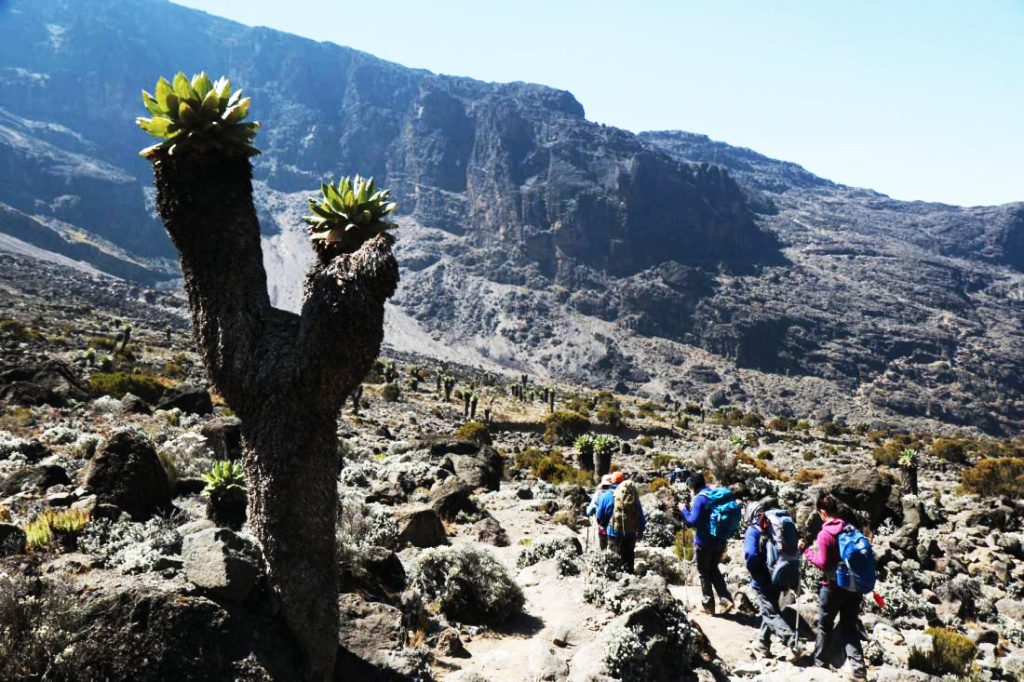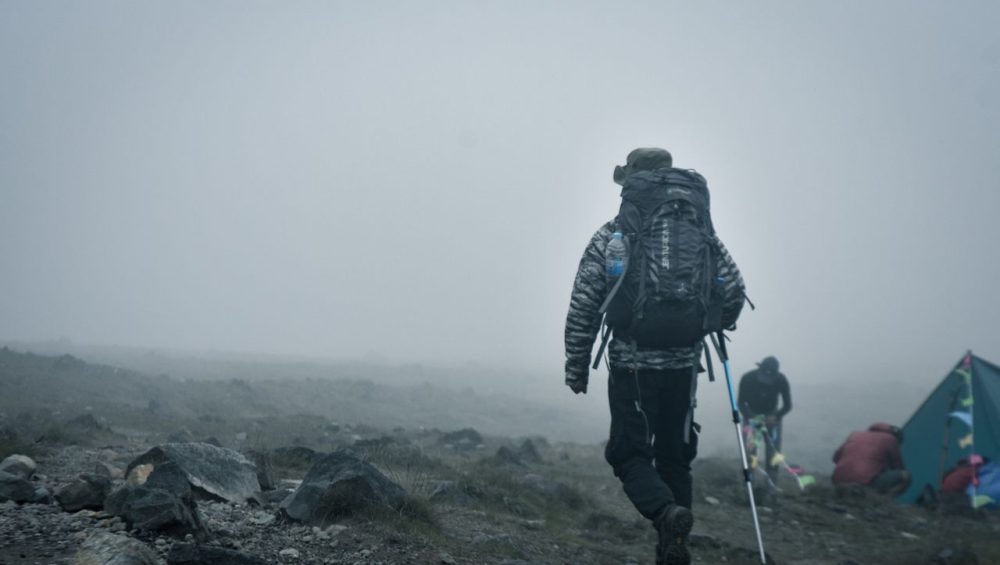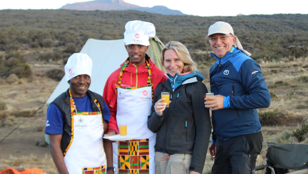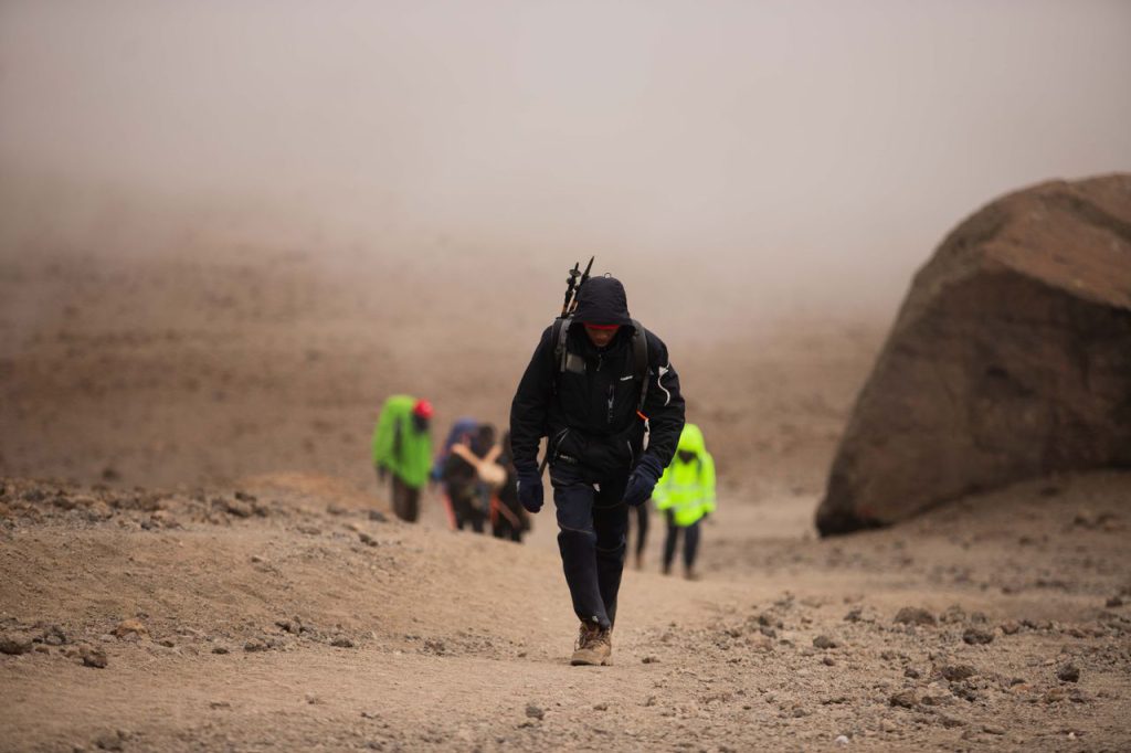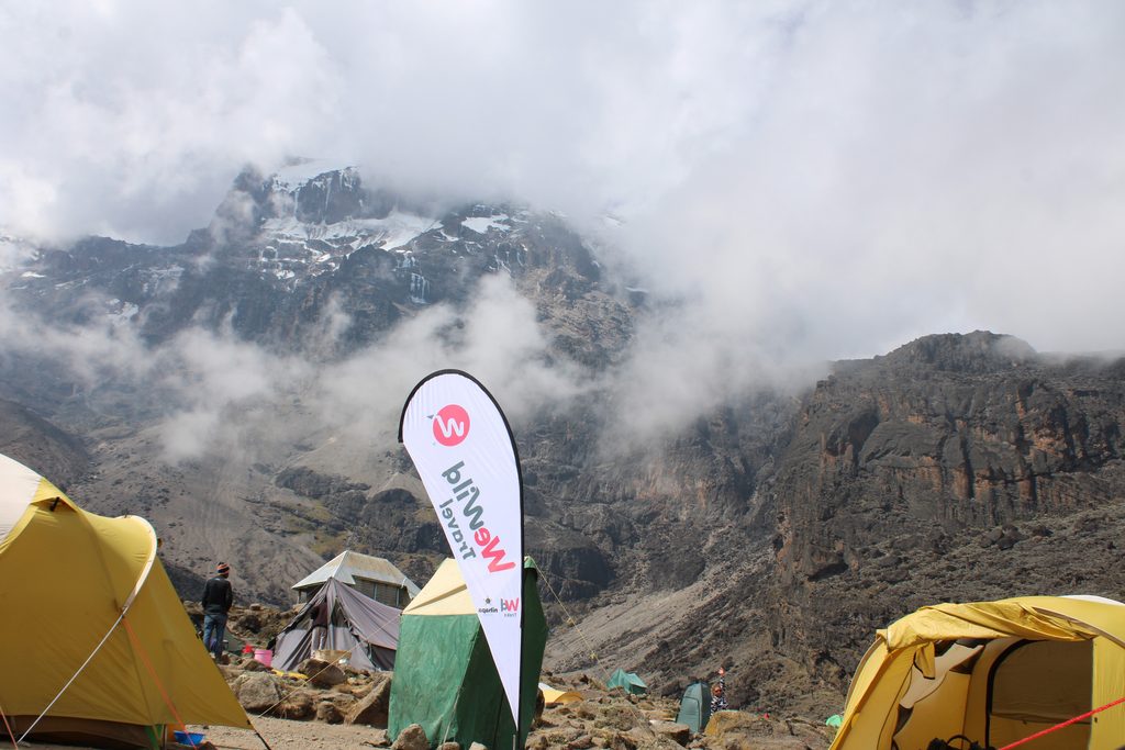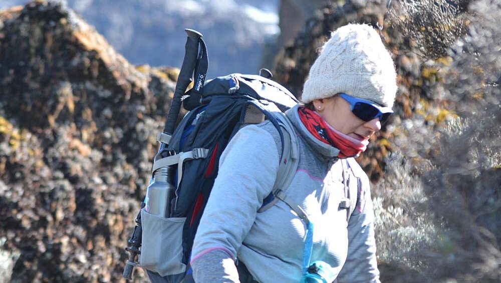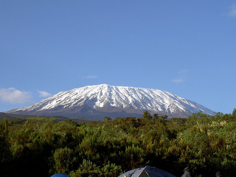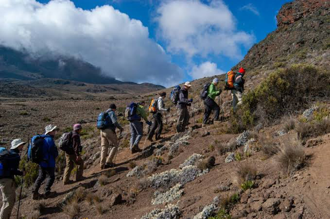
Shira Camp on Mount Kilimanjaro with open moorland and mountain views

Shira Plateau Kilimanjaro

Shira Plateau Kilimanjaro: Everything You Need to Know

Estimated reading time: 23 minutes

The Shira Plateau is a vast high-altitude plateau on the western side of Mount Kilimanjaro. It formed when the ancient Shira volcano collapsed thousands of years ago, leaving behind a broad landscape of grasslands, volcanic rock formations, and unique alpine vegetation. Today, the plateau serves as one of the most scenic sections of Kilimanjaro and plays a key role in popular trekking routes such as the Lemosho Route and the Northern Circuit Route.

At an average elevation of about 3,600 meters (11,811 feet), the Shira Plateau offers spectacular views of Kibo Peak, dramatic volcanic scenery, and excellent acclimatization opportunities. Many climbers consider it one of the most beautiful areas on Africa’s highest mountain.

Whether you plan to climb Kilimanjaro or simply want to learn about its geography, the Shira Plateau deserves a place on your itinerary.

What Is the Shira Plateau on Mount Kilimanjaro?

The Shira Plateau is a large volcanic plateau that sits on Kilimanjaro’s western flank. It marks the remains of the ancient Shira volcano, the oldest of the three volcanic cones that formed Mount Kilimanjaro.

Millions of years ago, volcanic activity created the Shira cone. Over time, the volcano became inactive and its summit collapsed, forming the broad plateau visitors see today. Later eruptions from Kibo Volcano reshaped parts of the landscape and added new volcanic features to the area.

Today, the Shira Plateau covers approximately 62 square kilometers and ranks among the highest plateaus in the world. The plateau attracts climbers with its wide-open views, fascinating geology, and unique plant life.

Is Shira a Volcano or a Plateau?

Shira is both a volcano and a plateau.

The original Shira Volcano formed more than two million years ago and became the first volcanic cone of the Kilimanjaro massif. After the volcano stopped erupting, its crater collapsed and created the Shira Plateau.

When people refer to the Shira Plateau today, they usually mean the large flat area that stretches across Kilimanjaro’s western side. When geologists discuss Shira, they often refer to the ancient volcano that existed before the collapse.

How the Shira Plateau Formed

The Shira Plateau formed through a series of volcanic and geological events.

First, volcanic eruptions built the Shira cone. Then the volcano became extinct and lost structural support near its summit. Eventually, the crater walls collapsed and created a massive caldera-like depression. Over time, lava flows from nearby Kibo Volcano covered parts of the eastern plateau and shaped the landscape seen today.

This process created one of the most distinctive geological features on Mount Kilimanjaro.

Why the Shira Plateau Is Important

The Shira Plateau plays an important role for both climbers and scientists.

For trekkers, the plateau provides excellent acclimatization opportunities before higher-altitude sections of the mountain. The relatively gentle terrain allows hikers to gain altitude gradually while enjoying panoramic views.

For researchers, the plateau offers valuable insights into Kilimanjaro’s volcanic history, ecosystems, and geological development.

The area also contains some of Kilimanjaro’s most famous landmarks, including Shira Cathedral, Shira Ridge, and Johnsell Point.

Where Is the Shira Plateau Located?

The Shira Plateau lies on the western side of Mount Kilimanjaro in northern Tanzania. It forms part of Kilimanjaro National Park and sits between the mountain’s lower rainforest zone and the higher alpine desert region. Most climbers reach the plateau through the Lemosho Route or the Northern Circuit Route, making it one of the first major highlights of their Kilimanjaro adventure.

The plateau offers wide-open landscapes, stunning views of Kibo Peak, and some of the mountain’s most unique volcanic scenery. Its location also makes it an important acclimatization area for climbers heading toward the summit.

Shira Plateau Location on Kilimanjaro

The Shira Plateau occupies Kilimanjaro’s western flank, between the Shira Ridge and the slopes of Kibo, the mountain’s highest volcanic cone. It stretches across a vast area of open moorland and volcanic terrain, creating one of the largest high-altitude plateaus in Africa.

Travelers typically enter the plateau after passing through Londorossi Gate and ascending from the western side of the mountain. From here, the landscape opens dramatically, revealing rolling grasslands, volcanic rock formations, and distant views of Kilimanjaro’s snow-capped summit.

Because of its position, the plateau serves as a natural gateway to several of Kilimanjaro’s most scenic trekking routes.

Shira Plateau Elevation and Size

The Shira Plateau sits at an average elevation of approximately 3,600 meters (11,811 feet) above sea level. Elevations across the plateau generally range from about 3,500 meters to nearly 4,000 meters, depending on the location.

Covering roughly 62 square kilometers (24 square miles), the plateau ranks among the highest and largest volcanic plateaus in the world. Its highest point, Johnsell Point, reaches approximately 3,962 meters (13,000 feet).

The combination of high altitude and relatively gentle terrain allows climbers to acclimatize while enjoying some of the most spectacular views on Mount Kilimanjaro.

Shira Plateau Map Overview

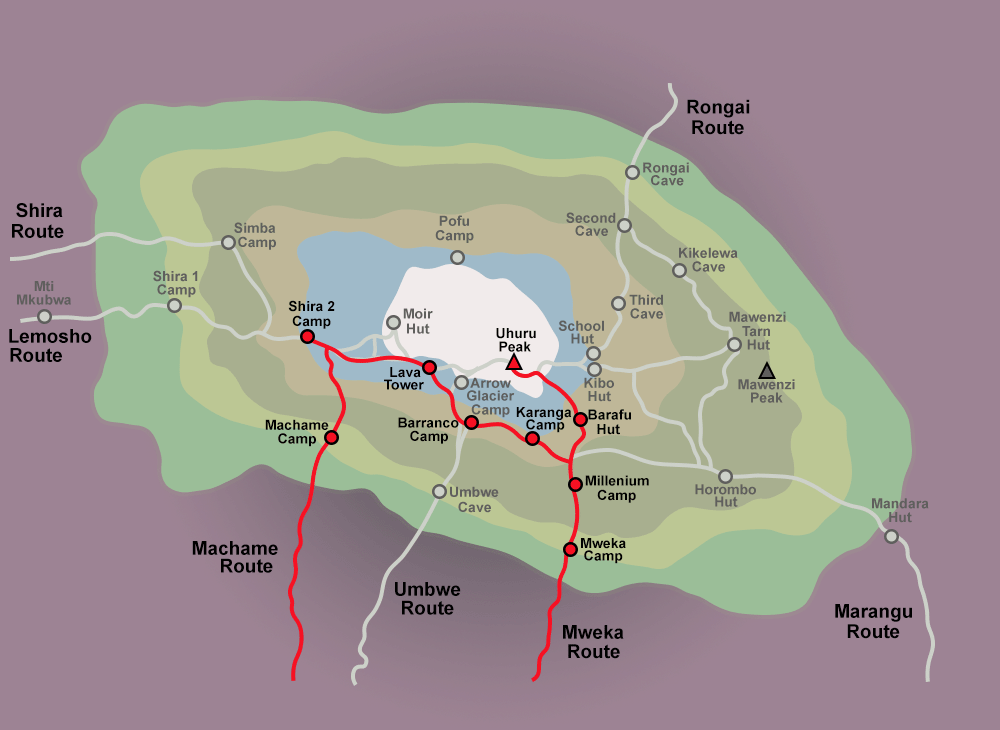
Map showing Shira Plateau location on Mount Kilimanjaro with western routes and surrounding mountain zones depicted

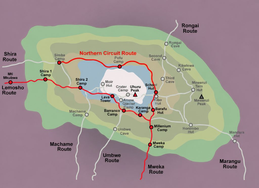
A map of the Shira Plateau shows a broad volcanic plain on Kilimanjaro’s western side. Several important landmarks stand out across the plateau, including Shira Cathedral, Shira Ridge, Johnsell Point, and the nearby Lava Tower.

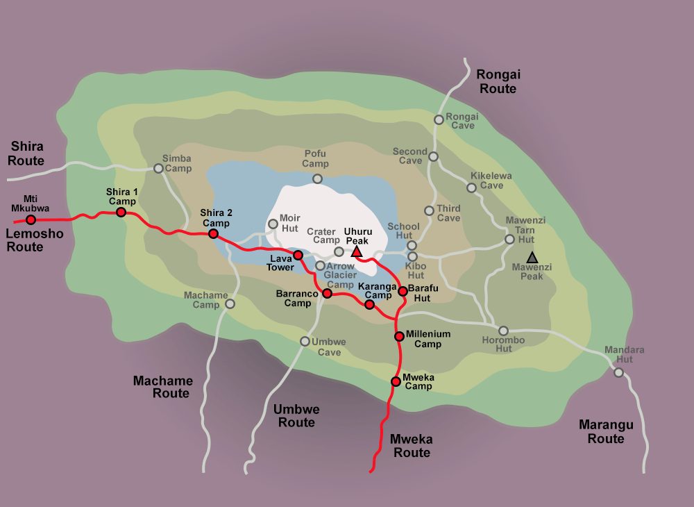
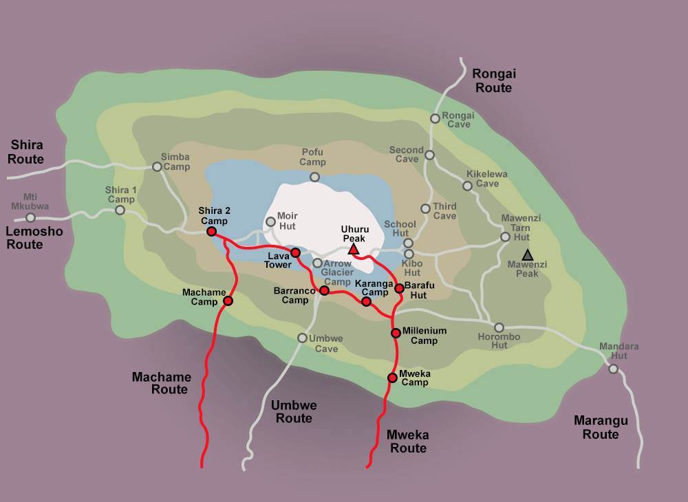
The Lemosho Route crosses the plateau from west to east before continuing toward Lava Tower and Barranco Camp. The Northern Circuit Route also passes through this area before circling around the northern slopes of Kibo.

When viewed on a Kilimanjaro route map, the Shira Plateau appears as a key transition zone between the mountain’s lower moorland habitats and the harsher alpine desert environment found at higher elevations.

Quick Facts About the Shira Plateau

The Shira Plateau is one of the most remarkable features on Mount Kilimanjaro. This vast high-altitude plateau combines stunning volcanic landscapes, unique plant life, and panoramic mountain views. Many climbers consider it one of the most beautiful sections of their Kilimanjaro trek.

Elevation

The Shira Plateau sits at an average elevation of approximately 3,600 meters (11,811 feet) above sea level. Most areas of the plateau range between 3,500 and 3,900 meters (11,480-12,795 feet).

Because of its high altitude, the plateau offers climbers their first real experience of Kilimanjaro’s alpine environment. The thinner air also helps trekkers begin acclimatizing before they move to higher camps on the mountain.

Highest Point

Johnsell Point marks the highest point on the Shira Plateau. This prominent summit rises to approximately 3,962 meters (13,000 feet) above sea level.

Several other notable landmarks surround the plateau, including Shira Cathedral, Klute Peak, and Shira Ridge. These volcanic formations create dramatic scenery and offer excellent viewpoints across the western side of Mount Kilimanjaro.

Climate and Weather

The Shira Plateau experiences cool temperatures throughout the year due to its high elevation. Daytime temperatures usually range between 5°C and 15°C (41°F-59°F), while nighttime temperatures often drop below freezing.

Clouds frequently drift across the plateau, especially during the rainy seasons. On clear days, trekkers enjoy spectacular views of Kibo Peak, Mount Meru, and the surrounding plains of northern Tanzania.

Weather conditions can change quickly, so climbers should carry warm layers, waterproof clothing, and sun protection.

Routes That Cross the Plateau

Several of Kilimanjaro’s most scenic routes cross the Shira Plateau.

Lemosho Route – The most popular route through the plateau. It offers excellent acclimatization, diverse scenery, and high summit success rates.

Northern Circuit Route – Kilimanjaro’s longest route. It crosses the plateau before circling around the quieter northern slopes of the mountain.

Shira Route – This route starts at a higher elevation and reaches the plateau quickly. Fewer climbers choose this option because the rapid altitude gain provides less time for acclimatization.

Each route gives trekkers the opportunity to experience the Shira Plateau’s open landscapes, unique vegetation, and breathtaking mountain views.

What Makes the Shira Plateau Unique?

The Shira Plateau stands out as one of the most extraordinary landscapes on Mount Kilimanjaro. Unlike the mountain’s steep trails and rugged slopes, the plateau offers a vast open expanse of volcanic terrain, unique alpine vegetation, and breathtaking views. Its geological history, high elevation, and dramatic scenery make it one of the most memorable parts of any Kilimanjaro climb.

One of the Highest Plateaus in the World

The Shira Plateau ranks among the highest plateaus on Earth. At an average elevation of about 3,600 meters (11,811 feet), it rises far above the surrounding plains of northern Tanzania.

Few places in the world allow visitors to walk across such a large plateau at this altitude while enjoying relatively gentle terrain. The combination of elevation and accessibility makes the Shira Plateau a rare geographical feature and one of Kilimanjaro’s most impressive natural attractions.

For many climbers, reaching the plateau feels like stepping into a completely different world above the clouds.

Views of Kibo Peak

The Shira Plateau offers some of the best views of Kibo Peak, the highest volcanic cone on Mount Kilimanjaro and home to Uhuru Peak.

On clear mornings, trekkers can see Kibo’s massive summit dome rising above the surrounding landscape. As sunlight reaches the mountain, the glaciers and rocky slopes create a spectacular scene that photographers and climbers never forget.

The open terrain of the plateau provides unobstructed views that few other sections of Kilimanjaro can match. Many climbers consider these views a highlight of the entire trek.

Volcanic Landscapes and Open Moorlands

Ancient volcanic activity shaped every part of the Shira Plateau. Today, visitors can see lava formations, volcanic rock outcrops, and rugged ridges that reveal Kilimanjaro’s geological past.

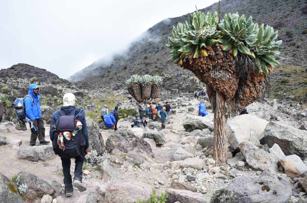
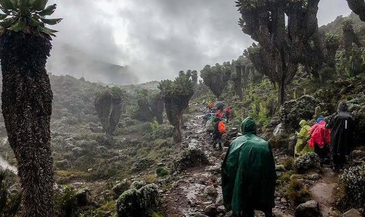
The plateau also supports vast moorlands covered with hardy alpine vegetation. Giant groundsels, giant lobelias, and colorful wildflowers thrive in this high-altitude environment despite the cool temperatures and harsh conditions.

This combination of volcanic terrain and open moorland creates a landscape unlike any other on Mount Kilimanjaro. The scenery changes constantly throughout the day as clouds drift across the plateau and sunlight illuminates the surrounding peaks and valleys.

Wildlife and Plants on the Shira Plateau

The Shira Plateau supports a remarkable variety of plant life despite its harsh high-altitude conditions. Cool temperatures, intense sunlight, and seasonal rainfall have created a unique environment where specialized species thrive. As climbers cross the plateau, they encounter some of Kilimanjaro’s most iconic plants and experience one of Africa’s most fascinating mountain ecosystems.

Giant Lobelias

Giant lobelia growing in Kilimanjaro's afro-alpine vegetation zone

Giant lobelias rank among the most recognizable plants on the Shira Plateau. These unusual plants grow tall rosettes of thick leaves that help them survive freezing nights and strong daytime sunlight.

Some giant lobelias can reach heights of over two meters (6.5 feet), creating striking silhouettes against the open landscape. Their unique appearance often surprises climbers who do not expect to find such large plants at high altitude.

The giant lobelia has adapted perfectly to Kilimanjaro’s challenging environment, making it a symbol of the mountain’s alpine zone.

Giant Groundsels

Giant groundsel plant adapted to cold conditions on Mount Kilimanjaro

Giant groundsels are another famous plant species found on the Shira Plateau. These tree-like plants belong to the daisy family and can grow several meters tall.

Their thick trunks store water, while their dense leaf crowns protect the plants from cold temperatures. Some specimens live for decades and become important landmarks along Kilimanjaro’s trekking routes.

The giant groundsels create an almost prehistoric landscape, giving the plateau a unique character that visitors rarely find elsewhere in the world.

Afro-Alpine Ecosystem

The Shira Plateau forms part of Kilimanjaro’s Afro-alpine ecosystem, a rare habitat found only on high mountains in East Africa. This ecosystem exists between the forest zone below and the alpine desert above.

Plants and animals in this environment have developed special adaptations that help them survive dramatic temperature changes, strong ultraviolet radiation, and limited oxygen levels.

In addition to giant lobelias and groundsels, the plateau supports hardy grasses, heathers, wildflowers, insects, and various bird species. Together, these organisms create a delicate ecosystem that contributes to Kilimanjaro’s status as one of Africa’s most important natural landmarks.

For many trekkers, the unique vegetation and open landscapes of the Shira Plateau provide some of the most memorable scenery on the journey to the summit of Mount Kilimanjaro.

Which Kilimanjaro Routes Pass Through the Shira Plateau?

Several of Mount Kilimanjaro’s most popular routes cross the Shira Plateau. These routes give climbers the opportunity to experience the plateau’s open landscapes, unique vegetation, and spectacular views of Kibo Peak. While each route follows a different itinerary, all offer unforgettable scenery as they traverse this remarkable section of the mountain.

Lemosho Route

The Lemosho Route is the most popular route that crosses the Shira Plateau. Many climbers choose this route because it combines beautiful scenery, gradual acclimatization, and high summit success rates.

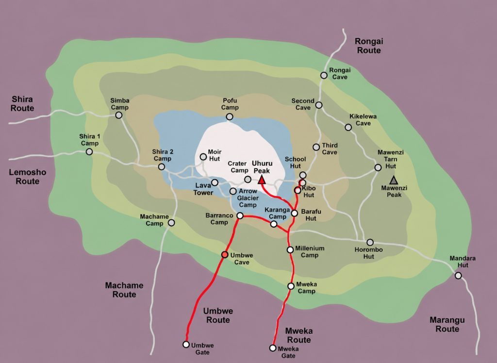
After entering Kilimanjaro National Park through Londorossi Gate, trekkers walk through rainforest and heathland before reaching the plateau. The route then continues eastward across Shira toward Lava Tower and the Southern Circuit.

The Lemosho Route typically takes 7 to 8 days, giving climbers plenty of time to adjust to the altitude while enjoying some of Kilimanjaro’s most impressive landscapes.

Northern Circuit Route

The Northern Circuit Route also passes through the Shira Plateau before circling around Kilimanjaro’s quieter northern slopes.

As the longest route on the mountain, the Northern Circuit offers excellent acclimatization and some of the highest summit success rates. After crossing the plateau, climbers continue around Kibo Peak and spend several days exploring remote sections of the mountain that receive far fewer visitors.

Trekkers who want solitude, diverse scenery, and maximum acclimatization often choose the Northern Circuit Route.

Shira Route

The Shira Route begins at a higher elevation than most Kilimanjaro routes and reaches the plateau almost immediately.

Vehicles transport climbers to the starting point at around 3,500 meters (11,480 feet), which reduces the amount of hiking required during the first day. While this route offers beautiful scenery, the rapid altitude gain provides less time for acclimatization.

For this reason, many climbers prefer the Lemosho Route, which follows a similar path but starts at a lower elevation and allows a more gradual ascent.

Route Comparison Table

RouteDurationStarting ElevationDifficultyAcclimatizationBest For
Lemosho Route7-8 DaysLowModerateExcellentFirst-time climbers and scenic trekking
Northern Circuit Route8-10 DaysLowModerateExcellentMaximum acclimatization and fewer crowds
Shira Route6-8 DaysHighModerate to ChallengingFairExperienced trekkers comfortable with altitude

For most climbers, the Lemosho Route offers the best overall experience on the Shira Plateau. However, the Northern Circuit provides greater solitude, while the Shira Route offers the quickest access to this spectacular high-altitude landscape.

Shira Route vs Lemosho Route

Trekkers usually spend 1 to 2 days on or around the Shira Plateau, depending on the route they choose. Shorter itineraries, such as the Shira Route, may cross the plateau in a single day, while the Lemosho and Northern Circuit routes allow more time to explore this remarkable area. Your itinerary and acclimatization schedule determine exactly how long you stay on the plateau. Extra time at this altitude helps your body adapt to thinner air, increasing your chances of a successful summit. During the journey, you’ll also have plenty of opportunities to admire the dramatic volcanic landscape, capture stunning photographs, and experience one of Kilimanjaro’s most scenic regions.

Shira Route and Lemosho Route are both western routes on Mount Kilimanjaro but they are different in safety, difficulty, and acclimatization. Shira Route starts at a very high altitude, around 3,500 meters, so climbers enter thin air immediately. Lemosho Route starts lower in the rainforest zone and climbs slowly. This makes Lemosho safer and more popular. Both routes give good views, but Lemosho gives a better trekking experience and higher summit success because the body adjusts better to altitude.

Key Differences

The main difference is altitude at the start. Shira Route starts high, so climbers feel altitude effects early. Lemosho Route starts low and climbs step by step. Shira Route skips the rainforest zone, while Lemosho passes through forest, moorland, and alpine desert. Lemosho gives more time for acclimatization, which reduces altitude sickness. Shira is shorter in lower zones but more difficult for beginners. Lemosho is longer but safer and more stable for most trekkers.

Advantages and Disadvantages

Shira Route advantages are fast access to high altitude views and fewer forest sections. But it has disadvantages like higher altitude sickness risk, poor acclimatization, and lower success rate. Lemosho Route advantages are better acclimatization, higher summit success rate, and more scenic variety. It is also safer for beginners. Its disadvantages are longer trekking days and higher cost because of more time on the mountain. Overall, Lemosho gives a better and safer climbing experience.

Which Route Is Better for Acclimatization?

Lemosho Route is better for acclimatization. It starts lower and allows the body to adjust slowly to altitude. This reduces headaches, tiredness, and altitude sickness. Shira Route starts too high, so the body struggles to adjust quickly. Because of this, Lemosho has a higher chance of reaching Uhuru Peak safely.

Top Attractions on the Shira Plateau

The Shira Plateau has several famous natural attractions that make it one of the most interesting parts of Mount Kilimanjaro. These attractions include rock formations, viewpoints, and volcanic features formed from ancient volcanic activity. Trekkers pass through or near these spots while hiking western routes like Lemosho, Shira, and Northern Circuit. Each attraction offers unique scenery, clear views of Kibo Peak, and great photography opportunities. The area is open, high-altitude, and peaceful, making it a memorable section of the climb for many hikers.

Shira Cathedral

Shira Cathedral is one of the most iconic rock formations on the Shira Plateau. It is a large volcanic structure shaped by ancient lava and erosion over time. Trekkers often stop here because it offers wide views of the surrounding plateau and Kibo Peak. The area feels open and quiet, with strong winds and thin air due to high altitude. It is also used as a resting point during acclimatization hikes. Its massive cliffs and distinctive rock formations make Shira Cathedral one of the most photographed landmarks on this side of Mount Kilimanjaro.

Shira Ridge

Shira Ridge is a long elevated section of the plateau that offers clear panoramic views of the landscape. From the ridge, trekkers can see open moorlands, volcanic rock formations, and distant views of the summit area. The ridge is important for acclimatization because it keeps climbers active at high altitude. The area is usually windy and cold, but the visibility is often very good on clear days. Many trekking routes pass near or along Shira Ridge, making it a natural viewpoint where climbers can rest and take photos.

Johnsell Point

Johnsell Point is a less crowded viewpoint on the Shira Plateau. It is used as a resting or observation spot during trekking. From this point, climbers can see wide open plains and parts of the mountain landscape. It is not as famous as other landmarks, but it is still valuable for its calm environment and scenic views. Trekkers often stop here to adjust to altitude and enjoy the silence of the plateau. The location gives a clear feeling of isolation and high-altitude wilderness.

Lava Tower

Lava Tower is a major volcanic rock formation near the Shira Plateau area and is one of the key acclimatization points on Kilimanjaro. It was formed from solidified lava from ancient volcanic activity. Trekkers usually pass this area on routes like Lemosho and Northern Circuit. The climb to Lava Tower helps the body adjust to higher altitude before descending for sleep, which improves acclimatization. The landscape around Lava Tower is rocky, dry, and very exposed, showing the harsh alpine environment of Kilimanjaro.

Can You Drive to the Shira Plateau?

Yes, you can drive close to the Shira Plateau, but you cannot drive across it. Vehicles can reach a high starting point on the western side of Mount Kilimanjaro through Londorossi Gate. From there, trekkers continue on foot. This makes the Shira Route different from other routes because it allows a vehicle-supported start at high altitude. However, the real experience of the plateau still requires hiking. The drive mainly helps reduce walking distance at the beginning, but climbers still need to adapt to high altitude conditions immediately after starting the trek.

Signboard marking the Shira Plateau along a Kilimanjaro trekking route

Access via Londorossi Gate

Londorossi Gate is the main access point used to reach the Shira Plateau area from the western side of Kilimanjaro. Vehicles drive from Moshi or Arusha through forest roads until they reach a drop-off point above the rainforest zone. This route is rough and depends on weather conditions, especially during rainy seasons. From Londorossi Gate, trekkers register and then continue deeper into the mountain area. This gate is important because it allows access to higher starting points compared to other Kilimanjaro routes.

Vehicle Access Explained

Vehicles can only go part of the way to the Shira Plateau. They stop at a designated drop-off point where the road ends and trekking begins. The rest of the journey must be done on foot because the terrain becomes too steep, rocky, and protected for vehicles. This is also done to protect the environment and maintain the natural condition of the mountain. The vehicle access mainly helps trekkers start at higher altitude, which shortens the first trekking section but increases immediate exposure to thin air.

What to Expect After Arrival

After arriving at the drop-off point, trekkers immediately enter a high-altitude environment. The air is cooler, thinner, and more open compared to the forest zone below. The landscape becomes wide and volcanic, with few trees and more grassland and rock formations. Climbers often feel the altitude quickly because of the elevation. The trekking begins across open moorland, and the scenery becomes very expansive with views of Kibo Peak on clear days. It is a quiet and remote area with strong winds and changing weather conditions.

How the Shira Plateau Helps With Acclimatization

The Shira Plateau plays an important role in helping climbers adjust to high altitude on Mount Kilimanjaro. It sits at a high elevation where oxygen levels are lower, so the body starts adapting early. This area is often used in western routes like Lemosho and Northern Circuit to improve acclimatization before moving to higher camps. Spending time on the plateau helps reduce altitude sickness because climbers experience high altitude conditions while still trekking at a steady pace. The open landscape also allows gradual exposure to changing oxygen levels, which helps the body prepare for the summit push.

Altitude Benefits

The main benefit of the Shira Plateau is its high altitude. At around 3,500 meters, the air is thinner and contains less oxygen compared to lower parts of the mountain. When climbers spend time here, their bodies start producing more red blood cells to carry oxygen more efficiently. This natural adjustment helps reduce symptoms of altitude sickness such as headaches, nausea, and fatigue. Because climbers are already exposed to high altitude early in the trek, their bodies become stronger and more prepared for higher camps later on Kilimanjaro.

Climb High, Sleep Low Principle

The “climb high, sleep low” principle is commonly used around the Shira Plateau area. Climbers hike to higher elevations during the day, such as ridges or nearby peaks, and then descend to sleep at a lower camp. This method helps the body adjust to altitude without putting too much stress on it. On the Shira Plateau, this process works well because the terrain allows easy movement between different elevations. It improves oxygen efficiency and gives the body time to recover at night, which is very important for long climbs like Kilimanjaro.

Impact on Summit Success Rates

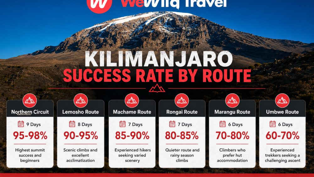
The Shira Plateau improves summit success rates because it supports early acclimatization. Climbers who spend time adjusting at this altitude are less likely to suffer from severe altitude sickness later on the mountain. This leads to better energy levels, stronger performance, and more stable climbing progress. Routes that pass through the Shira Plateau, especially Lemosho and Northern Circuit, usually have higher success rates compared to shorter or steeper routes. Proper acclimatization here increases the chance of reaching Uhuru Peak safely and comfortably.

Best Time to Visit the Shira Plateau

The best time to visit the Shira Plateau is during the dry seasons when the weather is more stable and the trails are easier to walk. During these months, the sky is usually clear, visibility is good, and trekkers get better views of Kibo Peak and the surrounding landscapes. The plateau is high and exposed, so weather changes quickly, but dry seasons reduce rain, mud, and cloud cover. This makes trekking safer and more comfortable, especially for climbers who want better photography and easier hiking conditions. The main trekking seasons on Kilimanjaro also match these periods, so more guided climbs happen during this time.

January to March

January to March is a good time to visit the Shira Plateau. The weather is generally clear, and the mountain is less crowded compared to peak season. Temperatures are cold, especially at night and early morning, but daytime conditions are usually stable for trekking. This period also offers good visibility of the landscape, including wide views of the plateau and Kibo Peak. However, some light rain can still occur in early March, so trekkers should be prepared for mixed conditions. Overall, this season is suitable for climbers who prefer fewer crowds and calm trekking routes.

June to October

June to October is the most popular and best time to visit the Shira Plateau. This is the main dry season in Tanzania, so the weather is more stable and predictable. Trails are dry, skies are often clear, and visibility is excellent. This makes it easier to enjoy the open landscapes of the plateau and take clear photos. Temperatures are cold but manageable for most trekkers. Because this is peak season, more climbers are on the mountain, so routes can feel busier. However, it is the safest and most reliable time for trekking Kilimanjaro.

Rainy Seasons

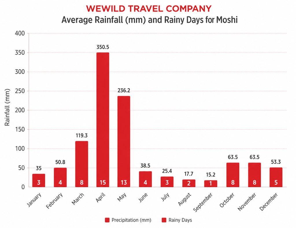
The rainy seasons are from April to May and again in November. During this time, the Shira Plateau becomes wetter, colder, and more difficult to trek. Clouds often cover the mountain, reducing visibility and blocking views of Kibo Peak. Trails can become muddy and slippery, making hiking more challenging. Heavy rain is not constant, but conditions are less stable compared to dry seasons. Fewer trekkers choose this time, so the mountain feels quiet and less crowded. However, it is not the best time for beginners or first-time Kilimanjaro climbers due to weather difficulty.

FAQ

Frequently Asked Questions About the Shira Plateau

The Shira Plateau is one of the most interesting parts of Mount Kilimanjaro, and many trekkers ask questions about its height, difficulty, routes, and trekking time. These questions usually come from climbers who want to understand what to expect before choosing a route. The plateau sits at high altitude and is part of several major Kilimanjaro routes, so it plays an important role in acclimatization and scenery. Below are the most common questions with simple answers to help you understand the Shira Plateau better before your climb.

How High Is the Shira Plateau?

The Shira Plateau is about 3,500 meters above sea level. This makes it one of the highest plateaus on Mount Kilimanjaro. At this altitude, the air is thinner and oxygen levels are lower compared to the lower forest zones. Climbers often feel the change in breathing and energy when they reach this level. Because of the height, the plateau is an important acclimatization area for western routes like Lemosho and Northern Circuit. The high elevation also creates wide views of the mountain landscape and Kibo Peak on clear days.

Can Beginners Visit the Shira Plateau?

Yes, beginners can visit the Shira Plateau, but only as part of a guided Kilimanjaro trek. The plateau is not a tourist site you can visit independently; it is inside the mountain climbing routes. Beginners usually experience it through routes like Lemosho, which are safer because they allow gradual acclimatization. However, the altitude is high, so beginners must be prepared for thin air, cold temperatures, and physical effort. With proper guidance, pacing, and acclimatization, beginners can safely experience the Shira Plateau during their climb.

Which Route Offers the Best Views?

The Northern Circuit Route offers the best views of the Shira Plateau because it spends more time crossing the area. Trekkers get wide panoramic views of open moorlands, volcanic formations, and Kibo Peak. The Lemosho Route also offers excellent views and is very popular for scenic trekking. Both routes pass through beautiful parts of the plateau, but Northern Circuit gives the longest and most detailed experience. Shira Route also offers direct views, but it is shorter and less commonly used today. Overall, Northern Circuit provides the most complete visual experience.

How Long Do Trekkers Spend on the Plateau?

Trekkers usually spend 1 to 2 days on or around the Shira Plateau depending on the route. Shorter routes like Shira may pass through quickly in one day, while Lemosho and Northern Circuit spend more time crossing and exploring the area. The duration depends on the trekking schedule and acclimatization plan. Spending more time on the plateau helps the body adjust better to altitude and improves summit success chances. Longer exposure also allows trekkers to enjoy the scenery, take photos, and experience the unique volcanic landscape of this part of Kilimanjaro.

Final Thoughts on the Shira Plateau Kilimanjaro

The Shira Plateau is one of the most important and scenic areas on Mount Kilimanjaro. It offers wide open landscapes, strong volcanic features, and clear views of Kibo Peak. It also plays a key role in acclimatization because of its high altitude. Trekkers passing through this area experience one of the most unique sections of the mountain, especially on western routes like Lemosho and Northern Circuit. The plateau shows both the beauty and the challenge of Kilimanjaro, combining high elevation with dramatic natural scenery. For most climbers, it becomes a memorable highlight of the entire journey to Uhuru Peak.

Chagga people of Tanzania working on banana and coffee farms on the slopes of Mount Kilimanjaro

The Chagga of Kilimanjaro

The Chagga People of Tanzania: Culture, History, Traditions and Life on Mount Kilimanjaro

Estimated reading time: 25 minutes

The Chagga people are one of Tanzania’s largest ethnic groups who live on the slopes of Mount Kilimanjaro. They have built thriving farming communities for centuries, known especially for coffee and banana cultivation.

Many visitors to Tanzania encounter the Chagga while climbing Mount Kilimanjaro because many local guides, porters, and tourism professionals come from Chagga communities. Their deep knowledge of the mountain, combined with a long history of agriculture and trade, has helped shape the Kilimanjaro region into one of the most developed areas in the country.

The Chagga have preserved many aspects of their cultural heritage, including traditional foods, music, dances, crafts, and community customs. At the same time, they have embraced education, entrepreneurship, and modern technology, creating a unique blend of tradition and progress.

In this guide, you’ll learn who the Chagga people are, where they live, what they believe, what they eat, how they built their society on the slopes of Mount Kilimanjaro, and why they remain an important part of Tanzania’s cultural identity today.

Who Are the Chagga People?

The Chagga are a Bantu ethnic group that lives on the southern and eastern slopes of Mount Kilimanjaro in northern Tanzania. They are one of the largest ethnic groups in the country and have played a major role in Tanzania’s agricultural, educational, and economic development. The Chagga are best known for coffee farming, banana cultivation, and their long connection to Africa’s highest mountain.

Map showing Chagga people living on the slopes of Mount Kilimanjaro in Tanzania

Why Are the Chagga Important in Tanzania?

The Chagga have made significant contributions to Tanzania’s economy and society for generations. Their fertile homeland on Mount Kilimanjaro supports some of the country’s most productive coffee and banana farms. Many Chagga families have invested heavily in education, helping produce teachers, business owners, government leaders, and tourism professionals.

The Chagga also pioneered organized coffee production through cooperative societies, which helped local farmers access international markets. Today, they remain one of Tanzania’s most economically active and educated communities.

Why Are They Associated with Mount Kilimanjaro?

The Chagga are the indigenous people of Mount Kilimanjaro and have lived on its slopes for hundreds of years. Their villages stretch across the mountain’s lower elevations, where fertile volcanic soil and reliable water sources support farming and daily life.

Because of this close relationship with the mountain, the Chagga developed extensive knowledge of Kilimanjaro’s climate, forests, trails, and natural resources. Many of the guides and porters who assist climbers on Mount Kilimanjaro come from Chagga communities. Visitors who explore the mountain often encounter Chagga culture through village tours, coffee farms, traditional foods, and historical sites such as the famous Chagga caves.

Today, Mount Kilimanjaro and the Chagga people remain deeply connected, and the Chagga community plays an important role in the mountain’s cultural heritage.

Quick Facts About the Chagga People

Population

The Chagga are one of the largest ethnic groups in Tanzania, with an estimated population of over one million people. Most Chagga people live in northern Tanzania, especially around Mount Kilimanjaro.

Location

The Chagga live on the southern and eastern slopes of Mount Kilimanjaro. Their communities stretch across the Kilimanjaro Region, with major populations in towns like Moshi and surrounding rural villages.

Language

The Chagga speak Kichagga, which includes several related dialects. Most Chagga people also speak Swahili, and many use English for education, business, and tourism.

Religion

Most Chagga people follow Christianity today, mainly Catholic and Protestant denominations. A smaller number follow Islam or continue to practice traditional beliefs alongside modern religions.

Traditional Occupation

The Chagga traditionally practice farming. They build their livelihoods around agriculture, irrigation systems, and small-scale livestock keeping.

Main Crops

The Chagga grow bananas as their staple food crop and coffee as their main cash crop. They also cultivate maize, beans, cassava, sweet potatoes, and a variety of fruits and vegetables due to the fertile volcanic soil of Mount Kilimanjaro.

Where Do the Chagga People Live?

The Chagga people live in northern Tanzania on the fertile slopes of Mount Kilimanjaro. Most Chagga communities are found on the southern, eastern, and northern lower mountain regions where the land is rich, well-watered, and suitable for farming. Their settlements also extend into nearby towns such as Moshi and Arusha, where many Chagga people now live for work, education, and business. Despite urban migration, the majority of Chagga families still maintain strong roots in their ancestral villages on Mount Kilimanjaro.

Which Regions of Tanzania Are Home to the Chagga?

The Chagga mainly live in the Kilimanjaro Region of Tanzania. Their communities are spread across districts such as Moshi Rural, Moshi Urban, Hai, Siha, and Rombo. These areas lie directly on or around the slopes of Mount Kilimanjaro. The region offers fertile volcanic soil and reliable rainfall, which makes it one of the most productive agricultural zones in the country. Some Chagga also live in nearby Arusha Region, especially in Arusha city, where they participate in tourism, trade, and professional jobs.

Why Did the Chagga Settle on Mount Kilimanjaro?

The Chagga settled on Mount Kilimanjaro because the mountain provided the best conditions for survival and farming. The volcanic soil is extremely fertile and supports crops like bananas, coffee, maize, and beans. The mountain also receives regular rainfall and has many natural springs and rivers that supply water throughout the year. The cooler highland climate reduces disease compared to lowland areas. Over time, the Chagga developed advanced irrigation systems and terraced farming techniques to maximize food production on the steep slopes.

Do Chagga People Still Live on Kilimanjaro Today?

Yes, the Chagga people still live on Mount Kilimanjaro today, and they remain the dominant ethnic group in the region. Most Chagga families continue to live in rural villages where they grow bananas and coffee and maintain traditional homesteads. At the same time, many Chagga have moved to towns like Moshi, Arusha, and Dar es Salaam for education, employment, and business opportunities. Even those living outside Kilimanjaro often keep strong cultural, family, and economic ties to their home villages, and many return regularly for farming, ceremonies, and community events.

What Is the History of the Chagga People?

The history of the Chagga people connects deeply with Mount Kilimanjaro, where they built organized societies, developed advanced farming systems, and formed powerful local kingdoms. Over time, they adapted to environmental changes, external influences, and colonial contact while maintaining strong cultural identity and traditions.

When Did the Chagga Arrive on Kilimanjaro?

Historians believe the Chagga began settling on the slopes of Mount Kilimanjaro between the 15th and 16th centuries. They moved into the region because it offered fertile volcanic soil, steady rainfall, and reliable water sources from mountain streams. As a result, they quickly established permanent settlements and developed intensive farming systems.

In addition, the Chagga built terraced fields and irrigation channels to maximize food production on the steep mountain slopes. Over time, these innovations allowed them to support large populations in a relatively small geographic area.

The Rise of the Chagga Kingdoms

Before colonial rule, the Chagga did not form a single unified kingdom. Instead, they organized themselves into several independent chiefdoms, each ruled by a local leader known as a “mangi.”

Moreover, these chiefdoms often competed for land, water, and trade control. Because of this competition, the Chagga developed strong defensive systems, including underground tunnels and fortified villages.

However, despite internal conflicts, trade and cooperation also existed between neighboring communities. This balance of competition and collaboration helped shape a complex and highly organized society on Mount Kilimanjaro.

European Missionaries and Colonial Influence

European missionaries arrived in the 19th century and introduced Christianity, formal education, and new administrative systems. For example, missionaries translated religious texts into local languages and established schools in Chagga areas.

As a result, many Chagga people gained early access to education compared to other regions in East Africa. In addition, colonial administrators introduced cash crops like coffee, which transformed the local economy.

Nevertheless, these external influences also changed traditional leadership structures and cultural practices. Despite this, the Chagga adapted quickly and used education and trade opportunities to strengthen their position in the region.

How Chagga Society Changed Over Time

Over time, Chagga society evolved from small independent chiefdoms into a more connected and economically active community. Today, many Chagga people live in both rural villages and urban centers such as Moshi and Arusha.

Furthermore, education, entrepreneurship, and tourism have become important parts of modern Chagga life. While many families still practice traditional farming, others now work in business, government, and the tourism industry.

However, the Chagga continue to maintain strong cultural ties to their ancestral land on Mount Kilimanjaro. For this reason, traditions, language, and community identity remain important in both rural and urban settings.

What Are the Chagga People Known For?

The Chagga people are known for their strong agricultural systems, economic creativity, and high level of education compared to many other communities in Tanzania. Over time, they have developed a reputation for turning the fertile slopes of Mount Kilimanjaro into one of the most productive farming regions in East Africa. In addition, they have built a strong culture of trade, business, and education that continues to shape their success today.

Coffee Farming

Arabica coffee farm on Mount Kilimanjaro in Tanzania

The Chagga people are widely known for coffee farming, especially Arabica coffee grown on the slopes of Mount Kilimanjaro. They grow coffee in small family-owned farms where they carefully manage each stage of production, from planting to harvesting and drying.

Moreover, the region’s volcanic soil and cool climate create ideal conditions for high-quality coffee beans. As a result, Kilimanjaro coffee has gained international recognition for its rich flavor and smooth taste. Many Chagga farmers also work through cooperatives, which help them sell their coffee in local and global markets.

Banana Cultivation

Banana farming plays a central role in Chagga daily life. The Chagga people grow many varieties of bananas, and they use them as a staple food in most meals. They prepare bananas in different ways, including boiling, frying, and fermenting them for traditional drinks.

In addition, banana plantations often grow alongside coffee plants in a mixed farming system. This system improves soil fertility and maximizes land use on the mountain slopes. Therefore, bananas remain both a food source and a cultural symbol for the Chagga community.

Advanced Irrigation Systems

The Chagga people are also known for their advanced irrigation systems, which they developed to support farming on the steep slopes of Mount Kilimanjaro. They built channels that carry water from mountain streams directly into their farms.

Furthermore, these irrigation networks allowed them to grow crops throughout the year, even during dry seasons. Because of this innovation, the Chagga achieved high agricultural productivity in a challenging mountain environment. Today, many of these traditional irrigation systems still operate in rural villages.

Education and Entrepreneurship

Education and entrepreneurship also define modern Chagga society. The Chagga people value education highly, and many families invest heavily in schooling for their children. As a result, a large number of Chagga individuals work in professional fields such as teaching, tourism, government, and business.

Moreover, the Chagga have a strong tradition of entrepreneurship. They run small businesses, coffee cooperatives, transport services, and tourism-related ventures around Mount Kilimanjaro. This business mindset has helped them build economic stability and expand opportunities beyond agriculture.

What Language Do the Chagga Speak?

The Chagga people speak Kichagga, a group of closely related Bantu languages spoken on the slopes of Mount Kilimanjaro. In addition, most Chagga people also speak Swahili, which serves as Tanzania’s national language, and many use English for education, tourism, and business. As a result, most Chagga communities communicate in more than one language in daily life.

The Kichagga Language

The Chagga people speak Kichagga as their native language at home and within their communities. Kichagga belongs to the Bantu language family and reflects the long history of the Chagga people on Mount Kilimanjaro.

Moreover, Kichagga plays an important role in preserving cultural identity, traditional stories, and local knowledge. However, because education and media mainly use Swahili and English, younger generations often mix Kichagga with these languages in everyday communication.

Chagga Dialects

Kichagga does not exist as a single uniform language. Instead, it includes several dialects that vary from one area of Mount Kilimanjaro to another. For example, communities in Moshi, Hai, and Rombo may speak slightly different versions of Kichagga.

In addition, these dialects remain mutually understandable in most cases, although pronunciation and vocabulary can differ. Despite these variations, the Chagga people still share a strong cultural identity through their language.

Do Chagga People Speak Swahili and English?

Yes, most Chagga people speak Swahili fluently because it serves as Tanzania’s national language and is used in schools, government, and daily communication. Therefore, Swahili acts as a common language between different ethnic groups in the country.

Furthermore, many Chagga people also speak English, especially those involved in tourism, business, and higher education. As a result, the Chagga community often communicates in three languages: Kichagga at home, Swahili in public life, and English in professional or international settings.

What Is Traditional Chagga Culture Like?

Traditional Chagga culture reflects a strong connection to family, farming, and community life on the slopes of Mount Kilimanjaro. The Chagga people built a society based on cooperation, hard work, and respect for elders. In addition, their cultural identity continues to evolve as modern influences mix with long-standing traditions.

Family and Community Life

Family plays a central role in Chagga society. Traditionally, extended families lived close to one another and worked together on farms, sharing responsibilities and resources. Men usually handled farming and livestock, while women managed household duties, food preparation, and trade in local markets.

Moreover, community cooperation remains important today. Neighbors often support each other during farming seasons, weddings, and other social events. As a result, Chagga society maintains strong social bonds that connect individuals to their families and villages.

Traditional Beliefs and Rituals

Before the spread of Christianity and Islam, the Chagga practiced traditional beliefs centered on a creator spirit known as Ruwa. These beliefs guided their understanding of nature, life, and ancestral connections.

However, over time, most Chagga people adopted Christianity, especially Catholicism and Protestantism. Despite this shift, some traditional practices and rituals still exist, particularly in rural areas. For example, people may still use symbolic plants or rituals to promote healing, protection, or reconciliation within families and communities.

Music and Dance

Traditional cultural dance performance in Kilimanjaro region

Music and dance play an important role in Chagga celebrations and cultural expression. Traditionally, people used drums, bells, and flutes to accompany dances during ceremonies such as weddings, harvests, and community gatherings.

Furthermore, music often tells stories about daily life, farming, love, and history. Today, while modern instruments are more common, traditional songs and dances still appear during cultural festivals and tourist performances, helping preserve Chagga heritage.

Traditional Crafts

The Chagga people are also known for their traditional crafts, which include basket weaving, wood carving, pottery, and tool making. These crafts supported daily life by producing household items, farming tools, and ceremonial objects.

In addition, skilled artisans created decorative items such as beadwork and woven mats. Over time, many of these crafts became part of cultural tourism, allowing visitors to learn about Chagga traditions while supporting local artisans economically.

What Do Traditional Chagga Houses Look Like?

Traditional Chagga houses reflect the practical needs of life on the slopes of Mount Kilimanjaro. These homes were designed to provide warmth, protection, and close family living in a cool and often rainy mountain environment. Over time, house designs changed, but many cultural elements still influence modern Chagga housing today.

The Beehive-Shaped House

Traditional Chagga houses often had a beehive shape with a low structure and a single entrance. Builders used natural materials such as grass, banana leaves, branches, mud, and sometimes cow dung to construct the walls and roof.

Moreover, these houses did not have windows, which helped keep the interior warm during cold nights on the mountain. The roof and walls often formed a continuous structure, which protected the home from heavy rain and strong winds. As a result, these houses created a simple but effective living space adapted to the local climate.

Why Did Families Live with Livestock?

In traditional Chagga households, families often lived together with their livestock inside the same structure. This practice helped protect animals from predators and theft, especially during the night.

In addition, livestock such as goats and cattle provided warmth in the house, which was important in the cold mountain climate. Animal manure also supported farming activities, as families used it as fertilizer for their banana and coffee gardens. Therefore, living closely with livestock supported both survival and agriculture.

Modern Chagga Homes Today

Today, most Chagga families live in modern houses made from bricks, cement, and iron sheets. These homes often include separate rooms, windows, and improved ventilation compared to traditional structures.

However, many cultural practices still remain. For example, families continue to rely on agriculture, and some households still use traditional cooking methods over open fires. Furthermore, many Chagga homes still stand near banana and coffee farms, maintaining a strong connection to their ancestral way of life on Mount Kilimanjaro.

What Food Do the Chagga Eat?

The Chagga people eat a diet that strongly depends on what they grow on the fertile slopes of Mount Kilimanjaro. Their meals mainly include bananas, vegetables, grains, and meat, which they prepare using traditional cooking methods passed down through generations. In addition, food plays an important role in cultural ceremonies, family gatherings, and community celebrations.

Mtori

Mtori is one of the most famous traditional Chagga dishes. People prepare it as a thick stew made from bananas and meat, usually beef or goat. The dish has a soft texture and rich flavor, making it a common meal for families, especially during important occasions.

Moreover, Mtori is often served to guests as a sign of respect and hospitality. It provides both nutrition and warmth, which is important in the cooler climate of Mount Kilimanjaro.

Ugali

Ugali is a staple food in Chagga households, as well as in many parts of Tanzania. People prepare it by cooking maize flour with water until it forms a thick dough-like consistency. They then eat it with vegetables, meat, or beans.

In addition, ugali provides energy for daily farming activities. As a result, it remains one of the most important foods in the Chagga diet and is eaten almost every day in many homes.

Bananas in Chagga Cuisine

Traditional Chagga food served in Tanzania on the slopes of Mount Kilimanjaro

Bananas play a central role in Chagga food culture. The Chagga people grow many types of bananas, and they use them in both sweet and savory dishes. They boil, fry, roast, or ferment bananas depending on the meal.

Furthermore, bananas also serve as a staple food, replacing grains in some households. Because of this, banana farming shapes both the economy and daily diet of the Chagga community.

Mbege (Traditional Banana Beer)

Mbege is a traditional fermented drink made from bananas and millet flour. The Chagga people prepare it during ceremonies, weddings, and social gatherings. It holds cultural importance and often symbolizes celebration and unity.

In addition, elders and community members often share mbege during discussions and rituals. Although modern beverages are now common, mbege still plays an important role in preserving Chagga cultural identity.

Traditional fermented banana beer served in a clay pot in Kilimanjaro

What Are the Famous Chagga Caves?

The famous Chagga caves are underground tunnels and shelters that the Chagga people built on the slopes of Mount Kilimanjaro. These caves played an important role in protecting communities during periods of conflict. Today, they remain important historical sites that help visitors understand how the Chagga people survived and organized their society in the past.

Why Were the Caves Built?

The Chagga people built caves mainly for protection and survival. During historical conflicts between different Chagga chiefdoms, as well as attacks from outside groups such as the Maasai, communities needed safe places to hide.

In addition, the caves helped families protect their food supplies, livestock, and valuable items during raids. Because of this, the underground shelters became an important part of community defense systems on Mount Kilimanjaro.

The History of the Chagga Underground Tunnels

The Chagga underground tunnel system developed over many years as different chiefdoms competed for land and resources. Each community expanded its own network of tunnels, which connected hiding places, storage areas, and escape routes.

Moreover, these tunnels reflect the organized and strategic nature of Chagga society before colonial rule. Some historical accounts suggest that the tunnels extended over long distances, allowing people to move safely during conflicts. As a result, the cave systems became a symbol of resilience and survival.

Can Visitors Explore the Caves Today?

Yes, visitors can explore some of the Chagga caves today, especially those preserved as cultural heritage sites near Moshi and other parts of Kilimanjaro. Local guides often lead tours that explain the history, structure, and purpose of the tunnels.

Furthermore, these visits give tourists a chance to learn about Chagga life beyond farming and culture. As a result, the caves have become an important attraction for cultural tourism, connecting visitors directly with the history of Mount Kilimanjaro’s indigenous people.

Chagga People vs Maasai People: What Is the Difference?

The Chagga people and the Maasai people are two well-known ethnic groups in Tanzania, but they live very different lifestyles and have distinct cultures. The Chagga live mainly on the fertile slopes of Mount Kilimanjaro and focus on farming, while the Maasai live in open savannah areas and mainly practice pastoralism. In addition, both groups have unique traditions, social systems, and ways of interacting with the land and economy.

Lifestyle

The Chagga people live a settled, agricultural lifestyle on the slopes of Mount Kilimanjaro. They build permanent homes, cultivate land, and manage irrigation systems to support year-round farming. As a result, their daily life focuses on farming activities, education, and community cooperation.

In contrast, the Maasai people traditionally live a semi-nomadic lifestyle. They move with their cattle in search of pasture and water. Therefore, their daily life centers around livestock management rather than permanent farming settlements.

Culture

Chagga culture strongly reflects farming traditions, family cooperation, and education. They value community support, trade, and entrepreneurship. Moreover, they have developed complex social systems tied to land ownership and agriculture.

On the other hand, Maasai culture emphasizes cattle herding, age-set systems, and warrior traditions. Their identity is closely connected to cattle, which represent wealth and social status. As a result, their cultural practices differ significantly from the Chagga way of life.

Traditional Livelihood

The Chagga people traditionally depend on agriculture. They grow bananas, coffee, maize, beans, and other crops using advanced irrigation systems on the mountain slopes. In addition, many Chagga families now engage in business, tourism, and professional jobs.

Meanwhile, the Maasai people traditionally depend on livestock such as cattle, goats, and sheep. They use livestock for milk, meat, and trade. Therefore, their economy is based on animal husbandry rather than crop farming.

Location

The Chagga people mainly live on the southern and eastern slopes of Mount Kilimanjaro in northern Tanzania. Their settlements include areas around Moshi, Hai, Siha, and Rombo.

In contrast, the Maasai people live in northern Tanzania and southern Kenya, especially in the Serengeti, Ngorongoro, and Maasai Mara regions. As a result, both groups occupy different ecological zones that shape their way of life.

How Can Tourists Experience Chagga Culture?

Tourists can experience Chagga culture in many authentic ways around Mount Kilimanjaro, especially near Moshi and the surrounding villages. These experiences allow visitors to learn directly from local communities, explore traditional lifestyles, and understand how the Chagga people live, farm, and preserve their heritage. In addition, these activities often combine culture, history, and nature, making them a valuable part of any Kilimanjaro trip.

Visit a Traditional Chagga Village

Tourists can visit traditional Chagga villages to see how local families live on the slopes of Mount Kilimanjaro. During these visits, guides explain daily life, farming practices, and family structures.

Moreover, visitors can walk through banana and coffee farms, observe irrigation channels, and learn how communities have adapted to mountain life for generations. As a result, this experience offers a direct connection to Chagga history and rural culture.

Take a Coffee Tour

Coffee tours are one of the most popular ways to experience Chagga culture. Tourists visit small family farms where they see how coffee is planted, harvested, dried, and processed.

In addition, visitors often participate in coffee roasting and tasting sessions. This hands-on experience helps tourists understand why Kilimanjaro coffee is highly valued. Therefore, coffee tours combine cultural learning with a memorable tasting experience.

Explore Chagga Caves

Tourists can also explore the famous Chagga caves with local guides who explain their historical purpose and construction. These underground tunnels show how the Chagga people protected themselves during conflicts in the past.

Furthermore, walking through the caves gives visitors a deeper understanding of Chagga resilience and survival strategies. As a result, this activity adds historical depth to cultural tourism on Mount Kilimanjaro.

Taste Traditional Chagga Food

Trying traditional Chagga food is another important cultural experience. Tourists can taste dishes such as mtori (banana and meat stew), ugali, and mbege, a traditional banana beer used in ceremonies.

In addition, many local families and cultural centers offer home-cooked meals for visitors. Therefore, food experiences allow tourists to connect with Chagga culture through taste, hospitality, and tradition.

10 Interesting Facts About the Chagga People

The Chagga people have a rich history and a unique way of life on the slopes of Mount Kilimanjaro. These interesting facts highlight their culture, agriculture, innovation, and daily life. In addition, they help visitors quickly understand why the Chagga community is one of the most important ethnic groups in Tanzania.

1. They Live on Africa’s Highest Mountain Slopes

The Chagga people live on the fertile southern and eastern slopes of Mount Kilimanjaro, which is the highest mountain in Africa. As a result, they enjoy rich volcanic soil and reliable rainfall for farming.

2. They Are Famous Coffee Farmers

The Chagga are well known for growing high-quality Arabica coffee. Moreover, Kilimanjaro coffee is one of Tanzania’s most respected export crops due to its rich flavor.

3. Bananas Are Their Main Staple Food

Bananas play a central role in Chagga daily life. In addition, they use bananas in meals, drinks, and traditional ceremonies.

4. They Built Advanced Irrigation Systems

The Chagga developed complex irrigation channels to bring water from mountain streams to their farms. Therefore, they can farm successfully throughout the year.

5. They Speak Multiple Languages

Most Chagga people speak Kichagga at home, Swahili in daily life, and English for education and tourism. As a result, they are often multilingual.

6. They Once Lived in Independent Chiefdoms

Historically, the Chagga did not form one kingdom. Instead, they lived in many small chiefdoms led by local leaders called “mangi.”

7. They Are Strong in Business and Education

The Chagga community places high value on education and entrepreneurship. Consequently, many Chagga people work in business, tourism, and professional careers.

8. They Built Underground Caves for Protection

The Chagga constructed caves and tunnels to protect themselves during past conflicts. In addition, these caves are now cultural heritage sites.

9. Coffee Cooperatives Started on Kilimanjaro

One of the earliest coffee cooperatives in Tanzania developed among the Chagga. Therefore, they played an important role in shaping the country’s coffee economy.

10. They Remain Closely Connected to Their Land

Even today, many Chagga families maintain strong ties to their ancestral villages on Mount Kilimanjaro. As a result, cultural traditions and farming practices continue across generations.

Frequently Asked Questions About the Chagga People

This section answers the most common questions travelers and readers ask about the Chagga people of Mount Kilimanjaro. These quick answers help you understand their culture, location, language, and daily life in a simple and clear way.

What people live on Mount Kilimanjaro?

The Chagga people live on the slopes of Mount Kilimanjaro in northern Tanzania. They are the main indigenous community in this region and have lived there for centuries. They are known for farming, especially coffee and bananas, and for building strong communities supported by advanced irrigation systems.

Are the Chagga the largest ethnic group in Tanzania?

No, the Chagga people are not the largest ethnic group in Tanzania. However, they are among the most influential and economically active communities in the country. Other groups, such as the Sukuma, have larger populations.
The Chagga are especially known for their strong presence in education, agriculture, business, and tourism. In addition, their long history on the slopes of Mount Kilimanjaro has made them an important part of Tanzania’s cultural and economic development.

What language do the Chagga speak?

The Chagga people speak Kichagga, which includes several related dialects. In addition, most Chagga people speak Swahili, and many also use English in education, tourism, and business.

What religion do the Chagga follow?

Most Chagga people follow Christianity, mainly Catholicism and Protestantism. However, some individuals also practice Islam or combine modern religion with traditional beliefs and customs.

What is mbege?

Mbege is a traditional Chagga drink made from fermented bananas and millet flour. It is often prepared for ceremonies, celebrations, and community gatherings. In addition, it plays an important cultural role in social bonding and hospitality.

Can tourists visit a Chagga village?

Yes, tourists can visit Chagga villages, especially around Moshi and Mount Kilimanjaro. Local guides often offer cultural tours that include farming visits, traditional food tasting, and historical explanations.

What are the Chagga known for?

The Chagga people are known for coffee farming, banana cultivation, advanced irrigation systems, and strong business and education culture. As a result, they are one of the most economically active communities in Tanzania.

Where do the Chagga live today?

Today, the Chagga people live mainly on the southern and eastern slopes of Mount Kilimanjaro. In addition, many also live in nearby towns such as Moshi and Arusha, while still maintaining strong ties to their ancestral villages.

Final Thoughts: Why the Chagga People Remain an Important Part of Kilimanjaro’s Heritage

Read more about Chagga people

The Chagga people remain a vital part of Mount Kilimanjaro’s cultural and historical identity. They have lived on the mountain’s fertile slopes for centuries, and they continue to shape the region through agriculture, education, tourism, and entrepreneurship. Moreover, their long connection to the land has created a deep relationship between culture and environment that still exists today.

Over time, the Chagga have adapted to major changes, including colonial influence, modernization, and urban migration. However, they have maintained strong cultural roots in their language, traditions, food, and community life. As a result, they continue to preserve a unique identity while also participating actively in modern Tanzanian society.

Furthermore, visitors who travel to Kilimanjaro often experience Chagga culture through village tours, coffee farms, traditional foods, and historical sites such as caves and irrigation systems. These experiences not only support local communities but also help preserve cultural heritage for future generations.

In conclusion, the Chagga people play an essential role in telling the story of Mount Kilimanjaro. Their history, resilience, and way of life make them an inseparable part of the mountain’s heritage and an important attraction for cultural tourism in Tanzania.

Woman climbing Mount Kilimanjaro during a summit ascent, following a rugged trail toward Africa's highest peak.

The First Woman to Climb Mount Kilimanjaro

The First Woman to Climb Mount Kilimanjaro: A Story of Courage

Estimated reading time: 14 minutes

The first woman to climb Mount Kilimanjaro was Sheila MacDonald, who reached the summit of Uhuru Peak in 1927 and made history on Africa’s highest mountain. She showed courage and determination in an era when very few women attempted serious high-altitude expeditions. Her climb on Mount Kilimanjaro proved that women could overcome extreme physical and mental challenges in mountaineering.

Sheila MacDonald faced harsh weather, thin air, and difficult terrain during her ascent. She moved through steep volcanic slopes, cold nights, and limited support, yet she kept pushing forward toward the summit. Kilimanjaro stood as one of the most challenging mountains in the world at that time, and her achievement gained international attention.

Her journey inspired future generations of climbers, especially women who wanted to explore high mountains. Today, thousands of women climb Mount Kilimanjaro every year, but Sheila MacDonald remains the first woman to climb Mount Kilimanjaro and reach its highest point, Uhuru Peak, in 1927.

Who Was the First Woman to Climb Mount Kilimanjaro?

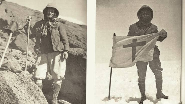
The first woman to climb Mount Kilimanjaro was Sheila MacDonald, a young Scottish mountaineer who made history in 1927 by reaching Uhuru Peak. She grew up in a well-connected British family and developed a strong interest in outdoor sports, travel, and mountaineering from an early age. She built her climbing experience in the Scottish Highlands and the European Alps before traveling to Africa.

Sheila MacDonald joined the Kilimanjaro expedition by chance after meeting experienced climbers during her journey to East Africa. She accepted the challenge because she wanted adventure and wanted to test her climbing ability on one of the highest mountains in the world. Kilimanjaro attracted her because it offered a difficult but achievable summit compared to Himalayan peaks, making it a serious goal for early explorers.

She stood out from other climbers because she showed confidence, endurance, and adaptability in extreme conditions. She handled high altitude, cold weather, and physical exhaustion while continuing toward the summit. Her determination and skill made her one of the most remarkable female climbers of her time and secured her place in mountaineering history.

Portrait of Sheila MacDonald, the first woman to climb Mount Kilimanjaro and reach the summit in 1927.

When Did the First Woman Climb Kilimanjaro?

The first woman to climb Mount Kilimanjaro reached the summit in 1927, when Sheila MacDonald successfully completed her historic ascent to Uhuru Peak, the highest point of Africa’s tallest mountain.

She joined the expedition during a period when Kilimanjaro climbing remained rare and extremely demanding. The journey to the summit took several days and required passing through dense rainforest, alpine desert, and icy volcanic slopes. The team relied on basic equipment, local porters, and limited scientific knowledge about altitude sickness.

Conditions on the mountain in 1927 were far more severe than today. Climbers faced thicker glaciers, unpredictable weather, and no established rescue systems. The final ascent demanded physical strength, mental endurance, and careful navigation through snow and ice near the crater rim. Despite these challenges, she pushed forward and reached the summit, making 1927 a historic year in Kilimanjaro’s climbing history.

Timeline of Women on Mount Kilimanjaro

YearClimberAchievementNotes
1909Gertrude BenhamEarly high-altitude attemptReached very high elevation but did not summit
1914Clara Ruckteschell-TruëbReached crater rimArrived at Gilman’s Point area
1925Estella LathamHigh crater ascentReached point later named Stella Point
1927Sheila MacDonaldFirst female summitReached Uhuru Peak (5,895 m)

Early Women Pioneers Before the First Summit

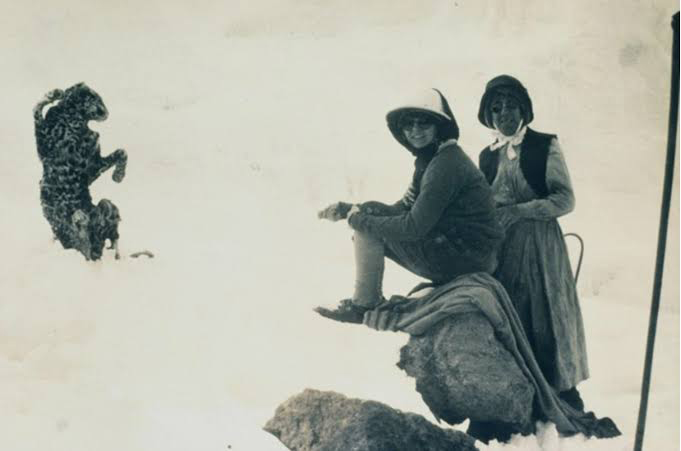
Before the first woman reached the summit of Mount Kilimanjaro, several brave women challenged the mountain and pushed human limits at extreme altitude. Their efforts built the foundation for later success and showed that women could survive and perform in harsh mountain environments. These pioneers did not always reach the top, but they changed the history of Kilimanjaro climbing forever.

Gertrude Benham

Gertrude Benham stands among the earliest women linked to Mount Kilimanjaro exploration. She traveled widely across Africa and built strong mountaineering experience in the Alps before coming to East Africa. In 1909, she attempted to climb Kilimanjaro during a time when the mountain had no established routes, no proper maps, and no modern climbing support.

She moved through dense rainforest, steep volcanic slopes, and cold alpine zones with a small expedition team. Benham pushed higher than many expected for a woman at that time and reached very high elevations near the glacier zone. However, she did not reach the main summit of Kibo. Despite this, her attempt proved that women could handle extreme altitude conditions and difficult expedition travel.

Her journey also revealed how dangerous early Kilimanjaro expeditions were. Climbers faced unknown weather patterns, lack of oxygen knowledge, and no rescue systems. Gertrude Benham’s effort became one of the earliest recorded female attempts on Africa’s highest mountain and inspired future climbers to continue pushing upward.

Clara Ruckteschell-Trueb

Clara Ruckteschell-Truëb played an important role in early Kilimanjaro climbing history. She traveled from Europe with her husband and joined an expedition to German East Africa in 1914. Unlike many travelers of her time, she actively participated in the climb rather than staying behind as a passive observer.

Her team ascended through forest zones and volcanic terrain toward the Kibo crater rim. Clara reached Gilman’s Point, one of the highest accessible points on the mountain before the summit. This achievement placed her among the first women to reach the upper edge of Kilimanjaro’s main crater.

Clara’s climb took place under extremely difficult conditions. She faced cold temperatures, thin air, and long trekking days with limited equipment. The expedition had no modern weather forecasts or reliable high-altitude gear, so every step required strong physical endurance and careful decision-making.

Her achievement matters because she proved that women could succeed in serious high-altitude expeditions alongside male climbers. Clara Ruckteschell-Truëb became one of the key early figures who helped open the path for future female summit attempts on Kilimanjaro.

Stella Latham

Estella Latham became part of Kilimanjaro history through her 1925 expedition, which reached one of the highest points on the crater rim. Her climb did not reach Uhuru Peak, but she reached an important location that later became known as Stella Point, one of the final steps before the summit.

She climbed during a period when Kilimanjaro expeditions still lacked proper infrastructure. There were no established huts at high altitude, and climbers depended heavily on porters and basic shelters. Despite these challenges, Stella showed strong determination and endurance as she moved higher into the icy upper slopes of Kibo.

Her expedition stands out because she nearly reached the summit zone at a time when very few women had ever climbed that high. The extreme cold, thin air, and steep volcanic terrain made every final meter extremely difficult. Even experienced climbers often turned back before reaching the crater rim.

Stella Latham’s journey remains important because it shows the gradual progress toward the first female summit. She helped bridge the gap between early failed attempts and the successful 1927 ascent. Her name remains connected to Kilimanjaro history through Stella Point, symbolizing courage and persistence in early women’s mountaineering.

Why Sheila MacDonald’s Climb Was Historic

The climb of Sheila MacDonald became historic because it marked the first confirmed time a woman reached the summit of Mount Kilimanjaro. In 1927, she stood on Uhuru Peak and changed the history of African mountaineering forever. Her achievement did not only represent a personal victory, but it also reshaped how people viewed women in extreme adventure sports.

First confirmed female summit

Sheila MacDonald achieved the first verified female ascent of Kilimanjaro’s highest point, Uhuru Peak (5,895 meters). Earlier women reached high points on the mountain, but none had officially reached the true summit. Her successful climb provided clear historical confirmation and established a new milestone in mountaineering records. This moment placed her name permanently in the history of African exploration.

Gender barrier breaking

Her ascent broke a strong social barrier in the early 20th century, when many people believed women could not handle extreme altitude or dangerous mountain conditions. She proved that skill, preparation, and determination mattered more than gender. Her success challenged old beliefs and helped open the door for more women to join serious expeditions in the Alps, Africa, and beyond.

Inspiration for modern climbers

Sheila MacDonald’s achievement continues to inspire modern climbers who attempt Mount Kilimanjaro today. Thousands of women now reach Uhuru Peak every year, and many follow the same spirit of courage she showed in 1927. Her story reminds climbers that persistence and mental strength can overcome one of the world’s most challenging mountains.

Challenges of Early Kilimanjaro Climbers

Early climbers of Mount Kilimanjaro faced serious and life-threatening challenges because they climbed without modern technology, scientific knowledge, or proper safety systems. Every part of the journey tested their physical strength, mental focus, and survival ability in extreme mountain conditions.

No modern equipment

Early climbers faced the mountain without modern climbing gear, which made every step more dangerous and exhausting. They did not have insulated jackets, oxygen tanks, waterproof boots, or advanced ropes designed for high-altitude safety. Instead, they used basic clothing and simple tools that worked well in lowlands but failed in freezing alpine conditions. This lack of equipment exposed climbers to frostbite, slipping hazards on ice, and rapid body heat loss during long ascents. Even carrying supplies became difficult because backpacks and support systems were very limited. As a result, climbers depended heavily on physical endurance and careful movement, which slowed progress and increased the risk of failure on steep volcanic slopes.

Extreme altitude

Mount Kilimanjaro creates one of the sharpest altitude changes in the world, and early climbers struggled because they had no understanding of how low oxygen affects the human body. As they climbed higher, air pressure dropped and oxygen levels decreased, causing severe fatigue, dizziness, headaches, and nausea. Many climbers experienced altitude sickness without knowing what caused it or how to treat it. The body becomes weaker at high elevation, so even simple walking felt extremely difficult near the summit zone. Without acclimatization knowledge or oxygen support, many expeditions slowed down or turned back before reaching the crater rim, making altitude one of the biggest barriers to success.

Harsh weather

Early Kilimanjaro climbers faced unpredictable and extreme weather conditions that changed quickly with elevation. The lower slopes had heavy rainfall and dense mist, while the upper zones turned into freezing cold deserts with strong winds and ice-covered terrain. Temperatures dropped sharply at night, often reaching below freezing, which made sleeping and resting very difficult. Sudden storms reduced visibility and increased the risk of losing the route on steep volcanic ground. Wet clothing and cold winds drained body heat quickly, increasing exhaustion and danger. These harsh weather conditions made the climb physically demanding and mentally stressful from start to finish.

Limited knowledge

Early explorers climbed Kilimanjaro with very limited scientific knowledge about high-altitude mountains and almost no reliable maps or route information. They did not fully understand acclimatization, oxygen levels, or how the body reacts to extreme elevation. Weather forecasting did not exist, so climbers could not predict storms or temperature drops. Most expeditions relied on trial, error, and basic guidance from local porters or previous explorers. This lack of knowledge increased uncertainty at every stage of the climb and often forced climbers to make risky decisions. Without proper understanding of the mountain, many early attempts ended before reaching the summit.

Women on Kilimanjaro Today

Today, women from all over the world successfully climb Mount Kilimanjaro every year. What once seemed like an extraordinary achievement reserved for a few pioneering adventurers has become an attainable goal for thousands of female trekkers. The courage shown by early climbers such as Sheila MacDonald helped inspire generations of women to challenge themselves on Africa’s highest mountain.

Thousands of Female Climbers Reach the Summit Every Year

Every year, thousands of women attempt and successfully complete the climb to Uhuru Peak. They come from different countries, backgrounds, and age groups. Some climb to celebrate personal achievements, while others raise money for charity, mark important life milestones, or simply pursue a lifelong dream. Many women with no previous mountaineering experience also reach the summit through proper preparation, training, and support from experienced guides.

Safe Guided Tours Make the Climb More Accessible

Modern Kilimanjaro expeditions are much safer than the journeys undertaken by early explorers. Professional guides monitor climbers throughout the trek and check for signs of altitude sickness. Organized tours provide meals, camping equipment, safety briefings, and emergency support. Porters carry most of the heavy gear, allowing climbers to focus on walking and acclimatizing. These improvements have made Kilimanjaro one of the most accessible high-altitude mountains in the world.

Several routes lead to the summit, each offering a different experience. The Machame Route attracts climbers who want beautiful scenery and good acclimatization opportunities. The Lemosho Route offers stunning landscapes, fewer crowds, and one of the highest success rates on the mountain. The Marangu Route, often called the “Coca-Cola Route,” provides hut accommodation instead of tents, making it a popular choice for climbers seeking additional comfort.

Today, women continue to make history on Mount Kilimanjaro. While the mountain remains a serious physical challenge, modern guiding standards, improved equipment, and well-established routes allow more women than ever before to follow in the footsteps of the first woman to climb Mount Kilimanjaro and experience the unforgettable journey to Uhuru Peak.

Interesting Facts About Women Climbers

Women have achieved remarkable milestones on Mount Kilimanjaro over the years. From record-breaking ascents to inspiring achievements by young climbers and older women, these accomplishments show that determination and preparation can help people of many ages reach Africa’s highest peak.

Oldest Female Climbers

Age has not stopped many women from reaching the summit of Kilimanjaro. One of the most famous examples is Anne Lorimor, who reached Uhuru Peak at the age of 89 in 2019. Her achievement inspired people around the world and proved that age does not automatically prevent someone from pursuing challenging goals. Before her ascent, other women in their seventies and eighties had also successfully climbed the mountain, demonstrating that proper training, determination, and professional guidance can make the climb possible for older adventurers.

Fastest Female Ascent Records

Some women have approached Kilimanjaro as an athletic challenge rather than a multi-day trek. Danish ultra-runner Kristina Schou Madsen gained international attention after completing an exceptionally fast ascent of Mount Kilimanjaro in 2018. Her performance highlighted the physical demands of the mountain and showed what elite endurance athletes can achieve. These speed records require extraordinary fitness, careful planning, and the ability to perform at high altitude while moving quickly through several climate zones.

Youngest Female Climbers

Young climbers have also made headlines on Kilimanjaro. One well-known example is Ashleen Mandrick, who reached the summit at a very young age. Her climb attracted international media attention and sparked discussions about the appropriate age for high-altitude trekking. While some children have successfully climbed Kilimanjaro, most trekking experts recommend that young climbers wait until they are older and better able to adapt to altitude and the physical demands of the mountain.

These achievements show that women of different ages and backgrounds continue to leave their mark on Mount Kilimanjaro. From pioneering explorers like Sheila MacDonald to modern record holders, their stories add another inspiring chapter to the history of Africa’s highest mountain.

Frequently Asked Questions

Who was the first woman to climb Mount Kilimanjaro?

The first woman to climb Mount Kilimanjaro was Sheila MacDonald. She reached the summit in 1927 and became the first woman to stand on the highest point of Africa. Her achievement marked an important moment in mountaineering history and inspired many women to pursue high-altitude adventures.

When did she climb Kilimanjaro?

Sheila MacDonald successfully climbed Mount Kilimanjaro in 1927. At that time, climbing the mountain was far more difficult than it is today because there were no established tourist routes, limited equipment, and little understanding of altitude sickness. Her successful ascent remains one of the most important milestones in Kilimanjaro’s history.

Is Kilimanjaro safe for women?

Yes, Mount Kilimanjaro is generally safe for women when they climb with a reputable tour operator and follow safety guidelines. Thousands of women reach the summit every year without major problems. Professional guides, trained porters, emergency procedures, and well-established routes make the climb much safer than it was in the past. Proper preparation, fitness, and acclimatization are the keys to a safe and successful climb.

How hard is Kilimanjaro?

Kilimanjaro is a challenging trek, but it does not require technical climbing skills. The biggest challenge is the high altitude, which can cause fatigue, headaches, and altitude sickness. Climbers must walk for several hours each day and face cold temperatures near the summit. Most people who prepare properly and choose a suitable route have a good chance of reaching Uhuru Peak.

Can beginners climb Kilimanjaro?

Yes, beginners can climb Mount Kilimanjaro. Many people who reach the summit have no previous mountaineering experience. However, beginners should train before the trip, choose a route with enough time for acclimatization, and climb with experienced guides. Routes such as Lemosho and Machame often provide better acclimatization opportunities and improve the chances of a successful summit.

Conclusion

Read more about Sheila MacDonald

The story of the first woman to climb Mount Kilimanjaro remains one of the most inspiring chapters in the mountain’s history. In 1927, Sheila MacDonald reached the summit of Africa’s highest peak and achieved what no woman had done before. Her success came after years of earlier attempts by other pioneering women who helped pave the way for future climbers.

Sheila MacDonald faced high altitude, freezing temperatures, and difficult mountain conditions, yet she continued to the summit with determination and courage. Her achievement proved that women could overcome the same challenges that confronted male explorers and mountaineers.

Today, thousands of women from around the world climb Mount Kilimanjaro every year. They follow established routes, benefit from modern equipment, and draw inspiration from the remarkable women who came before them. The mountain continues to attract adventurers seeking challenge, achievement, and unforgettable experiences.

More than a century later, Sheila MacDonald’s climb still reminds us that determination can turn ambitious dreams into historic achievements. Her journey to the Roof of Africa continues to inspire climbers to take the first step toward their own summit.

Mount Kilimanjaro summit at Uhuru Peak showing the highest point in Africa where the first ascent was completed in 1889.

First Person to Climb Mount Kilimanjaro

Who Was the First Person to Climb Mount Kilimanjaro?

Estimated reading time: 27 minutes

The first person to climb Mount Kilimanjaro was not just one individual but a team of explorers led by Hans Meyer and Ludwig Purtscheller, who reached the summit on October 6, 1889. This historic achievement marked the first recorded ascent of Africa’s highest mountain and changed the history of mountaineering forever. At that time, Kilimanjaro was one of the most mysterious and difficult peaks in the world, with no modern equipment, no established routes, and very limited knowledge about high-altitude climbing. Their successful summit opened the way for future explorers and made Mount Kilimanjaro one of the most famous mountains on Earth.

Their achievement marked a major milestone in the exploration of Africa. At the time, very few people understood the challenges of high-altitude climbing, and explorers had limited equipment, maps, and knowledge of the mountain. Kilimanjaro’s glaciers, steep slopes, and harsh weather created obstacles that made the journey far more difficult than it is today.

The successful expedition came after several failed attempts to reach the summit. Meyer refused to give up and returned to the mountain with better planning, stronger support, and valuable experience from earlier expeditions. His determination, combined with Purtscheller’s climbing skills and the assistance of local porters and guides, helped make the historic ascent possible.

This article explores the story of the first climb of Mount Kilimanjaro, the people behind the achievement, the challenges they faced, and the lasting impact of their journey on the history of Africa’s highest mountain.

Who First Climbed Mount Kilimanjaro?

If you are looking for a quick answer, Hans Meyer of Germany and Ludwig Purtscheller of Austria completed the first recorded ascent of Mount Kilimanjaro on October 6, 1889. Their successful expedition reached the summit of Kibo, the highest of Kilimanjaro’s three volcanic cones and the location of today’s Uhuru Peak.

First Ascent of Mount Kilimanjaro at a Glance

FactDetails
First Recorded ClimbersHans Meyer and Ludwig Purtscheller
Date of First AscentOctober 6, 1889
Summit ReachedKibo (present-day Uhuru Peak area)
MountainMount Kilimanjaro
LocationTanzania, East Africa
Elevation5,895 meters (19,341 feet)
Number of Attempts by MeyerThree
Historical SignificanceFirst recorded ascent of Africa’s highest mountain

Their achievement opened a new chapter in African exploration and mountaineering history. More than a century later, thousands of climbers follow in their footsteps each year as they attempt to reach the Roof of Africa.

"Hans Meyer and Ludwig Purtscheller, the first recorded climbers to reach the summit of Mount Kilimanjaro in 1889."

Why Climbing Kilimanjaro Was a Major Achievement in 1889

Today, thousands of people climb Mount Kilimanjaro every year with the support of experienced guides, established routes, weather forecasts, and modern equipment. In 1889, however, reaching the summit was a far greater challenge. Hans Meyer and Ludwig Purtscheller faced obstacles that modern climbers rarely encounter, making their success one of the most remarkable achievements in the history of African exploration.

No Modern Climbing Equipment

Modern climbers benefit from lightweight clothing, waterproof boots, insulated sleeping bags, GPS devices, and advanced mountaineering gear. Meyer and Purtscheller had none of these advantages. Their equipment was heavy, basic, and often uncomfortable for long days on the mountain.

The expedition also lacked detailed route information. The team had to navigate unfamiliar terrain while carrying supplies through dense forests, rocky slopes, and icy sections near the summit. Every stage of the journey required careful planning and determination.

Limited Knowledge of Altitude

In the late nineteenth century, scientists and explorers knew very little about how high altitude affects the human body. Today, climbers understand the importance of acclimatization and recognize the symptoms of altitude sickness. In 1889, many of these dangers remained poorly understood.

Previous expeditions had already failed because climbers struggled with the effects of thin air. Meyer learned valuable lessons from his earlier attempts and adjusted his strategy for the third expedition. Even so, he and his team faced uncertainty as they climbed higher into an environment that few people had ever experienced.

Harsh Conditions Near the Summit

Kilimanjaro’s summit region presented a harsh and unforgiving environment. Temperatures dropped well below freezing, strong winds swept across the mountain, and large glaciers covered parts of the upper slopes. Snow and ice created additional challenges for climbers attempting to reach the highest point.

As Meyer and Purtscheller approached the summit, they encountered steep icy terrain and deep crevasses that slowed their progress. Without modern weather forecasts or specialized climbing equipment, they relied on skill, experience, and perseverance to continue. Their ability to overcome these conditions helped secure the first recorded ascent of Africa’s highest mountain and cemented their place in history.

Kilimanjaro's summit area contained far larger glaciers during the first successful ascent

The First Successful Ascent of Mount Kilimanjaro

After two unsuccessful attempts, Hans Meyer returned to Mount Kilimanjaro in 1889 with a clear goal: reach the highest point in Africa. This time, he arrived better prepared and partnered with Austrian mountaineer Ludwig Purtscheller, whose climbing experience proved invaluable during the expedition. Their determination, careful planning, and support team helped them achieve what no recorded expedition had accomplished before.

Planning the Expedition

Meyer learned important lessons from his earlier attempts on Kilimanjaro. He understood that reaching the summit required more than courage. The expedition needed reliable supplies, proper organization, and carefully chosen camps. To improve their chances of success, Meyer assembled a large support team of local porters and guides who helped transport food, equipment, and other necessities up the mountain.

He also studied the terrain and planned the route in greater detail than before. This preparation allowed the team to move more efficiently and conserve energy for the final push to the summit.

Journey to the Mountain

The expedition traveled across what is now northern Tanzania before reaching the slopes of Mount Kilimanjaro. At the time, no established trekking routes existed. The team crossed forests, grasslands, and rugged terrain while carrying large amounts of equipment and supplies.

Support from local communities, especially the Chagga people who lived on the mountain’s lower slopes, played an important role in the expedition’s progress. Their knowledge of the region helped the climbers navigate the area and organize their journey.

Establishing Camps

One of Meyer’s smartest decisions involved creating a series of camps at different elevations. Instead of returning to the base of the mountain after every attempt, the team stored supplies higher on the mountain and used these camps as staging points.

This strategy saved time and energy while allowing the climbers to rest before continuing upward. Porters regularly carried food and equipment to the camps, ensuring that Meyer and Purtscheller could focus on the challenging ascent ahead.

Reaching the Summit

In early October 1889, Meyer and Purtscheller made their final push toward the summit. They climbed through cold temperatures, icy slopes, and glacier-covered terrain. Progress slowed as they encountered steep sections of ice and difficult conditions near the crater rim.

On October 6, 1889, the two explorers successfully reached the highest point of Kibo. Their achievement marked the first recorded ascent of Mount Kilimanjaro and the first documented climb to the highest point in Africa. After spending a short time at the summit, they began their descent back down the mountain.

Naming the Peak

Following the successful ascent, Hans Meyer named the summit “Kaiser Wilhelm Peak” in honor of the German emperor. At the time, the region formed part of German East Africa, and the name reflected Germany’s colonial presence in the area.

After Tanganyika gained independence, the summit received a new name. In 1962, authorities renamed it Uhuru Peak. The word “Uhuru” means “freedom” in Swahili and symbolizes the country’s independence and national pride. Today, Uhuru Peak stands as the highest point on Mount Kilimanjaro and remains a dream destination for climbers from around the world.

Ludwig Purtscheller during the first successful ascent of Mount Kilimanjaro in 1889."

Who Were Hans Meyer and Ludwig Purtscheller?

The names Hans Meyer and Ludwig Purtscheller remain closely linked to Mount Kilimanjaro because they completed the first recorded ascent of Africa’s highest mountain on October 6, 1889. Their successful expedition secured their place in mountaineering history and transformed Kilimanjaro from a largely unexplored peak into a mountain known around the world.

Hans Meyer

Hans Meyer was a German geographer, explorer, and publisher born in 1858 in Germany. From a young age, he developed a strong interest in geography, travel, and scientific exploration. His passion for discovering remote places eventually led him to East Africa and the towering slopes of Mount Kilimanjaro.

Meyer first attempted to climb Kilimanjaro in 1887 but failed to reach the summit. He returned in 1888 with renewed determination, yet circumstances once again prevented success. Rather than abandoning his goal, Meyer carefully studied his previous mistakes and prepared for a third expedition.

His persistence paid off in 1889 when he finally reached the summit alongside Ludwig Purtscheller. The achievement brought Meyer international recognition and established him as the first recorded person to stand on the highest point in Africa. After the climb, he continued researching Kilimanjaro’s glaciers, volcanic features, and geography, contributing valuable knowledge about the mountain for future generations.

Ludwig Purtscheller

Ludwig Purtscheller was an Austrian mountaineer and educator known as one of the most skilled climbers of his time. Born in 1849 in Tyrol, Austria, he spent much of his life exploring and climbing mountains throughout Europe. His extensive experience in high-altitude environments made him the ideal partner for Meyer’s ambitious Kilimanjaro expedition.

Unlike many explorers of the nineteenth century, Purtscheller already possessed advanced mountaineering skills and a deep understanding of difficult mountain terrain. His knowledge helped the expedition overcome the challenges of ice, steep slopes, and harsh conditions near Kilimanjaro’s summit.

On October 6, 1889, which happened to be his 40th birthday, Purtscheller reached the summit of Kilimanjaro with Meyer. The historic ascent became one of the greatest achievements of his mountaineering career. Today, historians and climbers remember him not only as a pioneer of alpine climbing but also as one of the first people to reach the highest point in Africa.

Why They Became Part of Kilimanjaro History

Hans Meyer and Ludwig Purtscheller earned their place in Kilimanjaro history because they accomplished what many explorers before them could not. Their successful ascent demonstrated that the summit of Africa’s tallest mountain could be reached through careful planning, determination, and skilled climbing.

More than a century later, their names continue to appear in books, museums, and historical accounts of Mount Kilimanjaro. Every climber who stands on Uhuru Peak today follows a path first opened by these pioneering explorers in 1889.

Earlier Attempts to Climb Mount Kilimanjaro

Before Hans Meyer and Ludwig Purtscheller reached the summit in 1889, several explorers attempted to unlock the secrets of Mount Kilimanjaro. Their journeys helped reveal important information about the mountain and laid the foundation for the first successful ascent. Although none of them reached the summit, their efforts contributed to one of the greatest achievements in African exploration.

Johannes Rebmann

Johannes Rebmann, a German missionary and explorer, played an important role in the early history of Mount Kilimanjaro. In 1848, while traveling through East Africa, he became one of the first Europeans to report seeing the snow-capped mountain.

Many geographers in Europe doubted his claims. They found it difficult to believe that snow and ice could exist near the equator. Despite the skepticism, Rebmann’s reports introduced Kilimanjaro to the wider world and sparked interest among explorers, scientists, and adventurers.

Although he never reached the summit, Rebmann helped place Mount Kilimanjaro on the map and inspired future expeditions to investigate the mountain further.

Count Samuel Teleki

Count Samuel Teleki, one of the earliest explorers to attempt climbing Mount Kilimanjaro in the 1880s.

Nearly four decades later, Hungarian explorer Count Samuel Teleki made one of the first serious attempts to climb Kilimanjaro. During an expedition to East Africa in the 1880s, he traveled to the mountain and pushed higher than many previous visitors.

Teleki reached the upper slopes but failed to reach the summit. Difficult conditions, limited equipment, and physical challenges forced him to turn back before completing the climb. Even so, his expedition provided valuable observations about the mountain and demonstrated that determined climbers could reach higher elevations than previously thought.

His efforts encouraged later explorers to continue pursuing the summit.

Dr. Abbott

American naturalist Dr. William L. Abbott also attempted to climb Mount Kilimanjaro during the late nineteenth century. Unlike many explorers who focused mainly on reaching the summit, Abbott showed great interest in studying the mountain’s plants, animals, and natural environment.

As he climbed higher, he encountered serious physical difficulties that prevented him from continuing. Many historians believe altitude-related illness may have contributed to the failure of his expedition. Although he never reached the summit, Abbott collected valuable scientific information and expanded knowledge of Kilimanjaro’s unique ecosystems.

His experience also highlighted the dangers that climbers faced at high altitude.

Hans Meyer’s Failed Attempts

Hans Meyer did not reach the summit on his first visit to Kilimanjaro. In 1887, he climbed higher than many explorers before him but failed to reach the mountain’s highest point. Harsh conditions and limited resources forced him to abandon the attempt.

Undeterred, Meyer returned in 1888 for a second expedition. Unfortunately, political unrest in the region disrupted his plans and prevented further progress. Once again, he left the mountain without achieving his goal.

Rather than giving up, Meyer carefully analyzed the challenges that had stopped him. He improved his planning, organized better logistical support, and gained valuable experience from both failed expeditions. These lessons proved crucial during his third attempt in 1889, when he finally reached the summit alongside Ludwig Purtscheller.

How Earlier Attempts Contributed to the First Successful Ascent

Every failed expedition added new knowledge about Mount Kilimanjaro. Explorers identified routes, studied weather conditions, recorded observations, and revealed the difficulties that future climbers would face. Without the efforts of Rebmann, Teleki, Abbott, and Meyer’s earlier expeditions, the historic ascent of October 6, 1889, might have taken much longer to achieve.

Their determination helped transform Kilimanjaro from a mysterious mountain into one of the world’s most famous climbing destinations.

ExplorerYearHighest Achievement
Johannes Rebmann1848Reported Kilimanjaro to Europe
Samuel Teleki1880sReached high elevations
Dr. Abbott1888Conducted scientific exploration
Hans Meyer1887-1888Two failed summit attempts
Meyer & Purtscheller1889First recorded summit ascent

The Important Role of Local Guides and Porters

The story of the first successful ascent of Mount Kilimanjaro would be incomplete without recognizing the contribution of local guides, porters, and members of the Chagga community. While Hans Meyer and Ludwig Purtscheller reached the summit in 1889, they depended heavily on the support of local people throughout the expedition. Their knowledge, hard work, and resilience played a vital role in the success of the historic climb.

Chagga Support

The Chagga people have lived on the slopes of Mount Kilimanjaro for centuries. Long before European explorers arrived, they understood the mountain’s environment, weather patterns, and terrain. During Meyer’s expedition, local Chagga leaders and communities provided valuable assistance that helped the climbers organize their journey.

Support from the Chagga people allowed the expedition to move more efficiently through the region. Their cooperation helped the team secure supplies, establish contacts, and navigate areas unfamiliar to foreign explorers.

Transporting Supplies

One of the greatest challenges of climbing Kilimanjaro in the nineteenth century involved moving food, equipment, and camping gear up the mountain. Without roads, vehicles, or modern infrastructure, the expedition relied entirely on local porters.

Porters carried heavy loads through dense rainforest, rocky slopes, and harsh alpine landscapes. They transported food, water, clothing, and scientific equipment to higher camps, allowing Meyer and Purtscheller to focus on the climb itself. Without this logistical support, reaching the summit would have been extremely difficult.

Mountain Knowledge

Local guides and porters brought valuable knowledge about the mountain and its surroundings. They understood the lower slopes, water sources, weather conditions, and natural features that could affect the expedition.

Although many sections of Kilimanjaro remained unexplored at higher elevations, local experience helped the expedition travel more safely and efficiently. This knowledge reduced risks and increased the chances of success during a time when accurate maps and route information were limited.

Challenges Faced by Local Teams

The local support team faced many of the same hardships as the climbers. They carried heavy loads over long distances while dealing with cold temperatures, difficult terrain, and the effects of increasing altitude.

Many porters lacked specialized clothing and equipment for the freezing conditions found near the summit. As the expedition climbed higher, the cold, thin air, and physical demands became increasingly difficult. Despite these challenges, local guides and porters continued supporting the expedition and played a crucial role in one of the most important events in Kilimanjaro’s history.

A Legacy Often Overlooked

Today, guides and porters remain an essential part of every Kilimanjaro expedition. Thousands of climbers reach the summit each year with the help of local mountain crews who continue a tradition that dates back to the earliest explorations of the mountain. Their contribution to the first successful ascent in 1889 deserves recognition alongside the achievements of Hans Meyer and Ludwig Purtscheller.

Yohani Kinyala Lauwo and the Debate Around the First Climb

The story of the first ascent of Mount Kilimanjaro does not end with Hans Meyer and Ludwig Purtscheller. Over the years, historians, researchers, and local communities have discussed another important question: who was the African guide associated with the historic 1889 expedition? This debate often centers on Yohani Kinyala Lauwo, a well-known figure in Kilimanjaro history, and Muini Amani, a porter who accompanied the expedition.

Who Was Lauwo?

Yohani Kinyala Lauwo, a famous Kilimanjaro guide associated with the history of the mountain's first ascent.

Yohani Kinyala Lauwo is one of the most famous names associated with Mount Kilimanjaro. Many Tanzanians know him as a legendary mountain guide who spent much of his life working on Kilimanjaro. According to popular stories, Lauwo accompanied Hans Meyer and Ludwig Purtscheller during their successful ascent in 1889 and became one of the first Africans connected to the climb.

Because of this belief, many articles, documentaries, and tourism publications have described Lauwo as the local guide who joined the first successful expedition. His story became widely known both in Tanzania and internationally, making him an important figure in the mountain’s history.

Why Historians Debate His Role

Although Lauwo’s name remains closely linked to the first ascent, some historians question whether he actually participated in the 1889 expedition. The debate mainly focuses on dates and historical records.

Several accounts suggest that Lauwo was born around the early 1870s. If these dates are correct, questions arise about his age during the first ascent and whether he could have played the role later attributed to him. Researchers who examined Hans Meyer’s writings and expedition records found little direct evidence connecting Lauwo to the summit expedition.

As a result, historians continue to discuss the accuracy of the popular story. While many people honor Lauwo as a pioneer of guiding on Kilimanjaro, scholars often distinguish between local tradition and documented historical evidence.
Grave of Yohani Kinyala Lauwo, a legendary Kilimanjaro guide connected to the history of the mountain's first ascent.

Muini Amani’s Contribution

Historical records from the 1889 expedition more clearly identify a man named Muini Amani as one of the Africans who accompanied Meyer and Purtscheller higher on the mountain than most members of the support team.

Muini Amani worked as a porter and assisted the expedition by carrying equipment and supplies to high-altitude camps. Historical accounts indicate that he reached elevations far above those attained by many other members of the caravan. However, available evidence suggests that he did not continue all the way to the summit itself.

Even though Muini Amani never reached the highest point of Kilimanjaro, his contribution remains significant. Without the support of porters and guides like him, the expedition would have faced far greater challenges. His role highlights the importance of local participation in the historic climb.

Understanding the Debate Today

Modern historians generally agree on one point: Hans Meyer and Ludwig Purtscheller completed the first recorded ascent of Mount Kilimanjaro on October 6, 1889. However, discussion continues about the local people who supported the expedition and how their contributions should be remembered.

Whether the focus falls on Yohani Kinyala Lauwo, Muini Amani, or the many unnamed porters who helped carry supplies up the mountain, their stories form an important part of Kilimanjaro’s history. Today, they represent the generations of Tanzanian guides and porters who continue to help climbers reach the Roof of Africa.

What Did Mount Kilimanjaro Look Like in 1889?

When Hans Meyer and Ludwig Purtscheller climbed Mount Kilimanjaro in 1889, they encountered a mountain that looked very different from the one visitors see today. More than a century of environmental change, scientific exploration, and tourism development has transformed the climbing experience. Understanding what Kilimanjaro looked like during the first successful ascent helps us appreciate the challenges faced by early explorers.

Larger Glaciers

One of the most striking differences was the size of Kilimanjaro’s glaciers. In 1889, extensive ice fields covered large areas of the summit region. Massive glaciers stretched across the crater rim and upper slopes, creating a dramatic landscape of snow and ice.

Today, many of these glaciers have shrunk significantly. Scientists have documented a major reduction in ice cover over the past century, making the summit area look very different from what Meyer and Purtscheller experienced during their historic climb.

No Tourist Routes

Modern climbers can choose from several well-established routes, including the Machame, Marangu, Lemosho, Rongai, Northern Circuit, and Umbwe routes. In 1889, none of these trekking routes existed.

The first climbers had to explore unfamiliar terrain and determine the safest way upward. They could not rely on detailed trail maps, route descriptions, or previous trekking reports. Every section of the mountain presented uncertainty and required careful decision-making.

No Summit Sign

Today, thousands of climbers celebrate their achievement by taking photos at the famous Uhuru Peak sign. This sign has become one of the most recognizable landmarks on Mount Kilimanjaro.

In 1889, no such sign existed. The summit area remained completely natural, with no markers, information boards, or facilities. When Meyer and Purtscheller reached the highest point, they stood on a remote volcanic summit far removed from the modern tourism infrastructure seen today.

No Mountain Huts

Climbers on some modern Kilimanjaro routes can stay in mountain huts or sleep in well-organized campsites with designated facilities. During the first ascent, no permanent mountain accommodations existed anywhere on the mountain.

The expedition relied entirely on temporary camps and tents. Porters carried supplies, food, and equipment to higher elevations, allowing the climbers to establish camps as they progressed. This approach required significant effort and careful logistical planning.

Fewer People Visiting

Today, Mount Kilimanjaro attracts tens of thousands of climbers from around the world every year. In contrast, very few outsiders visited the mountain during the nineteenth century.

Kilimanjaro remained a mysterious and largely unexplored landmark. Most information about the mountain came from local communities and a small number of explorers, missionaries, and scientists. As a result, Meyer and Purtscheller entered a landscape that felt far more remote and unknown than it does today.

A Mountain Transformed by Time

Although Mount Kilimanjaro remains Africa’s highest mountain, the experience of climbing it has changed dramatically since 1889. Larger glaciers, untouched summit landscapes, and the absence of modern infrastructure made the first ascent far more challenging. Yet despite these changes, the mountain continues to inspire adventurers from across the globe, just as it did more than a century ago.

Historic view of Mount Kilimanjaro's glaciers, which covered a much larger area during the first ascent in 1889.

Timeline of the First Ascent of Kilimanjaro

The journey to the first successful ascent of Mount Kilimanjaro did not happen overnight. Decades of exploration, failed attempts, and growing knowledge about the mountain paved the way for the historic summit climb in 1889. The timeline below highlights some of the most important milestones in the history of Kilimanjaro exploration.

1848 – Johannes Rebmann Reports Mount Kilimanjaro

German missionary Johannes Rebmann became one of the first Europeans to report seeing Mount Kilimanjaro. His descriptions of a snow-capped mountain near the equator surprised many people in Europe, and some scientists initially doubted his claims. Nevertheless, his observations introduced Kilimanjaro to the wider world and sparked interest in exploring the mountain.

1887 – Hans Meyer’s First Attempt

German explorer Hans Meyer made his first attempt to reach the summit of Mount Kilimanjaro. He climbed higher than many previous explorers but failed to reach the mountain’s highest point. Despite the setback, the expedition provided valuable information about the terrain and challenges of the climb.

1888 – Meyer’s Second Expedition

Meyer returned to Kilimanjaro hoping to complete the ascent. However, political unrest in East Africa disrupted his plans and prevented him from reaching the summit. Although the expedition ended unsuccessfully, Meyer gained additional experience and developed a better understanding of what would be required for a future attempt.

October 6, 1889 – The First Successful Ascent

After careful preparation and lessons learned from earlier failures, Hans Meyer partnered with Austrian mountaineer Ludwig Purtscheller for a third expedition. On October 6, 1889, the two explorers successfully reached the summit of Kibo, becoming the first recorded people to climb Mount Kilimanjaro. Their achievement marked a historic moment in African exploration and mountaineering history.

1962 – Kaiser Wilhelm Peak Becomes Uhuru Peak

Following Tanganyika’s independence, the summit received a new name. In 1962, authorities renamed Kaiser Wilhelm Peak as Uhuru Peak. The word “Uhuru” means “freedom” in Swahili and celebrates the nation’s independence. Today, Uhuru Peak remains the highest point on Mount Kilimanjaro and one of the most famous mountain summits in the world.

Key Dates at a Glance

YearEvent
1848Johannes Rebmann reports seeing Mount Kilimanjaro
1887Hans Meyer makes his first summit attempt
1888Meyer’s second expedition ends unsuccessfully
October 6, 1889Hans Meyer and Ludwig Purtscheller complete the first recorded ascent
1962The summit receives the name Uhuru Peak

This timeline shows how decades of exploration and perseverance eventually led to one of the greatest achievements in the history of Mount Kilimanjaro.

Can You Follow the First Climbers’ Route Today?

Many travelers who learn about the first ascent of Mount Kilimanjaro often wonder whether they can follow the same path taken by Hans Meyer and Ludwig Purtscheller in 1889. While some parts of their journey crossed areas that modern climbers still visit, today’s trekking experience differs significantly from the expedition that reached the summit more than a century ago.

Modern Routes

Today, climbers can choose from several established routes, including the Marangu, Machame, Lemosho, Rongai, Umbwe, Shira, and Northern Circuit routes. Each route offers a different experience, scenery, and acclimatization profile.

Unlike the first climbers, modern trekkers follow well-maintained trails with designated camps or huts. Professional guides lead every expedition, and national park regulations help ensure safety and environmental protection. These routes make Kilimanjaro far more accessible than it was in the nineteenth century.

Current Climbing Conditions

Although Mount Kilimanjaro remains a challenging high-altitude trek, climbers today benefit from significant advantages. Modern equipment, accurate weather forecasts, improved communication systems, and experienced mountain crews greatly increase the chances of a successful summit attempt.

Guides monitor climbers for altitude sickness, provide safety briefings, and help manage the pace of the trek. Organized support teams carry equipment and supplies, allowing visitors to focus on the climb itself. As a result, today’s climbers face fewer uncertainties than the explorers who first attempted the mountain.

Differences from 1889

The Kilimanjaro that visitors see today differs in several ways from the mountain Hans Meyer and Ludwig Purtscheller climbed in 1889. One of the most noticeable changes involves the glaciers near the summit. Large ice fields once covered much of the upper mountain, but many have shrunk significantly over the past century.

Modern infrastructure also transforms the climbing experience. Climbers now find established routes, campsites, rescue services, park regulations, and the famous Uhuru Peak sign at the summit. None of these existed during the first ascent.
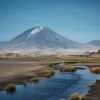
Another major difference is the number of visitors. In 1889, only a handful of explorers attempted to reach the summit. Today, thousands of people from around the world travel to Tanzania each year to experience Africa’s highest mountain.

Walking in the Footsteps of the First Climbers

Although no modern route perfectly follows the exact path used in 1889, every climber who reaches Uhuru Peak shares the same ultimate goal achieved by Hans Meyer and Ludwig Purtscheller. Standing on the summit allows visitors to connect with a remarkable chapter in Kilimanjaro’s history while experiencing one of the world’s most iconic mountain adventures.

For many trekkers, learning about the first ascent adds an extra layer of meaning to their journey. It reminds them how much determination, courage, and preparation were required to conquer Africa’s highest peak for the very first time.

Interesting Facts About the First Climb of Kilimanjaro

The first successful ascent of Mount Kilimanjaro is full of fascinating details that many travelers and history enthusiasts do not know. Beyond the achievement itself, several remarkable facts make the 1889 expedition one of the most important milestones in the history of African exploration.

The Third Attempt Finally Succeeded

Hans Meyer did not reach the summit on his first try. He made his first attempt in 1887 and returned again in 1888, but both expeditions ended without success. Rather than giving up, Meyer learned from each setback and improved his strategy.

His determination paid off during his third expedition in 1889 when he partnered with Austrian mountaineer Ludwig Purtscheller. Their persistence ultimately led to the first recorded ascent of Mount Kilimanjaro, proving that preparation and experience can make the difference between failure and success.

The Summit Once Had a Different Name

Today, climbers celebrate their achievement at Uhuru Peak, the highest point on Mount Kilimanjaro. However, the summit did not always carry this name.

After reaching the top in 1889, Hans Meyer named the summit “Kaiser Wilhelm Peak” in honor of the German emperor. Following Tanganyika’s independence, authorities renamed the summit Uhuru Peak in 1962. The word “Uhuru” means “freedom” in Swahili and symbolizes national independence and pride.

Larger Glaciers Covered the Mountain

When Meyer and Purtscheller climbed Kilimanjaro, they encountered a summit landscape dominated by much larger glaciers and ice fields than visitors see today. Vast stretches of ice covered sections of the crater rim and upper slopes, creating a dramatic alpine environment near the equator.

Over the decades, many of these glaciers have shrunk significantly. As a result, modern climbers experience a mountain that looks noticeably different from the one explored during the first ascent.

Few People Repeated the Climb for Years

Today, thousands of people attempt to climb Mount Kilimanjaro every year. In contrast, very few people followed Meyer and Purtscheller to the summit during the years after their historic achievement.

The mountain remained remote, challenging, and difficult to access. Travel across East Africa required significant time, resources, and planning. As a result, the first ascent remained an extraordinary accomplishment for many years before climbing Kilimanjaro became a more common goal for adventurers and explorers.

A Historic Achievement That Still Inspires Climbers

More than a century later, the story of the first ascent continues to inspire people from around the world. Every climber who stands on Uhuru Peak becomes part of a tradition that began on October 6, 1889, when two determined explorers reached the highest point in Africa and made history.

Frequently Asked Questions

This section answers the most common questions about the first ascent of Mount Kilimanjaro and helps clarify important historical details about the expedition.

Who was the first person to climb Mount Kilimanjaro?

The first recorded people to climb Mount Kilimanjaro were Hans Meyer (Germany) and Ludwig Purtscheller (Austria). They successfully reached the summit of Kibo, now known as Uhuru Peak, on October 6, 1889.

When was Mount Kilimanjaro first climbed?

Mount Kilimanjaro was first successfully climbed on October 6, 1889, after several earlier failed attempts by Hans Meyer and other explorers. This date marks the first recorded ascent to the highest point in Africa.

Who guided the first climbers?

The expedition was supported by local porters and guides from the Chagga community, who helped transport supplies and navigate the lower slopes of the mountain. Historical records also mention Muini Amani, a porter who accompanied the expedition to higher altitudes, although he did not reach the summit.

What was Uhuru Peak called before?

Before independence, Uhuru Peak was known as Kaiser Wilhelm Peak, named by Hans Meyer in honor of the German emperor during the colonial period. In 1962, after Tanganyika gained independence, the summit was renamed Uhuru Peak, meaning “freedom” in Swahili.

How many attempts did Hans Meyer make?

Hans Meyer made three attempts to climb Mount Kilimanjaro. His first attempt in 1887 and second attempt in 1888 were unsuccessful. He finally reached the summit on his third attempt in 1889 with Ludwig Purtscheller.

Can beginners climb Kilimanjaro today?

Yes, beginners can climb Mount Kilimanjaro today with proper preparation, training, and support from licensed guides. Modern trekking routes, established camps, and safety systems make the climb achievable for many first-time high-altitude hikers, although it still requires good fitness and acclimatization.

Who was Yohani Kinyala Lauwo?

Yohani Kinyala Lauwo was a famous Tanzanian Kilimanjaro guide who lived a very long life and became widely known in local mountain history. He is often associated with early Kilimanjaro expeditions, although historians debate whether he was part of the 1889 first ascent. Many records instead suggest that Muini Amani played a more documented role as a porter during the expedition.

Conclusion

The first successful ascent of Mount Kilimanjaro in 1889 remains one of the most important milestones in the history of African exploration. Hans Meyer and Ludwig Purtscheller achieved what earlier explorers could not, reaching the summit of Kibo on October 6, 1889 after careful planning, repeated attempts, and strong determination.

Their achievement marked the beginning of a new era in mountaineering and opened Mount Kilimanjaro to scientific study and global attention. It also highlighted the vital contribution of local guides and porters, whose support made the expedition possible under extremely difficult conditions.

Today, the legacy of the first ascent continues to inspire thousands of climbers who travel to Tanzania each year to reach Uhuru Peak. While modern routes, equipment, and support systems make the climb more accessible, the challenge and sense of achievement remain deeply connected to the historic journey of 1889. Every climber who stands on the Roof of Africa becomes part of the same story that began with Meyer and Purtscheller over a century ago.

Kilimanjaro Meaning

What Does Kilimanjaro Mean and Where Did the Name Come From?

Estimated reading time: 14 minutes

Mount Kilimanjaro is Africa’s highest mountain and one of the world’s most recognizable natural landmarks. Most researchers believe the name “Kilimanjaro” comes from a combination of the Swahili word Kilima, meaning “mountain,” and the Chagga word Njaro, often interpreted as “whiteness” or “shining.” Together, the name is commonly understood to mean “Mountain of Whiteness” or “Shining Mountain.”

However, the true meaning of Kilimanjaro remains a subject of debate. Over the years, historians, linguists, and explorers have proposed several theories linking the name to the Swahili, Chagga, and Maasai languages. Some interpretations suggest the name refers to the mountain’s snow-covered summit, while others connect it to local legends, water sources, caravans, or even spiritual beliefs.

Despite these different explanations, the name Kilimanjaro perfectly reflects the mystery and grandeur of Africa’s tallest peak. In this guide, we explore the most widely accepted theories about the meaning of Kilimanjaro, the history behind its name, and why it continues to fascinate climbers, travelers, and researchers from around the world.

What Does Kilimanjaro Mean?

The most widely accepted meaning of Kilimanjaro is “Mountain of Whiteness” or “Shining Mountain.” Most researchers believe the name comes from a combination of the Swahili word Kilima, meaning “mountain,” and the Chagga word Njaro, which is often interpreted as “whiteness,” “brightness,” or “shining.”

The Most Accepted Meaning of Kilimanjaro

Although the exact origin of the name remains debated, the “Mountain of Whiteness” theory is the explanation most commonly accepted by historians, linguists, and travel experts. This interpretation reflects the mountain’s snow-covered summit, which has long stood out against the warm plains of northern Tanzania.

The first part of the name, Kilima, comes from Swahili and means “mountain” or “hill.” The second part, Njaro, is believed to come from the Chagga language and refers to whiteness, brightness, or something that shines. When combined, these words create the meaning “Mountain of Whiteness.”

This explanation is especially fitting because Mount Kilimanjaro is famous for its glaciers and snow-capped peak. For centuries, local communities, travelers, and explorers were fascinated by the sight of snow on a mountain located close to the equator, making “Mountain of Whiteness” one of the most logical interpretations of the name Kilimanjaro.

Quick Meaning Table

WordLanguageMeaning
KilimaSwahiliMountain
NjaroChaggaWhiteness, Brightness, or Shining
KilimanjaroCombinedMountain of Whiteness

The most commonly accepted explanation is that the name Kilimanjaro combines the Swahili word Kilima and the Chagga word Njaro. Together, these words are generally interpreted as “Mountain of Whiteness” or “Shining Mountain,” a reference to the mountain’s snow-covered summit. Although other theories exist, this remains the most widely recognized meaning of Kilimanjaro.

Where Is Mount Kilimanjaro Located?


Read more about
Mount Kilimanjaro is located

Mount Kilimanjaro is located in northern Tanzania, East Africa, very close to the border with Kenya. It rises from the surrounding plains of the Kilimanjaro Region as a massive, free-standing volcanic mountain, meaning it is not part of a mountain range but stands alone. This isolated position makes it one of the most visually dominant landmarks in Africa, visible from long distances across both Tanzania and Kenya on clear days.

The mountain sits just south of the Equator, which makes its snow-capped summit even more remarkable. Despite being in a tropical region, its extreme height creates cold conditions at the top, allowing glaciers and ice fields to exist. Kilimanjaro is part of Kilimanjaro National Park, a protected area recognized as a UNESCO World Heritage Site due to its unique ecosystems, wildlife, and geological importance.

Geologically, Kilimanjaro is also part of the East African Rift system, one of the most active tectonic regions in the world. It is formed by three volcanic cones Kibo, Mawenzi, and Shira which were created through ancient volcanic activity millions of years ago. Among these, Kibo is the highest point and the location of Uhuru Peak, the summit of Africa.

What makes Kilimanjaro’s location especially unique is how it rises directly from flat savannah land. There are no surrounding high mountains, so its massive snow-covered peak appears suddenly above the horizon, creating one of the most iconic mountain views in the world.

About Mount Kilimanjaro

Mount Kilimanjaro is the highest mountain in Africa and rises in northern Tanzania as a massive free-standing volcanic mountain. It is not part of a mountain range, which makes it stand alone above the surrounding plains and clearly visible from long distances. Because of its size and location, it is one of the most iconic mountains in the world and a major symbol of Tanzania.

Height of Kilimanjaro

Mount Kilimanjaro is 5,895 meters (19,341 feet) high above sea level. This extreme height makes it the tallest mountain in Africa and the highest free-standing mountain on Earth. Its height is also the reason it has different climate zones, starting from warm forest at the base and ending in freezing conditions at the summit.

The Three Volcanic Cones

Mount Kilimanjaro has three volcanic cones formed by ancient volcanic activity. Kibo stands as the highest cone and reaches the summit point called Uhuru Peak. Mawenzi has sharp ridges and steep slopes, which make it very rugged and difficult. Shira is the oldest cone and now appears mostly as a wide plateau because erosion shaped it over time. Together, these three cones create the full structure of the mountain.

Why Kilimanjaro Has Snow Near the Equator

Mount Kilimanjaro has snow and glaciers even though it is located near the Equator because of its very high altitude. As height increases, temperature drops, creating cold conditions at the summit. This allows ice fields and glaciers to form at the top, even though the base of the mountain lies in a warm tropical climate.

History of the Name Kilimanjaro

Historic illustration and title page of early Kilimanjaro exploration book featuring portrait and mountain expedition records.

The name Kilimanjaro reached the outside world through European explorers and missionaries in the 19th century. Local communities who lived on the mountain’s slopes already knew and used their own names for it long before that time.

German missionaries Johannes Rebmann and Johann Ludwig Krapf played a key role in the first written records. In the 1840s, they became some of the first Europeans to document the mountain. They heard the name from local guides and traders. They recorded it as “Kilimanjaro,” but they did not fully understand its exact pronunciation or meaning at that time.

Before these written records, the mountain existed in strong oral traditions among the Chagga people, who lived around its base. These traditions passed stories and names through spoken language. No single standard written name existed at that time because most local languages did not use written forms.

Early explorers recorded the name in different ways based on what they heard. This led to variations in spelling and interpretation across early maps and travel reports.

As exploration of East Africa increased, the name Kilimanjaro began appearing more frequently in maps, travel reports, and scientific writings. German and British explorers in particular helped spread the name as they studied the geography of the region and attempted to map the highest peak in Africa. Over time, “Kilimanjaro” became the standardized international spelling, even though earlier documents sometimes showed variations in spelling and pronunciation.

There were also differences in interpretation of what the name actually meant. Some explorers believed it was purely a local place name without translation, while others tried to break it into parts such as “Kilima” and “Njaro” to understand its meaning. These differences created ongoing debates about whether the name is Swahili, Chagga, or a combination of both.

Today, people around the world recognize the name Kilimanjaro. Geographers, tourism experts, and scientists use it consistently. However, its exact linguistic origin still comes from a mix of local languages, early explorer records, and historical interpretations.

Theories About the Origin of Kilimanjaro’s Name

The origin of the name Kilimanjaro has several explanations because different communities and early explorers interpreted it in different ways. Historians and linguists still debate its true meaning today because no single theory has full proof.

Swahili Theory

The Swahili theory explains the name as a combination of two words: “Kilima,” which means mountain, and “Njaro,” which people often interpret as whiteness or brightness. According to this idea, Kilimanjaro means “Mountain of Whiteness,” and it refers to the snow-covered summit that people could see from the surrounding plains. This theory becomes strong because “Kilima” is a confirmed Swahili word and fits naturally with the geography of the mountain. However, the theory also has a weakness because “Njaro” does not appear clearly in standard Swahili vocabulary, so its exact linguistic origin remains uncertain and open to interpretation.

Chagga Theory

The Chagga people, who live on the slopes of the mountain, also influence the interpretation of its name. In this theory, “Njaro” connects to local Chagga expressions that describe brightness, coldness, or shining appearance. The mountain plays a central role in Chagga identity, so the name may reflect how they describe its glowing snow peak and spiritual importance. This theory emphasizes cultural meaning rather than strict word translation.

Maasai Theory

The Maasai theory links Kilimanjaro to water, spirituality, and sacred landscape beliefs. Some interpretations describe the mountain as a source of life-giving water, while others associate it with a white, sacred mountain connected to spirits. The Maasai view often focuses on the mountain’s role in nature and spiritual balance rather than direct linguistic meaning.

Other Historical Interpretations

Other historical explanations describe Kilimanjaro in symbolic ways. Some early accounts refer to it as the “Mountain of Caravans” because traders used it as a landmark. Others describe it as the “Mountain of Spirits,” reflecting local beliefs about ancestral presence. Some traditions call it the “Mountain Where Birds Cannot Fly,” highlighting its extreme height. Another interpretation calls it the “Mountain of Glory,” inspired by its impressive appearance rising above the plains.

What Did Local People Call Kilimanjaro?

Local people did not always use one single name for Kilimanjaro. Instead, different communities named its main peaks and described the mountain in ways that reflected their language, culture, and daily life.

The most common traditional names focus on the three volcanic cones. People called the highest peak Kibo, which describes its bright or spotted appearance. They used this name for the snowy summit area that rises above the clouds. The second peak, Mawenzi, refers to its rough and broken shape. Local communities used this name because the cone looks sharp, steep, and heavily eroded. The third cone, Shira, represents the oldest part of the mountain. People recognized it as a lower, wide plateau compared to the taller peaks.

Local communities did not treat Kilimanjaro as one single mountain in the way modern geography does. Instead, they saw it as a group of distinct peaks with different identities. Each name described a specific part of the mountain rather than the entire structure.

Different communities living around the mountain also viewed Kilimanjaro in cultural and spiritual ways. Some groups saw it as a source of water and life, while others connected it to spiritual beliefs and ancestral presence. These views show that Kilimanjaro held deep meaning beyond just geography.

Why the “Mountain of Whiteness” Meaning Matters

The meaning “Mountain of Whiteness” matters because it connects directly to what people actually see when they look at Kilimanjaro. The name reflects the snow and ice that sit on the summit of the mountain. Even from far away on the plains of northern Tanzania, the white peak stands out clearly above the landscape.

This meaning also comes from the mountain’s physical appearance. The high summit creates cold conditions, so ice fields and glaciers form at the top. These white features made early observers associate the mountain with brightness and whiteness, especially when sunlight reflects off the snow.

The meaning also carries cultural value. Local communities and early visitors did not just see Kilimanjaro as a physical landmark. They also connected it to identity, stories, and symbolic meaning. The idea of a “white mountain” became part of how people described its beauty and importance in East Africa.

Today, the meaning becomes even more significant because the mountain is changing. Climate change has reduced many of its glaciers over time. As the ice shrinks, the visual “whiteness” that inspired the name becomes less prominent. This makes the original meaning more important to understand, because it captures a feature that is slowly disappearing but still defines the mountain’s global identity.

Interesting Facts About Kilimanjaro’s Name

The name Kilimanjaro carries many interesting facts that show how history, language, and culture shaped it over time. Its meaning is still debated today because no single explanation has full proof. Scholars continue to study its origin, and they keep the discussion active in geography and linguistics. Different scholars continue to study its origin, and this keeps the discussion active in geography and linguistics.


The name also reflects multiple language influences. It likely connects Swahili and local Chagga expressions, and early European explorers added their own interpretations when they recorded what they heard. This mix of languages makes the name unique compared to many other mountains in the world.

Early explorers also created confusion in written records. They spelled and interpreted the name in different ways because they relied on spoken communication from guides and traders. These variations later appeared in maps and travel reports, which added more debate about the original meaning.

Local communities around the mountain preserve a strong oral tradition about its history and meaning. Communities around Kilimanjaro passed stories, names, and meanings through spoken history rather than written documents. This oral knowledge still influences how people understand the mountain today.

Today, Kilimanjaro remains one of the most famous mountain names in Africa and the world. Its global recognition comes not only from its height but also from the mystery and cultural depth behind its name.

Why the Meaning of Kilimanjaro Matters Today

The meaning of Kilimanjaro matters today because it connects geography with culture, identity, and human experience. It is not just a name for Africa’s highest mountain. It also reflects the history and traditions of the people who live around it.

In Tanzania, Kilimanjaro holds strong cultural importance. The mountain stands as a national symbol and a source of pride for local communities. It also represents nature, life, and heritage in everyday life.

For the Chagga people, who live on the slopes of the mountain, Kilimanjaro forms part of their identity. The mountain influences their stories, traditions, and way of life. It also shapes how they see their connection to the land and environment.

For climbers, the meaning adds emotional value to the journey. Understanding the name gives trekkers a deeper connection to what they are climbing. It turns the experience from a physical challenge into a cultural and meaningful adventure.

The meaning of Kilimanjaro also connects culture with adventure tourism. Visitors do not only come for the summit. They also come to understand the stories, people, and history behind the mountain. This makes the climb more meaningful and memorable.

Frequently Asked Questions About Kilimanjaro Meaning

What does Kilimanjaro mean in English?

Kilimanjaro most commonly means “Mountain of Whiteness.” The name describes the snow and bright ice that cover the summit of the mountain.

Is Kilimanjaro a Swahili word?

Kilimanjaro does not come from only one language. “Kilima” comes from Swahili and means mountain, while “Njaro” likely comes from local Chagga expressions.

Why is it called the Mountain of Whiteness?

People call it the Mountain of Whiteness because the summit has snow and ice. The white peak stands out clearly above the surrounding plains.

What language does Kilimanjaro come from?

The name comes from a mix of languages. Swahili and Chagga both influence its meaning, and early explorers also shaped how the name spread.

What did the Chagga call Kilimanjaro?

The Chagga people used different names for the mountain’s peaks, such as Kibo and Mawenzi, instead of one single name for the whole mountain.

Is Kilimanjaro one mountain or three volcanoes?

Kilimanjaro is a volcanic mountain made of three cones: Kibo, Mawenzi, and Shira. Each cone formed during different stages of volcanic activity.

What is the oldest known reference?

The earliest known written references come from 19th-century European missionaries and explorers like Rebmann and Krapf, who recorded the name after learning it from local guides.

Final Thoughts on the Meaning of Kilimanjaro

The meaning of Kilimanjaro most commonly refers to the “Mountain of Whiteness,” a name inspired by its snow-covered summit and bright appearance above the plains of Tanzania. This simple meaning connects directly to what people see when they look at the mountain from far away.

At the same time, alternative theories still exist. Some explanations link the name to Swahili and Chagga words, while others reflect Maasai interpretations and early explorer records. Each theory adds a different layer to the story of the mountain and shows how multiple cultures influenced its identity.

The true origin of the name remains debated today because no single explanation has complete historical proof. Different languages, oral traditions, and early written records all contribute to the ongoing discussion. This mix of influences makes Kilimanjaro’s name both mysterious and fascinating.

For travelers, Kilimanjaro is more than a name or a destination. It represents culture, history, and natural beauty combined in one iconic mountain. If you want to experience this meaning in real life, you can climb Kilimanjaro with WeWild Travel and discover the mountain behind the name step by step.

Gilman’s Point Mount Kilimanjaro summit sign under starry night sky showing elevation and rocky volcanic landscape.

Gilman’s Point on Kilimanjaro

Gilman’s Point on Kilimanjaro: Everything You Need to Know

Estimated reading time: 15 minutes

Gilman’s Point is one of the most important landmarks on Mount Kilimanjaro. Located on the crater rim at an altitude of 5,685 meters (18,652 feet), it marks a major milestone for climbers making their summit attempt. Many trekkers reach Gilman’s Point during summit night after a challenging climb up steep volcanic scree from Barafu Camp or Kibo Hut.

Although some climbers think Gilman’s Point is the highest point on Kilimanjaro, the true summit is Uhuru Peak, which stands higher on the crater rim. However, reaching Gilman’s Point remains a remarkable achievement because it means you have successfully reached the edge of Kilimanjaro’s crater at extreme altitude.

Most climbers arrive at Gilman’s Point around sunrise, where they enjoy spectacular views of the mountain, glaciers, and surrounding landscapes. For many, this moment becomes one of the most memorable parts of the entire trek.

In this guide, you’ll learn where Gilman’s Point sits on Kilimanjaro, how difficult it is to reach, how it compares to Uhuru Peak, what to expect during summit night, and tips to improve your chances of success.

What Is Gilman’s Point?

Gilman’s Point is one of the three official summit points on Mount Kilimanjaro. It sits on the edge of Kibo Crater and serves as a major milestone for climbers during their summit attempt. Many trekkers reach this point after several hours of climbing through the darkness on summit night. For many climbers, arriving at Gilman’s Point marks the moment when they realize they are close to achieving their goal of standing on Africa’s highest mountain.

Location on Mount Kilimanjaro

Gilman’s Point sits on the eastern side of Kibo Crater, the volcanic cone that forms Kilimanjaro’s highest summit area. Climbers usually reach it after ascending steep scree slopes from Barafu Camp or Kibo Hut during summit night.

The point stands on the crater rim and offers spectacular views across the mountain. From here, climbers can see parts of the crater, nearby glaciers, and the vast plains surrounding Kilimanjaro. Many routes that approach the summit from the south and east pass through Gilman’s Point before continuing toward Uhuru Peak.

Elevation of Gilman’s Point

Gilman’s Point stands at 5,685 meters (18,652 feet) above sea level. This elevation places it well within the extreme altitude zone, where oxygen levels are significantly lower than at sea level.

At this height, many climbers feel the effects of altitude. Shortness of breath, fatigue, and slower walking speeds become common. For this reason, guides encourage climbers to move slowly and maintain a steady pace during the final ascent.

Although Gilman’s Point is not the highest point on Kilimanjaro, reaching this elevation remains a significant achievement and demonstrates strong physical and mental determination.

Why It Matters to Climbers

Gilman’s Point represents a major milestone on the journey to the summit. Reaching this point means a climber has successfully completed the most demanding section of summit night and arrived at the crater rim.

Many climbers celebrate when they see the Gilman’s Point sign because it confirms they have reached one of Kilimanjaro’s official summit points. Some climbers choose to stop here due to altitude, weather, or exhaustion, while others continue toward Uhuru Peak, the highest point on the mountain.

Whether a climber stops at Gilman’s Point or continues to the main summit, reaching this landmark remains an unforgettable accomplishment and one of the highlights of the Kilimanjaro experience.

Where Is Gilman’s Point Located?

Many climbers hear about Gilman’s Point while planning their Kilimanjaro trek, but they often wonder exactly where it sits on the mountain. Gilman’s Point lies on the rim of Kibo Crater and serves as one of the key landmarks during summit night. Understanding its location helps climbers visualize the final stages of their ascent and prepare for the challenge ahead.

Position on the Crater Rim

Gilman’s Point sits on the eastern edge of Kibo Crater, the highest volcanic cone on Mount Kilimanjaro. Climbers reach this point after ascending steep volcanic scree during the final push to the summit area.

The location offers dramatic views across the crater, surrounding glaciers, and the plains below. Many trekkers arrive here around sunrise, creating one of the most memorable moments of the entire climb. The famous wooden sign at Gilman’s Point marks the spot and provides an excellent photo opportunity after a long night of trekking.

Distance From Uhuru Peak

Gilman’s Point is not the highest point on Kilimanjaro. Uhuru Peak holds that title and stands at 5,895 meters (19,341 feet), while Gilman’s Point sits at 5,685 meters (18,652 feet).

The distance between Gilman’s Point and Uhuru Peak is approximately 1.5 kilometers (0.9 miles) along the crater rim. Although this distance may seem short, the high altitude makes every step more challenging. Most climbers need between one and two hours to walk from Gilman’s Point to Uhuru Peak, depending on their pace, weather conditions, and physical condition.

Which Routes Reach Gilman’s Point?

Several Kilimanjaro routes lead climbers to Gilman’s Point during summit night. The most common routes include Machame, Lemosho, Umbwe, Rongai, and the Northern Circuit.

Climbers on the Machame, Lemosho, Umbwe, and Northern Circuit routes usually begin their summit attempt from Barafu Camp before reaching Gilman’s Point. Climbers on the Rongai Route typically start from Kibo Hut and approach the crater rim from the northern side.

The Marangu Route follows a different path but also reaches the crater rim near Gilman’s Point before continuing toward Uhuru Peak. As a result, many Kilimanjaro climbers pass through Gilman’s Point regardless of the route they choose.

How Difficult Is the Climb to Gilman’s Point?

Many climbers consider the trek to Gilman’s Point the most challenging part of the entire Kilimanjaro climb. The route does not require technical mountaineering skills, ropes, or rock climbing experience, but it demands determination, patience, and the ability to cope with high altitude. Most climbers begin this section around midnight and spend several hours climbing in darkness before reaching the crater rim.

The Challenge of Summit Night

Summit night tests both your body and mind. Most climbers leave camp between midnight and 1:00 a.m. and begin a slow ascent toward the crater rim. At this stage, you may already feel tired after several days on the mountain.

The cold temperatures, darkness, and thin air make the climb feel much harder than previous trekking days. Many climbers focus on one step at a time and follow their guide’s pace. Moving slowly helps conserve energy and improves your chances of reaching Gilman’s Point successfully.

Steep Scree Slopes

One of the biggest challenges between camp and Gilman’s Point is the steep scree slope. Scree consists of loose volcanic gravel and small rocks that shift under your feet as you climb.

Many climbers describe this section as taking two steps forward and sliding one step back. The steep terrain can feel frustrating, especially during the final hours before sunrise. Trekking poles help maintain balance and reduce pressure on your legs during the ascent.

Although the scree slope requires effort, most climbers can complete it by maintaining a steady pace and following their guide’s instructions.

Effects of High Altitude

Altitude creates the greatest challenge on the way to Gilman’s Point. At 5,685 meters (18,652 feet), the air contains much less oxygen than at sea level.

Many climbers experience shortness of breath, headaches, fatigue, or reduced energy levels during the ascent. Even simple movements can feel more difficult at this elevation. The effects vary from person to person, which is why proper acclimatization plays such an important role in summit success.

Guides closely monitor climbers throughout summit night and encourage regular hydration and a slow walking pace to help manage altitude effects.

Physical and Mental Preparation

You do not need advanced climbing skills to reach Gilman’s Point, but good preparation can make the experience much easier.

Regular hiking, cardiovascular exercise, and leg-strength training help prepare your body for long days on the mountain. Training several weeks before your trek improves endurance and confidence during the climb.

Mental preparation matters just as much as physical fitness. Summit night can feel long and demanding, especially when you climb in darkness and cold conditions. Climbers who stay positive, remain patient, and focus on small goals often handle the challenge more successfully.

With proper training, good acclimatization, and support from experienced guides, many first-time trekkers successfully reach Gilman’s Point and continue toward Uhuru Peak.

Gilman’s Point vs Uhuru Peak

Many climbers wonder whether reaching Gilman’s Point means they have reached the summit of Kilimanjaro. While Gilman’s Point is an important achievement, it is not the mountain’s highest point. Understanding the difference between Gilman’s Point and Uhuru Peak helps climbers set realistic expectations for summit night and appreciate each milestone along the journey.

Uhuru Peak Mount Kilimanjaro summit sign marks Africa's highest point surrounded by glaciers and mountain views.

Key Differences

Gilman’s Point and Uhuru Peak both sit within Kilimanjaro’s summit area, but they represent different stages of the final ascent. Gilman’s Point stands on the eastern rim of Kibo Crater and serves as a gateway to the summit plateau. Most climbers reach it first after climbing steep scree slopes during summit night.

Uhuru Peak sits farther along the crater rim and marks the highest point on Mount Kilimanjaro. Climbers who continue beyond Gilman’s Point follow a gradual trail across the summit area until they reach the famous Uhuru Peak sign.

The biggest difference is simple: Gilman’s Point marks arrival at the crater rim, while Uhuru Peak marks the highest point of the mountain.

Elevation Comparison

The elevation difference between these two points is significant.

  • Gilman’s Point: 5,685 meters (18,652 feet)
  • Uhuru Peak: 5,895 meters (19,341 feet)

This means Uhuru Peak stands approximately 210 meters (689 feet) higher than Gilman’s Point.

Although the elevation gain may seem small on paper, many climbers feel the effects of altitude strongly during this final section because they are already near the limit of human endurance.

Which Point Counts as the Summit?

Uhuru Peak counts as the true summit of Mount Kilimanjaro.

When climbers talk about standing on the roof of Africa, they refer to reaching Uhuru Peak. It holds the title of the highest point in Africa and represents the ultimate goal for most trekkers.

However, reaching Gilman’s Point still qualifies as a major achievement. Many climbers celebrate when they arrive at the crater rim because they have successfully completed the most demanding section of the climb.

Why Most Climbers Continue to Uhuru Peak

Most climbers continue to Uhuru Peak because they have already come so far and want to reach the highest point on the mountain.

The trail from Gilman’s Point to Uhuru Peak follows the crater rim and offers stunning views of glaciers, volcanic landscapes, and sunrise over Tanzania. Although the altitude remains challenging, the terrain becomes less steep than the scree slope below Gilman’s Point.

For many climbers, reaching Uhuru Peak completes the Kilimanjaro experience. The summit sign, panoramic views, and sense of accomplishment create memories that last a lifetime. After days of trekking and hours of effort on summit night, standing at Uhuru Peak becomes the reward for all the hard work.

What Happens When You Reach Gilman’s Point?

Reaching Gilman’s Point marks one of the most emotional moments on Mount Kilimanjaro. After hours of climbing in the dark, cold, and thin air, climbers finally arrive at the crater rim. This moment feels like a major victory because it confirms you have completed the hardest section of summit night.

Summit Sign and Photos

When you reach Gilman’s Point, you see the famous wooden summit sign. Many climbers stop here to take photos, celebrate, and rest after the long ascent. The sign becomes proof that you have reached the crater rim of Kilimanjaro.

Guides often encourage climbers to take a short break, drink water, and capture the moment before continuing toward Uhuru Peak. Even climbers who feel exhausted usually smile at this point because they realize how far they have come.

Sunrise Views

Many climbers arrive at Gilman’s Point just as the sun begins to rise. The sunrise over the African plains creates one of the most beautiful views on the mountain.

Golden light spreads across glaciers, clouds, and volcanic rocks, creating a powerful contrast between darkness and daylight. This view often gives climbers a second boost of energy after the long night climb.

Crater Rim Experience

At Gilman’s Point, you stand on the edge of Kibo Crater. The landscape feels dramatic and otherworldly, with steep walls, ice formations, and wide views across the summit area.

The air feels extremely thin, and every step requires effort. Despite the difficulty, many climbers describe this section as one of the most rewarding parts of the entire Kilimanjaro journey.

From this point, climbers can continue along the crater rim toward Uhuru Peak or rest briefly before making their final push.

Feeling the Effects of Altitude

The altitude at Gilman’s Point affects almost every climber. At over 5,600 meters, oxygen levels drop significantly, and the body works harder to function.

Climbers may feel shortness of breath, dizziness, or fatigue. Even simple movements feel slow and heavy. Guides closely monitor each climber and encourage a slow pace, steady breathing, and regular hydration.

Despite these challenges, most climbers push through because they know the final summit lies just ahead. Reaching Gilman’s Point shows strong determination and brings climbers very close to standing on the highest point in Africa.

Wildlife and Scenery Around Gilman’s Point

The area around Gilman’s Point offers some of the most dramatic scenery on Mount Kilimanjaro. At this high altitude, the environment becomes harsh and almost lifeless, yet it still delivers unforgettable views. Climbers experience a unique mix of glaciers, volcanic terrain, and wide-open landscapes that stretch far beyond the mountain.

Glaciers and Ice Fields

Near Gilman’s Point, climbers can see remnants of Kilimanjaro’s famous glaciers and ice fields. These frozen formations sit on the upper slopes of Kibo and create a striking contrast against the dark volcanic rock.

Although the glaciers have reduced over time, they still give climbers a powerful reminder of the mountain’s icy past. The early morning light often reflects off the ice, creating bright and dramatic scenes that many trekkers remember for life.

Volcanic Landscape

The climb to Gilman’s Point passes through a rugged volcanic environment shaped by ancient eruptions. Loose scree, sharp rocks, and steep slopes dominate the terrain during summit night.

This volcanic landscape feels raw and untouched. The ground shifts underfoot, and the lack of vegetation highlights the extreme conditions at this altitude. Every step shows the power of nature that formed Kilimanjaro millions of years ago.

Views Across Tanzania

From Gilman’s Point, climbers enjoy wide panoramic views across Tanzania. On clear mornings, the horizon stretches far into the distance, revealing clouds, plains, and sometimes even the curvature of the landscape below.

The sunrise often paints the sky in warm colors, turning the clouds into layers of gold and orange. These views reward climbers after a long and demanding ascent, creating one of the most memorable moments of the entire journey.

Tips for Reaching Gilman’s Point Successfully

Reaching Gilman’s Point requires more than fitness alone. Climbers succeed when they prepare well, manage altitude carefully, and follow their guide’s instructions. These simple but powerful strategies can improve your chances of reaching the crater rim safely and comfortably.

Acclimatize Properly

Good acclimatization helps your body adjust to high altitude. Choose a longer route that gives your body more time to adapt to lower oxygen levels. Spend extra days on the mountain when possible and avoid rushing the climb.

Climbers who acclimatize well reduce their risk of altitude sickness and increase their chances of reaching Gilman’s Point and continuing to Uhuru Peak.

Walk Slowly

A slow and steady pace improves your summit success. Many climbers fail because they move too fast and burn energy early.

Follow the “pole pole” style that guides recommend. Take small steps, maintain a steady rhythm, and avoid rushing even when the summit feels close. Slow walking helps your body conserve energy and handle the steep scree slopes more effectively.

Stay Hydrated

Proper hydration supports your body at high altitude. Drink water regularly throughout the climb, even when you do not feel thirsty.

Water helps reduce fatigue, supports circulation, and improves your body’s ability to handle altitude stress. Carry a hydration system or water bottles and sip frequently during summit night.

Listen to Your Guide

Your guide understands the mountain and monitors your condition throughout the climb. Follow their instructions closely, especially during summit night.

Guides control the pace, choose rest breaks, and watch for signs of altitude sickness. Listening to your guide improves your safety and increases your chance of reaching Gilman’s Point successfully.

Wear Proper Summit Gear

Correct clothing makes a big difference during the final ascent. Temperatures near Gilman’s Point drop far below freezing, especially at night.

Wear warm layers, a waterproof jacket, insulated gloves, and proper trekking boots. Use headlamps for visibility during night climbing and carry extra layers in case conditions change.

Good gear protects you from cold, wind, and fatigue, helping you focus on reaching the crater rim safely.

Frequently Asked Questions

Is Gilman’s Point the top of Kilimanjaro?

No, Gilman’s Point is not the highest point on Kilimanjaro. Uhuru Peak holds that title. Gilman’s Point sits on the crater rim and marks an important milestone during summit night, but climbers must continue to Uhuru Peak to reach the true summit.

How high is Gilman’s Point?

Gilman’s Point stands at 5,685 meters (18,652 feet) above sea level. At this altitude, oxygen levels drop significantly, and most climbers feel the effects of thin air during the final ascent.

How far is Gilman’s Point from Uhuru Peak?

Gilman’s Point sits about 1.5 kilometers (0.9 miles) from Uhuru Peak. Even though the distance seems short, the high altitude makes the walk challenging and slow for most climbers.

Can you stop at Gilman’s Point?

Yes, climbers can stop at Gilman’s Point if they feel too tired or experience altitude sickness. Some trekkers choose to rest here, while others continue to Uhuru Peak if they feel strong enough.

Which routes reach Gilman’s Point?

Most Kilimanjaro routes reach Gilman’s Point during summit night. These include Machame, Lemosho, Umbwe, Rongai, Northern Circuit, and Marangu routes. Each route approaches the crater rim from a different direction but often passes this key point.

How long does it take to walk from Gilman’s Point to Uhuru Peak?

The walk from Gilman’s Point to Uhuru Peak usually takes between 1 and 2 hours. The exact time depends on weather conditions, fitness level, and how well a climber handles high altitude.

Final Thoughts

Gilman’s Point stands as one of the most important milestones on Mount Kilimanjaro. It marks the moment climbers reach the crater rim after a long and demanding summit night. Many trekkers remember this point as a powerful achievement because it confirms they have conquered the hardest section of the climb.

Reaching Gilman’s Point shows real strength, determination, and resilience. Climbers face cold temperatures, thin air, and steep scree slopes before they arrive at this location. Even though it does not represent the highest point on the mountain, it still holds deep meaning for many who attempt Kilimanjaro.

The difference between Gilman’s Point and Uhuru Peak lies in elevation and final position. Gilman’s Point sits on the crater rim, while Uhuru Peak stands as the highest point in Africa. Climbers who continue beyond Gilman’s Point complete the final push and reach the true summit. However, both points represent major accomplishments on the journey.

Every climber experiences Kilimanjaro differently, but reaching Gilman’s Point always brings a sense of pride and achievement. With proper preparation, good pacing, and support from experienced guides, future climbers can increase their chances of reaching this memorable point and continuing all the way to Uhuru Peak.

Mountain tents on Mount Kilimanjaro campsite beneath towering peaks, illustrating climbing Kilimanjaro cost and adventure planning.

Climbing Kilimanjaro Cost

Climbing Kilimanjaro Cost: Complete Price Guide

Estimated reading time: 25 minutes

How much does it cost to climb Mount Kilimanjaro? The average cost of climbing Kilimanjaro ranges from $2,000 to $6,000 per person, depending on the route, number of climbing days, group size, operator quality, and level of service. While budget climbs can cost less, choosing the cheapest option may affect safety, equipment quality, food standards, and porter welfare. In addition to the tour price, climbers should budget for flights, visas, travel insurance, tips, and personal gear.

This guide explains the complete cost of climbing Kilimanjaro, including park fees, crew wages, route prices, hidden expenses, and practical budgeting tips. By the end, you’ll know exactly what to expect and how to choose the best Kilimanjaro climb for your budget and goals.

How Much Does It Cost to Climb Kilimanjaro?

The cost of climbing Mount Kilimanjaro varies widely depending on the route, trip length, group size, and the quality of services provided by the tour operator. Most climbers spend between $2,000 and $6,000 for a guided Kilimanjaro expedition. However, the total cost of the adventure often exceeds the tour price once you include flights, travel insurance, visas, tips, and personal trekking gear.

Many first-time climbers wonder why one company charges $2,000 while another charges more than $5,000 for what appears to be the same mountain. The answer lies in what the price includes. Factors such as guide experience, porter welfare, safety equipment, accommodation quality, food standards, group size, and route duration all influence the final cost.

Before booking your climb, it is important to understand where your money goes and what level of service you can expect. Choosing a climb based only on price can lead to disappointment, while understanding the true costs helps you select the best value for your budget and goals.

Average Kilimanjaro Cost

For most travelers, a Kilimanjaro climb falls into one of three price categories: budget, mid-range, or luxury. While prices vary between operators, the following ranges provide a realistic estimate of what climbers can expect to pay.

Climb Type  Average Cost Per PersonTypical Experience
Budget Climb$2,000 – $2,800  Basic services, larger groups, fewer comfort features
Mid-Range Climb$2,800 – $4,500Experienced guides, quality equipment, balanced value
Luxury Climb  $4,500 – $8,000Premium service, private support, maximum comfort

These prices usually include park fees, mountain crew, meals during the trek, camping equipment, and transportation between Moshi and the trailhead. Most operators do not include international flights, visas, travel insurance, tips, or personal equipment.

Why Prices Vary Between Operators

No two Kilimanjaro operators provide exactly the same experience. While all climbers aim for Uhuru Peak, the quality of support on the mountain can differ significantly.

One of the biggest factors affecting price is route duration. A longer climb requires additional park fees, more food, extra staff wages, and additional logistical support. For example, an eight-day Lemosho Route typically costs more than a six-day Marangu Route because climbers spend more time inside the national park.

Staff quality also influences the price. Reputable operators invest in guide training, emergency procedures, medical equipment, and fair wages for guides and porters. These investments improve safety and contribute to higher summit success rates.

Equipment standards create another difference. Quality four-season tents, comfortable sleeping arrangements, dining tents, emergency oxygen, and communication equipment all increase operating costs but improve the overall climbing experience.

Group size also plays a role. Larger groups often reduce the cost per climber, while private climbs and small-group adventures usually cost more because fewer people share the expedition expenses.

Budget, Mid-Range, and Luxury Kilimanjaro Climbs

Understanding the differences between budget, mid-range, and luxury climbs helps you choose the right option for your expectations and budget.

Budget climbs focus on keeping costs low. These trips often use larger groups and provide fewer comfort features. While some budget operators offer excellent value, climbers should carefully research safety standards, equipment quality, and porter treatment before booking.

Mid-range climbs provide the best balance between cost and quality. Many experienced climbers choose this category because it combines professional guides, reliable equipment, good food, and strong safety practices without the premium price of luxury expeditions.

Luxury climbs deliver the highest level of comfort and personalized service. These trips often include private guides, spacious tents, upgraded accommodation before and after the trek, premium meals, and additional support staff.

For many climbers, the best value comes from a mid-range seven or eight-day route. These itineraries provide excellent acclimatization, strong summit success rates, and a comfortable experience without the higher cost of a luxury expedition.

Example Pie Chart

Pie chart showing typical Kilimanjaro climb cost breakdown including park fees, crew wages, gear, accommodation.

Typical Kilimanjaro Climb Cost Breakdown table

CategoryShare
Park Fees35
Guide & Porter Wages30
Food & Water8
Transportation5
Equipment & Safety Gear10
Accommodation12

Quick Kilimanjaro Cost Breakdown

Many climbers wonder why climbing Kilimanjaro costs several thousand dollars. While reaching the summit lasts only a few days, a successful expedition requires permits, experienced guides, porters, food supplies, transportation, safety equipment, and logistical support. Understanding these costs helps you compare operators and choose a climb that offers genuine value rather than simply the lowest price.

Park Fees

Read more about Kilimanjaro National Park fees

Kilimanjaro national park fees represent one of the largest expenses for every climb. The Tanzania National Parks Authority charges conservation fees, camping or hut fees, rescue fees, and other mandatory charges for each day spent on the mountain.

For many routes, park fees alone can exceed $1,000 per climber. Longer routes cost more because climbers spend additional days inside the national park. While these fees increase the overall price of a trek, they support conservation efforts and help maintain the mountain’s infrastructure.

Guide and Porter Wages

Every successful Kilimanjaro climb depends on a dedicated mountain crew. Guides lead the expedition, monitor climbers’ health, and manage safety throughout the trek. Porters carry tents, food, cooking equipment, and other supplies required for life on the mountain.

Responsible operators invest in fair wages, proper training, and good working conditions for their staff. Paying guides and porters fairly improves morale, supports local communities, and contributes to a safer climbing experience. For many operators, crew wages account for a significant portion of the expedition cost.

Food and Water

Climbing at high altitude requires proper nutrition and hydration. Mountain crews prepare breakfast, lunch, dinner, and snacks every day to help climbers maintain energy throughout the trek.

Food costs include fresh ingredients, transportation, kitchen equipment, cooking fuel, and chef support. Operators also provide treated drinking water during the climb. Quality meals play an important role in recovery and can greatly improve the overall experience on the mountain.

Transportation

Every Kilimanjaro expedition requires transportation between Moshi, Arusha, airports, hotels, and the trailhead. Route selection often influences transportation costs because some trailheads lie farther from town than others.

Transportation expenses include vehicle maintenance, fuel, driver services, and logistics support. Although transportation represents a smaller portion of the total budget, it remains an essential part of the climb.

Equipment and Safety Gear

Quality equipment directly affects comfort and safety on Mount Kilimanjaro. Professional operators invest in durable mountain tents, dining tents, tables, chairs, sleeping equipment, communication devices, and emergency supplies.

Safety equipment often includes oxygen systems, first-aid kits, pulse oximeters, and other tools used to monitor climbers during the ascent. Operators who regularly replace and maintain their gear usually charge higher prices, but these investments provide a better and safer experience.

Accommodation Before and After the Climb

Most Kilimanjaro packages include accommodation before the trek begins and after climbers return from the mountain. These hotel stays allow travelers to rest, prepare equipment, attend climb briefings, and celebrate a successful summit.

Accommodation costs vary depending on the standard of the hotel and the services included. Comfortable lodging before and after the trek adds convenience and helps climbers recover from the physical demands of the expedition.

Kilimanjaro Cost by Route

The cost of climbing Mount Kilimanjaro depends mainly on the route you choose. Each route has different trekking days, logistics, and difficulty levels. Longer routes cost more because they include more park fees, food, guide support, and better acclimatization. Short routes reduce cost but lower summit success rates.

Machame Route Cost

Machame Route costs between $1,500 and $4,500+ USD per person. The price depends on whether you choose a 6-day or 7-day itinerary and group size.

This route gives strong value because it balances cost and summit success. The 7-day option improves acclimatization and increases summit success rates. It is the most popular route for first-time climbers.

Lemosho Route Cost

Lemosho Route costs between $1,800 and $5,000+ USD per person. It is more expensive because it takes 7 to 8 days and starts from a remote location that requires extra transport.

The longer duration improves acclimatization and increases summit success rates. It is ideal for climbers who want a higher chance of reaching the summit and a quieter trekking experience.

Marangu Route Cost

Marangu Route costs between $1,400 and $3,500 USD per person. It is the cheapest route because it takes 5 to 6 days and uses hut accommodation instead of camping.

The shorter duration reduces acclimatization time, which lowers summit success rates. It is suitable for budget travelers who accept higher risk.

Rongai Route Cost

Rongai Route costs between $1,800 and $4,000+ USD per person. It starts from the northern side near the Kenya border, which increases transport and logistics costs.

The route is less crowded and drier than others. It offers moderate difficulty and balanced success rates depending on itinerary length.

Umbwe Route Cost

Umbwe Route costs between $1,600 and $3,800+ USD per person. It is short but very steep and physically demanding.

The fast ascent reduces acclimatization time, which lowers summit success rates. It is only recommended for experienced climbers.

Northern Circuit Cost

Northern Circuit Route costs between $2,200 and $5,500+ USD per person. The 9-day itinerary makes this the most expensive route, as additional park fees, meals, and guide costs increase the total price.

It offers the best acclimatization and the highest summit success rate. It is the best option for climbers who prioritize success.

Route Comparison Table (Cost, Duration, and Success Rate)

RouteCost RangeDurationSummit Success RateBest For
Marangu$1,400-$3,5005-6 daysLow-MediumBudget climbers
Machame$1,500-$4,5006-7 daysHighBest overall value
Lemosho$1,800-$5,0007-8 daysVery HighHighest success rate seekers
Rongai$1,800-$4,0006-7 daysMediumLess crowded experience
Umbwe$1,600-$3,8005-6 daysLowExperienced climbers only
Northern Circuit$2,200-$5,5008-9 daysVery HighMaximum success + experience

Which Route Offers the Best Value?

The best value route depends on what the climber wants to achieve.

For budget-conscious climbers, Marangu is the cheapest option, but its shorter acclimatization period leads to a lower summit success rate.

If the goal is balanced cost and high success, Machame offers the best overall value for most climbers.

If the goal is the highest chance of reaching the summit, Lemosho and Northern Circuit offer the best value because they provide longer acclimatization and higher success rates.

Umbwe offers the lowest value for beginners because it is steep, difficult, and reduces summit success chances.

In simple terms, the real value on Kilimanjaro is not just price  it is the combination of cost and probability of reaching the summit successfully.

Additional Costs to Budget For

Many climbers focus on the price of their Kilimanjaro package, but several important expenses fall outside the climb cost. Understanding these additional costs helps you create a realistic budget and avoid unexpected expenses during your trip.

International Flights

Most Kilimanjaro operators do not include international flights in their packages. You will need to book your own flight to Tanzania, usually through Kilimanjaro International Airport (JRO).

Flight prices vary based on your departure country, travel season, and booking date. Travelers from Europe often pay between $600 and $1,500 for round-trip flights, while visitors from North America may spend $1,000 to $2,500 or more.

To save money, book your flights several months in advance and compare prices across multiple airlines.

Tanzania Visa Fees

Read more about visa to enter Tanzania.

Most visitors need a visa to enter Tanzania. In most cases, travelers apply and pay for their own visa before arrival or upon entry, depending on their nationality.

Visa fees vary by country. Many travelers pay around $50 for a standard tourist visa, while some nationalities may pay different amounts.

Before traveling, check the latest visa requirements for your country to avoid delays or unexpected costs.

Travel Insurance

Travel insurance is one of the most important expenses to include in your budget. Many Kilimanjaro operators require proof of insurance before the climb begins.

Your policy should cover high-altitude trekking, emergency medical treatment, trip cancellation, and evacuation if necessary.

Most climbers spend between $100 and $300 on travel insurance, depending on their age, coverage level, and country of residence.

Vaccinations and Medical Preparation

Before traveling to Tanzania, you may need certain vaccinations or health precautions based on your home country and travel history.

Some travelers also purchase altitude medication, first-aid supplies, and prescription medications before the climb.

Medical preparation costs vary widely, but many climbers spend between $50 and $300 before departure.

Consult your doctor or a travel health clinic several weeks before your trip to determine what you need.

Sunrise over Mount Kilimanjaro illuminates rugged slopes and clouds, creating breathtaking views during an early trek.

Personal Spending Money

You should also set aside money for personal expenses during your trip. While many packages include meals and accommodation, you may want extra cash for items such as:

  • Crew tips
  • Souvenirs
  • Snacks and drinks
  • Laundry services
  • Additional hotel nights
  • Optional activities before or after the climb

Most climbers bring between $200 and $600 in additional spending money, depending on their travel style and plans.

How Much Should You Budget for Additional Costs?

As a general rule, most climbers should budget an extra $1,000 to $3,000 beyond the advertised Kilimanjaro package price. The exact amount depends on your flight costs, insurance coverage, visa requirements, and personal spending habits.

By planning for these expenses early, you can focus on enjoying your Kilimanjaro adventure without worrying about unexpected costs.

Kilimanjaro Gear Costs

Many climbers focus on the cost of permits, guides, and accommodation, but gear can also affect your overall Kilimanjaro budget. The amount you spend depends on what equipment you already own, what you need to buy, and what you choose to rent.

Some travelers already have hiking clothing and only need a few additional items. Others start from scratch and need to purchase most of their equipment. Understanding these costs before your trip helps you create a realistic budget and avoid last-minute expenses.

In this section, you’ll learn which gear you must buy, which items you can rent in Tanzania, how much most climbers spend on equipment, and how to keep your gear costs under control without compromising comfort or safety.

Essential Gear You Must Buy

You need several pieces of personal equipment to climb Kilimanjaro safely and comfortably. Start with a good pair of hiking boots because your feet will carry you through several days of trekking across different terrains. Choose boots that fit well and provide ankle support.

You should also buy moisture-wicking base layers, hiking socks, thermal clothing, gloves, a warm hat, sunglasses, and a headlamp. These items touch your skin directly, so buying your own gear gives you better comfort and hygiene throughout the climb.

Most climbers spend between $200 and $800 on essential gear, depending on the brands they choose and the equipment they already own.

Gear You Can Rent

You do not need to buy every item on the Kilimanjaro packing list. Many trekking companies in Tanzania offer rental equipment at reasonable prices.

You can rent sleeping bags, trekking poles, down jackets, gaiters, sleeping pads, and duffel bags. Renting helps you avoid large upfront costs, especially if Kilimanjaro is your first and only high-altitude trek.

Before accepting rental gear, inspect each item carefully. Check the zippers, insulation, and overall condition to make sure the equipment will perform well on the mountain.

Average Gear Budget

Your total gear budget depends on how much equipment you already own before booking your climb.

If you already hike regularly, you may only need a few additional items and spend between $200 and $500. Climbers who need several new pieces of equipment often spend between $500 and $1,000. Those who purchase premium outdoor gear from top brands may spend more than $1,500.

Many climbers find a balance by purchasing essential personal items and renting specialized mountain equipment.

How to Save Money on Equipment

You can reduce your gear costs without sacrificing comfort or safety. Start by reviewing your current hiking equipment. Many travelers already own waterproof jackets, backpacks, hiking pants, and base layers that work well on Kilimanjaro.

Renting expensive items such as sleeping bags, down jackets, and trekking poles can significantly lower your budget. Instead of purchasing equipment that you may only use once, you can pay a small rental fee during your climb.

You can also look for high-quality second-hand outdoor gear. Many outdoor products last for years and remain in excellent condition after only a few uses. Buying used equipment allows you to save money while still getting reliable performance.

When spending money, prioritize the items that matter most. Invest in comfortable hiking boots, warm clothing, and reliable waterproof layers. These items directly affect your comfort on the mountain and can make a major difference during your trek.

Kilimanjaro Crew Tips Explained

Many climbers ask the same question before booking their trek: How much should I tip on Kilimanjaro? The answer depends on the size of your crew, the length of your route, and whether you join a group or book a private climb.

Most Kilimanjaro operators do not include tips in the advertised climb price. As a result, many visitors underestimate this expense and face unexpected costs at the end of their trek. By understanding Kilimanjaro tipping guidelines before you travel, you can budget accurately and show appreciation to the people who help you reach the summit.

Why Tipping Is Important

Your Kilimanjaro crew works hard throughout the trek. Guides lead the climb, monitor your health, and help you acclimatize safely. Porters carry tents, food, cooking equipment, and other supplies up the mountain. Cooks prepare meals that keep you energized during long trekking days.

Tipping rewards the crew for their effort and dedication. It also supports local employment and helps many mountain workers provide for their families. While tipping remains voluntary, most climbers consider it an important part of the Kilimanjaro experience.

Guides carry significant responsibility on the mountain. They manage daily schedules, assess weather conditions, monitor altitude sickness symptoms, and make critical decisions throughout the climb.

Most operators recommend tipping the lead guide between $20 and $30 per day from the group, while assistant guides often receive $15 to $20 per day from the group.

If your guide provides exceptional support, motivation, and care throughout the trek, many climbers choose to tip above the recommended amount.

Porters play a vital role in every Kilimanjaro expedition. They transport equipment, set up camp, and ensure everything reaches each campsite before climbers arrive.

Most operators recommend tipping each porter between $6 and $10 per day. The exact amount depends on the route length and the level of service provided.

Because a typical climb involves several porters, these tips add up quickly. For this reason, climbers should include porter tips in their overall budget from the beginning.

Total Tip Budget

Most climbers spend between $250 and $500 per person on crew tips during a Kilimanjaro climb. The final amount depends on the route, crew size, and group size.

For example, a climber on a seven-day route may budget around $300 to $400 for tips, while a climber on a longer route with a larger crew may spend more.

Before your climb begins, ask your operator for a detailed tipping guideline. This information will help you plan your expenses and avoid surprises at the end of the trek.

When calculating the total cost of climbing Kilimanjaro, always include crew tips in your budget. Many climbers focus on the package price and forget this important expense, but proper planning helps you avoid unexpected costs and ensures you can thank your crew appropriately for their support.

Why Are Some Kilimanjaro Climbs So Cheap?

Some Kilimanjaro operators advertise prices that look much lower than the market average. While a low price may seem attractive, it often raises an important question: How can one company charge thousands of dollars less than another?

In many cases, cheap operators reduce costs by cutting spending on staff, equipment, food, safety measures, or porter welfare. A lower price does not always mean poor service, but climbers should understand exactly what they receive before making a booking decision.

Hidden Risks of Very Cheap Operators

Very cheap Kilimanjaro climbs often save money in areas that directly affect your experience on the mountain.

Some operators hire fewer crew members, provide lower-quality meals, use older equipment, or limit support services during the trek. Others advertise a low base price but add extra charges later.

Before booking, ask exactly what the package includes. Confirm the number of guides, meals, transfers, accommodation nights, and safety equipment. A slightly higher price often provides better value and a smoother experience.

Porter Welfare Concerns

Some budget operators reduce costs by paying porters less than industry recommendations or by providing poor working conditions.

Porters carry tents, food, cooking equipment, and supplies across difficult terrain. Fair wages, proper clothing, adequate food, and reasonable carrying loads help protect their health and wellbeing.

When choosing an operator, ask whether the company supports ethical porter treatment. Responsible companies invest in their staff and create better working conditions for the people who make Kilimanjaro climbs possible.

Safety and Emergency Equipment

Safety should never become an area for cost cutting on a high-altitude mountain.

Professional operators carry essential emergency equipment such as oxygen systems, first-aid kits, communication devices, and altitude monitoring tools. They also train guides to recognize altitude sickness and respond quickly when problems occur.

Before booking, ask what emergency equipment the company provides and how guides handle medical situations. Understanding these details can help you make a safer decision.

What to Check Before Booking

Before you choose a Kilimanjaro operator, compare more than just the price.

Ask these questions:

  • How many guides and porters support each group?
  • Does the company provide emergency oxygen?
  • What medical training do the guides have?
  • What equipment does the operator supply?
  • Does the package include all park fees?
  • How does the company treat its porters?
  • What do recent customer reviews say?

A reputable operator answers these questions clearly and transparently. Instead of focusing only on the lowest price, look for a company that offers strong safety standards, fair porter treatment, reliable equipment, and experienced guides. That approach often leads to a safer and more enjoyable Kilimanjaro experience.

How to Save Money on a Kilimanjaro Climb

Many travelers ask whether they can reduce the cost of climbing Kilimanjaro without sacrificing safety or summit success. The answer is yes. You can lower your expenses by making smart decisions before you book your trip.

The best way to save money is not to choose the cheapest operator. Instead, focus on finding the best value. The following strategies can help you reduce costs while still enjoying a safe and rewarding Kilimanjaro experience.

Choose the Right Route

The route you choose has a direct impact on the total cost of your climb. In general, longer routes cost more because they require additional park fees, crew wages, food, and camping services.

For example, a six-day route often costs less than an eight-day route. However, shorter routes usually offer lower acclimatization time and lower summit success rates.

Many climbers consider the Machame and Lemosho routes good value because they balance cost, scenery, and success rates. Instead of focusing only on the cheapest route, compare the overall value and your chances of reaching the summit.

Travel During Low Season

Traveling during the low season can help you reduce the overall cost of your Kilimanjaro adventure.

Many operators offer discounts during the rainy seasons because fewer people visit the mountain. Hotels and flights may also cost less during these periods.

However, lower prices come with trade-offs. Rain, mud, and reduced visibility can affect your experience. Before choosing a low-season climb, consider whether the savings outweigh the weather challenges.

Join a Group Climb

Joining a group climb is one of the most effective ways to reduce costs.

When several climbers share guides, porters, transportation, and camping equipment, each person pays less. Group departures often cost significantly less than private climbs while still providing excellent support on the mountain.

If your schedule is flexible, ask operators about upcoming group departures. Many travelers save hundreds of dollars by joining an existing group instead of booking a private trek.

Rent Instead of Buying Gear

Many first-time climbers assume they need to purchase every item on the Kilimanjaro packing list. In reality, you can rent much of the expensive equipment in Tanzania.

Items such as sleeping bags, trekking poles, down jackets, gaiters, and duffel bags are widely available for rent. Renting these items can save several hundred dollars, especially if you do not plan to climb high mountains regularly.

Reserve your rental gear in advance and check its condition before the trek begins.

Book Directly With a Local Operator

Many international travel agencies sell Kilimanjaro climbs and then partner with local companies in Tanzania to operate the trek. While this arrangement can work well, it often increases the final price.

Booking directly with a reputable local operator can help you reduce costs because you avoid additional agency markups. You also gain direct access to the team that will organize your climb.

Before booking, compare reviews, ask detailed questions, and confirm exactly what the package includes. A trustworthy local operator can provide excellent service, fair crew treatment, and competitive pricing while helping you get the best value for your budget.

Sample Kilimanjaro Budget

Many travelers want a clear idea of how much they will spend on a Kilimanjaro climb before they book. The total cost depends on the level of service, route choice, travel season, and personal spending habits. Below are real-world examples that show what different types of climbers usually pay.

Budget Climber

A budget climber usually spends $2,000 to $3,200 USD for a full Kilimanjaro experience.

The climb package often costs around $1,400 to $1,900. This covers basic services such as guides, porters, meals, and camping equipment. However, climbers still need to add extra expenses such as tips for the crew, international flights, visa fees, gear rental or purchase, and travel insurance.

This option works best for travelers who want to complete Kilimanjaro at the lowest possible cost while accepting simple comfort and fewer luxury services.

Mid-Range Climber

A mid-range climber usually spends $3,400 to $5,300 USD in total.

This level offers a stronger balance between cost, safety, and comfort. The package includes more experienced guides, better meals, improved camping equipment, and stronger overall support on the mountain. Most climbers in this category also invest in better gear and choose more reliable operators.

This option suits travelers who want a safe and comfortable climb without paying luxury prices.

Luxury Climber

A luxury climber spends about $6,000 to $9,500+ USD per person.

This level focuses on comfort, privacy, and high-end service. Climbers receive top-quality meals, highly experienced guides, premium camping setups, and extra support throughout the journey. Many luxury packages also include additional recovery services and enhanced safety equipment.

This option works best for travelers who want a highly comfortable, well-supported climb with minimal stress and maximum service quality.

Kilimanjaro Budget Comparison Table

Budget TypeTotal Cost (USD)Experience LevelMain Focus
Budget Climber$2,000 – $3,200BasicLow-cost trekking with essential services
Mid-Range Climber$3,400 – $5,300BalancedGood comfort, safety, and value
Luxury Climber$6,000 – $9,500+PremiumHigh comfort, privacy, and top service

This breakdown helps you understand what you really pay for when climbing Kilimanjaro. It also shows how your choice of budget directly affects comfort, safety, and overall experience.

Is Kilimanjaro Worth the Cost?

Many travelers ask a simple question before booking: Is climbing Kilimanjaro worth the money? The answer depends on what you expect from the experience. When you compare the cost with what you receive, Kilimanjaro offers strong value for most climbers.

What You Get for the Price

You pay for much more than a mountain trek when you climb Kilimanjaro. Your package includes professional guides who lead the climb, porters who carry equipment, cooks who prepare meals, and a full logistics team that supports your journey every day.

You also receive national park access, camping facilities, safety monitoring, and organized routes that take you through different climate zones. Each day on the mountain brings new landscapes, from rainforest to alpine desert and finally to the glacier zone near the summit.

When you combine all these services, the cost reflects a complete expedition experience rather than a simple hike.

Safety vs Saving Money

Safety plays the most important role on Kilimanjaro. Cheaper climbs often reduce costs by cutting support staff, using lower-quality equipment, or limiting safety resources. These choices can increase risk and reduce comfort during the trek.

A higher-quality operator invests in experienced guides, proper altitude monitoring, emergency equipment, and well-trained porters. These factors improve your chances of reaching the summit safely.

Instead of focusing only on the lowest price, smart climbers compare value, safety standards, and success rates before booking.

Lifetime Experience Value

Kilimanjaro gives you a once-in-a-lifetime experience. You walk through five different ecological zones, see unique wildlife, and stand on the highest point in Africa.

Most climbers remember the journey more than the cost. The challenge, the scenery, and the achievement create memories that last for life.

When you look at the experience as a whole, many travelers see Kilimanjaro as a valuable investment in adventure, personal growth, and achievement.

Frequently Asked Questions

What is the cheapest way to climb Kilimanjaro?

You save the most money by joining a group climb, choosing a mid-range route, and booking directly with a local operator. You also reduce costs when you rent gear instead of buying everything new.

Can I climb Kilimanjaro for under $2,000?

You rarely complete Kilimanjaro for under $2,000. Very cheap trips often cut important services like safety equipment, proper food, or fair porter wages. Most safe climbs start above $2,000 when you include all required costs.

What is included in the price?

Most Kilimanjaro packages include park fees, guides, porters, cooks, meals, camping equipment, and mountain logistics. Some operators also include hotel stays before and after the climb.

Are flights included?

No, most operators do not include international flights. You book your flight separately to Tanzania, usually into Kilimanjaro International Airport.

Do I need travel insurance?

Yes, you need travel insurance. Most operators require it before you start the climb. Your insurance should cover high-altitude trekking, medical emergencies, and evacuation.

How much should I tip my crew?

Most climbers tip between $250 and $500 in total. The amount depends on your route length, group size, and level of service.

Which route offers the best value?

Many climbers choose Machame or Lemosho because they balance cost, scenery, and summit success rates. These routes often give better value than shorter options.

Are there hidden fees?

Yes, some costs appear outside the main package. These include tips, gear rental, flights, visa fees, insurance, and personal spending money. Always check what your operator includes before you book.

Is a longer route worth the extra cost?

Yes, longer routes increase your chances of reaching the summit. They also give your body more time to adjust to altitude, which improves safety and success rates. Most climbers prefer longer routes for a better overall experience.

Final Thoughts on Kilimanjaro Climbing Costs

Climbing Kilimanjaro costs more than a normal holiday, but the value matches the experience. You do not pay only for a hike. You pay for a full mountain expedition that includes guides, porters, food, camping, safety support, and national park access.

The total cost changes based on the route you choose, the operator you book, the gear you use, and the level of comfort you want. Budget climbs reduce the price but also reduce comfort and sometimes safety. Mid-range climbs give most travelers the best balance between cost, safety, and success rate. Luxury climbs focus on comfort and premium service.

When you plan your budget, you should not focus only on the lowest price. You should focus on value, safety, and success on the mountain. A slightly higher price often gives you better food, stronger support, and a higher chance to reach the summit.

You should also remember that Kilimanjaro creates a once-in-a-lifetime experience. You walk through different climate zones, see unique landscapes, and stand on the highest point in Africa. That experience often matters more than the cost itself.

If you plan your budget well and choose a responsible operator, you increase your chances of a safe, successful, and unforgettable climb.

Baintha Brakk ranks among the hardest and most dangerous mountains to climb in Pakistan's rugged Karakoram Range.

Hardest and Most Dangerous Mountains to Climb in the World

Top 10 Hardest and Most Dangerous Mountains to Climb in the World

Estimated reading time: 24 minutes

The world’s tallest and most dangerous mountains attract climbers because they offer a rare mix of challenge, beauty, and risk. These peaks test human strength, skill, and mental endurance in ways few other adventures can match. From freezing temperatures to thin air, every step on these mountains demands focus and preparation.

Mountains become dangerous mainly because of extreme altitude, unpredictable weather, steep terrain, and the constant risk of avalanches or falling ice. As climbers go higher, oxygen levels drop, which makes breathing harder and slows the body down. Sudden storms can also hit without warning, turning a difficult climb into a life-threatening situation. Some mountains also have technical sections that require rope skills, ice climbing, and experience in harsh conditions.

Despite these dangers, people still climb these peaks because they want adventure, personal achievement, and the chance to stand on some of the highest points on Earth. Many climbers also aim to push their limits, break records, or complete the challenge of the world’s highest mountains. For some, it is a lifelong dream that represents courage and determination.

Famous extreme peaks like Annapurna I, K2, and Mount Everest show both the beauty and the danger of high-altitude climbing. These mountains stand as powerful symbols of nature’s strength and remind climbers that respect and preparation matter more than ambition alone.

What Makes a Mountain Dangerous?

Mountains become dangerous because of a combination of natural forces and extreme environmental conditions that put climbers under constant pressure. As altitude increases, the body struggles more, weather becomes less predictable, and the margin for error becomes very small. These factors work together and make high mountains some of the most challenging places on Earth.

Altitude Sickness

High altitude reduces oxygen levels in the air. As climbers go higher, the body receives less oxygen with every breath, which affects physical and mental performance. Many climbers start to feel headaches, nausea, dizziness, loss of appetite, and extreme fatigue. Movement becomes slow and difficult, and even simple tasks require a lot of effort. If climbers do not acclimatize properly, altitude sickness can become severe and even life-threatening. This is why most high-altitude climbs require gradual ascent and rest days.

Weather Conditions

Weather on high mountains changes very fast and often without warning. A clear sky can turn into a snowstorm within minutes. Strong winds can hit suddenly and make it hard to stand or move safely. Heavy snowfall reduces visibility and covers climbing routes, which increases the risk of getting lost or making mistakes. Low temperatures also freeze equipment and reduce the body’s ability to function properly, making every step more difficult and dangerous.

Technical Difficulty

Some mountains require advanced climbing skills and proper equipment. Climbers often face steep rock walls, icy slopes, and narrow ridges where balance and precision are critical. They use ropes, ice axes, harnesses, and crampons to move safely across these sections. In technical areas, one small mistake can lead to serious injury or fatal falls, especially in high-altitude conditions where reaction time becomes slower.

Avalanche Risk

Avalanches are one of the most dangerous threats in mountain climbing. They happen when snow, ice, or rock suddenly breaks loose and rushes down the slope at high speed. Climbers often cannot predict when an avalanche will occur, especially in unstable snow conditions. The force of an avalanche can bury climbers under heavy snow in seconds, making survival very difficult.

Isolation

Many of the world’s most dangerous mountains sit in remote and hard-to-reach locations. Rescue teams cannot reach climbers quickly if something goes wrong. Weather conditions, distance, and rough terrain often delay emergency response. This isolation increases the risk level because climbers must rely on their own skills, equipment, and teamwork until help arrives.

Top 10 Deadliest Mountains in the World

This section presents the world’s most dangerous mountains based on real climbing risks such as fatality rates, extreme weather, technical difficulty, and rescue challenges. These mountains are not ranked by height alone, but by the actual danger climbers face during expeditions.

Some mountains are included because they have very high death rates even among experienced climbers. Others appear on this list because they combine multiple risks such as steep technical sections, unpredictable storms, and long exposure to extreme altitude. Above 8,000 meters, the human body enters a survival zone where oxygen levels drop dramatically, and every decision becomes critical.

We also consider how difficult it is to rescue climbers in emergencies. Many of these peaks are located in remote regions where helicopters cannot reach, and weather conditions often delay rescue attempts. This increases the overall danger level significantly.

This list helps readers understand which mountains challenge human survival the most and why only highly experienced climbers attempt them.

1. Annapurna I (Nepal)

Annapurna I is among the hardest and most dangerous mountains to climb in the world.

Annapurna I stands as one of the most dangerous mountains in the world and often ranks at the top of fatality lists. It rises to 8,091 meters in Nepal and challenges climbers with extreme natural risks that go beyond technical difficulty. Unlike some other high peaks, Annapurna does not forgive small mistakes, which makes it especially feared among mountaineers.

The main danger on Annapurna comes from its unstable snow and ice structure. Large sections of the mountain sit on steep slopes where snow does not stay stable for long. This creates a constant avalanche risk that can strike without warning. Even experienced climbing teams struggle to predict when conditions will change, which increases the danger level significantly.

Another major challenge is the steep and complex terrain. Climbers must navigate sharp ridges, deep snow, and icy walls that require both strength and precision. The weather also changes quickly, bringing heavy snowfall and strong winds that reduce visibility and make movement very slow.

What makes Annapurna even more dangerous is its high fatality rate compared to other eight-thousand-meter peaks. Historically, a large percentage of climbers who attempted the summit did not return safely. Even with modern gear and improved weather forecasting, the mountain continues to claim lives.

Despite its danger, Annapurna still attracts elite climbers who seek the ultimate challenge in mountaineering. It represents both beauty and risk, making it one of the most respected and feared mountains in the world.

2. K2 (Pakistan / China)

K2 ranks among the hardest and most dangerous mountains to climb in the world today.

K2 is the second-highest mountain in the world at 8,611 meters, and climbers widely call it the “Breathtaking Mountain” because of its extreme difficulty and harsh climbing conditions. Unlike Mount Everest, K2 demands a much higher level of technical skill, and it offers very little room for error.

One of the biggest dangers on K2 is its steep and technical terrain. Climbers face long sections of ice walls, narrow ridges, and exposed climbing routes where balance and precision are critical. The most famous and dangerous section is the “Bottleneck,” a narrow couloir beneath massive hanging ice blocks that can collapse at any time.

Weather conditions on K2 also change rapidly and often become severe without warning. Strong winds, heavy snowfall, and sudden storms make it extremely difficult for climbers to continue safely. Many expeditions fail because of poor weather windows that close too quickly.

K2 also sits in a very remote location between Pakistan and China, which makes rescue operations extremely difficult. If an emergency happens at high altitude, help cannot arrive quickly, forcing climbers to rely on themselves in life-threatening situations.

The mountain also has a high fatality rate compared to most other peaks above 8,000 meters. Many experienced climbers consider K2 more dangerous than Everest because it combines extreme technical difficulty with unpredictable weather and limited support infrastructure.

Despite these dangers, K2 remains one of the most respected achievements in mountaineering, attracting only the most skilled and prepared climbers in the world.

3.Nanga Parbat (Pakistan)

Nanga Parbat is one of the hardest and most dangerous mountains to climb in the world.

Nanga Parbat rises to 8,126 meters and ranks as one of the most dangerous mountains in the world. Climbers often call it the “Killer Mountain” because it has claimed many lives throughout mountaineering history. Its massive size, extreme weather, and difficult terrain make it a serious challenge even for expert climbers.

One of the biggest dangers on Nanga Parbat comes from its huge vertical walls, especially the famous Rupal Face. This face rises about 4,600 meters from base to summit and stands as one of the tallest mountain walls on Earth. Climbers must move through steep ice, loose rock, and exposed sections where a single mistake can become fatal.

Weather conditions on Nanga Parbat also change very quickly. Strong winds, heavy snow, and sudden storms can appear without warning and trap climbers at high altitude. These unpredictable conditions reduce visibility and make climbing routes more dangerous and harder to follow.

Another major challenge is the isolation of the mountain. Nanga Parbat sits in a remote region of Pakistan, far from fast rescue support. If an emergency happens during the climb, help often takes a long time to arrive, which increases the risk for climbers.

Because of these combined factors extreme terrain, unstable weather, and isolation Nanga Parbat remains one of the deadliest peaks in the world. Only highly skilled and well-prepared climbers attempt this mountain, and even then, success is never guaranteed.

4.Kangchenjunga (Nepal / India)

Kangchenjunga stands among the hardest and most dangerous mountains to climb in the world.

Kangchenjunga stands at 8,586 meters and ranks as the third-highest mountain in the world. It lies on the border between Nepal and India and remains one of the most remote and least climbed eight-thousanders. Climbers respect this mountain not only for its size but also for its serious dangers.

One of the main challenges on Kangchenjunga comes from its long and isolated approach. Teams must travel through remote terrain before even reaching the higher camps, which makes logistics and rescue support very difficult. If an emergency happens, help cannot arrive quickly due to distance and weather limitations.

The mountain also presents very demanding technical climbing sections. Near the summit, climbers face steep ice slopes, narrow ridges, and unstable snow conditions. These areas require careful movement and strong experience in high-altitude climbing. The low oxygen level at this height makes every step slower and more exhausting.

Weather conditions on Kangchenjunga also add to the risk. Strong winds, deep snow, and sudden storms often reduce visibility and increase the chance of accidents. Climbers must carefully choose short weather windows to attempt the summit safely.

Another important factor is tradition. Many climbers stop just short of the true summit out of respect for local beliefs, which also reflects how challenging and respected this mountain is.

Because of its isolation, technical difficulty, and harsh weather, Kangchenjunga remains one of the most dangerous and least forgiving mountains in the world.

5. Baintha Brakk (The Ogre) – Pakistan

Baintha Brakk, one of the hardest and most dangerous mountains to climb, rises above Pakistan's Karakoram Range.

Baintha Brakk, also known as “The Ogre,” rises to 7,285 meters in the Karakoram range of Pakistan. Even though it is lower than many eight-thousand-meter peaks, it is considered one of the hardest and most dangerous mountains in the world because of its extreme technical difficulty.

The main challenge on Baintha Brakk comes from its steep and complex rock structure. Climbers face near-vertical granite walls mixed with unstable ice sections. These conditions require advanced rock and ice climbing skills, and every move demands precision and full focus. One small mistake can lead to a serious fall because the routes offer very little protection.

Weather conditions on The Ogre also increase the danger. Strong winds, sudden snowstorms, and freezing temperatures often hit the mountain without warning. These harsh conditions make climbing slow and dangerous, especially on exposed sections where climbers cannot find shelter.

Another major risk comes from the mountain’s isolation. Baintha Brakk sits deep in a remote part of the Karakoram range, far from rescue support. If an accident happens, evacuation becomes extremely difficult and sometimes impossible within a safe time frame.

The mountain has a very low success rate, and only a few expeditions in history have managed to reach the summit. This shows how technically demanding and unpredictable it is compared to other peaks.

Because of its extreme technical difficulty, unpredictable weather, and remote location, Baintha Brakk remains one of the most feared climbing challenges in the world.

6. The Eiger (Switzerland)

The Eiger is one of the hardest and most dangerous mountains to climb in the world.

The Eiger stands at 3,967 meters in the Swiss Alps, but its danger level makes it one of the most feared mountains in the world. Its height is not extreme compared to the Himalayas, but its north face creates one of the toughest climbing challenges in alpine history.

The most dangerous part of The Eiger is its North Face, also known as the “Mordwand” or “Murder Wall.” This face rises about 1,800 meters and combines steep rock, ice, and constant falling debris. Climbers face rockfalls and ice collapse throughout the climb, which creates unpredictable danger at every section.

Weather on The Eiger changes very quickly. Strong winds, sudden snowstorms, and freezing temperatures can appear without warning. These conditions often reduce visibility and make it very difficult for climbers to find safe routes or continue their ascent.

The mountain also has complex route-finding challenges. Many sections look similar, and climbers can easily take the wrong path in poor visibility. This increases the risk of accidents and delays, especially when weather conditions worsen quickly.

Another major risk comes from warming temperatures in the Alps. Ice melts faster, which increases rockfall activity and makes climbing conditions even more unstable than in the past.

Because of its technical difficulty, unstable conditions, and dangerous North Face, The Eiger remains one of the most respected and deadly climbing challenges in the world, even for highly experienced alpine climbers.

7. Cerro Torre (Argentina / Chile)

Cerro Torre mountain on the Argentina-Chile border rises sharply above glaciers with dramatic granite spires.

Cerro Torre rises to 3,128 meters in the Patagonian Andes between Argentina and Chile. Climbers consider it one of the most difficult and dangerous peaks in the world because of its extreme weather and highly technical climbing conditions, even though it is not very high compared to Himalayan mountains.

The biggest challenge on Cerro Torre comes from its weather. Strong winds constantly hit the mountain, and storms can develop very quickly. These winds often reach extreme speeds and make it almost impossible for climbers to maintain balance or continue safely. Weather windows for climbing stay very short and unpredictable.

Another major difficulty comes from the mountain’s shape. Cerro Torre features steep granite walls covered with unstable ice formations. At the summit, climbers often face a mushroom-like cap of rime ice that changes shape depending on weather conditions. This makes the final push extremely unpredictable and dangerous.

Technical climbing skills are essential on Cerro Torre. Climbers must use advanced rock and ice techniques to move through vertical sections where protection is limited. Every movement requires precision because falling rocks and ice increase the risk level.

The remote location of the mountain also adds difficulty. Rescue support remains limited, and harsh weather often prevents helicopters from reaching climbers in emergencies. This isolation increases the seriousness of any accident.

Because of its extreme winds, technical routes, and unstable summit conditions, Cerro Torre remains one of the most challenging and feared mountains for climbers worldwide.

8. Makalu (Nepal / China)

Makalu ranks among the hardest and most dangerous mountains to climb in the world for mountaineers.

Makalu stands at 8,485 meters and ranks as the fifth-highest mountain in the world. It sits on the border between Nepal and China and forms part of the Himalayas. Climbers respect Makalu because it combines extreme altitude with steep, technical terrain that demands full focus and strong experience.

The mountain has a sharp pyramid shape with narrow ridges and steep faces on all sides. These conditions make climbing very technical because climbers must move carefully on exposed sections where balance becomes difficult. One wrong step on these ridges can lead to serious danger due to the steep drop below.

Weather on Makalu adds another level of difficulty. Strong winds often hit the upper sections of the mountain, and sudden storms can reduce visibility quickly. Heavy snowfall also makes routes unstable and slows down progress during summit attempts.

Another major challenge comes from altitude. At this height, oxygen levels are extremely low, which slows down the body and affects decision-making. Climbers must move slowly and carefully to avoid exhaustion and altitude sickness.

Makalu also requires strong endurance because its routes are long and physically demanding. Climbers spend many days on the mountain, facing cold temperatures and harsh conditions before reaching the summit.

Because of its technical ridges, extreme altitude, and unpredictable weather, Makalu remains one of the most difficult and dangerous mountains in the world, even for experienced high-altitude climbers.

9. Denali (USA)

Denali is one of the hardest and most dangerous mountains to climb in North America.

Denali rises to 6,190 meters and stands as the highest mountain in North America. It sits in Alaska and presents one of the toughest climbing environments in the world because of its extreme cold, strong winds, and remote location.

The biggest challenge on Denali comes from its weather. Climbers face some of the coldest conditions on Earth, with temperatures dropping far below freezing even in climbing season. Strong Arctic winds also increase the danger by creating wind chill that makes the mountain feel much colder than its actual temperature.

Another major difficulty comes from the mountain’s latitude. Denali sits close to the Arctic Circle, so the air pressure is lower than on mountains at the same height near the equator. This makes the climb feel more physically demanding and increases fatigue at lower altitudes.

Climbers also face complex glacier travel on Denali. They must move across deep crevasses, unstable snow bridges, and long icy slopes while carrying heavy loads. These conditions require strong navigation skills and careful teamwork to avoid accidents.

Isolation adds another serious risk. Denali sits in a remote wilderness with limited rescue options. Weather conditions often prevent helicopters from flying, so climbers must rely heavily on self-sufficiency during emergencies.

Because of its extreme cold, remote location, and challenging glacier terrain, Denali remains one of the most demanding and dangerous mountains in the world, even though it is not as tall as the Himalayan peaks.

10. Mount Everest (Nepal / China)

Mount Everest remains one of the hardest and most dangerous mountains to climb despite its popularity.

Mount Everest stands at 8,849 meters and ranks as the highest mountain in the world. It sits on the border between Nepal and China and attracts thousands of climbers every year. Even though it is the most famous peak, it still remains extremely dangerous due to altitude, weather, and overcrowding.

The biggest challenge on Everest comes from extreme altitude. Above 8,000 meters, climbers enter the “death zone,” where oxygen levels drop so low that the human body cannot fully recover. At this height, climbers feel extreme fatigue, confusion, and slow physical movement, which increases the risk of mistakes.

Another major danger comes from the Khumbu Icefall on the Nepal side. This section contains moving ice blocks, deep crevasses, and unstable ladders that climbers must cross carefully. Ice constantly shifts in this area, which creates unpredictable and serious risks.

Weather conditions on Everest also change quickly. Strong winds and sudden storms can trap climbers at high altitude and delay descent. Even small weather changes can turn a safe climb into a dangerous situation.

Crowding has also become a serious issue on Everest. Many climbers attempt the summit during the same short weather window, which creates traffic jams in narrow sections. This slows down movement and increases exposure time in the most dangerous zones.

Because of its extreme altitude, dangerous icefall, and unpredictable conditions, Mount Everest remains one of the most challenging and high-risk mountains in the world, despite modern climbing support and equipment.

Comparison Table (K2 vs Everest vs Annapurna)

This section compares the three most dangerous mountains in the world: K2, Mount Everest, and Annapurna I. These mountains appear in this comparison because they represent the highest levels of climbing danger based on real risks such as fatality rates, technical difficulty, and extreme weather conditions.

Climbers and researchers often compare these peaks to understand which mountain creates the highest risk for human survival. While all three sit in the “death zone” above 8,000 meters, they each present different types of danger. Some focus more on technical climbing challenges, while others involve extreme weather or high avalanche risk.

This comparison helps you clearly see why these mountains consistently rank at the top of the world’s deadliest climbs.

What This Comparison Shows

K2 ranks as the most technically difficult of the three because it combines steep climbing sections, unpredictable weather, and limited rescue options. Annapurna I shows the highest fatality risk because avalanches occur frequently and without warning. Mount Everest, although the highest mountain in the world, has a lower technical difficulty but still creates serious danger due to extreme altitude and overcrowding.

This comparison clearly shows that height alone does not determine danger. Instead, the combination of weather, terrain, and fatality history decides how dangerous a mountain truly is.

Why Climbers Still Risk These Mountains

Even though the world’s hardest and most dangerous mountains put human life at serious risk, climbers still travel from different countries to attempt these peaks. Each expedition carries danger, but strong motivation pushes people to continue climbing in extreme conditions.

Adventure

Many climbers pursue these mountains for pure adventure. They want to experience extreme environments that test their physical strength and mental control. High-altitude climbing creates moments that no normal travel experience can offer, such as walking through ice walls, crossing glaciers, and surviving freezing winds at extreme heights. This sense of adventure attracts experienced climbers who seek challenges beyond ordinary limits.

Records

Some climbers aim to break records in mountaineering. They attempt to become the youngest, fastest, or first from their country to reach a summit. These achievements bring global recognition and personal satisfaction. Records in high-altitude climbing also push climbers to attempt more difficult routes or climb multiple dangerous peaks in a short time, even when risks remain very high.

Human Challenge

Many climbers see these mountains as a test of human strength and endurance. They want to prove what the human body and mind can achieve under extreme pressure. High-altitude environments challenge decision-making, stamina, and emotional control. For many climbers, reaching the summit represents personal victory over fear, pain, and exhaustion.

Tourism

Adventure tourism also plays a major role. Guided expeditions and professional support teams make it possible for more climbers to attempt dangerous peaks. This industry provides jobs for local guides, porters, and rescue teams in mountain regions. Although the risks remain high, structured tourism systems help improve safety and organization during expeditions.

Safer Alternatives for Beginners

Not everyone wants to climb the world’s most dangerous mountains. Many adventure travelers dream of reaching a mountain summit without facing extreme technical challenges, deadly weather, or high-risk climbing conditions. Fortunately, several mountains offer an exciting trekking experience while remaining accessible to beginners with proper preparation.

Mount Kilimanjaro, Tanzania

Mount Kilimanjaro stands as one of the best beginner-friendly high-altitude mountains in the world. At 5,895 meters (19,341 feet), it ranks as the highest mountain in Africa and attracts thousands of trekkers every year.

Unlike mountains such as K2 or Annapurna, Kilimanjaro does not require technical climbing skills, ropes, or mountaineering experience. Trekkers follow established routes through rainforests, alpine deserts, and arctic summit zones before reaching Uhuru Peak.

The main challenge comes from altitude rather than difficult climbing. Most climbers who choose a longer route and allow enough time for acclimatization have a strong chance of reaching the summit successfully.

For many first-time mountain adventurers, Kilimanjaro provides the perfect introduction to high-altitude trekking.

Mount Meru, Tanzania

Many travelers overlook Mount Meru, but it offers one of the most rewarding trekking experiences in East Africa. Rising to 4,566 meters (14,980 feet), Mount Meru stands within Arusha National Park and delivers spectacular scenery throughout the climb.

Trekkers pass through forests filled with wildlife, open grasslands, and dramatic volcanic landscapes. Along the way, hikers often spot giraffes, buffaloes, zebras, and monkeys.

Mount Meru challenges trekkers physically, but it remains far less crowded than Kilimanjaro. Many climbers also use Mount Meru as preparation for a future Kilimanjaro summit attempt because it helps the body adjust to higher elevations.

Other Great Trekking Peaks for Beginners

Several mountains around the world offer excellent trekking opportunities for beginners who want adventure without extreme danger.

Mount Toubkal in Morocco gives trekkers the chance to climb North Africa’s highest peak while enjoying stunning Atlas Mountain scenery.

Island Peak in Nepal provides a stepping stone for hikers who want to gain basic mountaineering experience before attempting more difficult Himalayan expeditions.

Mount Kinabalu in Malaysia combines beautiful landscapes, well-maintained trails, and a challenging but achievable summit experience.

These mountains allow travelers to build confidence, improve fitness, and gain valuable mountain experience before considering more demanding climbs.

Why Start with Beginner-Friendly Mountains?

Climbing a safer trekking peak helps adventurers learn how their bodies respond to altitude, changing weather, and multi-day hikes. It also builds confidence and mountain skills in a controlled environment.

Many experienced mountaineers began their journey on mountains such as Kilimanjaro or Mount Meru before moving on to more technical and dangerous peaks.

For most people, the goal is not simply to reach a summit. The goal is to enjoy the experience, explore incredible landscapes, and return home with unforgettable memories. Beginner-friendly mountains make that possible while keeping risks much lower than the world’s most dangerous climbs.

Safety Tips for High-Altitude Climbing

High-altitude mountains offer incredible adventures, but they also present serious challenges. Thin air, changing weather, and physical exhaustion can quickly turn a climb into a dangerous situation. Whether you plan to climb Kilimanjaro, Mount Meru, or a higher peak, following basic safety practices can greatly improve your chances of a successful summit.

Take Time to Acclimatize

Your body needs time to adjust to lower oxygen levels at high elevations. If you climb too quickly, you increase your risk of altitude sickness, which can cause headaches, nausea, dizziness, and extreme fatigue.

Choose an itinerary that includes enough days for acclimatization. Climb slowly, stay hydrated, and listen to your body throughout the trek. Many successful climbers follow the simple rule: walk slowly and conserve energy.

Climb with Experienced Guides

A professional guide does much more than show the way. Experienced guides monitor your health, track weather conditions, manage emergencies, and help you make safe decisions on the mountain.

When choosing a trekking company, look for trained guides with strong safety records and extensive experience on the mountain. Their knowledge can make a significant difference, especially at higher elevations.

Use the Right Gear

Proper equipment helps you stay warm, dry, and comfortable during your climb. Mountain weather can change quickly, and temperatures often drop dramatically as you gain altitude.

Pack quality hiking boots, warm layers, waterproof clothing, gloves, a hat, sunglasses, and a reliable backpack. Test your gear before the trek to ensure everything fits well and works properly.

Plan Your Climb Carefully

Good planning reduces risks and helps you prepare for unexpected challenges. Research your route, understand the weather patterns, and choose the best season for your climb.

Train several weeks or months before your trek to improve your endurance and strength. Make sure you have travel insurance, emergency contacts, and all required permits before you begin your adventure.

Put Safety Before the Summit

Many climbers focus only on reaching the top, but smart mountaineers know that safety comes first. If you experience severe altitude sickness or dangerous weather conditions, turning back is often the best decision.

The mountain will always remain there for another attempt. Protecting your health and returning safely should always be your highest priority.

FAQ Section (Google Snippet Booster)

What is the deadliest mountain?

Mountaineers often call Annapurna I one of the deadliest mountains in the world. Many climbers have lost their lives there because of avalanches, steep faces, and unstable snow conditions. Unlike other high peaks, Annapurna gives very little room for error, so even experienced climbers face serious risk.

Is Everest or K2 more dangerous?

K2 is more dangerous than Mount Everest. Everest stands higher, but it offers more established routes, better rescue support, and more climbing traffic. K2 has steeper sections, harsher weather, and fewer safety options. Climbers face a much lower survival rate on K2 compared to Everest.

Can beginners climb these mountains?

Beginners should not attempt extreme peaks like Everest, K2, or Annapurna. These mountains require technical skills, high-altitude experience, and strong physical conditioning.
Instead, beginners should start with trekking peaks like Mount Kilimanjaro or Mount Meru. These mountains do not require technical climbing skills and give new climbers a safer way to experience high-altitude adventure while building experience for future expeditions.

Final Thoughts

Mountains inspire adventure, challenge, and personal growth, but they also demand respect. Every peak, whether small or extreme, carries real risks that climbers must take seriously.

Always put safety first. Good preparation, the right equipment, and proper guidance can turn a difficult climb into a successful and memorable journey. Never rush the mountain, and never ignore warning signs from your body or the environment.

Travel responsibly every time you step into the mountains. Protect nature, respect local communities, and follow established trekking rules. Clean trails, responsible waste management, and cultural respect keep these destinations beautiful for future generations.

At WeWild Travel, we believe that every journey should combine adventure with safety and respect for nature. We help travelers explore iconic mountains like Kilimanjaro and Mount Meru with trusted guides and well-planned experiences that focus on both achievement and responsible travel.

In the end, the best summit is not just reaching the top-it is returning safely with unforgettable memories and a deeper connection to the wild world.

Climbers reaching Stella Point on Mount Kilimanjaro crater rim during summit night near Uhuru Peak

Kilimanjaro Stella Point

Estimated reading time: 10 minutes

Stella Point is one of the most important landmarks on the summit route of Mount Kilimanjaro. It is located on the crater rim and marks the point where climbers finally reach the top edge of the mountain after a long and difficult ascent. At this stage, trekkers are already at extreme altitude, and the environment becomes very harsh due to low oxygen, cold temperatures, and strong winds.

Stella Point is not the highest point on Kilimanjaro, but it is a major achievement in the summit journey. Reaching it means a climber has successfully completed the toughest section of the climb, usually done during the final night push from Barafu Camp. From Stella Point, the trail continues for about 30 to 60 minutes along the crater rim to reach Uhuru Peak, which is the highest point in Africa at 5,895 meters.

Many climbers consider Stella Point a powerful emotional milestone because it represents almost reaching the summit after hours of physical and mental challenge. The sunrise often happens around this area, making the moment even more memorable. In simple terms, Stella Point is the gateway to the summit of Kilimanjaro and a sign that the hardest part of the journey is already behind you.

Stella Point Altitude

Stella Point is located at an altitude of 5,756 meters (18,885 feet) above sea level on Mount Kilimanjaro’s crater rim. This makes it one of the highest reachable points on the mountain before reaching the true summit, Uhuru Peak. At this elevation, the environment becomes extremely harsh, and climbers enter what experts call the “extreme altitude zone.”

At 5,756 meters, oxygen levels drop significantly compared to sea level, reaching almost half of what the human body normally experiences. Because of this, most climbers experience noticeable altitude effects such as heavy breathing, slow movement, fatigue, headaches, and reduced physical strength. Even simple steps can feel very demanding, and the body must work much harder to function normally.

The cold temperature at Stella Point also adds to the difficulty. It is common to experience freezing winds, especially during the summit night ascent. Despite these challenges, reaching Stella Point is a major achievement because it confirms that a climber has successfully reached the crater rim after hours of steep and exhausting trekking from Barafu Camp.

In simple terms, Stella Point’s altitude represents the final test of endurance before the last short push to Uhuru Peak. It is a place where mental strength becomes just as important as physical fitness, and every step forward brings climbers closer to standing on the roof of Africa.

Which Routes Reach Stella Point?

Not all climbing routes on Mount Kilimanjaro pass through Stella Point, but several popular routes reach it during the final summit push. Climbers usually access Stella Point through the crater rim near the summit, and most of them arrive there after passing Barafu Camp, which serves as the main high camp before the final ascent.

Machame Route

The Machame Route is one of the most popular routes to Mount Kilimanjaro and it does reach Stella Point during the summit climb. Climbers using this route typically ascend through different ecological zones and acclimatization camps before arriving at Barafu Camp, which serves as the base for the final summit attempt.

From Barafu Camp, climbers begin their summit push at midnight or early morning, climbing steep scree and rocky terrain in very low oxygen conditions. After several hours of slow and challenging ascent, they reach Stella Point on the crater rim. This is usually the first major achievement of summit day. From Stella Point, climbers continue along the crater rim for about 30 to 60 minutes to reach Uhuru Peak, the highest point in Africa.

The Machame Route offers a strong acclimatization profile, which helps climbers increase their chances of reaching the summit. Because of this advantage, many climbers prefer it, even though it demands strong physical effort.

Lemosho Route

The Lemosho Route also leads climbers to Stella Point through its standard summit approach. Many climbers choose this route because it offers some of the most scenic views on Kilimanjaro and provides a longer acclimatization period, which improves summit success rates.

After several days of trekking through rainforest, moorland, and alpine desert zones, climbers eventually join the Machame Route near the upper mountain section. From there, they proceed to Barafu Camp, which is the final base before the summit attempt.

During summit night, climbers leave Barafu Camp and make a slow, steady ascent toward the crater rim. After hours of climbing in freezing temperatures and thin air, they arrive at Stella Point. This moment is often emotional because it confirms that the hardest part of the climb is complete. From Stella Point, the final stretch to Uhuru Peak is relatively short but still very challenging due to extreme altitude.

Umbwe Route (via Barafu)

The Umbwe Route stands as the steepest and most direct route on Mount Kilimanjaro, which makes it one of the most physically demanding options. Although climbers face a difficult ascent, they still follow the same summit approach as other major routes to reach Stella Point.

Climbers on the Umbwe Route usually ascend quickly through the lower slopes and join the higher trails leading toward Barafu Camp. Because of its steep profile, proper acclimatization is very important for safety and success on this route.

From Barafu Camp, the summit push follows the same pattern as other routes: a nighttime ascent through extreme altitude conditions. After several hours of continuous climbing, trekkers reach Stella Point on the crater rim. This is a major milestone, especially for Umbwe climbers, as it confirms they have overcome one of the toughest ascent profiles on Kilimanjaro. The journey then continues for the final short section to Uhuru Peak.

Northern Circuit Route

The Northern Circuit Route is the longest and most scenic route on Mount Kilimanjaro. It circles around the northern slopes of the mountain, giving climbers more time to acclimatize and experience different landscapes such as rainforest, moorland, alpine desert, and high-altitude zones.

Yes, the Northern Circuit Route also reaches Stella Point during the summit push. Even though the route begins on the western side of Kilimanjaro (usually through Lemosho Gate), it eventually joins the same final summit path used by other major routes like Machame and Lemosho.

From Barafu Camp, climbers begin their final ascent at midnight in very cold and low-oxygen conditions. After several hours of slow and steady climbing, they reach Stella Point on the crater rim at 5,756 meters. This moment marks a major milestone on summit day and proves that climbers have already completed the hardest part of the climb. From Stella Point, it takes about 30 to 60 minutes to reach Uhuru Peak, the highest point in Africa.

The Northern Circuit Route achieves the highest summit success rate because it gives climbers more time to acclimatize, offers fewer crowds, and provides a better overall climbing experience.

Stella Point vs Uhuru Peak

Stella Point and Uhuru Peak are two important summit points on Mount Kilimanjaro, but they differ in altitude, purpose, and overall climbing experience.

Located on the crater rim at 5,756 meters, Stella Point is the first major milestone climbers reach during the final ascent. It represents the moment you step onto the summit zone after a long and exhausting climb.

Uhuru Peak, on the other hand, stands higher at 5,895 meters and is the true summit of Kilimanjaro. This is the final destination where climbers celebrate reaching the highest point in Africa after completing the full challenge.

Comparison Table (Explained)

FeatureStella PointUhuru Peak
Altitude5,756m5,895m
Meaning / ImportanceFirst point on crater rim after long climbHighest point in Africa and official summit
DifficultyVery hard due to altitude and fatigueExtremely hard, final push after exhaustion
Time betweenAbout 30-60 minutes from Uhuru PeakFinal summit destination

Simple Explanation of the Table

  • Altitude: Stella Point is slightly lower than Uhuru Peak, but still at extreme high altitude where oxygen is very low.
  • Importance: Stella Point shows you have reached the top edge of the mountain, while Uhuru Peak is the actual highest point where climbers celebrate success.
  • Difficulty Both Stella Point and Uhuru Peak are very challenging to reach. However, climbers often find Uhuru Peak harder because they already feel exhausted after reaching Stella Point. At this stage, the body works under extreme fatigue, low oxygen, and freezing conditions, which makes the final push even more demanding.
  • Time between: After reaching Stella Point, it takes around 30 to 60 minutes of walking along the crater rim to finally reach Uhuru Peak.

What to Expect on Summit Night

Reaching Stella Point usually happens early in the morning after climbers begin their summit push at midnight from Barafu Camp. This part of the climb is known as summit night, and it represents the most challenging section of the entire Mount Kilimanjaro journey. Climbers leave the camp in darkness and start a slow, steady ascent toward the crater rim.

During the climb, temperatures drop sharply and often fall well below freezing. The cold becomes intense as climbers gain altitude, and every step feels heavier due to the lack of oxygen. The air at this height is very thin, so the body works much harder to supply enough oxygen, which causes shortness of breath and slow movement.

Climbers also face a very slow trekking pace because the steep volcanic slope requires careful and controlled steps. Strong winds often blow across the upper mountain, especially near the crater rim, making the conditions even more challenging. At the same time, fatigue builds up from several days of trekking, so both the mind and body feel exhausted during this final push.

Despite these difficulties, climbers continue moving forward with determination because Stella Point is close. Reaching it brings a strong emotional reward, as it confirms that the hardest part of the ascent is already complete. From Stella Point, climbers stand on the edge of the summit zone and can see that they are almost at the top of Africa, with only a short final walk remaining to reach Uhuru Peak.

How Long Does It Take to Reach Stella Point?

The time it takes to reach Stella Point depends on where climbers start their summit push, how well they have acclimatized, and their overall fitness level. Most climbers begin the final ascent from Barafu Camp, which serves as the main high camp before the summit attempt.

From Barafu Camp, it usually takes about 5 to 7 hours of steep climbing to reach Stella Point. Climbers start at midnight or early morning and move very slowly because of the extreme altitude, cold temperatures, and thin air. Every step requires effort, and frequent short breaks help the body adjust to the low oxygen conditions.

The total duration also depends on the chosen route, physical preparation, and how well the body has adapted to altitude during previous days on the mountain. Climbers who acclimatize well often move more steadily and handle the ascent more comfortably, while others may take longer due to fatigue.

After reaching Stella Point, the final stretch to Uhuru Peak takes about 30 to 60 minutes. Although this section is shorter, it still feels challenging because climbers are already exhausted and are moving at the highest altitude on the mountain.

Is Stella Point the Summit?

Technically, Stella Point is not the summit of Mount Kilimanjaro. The true summit is Uhuru Peak, which stands as the highest point in Africa at 5,895 meters.

However, in real climbing experience, Stella Point still feels like a major summit achievement. Many climbers stop here to rest, take photos, and celebrate because they have already completed the hardest and most exhausting part of the climb. Reaching the crater rim at this altitude feels like a big victory after hours of steep climbing in cold, low-oxygen conditions.

Stella Point also serves as the first official “summit milestone” on the mountain. From this point, climbers stand on the edge of the volcanic crater and see that the final destination is very close. Even though it is not the highest point, the emotional impact is very strong because it marks success after a long and difficult journey.

Still, Uhuru Peak remains the official highest point, and most climbers continue for another 30 to 60 minutes to complete the full summit experience.

Final Thoughts

Stella Point stands as one of the most emotional and rewarding moments on Mount Kilimanjaro. Climbers reach this point after hours of tough ascent in extreme altitude conditions, where every step requires strength, focus, and determination.

Reaching Stella Point marks a powerful breakthrough in the journey. It shows that climbers have overcome the hardest part of the climb and have reached the crater rim after pushing through cold temperatures, thin air, and complete exhaustion.

Some climbers take a moment here to rest and celebrate their achievement, while others continue the final short stretch to Uhuru Peak. Both choices carry great meaning because Stella Point itself represents success on one of the toughest mountains in the world.

Whether a climber stops at Stella Point or continues to the highest point in Africa, reaching this location remains a life-changing experience that stays in memory forever.

Climbers hiking on Mount Kilimanjaro with stunning mountain scenery, alpine landscape, and clear skies in Tanzania.

Where Is Mount Kilimanjaro Located

Where Is Mount Kilimanjaro Located? Complete Guide to Africa’s Highest Mountain

Estimated reading time: 22 minutes

Mount Kilimanjaro is located in northeastern Tanzania, East Africa, close to the border with Kenya. It rises from the plains of the Kilimanjaro Region and dominates the landscape as Africa’s highest mountain at 5,895 meters (19,341 feet). Although many travelers first see stunning photos of its snow-capped summit from Kenya’s Amboseli region, the entire mountain sits within Tanzania and forms part of Kilimanjaro National Park.

This location makes Kilimanjaro one of the most iconic landmarks in Africa. Its position near the equator creates a unique environment where tropical rainforest, alpine desert, and glacial summit exist on a single mountain. For climbers and travelers, understanding where Kilimanjaro is located helps with planning the journey, choosing the best routes, and preparing for changes in climate and altitude as they ascend.

The mountain lies near key travel hubs such as Moshi and Arusha, which serve as the main gateway towns for climbers. Kilimanjaro International Airport also provides direct access for visitors arriving from around the world. Because of this strategic location, the mountain attracts both adventure travelers and safari visitors who combine climbing with wildlife experiences in nearby national parks.

In this guide, you will learn exactly where Mount Kilimanjaro is located on the map of Africa, which country and region it belongs to, how close it is to Kenya, and how travelers reach the mountain. You will also explore nearby cities, transport routes, and key geographical facts that make Kilimanjaro one of the most famous trekking destinations in the world.

Where Is Mount Kilimanjaro Located?

Mount Kilimanjaro is located in northeastern Tanzania, East Africa, very close to the border with Kenya. It rises dramatically from the surrounding plains of the Kilimanjaro Region and stands as Africa’s highest mountain at 5,895 meters (19,341 feet). Its position makes it one of the most famous landmarks on the African continent and a major destination for climbers and adventure travelers.

The Exact Location of Mount Kilimanjaro

Mount Kilimanjaro is located in northeastern Tanzania at approximately 3.067°S latitude and 37.355°E longitude. It sits within Kilimanjaro National Park, which protects the mountain’s forests, wildlife, and summit zones. The mountain lies very close to the Kenya-Tanzania border, which creates a unique situation where visitors in Kenya, especially from Amboseli National Park, often see clear views of Kilimanjaro’s snow-capped peak.

However, Mount Kilimanjaro belongs entirely to Tanzania. All climbing routes, including Machame, Marangu, Lemosho, Rongai, and Umbwe, start from the Tanzanian side. The mountain does not extend into Kenya, even though it dominates the skyline across the border. This exact location makes Kilimanjaro one of the most accessible high mountains in the world, as travelers can reach it through Kilimanjaro International Airport and nearby towns like Moshi and Arusha.

Which Country Is Mount Kilimanjaro In?

Mount Kilimanjaro is located entirely in Tanzania. It does not sit on a shared border mountain range but instead stands independently within Tanzanian territory. Many people confuse its location because of its visibility from Kenya, especially in clear weather conditions when the summit appears above the clouds from Amboseli National Park.

Tanzania manages the mountain through Kilimanjaro National Park, which controls all trekking activity, conservation efforts, and tourism operations. Every climber who ascends Kilimanjaro must enter through Tanzanian park gates, making Tanzania the only official country associated with the mountain. This clear national ownership helps protect the mountain’s ecosystems and regulate tourism sustainably.

Which Region of Tanzania Is Mount Kilimanjaro In?

Mount Kilimanjaro is located in the Kilimanjaro region of Northern Tanzania This region plays a major role in Tanzania’s tourism industry because it connects mountain climbing, cultural experiences, and wildlife safaris. The nearby town of Moshi serves as the main base for climbers, offering hotels, guides, and transport services to the park gates.

Arusha, another important city in northern Tanzania, also supports Kilimanjaro tourism and serves as a gateway for safari trips to Serengeti, Ngorongoro, and Tarangire. The region’s location makes it easy for travelers to combine a Kilimanjaro climb with a safari adventure, creating one of the most popular travel combinations in Africa.

Quick Facts About Mount Kilimanjaro

FactDetails
Country  Tanzania
RegionKilimanjaro Region
Nearest TownMoshi
Nearest CityArusha
Elevation5,895 m (19,341 ft)
ContinentAfrica
National ParkKilimanjaro National Park

Mount Kilimanjaro on the Map of Africa

Mount Kilimanjaro stands in East Africa and rises from the northern part of Tanzania. On the map of Africa, it appears near the border between Tanzania and Kenya, making it one of the most strategically visible mountains on the continent. Its isolated position on the African plains allows it to rise dramatically above the surrounding landscape, making it visible from long distances on clear days.

Map of East Africa showing Mount Kilimanjaro, Mount Kenya, and Mount Meru within Tanzania and Kenya.

Where Is Kilimanjaro in East Africa?

Mount Kilimanjaro is located in northeastern Tanzania in East Africa, close to the equator. It sits in a unique geographic position where tropical climates meet high-altitude mountain environments. This East African location places Kilimanjaro within a major travel and safari corridor that connects Tanzania and Kenya, two of Africa’s most popular tourism destinations.

Geographically, Kilimanjaro rises from the savannah plains and dominates the surrounding landscape with its snow-capped summit. Its position near major wildlife regions and national parks makes it part of one of the most famous adventure travel zones in Africa. This location also creates its famous climate zones, ranging from rainforest at the base to glaciers at the summit.

How Close Is Kilimanjaro to Kenya?

Mount Kilimanjaro sits very close to the Kenya–Tanzania border, with only a short distance separating the mountain from Kenya’s Amboseli region. The border lies roughly 20–30 kilometers from the mountain’s northern slopes, depending on the exact point of reference.

This close proximity explains why Kilimanjaro appears so prominent in Kenya’s landscape. The mountain rises directly behind the Amboseli plains, creating one of the most iconic safari views in Africa. Although many visitors assume Kilimanjaro belongs to Kenya due to these views, the entire mountain lies within Tanzania. This border location also makes the mountain easily accessible from both countries for tourism and photography.

Can You See Mount Kilimanjaro From Kenya?

Yes, visitors can clearly see Mount Kilimanjaro from southern Kenya, especially from Amboseli National Park. On clear mornings and evenings, the mountain often appears above the clouds, creating dramatic views that attract photographers and safari travelers from around the world.

Amboseli offers some of the best photography opportunities of Kilimanjaro because the flat savannah foreground contrasts with the towering snow-capped peak in the background. Many of the world-famous images of Kilimanjaro with elephants or acacia trees in the foreground come from this Kenyan viewpoint. However, despite these views, the mountain itself remains fully inside Tanzania, and all climbing routes begin on the Tanzanian side.

Why Is Mount Kilimanjaro Famous?

Mount Kilimanjaro is famous because it stands as one of the most iconic mountains in the world and attracts thousands of climbers and travelers every year. Its unique height, location, and natural features make it a global landmark and a symbol of African adventure tourism. Unlike many other high peaks, Kilimanjaro rises directly from the plains, creating a dramatic and visible presence that draws attention from across East Africa.

Africa’s Highest Mountain

Mount Kilimanjaro is famous because it is the highest mountain in Africa, reaching an elevation of 5,895 meters (19,341 feet). This makes it the highest free-standing mountain on the African continent. Climbers from all over the world travel to Tanzania specifically to reach its summit, Uhuru Peak. Its status as Africa’s tallest mountain makes it one of the most important natural landmarks in global geography and adventure travel.

The World’s Tallest Free-Standing Mountain

Mount Kilimanjaro is also famous because it is the tallest free-standing mountain in the world. Unlike mountain ranges such as the Himalayas or the Andes, Kilimanjaro does not form part of a larger range. It rises alone from the surrounding plains, which makes its shape and presence even more dramatic. This unique geological feature makes it stand out among the world’s great peaks and increases its popularity among climbers seeking a non-technical high-altitude challenge.

One of the Seven Summits

Mount Kilimanjaro is part of the Seven Summits, a list of the highest mountains on each continent. This global challenge attracts climbers who aim to reach the highest peak in every part of the world. Kilimanjaro is considered one of the most accessible of the Seven Summits because it does not require technical climbing skills. Instead, trekkers can reach the summit through endurance hiking, which makes it especially popular among first-time high-altitude climbers.

UNESCO World Heritage Status

Mount Kilimanjaro is also famous because UNESCO recognized it as a World Heritage Site in 1987. This status highlights its ecological, geological, and cultural importance. The mountain supports diverse ecosystems, including rainforest, moorland, alpine desert, and glaciers, all within a relatively small area. UNESCO protection helps preserve its unique environment and ensures that future generations can continue to experience its natural beauty and biodiversity.

Understanding Kilimanjaro’s Geography

Mount Kilimanjaro has a unique geographic structure that makes it different from most mountains in the world. It does not form part of a long mountain range. Instead, it rises as a standalone volcanic massif from the plains of northeastern Tanzania. This isolated structure creates dramatic changes in climate, vegetation, and altitude as climbers move from the base to the summit. Understanding Kilimanjaro’s geography helps visitors appreciate why the mountain feels like several different environments stacked on top of each other.

The Three Volcanic Cones

Mount Kilimanjaro consists of three main volcanic cones: Kibo, Mawenzi, and Shira. These cones formed during different stages of volcanic activity and together create the mountain’s massive structure.

Kibo stands at the highest point of Kilimanjaro and contains the famous Uhuru Peak, the highest point in Africa. Kibo remains dormant, but it still shows signs of volcanic activity such as gas emissions near the crater. This central cone forms the main summit area that climbers aim to reach.

Mawenzi sits to the east of Kibo and rises as a jagged, rugged peak. It appears more eroded and dramatic compared to the smoother slopes of Kibo. Mawenzi is not climbable for most trekkers due to its steep and technical terrain, but it plays an important role in the mountain’s overall shape.

Shira represents the oldest of the three cones. It collapsed long ago and now forms a broad plateau on the western side of Kilimanjaro. Today, trekkers often cross the Shira Plateau on routes like Lemosho, where they experience wide open landscapes and early mountain views.

How Mount Kilimanjaro Formed

Mount Kilimanjaro formed through volcanic activity millions of years ago along the East African Rift system. Magma rose through cracks in the Earth’s crust and built up layers of lava and ash over time. This repeated volcanic activity created the massive mountain structure we see today.

Over time, erosion and glacial activity shaped Kilimanjaro’s current form. The once-active volcanoes gradually became dormant, and glaciers formed near the summit during colder climatic periods. Even today, scientists continue to study Kilimanjaro’s geology to understand how volcanic mountains evolve in tropical regions. Its formation process makes it one of the most fascinating geological landmarks in Africa.

Kilimanjaro’s Unique Ecosystems

Mount Kilimanjaro contains several distinct ecosystems that change with altitude, creating one of the most diverse ecological zones in the world. As climbers ascend the mountain, they move through different climate zones that support unique plants and animals.

The lower slopes feature fertile farmland and human settlements. Above this, the rainforest zone supports dense vegetation and rich wildlife, including monkeys and birds. Higher up, the heath and moorland zone contains giant heathers and shrubs adapted to cooler temperatures. Beyond that, the alpine desert zone becomes dry and rocky with extreme temperature changes between day and night. At the top, the arctic zone features ice, snow, and volcanic rock with very limited life.

These ecosystems make Kilimanjaro a natural laboratory for studying altitude-based biodiversity. They also create a visually changing landscape that makes every stage of the climb feel different and memorable.

Which Mountains Surround Mount Kilimanjaro?

Mount Kilimanjaro does not sit inside a long mountain range. Instead, it rises alone from the plains of northeastern Tanzania. However, several important mountains in East Africa surround it at a regional scale. These nearby peaks include Mount Meru in Tanzania, Mount Kenya in Kenya, and smaller volcanic formations along the Eastern Rift Valley. Together, they form part of the dramatic highland landscape of East Africa and help define the region’s geography and tourism routes.

Mount Meru

Mount Meru lies about 70 kilometers west of Mount Kilimanjaro inside Arusha National Park. It stands as Tanzania’s second-highest mountain at 4,566 meters. Although it does not reach Kilimanjaro’s height, Mount Meru offers a challenging climb and provides excellent views of Kilimanjaro on clear days. Many climbers use Meru as an acclimatization trek before attempting Kilimanjaro because its altitude gain helps the body adjust to high elevation conditions.

Mount Kenya

Mount Kenya stands in neighboring Kenya and ranks as the second-highest mountain in Africa after Kilimanjaro. It rises to 5,199 meters and sits about 300 kilometers north of Kilimanjaro. Like Kilimanjaro, Mount Kenya is a volcanic mountain with glaciers near its summit, although these glaciers continue to shrink due to climate change. The two mountains often get compared because they both represent iconic climbing destinations in East Africa and offer similar high-altitude trekking experiences.

The Eastern Rift Valley Mountains

The Eastern Rift Valley contains several volcanic mountains, hills, and highland areas that stretch across Tanzania and Kenya. These formations developed through tectonic activity along the Great Rift Valley system, which continues to shape East Africa today. While none of these mountains match Kilimanjaro’s height, they create a dramatic landscape of elevated terrain, savannah plains, and volcanic features that define the region’s geography. Kilimanjaro stands as the tallest and most prominent peak within this broader geological system.

Comparison of Major East African Mountains

MountainCountryHeight
KilimanjaroTanzania5,895 m
Mount KenyaKenya5,199 m
Mount MeruTanzania4,566 m

How to Get to Mount Kilimanjaro

Travelers can reach Mount Kilimanjaro easily through northern Tanzania, with well-developed transport routes connecting international flights, major cities, and national park gates. Most climbers plan their journey through Kilimanjaro International Airport and nearby towns such as Moshi and Arusha before starting the climb.

Flying to Kilimanjaro International Airport

Most international visitors arrive at Kilimanjaro International Airport (JRO), which sits between Moshi and Arusha in northern Tanzania. The airport connects the region with major hubs in Europe, the Middle East, and Africa. From the airport, travelers can reach their hotels or trekking companies within 45 minutes to 1.5 hours depending on traffic and destination. This airport provides the fastest and most convenient access to Mount Kilimanjaro and serves as the main entry point for climbers.

Reaching Moshi

Moshi is the closest town to Mount Kilimanjaro and serves as the main base for most trekking expeditions. Climbers usually stay in Moshi before starting their ascent because it offers hotels, gear shops, tour operators, and guide services. The town sits at the foothills of the mountain, giving travelers their first close view of Kilimanjaro on clear days. Most routes begin with a transfer from Moshi to the national park gates.

Traveling From Arusha

Arusha is another important gateway city located about 1.5 to 2 hours from Kilimanjaro. Many travelers choose Arusha because it also connects easily to safari destinations such as Serengeti, Ngorongoro Crater, and Tarangire National Park. Tour operators often organize combined itineraries that include both a Kilimanjaro climb and a wildlife safari starting from Arusha, making it a key tourism hub in northern Tanzania.

Getting to Kilimanjaro National Park Gates

All climbing routes begin at official Kilimanjaro National Park gates, which sit at different points around the mountain depending on the chosen route. Popular gates include Machame Gate, Marangu Gate, Londorossi Gate, and Rongai Gate. Tour operators arrange transport from Moshi or Arusha directly to these gates. From there, climbers register, meet their guides and porters, and officially begin their journey to the summit of Africa’s highest mountain.

What Is the Nearest City to Mount Kilimanjaro?

Several cities and towns sit near Mount Kilimanjaro, but Moshi and Arusha serve as the two main urban centers for climbers and travelers. These cities provide accommodation, transport, tour operators, and essential services for anyone planning to climb Africa’s highest mountain. Understanding the difference between them helps travelers choose the best base for their Kilimanjaro adventure.

Moshi

Moshi stands as the closest town to Mount Kilimanjaro and serves as the primary base for most climbing expeditions. It sits directly at the foothills of the mountain, giving visitors clear views of Kilimanjaro on cloud-free days. Most trekking companies operate from Moshi, and climbers usually stay here for at least one night before starting their ascent.

Moshi offers a calm and relaxed atmosphere compared to larger cities. Travelers find hotels, guesthouses, equipment rental shops, and local markets within easy reach. The short distance to Kilimanjaro National Park gates makes Moshi the most convenient starting point for routes such as Machame, Marangu, and Umbwe.

Arusha

Arusha is a larger and busier city located about 1.5 to 2 hours from Mount Kilimanjaro. It acts as a major tourism hub in northern Tanzania and connects travelers to both Kilimanjaro and famous safari destinations such as Serengeti National Park, Ngorongoro Crater, and Tarangire National Park.

Many international visitors arrive in Arusha first before transferring to Moshi or directly to Kilimanjaro. The city offers a wide range of hotels, restaurants, and tour operators, making it a convenient base for travelers combining mountain climbing with safari experiences.

Which City Is Better for Climbers?

Moshi is generally the better choice for climbers because it sits closer to Mount Kilimanjaro and reduces travel time to the park gates. Most trekking companies prefer Moshi as their main operations base, which makes logistics easier and more efficient.

However, Arusha works better for travelers who plan to combine a Kilimanjaro climb with a safari. It offers more flight connections, more luxury accommodation options, and easier access to Tanzania’s northern safari circuit.

In summary, Moshi suits climbers focused purely on Kilimanjaro, while Arusha fits travelers who want a broader East African adventure.

Mount Kilimanjaro and Kilimanjaro National Park

Mount Kilimanjaro sits inside Kilimanjaro National Park in northern Tanzania, and the park protects the entire mountain from its forest base to the summit. The park manages all trekking routes, wildlife, and ecosystems, making it the official authority for every Kilimanjaro climb.

Snow-capped Mount Kilimanjaro rises above the clouds, showcasing Africa's highest peak in northern Tanzania.

Where Does the National Park Begin?

Kilimanjaro National Park begins at the forest reserve boundary on the lower slopes of the mountain in Tanzania. From this point upward, the park controls all land, meaning every climber enters through an official gate such as Machame Gate, Marangu Gate, Lemosho Gate, or Rongai Gate. As soon as climbers pass the gate, they enter protected park land and must follow national park rules for trekking, camping, and wildlife protection. This system ensures that all climbing activities stay organized and environmentally controlled from the very start of the journey.

Protected Wildlife and Forests

Kilimanjaro National Park protects the mountain’s forests and wildlife, especially in the lower rainforest zone where most animals live. Climbers often see blue monkeys, black-and-white colobus monkeys, olive baboons, bushbucks, duikers, and many bird species in this protected environment. As the trail rises, the park continues to protect different ecological zones, including heath, moorland, alpine desert, and the icy summit zone. These protections help preserve both wildlife habitats and unique plant life across the mountain’s altitude range.

Why the National Park Matters

Kilimanjaro National Park matters because it protects one of Africa’s most important natural landmarks. It preserves the mountain’s ecosystems, controls tourism, and ensures sustainable climbing practices. The park also supports conservation efforts that protect wildlife and reduce environmental damage caused by increasing visitor numbers. Without this protection, the mountain’s forests, glaciers, and biodiversity would face serious long-term risks. The park also helps generate income for Tanzania through tourism, which supports local communities, guides, porters, and conservation programs.

Best Time to Visit Mount Kilimanjaro

Read more about The best time to visit Mount Kilimanjaro

The best time to visit Mount Kilimanjarois during the dry seasons, when trails are clearer, weather conditions are more stable, and visibility is higher. These periods give climbers the safest and most comfortable trekking experience, especially on higher slopes where weather changes quickly.

January to March

January to March is one of the best times to climb Mount Kilimanjaro because the weather is generally clear and temperatures are slightly warmer at lower elevations. During this season, climbers experience fewer crowds compared to mid-year months, which creates a more peaceful trekking environment.

This period also offers good chances for clear summit views, although higher slopes can still be cold and windy. Occasional light rain may occur, but it does not usually disrupt climbing routes. Many trekkers prefer this season for photography because the mountain often appears sharp against blue skies.

June to October

June to October is the most popular and most recommended time to climb Mount Kilimanjaro. This long dry season provides stable weather conditions, minimal rainfall, and excellent trail visibility. Most successful summit attempts happen during this period because climbers face fewer weather-related challenges.

However, this is also the busiest season on the mountain. Popular routes such as Machame and Marangu can become crowded, especially in July and August. Despite the higher number of climbers, the conditions remain ideal for reaching the summit safely.

Rainy Seasons

Mount Kilimanjaro has two main rainy seasons: March to May (long rains) and November to December (short rains). During these months, trails become muddy and slippery, especially in the rainforest zone. Heavy clouds often reduce visibility, and climbing conditions become more challenging.

However, some experienced trekkers still choose these months because the mountain is quieter and prices may be lower. Wildlife in the lower forest zone also becomes more active during rainy periods, although summit success rates tend to be lower compared to dry seasons.

Monthly Overview Table

MonthConditionsRecommendation
JanWarm, dry, clearExcellent
FebWarm, dry, clearExcellent
MarStart of rainsModerate
ApryHeavy rainsNot ideal
MayHeavy rainsNot ideal
JunDry, clearExcellent
JulPeak seasonExcellent
AugDry, busyExcellent
SepStable weatherExcellent
OctEnd of dry seasonVery good
NovShort rainsModerate
DecMixed weatherGood

Interesting Facts About Mount Kilimanjaro’s Location

Mount Kilimanjaro’s location makes it one of the most unique mountains in the world. It stands near the equator in East Africa, yet it supports glaciers, extreme climate zones, and diverse ecosystems within a single mountain. These geographic features make Kilimanjaro not only a climbing destination but also a natural wonder that attracts scientists, travelers, and photographers from around the world.

Mount Kilimanjaro on the Map of Tanzania

In this section, you can place a map of Tanzania highlighting the location of Mount Kilimanjaro in the country’s northern region near the border with Kenya. This visual helps readers understand exactly where Kilimanjaro sits within Tanzania and its relationship to nearby landmarks such as Mount Meru and the city of Arusha.

Map of Tanzania highlighting Mount Kilimanjaro's location in northern Tanzania near the Kenya border in East Africa.

Near the Equator Yet Snow-Capped

Mount Kilimanjaro sits just a few degrees south of the equator in northeastern Tanzania. Despite this tropical location, the mountain still supports snow and ice at its summit. This happens because of its extreme height, which creates very low temperatures at higher elevations. As climbers ascend, they move from warm tropical rainforest to freezing alpine conditions in just a few days. This rare combination of equatorial location and glacial summit makes Kilimanjaro one of the most unusual mountains on Earth.

Visible From Space

Mount Kilimanjaro is so large and prominent that it is visible from space on clear days. Its massive volcanic structure rises sharply from the surrounding plains, making it stand out even in satellite images. The snow-capped summit and distinct shape help astronauts and satellites identify it easily. This visibility highlights the mountain’s size and its dominance over the East African landscape.

Rising Above the African Plains

Kilimanjaro rises dramatically from the flat savannahs of northern Tanzania. Unlike mountain ranges that connect to other peaks, Kilimanjaro stands alone, creating a powerful visual contrast between the mountain and the surrounding plains. This isolated structure allows travelers to see the mountain from long distances, especially when approaching from Arusha or even southern Kenya. Its position also creates clear ecological transitions from farmland to rainforest and then to alpine desert.

One Mountain, Five Climate Zones

Mount Kilimanjaro contains five distinct climate zones, all stacked vertically due to its elevation. These include cultivated farmland, rainforest, heath and moorland, alpine desert, and the arctic summit zone. Each zone has its own temperature, vegetation, and wildlife. This rare geographic structure allows climbers to experience multiple ecosystems in a single journey, making Kilimanjaro one of the most ecologically diverse mountains in the world.

Frequently Asked Questions About Mount Kilimanjaro Location

Where exactly is Mount Kilimanjaro located?

Mount Kilimanjaro is located in northeastern Tanzania in East Africa, near the border with Kenya. It sits within Kilimanjaro National Park and rises from the plains of the Kilimanjaro Region. The mountain stands at 5,895 meters, making it the highest point in Africa and a major landmark visible across the surrounding region.

Is Mount Kilimanjaro in Kenya or Tanzania?

Mount Kilimanjaro is located entirely in Tanzania. Although many people see the mountain from Kenya and assume it belongs to both countries, all official climbing routes and the entire mountain fall within Tanzanian territory. Tanzania manages and protects Kilimanjaro through Kilimanjaro National Park.

What city is closest to Mount Kilimanjaro?

Moshi is the closest town to Mount Kilimanjaro and serves as the main base for climbers. It sits directly at the foothills of the mountain and provides easy access to all major trekking routes. Arusha is another nearby city, located about 1.5 to 2 hours away, and also supports tourism in the region.

Can you see Mount Kilimanjaro from Kenya?

Yes, you can see Mount Kilimanjaro from southern Kenya, especially from Amboseli National Park. On clear days, the snow-capped summit appears above the clouds and creates one of the most famous safari views in Africa. However, the mountain itself remains fully inside Tanzania.

Why is Kilimanjaro famous?

Mount Kilimanjaro is famous because it is the highest mountain in Africa, the tallest free-standing mountain in the world, and one of the Seven Summits. It is also a UNESCO World Heritage Site and offers climbers a unique journey through multiple climate zones from rainforest to glacier.

Is Mount Kilimanjaro part of a mountain range?

No, Mount Kilimanjaro is not part of a mountain range. It is a free-standing volcanic mountain that rises alone from the surrounding plains. It consists of three volcanic cones: Kibo, Mawenzi, and Shira, which formed through volcanic activity along the East African Rift system.

How far is Kilimanjaro from Arusha?

Mount Kilimanjaro is approximately 80 to 100 kilometers from Arusha, depending on the route and specific location. The drive usually takes around 1.5 to 2 hours. Arusha serves as a major gateway for both Kilimanjaro climbs and northern Tanzania safari tours.

How far is Kilimanjaro from Nairobi?

Mount Kilimanjaro is roughly 330 to 350 kilometers from Nairobi, Kenya, depending on the route taken. The journey typically takes 5 to 7 hours by road, including border crossing time. Many travelers combine visits to Nairobi, Amboseli National Park, and Kilimanjaro as part of a broader East African itinerary.

Final Thoughts: Where Is Mount Kilimanjaro Located?

Mount Kilimanjaro is located in northeastern Tanzania, East Africa, near the border with Kenya. It rises from the Kilimanjaro Region and sits fully within Kilimanjaro National Park. Its position close to major travel hubs like Moshi, Arusha, and Kilimanjaro International Airport makes it one of the most accessible high mountains in the world.

Kilimanjaro stands out because it combines location, height, and geography in a unique way. It rises alone from the African plains instead of forming part of a mountain range, and it creates a dramatic landscape where rainforest, moorland, alpine desert, and glaciers all exist on a single mountain. This rare structure makes it one of the most visually and ecologically diverse mountains on Earth.

As Africa’s highest mountain and the world’s tallest free-standing peak, Kilimanjaro attracts climbers and travelers from every continent. Its global fame comes not only from its height but also from its easy accessibility compared to other major peaks. Today, it remains one of the world’s most famous trekking destinations and a symbol of adventure in Africa.